As the gateway to this part of the Andes, most travelers will make travel arrangements through a variety of tour operators headquartered in Huaraz. It is helpful to communicate with agencies in advance of your trip – but we have found that trips can often be arranged last minute. Regardless, shop around, services and prices vary between each company. We have been to or participated in the following area activities. Read on!

Bike Riding
A number of exciting bike riding opportunities are available in both the Cordillera Negra and Blanca. Several agencies rent mountain bikes. We used Galaxia Expeditions – a mountain bike will run about $20-$25 US dollars to rent per day.
The brown hills of the Cordillera Negra come right down to the western side of Huaraz and its easy to jump on any dirt road and begin exploring directly from the city.
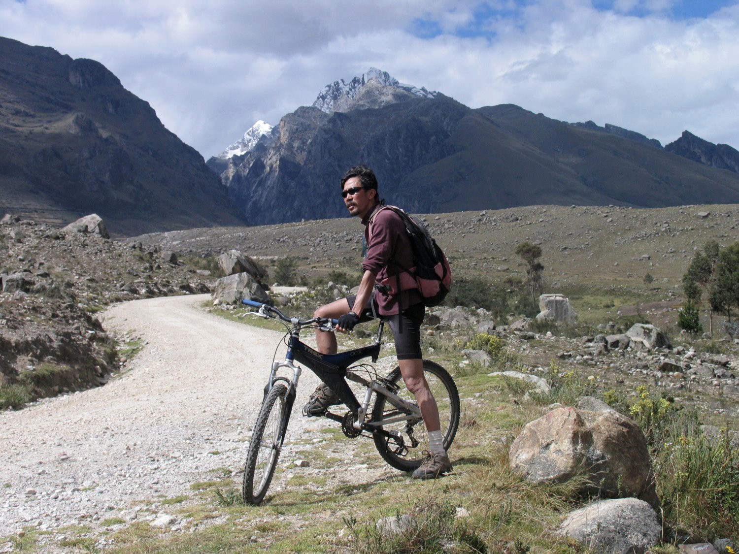 A variety of dirt roads and single track trails are located directly behind Huaraz in the Cordillera Blanca. In a day one can climb 4000 to 5000 feet above the city. And returning features some killer downhill!
One can join biking trips through a number of agencies – the advantage of an agency is they will coordinate transportation including bringing passengers high into the Andes so the ride will be mostly downhill. However you can certainly ride directly from town and explore the nearby slopes on your own.
From town, one rides through small villages until finally reaching the upper alpine barren slopes. These begin around 12,000 to 12,500 feet. Be careful of stray dogs as you ride through the villages as sometimes they will chase and bark at you. Typically if you stop and then walk the bike slowly until you are away from the animal, you will be fine.
A reference point for where bikers often start rides is from the Way Inn Lodge located far above Huaraz, at about 12,500 feet. It is a fun mostly downhill road from this lodge back to the center of town. One can also reach this lodge by taxi – you can stuff your bike into the trunk of a taxi (needing to remove both wheels most likely). Expect to pay about 30 soles from downtown Huaraz..
Carhuaz is a small town with a small “zocalo” or town square. Located about an hour driving from Huaraz. A quiet town, it is a great place to people watch or just to sit down and relax. This town is known for its many ice cream shops, especially fruit flavors including Cherimoya, Lucuma, and Guanabana. Tour groups passing through often stop here for at least 30 minutes. trips through this region a tourist company usually stop in this town for at least 30 minutes. Those doing the 300km Huascaran Circuit on bicycle typically will start and end their journey in Carhuaz.
Hot Springs
 two sets of Hot Springs are located within about 45 minutes of Huaraz. Monterrey is the closest, within about 10 km of the center of Huaraz. However we prefer Chancos Hot Springs, 27km away from the center of town. Monterrey Hot Spring tends to be more public in nature and due to their close proximity to Huaraz sometimes can be very crowded. In addition there are no steam caves at Monterrey.
To get to the Chancos Hot Springs (as pictured to the left) proceed to the main bus/collectivo station and take a collectivo to the small town of Marcara. A collectivo is essentially a van that leaves when it becomes full and because it usually fills up with many people (standing room only), the price can be very cheap per person. In this case from Huaraz to the town of Marcara the price should be several soles. From Marcara its about 3km to the hot springs via taxi collectivo and the price should be no more than 2 or 3 soles.
Alternatively, you can also take a taxi directly to the Chancos Hot Springs but it will cost you at least 35-40 soles – much more expensive than the collectivo option.
Once you arrive at Chancos Hot Springs you have to purchase a ticket for one of the steam caves. Don’t expect luxurious hot springs – rather, they are somewhat primitive looking. Often young boys work here to make a little extra income and will offer to show you around. If you use their services, consider tipping 1 sole. Approximately 10 caves are located on site, all at different temperatures. These are some of the best steam baths we’ve ever used and they are 100% natural! Each cave is private with a small changing room. If its not too crowded its easy to stay inside one of the caves for upwards of an hour.
Should you decide to use one of their private hot water baths, you have to pay an additional few soles and you will be shown to a private room. Put the plunger on top of the drain and turn on the large faucet until the bath is full. None of their private water baths are very hot (typically topping out around 35C or 95F). A few public baths are also located here, but again the water is not that hot.
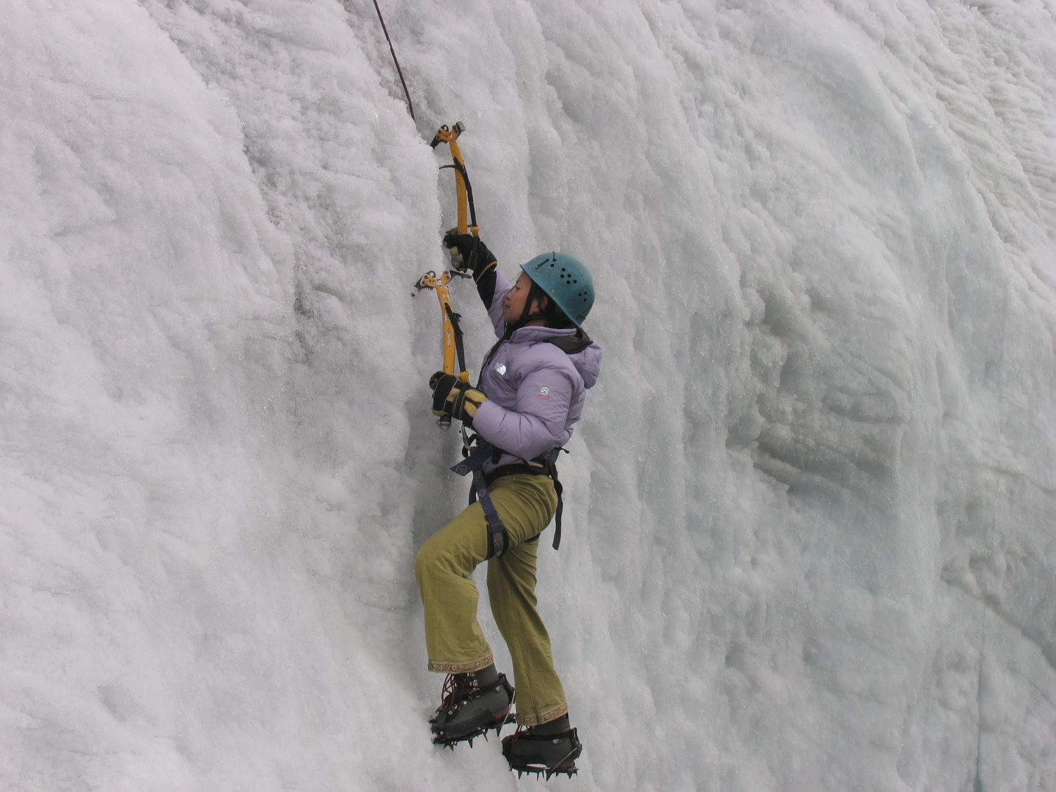
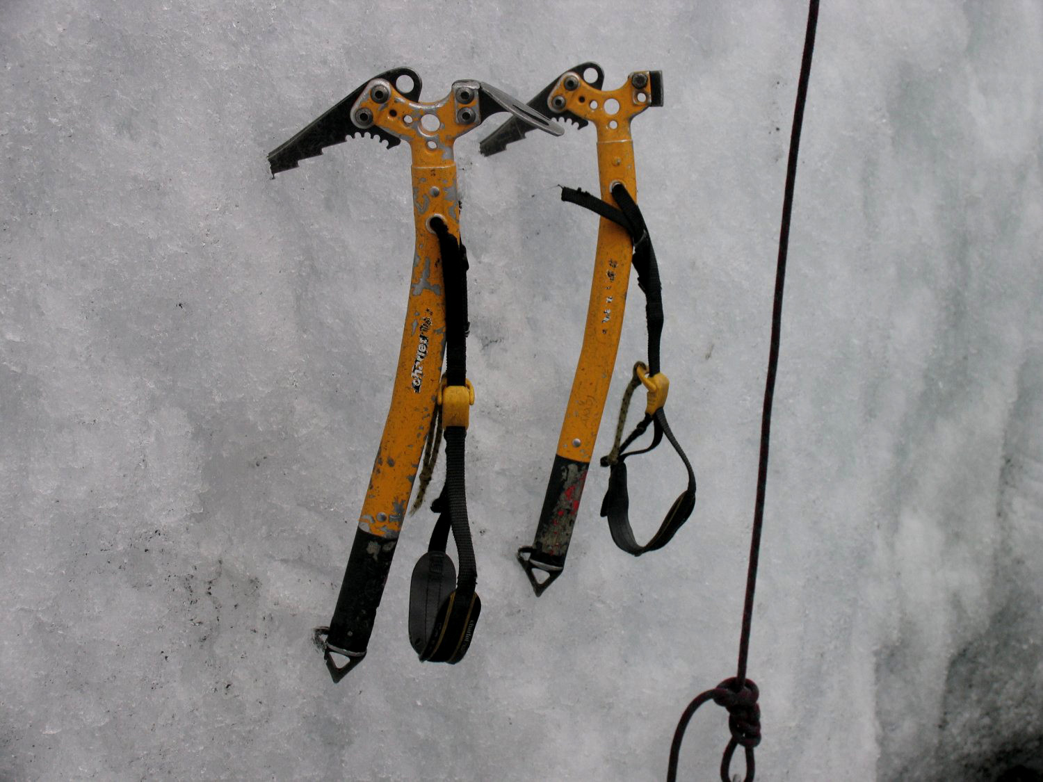
Ishinca & Toclaraju Climb
Visit our Climbing Page for more information
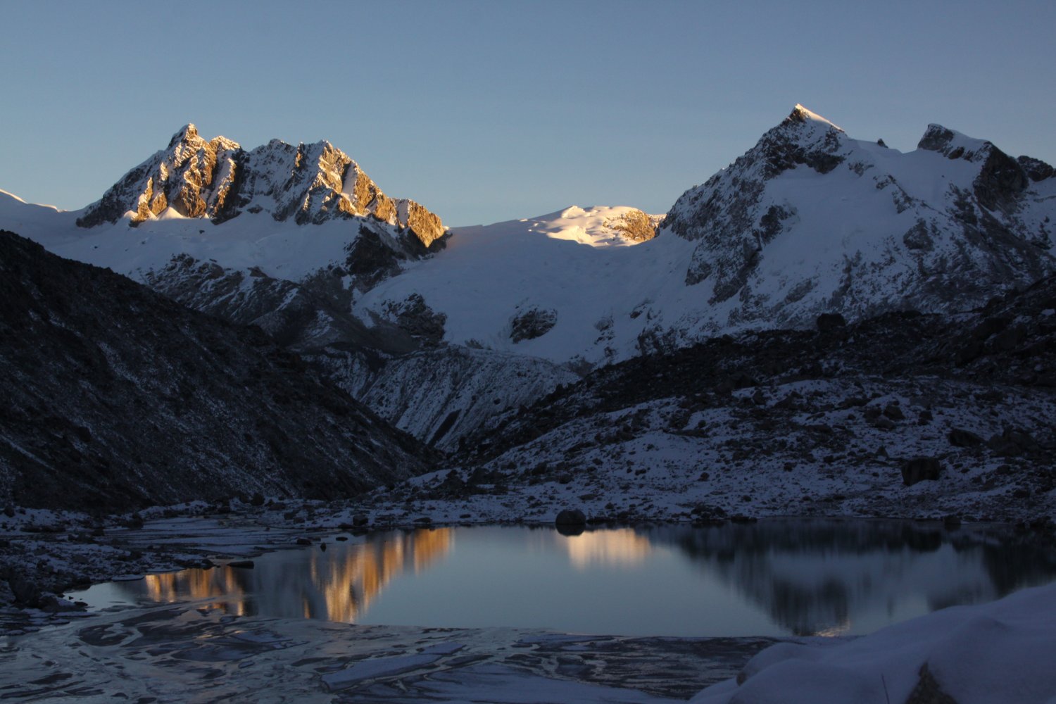
Lago 69
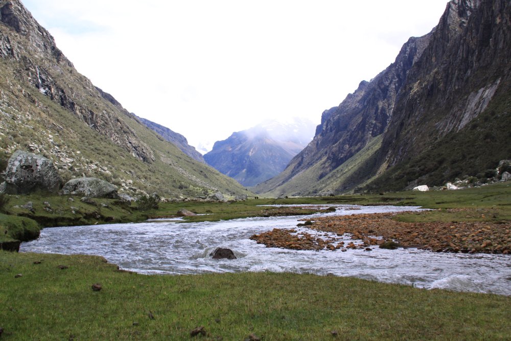
 This trek is one of the most scenic short day treks in all of the Cordillera Blanca. It is truly a unique and *special* place. Highly recommended, especially for those on a limited schedule who want to experience as much visually stunning terrain as possible in as short of a time as possible! It takes between 2.5 and 3 hours from Huaraz via a private taxi or car to reach the trailhead – located off of a dirt road above Llangannco Lakes.
One can also get to Lago 69 by collectivo – leaving from Huaraz to the town of Yungay located at the foot of the Cordillera Blanca mountains. A collectivo is essentially a mini-van that leaves when the vehicle is full. From Yungay take a private taxi to the trailhead at Cebollapama – a bit higher than the Llangannco Lakes – which takes about an hour on the entirely steep dirt road. Note that just before the entrance to the large canyon well above the town of Yungay is the Huascaran entrance gate – where visitors pay the park entrance fee. One day and 30 day options are available.
If you use a collectivo, note the following. It is the cheapest way to get to Lago 69; you go to the main bus/collectivo station in Huaraz (ask for directions) and take a collectivo to the small town of Yungay in the Llangannco region. Collectivo prices are very good as you share the cost of the ride with other passengers.
The trail is well defined to Lake 69. Just about the only downhill part of the trek up to Lake 69 starts where the trail meets the dirt road. It doesn’t last long, crosses a bridge over a creek and then enters a small valley. One very important note though; at the beginning of your hike be sure not to take the trail to the left to Pisco which joins the main Lake 69 trail after you cross a small bridge. Expect the hike to Lake 69 to take between 3 and 4 hours. Allow 2 hours for the return trip. If you have 2 days and can camp, we recommend camping one night about an hour before Lake 69 near the Cascada Waterfalls – as this way (weather permitting) you will be able to see sun kiss the tops of the jagged Andes when it rises in the morning.
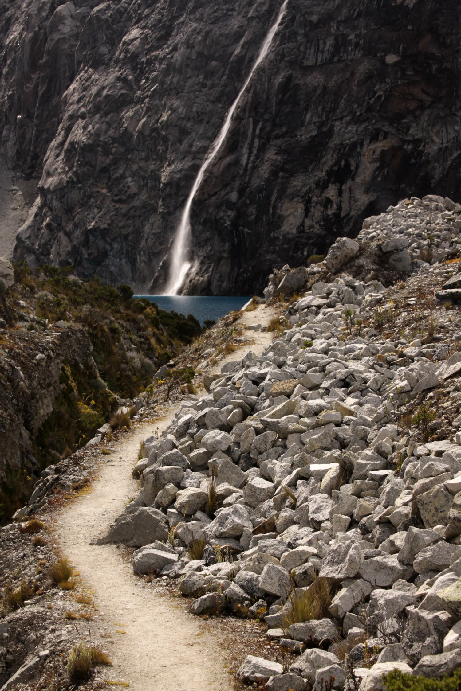
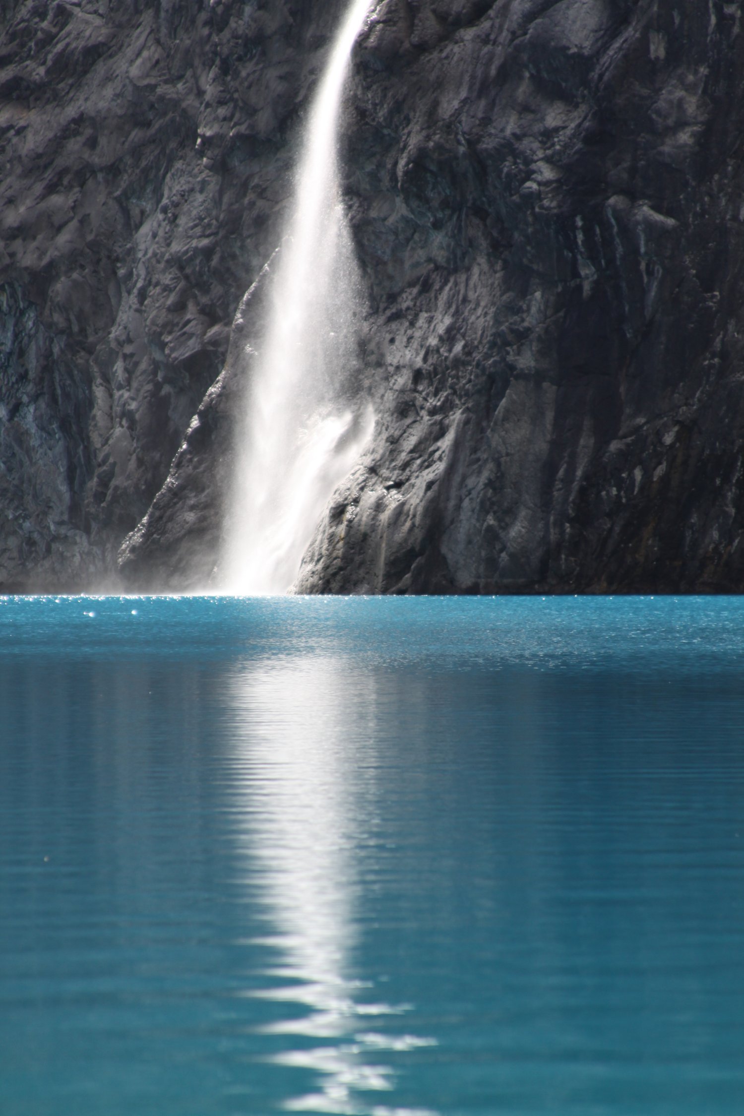
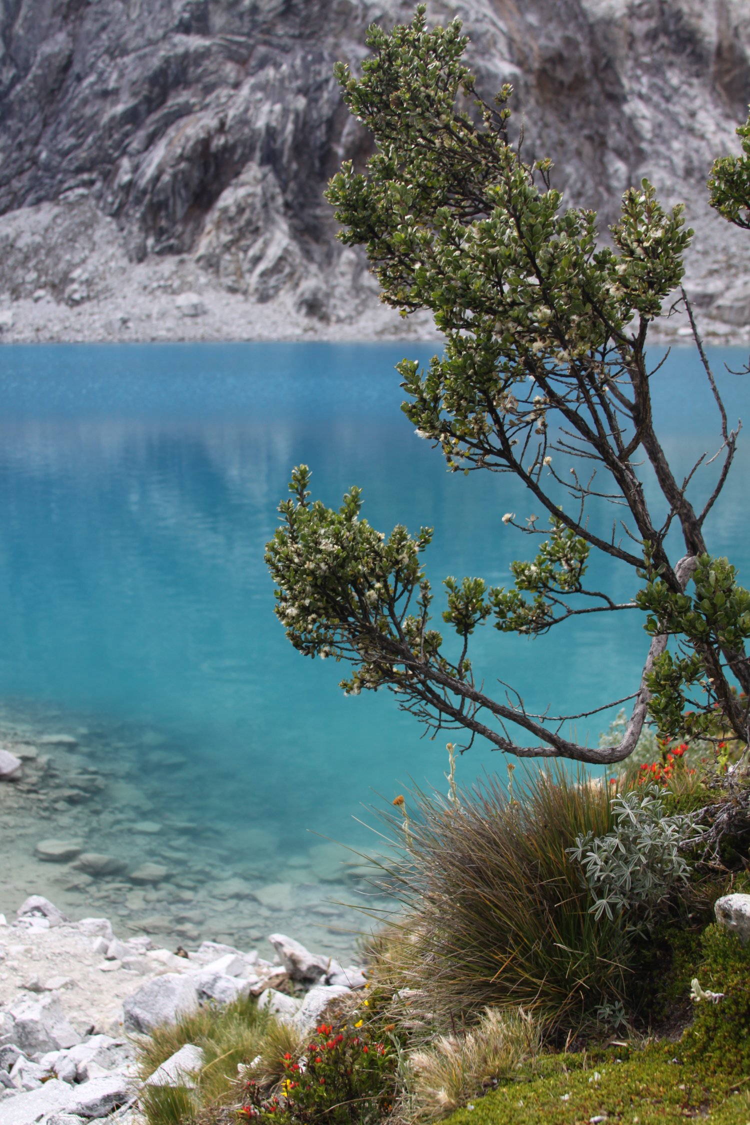
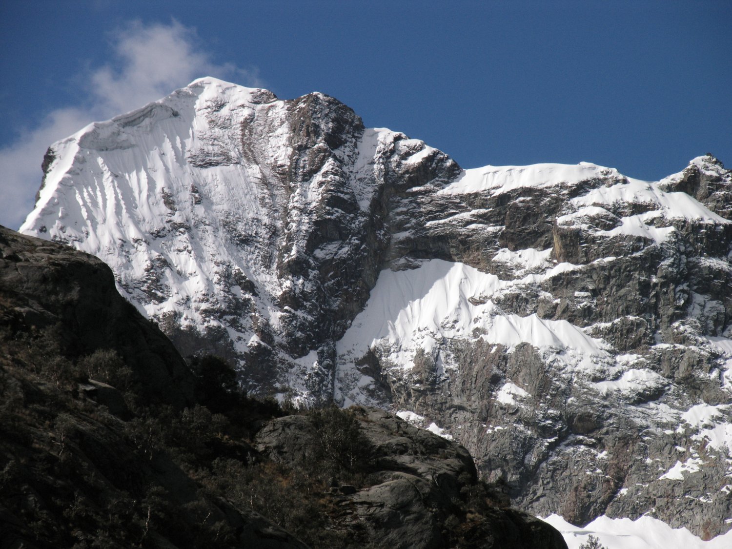
If you are spending 1 day only then make the most of it and spend some time at Lake 69. This is one of the most beautiful glacier colored lakes that we have seen on the planet. On a clear day you can look straight through its waters to the rocks below and the sunlight dances on the water with all types of blues, greens and aquamarines. Check out the incredible waterfall running right into the far end of the lake. This lake is located at about 4600 meters or just above 15,000 feet.
The views behind the lake are spectacular featuring rugged glacier covered slopes – if in season, a long waterfall cascades down the rocks. If you thought the nearby Llangannco lakes were spectacular just wait until you see this lake! You can also climb above Lake 69 on a steep trail that quickly ascends into the high Andes. You must first cross a channel containing fast moving water, that drains out of Lake 69. Cross using several rocks strategically located in the water. We’ve climbed at least 400 meters up this trail into a zone completely surrounded by gorgeous mountains. Hikers stare across massive peaks; this extra elevation gain above the lake provides another perspective – at Lake 69 hikers stare up at the mountains, several hours spent climbing above Lake 69 provides vistas where one looks across at the mountains rather then up. From up here, one has an even greater appreciation their sheer size!
As you initially hike up the trail, one will have good views looking down onto Lake 69. But then the lake disappears as your climb higher. Once you reach about 15,500 feet notice the green clumps of what look like moss. During parts of the year this “moss” will be completely dry and shows a light shade of green rather than its normal dark green color.
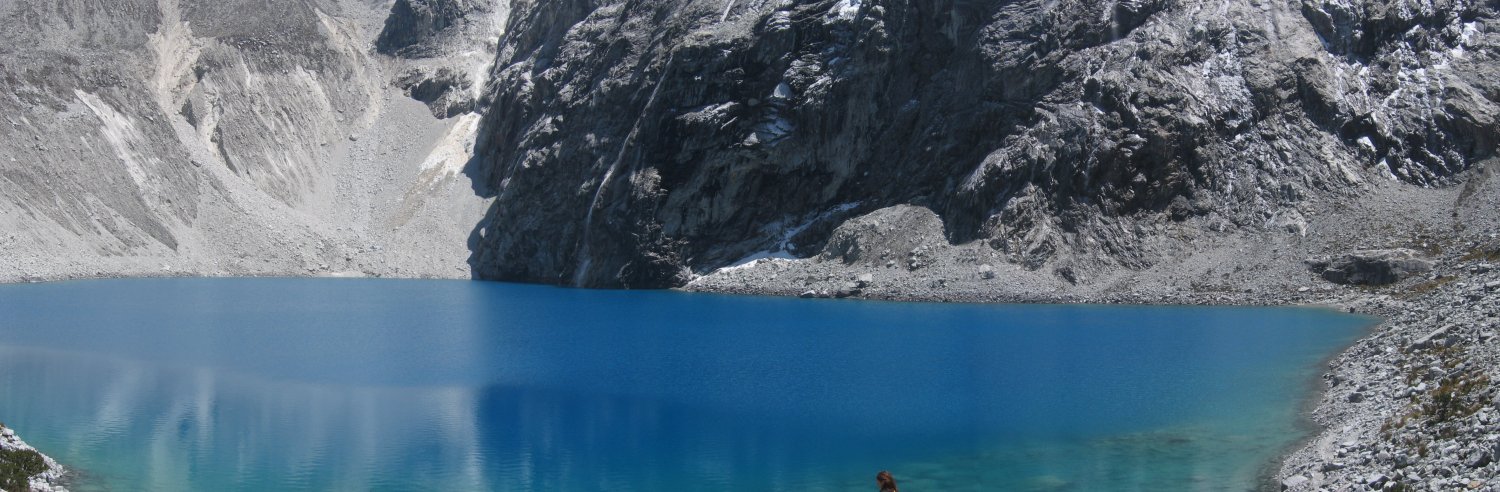
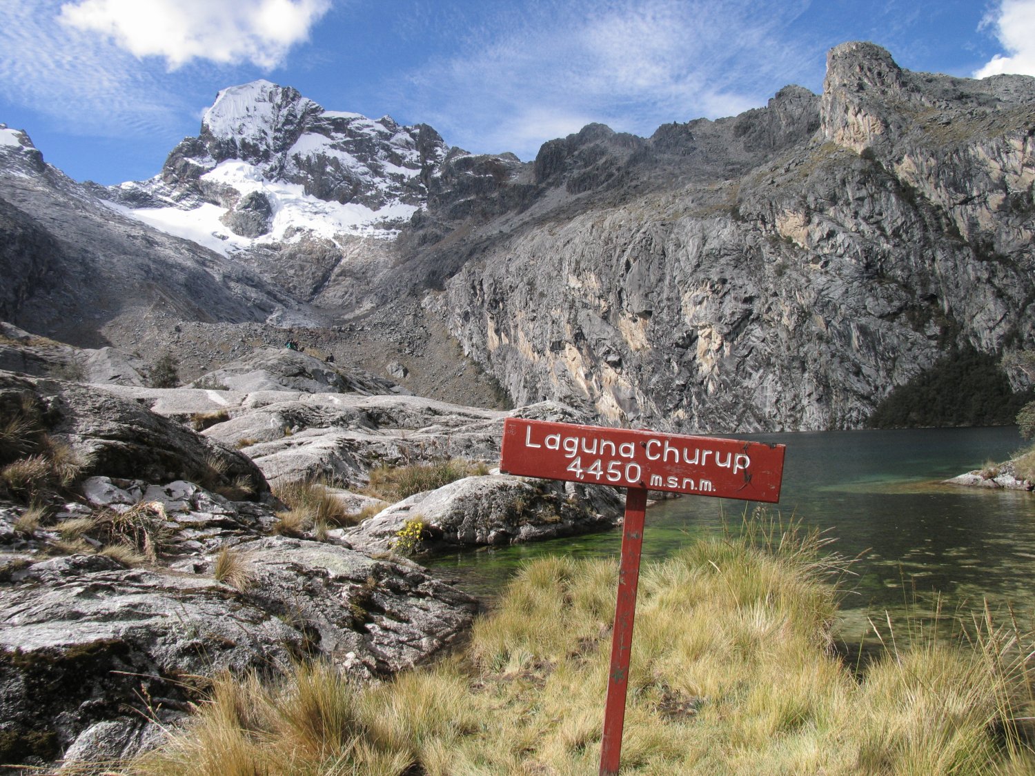
Lake Churup
The trek to Laguna Churup is a fantastic hike affording one excellent views. It is located almost due east of Huaraz. Travelers will want to go to the main bus/collectivo station in Huaraz and take one of the collectivos to a very small town call Llupac. At Llupa two roads fork; take the upper road to the right. This leads up to a small area called Pitec from which its still about 2 hours to the lake. Pitec is not a town and is where sometimes the National Park service will be located to collect a park fee – around 8 soles. This is also where the real trail (no longer a dirt road) to Lake Churup begins.
Walking from Huaraz to Llupa will take between 90 and 120 minutes which is why we recommend taking the collectivo to save time. A taxi to this point will cost you about 30 soles one way. The last collectivo to return to Huaraz typically leaves from Llupa around 6pm.
The road is all dirt and the initial part of your hike will take you past small villages and mud homes. Once you pass all the villages the road becomes narrower and more like a trail. Chances are you will at some point be walking with lambs, or bulls or dogs. The local Quechua ladies often move livestock between villages using the main dirt road.
The following incident is very uncommon but we will mention it. At one point I was walking along the trail when a horned bull charged me and pinned me against the steep side of the trail for about 15 seconds. This bull was very large and strong and had long curved horns which fortunately went into my backpack as I had turned at the last minute. Without my pack pack to protect me, things could have become quite gory and I probably would have been taken to a hospital. Apparently this incident is not common at all and the locals couldn’t remember this ever happening to anyone. I mention it here, so you can be aware of the bulls on the trail – try to keep them in front of you rather than walking right by them – be aware of animals sneaking up from behind you.
If you are in good shape and already acclimatized to the altitude it will take you between 3 to 3.5 hours from the small village of Llupa where the collectivo drops you off, to Lake Churup. Slow hikers and or those with altitude problems will take much longer time than that.
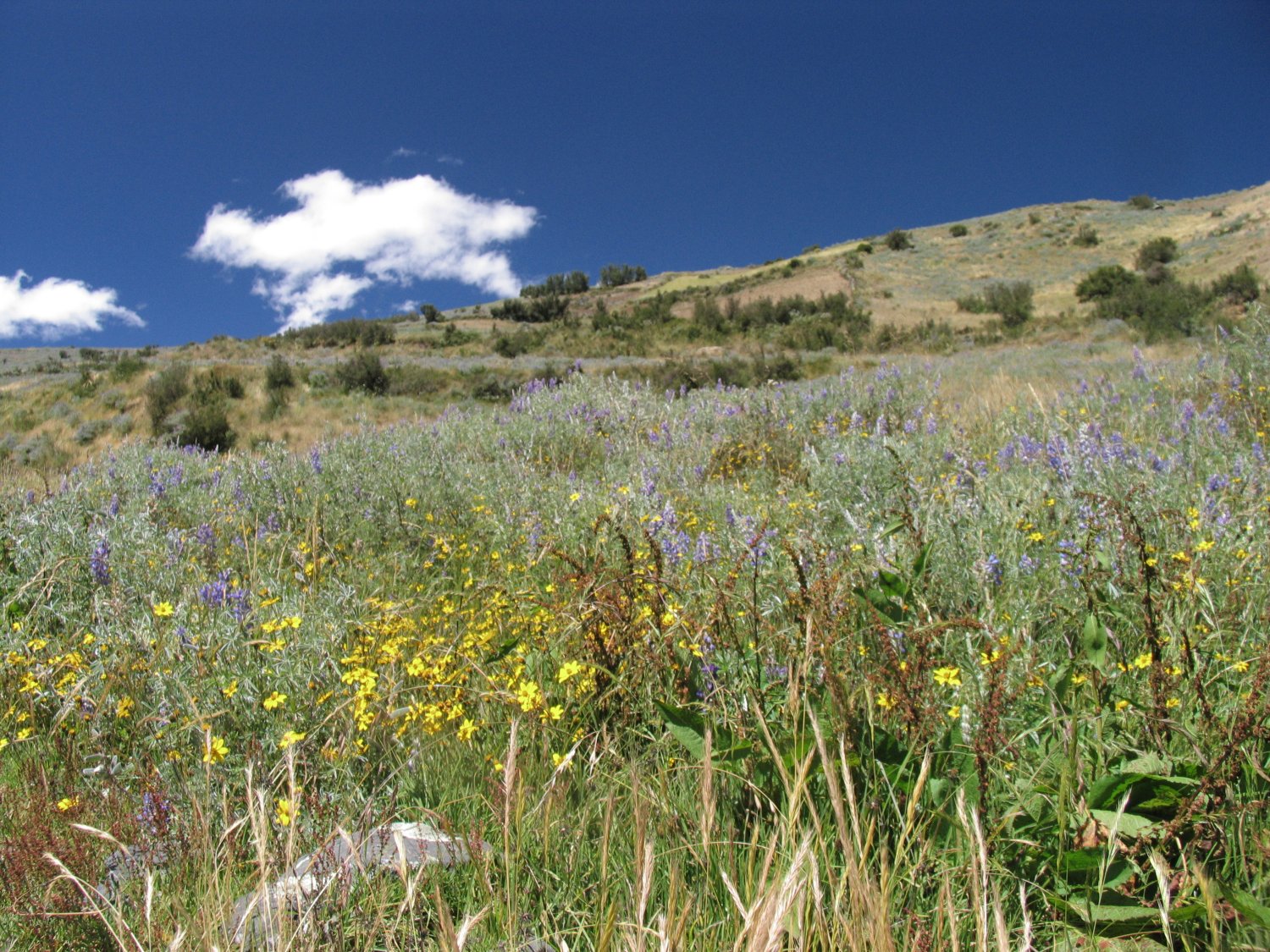
Depending on the time of the year, once you climb higher than the villages you may be hiking through a lot of greenery – including bush lupines and other alpine flowers. When you reach the upper dirt road, a small mountain hut and the red Huascaran park sign, you are about 40% of the way to Lake Churup. This is a good resting place. From here on to the lake you will be hiking up a small narrow steep trail. The trail leads proceeds behind the red park sign. Parts of this trail are extremely steep and you may need to stop often for rest breaks.
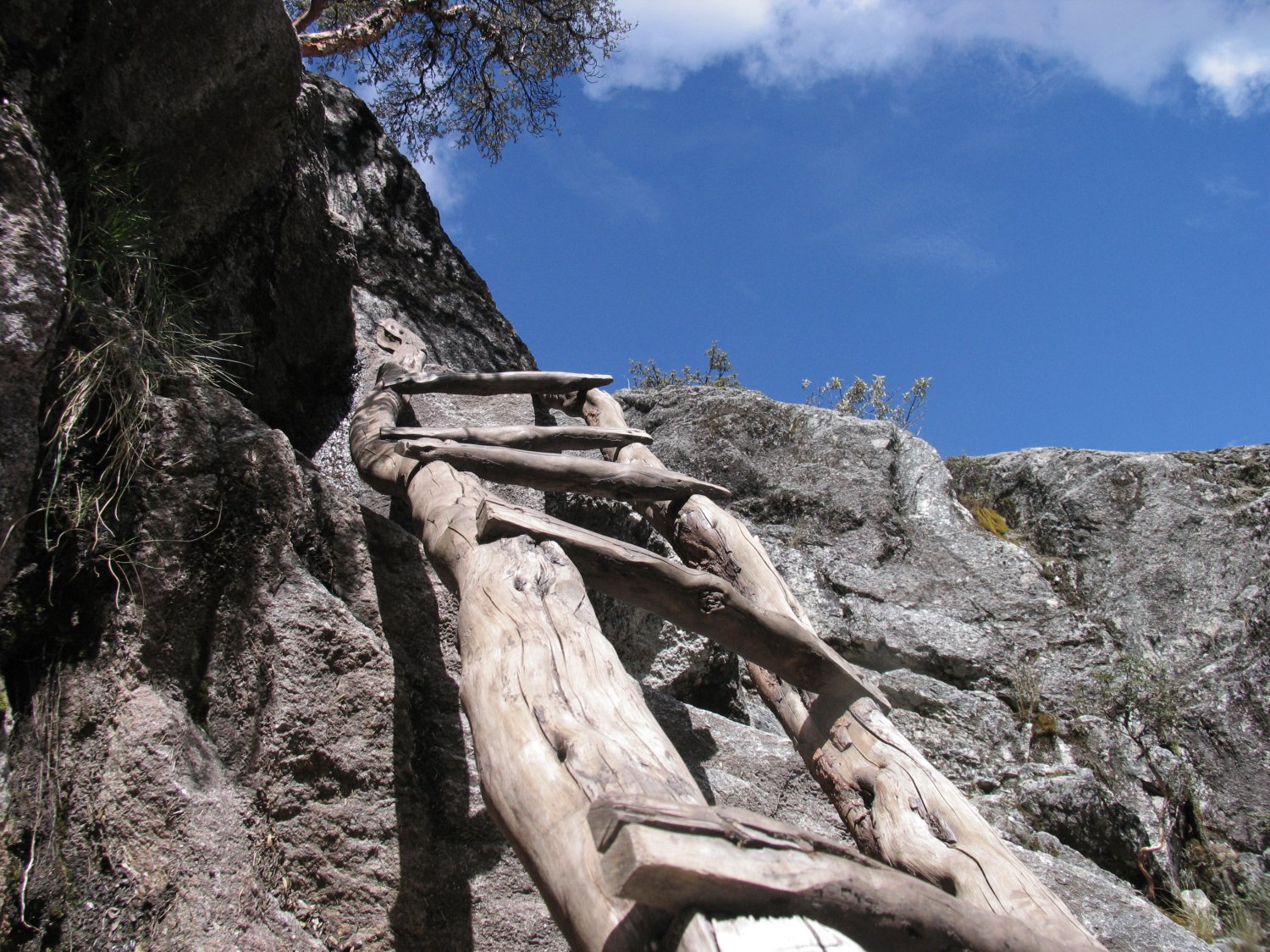
About 40 minutes before Lake Churup hikers will reach a long steep waterfall on the side of a sheer cliff. There are two ways to hike up – the right side of the waterfall is very steep and more dangerous and involves numerous rocks and slippery slopes. To the left is also very steep but slightly less dangerous. Both routes involve some almost vertical sections – the left side has 1 or 2 ladders to help with the vertical sections. You can climb the left side without ropes, but you need to be very careful. Once you reach the top of the waterfall it is merely a 10 minute hike to Lake Churup. This lake sits 4450 meters at the base of Churup Mountain. Another smaller lake (Lago Churupita) 150 meters higher – one can also hike here. Lake Churup is a beautiful small glacier colored lake – if the weather is good, the rocks above its shores are a good place to sit down and enjoy the scenery and eat some lunch. Allow two hours for your return trip to the village of Llupa.
Llangannco
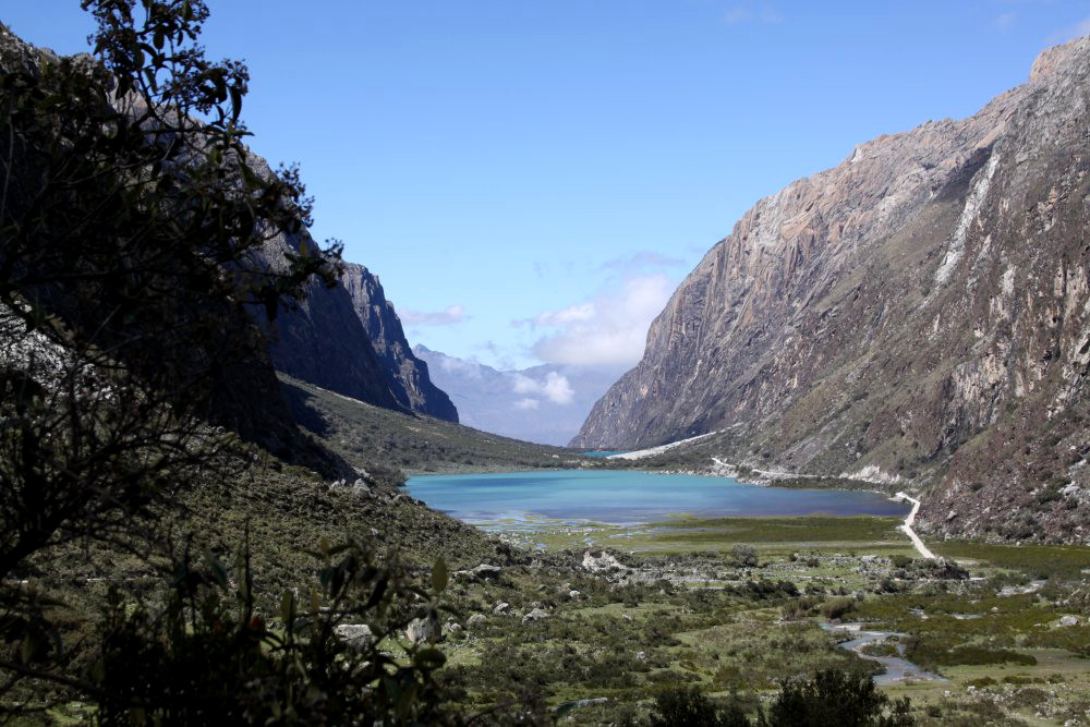 is an area high in the Andes with two beautiful aqua marine small lakes. From Huaraz drive to the small town of Yungay, located north of Huaraz. This is at least a 90 minute ride on the paved road. Note that Yungay was entirely destroyed in the great earthquake of 1970 and the new town is actually called “new Yungay”. A somber memorial to this disaster is located just off of the main road north of Huaraz. From Yungay its at least a 90 minute drive all up hill on a dirt road to the first lake. Compared to some of the dirt roads in Peru this road is fairly well off and a car can easily traverse it. Be sure to bring water and warm clothes as it can be cold and windy at these lakes any time of the year. From the lakes, one has great views of the nearby high mountains including Peru’s tallest mountain, Huascaran.
The 2nd lake is the smallest – there are no facilities there. Continuing past the second lake higher up into the mountains one will have great views of snow capped peaks and then also of the two lakes. Drive up this road for a ways and then look back, the two lakes appear much lower and in the distance. Then even further in the distance is the valley and Yungay. The elevations are extreme and the distances great in the Andes.
The first lake visitors arrive at is the largest one – and features a trail circling its shores. From the shoreline, look at the blue water through the quecuals, a tree whose outside dark brown bark always seems to be peeling. Expect the hike from one end of this lake to the other to take about 45 minutes to an hour. Also several side trails branch off from the main trail. One can even go boating with boats available for rent. Several vendors sell a limited supply of bread, BBQ meats, snacks and other drinks. Shaded tables are available – especially nice during afternoon thunderstorms.
Pastoruri Glacier
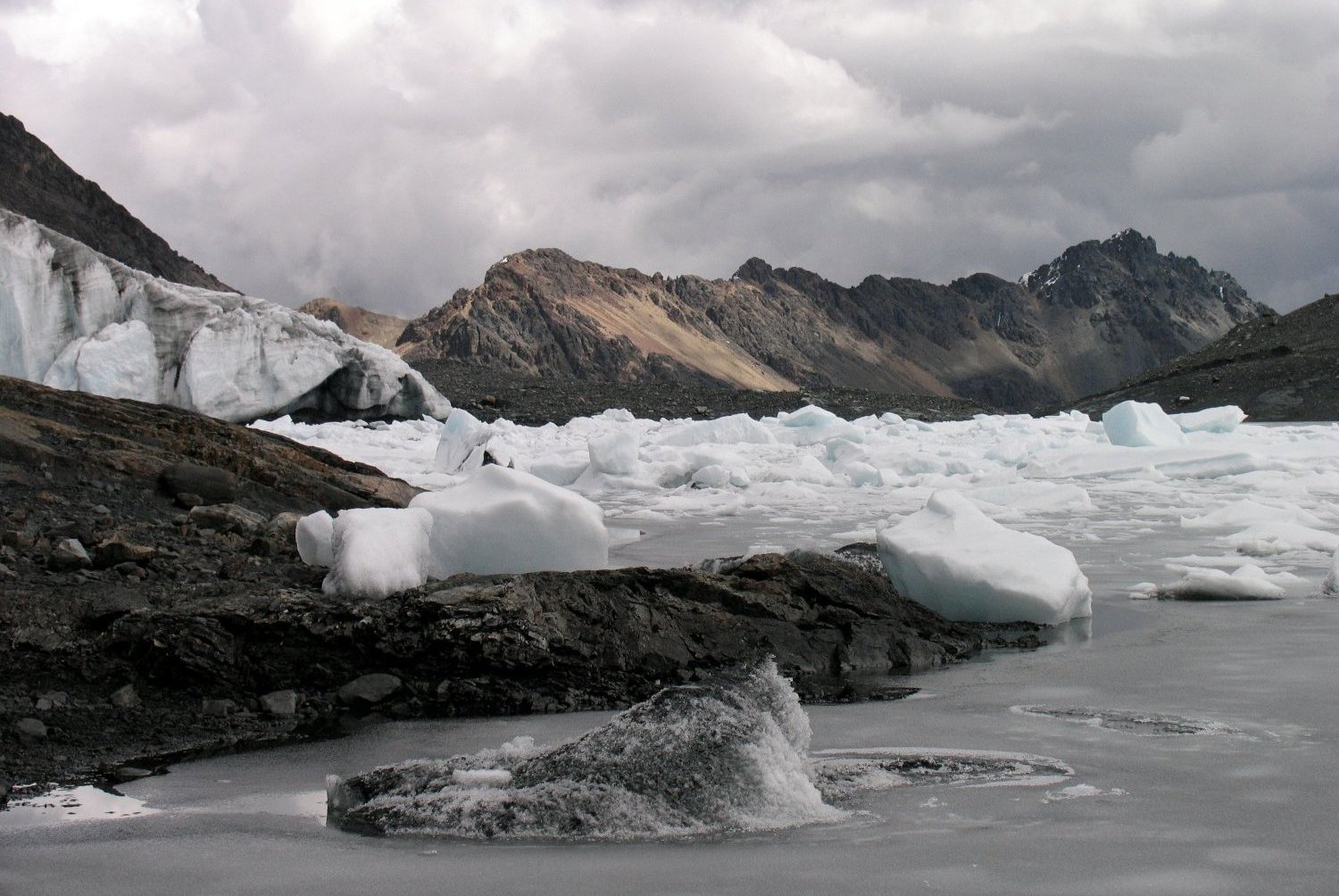
The main glacier on the slopes of Pastoruri mountain is located slightly above 5000 meters. Because of its extreme altitude you should be well acclimatized before you visit this glacier.
Update to Ice Climbing: Huarascaran National Park no longer allows ice climbing here which is the unfortunate result of this glacier melting at a super rapid rate. In addition you cannot even walk onto the glacier. During one year when we ice climbed and the next year when we returned to this glacier, the lake that had formed at the glaciers edge was now entirely by itself surrounded by bare rock. It was now hundreds of feet below the actual edge of the glacier. Experts say at the current melt rate, this glacier will be completely gone shortly.
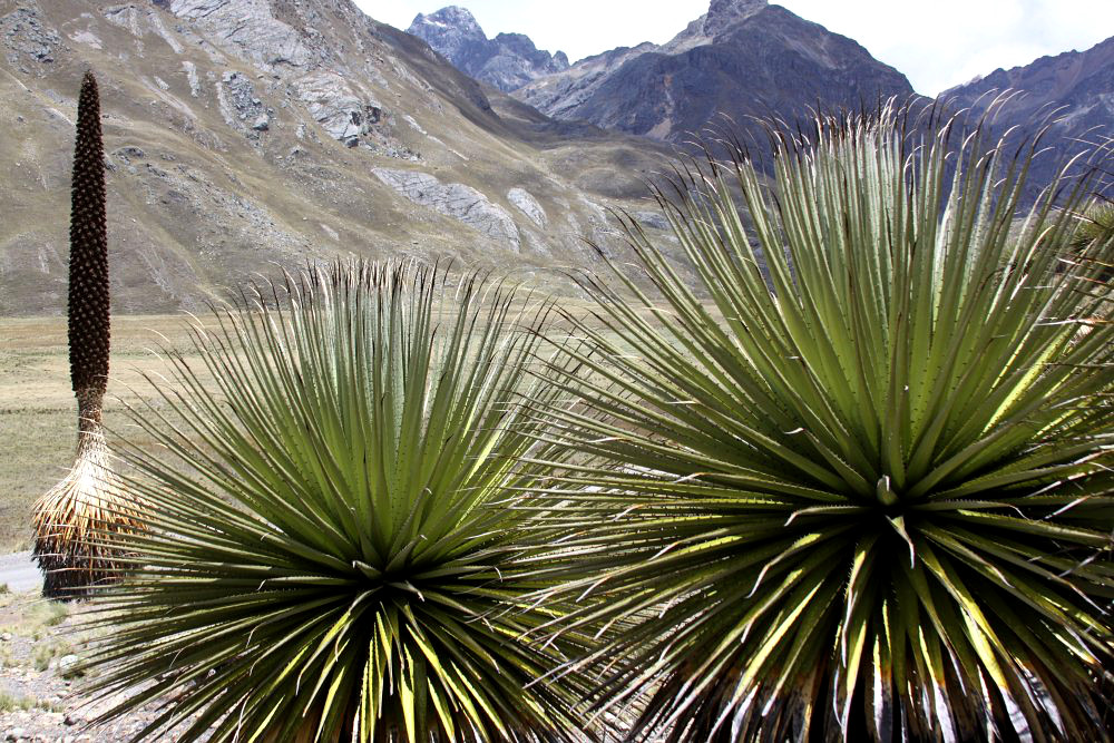
Many of the local tour agencies in Huaraz offer day trips to this location usually leaving around 7am and returning around 6 to 7pm. It takes about 2.5 hours by car from Huaraz to the dirt parking lot where one will hike another 30 to 40 minutes for a view of the actual glacier. Travelers can also go in buses for cheaper (rather than a private car), and tour agencies in Huaraz are able to arrange this. If you take a bus they will most likely make several stops – on your way to the glacier you will pass by the stately looking Puya de Raimondi, a tall spiky mountain Bromeliad plant that blooms once every 80 to 100 years and then dies. There are some good photo ops here as these plants tend to grow next to each other. You may also see a rock wall next to the road that contains prehistoric art, and a small cold pond that contains gaseous water (you can fill up your water bottle to take some with you).
Vendors commonly sell food, snacks and cold drinks next to the main dirt parking lot. In addition, mules are available for rent to carry you about 3/4 of the way to the glacier but you will have to walk the final distance on the regular stone trail. The glacier walls are quite steep, vertical in places with overhangs in other places. During busy weekends sometimes park service officials will be on hand to make sure you don’t get too close to the glacier.
There are often small ice caves within the glacier with long icicles dripping down. “Glacier” lakes are sometimes found near the glacier walls. We have climbed all the way to the top of this glacier staying well away from the actual ice. There is no trail and you have to climb up steep rocky hillsides.
The base parking lot is at 5000 meters and the upper parts of the glacier are around 5400 meters. We made it above 5300 meters according to our altimeter. As a result of the altitude here, a visit should not be made by someone on their first or second day in Huaraz! We have been here several times and on each trip a few people have been severely affected by the altitude to the point that they were having trouble walking and were throwing up. You need to be well acclimatized before you come here, visitors arrive by vehicle to 5000 meters, however if you are not acclimatized, altitude sickness does not care whether you drove or walk!
We cannot stress enough the benefits of taking ones time to acclimatize and let your body adjust to the high elevation. We tend to get altitude sickness quickly. We have used Soroche Pills before and have noticed some definite improvement. Try going to 5300 meters on day 5 – that’s not something we generally can do but with the Soroche pills we had no altitude problems other than shortness of breath. Supposedly these pills contain mostly just caffeine and aspirin. They are made in La Paz Bolivia and can be purchased at most any Pharmacy in Huaraz.
Note: the park entrance fee is now 12 soles per person.
Quebrada Llaca
(information coming soon
Quebrada de Quilcayhuanca
is located in the mountains about 1 hour by car, almost due east of downtown Huaraz. It is near the trailhead for Lake Churup (see above for more information about hiking to that lake). If there is a national park employee at the entrance to the national park (usually on his motorcycle), you may be asked to pay 8 soles to enter the park. Quebrada means valley in Spanish; this is a very long flat green valley.
A visit here is not one of the first recommendations guides provide for day trips, however that means it usually is not very crowded. Hiking through the valley is calming – and the surrounding views are spectacular.
A river winds through part of the center of this valley – at times meandering more towards the right side (facing up valley). It is *not* recommended to walk straight up the valley as when hikers reach about halfway up the valley, the center becomes very marshy and muddy. The best way to walk up the valley is on a rudimentary trail located on the left side of the valley (as you look up the valley).
Once you reach the end of the valley, the trail on the left side starts to rise and meanders through several canyons all the while getting much closer to the massive jagged peaks. On a clear day there are beautiful views of these mountains, especially as you hike closer. This is an ideal hike for those wanting to relax or get acclimatized.
The full trek up this valley and into the canyons typically takes three days and can be arranged through any of a number of trekking agencies in town. One may also do this trek independently. Day trippers have enough time to reach the back of the valley and even explore some of the side canyons. Several lakes are located even further in on this trek – typically reached on multi-day treks.
is there a bus that gets in before 6am? seems like most groups leave at 6am but most buses get there at 8am. And then you end up paying a premium difference of $60.
Also, is there a hotel or hostel on lake 69 or what is the closest one to it?
OMG! first blog where I find instructions how to get on your own to Laguna 69….and I was loking for a while! Thanks a lot!
Pastoruri and Llanganuco on my bucket list
Pastoruri and Llanganuco… ahhh I need to get back to Peru again!
Hello Dave, first of all thanks a lot for the detailed information helping us to find our way around once acclimatised. We found out that it is again possible to visit Pasturori (by tour). Even though the rusty river and the plants were highlights we weren’t too impressed by the glacier Pasturori, which is probably because of the glacier melting away.
Fyi, the park fees in 2017 are Soles 10 per day and Soles 65 for 21 days. Online a came across a message informing that the prices will jump again as of the 1st of January 2018.
Best regards,
Michiel
Excellent article! I really loved Huaraz because there are several activities you can make. For example if you like nature you can go to visit the Llanganuco and 69 Lakes. They are incredible! And if you like to take photos you can ho to Yungay, the view of the old town is impressive. Also I liked a lot the food such as the pizzas and ice creams!
Michiel – thanks for the update 😉