Few people who visit Las Vegas actually make the trek out to Red Rock Canyon. This state park is located about 35 minutes west of Vegas proper – off of W. Charleston Blvd (route 159). Note that there may be signs off of the 15 freeway telling you to exit for Red Rock but there may not be any signs telling you to turn onto Charleston Blvd to get to Red Rock.
With the urban sprawl making its way across the creosote covered high desert towards this park, soon the city limits of Vegas will only be several minutes away. Update: early 2018 – homes and subdivisions are creeping ever so close to the BLM land that surrounds Red Rock Canyon drive.
This is a great park to enjoy the quiet and solitude of the natural high desert world. Its so close to downtown Las Vegas, yet so far away. Be sure to drive the 13-mile drive. This road winds its way through the Red Rock Canyon area. Cost to drive for a regular car is $15 – a very informative map and guide will be given to you. This road generally closes at sunset.
Couple of places you will want to stop at on the 13-mile drive: at the start of the drive just up from the Visitor’s center are several overlooks with parking lots where you can view or hike among the reddest of the rocks. Continuing your drive, there is a high point overlook which affords excellent views of the desert. A little more than 1/2 through the drive there is a turn off for Lost Creek and Willow Springs Picnic area. There is a unimproved dirt road here leading from the gravel parking lot. Only consider driving this with a regular 2wd car if you have experience driving on these types of roads with a regular car. You can drive about 1 mile in until the road crosses the dry wash, at which point you definitely would need 4-whd. If you do not have experience driving these types of roads, do not even attempt to drive this road, rather park in the main gravel parking lot and hike in. About 1/2 mile in are examples of Agave Roasting Pits, which essentially look like holes in the ground with dirt & rocks piled up around them. These were used to cook foods such as agave, desert tortoise, & rabbit among other things, but the local Native Americans. Some Native American handprints were painted on the walls over 800 years ago in this area. There is a short trail that leads to these handprints from between the main gravel parking lot and the picnic area.
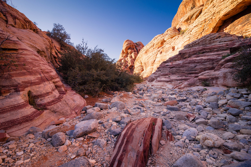
Icebox canyon however never hiked by this author comes highly recommended. The turn off for this trail is just past the Lost Creek parking lot (as described above). There is some bouldering involved in this trail – the actual trail starts in the desert and then winds into the canyon. Winter months might see some waterfalls here.
Some of the activities to be enjoyed here are mountain biking, hiking, climbing (this park is a major climbing destination), picnicking, and camping.
Additional information about Red Rock Canyon
Friends of Red Rock Canyon: www.friendsofredrockcanyon.org
Red Rock Canyon Interpretive Association: www.redrockcanyonlv.org
Leave a Reply