Introduction

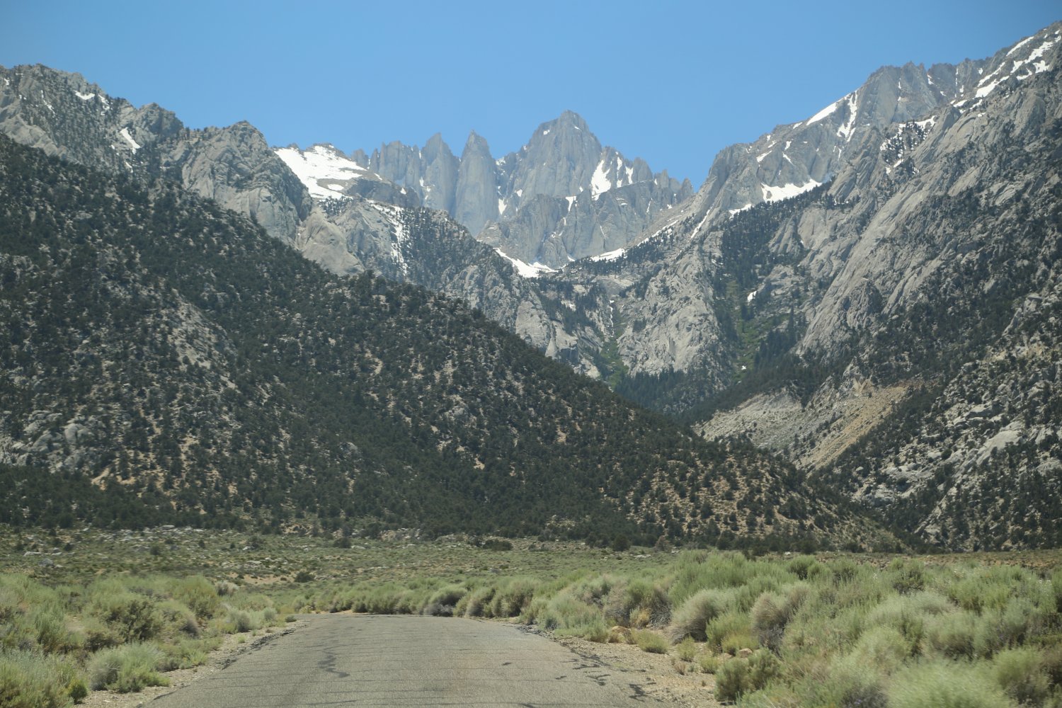
 When you first drive out of Lone Pine you will see several mountains that look very tall. In fact Lone Pine Peak to the far left of Whitney looks much taller then Whitney itself. This is an illusion stemming from the fact that Lone Pine Peak is much closer in the foreground. Lone Pine Peak in actuality is about 13,000 feet. Mt. Whitney is the spire situated on the right side of all the other sharp jagged spires. It is 14,494 feet in elevation. Most people when they stand on the summit (or on top of rocks on the summit) are over 14,500 feet in elevation.
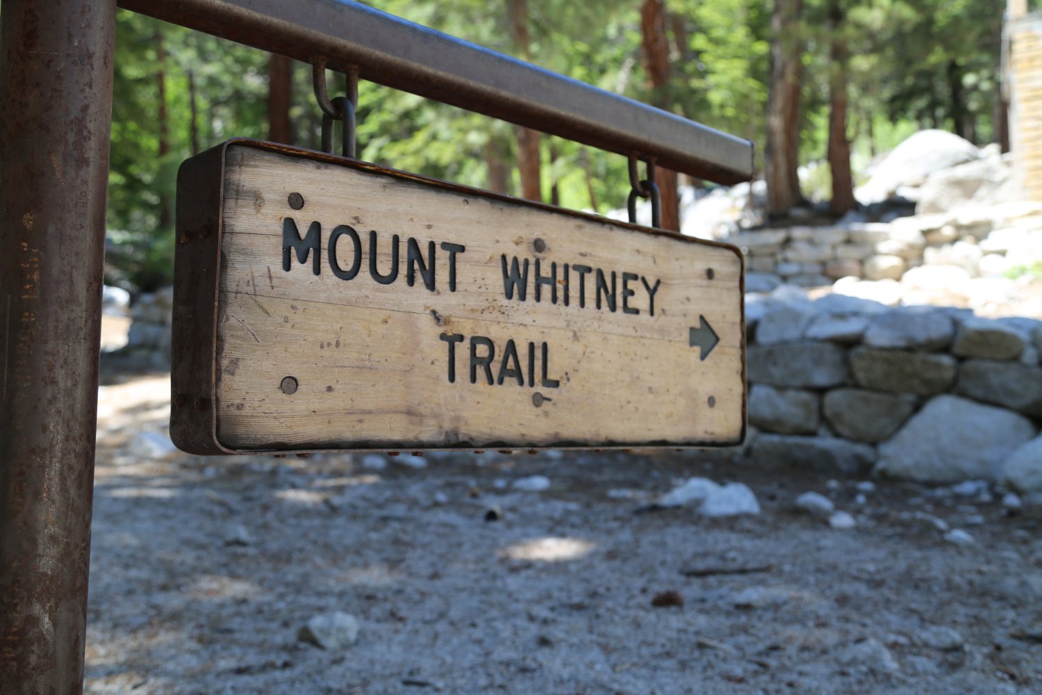
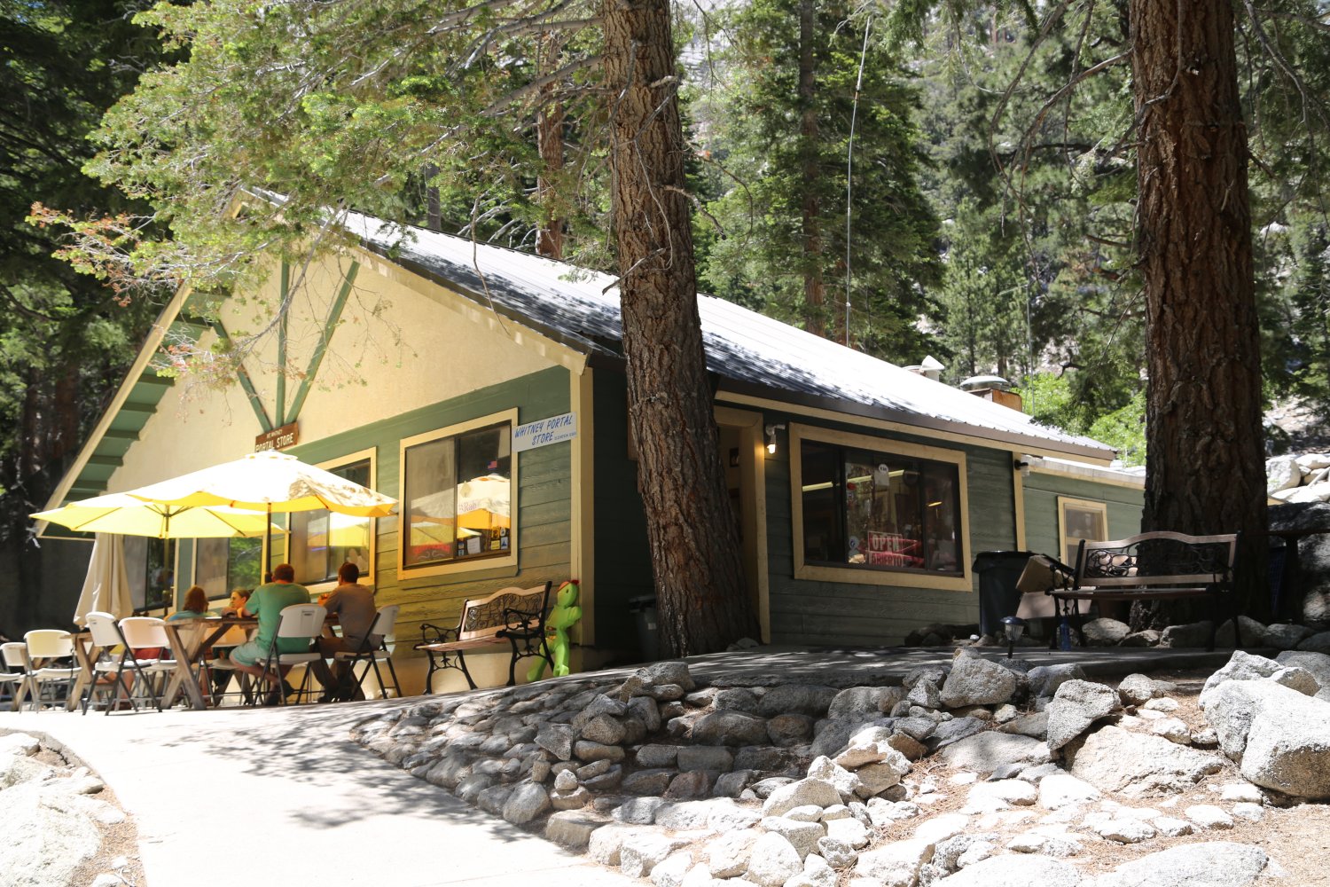
This hike is best spread out over several days. The entire trip is nearly 22 miles round trip from the trailhead to the summit and then back to the trailhead. The trailhead starts at approximately 8300 feet. A small restaurant, fishing pond and a small store are located near the trailhead. This pond is stocked with trout and is a favorite place for the children to practice their fishing skills. A large parking lot fills up during the busy weekends in the summer months.
Several informational signs about hiking Mt. Whitney are located at the trailhead. It is a good idea to review these before starting your climb. The forest service currently runs a mandatory “poop and pack” program – in which you must pack out any poop you create while on the hike. Pack-out kits are provided when you pickup your wilderness permit.
This is similar to the system on Mt. Shasta in northern California (which began doing this before it was required on Mt. Whitney). The problem was that the solar toilets on Whitney were not always open and were often unable to handle the volume of shit. These toilets have since been removed from the trail.
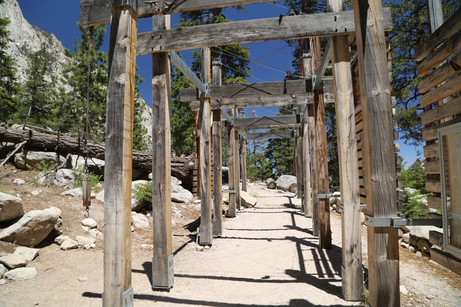
For those concerned about weight (and you should be especially if you are doing this as a 22 mile day hike) a hanging scale is located at the trailhead which can handle weight up to 100 pounds. Weigh your backpack here before you start hiking.
I have been told and have read that the Whitney hike is the most popular hike in California. After hiking it I can see why. Not only are you hiking up to the highest point in the Continental United States but you are hiking through some gorgeous rock formations and you have spectacular views of not only the eastern desert regions but once you reach 12,500 feet, also of the western Sierras. People hike this trail in different times of the year. By far the most popular months are July, August, and September. I know of several people who snow shoed the entire trail in a 3 or 4 day trip in the springtime (often an ice ax and or crampons are needed).

Permit Fees & Info
When I say that this hike is best if done over a span of several days I mean that you won’t have as much problem with altitude sickness and you will not need to be in as excellent physical shape. The main drawback to hiking this hike in several days is that multi day permits are extremely hard to come by. They are sold out months in advance. I recommend that you call at least a year in advance if you want multi day permits.
The phone to call for permits or campground reservations is (760) 873-2483. Also visit www.fs.usda.gov/inyo for more information about how to obtain a wilderness permit. You may find that during the summer the phone number above is hard to get through. You may be bombarded with constant busy signals. Try calling very early in the morning. The Lone Pine Chamber of Commerce can be contacted via the web: www.lonepinechamber.org or by calling (87) 253-8981
Various permit fees apply. At last check, day hike tickets are $20 per person. Overnight trips into The Mt. Whitney “zone” are more. Visa or Mastercard are accepted.
Local Campgrounds

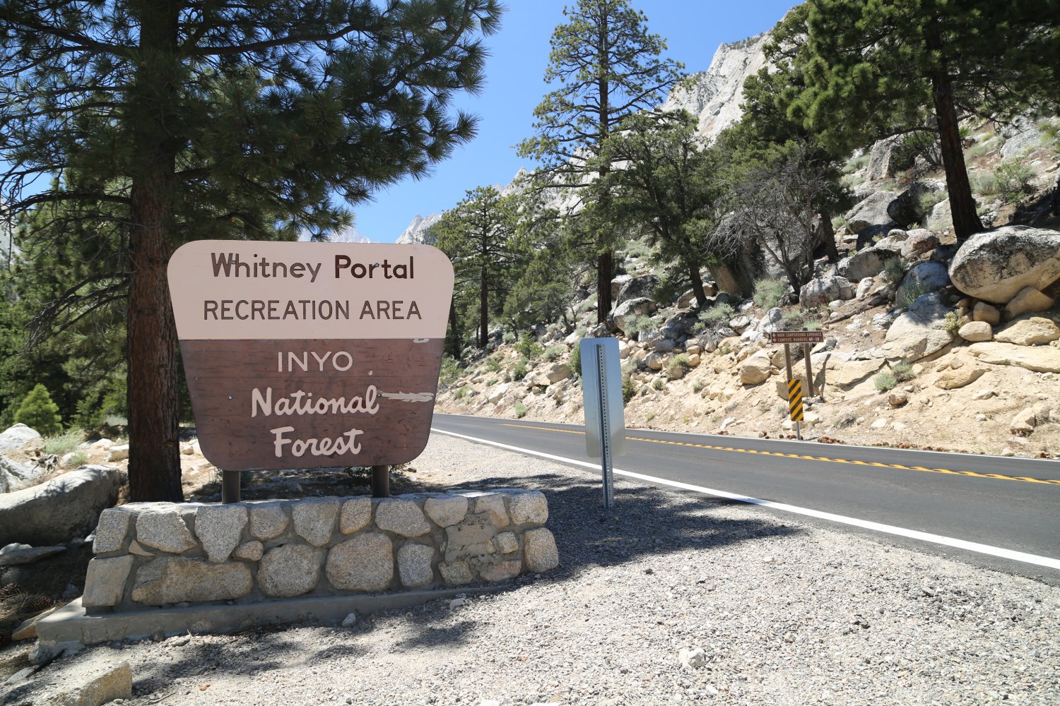
 Several campgrounds are located within or near the Whitney Portal Road. The most preferable is the Whitney Portal Campground which is located nearby the trailhead. This is usually full so I recommend to call for reservations months in advance. We hiked the Whitney trail with 2 other friends. We were able to secure 2 nights camping at the Lone Pine Campground which is located next to the Lone Pine River at about 6000 feet just before you start driving up the 2 major switchbacks leading to the Trailhead.
There are two minor disadvantages to this campground; one is that you are camping at 6000 feet instead of at 8300 feet so its harder for your body to adjust to the altitude as you are at a lower elevation. (See our Nepal article and the subsection on altitude sickness for lots more information) and the other disadvantage is that you have to spend time driving about 5 miles up a steep grade to access the trailhead before starting your hike.
The main advantages of the staying at the Lone Pine campground is that this campground is far less crowded then its counter part at the trailhead. This means that you will be able to get a campground reservation more easily. I was able to get our reservation for this campground for the two nights, about only 1.5 months in advance. You are also next to the Lone Pine River which can be very relaxing. This river is quite cold and feels nice to splash around in on a very warm Owens Valley summer day. There are fish here and I saw several fisherman have some luck with catching small trout. Bear proof containers are available at each campsite.
Another good camping alternative in the Whitney area is the Tuttle Creek Campground. It doesn’t have any water or bathrooms but it is always available if the Lone Pine Campground or the Whitney campground become full during peak times. It is a bit on the rustic side though.
In order to defeat some of the effects of the altitude my friend and I camped out for a night at 10,200 feet. During one of the days I hiked up to 12,000 feet as fast as I could. I paid for that hike in the short term with a splitting headache. In the long term on the Whitney hike (which was done at a more leisurely pace) I had no altitude effects. This location where we camped was in the wilderness area near Saddlebag Lake about 2 or 3 miles off of Highway 120, about 2 miles on the eastern side of Tioga Pass. We were just outside of Yosemite National Park. The access road is dirt and a bit rocky in the beginning. If you drove slowly you could get an RV over this road. The first part of the road is the worst and then it gets better. The steep portions are even paved. To camp over night, without staying in a campground, you need to get a free wilderness permit from the general store above Saddlebag Lake. The hike to the wilderness area is about 15 or 20 minutes at a rapid pace, around the west shore of the lake.
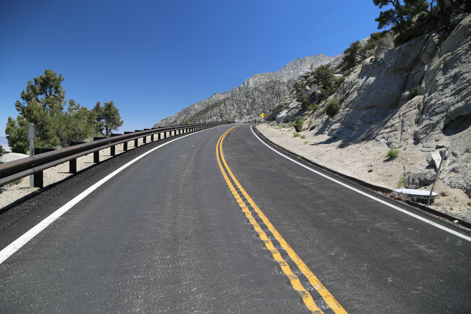
The Lone Pine Campground is about 6 miles due west of downtown Lone Pine, just off of the Whitney Portal Road. The Whitney trailhead is about 13 miles from downtown Lone Pine. Be sure not to miss this portal road. It can be quite easy to do as it looks like any other road branching off of the main street (US 395). It is located next to a pizza place that advertises “we toss em’, there awesome”! We ate here and can recommend a stop here before you begin the hike as you will want to pasta and carbo load.
I found that we were able to coast down the entire 13 miles of the Whitney portal road without applying the gas pedal. The 5 miles or so near the trail head are quite steep, so watch those brakes. If you accidentally cross the double yellow line – your ears and tires will pay for it – deep grooves in the pavement alert you to this. Gear down!
The Trek to the Summit
We woke up at 4:15am towards the end of August and were on the trail by 4:45am. We decided due to the unavailability of multi day permits to trek the entire hike in one day. It turns out that had we known that an entire group of 12 decided to not show up, we could have gotten multi day permits the day before. I guess it is a good idea to call a few days before your hike to just make sure there are not any multi day cancellations. The number of permits given per person is 6. The Forest Service only allows a certain number of people on the trail per day and when that number is filled, no more permits are given out.
Our hike started out in the darkness and stayed that way for about an hour until the sun rose. We began our hike up the side of a steep canyon. Just about most of the hike to the top was up hill. The trail condition varied from flat to quite rocky and rugged in places. There were several steep canyons that we hiked up. The sun rising over the eastern hills on the far side of the Owens Valley was spectacular. We passed several small lakes and creeks next to the trail. Tree line ended around 10,500 feet. There was a solar bathroom around 9,500 feet and then again at 11,000 feet (both of since been removed). There were solar cells lining one side of the slanted roof. A ranger we met on the way down told us that they are used to power a fan which dries out the waste. This made is extremely light and then the rangers packed it out and used it as fertilizer.
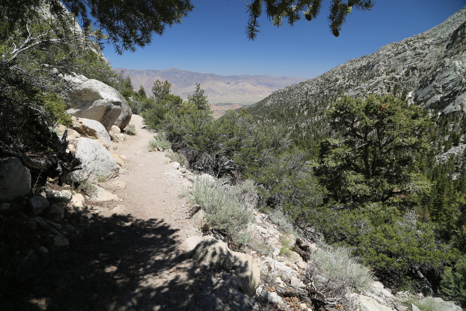
 The rock strata looks like granite but is more white. Some of the formations look like some of the granite that you would see in Yosemite National Park. There are 2 campgrounds where most people camp. Apparently you can camp near the trail in other areas but at least 100 feet away from lakes and streams. The second campground lies in a small rocky plain at the base of Mt. Whitney and the other spires. This is about 11,500 feet and above timber line. This would be a good place to camp on your first day if you were taking 3 days to climb to the top. This campground also lies at the base of the infamous 99 switchbacks.
There are actually 99 switchbacks that make there way up an incredibly steep slope becoming almost a cliff towards the middle top part. If you are susceptible to altitude sickness, the base of these switchbacks is probably where you will start feeling some symptoms. I took a precautionary Advil at this point and was fine for the rest of the hike. I probably did not even need to take it, but after my travels in Nepal I was very, very, very leery of altitude sickness!
One member of our party took the motivation to cut the switchbacks. He was making at least as good a time if not better as the rest of us. You are able to cut the switch backs during the first part of the 99 switchbacks as the terrain is not too steep yet. You are climbing over boulders and many many rocks. Some of these 99 switchbacks are so tight that they extend for maybe 15 feet in one direction before they make the next cut. It was about half way up these switch backs that we saw several people dealing with headaches and the usual altitude symptoms. I also briefly talked to a jogger who said he made it to the summit and back to the middle of the switchbacks in 4 hours. That is incredible speed.
After what seems like an eternity you will reach the end of these switchbacks at the edge of a divide at the trail crest. The elevation is about 13,800 here. On the eastern side of the divide you won’t feel any wind but as soon as you step onto the divide and on the eastern side you will be blown around as the wind is quite strong. Just out of reach of the wind on the eastern side is a good place to take a lunch or snack break. On the other side of the divide the trail unbelievably drops down in elevation. We all became discouraged because dropping in elevation was the last thing that we wanted at this point! Don’t worry, as this elevation drop was not more then a couple of hundred feet and the trail soon resumed climbing. The top of the 99 switchbacks (the small divide) is about 1.5 to 2 hours from the summit at a leisurely pace.
As you climb this part of the trail you can look west and see some impressive terrain. You are nearing 14,000 feet and you can look down steep cliffs and see valleys far below where trees have only partially taken hold as most of the terrain is above timber line. Peaks of 12,000 to 14,000 rise in the distance. The trail crest is 2.5 miles from the summit, about 2 hours of hiking. The crest is also a good place to stop and look at the sky. If there are thunderheads beginning to build, now is a good time to turn back. When hiking in the high country it is better to err on the side of caution. There is little in the way of protection from a lightning storm or the elements at this elevation.
Soon you will be hiking on the backside of the jagged spires that you saw in the distance as you were driving along the 395 or the Whitney Portal Road. The backside of these are really quite gradual in steepness, not the sheer cliffs as on their eastern side. At several points on the trail you will be hiking on a trail that is about 3 feet in width. On both sides of the trail are steep cliffs that drop for a thousand or more feet. I only lingered here for a very short while in order to snap a photo. The wind was stronger in this part of the trail.
We were hiking on a Monday and as we hiked up towards the end of the trail we were greeted by people on there way down the trail. They all had words of encouragement. I was surprised to see the large number of people for a Monday. I can only imagine how crowded the summit would be on a weekend. Once you get close to the summit you will hike up a gentle slope on the backside. There were several small snow banks around, but they were not very large or extensive.
 We all reached the summit at about the same time. We were greeted with clear skies in all directions. There is a guest book that is stored in a metal lift up drawer on the outside of the lone building on the summit. Everyone who makes the summit is rewarded with signing this guest book.
There were people sleeping in this small building. There are signs notifying people of the extreme danger of staying in this building in the case of an electrical or lightening storm. There is one rock with a plaque commemorating the end of the construction of “the highest trail in the continental United States”. As far as I could tell this was the true summit. This is a good place for a photo op!
We arrived on the summit around 12pm and left around 1pm. Two of us made it back to the trail head by 5:45pm. The other member made it back around 8pm. Every travel guide, article, or book that I have read about Whitney says that you must be in top physical shape to attempt this hike in a single day. That is true but you can still do this hike if you are not in the best shape. One of our party had not exercised very much for several months and he was still able to finish. Granted he was several hours behind, and he probably was quite sore for the next few days, but he was able to summit in a single day. But most importantly, youth was on his side.
Do NOT expect an easy hike. It is not. It is quite rugged and very steep and the altitude sickness may be a problem for some people. If you use Tylenol, Advil or other acceptable pain relieving pills take a few just as you begin to get the slight beginnings of a headache. Do not wait until it becomes slightly worse. If the headache becomes much worse, descend immediately.

Were there areas on the trail where it was just a straight drop down, or that you felt unsafe?
The trail felt quite safe – although on the trail close to the summit and when you reach the summit, there are parts that drop straight down facing east – if you stray to far in that direction. If you look up at Whitney from say, Lone Pine – you will see these sharp rock faces.