The following are the most popular community, neighborhood or state parks found either within Santa Rosa or among the surrounding area. Nearly all of the ones located outside of the city limits listed below are within a 10-30 minute drive of downtown Santa Rosa (unless otherwise noted).
Camping – for information about camping please visit the Sonoma County Parks Website here.
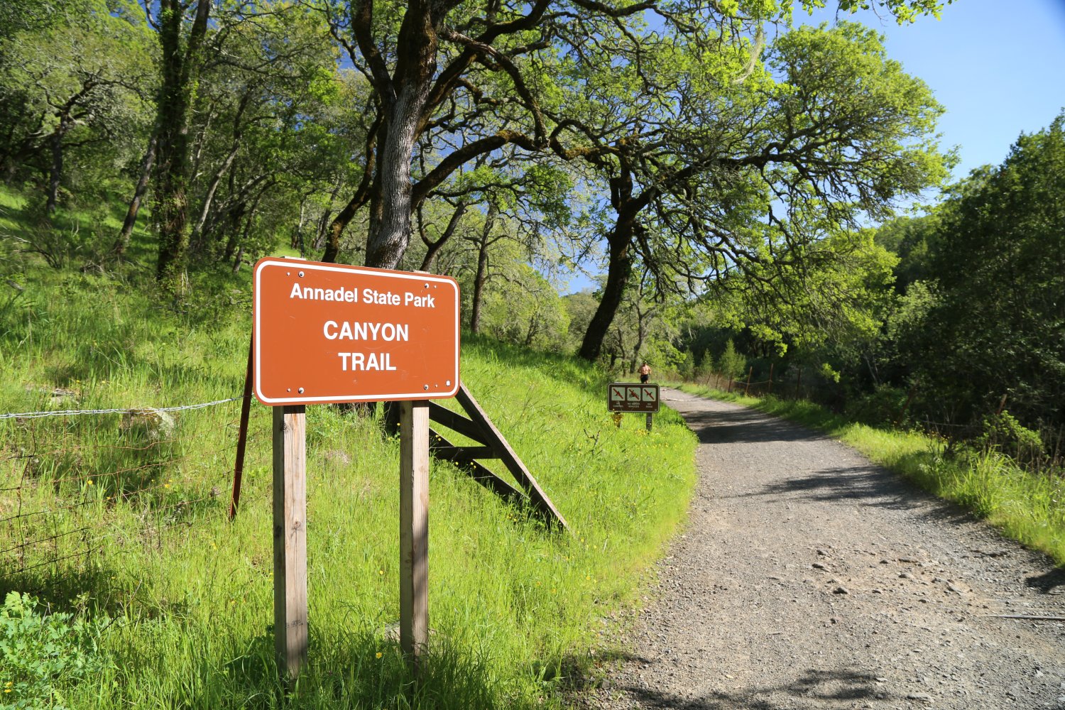
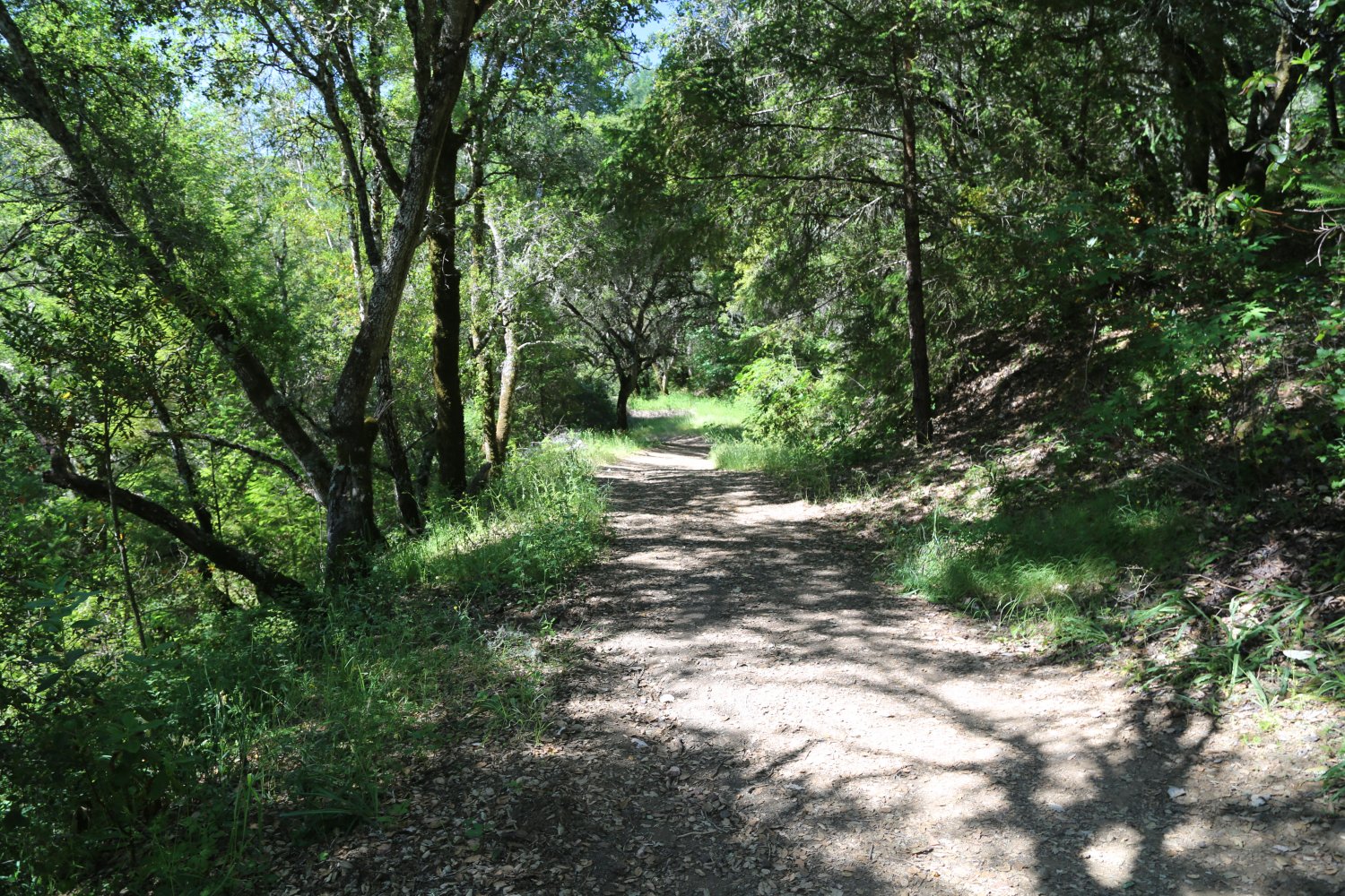
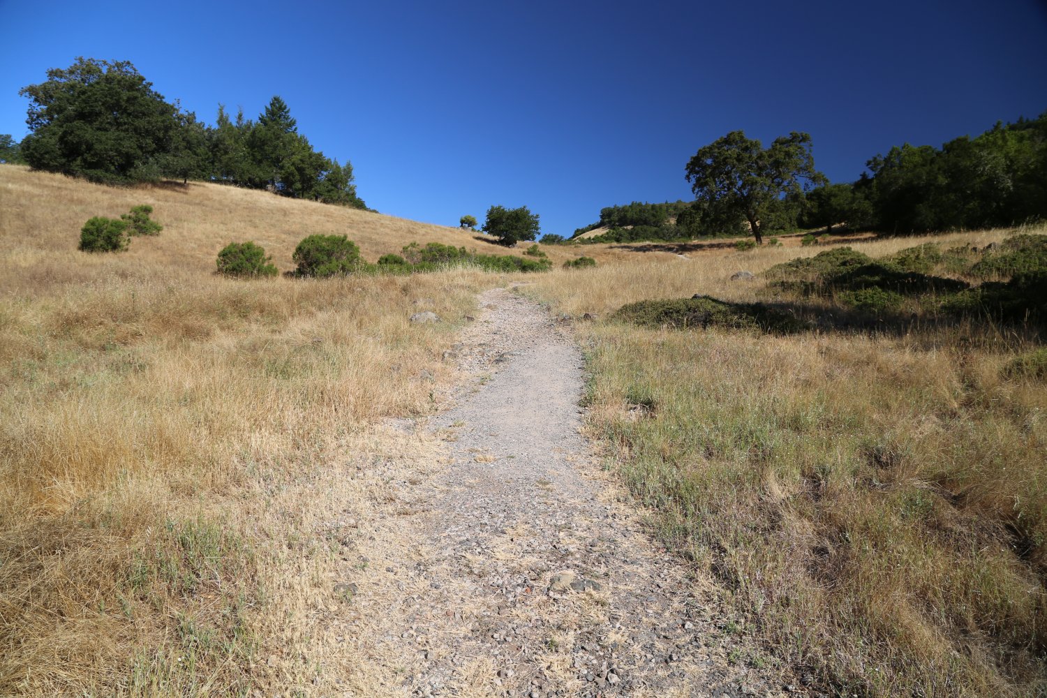
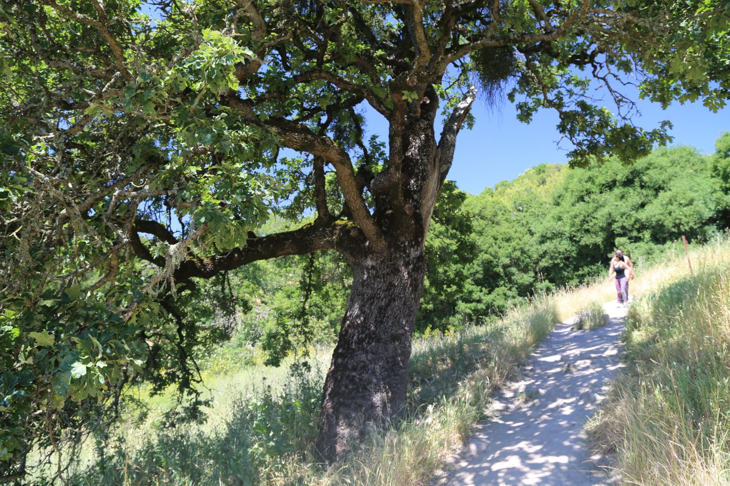
Annadel State Park is located east of Santa Rosa off of Montgomery Drive. This park borders two other parks mentioned below; Howarth Park, and Spring Lake Park. Annadel is composed of 4,913 acres, some rugged, some developed. There are many bike paths ranging from easy to some that will make professional mountain bikers cry in agony.
Over 40 miles of hiking, biking, and horse riding paths are in the park. A bike ride that we recommend is from Spring Lake (which is just off of Montgomery Drive) to Lake Ilsanjo.
This ride offers several options. For example the main trail provides a relatively easy ride, but you can also take the rough go trail, which is very steep, and winds its way up the side of a dry grassy slope. The ride from Spring Lake to Lake Ilsanjo is about an hour of moderate riding. There is a paved bike path around Spring Lake, but once you leave the lake, the trail becomes dirt. www.parks.ca.gov/default.asp?page_id=480
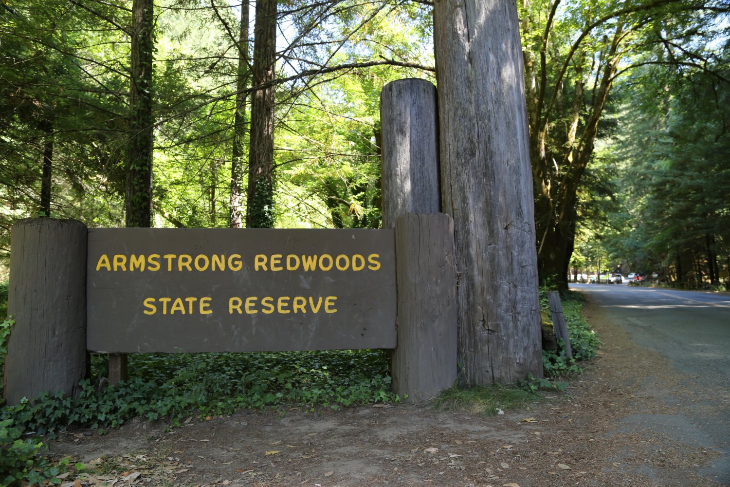
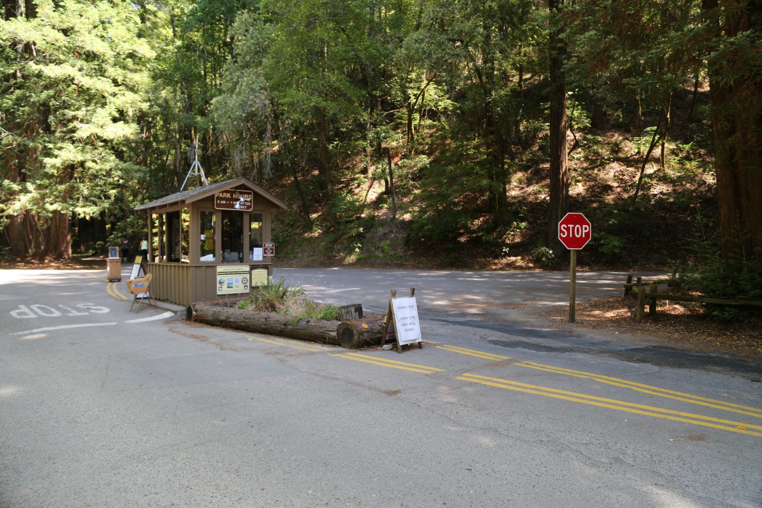
Armstrong Redwoods State Park is located just north of Guerneville just off of Highway 116 (the park is 805 acres).
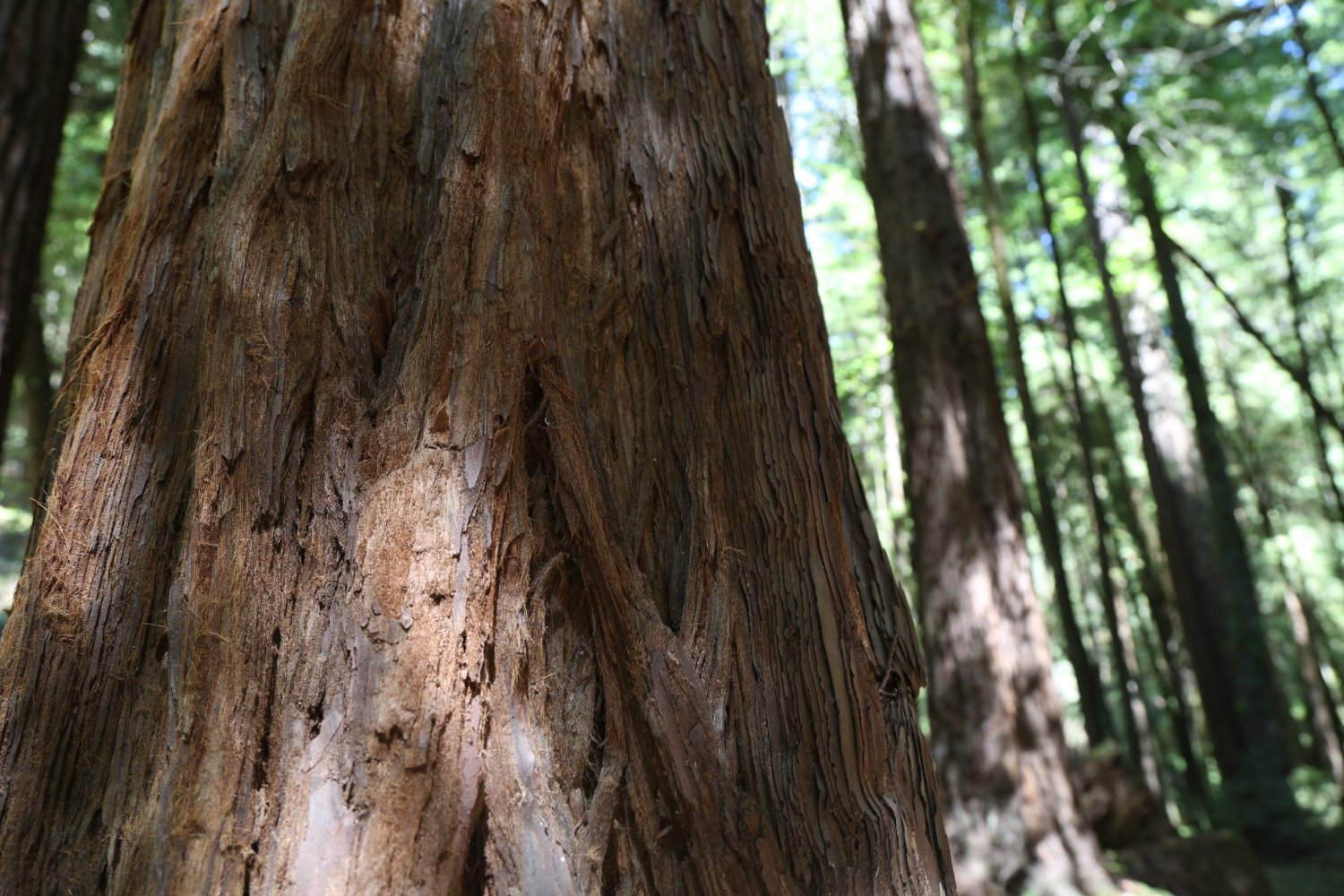
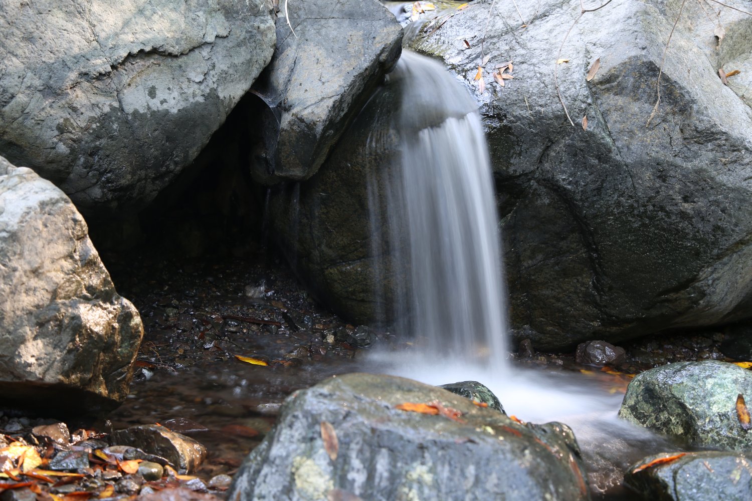
 This park is well worth seeing. Thousand year old redwood trees are common here. There are over 5000 acres. This park was set aside in the 1870’s. There are many hiking trails. Dogs are not allowed on the trails. All that remains of one large tree is the stump, and many of the tree’s rings are marked with plaques listing historical events. For example, the tree ring that marks Columbus’s discovery of America in 1492 is located towards the outside of the trunk.
A very quiet place to hike – you will be dwarfed by this giant trees. Often not very crowded on the weekdays.
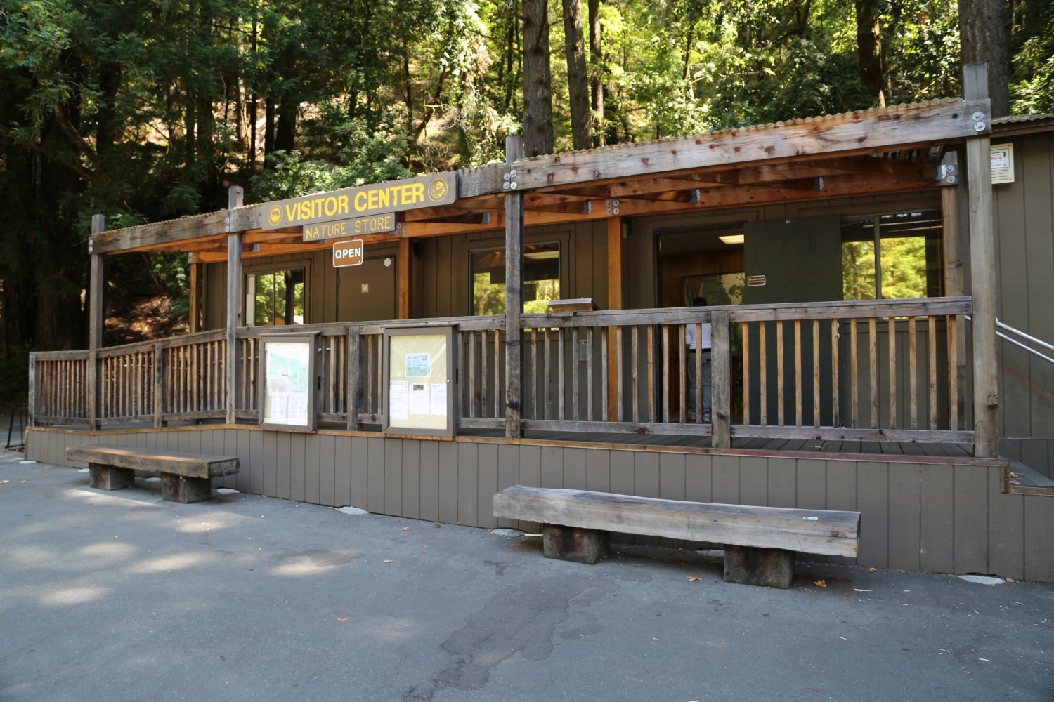
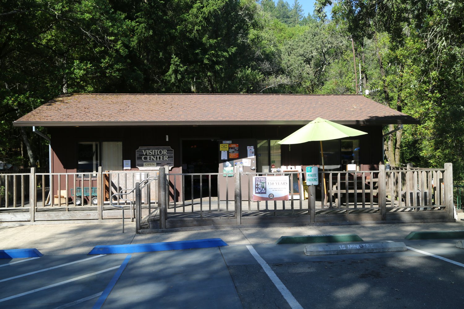
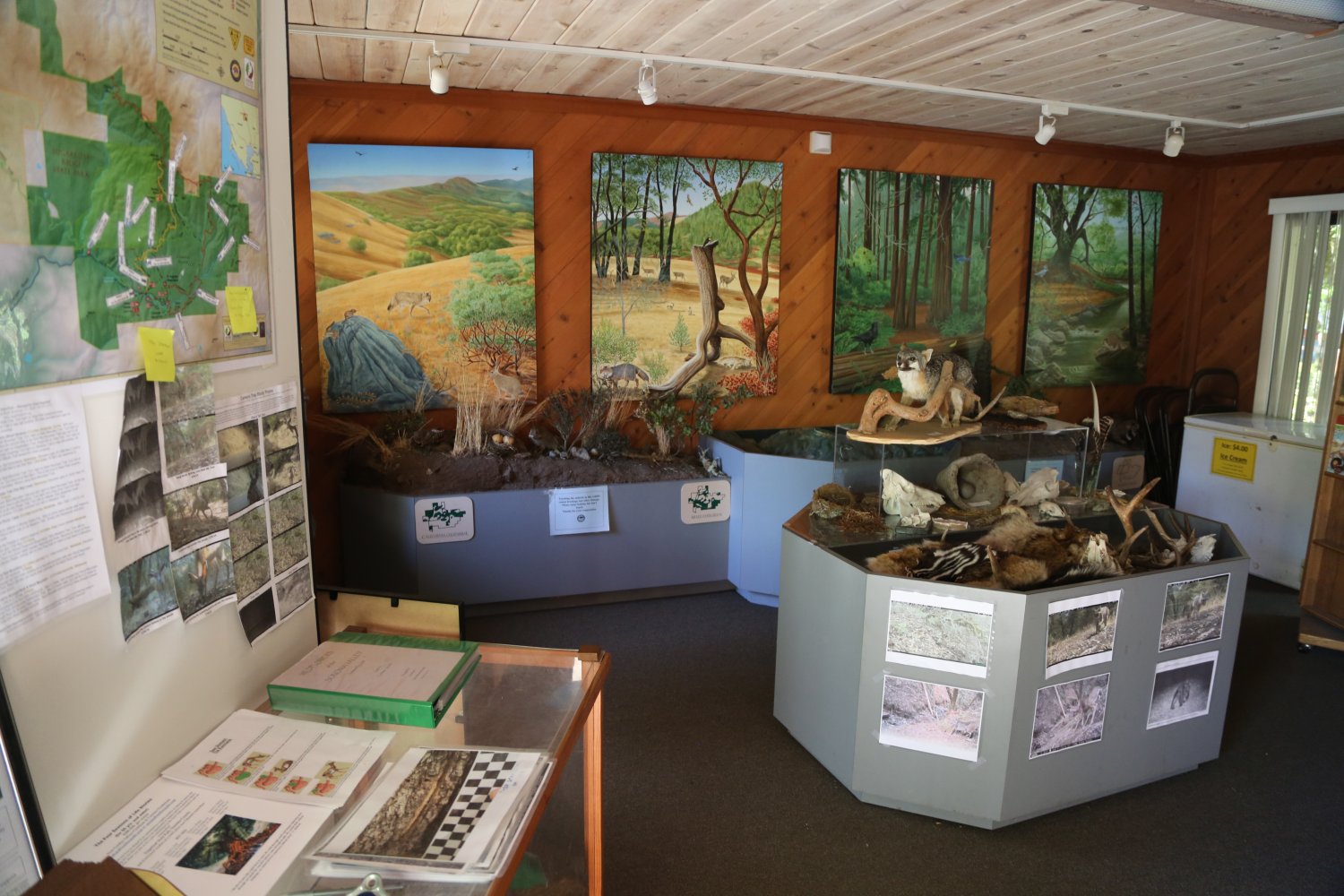
This is a great park to bring a picnic lunch and enjoy the solitude and quiet under these giant trees. Parking is free just outside the main park entrance – a small parking lot is located here – which is only a several minute walk to the edge of the redwoods. The drive from Guerneville is only a few minutes to the park entrance. Also if open, stop into the small Visitor Center & museum next to the parking lot; this highlights local flora and fauna.
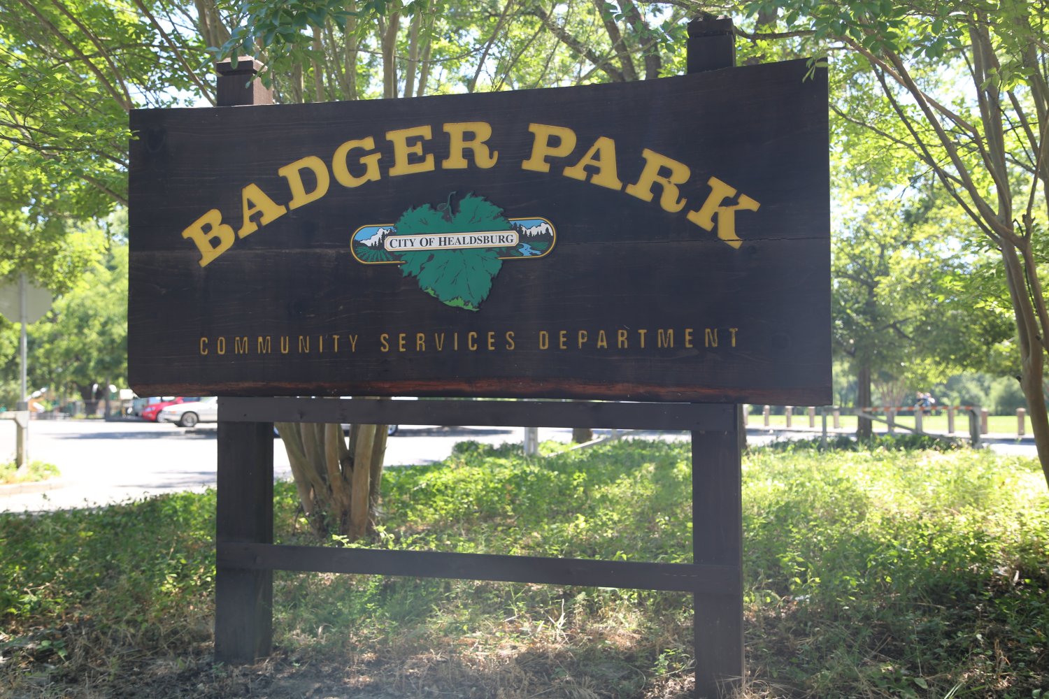
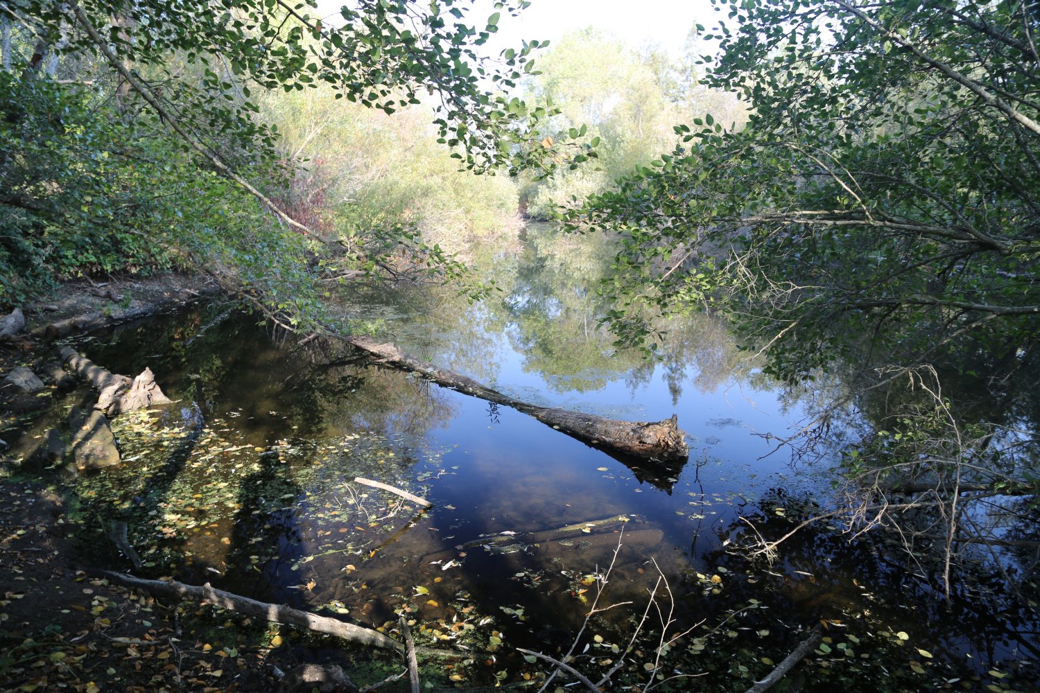
Badger Park is located within the Healdsburg city limits at 750 Heron Drive. The park features some 12 acres spread out along the banks of the Russian River. The river and the riparian zone along it’s banks is what sets this park apart from other Sonoma County parks. A footpath leads along part of the river with many little narrow dirt trails leading down to “secret” spots right on the river. Great place to bring some food, a blanket and a good book on warm summer days.
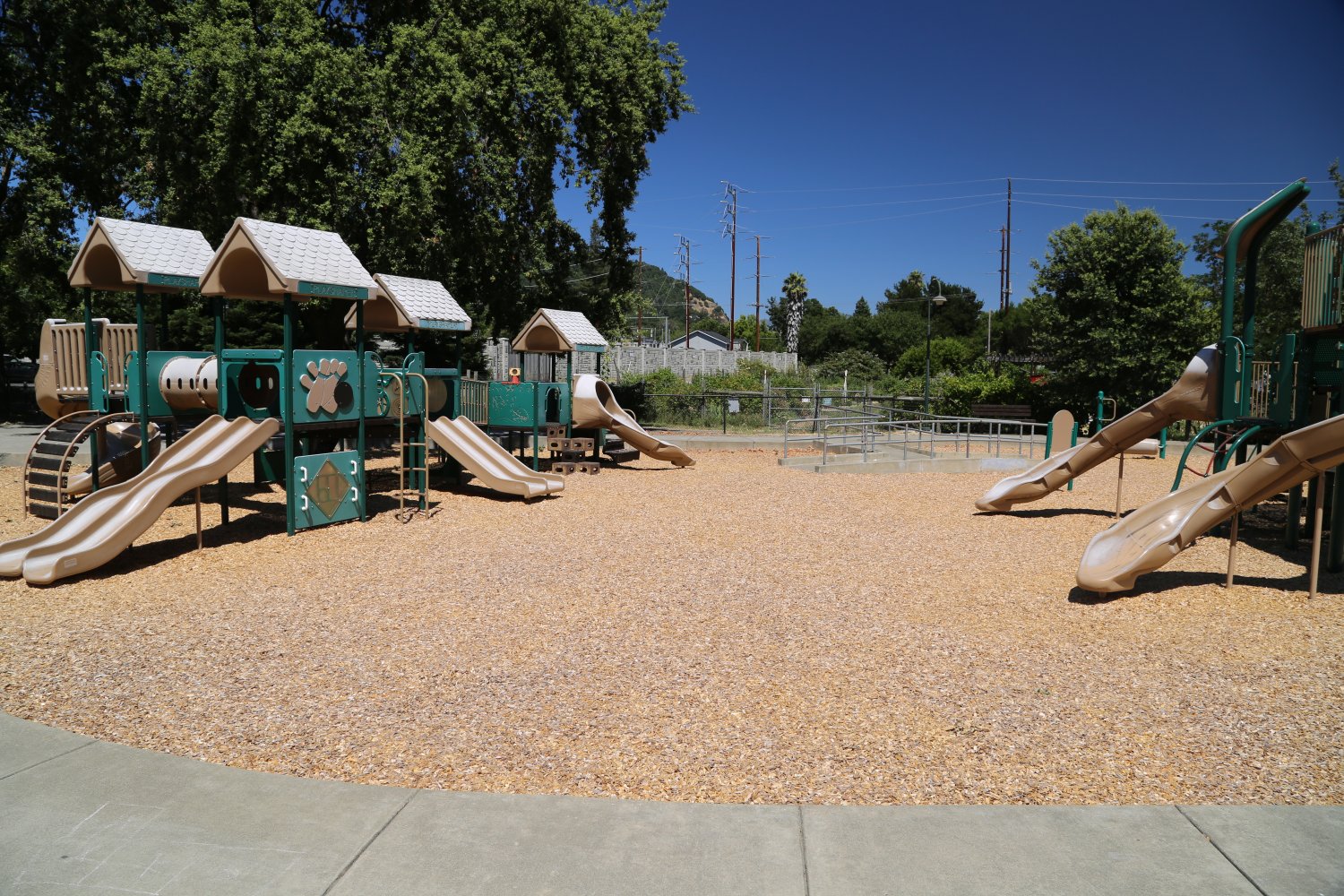
The park also has a large grass area where people often play frisbee, walk their dogs or play soccer. A paved path circles most of this grassy area and people will often be walking or jogging here. A small fenced off dog park is located near the parking lot as is a community garden. Also a small playground is on site – during the weekdays often busy with mothers and children. One of our favorite and most relaxing parks in the county.


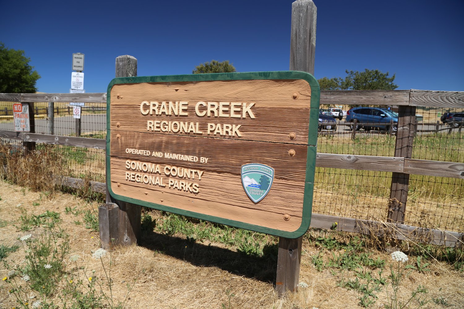
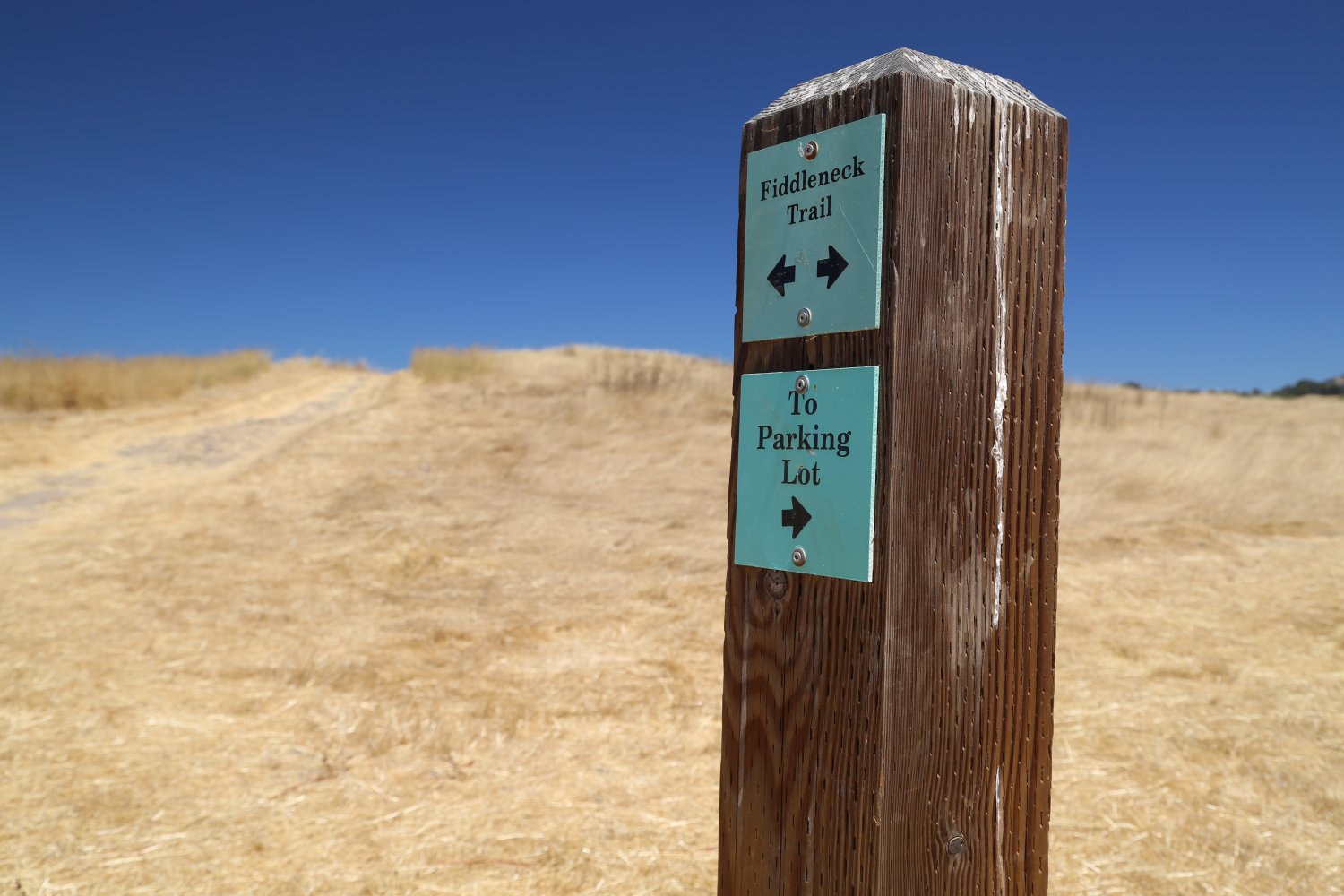
Crane Creek Regional Park is located south of Santa Rosa about 2 miles off of Petaluma Hill Road (south of Sonoma State University). Vistiors pass a series of almost right angle turns on their journey up to this rolling hill side located park. Like many of the other parks in Sonoma County, those who want to park here need to pay for each parking spot. Unlike some of the other area parks whee you can park outside and walk in –
there isn’t much parking on the main road – and some of the pull out spaces are signed “no parking”.
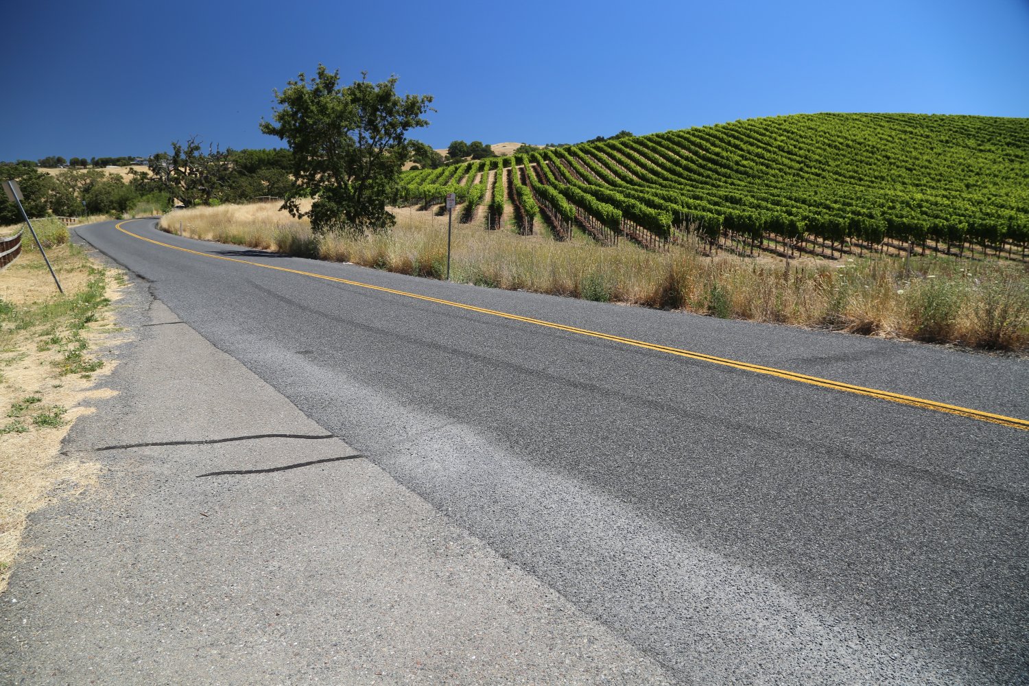
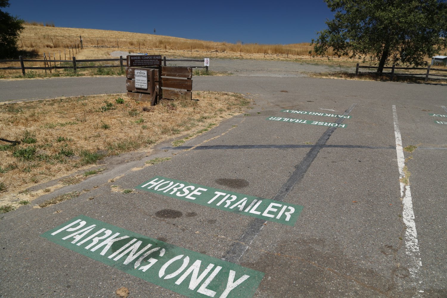
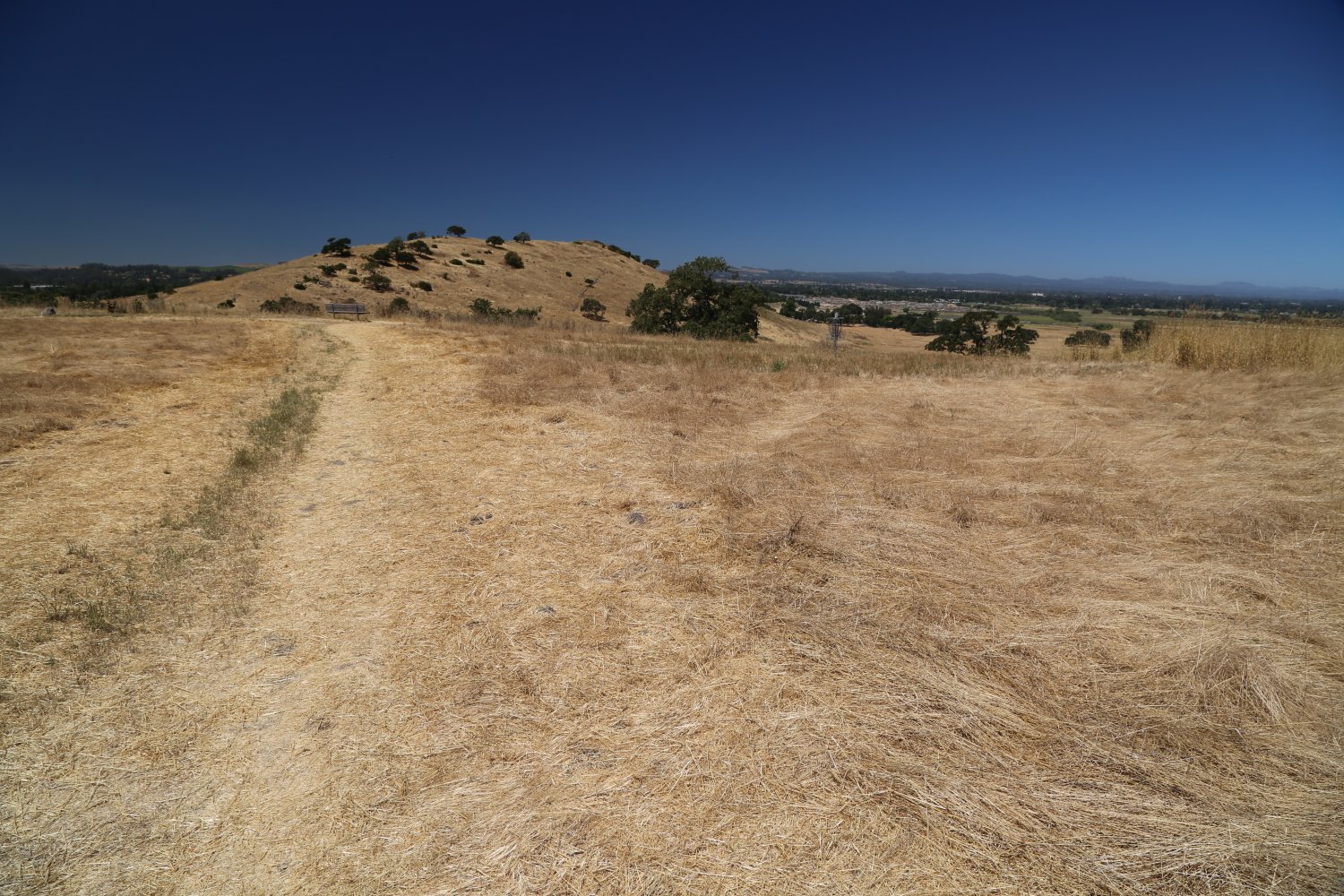
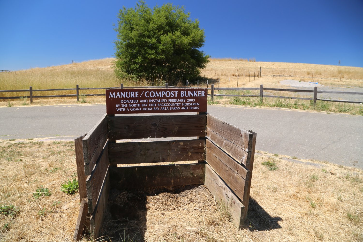
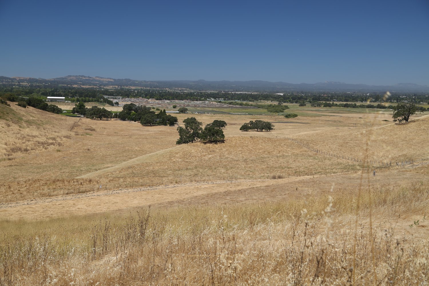
This park is categorized by its absence of shade – mostly open hillsides and trails in the open sun. Within a short walk of the parking lot are excellent views overlooking the Santa Rosa plains. Horses are welcome – with several long horse trailer parking spots and a manure/compost bunker. The park is surrounded by vineyards on it’s eastern flanks.
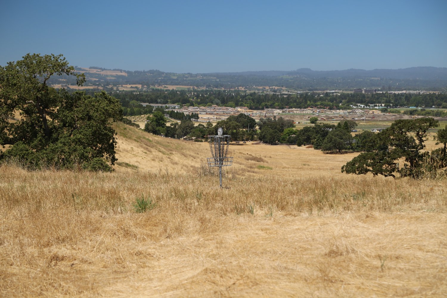
Features 128 acres and 3.5 miles of hiking/biking/horse riding trails. Also a popular location for disk golf – an 18-hole disc golf course is on site (which explains those metal looking structures scattered about in the fields near the parking lot). Crane Creek flows through the park – and makes for a relaxing hiking destination. The Crane name comes from the family that settled here many years ago (part of the same family that grows the locally well-known Crane Melons).
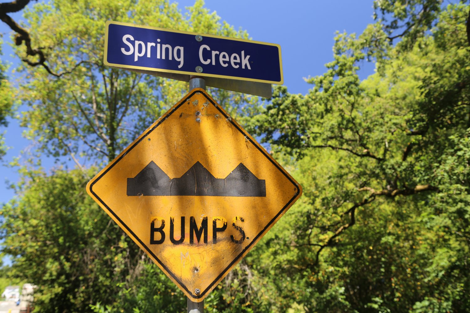
Doyle Community Park is located off of Sonoma Ave via Doyle Park Drive (the main entrance) in Santa Rosa. Also an entrance off of Farmers Lane. Guest driving here will notice a very aggressive speed bump program on Doyle Park Drive – mostly due to the nearby Santa Rosa French American Charter School (formerly Doyle Park Elementary School – go dragons).
Named for Frank P. Doyle – a recognizable name around Santa Rosa – he was the chairman and majority shareholder of Exchange Bank (prominent local bank), the library at SRJC is named for him and he created a scholarship for students in good standing at SRJC. In addition, he set a specific amount of money aside from his trust for the annual upkeep of Doyle Park.
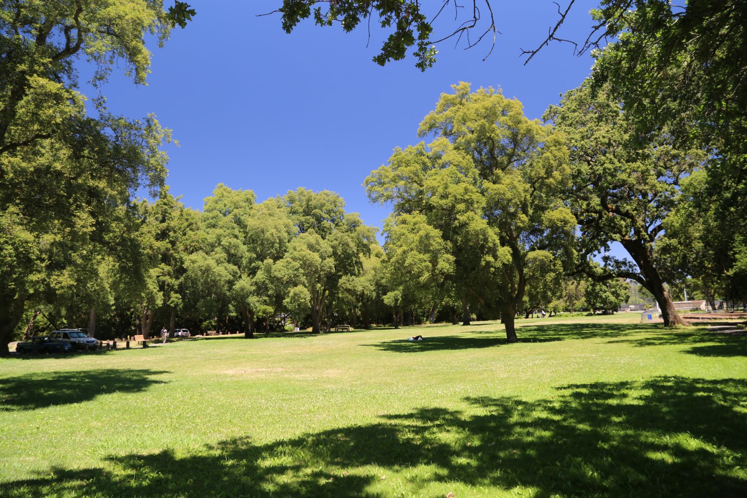
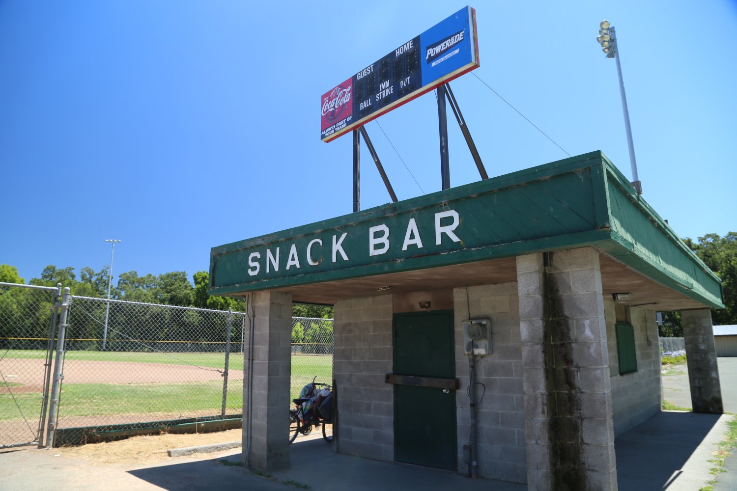
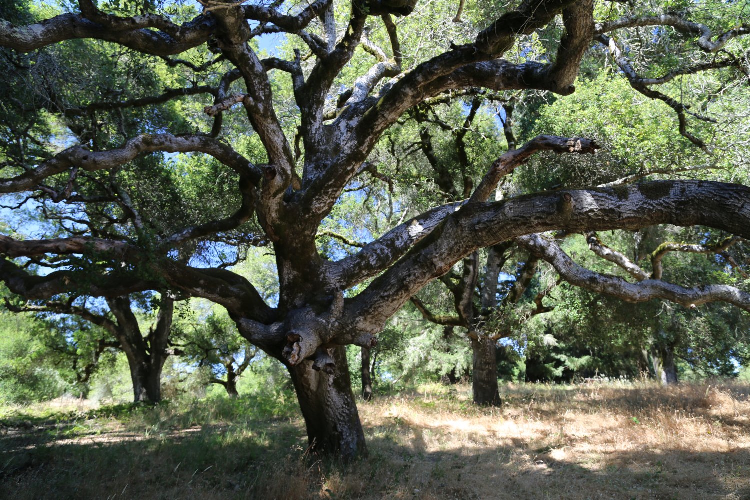
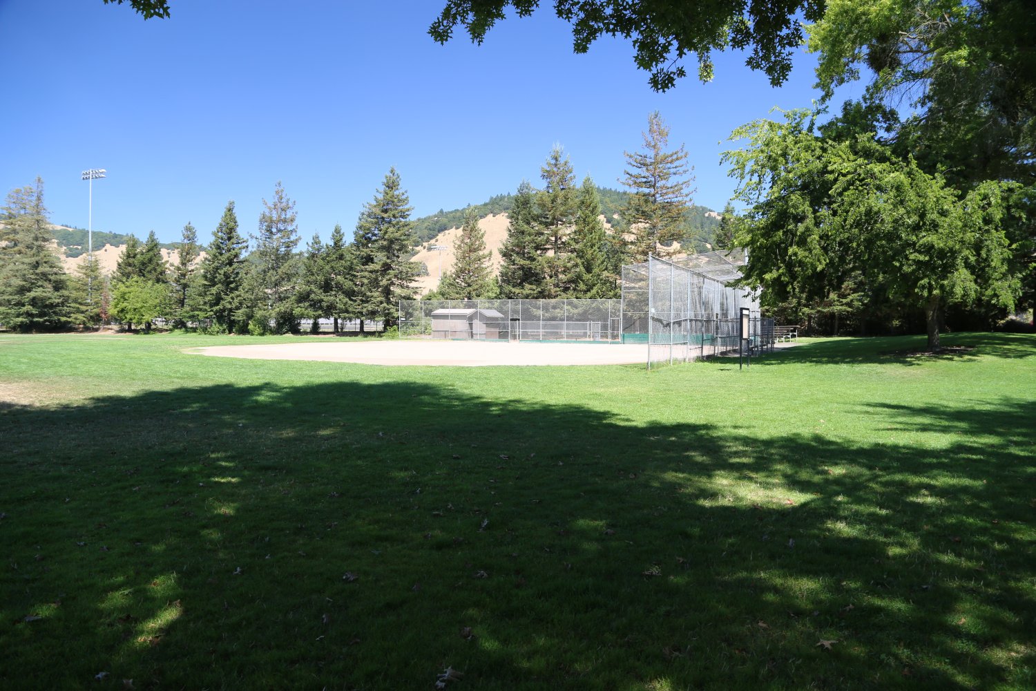
The park is spread out lengthwise along the banks of the tiny Spring Creek. Very sheltered, it is a mix of open grassy space with many oak trees (including several cork oak trees – yes the same species used for harvest corks for wine from). Weekdays in the summer seems to be a mix of some homeless folks, with young mothers and children and other lounging around in the sunshine. Features a small playground, a nearby baseball field, a few raised BBQ stands and some picnic tables. Also a sizable dog park. The park is surrounded by residential neighborhoods, but is big enough that you don’t feel the presence of all the nearby homes.

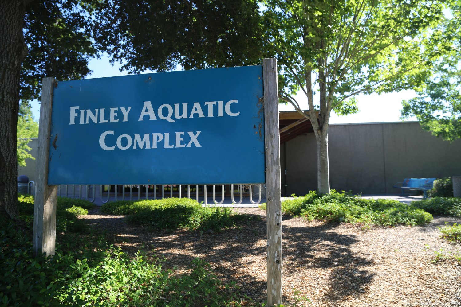
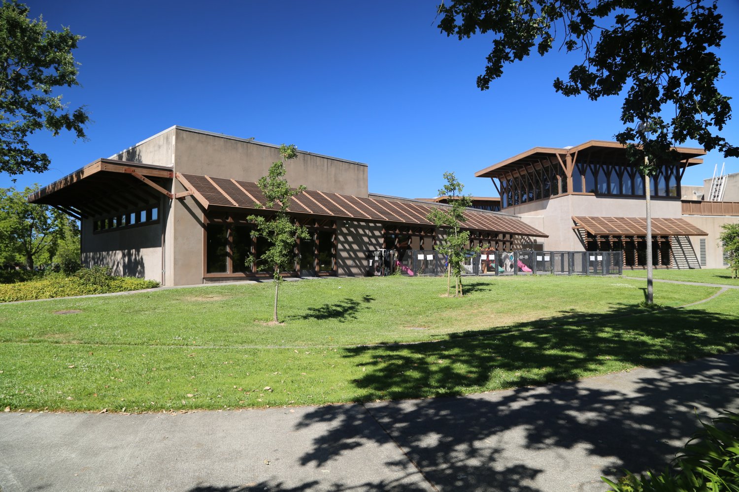
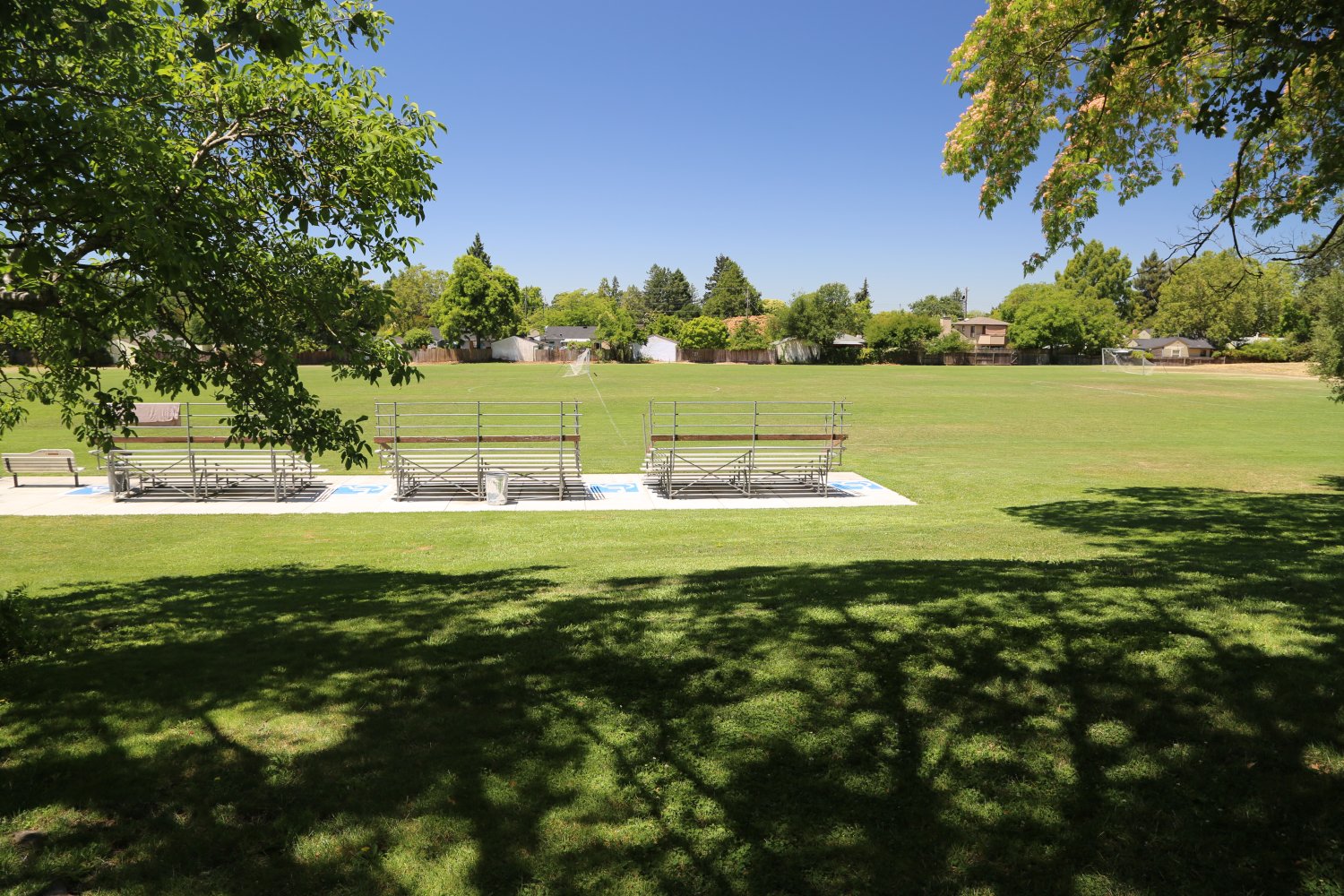
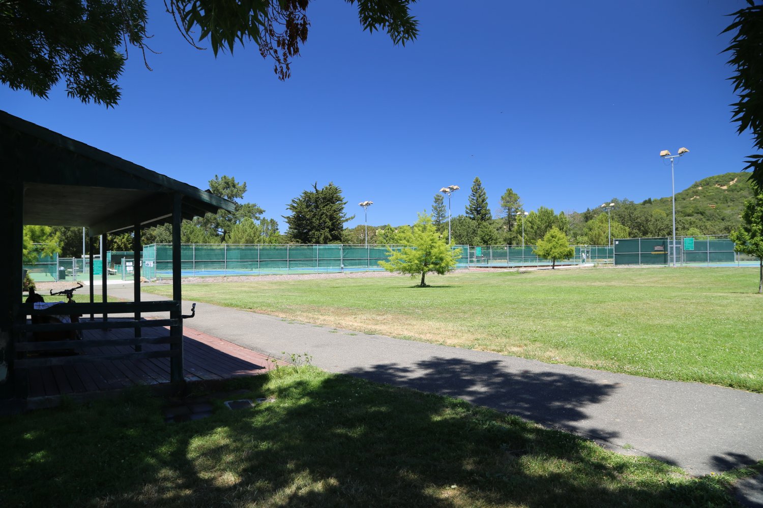
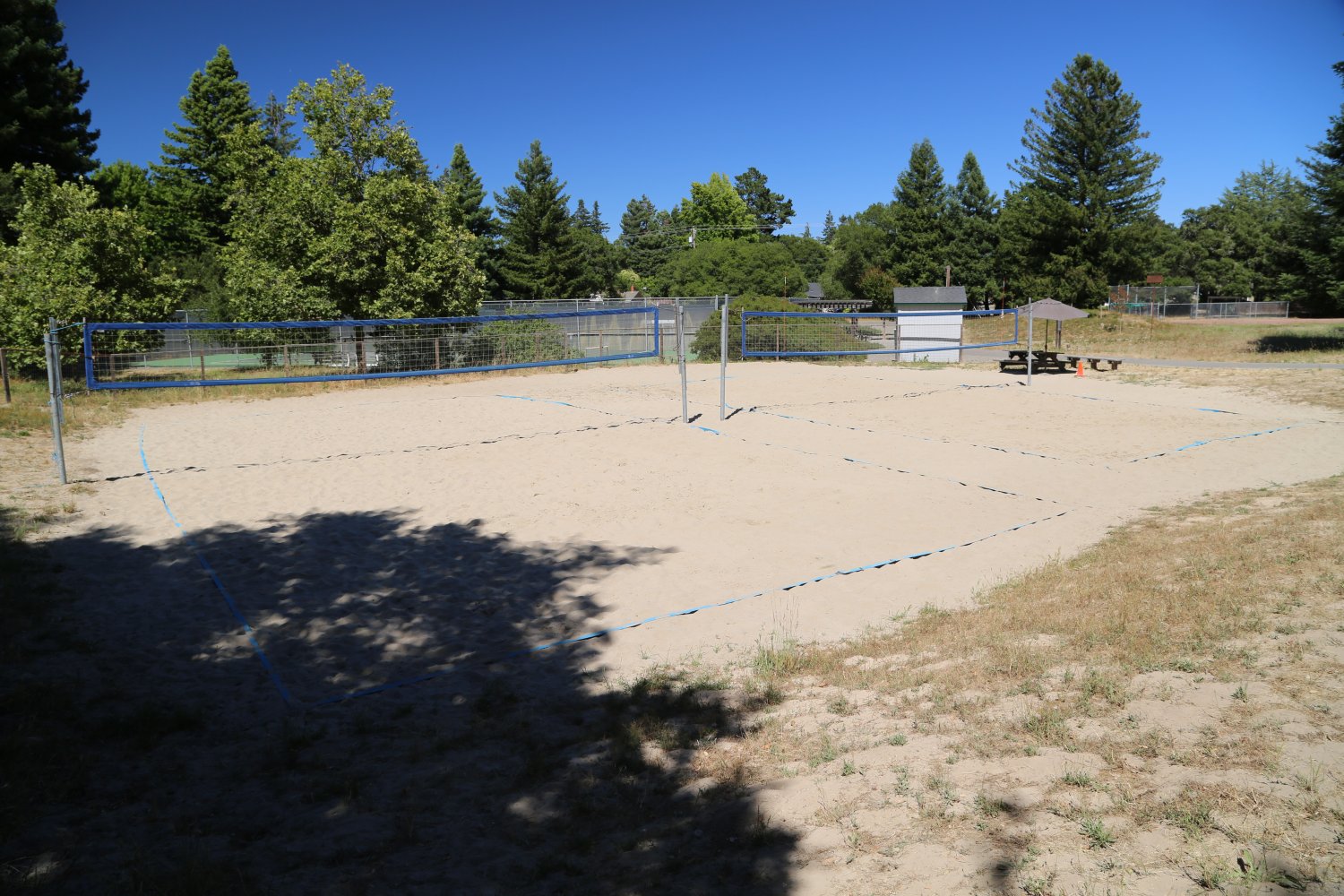
Finley Park & Community Center is located at 2060 W. College Avenue in Santa Rosa. This often popular park is neighbors with the nearby business park to the south. There is plenty of space spread out across 22 acres. Highlights include the Aquatic Center which is often a popular spot for families in the summer.
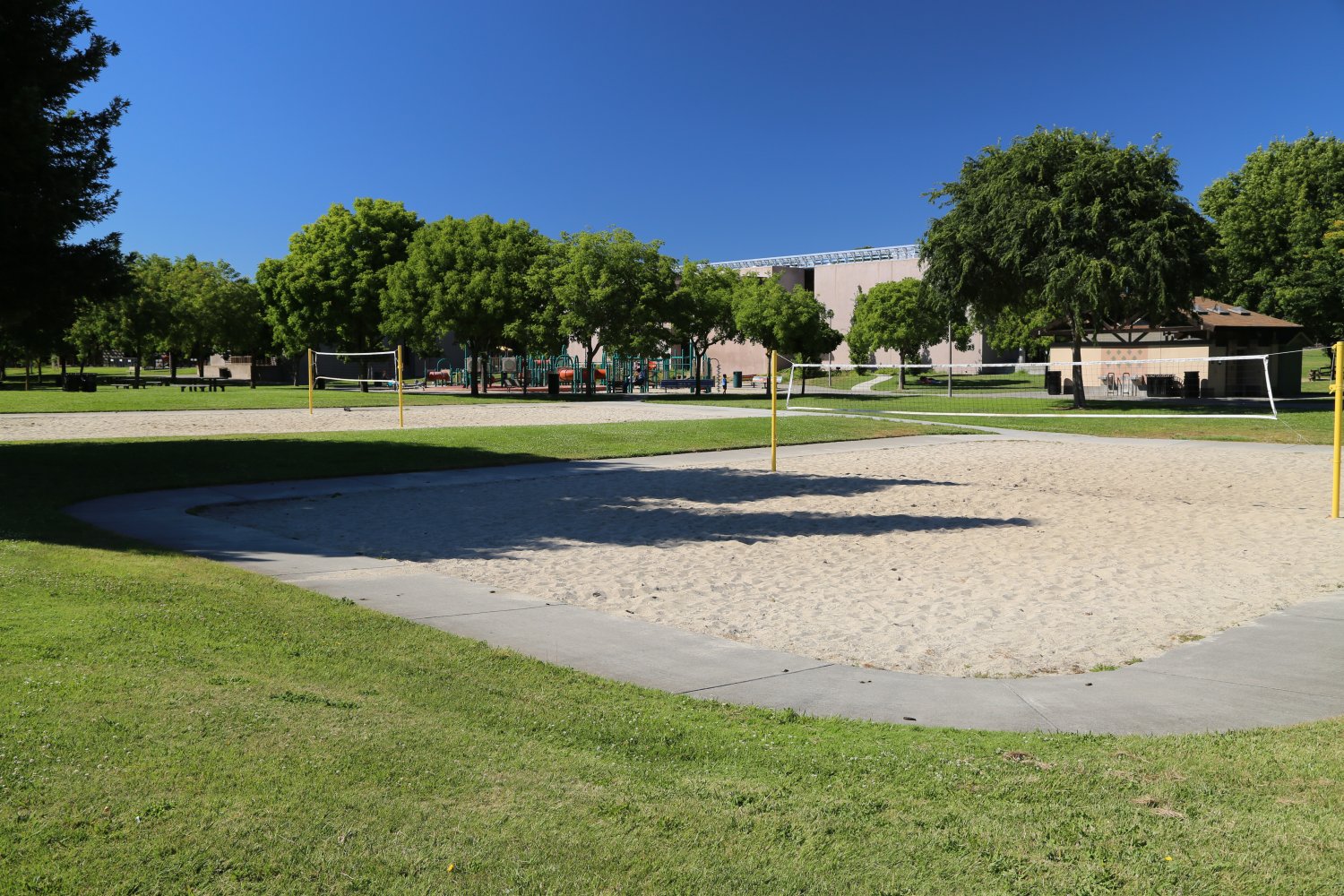
Offers plenty to do for all ages. Has one of the few open air volleyball courts open to the public within the city of Santa Rosa – also features tennis courts, basketball courts, a children’s playground and plenty of lawn space for lounging. Also some picnic tables in the shade of several oak trees. Lots of parking in a pull in parking lot (two entrances: one off of West College and the other off of Stony Point). Often special events are held here throughout the year.
This park and center was made possible in part by a donation from Ernest L. and Ruth W Finley – patrons of the community and also of the arts (generously have donated to the Luther Burbank Center).

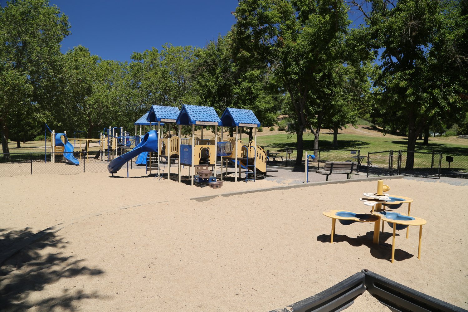
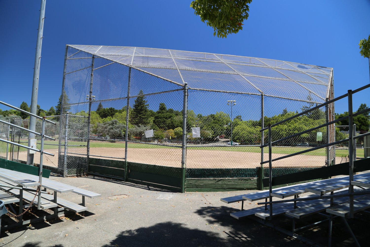
Franklin Park is best accessed off of Franklin Ave (the main entrance) in Santa Rosa. There is plenty of parking in a parking lot that wraps around towards the back of the park. Pedestrians and cyclists can also enter off of Beaver Street (a residential area the borders the park). A preschool is located near the main entrance just below a hill that represents what perhaps this part of town looked like before it was completely developed.
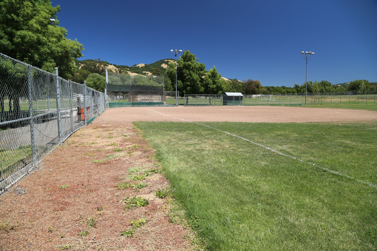
This approximately 13 acre park Features a baseball diamond (although you don’t want to hit the ball to far otherwise it will end up on Franklin Ave or in someone yard on the other side of Franklin Ave. Also has a small playground (with sand) and some picnic tables in the shade on top of a small grassy hill. The largest feature of this park is the football/soccer field.
Both this park and the adjoining street get their names from a small settlement in the area originally called Franklintown. An old sawmill stood on what is now Franklin Park and was eventually replaced with a small clubhouse (which still stands).

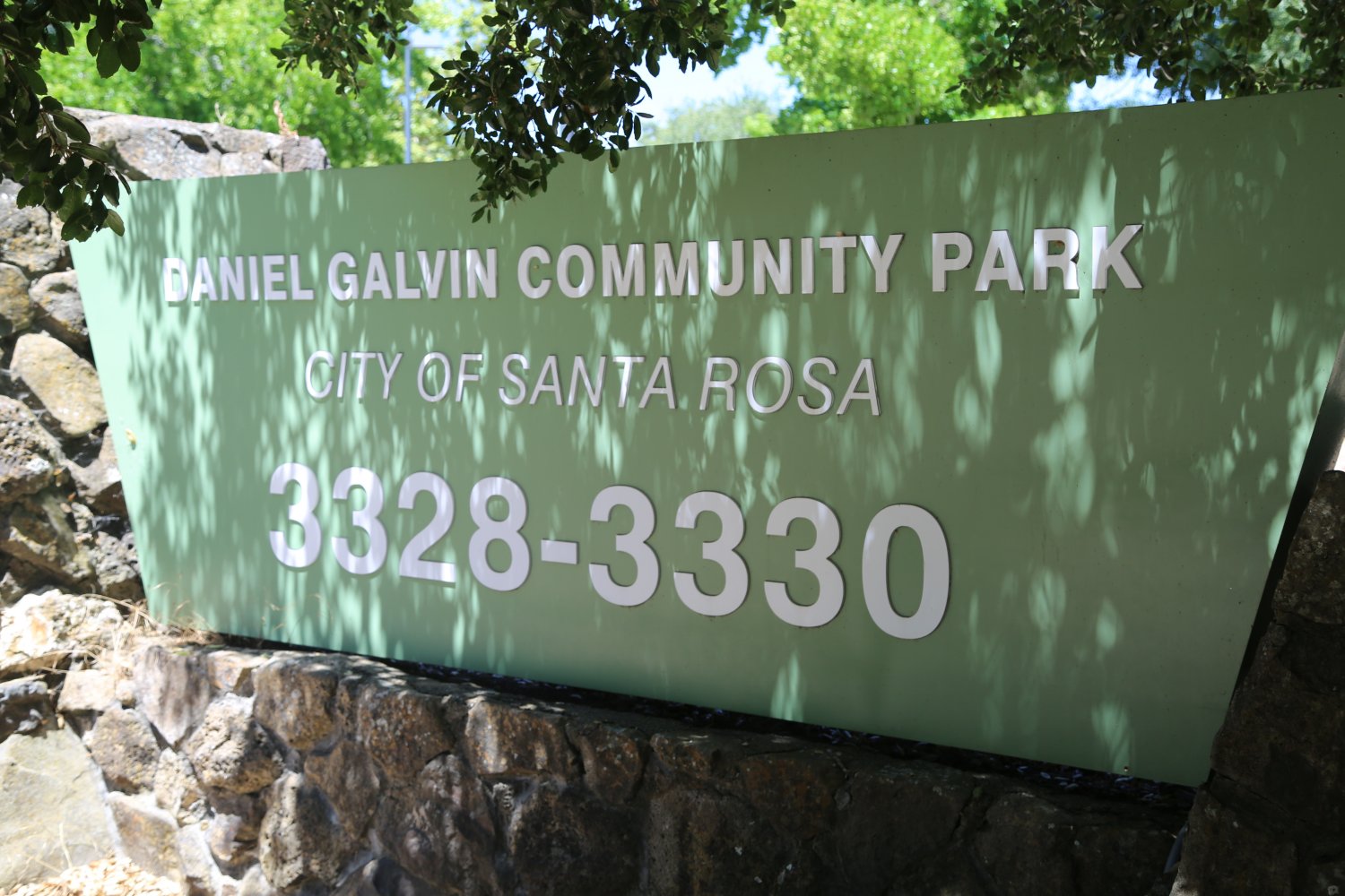
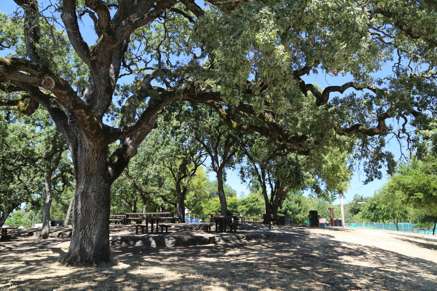
Galvin Community Park is located in Southeast Santa Rosa off of Yulupa/Bennett Valley Road on the edge of town. It shares the main entrance/driveway with the sizable Bennett Valley Golf Course. Very wide open space with lots of green grass including a soccer field and a baseball field (total park size is nearly 24 acres). Also one of several places in Santa Rosa that offers public tennis courts. Like with many other local parks, it’s namesake comes from an individual. In this case Galvin Park was named after Dan Galvin; he was a member of the Santa Rosa Recreation and Parks Commission.
Incidentally, this land was previously owned by the Santa Rosa School District – they had plans to build a Junior High School. Those plans never materialized and they sold it to the City of Santa Rosa. Also former home of the Memorial Hospital Summer Picnic day. Plenty of parking throughout the park. Also several dog parks within the park.
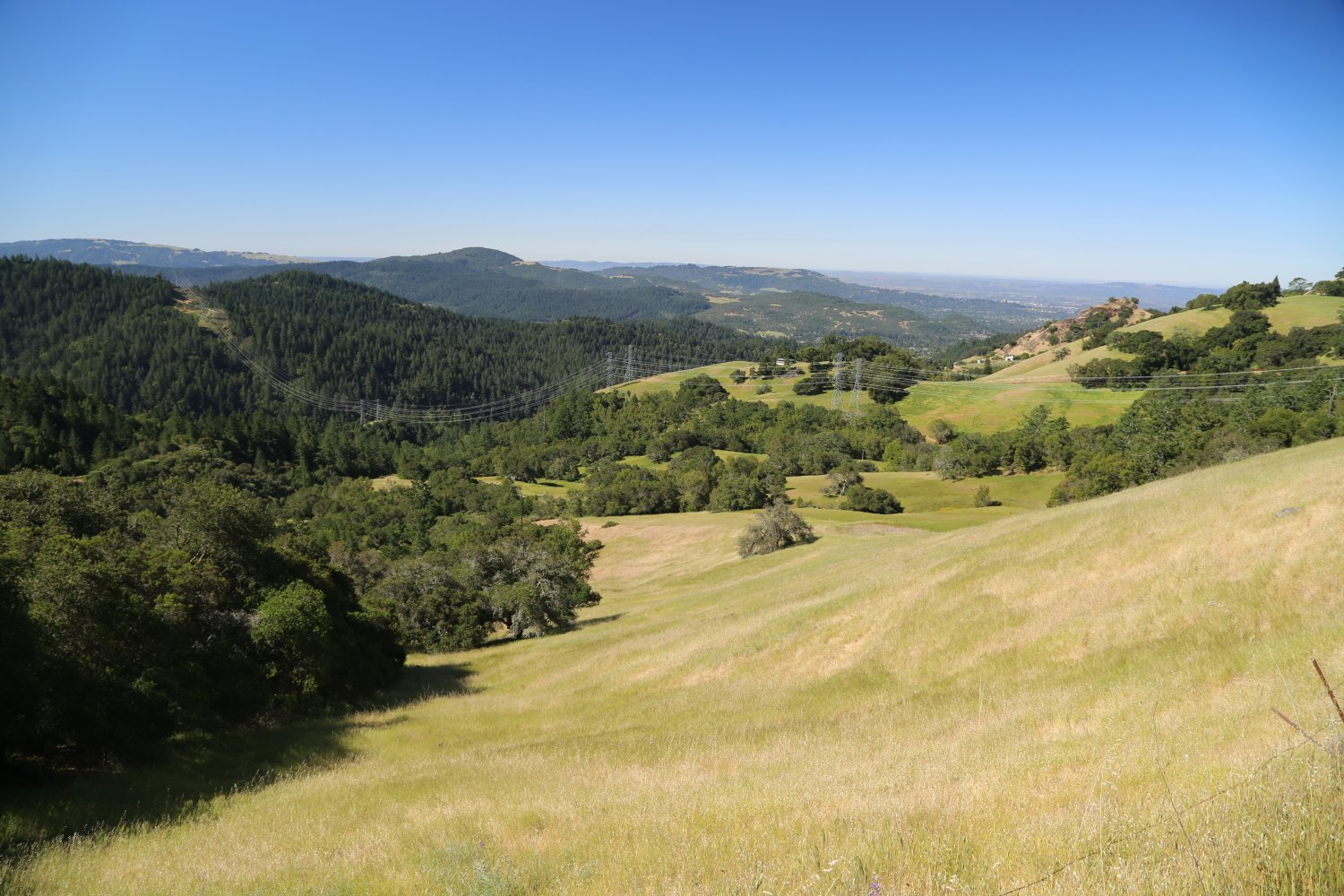
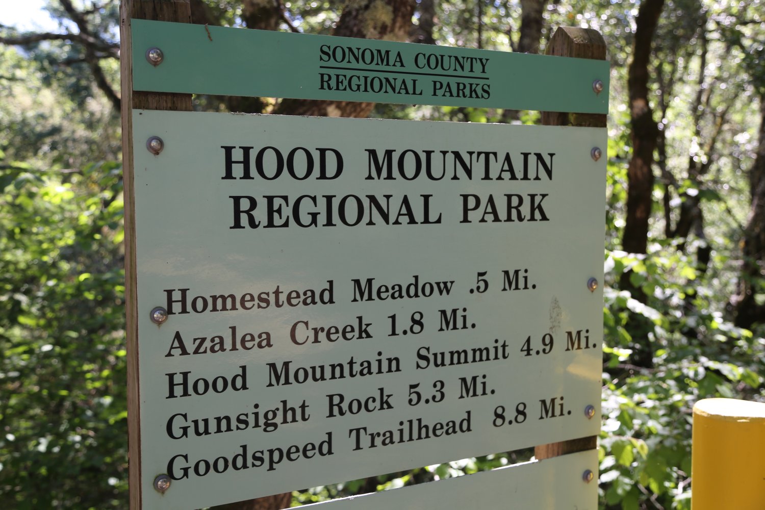
Hood Mountain offers 1,750 acres of wilderness terrain with 19 developed dirt trails throughout the park. There are two entrances – the north entrance is several miles in off of the very windy and at times offering scenic views – Los Alamos Road off of Highway 12. This road winds past several residential subdivisions before it begins its climb high into the hills. Eventually it will begin to descend via a one lane road until you reach the gravel parking lot at the trailhead.
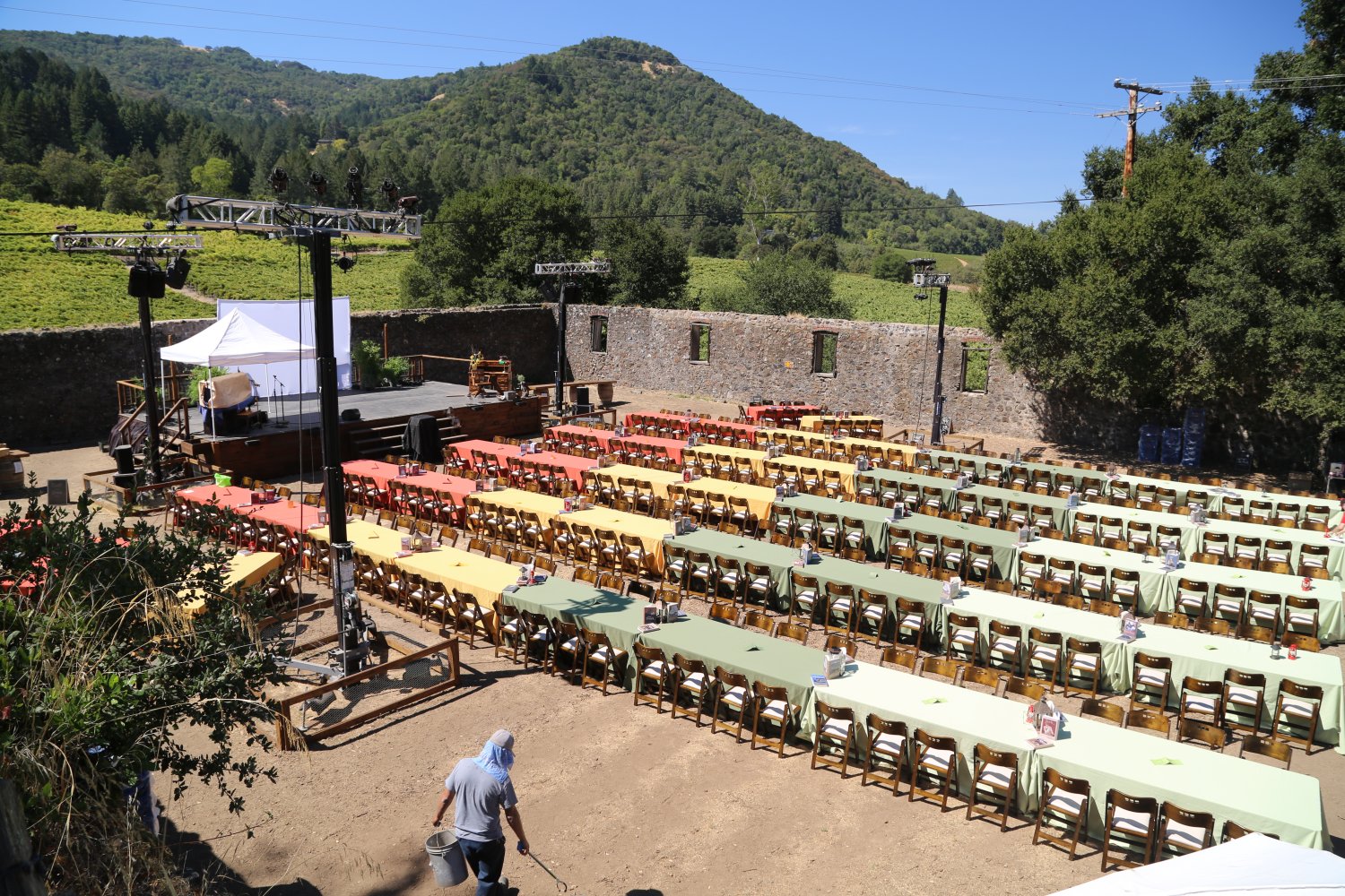
The south entrance, also off of Highway 12 (east Santa Rosa) is via Pythian Road. During the summer months – an event is held every Friday via the south entrance called Funky Fridays at on the grounds of the Hood Mansion. Features music in the evenings with the proceeds benefiting the Sonoma County parks system.
Open from 7am or 8am until sunset – parking is charged at $7 per vehicle per day via the automatic ticket machine dispensers.
On a very clear day you can see all the way down to the Golden Gate Bridge from Gunsight Rock and several lookouts along the Valley View Trail. Several primitive camp sites are available in the park – by walkin only.


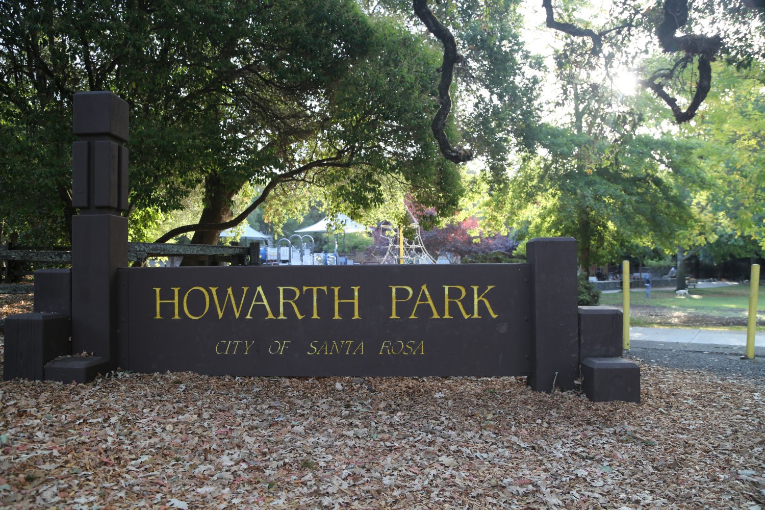
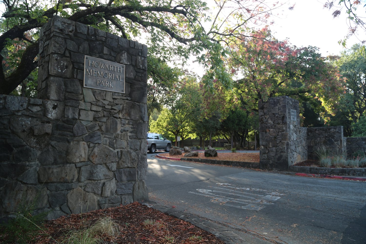
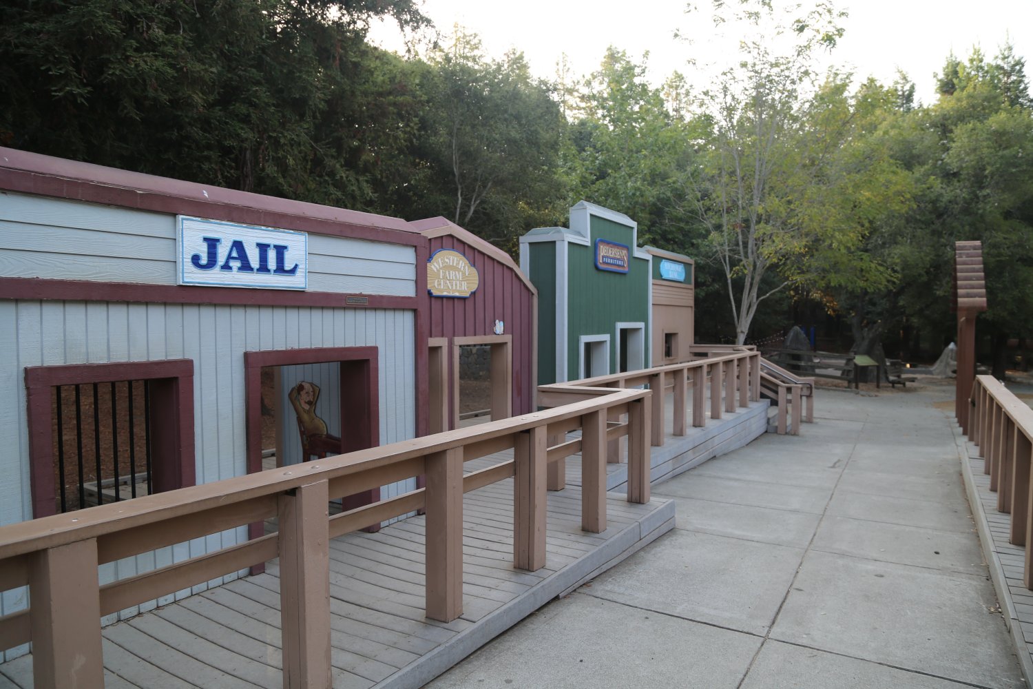
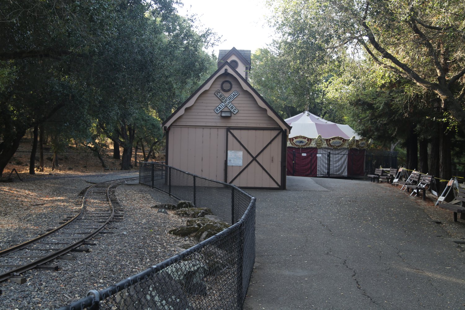
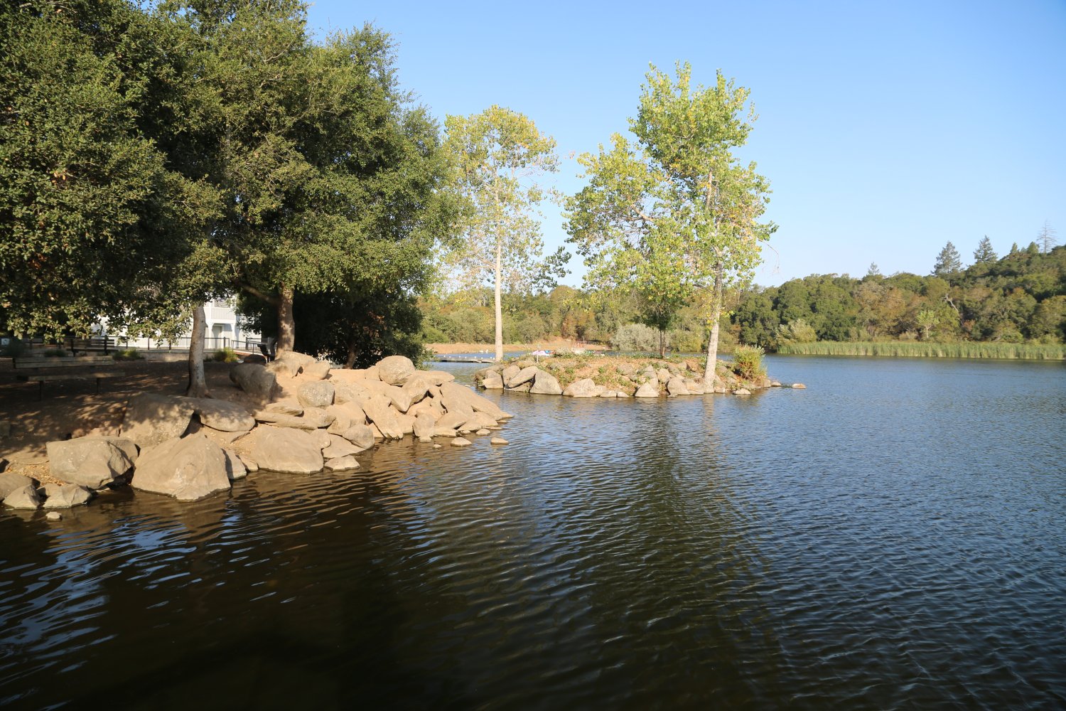
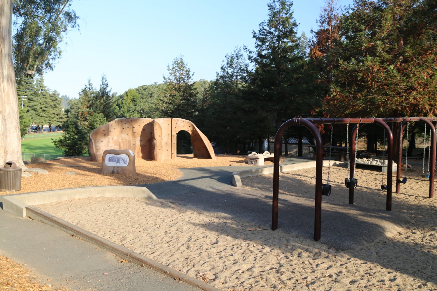
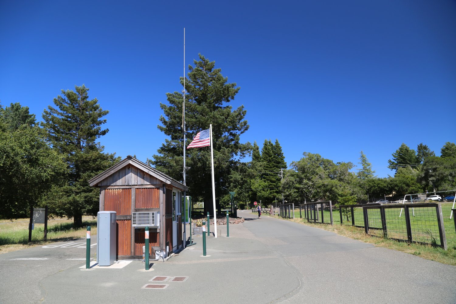
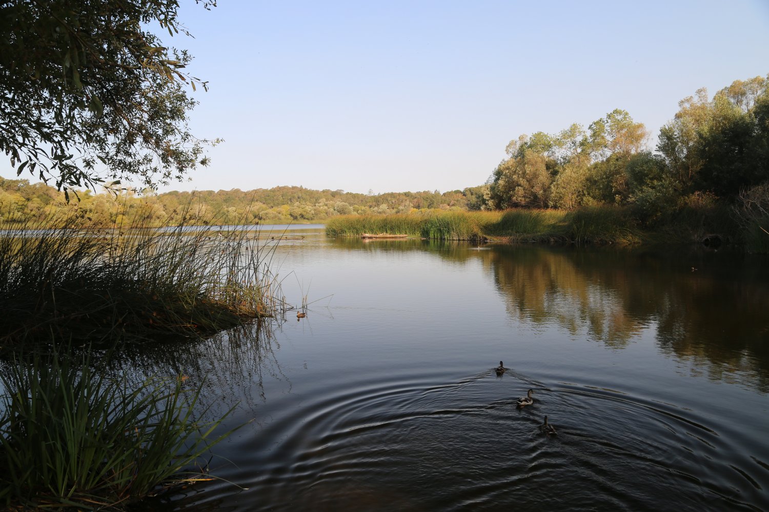
Howarth Park is located next to Spring Lake and in front of Annadel State Park in Santa Rosa. This park is composed of 152 acres and includes a small lake (Lake Ralphine) with sailboat, canoe, and paddleboat rentals. The lake is stocked with catfish, bass, trout, and bluegill year round. Howarth Park also has an amusement section featuring a carousel, pony rides, a petting zoo, and miniature train rides. A number of years ago, the train depot burned down but has since been rebuilt. The Western Street is always a favorite with children and features a number of prominent and long time Sonoma County businesses as sponsors.
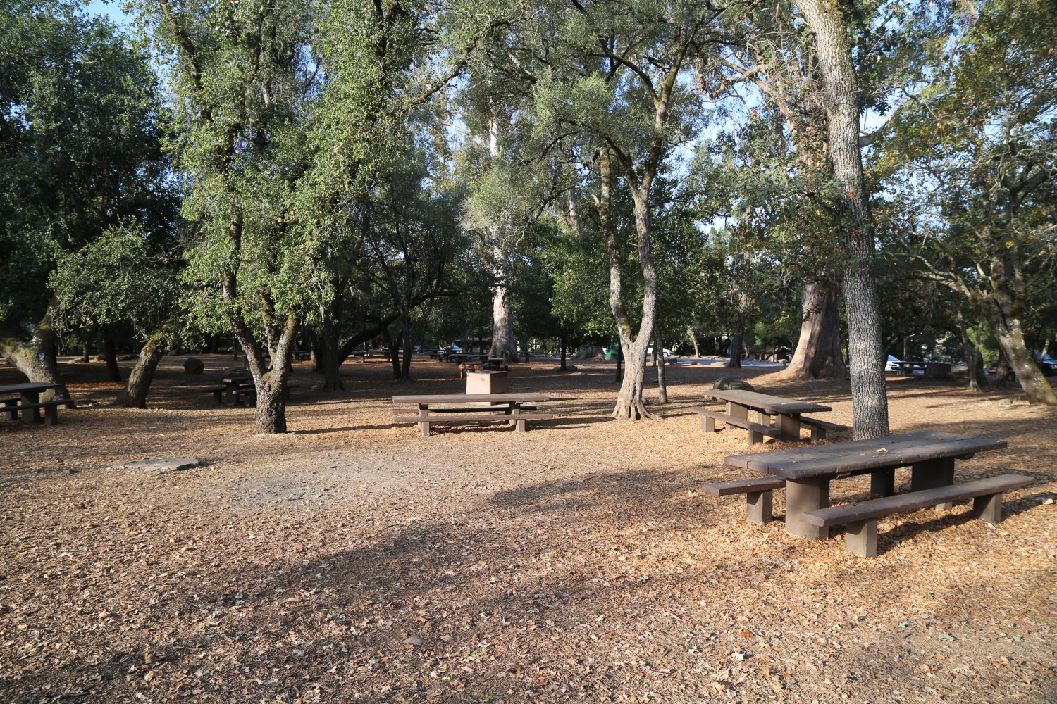
Lighted tennis courts are located directly next to Montgomery Drive, as well as hillside picnic areas (families often have family picnics at this park), and jogging paths. Several made for TV movies have been partially filmed at this park. For more information call (707) 543-3282. To reach the boat house call (707) 543-3424.

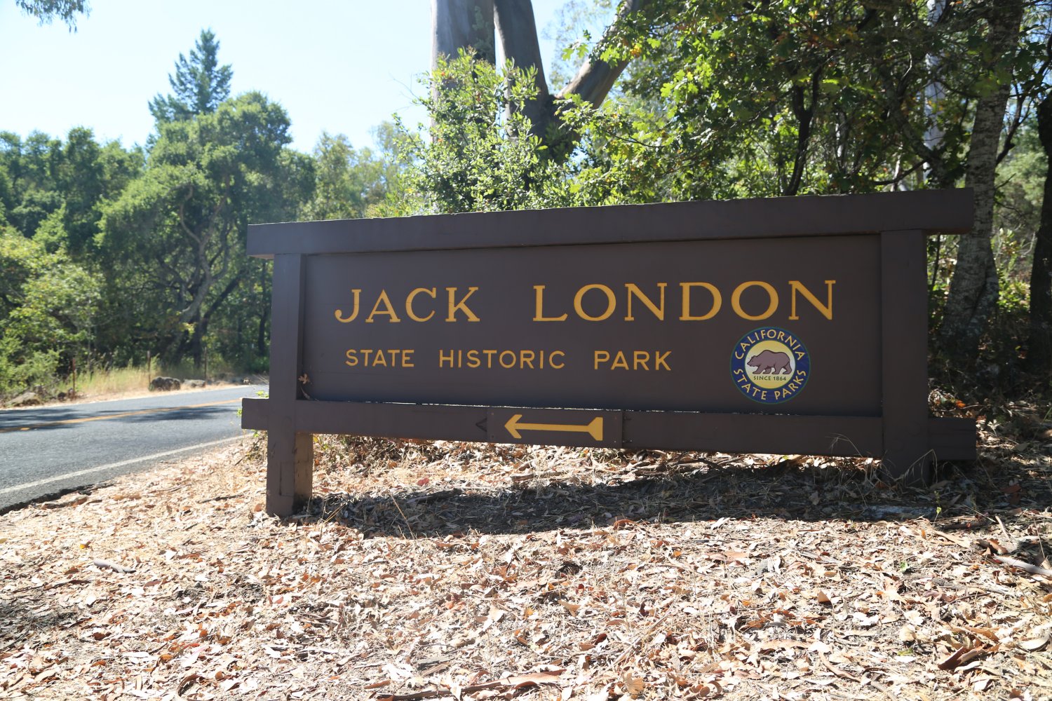
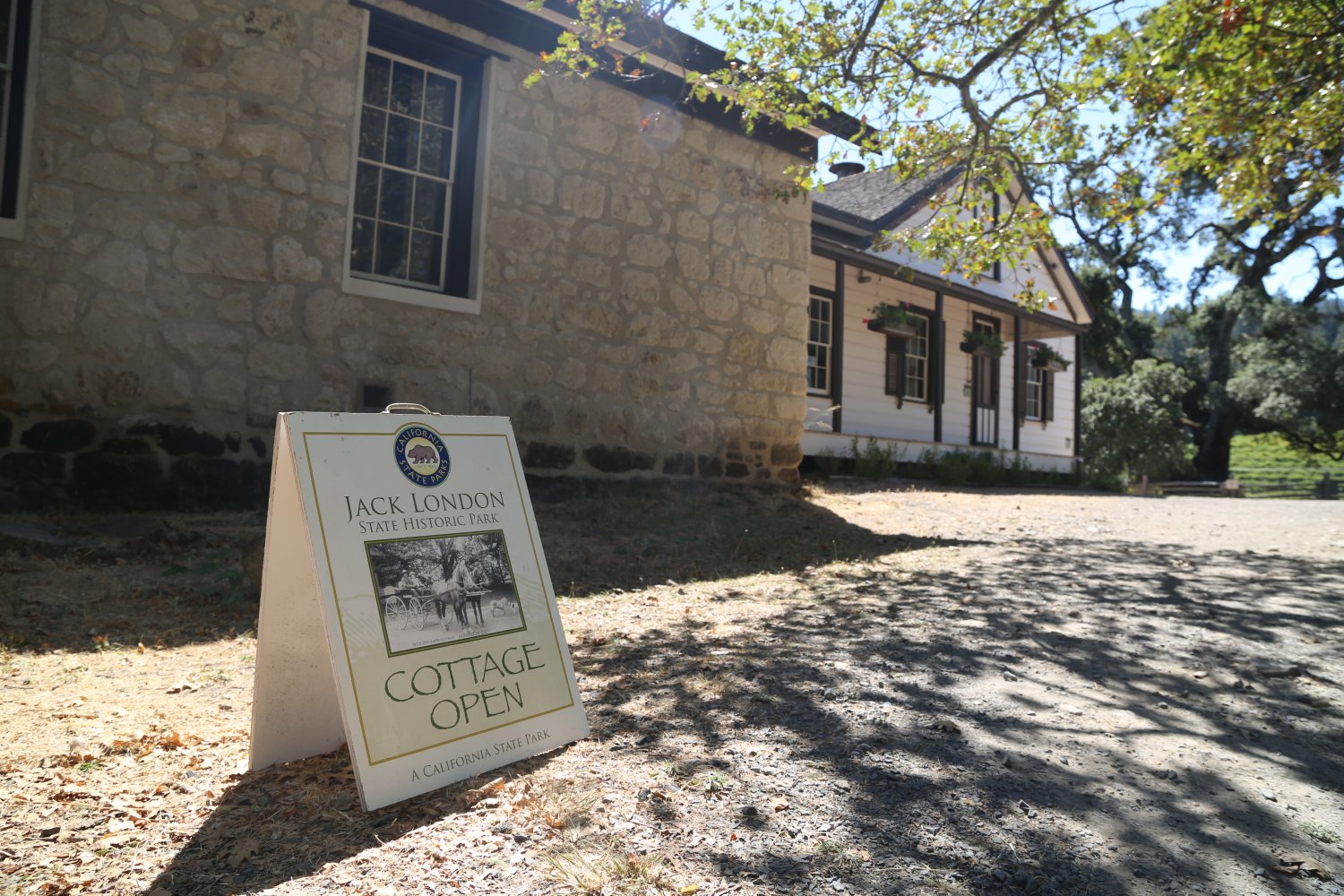
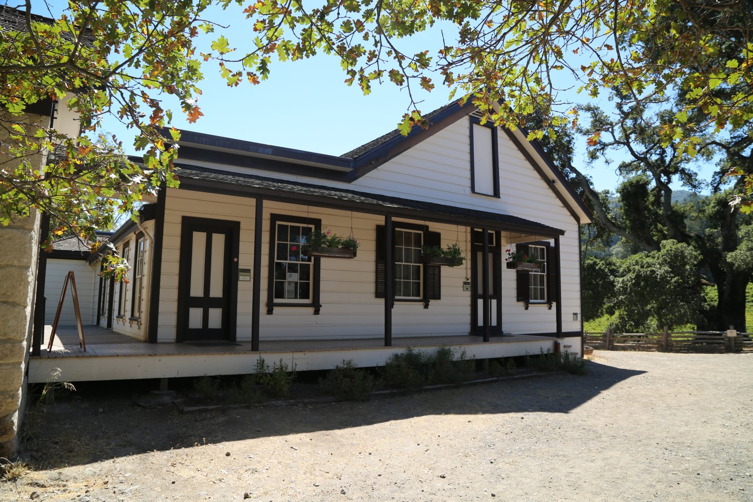
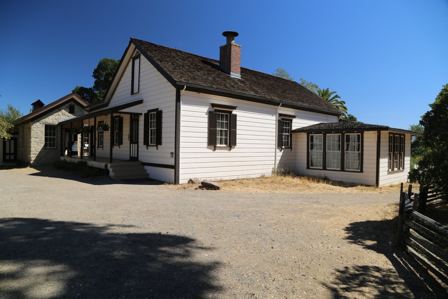
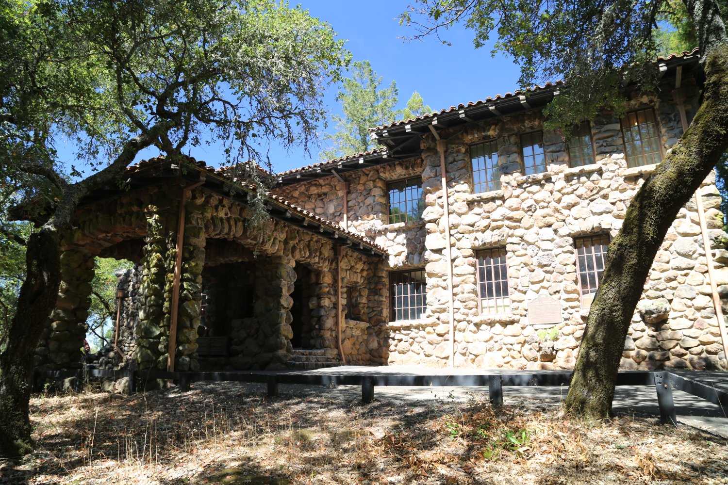
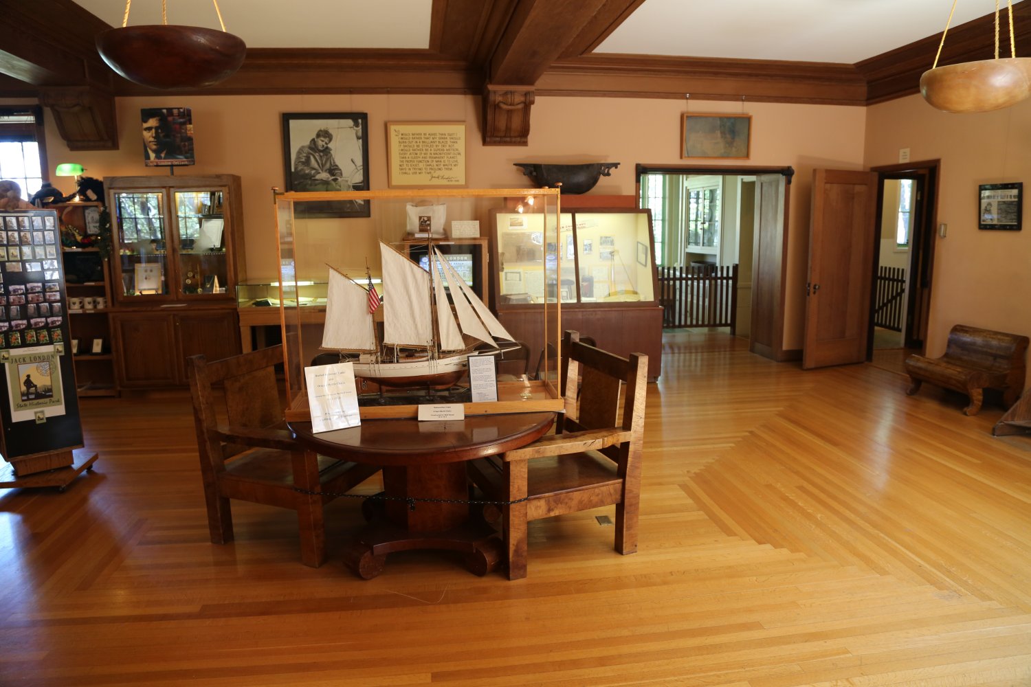
Jack London State Park is located about half way between Santa Rosa and the town of Sonoma off of the same road that Benzinger Winery is located on (near the town of Glen Ellen). As you pull into the park, stop at the kiosk and pay the entrance fee. View the remains of the famous author Jack London’s old cabin. 1400 acres include the Jack London Museum, the London Cottage (where Jack and Charmian hosted guests – this cottage also includes a look at Jack’s writing study) and the ruins of the old Kohler and Frohling Winery (damaged in the 1906 earthquake and later destroyed by fire in 1965).
It is about a quarter mile hike from the parking lot to the Jack London Museum and ruins of the old winery. There are more then 20 miles of hiking trails in the park from an elevation ranging from 400 to 2300 feet.

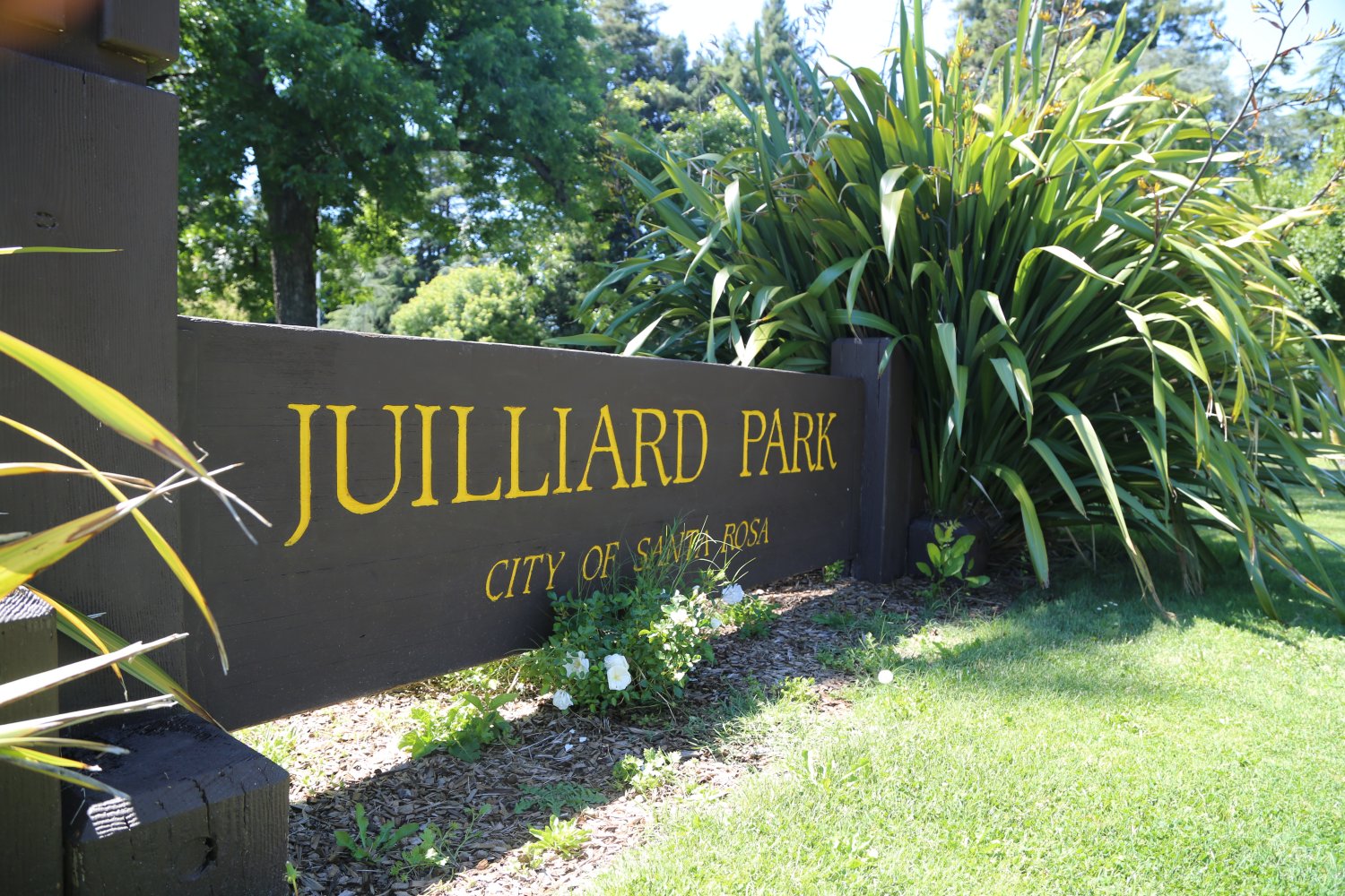
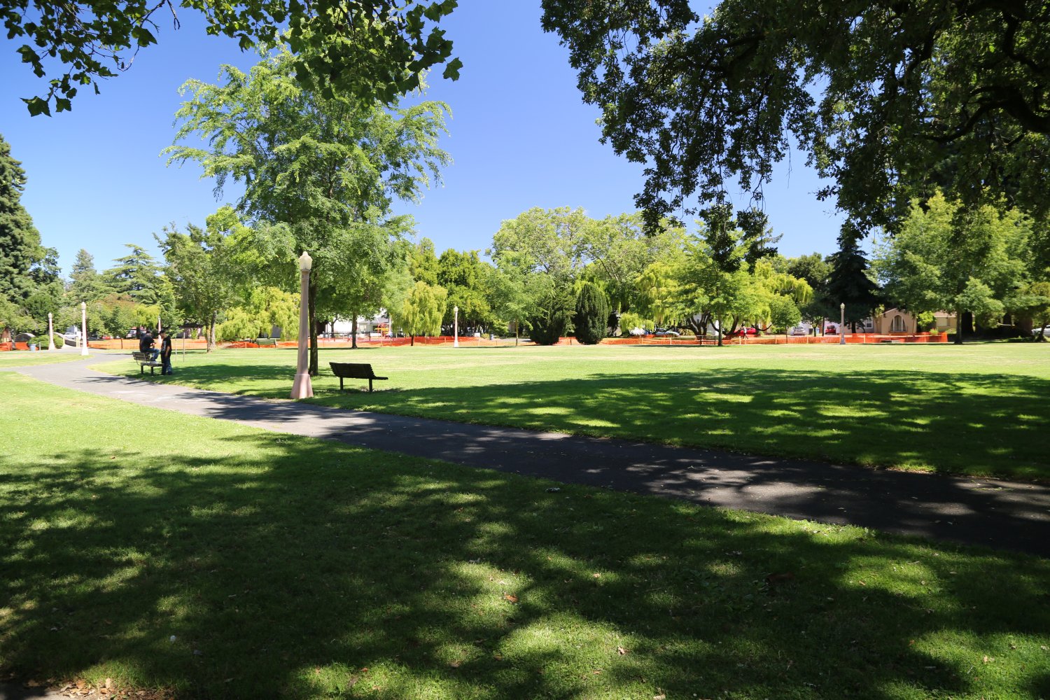
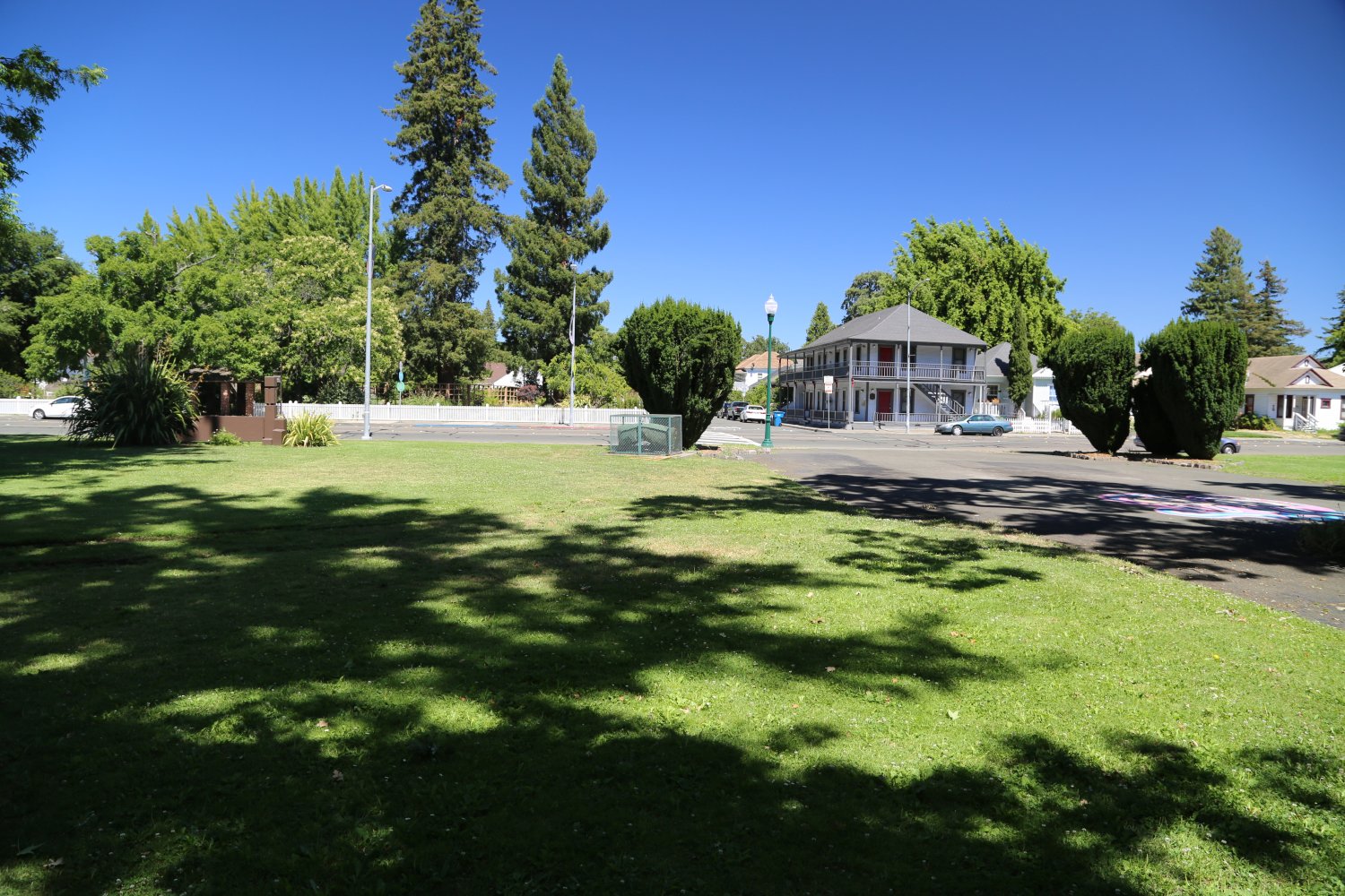
Juilliard Park is a sizable green space (approximately 9 acres) located just south of downtown Santa Rosa – bordered by Santa Rosa Avenue to the east and the city’s tiny and fledgling Arts District to the west. Ask most native Santa Rosan’s how to spell the name of this park and they will fall short in their efforts. Parking is curbside along some of the neighboring streets – including along Sonoma Ave where a shortcut path to the park leads next to the Church of One Tree.
Named after the family that used to live here (Charles Juilliard was a winemaker) – their 2-story Victorian stood roughly in what is now the center of the park. This same family is related to the family in New York that founded the Juilliard School of Music. The surrounding land used to be orchards of trees. Today it is mostly lawn with some older trees on site including redwoods which line the northern edge of the park as well as most of the southern edge.
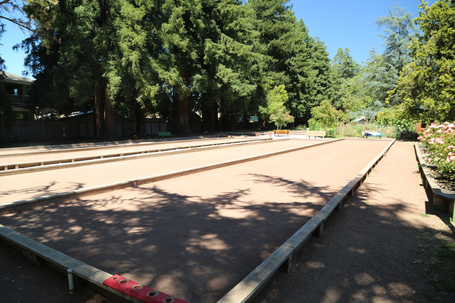
The park also features several very nice Bocce Ball courts and a community garden that always looks its healthiest in late Spring and early Summer. A small playground is also on the the park grounds. Within easy walking distance to several restaurants in the area.
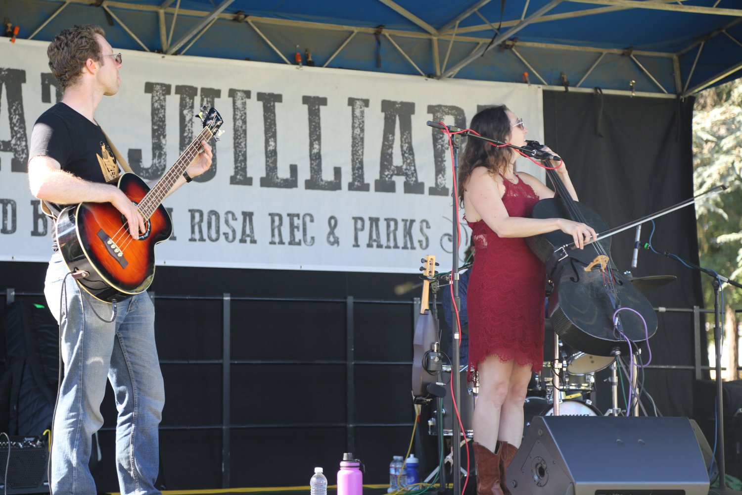
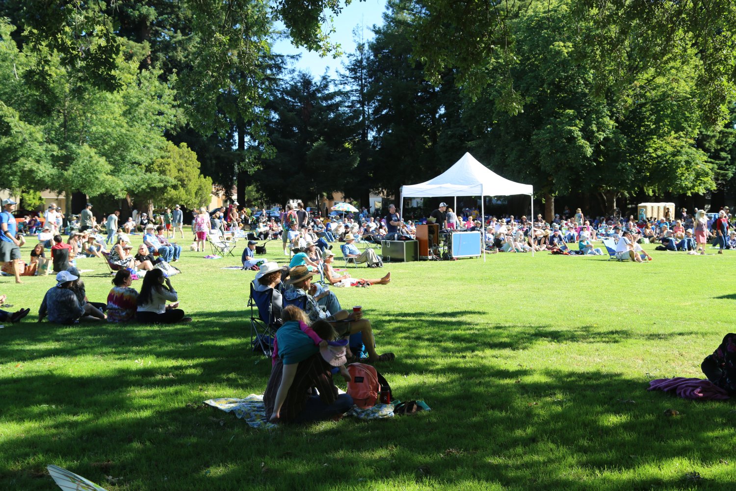
The park is also home to Live at Juilliard Park, a series of free outdoor concerts from the last weekend in June through all of July – from 5-7pm every Sunday afternoon/evening. Every Sunday features a different band and a different style of music. Has been held annually since 1993.


Lake Ilsanjo is a great lake for fishing or swimming in after a hot summer ride or hike. There is a bench on top of the dam which stretches from one end to the other. Often on warm days this bench is filled with hikers, joggers, and mountain bikers.
From the lake you can bike up to Ledson Marsh and circle around the park. The trail to Ledson marsh is initially quite steep but eventually meanders through a small redwood grove, and comes out at a large meadow.
In the summer months the climate can be quite hot, especially on those trails on the south facing slopes. Carrying water is highly recommended as there are no water faucets above Spring Lake. There are a few springs in Annadel but the water is unsafe for human consumption. For more information call Phone Number (707) 539-3911 or (707) 938-1519.


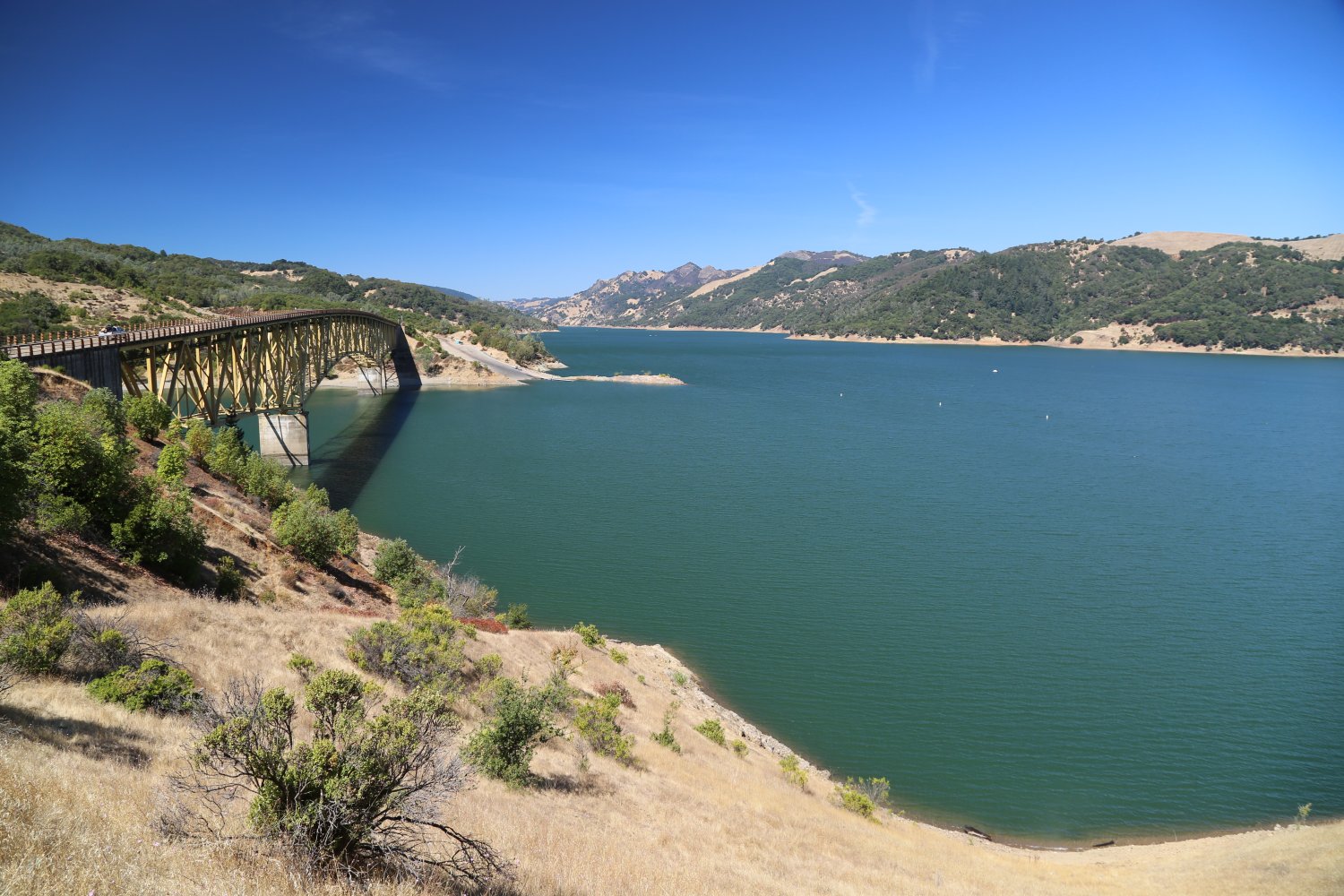
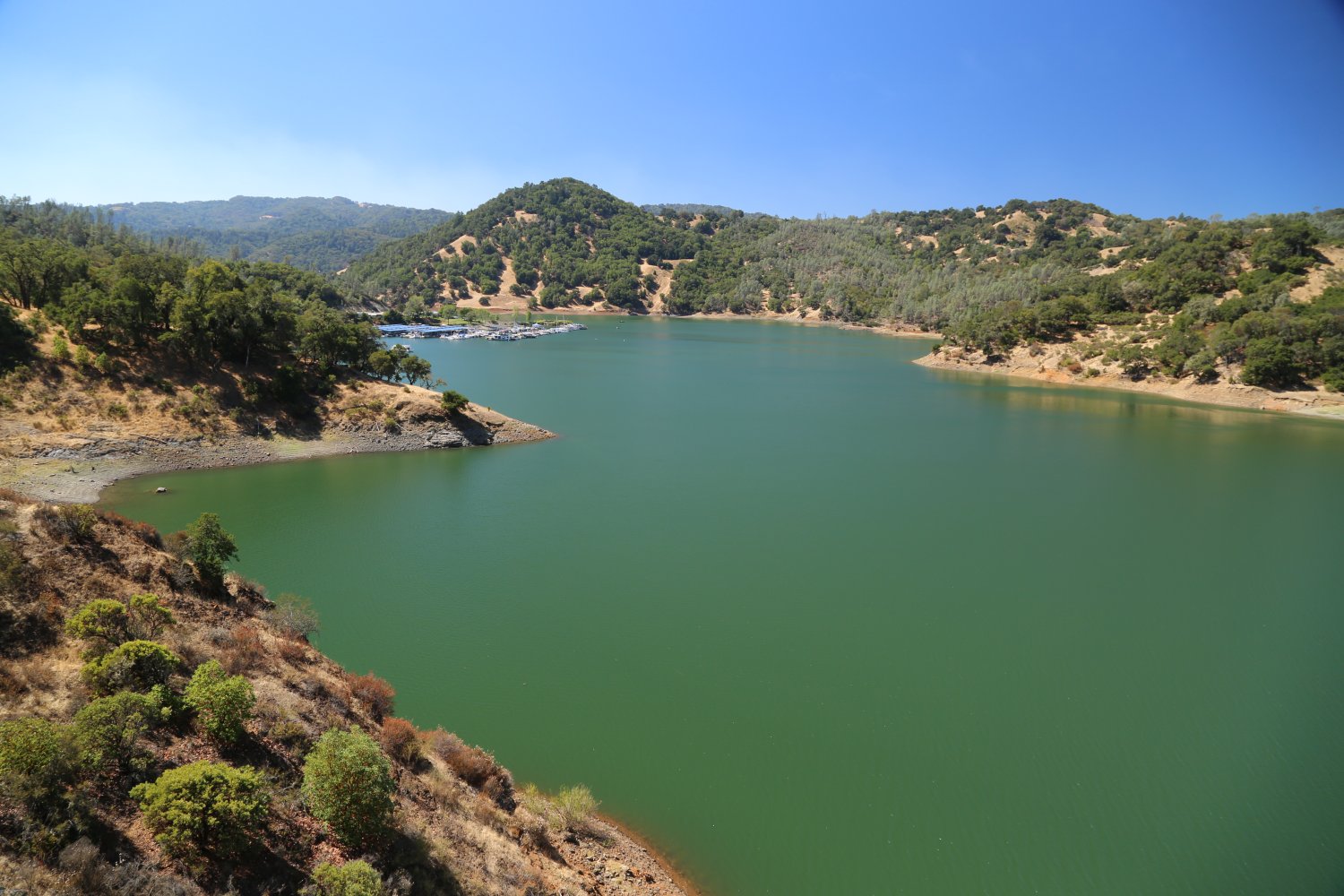
Lake Sonoma is about a half hour drive from Santa Rosa. This is Sonoma County’s largest park. It is located north of Santa Rosa, and 11 miles north of Healdsburg on Dry Creek Road. This dam was built in the early 1980’s. We used to hike in the area before the dam was built. There were some small creeks and old cabins. We metal detected near the cabins and found some old silver coins
Today the lake is a popular water skiing and fishing area. Windsurfing and jet skiing are also quite popular. I have been water skiing and boating on this lake several times. As with most lakes, the early morning is the best time for water skiing. The surface of the lake is like silk, very smooth; ideal for water skiing. Large bass are regularly caught in this lake.
A boat launch and marina are available. Hikers will find over 40 miles of trails in the 18,000 acre park. There is a visitor center below the dam. Next to the center a short trail leads to a fish hatchery. The visitors center features native plant and animals and also Pomo Indian artifacts. For more information the Phone Number is (707) 433-9483.
And looking to explore by horseback in the hills above the lake? Check out The Ranch at Lake Sonoma offering a number of trail ride experiences from the saddle of a horse.

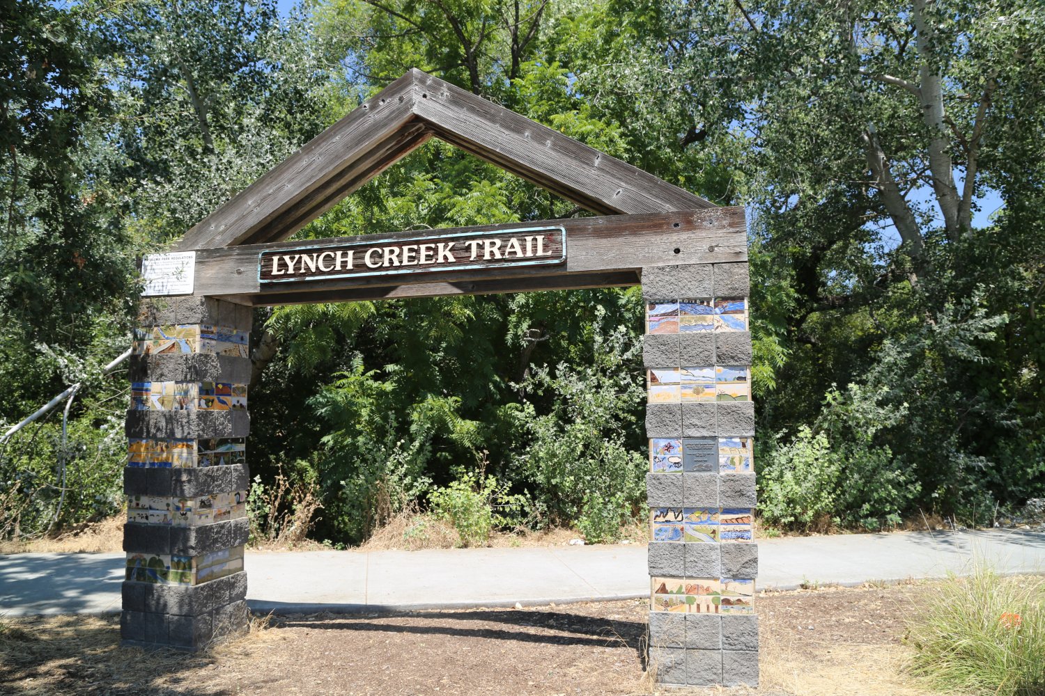
Lucchesi Park is located in the city of Petaluma, just east of the 101 freeway off of N. McDowell Blvd (closest entrance and exit off ramps from the freeway are on E Washington Street. This park is nearly 30 acres – there is plenty of room to spread out and for visitor’s to enjoy a variety of activities including sun bathing, play a game of horseshoes, bring your dog for the dark run, picnic, small baseball fields, lighted tennis courts, a 9-hole frisbee golf course and a number of hiking/biking trails. The 12.5 mile long Lynch Creek trail borders the northern part of the park.
The park’s primary visual attraction is the man-made pond offset by the surrounding green grass. Home of the Petaluma Community Center. The park was named after Mario Lucchesi in the 1970’s. Mario was a Petaluma native, sports enthusiast and local baseball coach. The park is also home to one of Sonoma County’s few year round farmers’ markets – every Tuesday from 10am until 130pm.


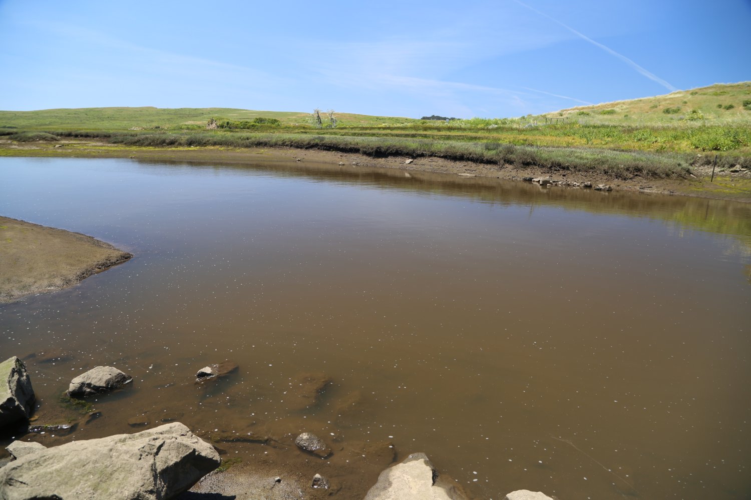
Point Reyes National Seashore contains more then 70 miles of trails weaving through rugged coastline and coastal cliffs (about a 60 minute drive from Santa Rosa). This area is composed of 70,000 acres. Four primitive campgrounds are available (use is by permit only). Hiking and biking trails are also available. Swimming is unsafe at most beaches but is relatively safe at Drake’s Beach and at Limantour Beach.
Over 400 bird species have been observed at the Point Reyes Bird Observatory. The park has three visitor centers. For more information call Phone Number (415) 663-1092. This park is located in west Marin County, west of Highway 1 between Bolinas and Inverness.
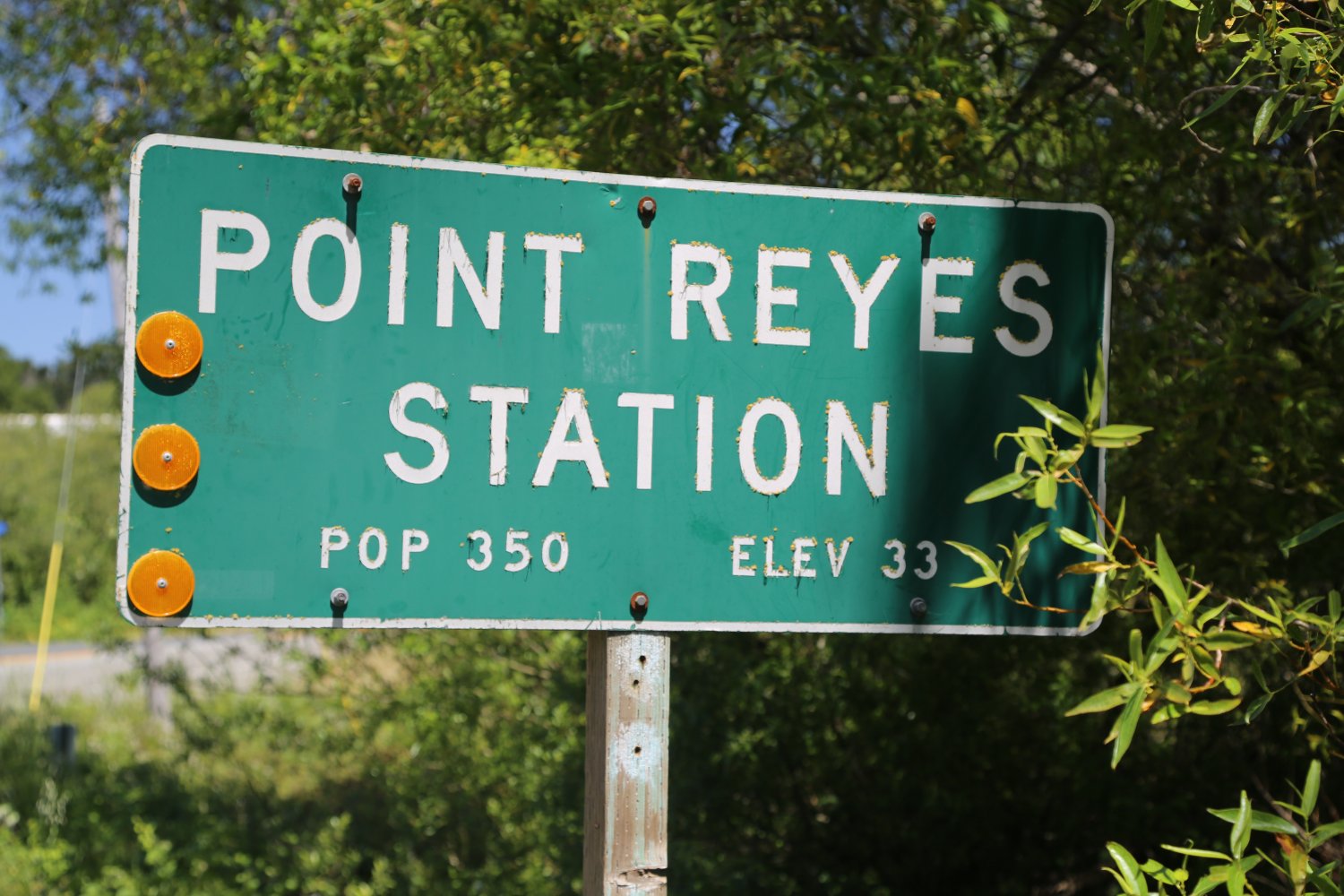
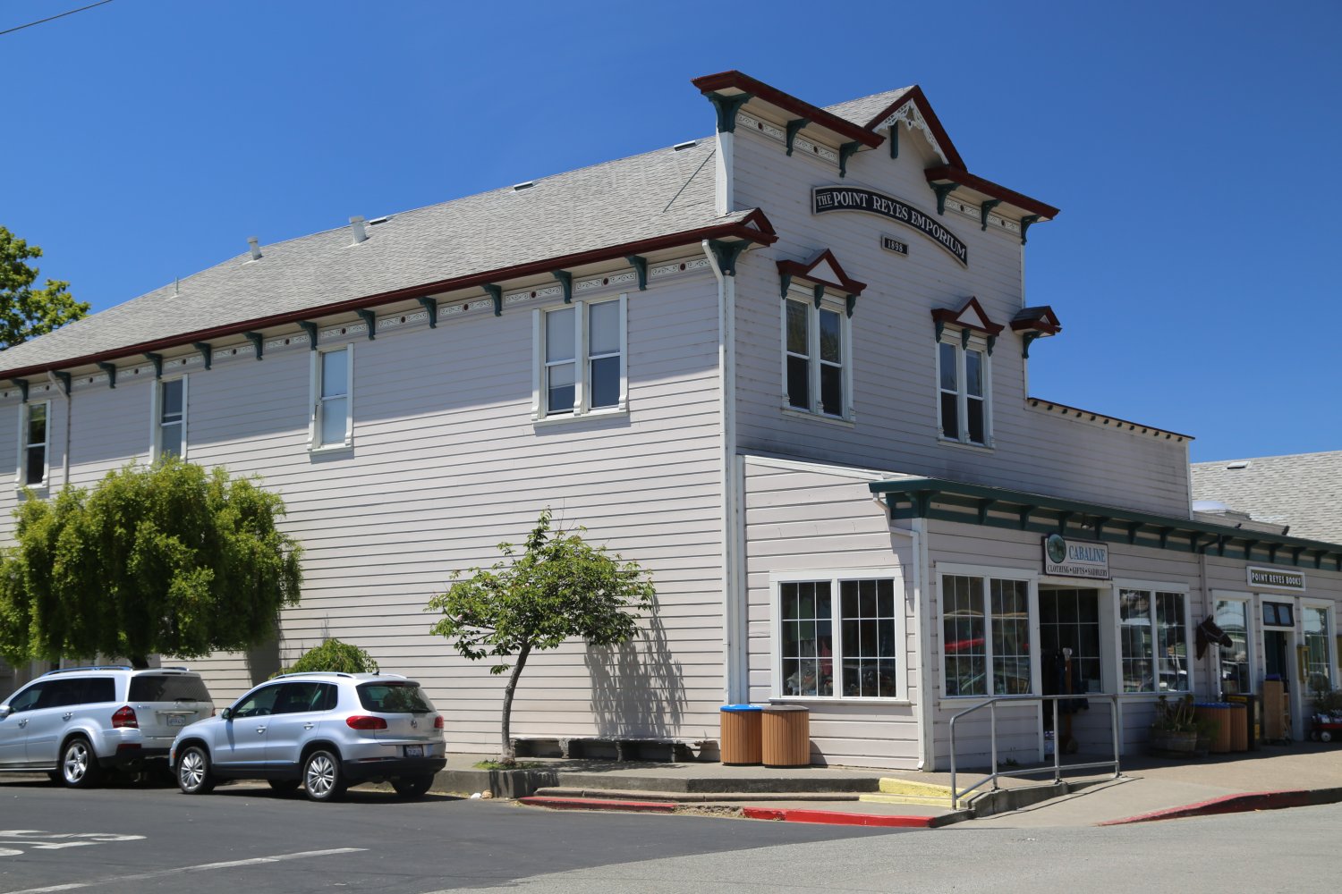
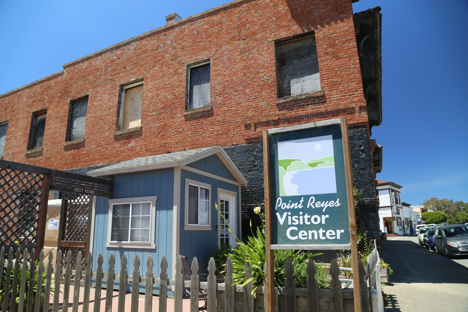
On your way, stop at the tiny and historical town of Point Reyes Station – for the visitor’s center, the Old Western Saloon and the Station House Cafe – or just to sight-see along the main street. This part of West Marin County is home to a number of dairy and beef ranches, oyster farms and other organic farms.
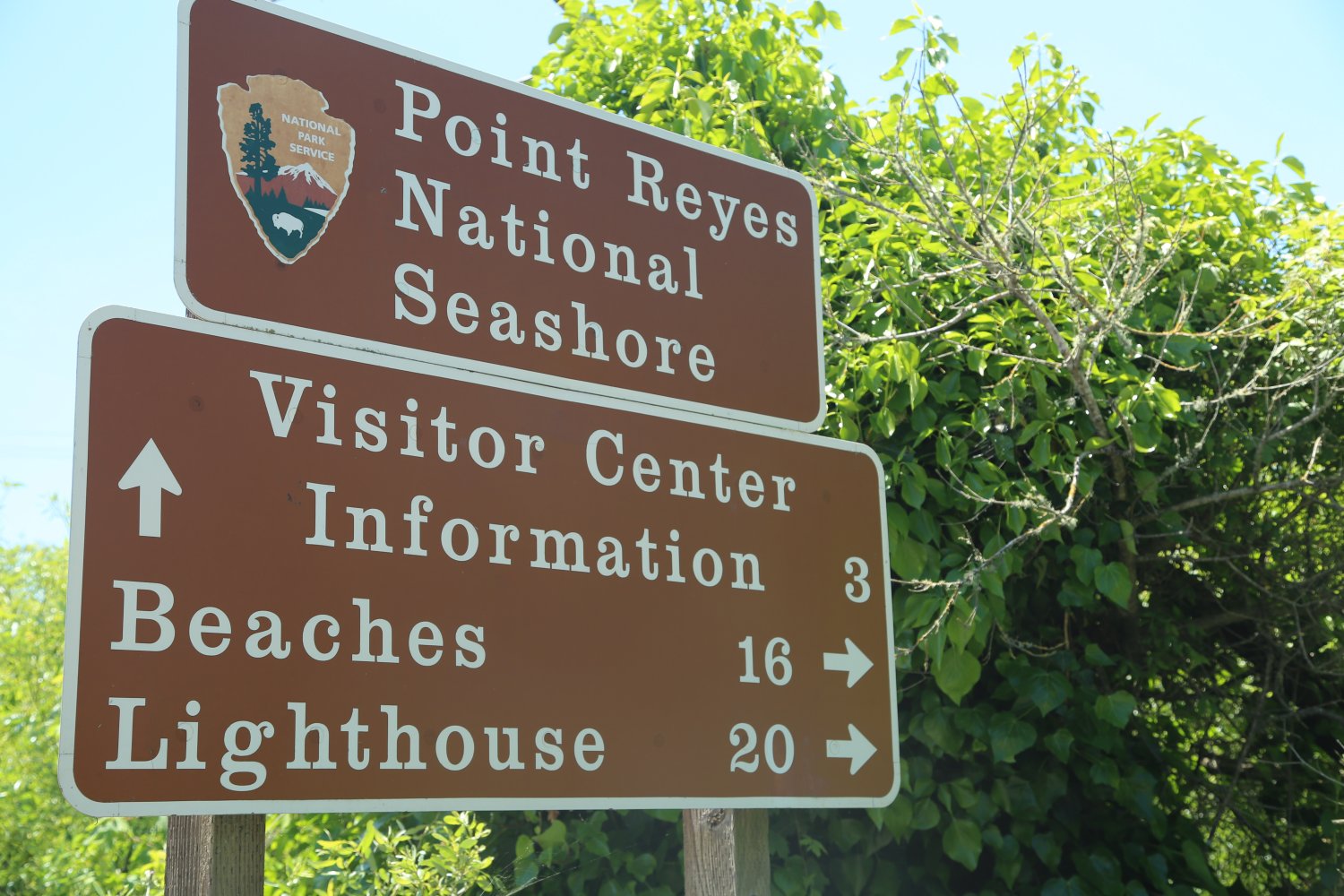


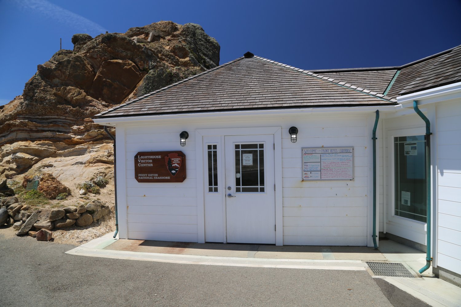
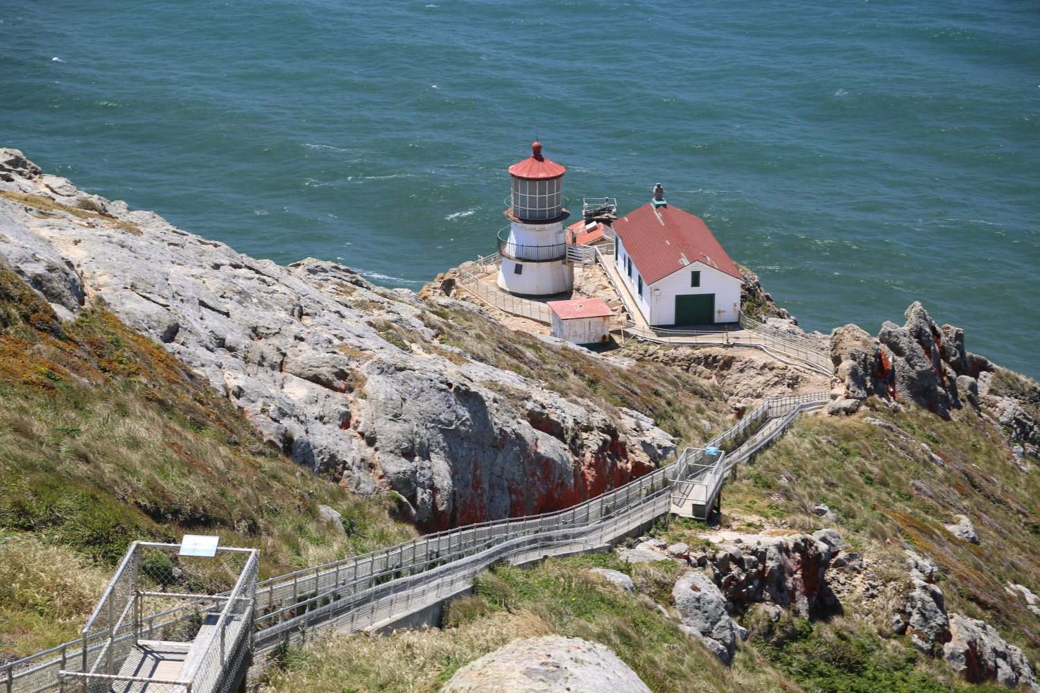
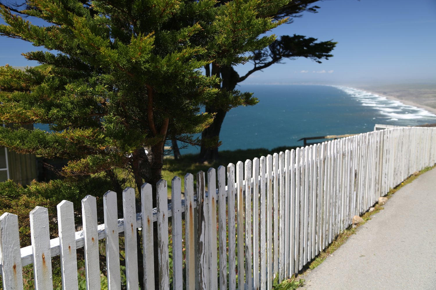
A popular stop is the Point Reyes Lighthouse – (about a 90 minute drive from Santa Rosa) perched at the western most tip of the Point Reyes National Seashore. The road is narrow and quite bumpy at times – a parking lot is located 0.4 miles from the actual lighthouse (a fairly easy walk on a paved road until you reach the small visitor’s center). From here it is a steep trek down to the actual lighthouse (closed to visitors on Tuesday, Wednesday and Thursday). Excellent views of the beaches and coastline directly to the north of here.
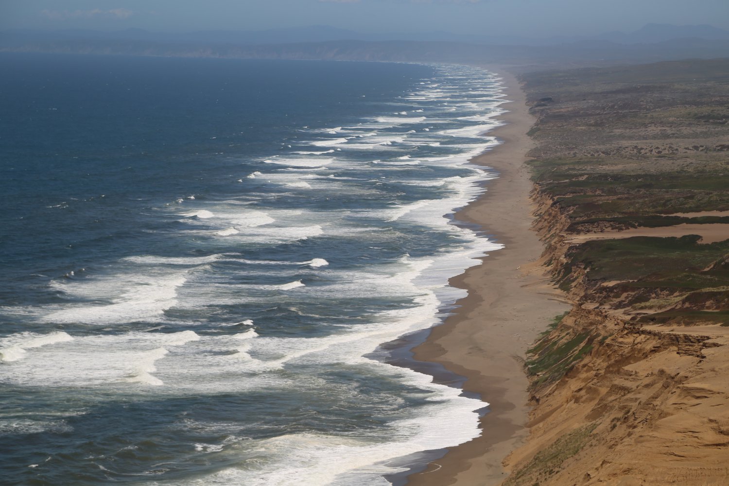
The park features a number of beaches including the 11 mile long appropriately named, Great Beach. Excellent surf here as well as off shore from a number of the western most beaches that face the open ocean.

Ragle Ranch Regional Park is located at 500 Ragle Road in Sebastopol and covers some 157 acres. Named after the family who originally settled this area in 1857. It was a working cattle ranch and also was home to an apple orchard as well as a number of berries (in that sense, not much has changed around Sebastopol in some 160+ years). One hundred years exactly after the ranch’s founding – it was sold to the state of California to pay for back taxes and other financial difficulties the family had gotten themselves into. Sonoma County then purchased the land in 1976 and converted it into a park.
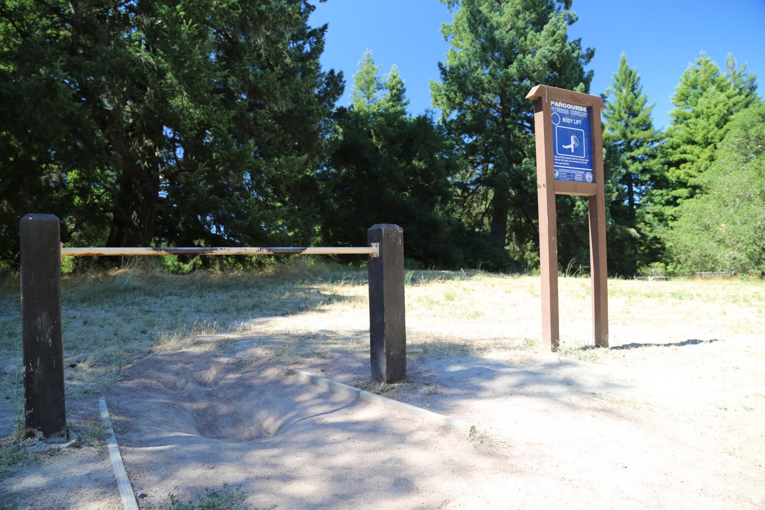
Visitor’s to the park need to pay to park their vehicle in the main parking lot (use the pay station on site). Alternatively, there is some nearby street-side parking – visitors who walk or bike into the park do not have to pay a fee. The park features a variety of activities for all ages – several football/soccer fields are on site as are two playgrounds. Those interested in perfecting their athletic prowess can train on the Parcourse Fitness Circuit – a series of athletic stations setup. Also offers volleyball, a tiny softball field and tennis courts.
But most attractive is the park’s amount of space. Several fairly short hiking trails lead through the woodlands including the Blackberry Trail. Much of the park is on a very sandy soil base. Veteran’s Memorial Grove contains approximately 50 Redwood trees and makes for a relaxing place to meditate. A number of picnic tables and benches are located near the main entrance off of Ragle Road.
Also home of the locally famous and long running annual Gravenstein Apple Fair in August.


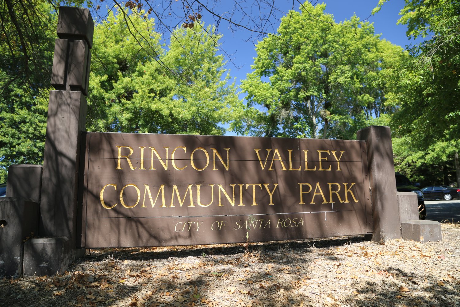
Rincon Valley Community Park is located at 5108 Badger Road in Rincon Valley (next to the Rincon Valley Public Library and just down the street from Maria Carrillo High School). Plenty of parking spots are located just off of Badger Road. Alternatively, one can enter via Montecito Road.
This park is nearly 19 acres and features a softball diamond, a popular at times rectangular fenced off dog park/run area, plenty of picnic tables (several of which can be reserved ahead of time), BBQ’s and several ponds. Also a small play area for children. Lots of open green space.

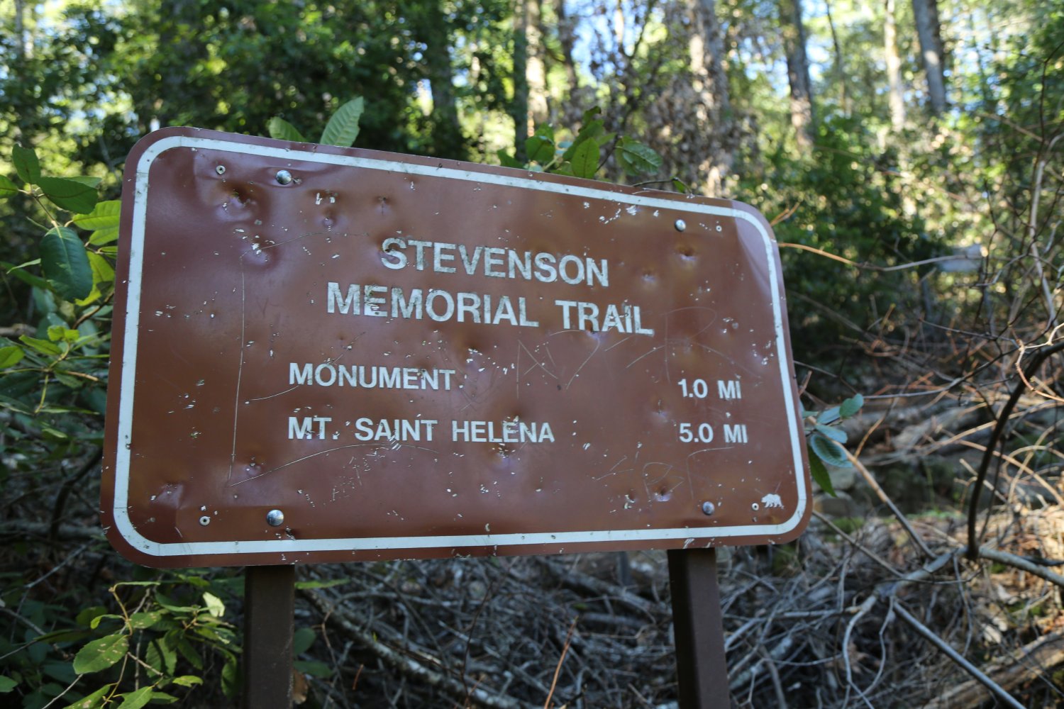
Robert Louis Stevenson Memorial State Park is composed of 4000 acres and is named after the famous author Robert Louis Stevenson. The park is about a 45-50 minute drive from Santa Rosa. Robert actually honeymooned here in 1880 – we heard somewhere that he ran out of money on his honeymoon. Mount St. Helena is located in this park. Parking is on both sides of the highway – off of the shoulder or in two very small dirt parking lots. From the summit of Highway 29 there is a five mile trail leading up to the summit. Except for the first 1/2 mile the hike is along a fire road. The first 1/2 mile is up a narrow trail that switches back and forth up a steep hill. Hiking or biking along the fire road is easy to moderate. The road is not too steep.
From the top of Mount. St. Helena on a clear day, you have views that are seldom matched by most areas in California. On one side of the mountain you can see the vineyards of the Napa and Sonoma Valleys. In the distance you can see the ocean. Then looking east you can see the Sierra Nevadas. If you know where to look and the day is exceptionally clear you will be able to see Mount Lassen and very rarely Mount Shasta, both many miles to the north. San Francisco and the Farallon Islands are visible to the south.
The hike from the main highway to the summit is a 1,400 foot elevation gain. The first part of the trail passes the remains of Robert Louis Stevenson’s old stone cabin, and soon after you will see the remains of the old Silverado Mine. There are some rock climbing areas above the fire road, and often you will see rock climbers draped to the walls. Quartz crystals can be found in certain areas along the fire road. If you enjoy the outdoors and moderate hiking or biking we highly recommend this park. Expect to take 1/2 a day if you are biking the trail, and most of the day if you are walking.
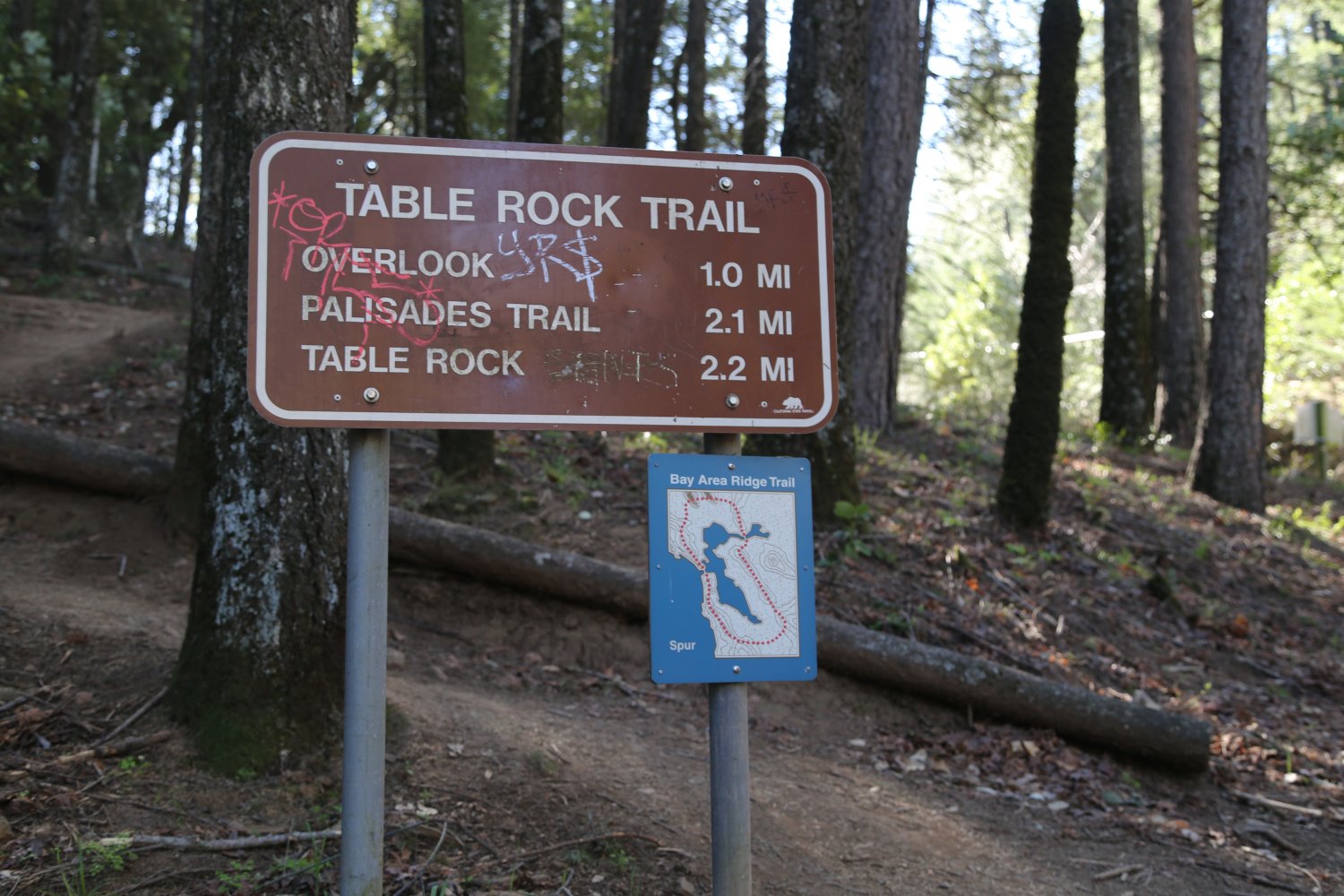
And if you are looking for a shorter less rigorous hike check out the 2.2 mile trail to Table Rock – accessed via the other side of Highway 29. The views of the world famous Napa Valley from Table Rock are worth every step of the hike.


Shiloh Ranch Regional Park is fairly easy to find – from the 101 take the Shiloh Exit and head east until you reach the park. Turn right onto Faught Road and enter the park on your left. To park here you must pay the parking fee using one of the machines in the parking lot. Or you may park outside the park on the edge of Faught Road and walk in (about a minute walk to the trail head from the street side parking outside the park).
You know your in wine country when you visit this park – fields of vineyards surround it’s western perimeter – and from some of the vantage points along the hiking trails – there are excellent vistas looking out to the west over the vineyard covered valley. A private high-end residential community and the Mayacama Golf Club border parts of the rest of the park. A pretty pond is also located on the ridge (years since we biked there). The park features some 850 acres of land with approximately 8 miles of hiking/biking/horseback riding trails. More old roads then single track trails. Well suited for horse riders with the older roads – and a large gravel parking lot for horse trailers along with a manure/compost bunker for all that extra horse shit you might collect!
Note that no dogs are allowed on any of the trails. The Creekside Trail is mostly in the shade – the Ridge Trail has a number of exposed parts where you will be hiking in the sun.
The park offers plenty of activities for those who aren’t into hiking – including a horseshoe pit (with an accompany score system), a Bocche Ball court and picnic tables in mostly in the sun.


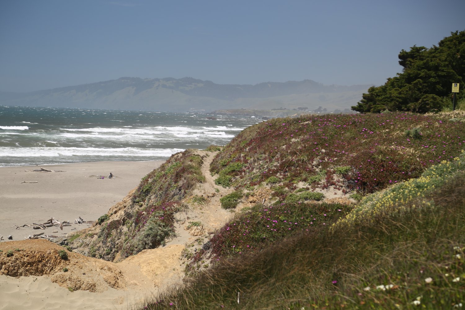
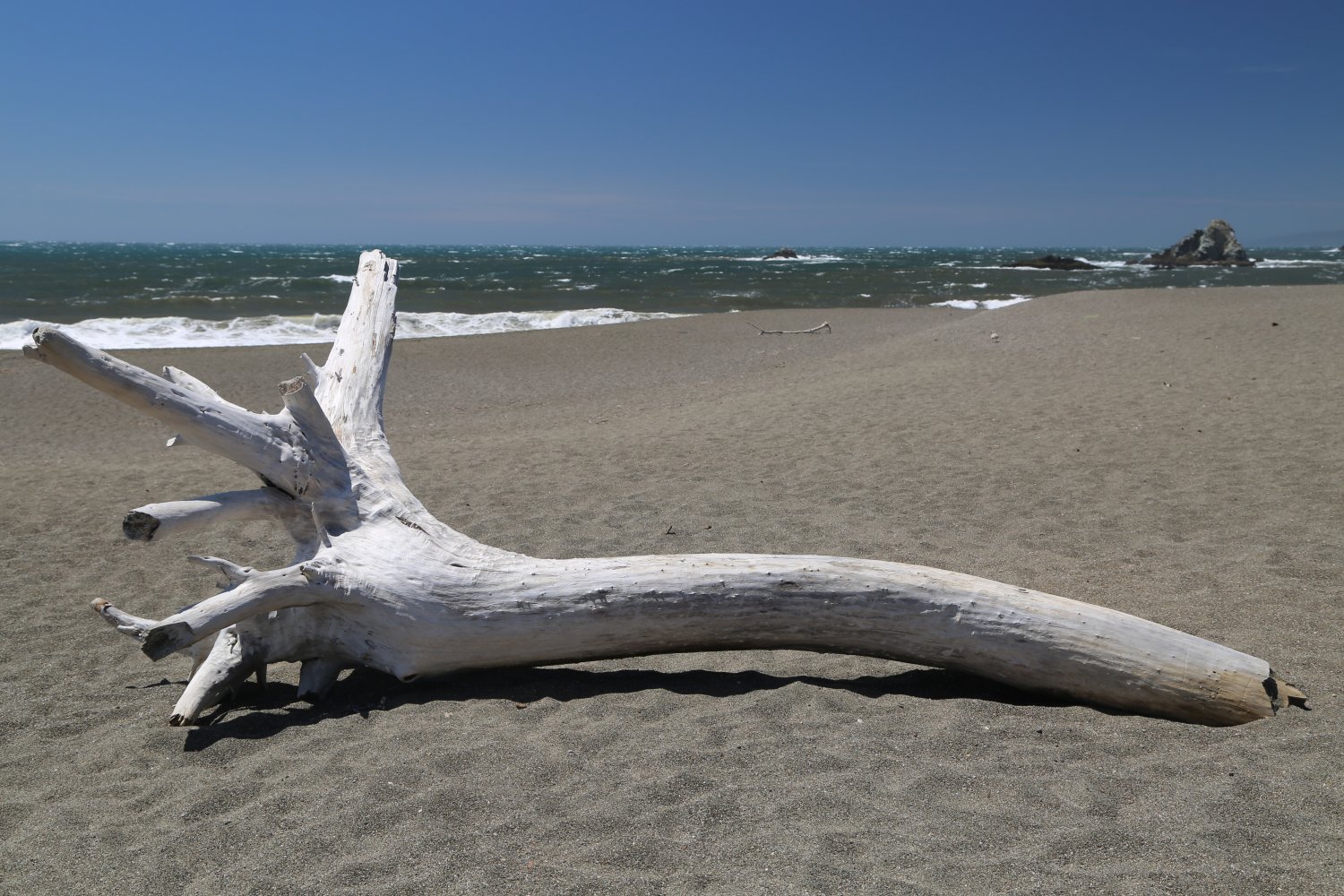
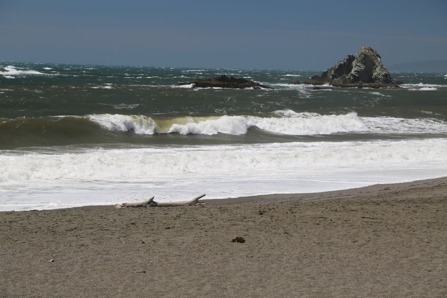
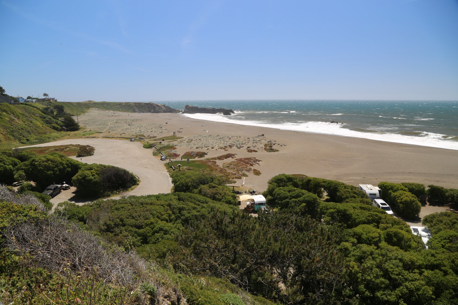
Sonoma Coast State Beach is a 5000 acre recreational wilderness region located along Highway 1 between Jenner and Bodega Bay. Dunes, tide pools, sea bluffs, and many beaches can be found in this region. Seals and sea lions often gather at the mouth of the Russian River. More than 5 miles of hiking and equestrian trails are present in the dunes. Excellent whale watching can often be found at Bodega head.
Volunteers lead whale watching and interpretive programs during the winter. Four campgrounds are in the area. Watch for rough waters and under currents. Swimming is strongly discouraged. There are often several deaths each year due to people becoming stuck in an under current and not being able to reach the shore. For more information call Phone Number (707) 875-3483.

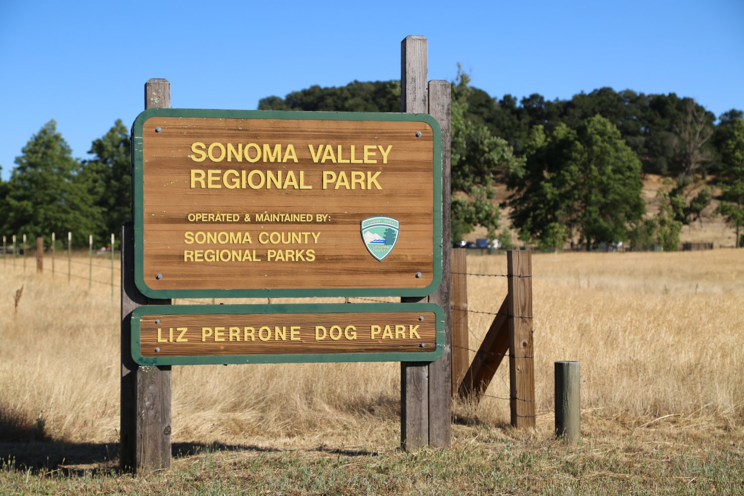
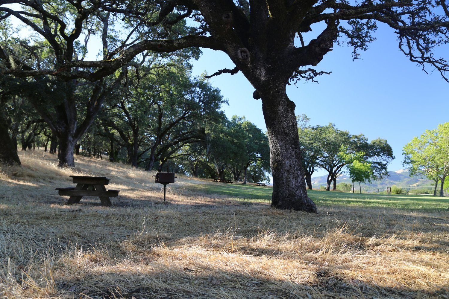
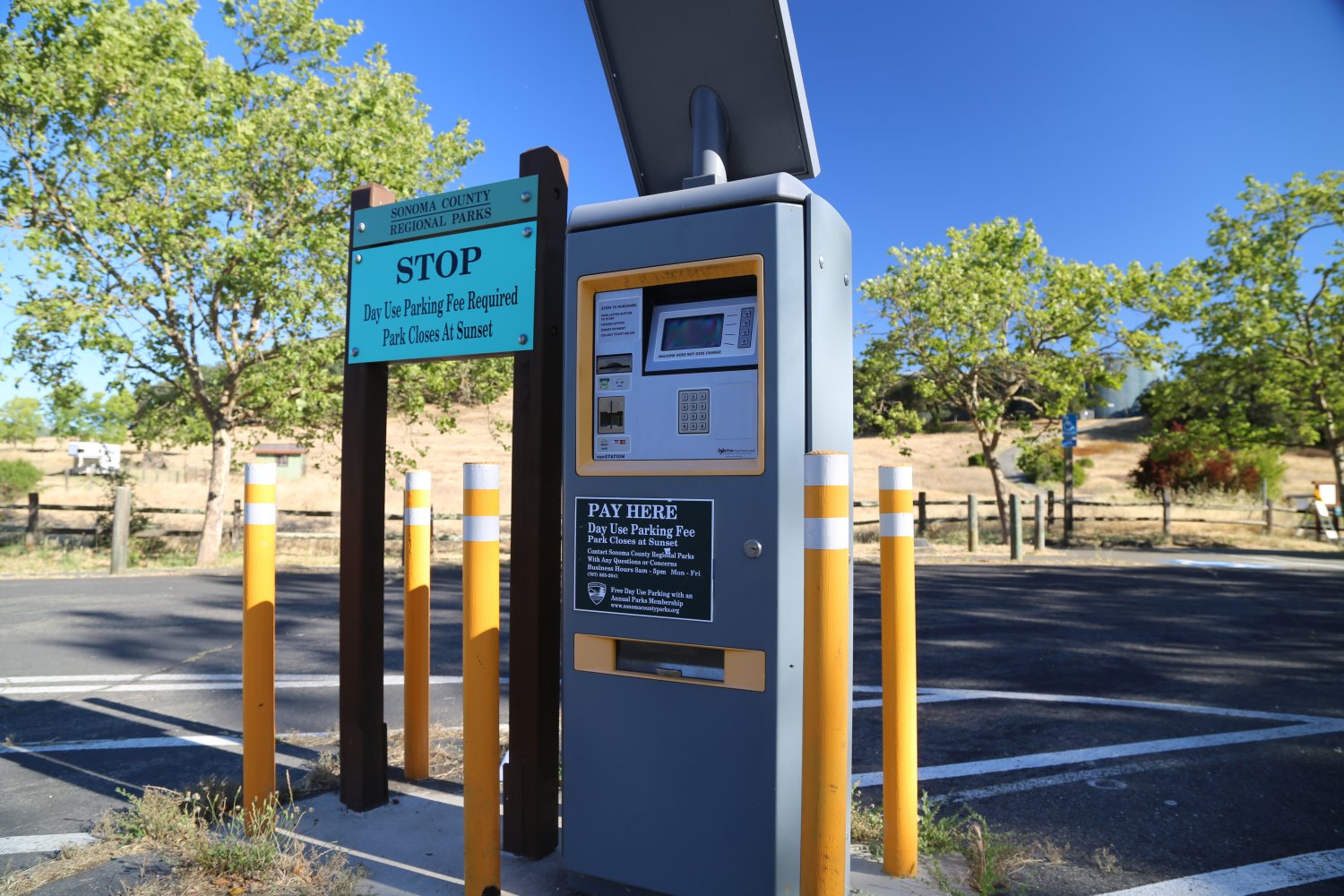
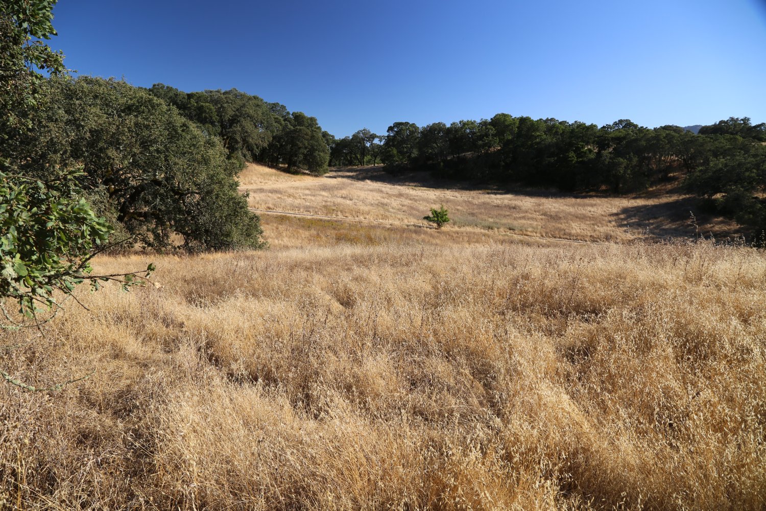
Sonoma Valley Regional Park is located directly off of Highway 12 – about 1/2 way between Santa Rosa and the town of Sonoma (the closest community to the park is Glen Ellen). Like a number of other regional parks in the county parking is metered (use the parking machine on site). Rather then entering from Highway 12, locals know to park along side Arnold Drive for free and walk into the park from its western borders. This is also an ideal side of the park to enter for early risers (as the main gate is locked in the very early morning). There is plenty of space to spread out here over 202 acres. Several miles of trails are available for hiking, biking or horseback riding. The primary path is the 1.3 Valley of the Moon Trail passing through oaks and following a seasonal creek.
From the parking lot if you walk north you will reach a new section of the park added in 2015 – 29 acres which features the Cougar Trail leading up in elevation and offering great views overlooking the Sonoma Valley.
The Elizabeth Perrone Dog Park is located immediately off of Highway 12 (most people who access this dog park – park their vehicles on the gravel shoulder off of the highway (one could also save the parking fee by doing this)
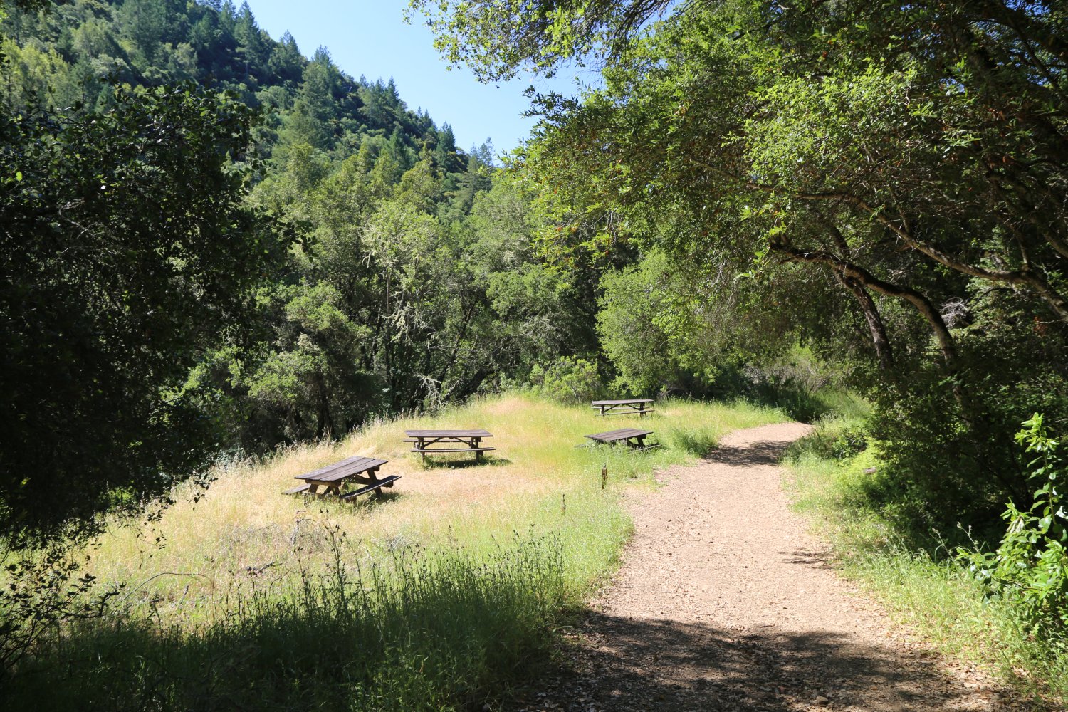
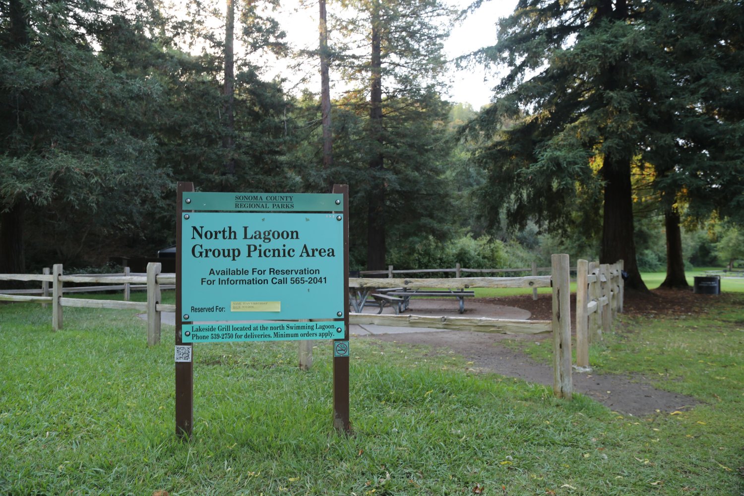
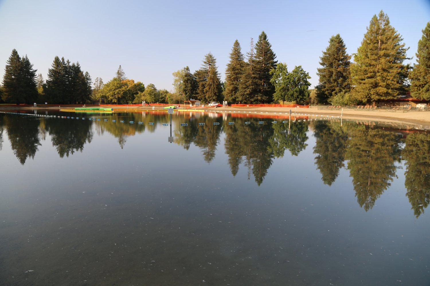
Spring Lake Regional Park is located in Santa Rosa off of either Montgomery Drive or Newanga Avenue off of Summerfield Drive. This lake is very popular in the summer months. This park is surrounded by Annadel Park and Howarth Park. The Spring Lake basin is used as an overflow to prevent flooding in Santa Rosa Creek which runs through downtown Santa Rosa. This reservoir was built in the 1960s. On particularly wet winters this lake will swell to many times its normal size and the water will cover some of the campgrounds and buildings. After the water recedes there is debris and muck over much of the roads and tourist areas.
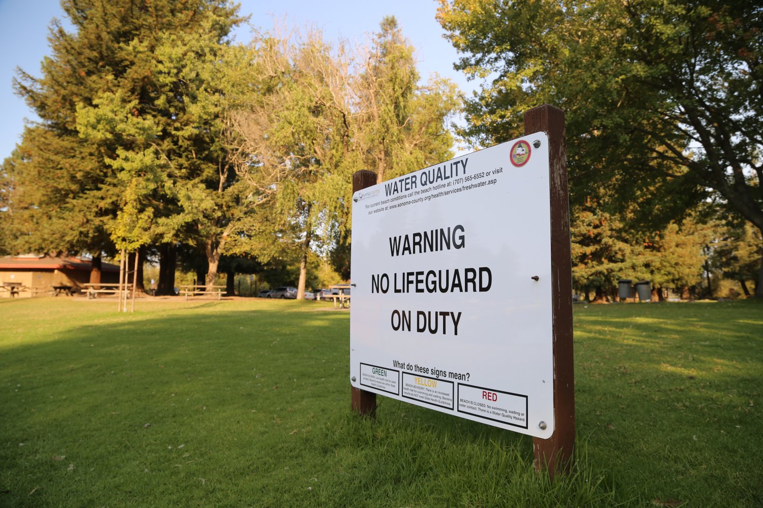
There are more then 15 miles of hiking trails in this 320 acre park. A two mile bike path encircles the lake. There are 200 picnic sites and 31 developed campsites, including a group site. There is a visitors center which is only open on the weekends. It displays native animal and plant exhibits. Boat rentals are available although no gasoline powered boats are allowed on the lake. There is also a small swimming lagoon and lifeguards are on duty. For more information about the park call Phone Number (707) 539-8092.
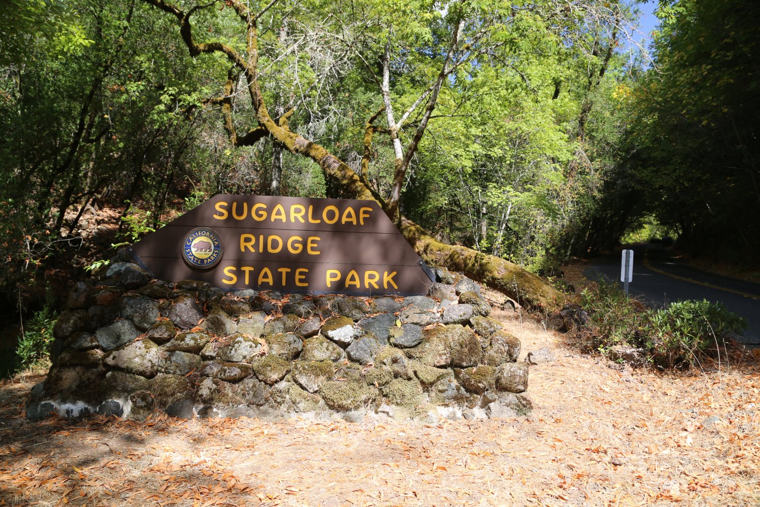
Sugarloaf Ridge State Park is in the hills near Sonoma Mountain about 30 minutes roughly east of Santa Rosa. Sugarloaf offers over 2700 acres and 25 miles of hiking, biking and horseback riding trails. There are 50 developed camp sites in the park. A small visitor center is worth a stop to see their small collection of items gathered from the park as well as some local arts and crafts for sale. Usually only open limited hours on the weekends with slightly extended hours in the summer.
To access the park take Adobe Canyon Road off of Highway 12 (at Landmark Vineyards Winery). You will wind through a semi residential area until you reach the base of the hills. Then you will start climbing quickly in elevation. It is about a 3.5 mile drive to the park from Highway 12.
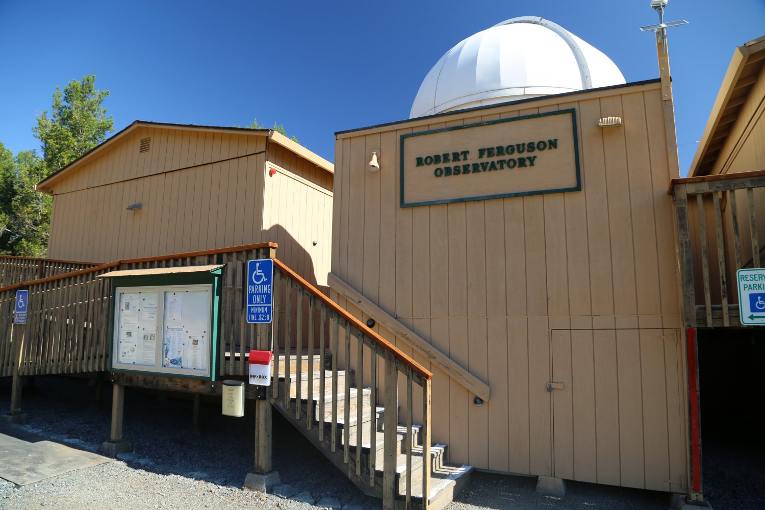
Did you know that there is an observatory located within the park? One of the north state’s most used observatories is here – called the Robert Ferguson Observatory. It is located as far as you can drive into the park – with a gravel parking lot next to the usually locked gate. From the parking lot it is a very short walk up a slightly sloped paved path to the observatory. It is not open to the public except for scheduled events. For more information, visit: www.rfo.org
Hikes in the park are categories by Family Hikes (two miles or less or 1 hour or less) or Extended Hikes (4+ miles between 2 to 6 hours hiking). Several recommended hikes include the Meadow Hillside Loop (2 miles). The Canyon-Pony Gate Loop (2 miles) is a moderate hike with about a 400′ elevation gain – meanders through some larger redwoods and passes by a seasonal 25′ waterfall. For those who have longer time check out the Vista Trail Loop (4.1 miles).
Also a nice place to camp – year-round. 47 camp sites are available with on site showers. Note: camp sites are nearly always already reserved on weekends from April through October. Visit: www.sugarloafpark.org
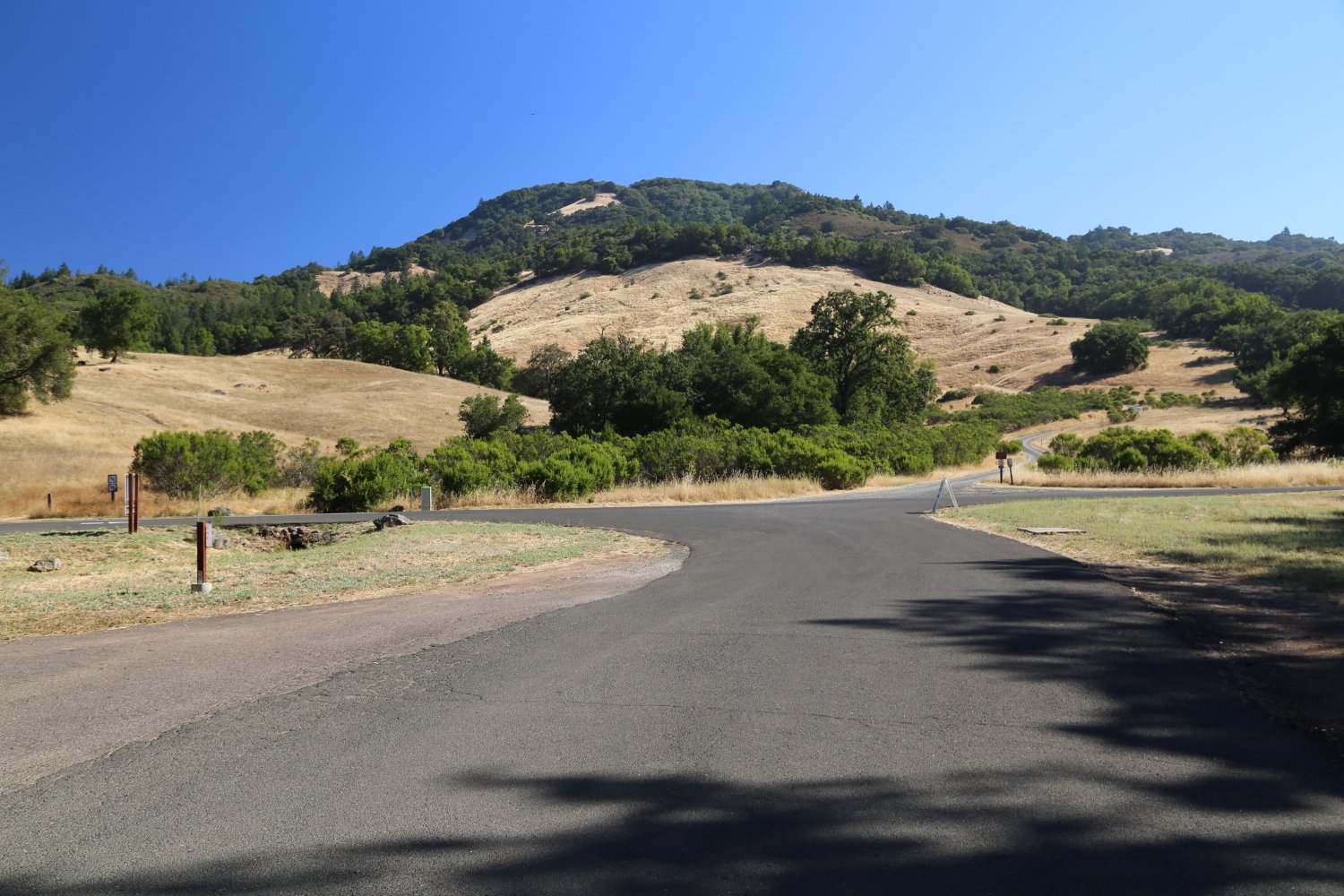

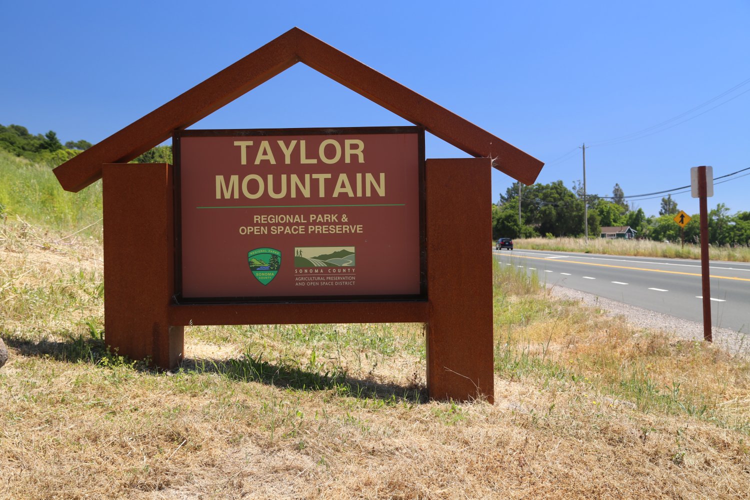
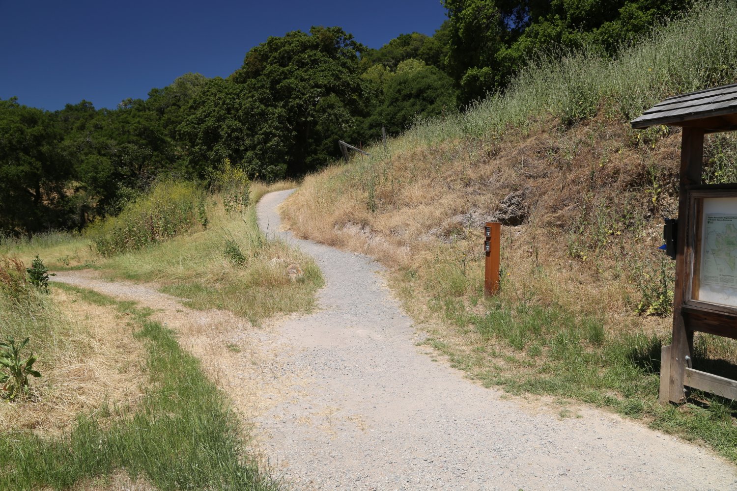
Taylor Mountain is one of Santa Rosa’s newest parks – what is weird, is this park takes it’s name from Taylor Mountain – yet the top of Taylor Mountain at 1403 feet is technically just outside the park’s boundaries! Features over 1,100 acres of terrain. The park and nearby mountain are named after one of Santa Rosa’s early settlers, John Taylor (no, not the SF 49ers former wide receiver). This John came from the gold mines of northern California and settled near Taylor Mountain – in the process he discovered a small vein of coal on site, planted vineyards and built a small resort around a hot springs he initially called White Sulphur Springs (not the only hot spring of this name in California). Eventually it became known as Kawana Sulphur Springs (the new name was decided by the great local horticulturist, Luther Burbank). The great 1906 earthquake ‘turned off’ the hot springs and the resort closed.
There are currently two entrances to the park – one at 3820 Petaluma Hill Road and the other one at 2080 Kawana Terrace. We have entered through the Petaluma Hill side – a parking lot at the trail-head features numerous parking spots – a side parking lot is mean for trailers carrying horses. Parking fees are $7/car/day – open from 7am until sunset. Porta potty bathroom located here as well as a few picnic tables.
The primary route from this side of the park is the Redtail Trail (the loop is about 3/4 of a mile) – this trail connects to much longer routes including the Western Route, Eastern Route and the Todd Creek Trail. There are currently about 6 miles of developed dirt trails (hiking, bikes or for horses). Plans eventually call for more trails plus some walk in campsites.

Leave a Reply