Mount Makiling is an ASEAN Heritage Park rising to 1,090 MASL in the CALABARZON region. Managed exclusively by the UPLB Makiling Center for Mountain Ecosystems (MCME), the standard 2026 hike requires a mandatory guide (PHP 1,200), strictly enforced cut-off times, and a physical ID for entry. The Mariang Makiling Trail (MMT) is a 4/9 Difficulty minor climb, taking 5-7 hours to complete.
Rising like a sleeping giant over the Southern Tagalog plains, Mt. Makiling is more than just a geological formation—it is a cultural institution. For decades, this dormant stratovolcano has served as the mythical abode of the guardian spirit Maria Makiling and the ultimate training ground for Manila-based mountaineers.
But if you are planning to summit in 2026, you need to throw out your old itineraries.
Unlike mountains managed by the Department of Environment and Natural Resources (DENR), the Mount Makiling Forest Reserve (MMFR) is under the exclusive jurisdiction of the University of the Philippines Los Baños (UPLB). The rules here are based on strict academic conservation and biosecurity, not commercial tourism. The “free-for-all” cowboy days of hiking Makiling are officially over. Whether you’re a seasoned trekker or a weekend warrior, here is your definitive insider’s guide to navigating the mountain this year.
The 3-Peak Topography: Understanding the Caldera
First-timers often misunderstand the mountain’s structure. The summit is not a singular point but a complex caldera rim system comprising three distinct peaks:
-
Peak 1: Situated on the northern rim, this peak is highly restricted. Access is routed near Agila Base but is frequently gated off by UPLB for geothermal monitoring and scientific preservation.
-
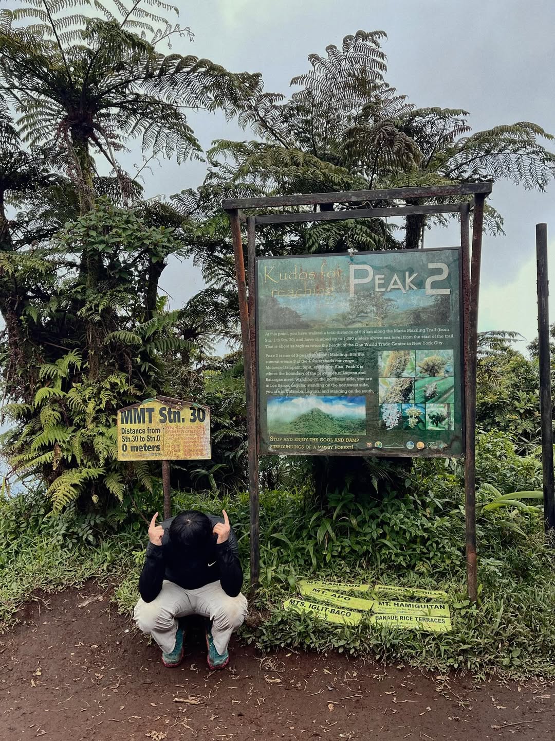
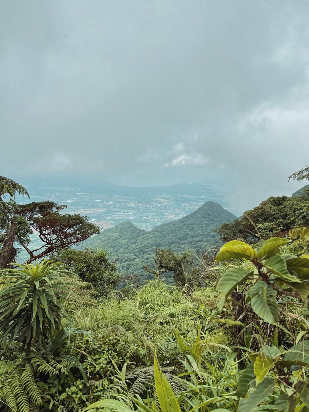
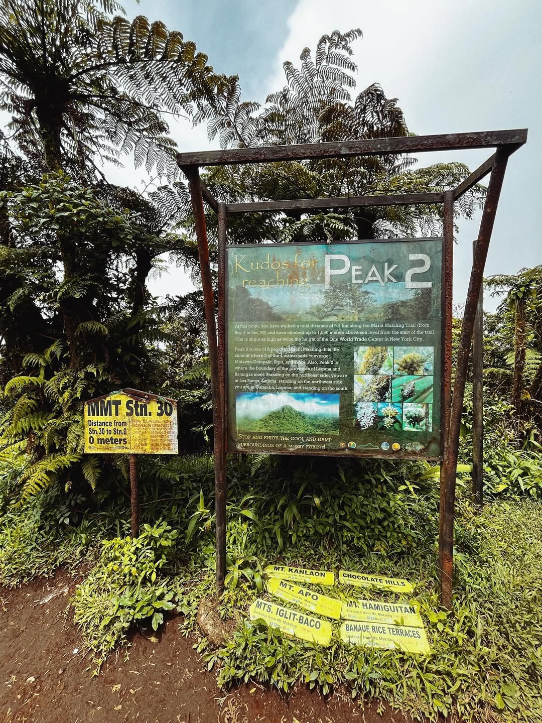
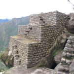
Peak 2 (1,090 MASL): This is the primary objective for 99% of hikers. It serves as the terminus of the standard Mariang Makiling Trail (MMT). The small viewing deck offers sightlines to Laguna de Bay and Mt. Banahaw, though the mountain’s microclimate often results in a total whiteout.
-
Peak 3 (1,020 MASL): The “wild” peak accessed via the Sipit Trail from Sto. Tomas, Batangas. This connects to Peak 2 via a rugged ridge, forming the infamous traverse route.
Mt. Makiling Summit
Mt. Makiling Summit
The 2026 Reality Check: IDs, Guides, and Checkpoints
The 2026 UPLB protocols are non-negotiable. Hikers must surrender a physical government ID at Station 1. Guides are mandatory at a 1:5 ratio (PHP 1,200 per group). The gate opens at 06:00 AM, with a strict 09:00 AM cutoff at Station 11 (Agila Base).
When I say UPLB manages the mountain like a strict university campus, I mean it. The most significant friction point you will encounter is at Monitoring Station 1 (the College of Forestry gate).
The golden rule for 2026 is “No Valid ID, No Entry.” Digital IDs, photocopies, or photos on your phone will be instantly rejected. The group leader must surrender a physical government ID (Driver’s License, UMID, Passport), which acts as collateral. The rangers operate on a “one-out, all-out” system; your ID is only returned when every single member of your group has safely logged out. If someone is slow, you wait.
Furthermore, guides are now mandatory. The ratio is strict: one guide for every five hikers, with a fixed rate of PHP 1,200 per group paid directly to the local association. For solo hikers, this means you will be shouldering the entire “Solo Tax” unless you hang around the jump-off to find a joiner group to split the costs.
Lastly, respect the clock. The gate opens at 06:00 AM. There is a strict 09:00 AM cutoff at Agila Base (Station 11). Arrive at 09:01 AM, and the rangers will block you from pushing to the summit, diverting you to shorter excursions like the Mud Springs. All day hikers must exit the trail by 02:00 PM.
Decoding the Mariang Makiling Trail (MMT)
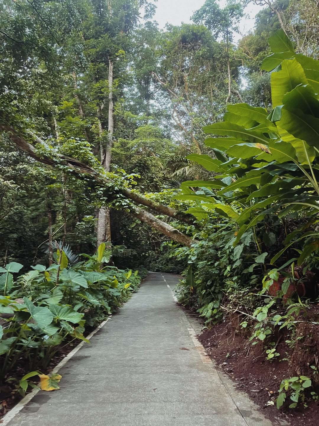
The UPLB Backtrail is divided into the “Paved Agony” (Stations 1-11), a steep 5.4km concrete road, and the “Wilderness Zone” (Stations 12-30), characterized by slippery clay mud and root scrambling. It is a 5-7 hour endurance test.
The trail is a Minor Climb (4/9 Difficulty), but do not let the “Minor” classification fool you.
Sector 1: The Paved Agony (Stations 1 to 11) The first 5.4 kilometers from the registration area to Agila Base is a continuous uphill concrete and dirt road. The heat radiating off the pavement is punishing. I’ve seen fit marathon runners cramp up at Station 7 because the concrete impact is incredibly harsh on the shins.
-
Insider Hack: Ask the rangers at Station 1 if the local Habal-Habal (motorcycle taxis) are operating. For about PHP 100, they can shuttle you straight to Agila Base. It turns an exhausting 90-minute walk into a breezy 15-minute ride, saving your energy for the real jungle.
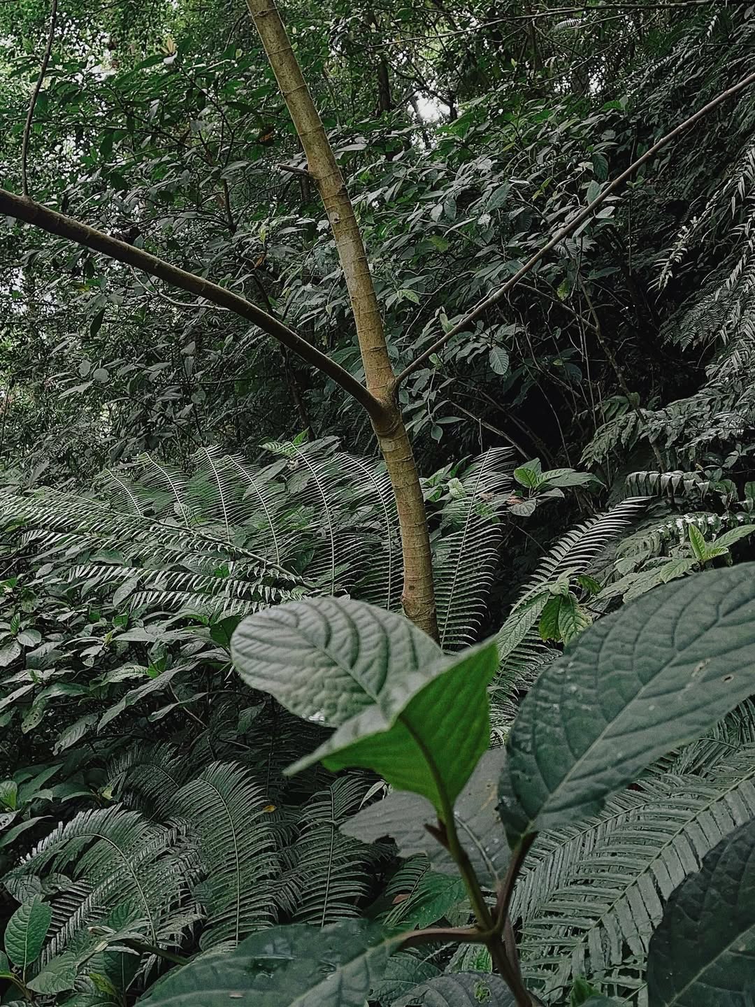
Sector 2: The Wilderness Zone (Stations 12 to 30) Past Agila Base, the pavement ends. You will navigate through a dense, humid mossy forest. The terrain here is infamous for its “Chocolate Mud”—a highly viscous, shoe-sucking clay that offers zero traction, especially from June to December. By the time you hit Station 25, the gradient spikes, and you will be scrambling on all fours through massive root systems to reach the Station 30 summit marker.
Mt. Makiling Summit
Mt. Makiling Summit
Mt. Makiling Summit
The MakTrav Reality: A Warning for 2026
The Makiling Traverse (MakTrav) is a Major Climb (6/9 Difficulty) taking 6-9 hours. Starting at Sitio Jordan in Sto. Tomas, Batangas, it involves near-vertical roped segments and the exposed Melkas Ridge. It is frequently closed due to landslides.
If you are an experienced mountaineer, the UPLB backtrail might feel too tame. The alternative is the Makiling Traverse (MakTrav). You start in Barangay San Miguel, Sto. Tomas, pass the massive geothermal pipes, and ascend the Sipit Trail to Peak 3.
The highlight of this route is Station 15 (Melkas Ridge or Haring Bato), a jagged rock formation offering panoramic views but requiring serious scrambling with high exposure to wind and drop-offs. The connector ridge between Peak 3 and Peak 2 (the “Wild Boar Trail”) is choked with teka-teka (thorny vines) and features near-vertical roped ascents requiring solid upper body strength.
Warning: As of late 2025/early 2026, the MakTrav route’s administrative status is volatile. Always call the Sto. Tomas tourism office before marketing or planning this itinerary.
The Limatik Dossier & Biological Hazards
Mt. Makiling is a “High Concern” zone for Limatik (blood leeches). Prevent bites by wearing compression tights and using 70% alcohol spray. Natural water sources on the mountain are non-potable; bring 2-3 Liters from the jump-off.
You cannot hike Makiling without preparing for the Limatik (Haemadipsa sylvestris). These terrestrial tiger leeches reside on leaves and ground cover, sensing your body heat and carbon dioxide.
Leave your loose trekking pants at home. The best defense is a mechanical barrier: wear compression leggings or tights, which they cannot burrow through. Bring a small spray bottle of 70% Isopropyl Alcohol. If a leech latches onto your eyeball or skin, do not pull it off—this can leave the mouthparts embedded and cause infection. A quick spray of alcohol will force it to detach safely.
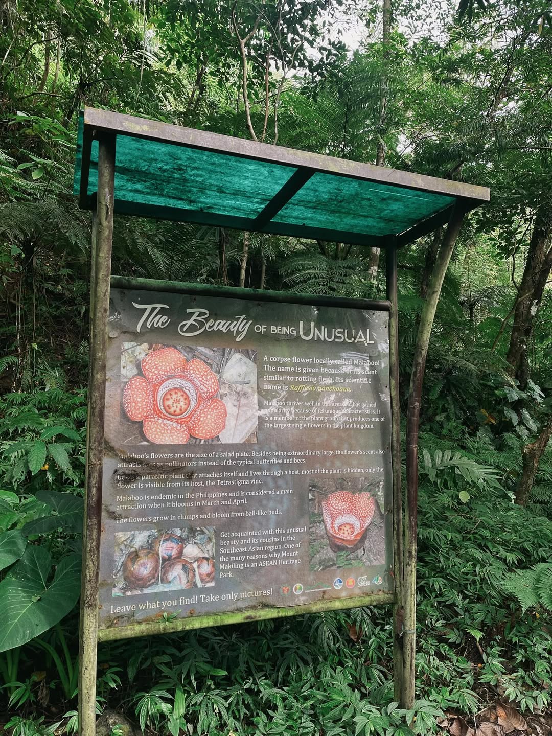
The Rafflesia Hunt: If you are hiking between February and May, keep your eyes peeled near Station 14. This is the blooming season for the Rafflesia panchoana, an endemic parasitic flower. Spotting one is a rare privilege, so have your cameras ready, but observe strict Leave No Trace (LNT) principles.
Mt. Makiling Summit
Mt. Makiling Summit
Mt. Makiling Summit
The “Make It Makiling” (MIM) Holy Week Exception
Every Holy Week (Maundy Thursday to Black Saturday), UPLB launches the “Make It Makiling!” (MIM) program. This is a unique window for budget hikers because the mandatory guide fee is traditionally waived. Hundreds of volunteer marshals and EMTs are stationed along the trail.
The trade-off? The trail becomes a crowded queue. Parking at the College of Forestry becomes impossible, and the April heat on the paved section is brutal. I advise avoiding MIM if you want a peaceful nature escape, but it’s a great option for cash-strapped student groups.
DIY Logistics & The Safe Budget Matrix
Take a bus from LRT Buendia or PITX bound for Sta. Cruz, Laguna (PHP 130-170), and alight at College Junction. Take a jeepney marked “Forestry” (PHP 15) to the jump-off. A safe budget is PHP 1,000 per person for a group of 5.
Getting there is straightforward but requires knowing the exact drop-offs.
-
Bus: Board a DLTB Co. or JAC Liner at LRT Buendia or PITX with the signboard “Sta. Cruz, Laguna.”
-
Drop-off: Alight at Olivarez Plaza or College Junction in Los Baños.
-
The “Last Mile” Jeep: From the junction, take a jeepney specifically marked “Forestry”. Do not take the “UP College” jeepney, as it terminates at Freedom Park, leaving you with a 2-kilometer uphill walk to the jump-off.
If you are bringing a private vehicle, set your Waze to UPLB College of Forestry. Arrive by 05:30 AM. If you arrive late on a weekend, security will divert you to park at Baker Hall in the lower campus, adding 4 kilometers (roundtrip) to your hike.
The Financial Breakdown: For a group of 5, your estimated expenses are highly manageable:
-
Roundtrip Bus: PHP 340
-
Local Transfers: PHP 60
-
Registration Fee: PHP 40 (Students get a discount with a valid ID!)
-
Guide Fee Share: PHP 240 (Total is PHP 1,200)
-
Shower/Food: PHP 320
-
Safe Budget: ~PHP 1,000 per person.
For solo DIY hikers, prepare close to PHP 2,000 to cover the solo guide fee.
The Post-Climb Ritual: Where to Eat in Los Baños
A Mt. Makiling itinerary is incomplete without a culinary recovery in Los Baños. After washing off the chocolate mud at the Forestry Administration building showers (PHP 20-50 for a basic bucket-style bath), head down to Lopez Avenue.
Treat yourself to the legendary Ravioli Lasagna at Bonitos Bar & Restaurant, or feast on authentic Korean BBQ at Seoul Kitchen (a favorite among the local university crowd).
Before you hop on the bus back to the concrete jungle of Manila, make sure to queue up for The Original Buko Pie or Lety’s Buko Pie in Brgy. Anos. The line usually takes 30-60 minutes on weekends, but securing a hot box of pie is the ultimate Laguna pasalubong. You’ve earned the calories.

Leave a Reply