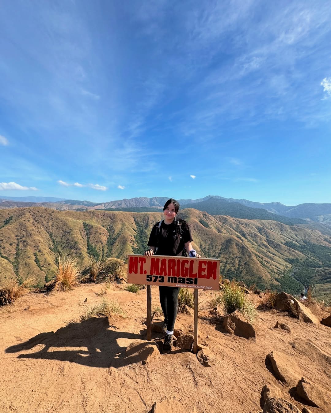
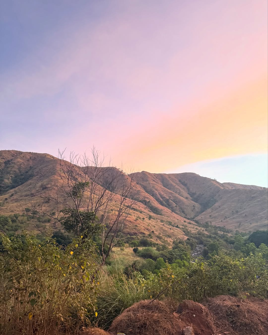
Mt. Mariglem in Cabangan, Zambales is a 573 MASL minor peak famous for its “Ridge-to-River” trail. While often labeled “beginner-friendly” due to its short 2–3 hour ascent, the open trail exposes hikers to extreme heat (Heat Index >40°C), making it a High-Intensity Short-Duration (HISD) challenge. The reward is a refreshing descent into the emerald waters of the Maligha and Agbobotilya Rivers.
If I had to describe Mt. Mariglem in one sentence, it would be this: It is a beautiful, scorching trap that rewards you only after it has tested your resolve.
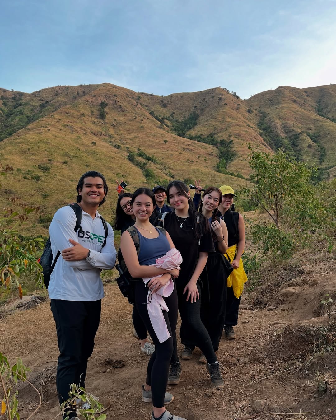
Located in Sitio Maporac, Cabangan, this mountain has quickly become a staple in the Zambales hiking scene. The allure is undeniable—a “Ridge-to-River” experience where you battle the sun on exposed peaks in the morning and wash off the grime in crystal-https://www.davestravelcorner.com/clear emerald rivers by lunch. It sounds like the perfect day hike, and in many ways, it is.
But there is a catch that catches many first-timers off guard.
The “Beginner-Friendly” Myth
Let’s be real for a second. On paper, Mt. Mariglem looks easy. It sits at just 573 MASL (Meters Above Sea Level) and carries a technical difficulty rating of roughly 3/9. Most guides will tell you it takes just 2 to 3 hours to summit.
Because of this, I’ve seen countless “joiners” show up in cotton shirts with a single 500ml water bottle, expecting a walk in the park.
This is a rookie mistake.
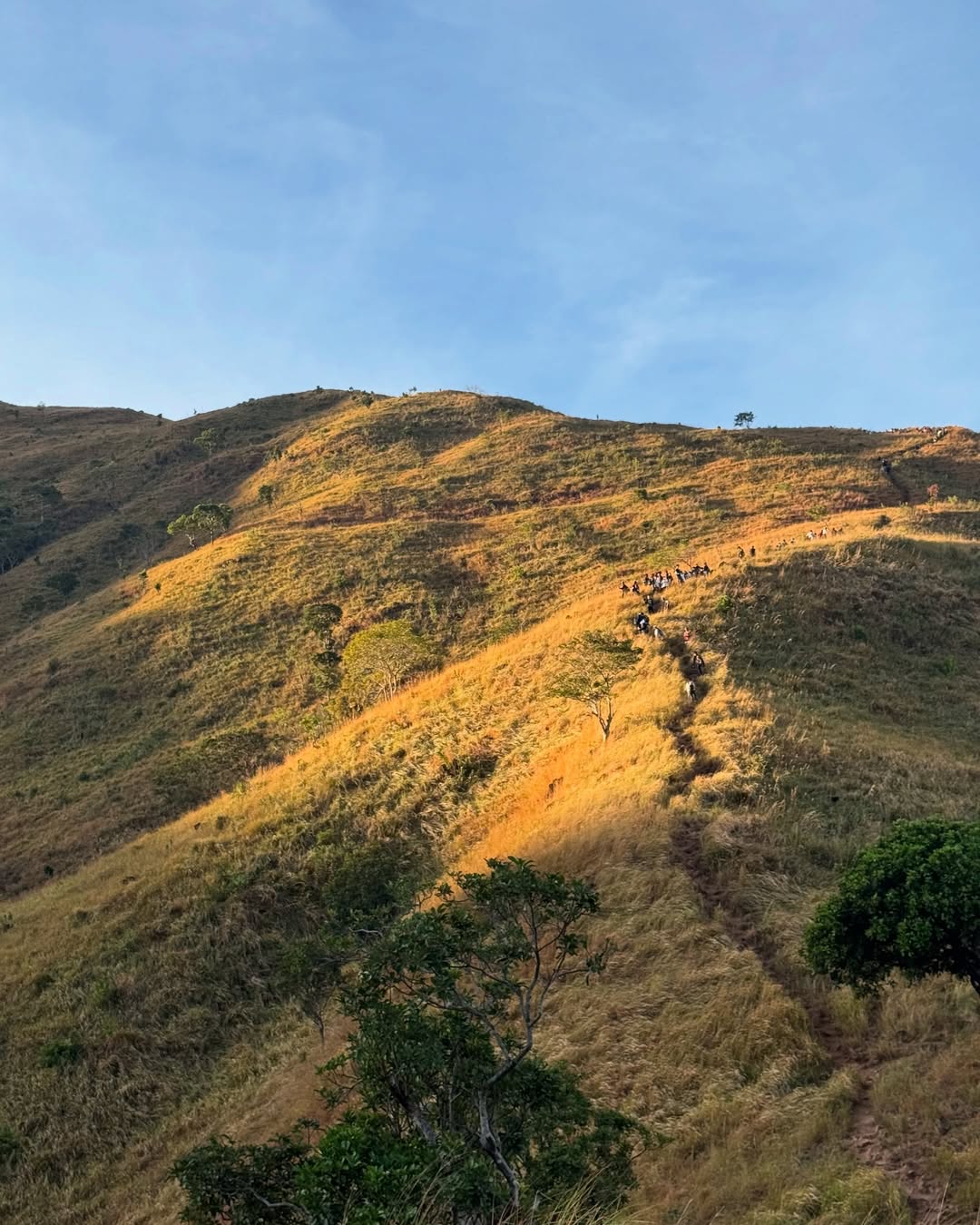
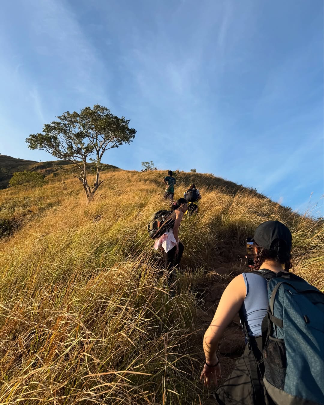
The challenge of Mariglem isn’t the altitude; it’s the exposure. The trail is widely known as an “open trail”—meaning there is zero forest canopy. From the moment you leave the jump-off at Sitio Maporac, you are walking on volcanic soil and grassland under the direct glare of the sun. By 8:00 AM, the heat index on these ridges can easily breach 40°C.
I classify this hike not as a “beginner walk,” but as a High-Intensity Short-Duration (HISD) event. It hits you hard and fast. If you aren’t prepared for the Zambales heat, that short climb will feel like an eternity.
However, if you respect the heat and start early (I recommend a 3:00 AM start), this mountain offers one of the best payoffs in Luzon: the Maligha and Agbobotilya Rivers.
Mt. Mariglem Quick Facts
Mt. Mariglem is a minor peak (573 MASL) in Cabangan, Zambales, known for its scenic open ridges and “Ridge-to-River” trail. While the hike only takes 2–3 hours to summit, the extreme heat exposure makes it a moderate 3/9 difficulty. The trail features loose scree (Class 1-2) and leads to the Maligha and Agbobotilya Rivers. Best visited from December to February.
-
Location: Sitio Maporac, Brgy. New San Juan, Cabangan, Zambales
-
Elevation: 573 MASL
-
Difficulty: 3/9 (Minor Climb, but Heat Index can push it to 5/9)
-
Trail Class: 1-2 (Non-technical, but plenty of loose scree)
-
Hours to Summit: 2–3 Hours
-
Limatik Presence: None (But beware of sharp Cogon grass)
How to Get to Mt. Mariglem (DIY & Private)
To get to Mt. Mariglem from Manila, take a Victory Liner bus bound for Iba or Santa Cruz (~₱450–₱500) and drop off at the Cabangan Municipal Hall or Highway. From there, hire a tricycle to Sitio Maporac (~₱300/trip), then transfer to a mandatory “Kolong-Kolong” (4×4 motorcycle) ride to the trailhead (₱550/ride). The total travel time is approximately 4 to 5 hours.
Option A: Public Transportation (Commute)
The most reliable way to reach Zambales is via Victory Liner. I suggest booking trips from the Pasay or Cubao terminals.
-
Step 1: Bus to Cabangan Board a bus bound for Iba or Santa Cruz, Zambales. Ask the conductor to drop you at Cabangan Town Proper or San Narciso (if meeting a guide there).
-
Fare: ~₱450–₱500
-
Travel Time: 4–5 Hours
-
-
Step 2: Tricycle to Jump-off From the highway, hire a tricycle to Sitio Maporac. This is usually a “special trip” arrangement.
-
Cost: ~₱300 (Good for 3-4 pax)
-
Duration: 20 Minutes
-
-
Step 3: The Kolong-Kolong Ride You cannot bring a normal car or tricycle to the trailhead. You must transfer to a local Kolong-Kolong (a modified 4×4 motorcycle).
-
Cost: ₱550 per ride (Up to 5 pax)
-
Warning: It is bumpy and dusty. Wear a face mask or buff.
-
Option B: Private Vehicle
If driving, navigate via Waze to Sitio Maporac, Cabangan.
-
Parking: Secure parking is available at the registration area for ₱50–₱100.
-
Warning: Do not attempt to drive your sedan to the actual trailhead; the rocks will destroy your underchassis. Leave it at the jump-off and take the Kolong-Kolong.
Mt. Mariglem
The Trail Experience: What to Expect
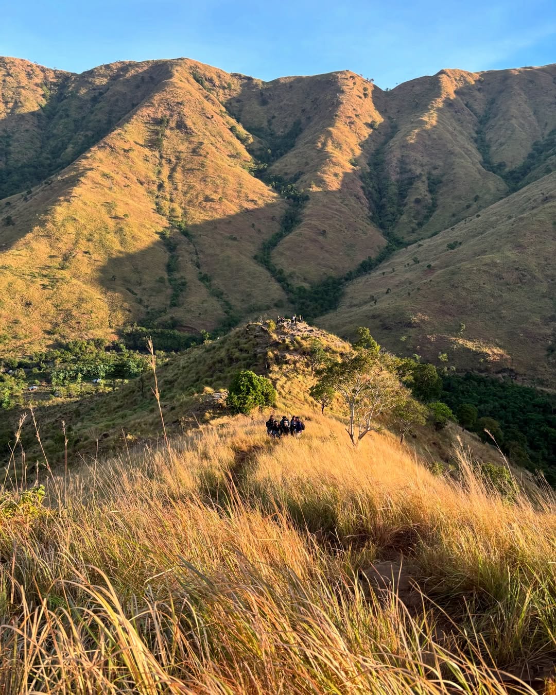
The Mt. Mariglem trail is characterized by “unli-ahon” (continuous assault) on open, grassy ridges with zero shade. Hikers pass through 4 Stations/Peaks before the summit. The descent involves loose scree leading to the Maligha and Agbobotilya river systems for recovery.
Phase 1: The Pre-Dawn Assault (Stations 1-3)
We started trekking at 3:00 AM. The first hour involves walking through agricultural buffer zones before the “unli-ahon” (unlimited ascent) begins. The trail is a mix of compacted dirt and loose volcanic rocks.
-
Pain Point: There are no “flat” recovery sections. It is a straight cardio grind.
-
Tip: Use this dark time to gain elevation before the sun rises.
Phase 2: The Summit Push (Peak 4)
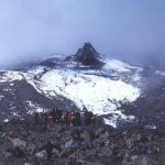
By 5:30 AM, you should be approaching Peak 4. The ridge narrows, and you will see the true summit ahead.
-
The View: To your West is the vast West Philippine Sea; to your East is the towering Mt. Tapulao.
-
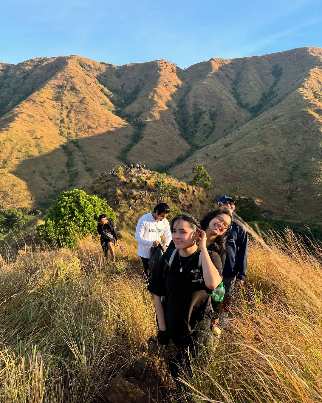
The Exposure: This is where the lack of trees becomes obvious. You are completely exposed to the wind and sun.
![INSERT PHOTO: Hiker standing on Peak 4 with the summit ridge in the background]
Phase 3: The Scree Descent & River (The Payoff)
Descending the back of the mountain is tricky due to loose “scree” (gravel). I slipped twice here—trekking poles are a lifesaver.
-
Maligha River: This is the main lunch area with bamboo cottages and sari-sari stores selling soft drinks.
-
Agbobotilya River: A short walk from Maligha, this river features stunning white rocks and emerald water.
-
River 3 (Mossy Sector): Avoid the mossy areas; the “biofilm” makes the rocks as slippery as ice.
Mt. Mariglem
Mt. Mariglem
Sample Itinerary (Day Hike)
A standard day hike itinerary starts with a 3:00 AM trek to catch the sunrise at the summit by 5:30 AM. Descent begins at 6:30 AM to avoid heat, reaching the river by 8:30 AM for breakfast. Hikers typically return to the jump-off by 11:00 AM.
| Time | Activity |
| 02:00 AM | Arrive at Cabangan / Meet Guide |
| 02:30 AM | Registration & Kolong-Kolong Ride |
| 03:00 AM | Start Trek (Bring headlamps) |
| 05:30 AM | Summit Arrival / Sunrise Viewing |
| 06:30 AM | Start Descent (Strict time to beat the heat) |
| 08:30 AM | Arrival at Maligha River (Breakfast/Lunch) |
| 09:30 AM | Swim at Agbobotilya River |
| 11:00 AM | Trek back to Jump-off |
| 12:00 PM | Wash up at Sitio Maporac |
Budget Breakdown (Per Person)
A DIY trip to Mt. Mariglem costs approximately ₱1,500 – ₱2,000 per person. Major expenses include Bus Fare (~₱900 roundtrip), Guide Fee (₱1,500/group of 5), and Kolong-Kolong transfer (₱550/ride).
Estimates based on a group of 5 hikers.
| Expense Item | Cost (PHP) | Notes |
| Bus Fare (RT) | ₱900 – ₱1,000 | Manila to Cabangan (Victory Liner) |
| Tricycle (RT) | ₱120 | Share of ₱300/trip |
| Kolong-Kolong | ₱110 | Share of ₱550/ride |
| Guide Fee | ₱300 | Share of ₱1,500 (1:5 Ratio) |
| Registration | ₱100 | LGU Fee (Verify current rate) |
| Food/Water | ₱300 | Packed lunch + Trail food |
| Total | ~₱1,830 | Safe budget per person |
Mt. Mariglem
Mt. Mariglem
Essential Guides & Safety Requirements
Hikers must secure a local guide (1:5 ratio) at the Sitio Maporac registration area. No medical certificate is strictly required for day hikes, but a waiver must be signed. A silver umbrella is highly recommended due to extreme heat exposure.
-
The Silver Umbrella: Do not hike Mariglem without one. It lowers the “feels like” temperature by 5-10°C. Sunscreen will just sweat off.
-
Water Strategy: Carry at least 2-3 Liters. There is NO potable water source on the ridge. You can buy drinks at the river, but that’s at the end of the hike.
-
The Guide Ratio: The LGU strictly enforces 1 guide for every 5 hikers. This is non-negotiable for safety.
“What I Wish I Knew” (The Honest Review)
I wish I knew that the “beginner” label was about technicality, not endurance. My friend, a first-timer, nearly fainted from heat exhaustion because we started late (5:00 AM). By 9:00 AM, the sun was unbearable.
-
The Dust: The Kolong-kolong ride covered us in dust before we even started walking. Bring a change of clothes or a cover-up.
-
The Flash Flood Risk: The guides are serious about this. If it rains in the mountains, the Binaong River system swells instantly. If the water turns brown, get out immediately.
Mt. Mariglem
Frequently Asked Questions (FAQ)
Q: Do I need to book in advance? A: Walk-ins are allowed, but it’s safer to message the Cabangan Tourism Office on Facebook to secure a guide, especially on weekends.
Q: Is there a signal on the mountain? A: Smart/Globe signal is intermittent (4G) at the summit but completely dead in the river valley/canyon.
Q: Can I wear shorts? A: Yes, but I recommend leggings or high socks. The Cogon grass is sharp and will leave your legs with “cat scratches.”
Q: Is it safe for solo joiners? A: Absolutely. You will be grouped with others or can hire a solo guide (standard fee applies). The trail is very established.
Q: Where can I stay overnight? A: Camping is allowed at the river/jump-off, not the summit. Alternatively, head to Liwliwa Beach (San Felipe) which is just 30 minutes away for a post-hike staycation.


Leave a Reply