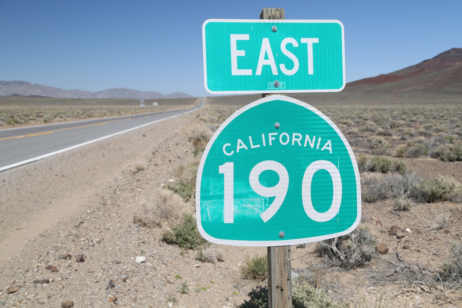

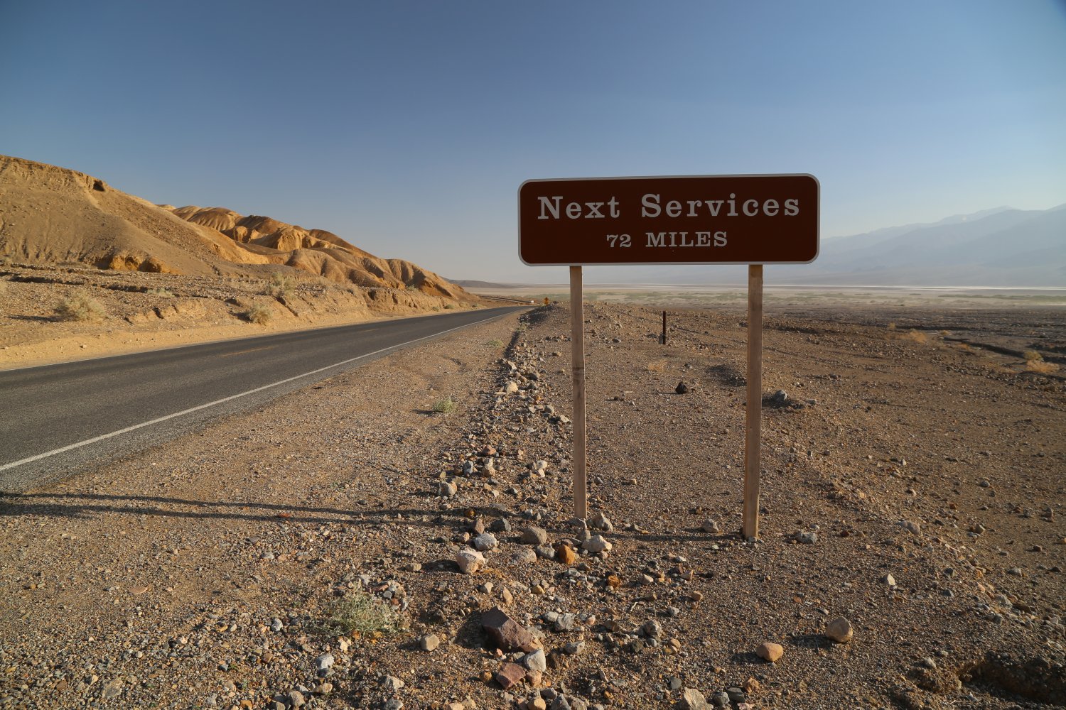
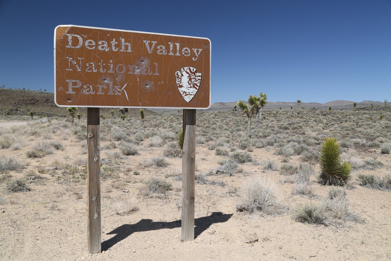
Death Valley is the largest national park in the lower 48 states; it houses a diversity of natural and human-made attractions. Based on numerous trips to Death Valley, we recommend at least 4-5 days to have enough time to visit some of the following highlights.
However some schedules may not allow that amount of time:
One day: we recommend you concentrate your sightseeing efforts near Furnace Creek as many natural attractions are located within a short drive of it’s cozy confines.
Two days: consider visiting additional attractions further away from Furnace Creek – including in the northern part of the park near Scotty’s Castle and also in the vicinity of Stovepipe Wells.
Three days: add on stops outside of the valley floor but still within the national park including Wildrose, Darwin Falls, Crowley Overlook or perhaps a drive through Titus Canyon.
We have visited the following highlights within Death Valley (listed in alphabetical order):
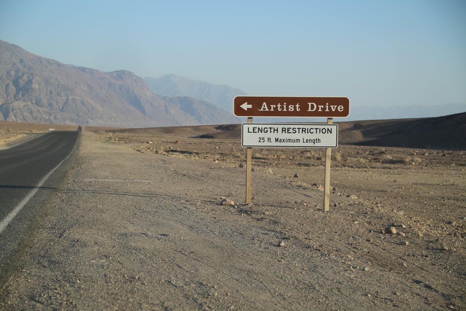
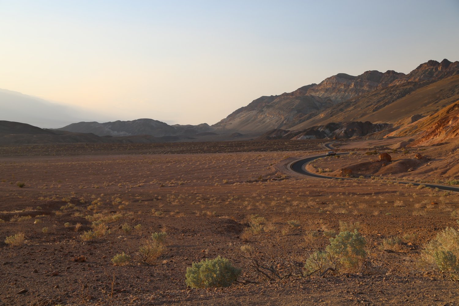
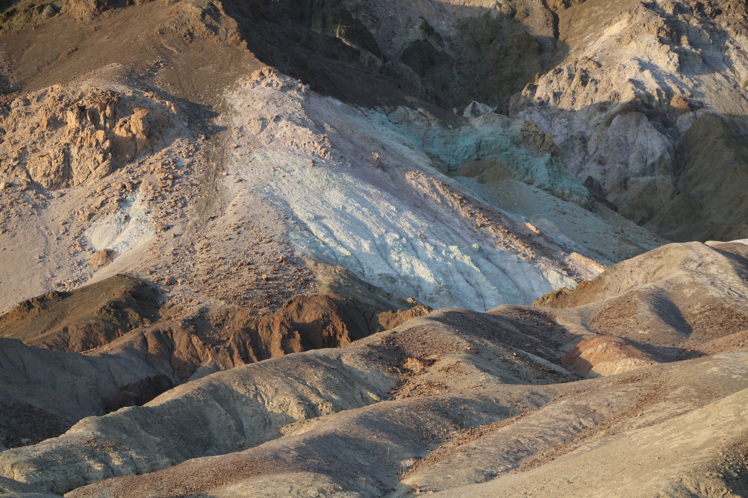
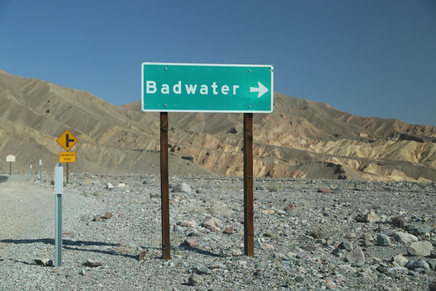
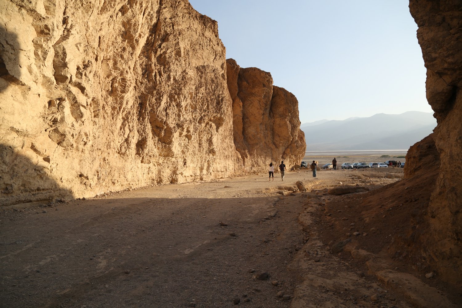
Artist’s Drive is located almost 1/2 way between Furnace Creek and Badwater. This 9 mile one way narrow paved loop drive was severely damaged in floods in the early 2000’s but was repaired soon after. Motorists enter from closer to the Badwater side and exit north a few miles of where you started (essentially a loop drive). Note that vehicles longer than 25 feet are not allowed.
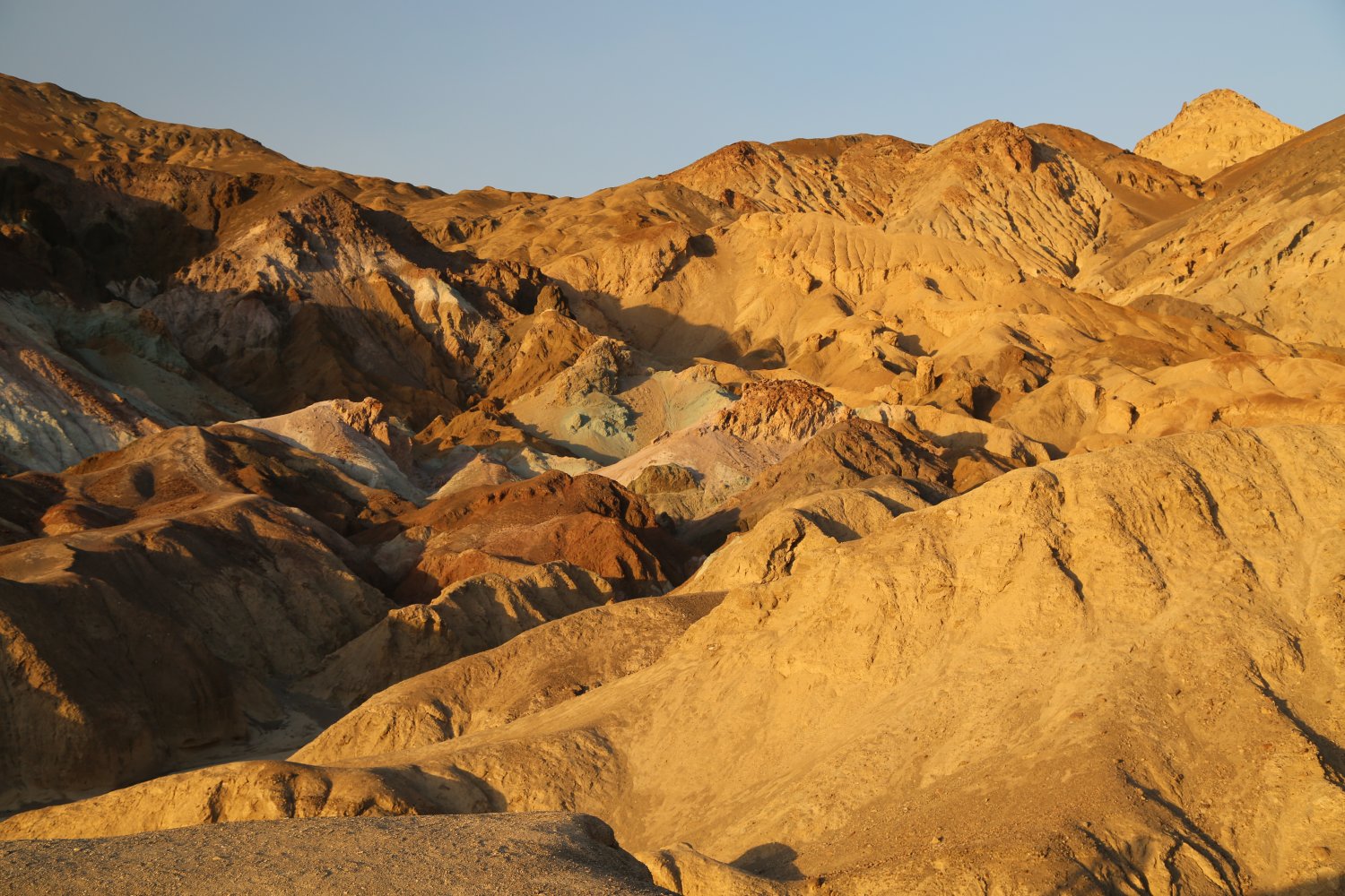
This drive is meant to be taken slow – various shades of color are represented in the sedimentary and volcanic rocks. A must stop is Artist’s Palette located towards the latter part of the drive on the right hand side. A parking lot is available and you can take several very short hikes which bring you out onto the multi colored soil. Hues of green, blue, pink and tan make very nice photo opportunities especially in the “golden hour” of the evening. The hour just before sunset is a recommended time to be on Artist’s Drive.
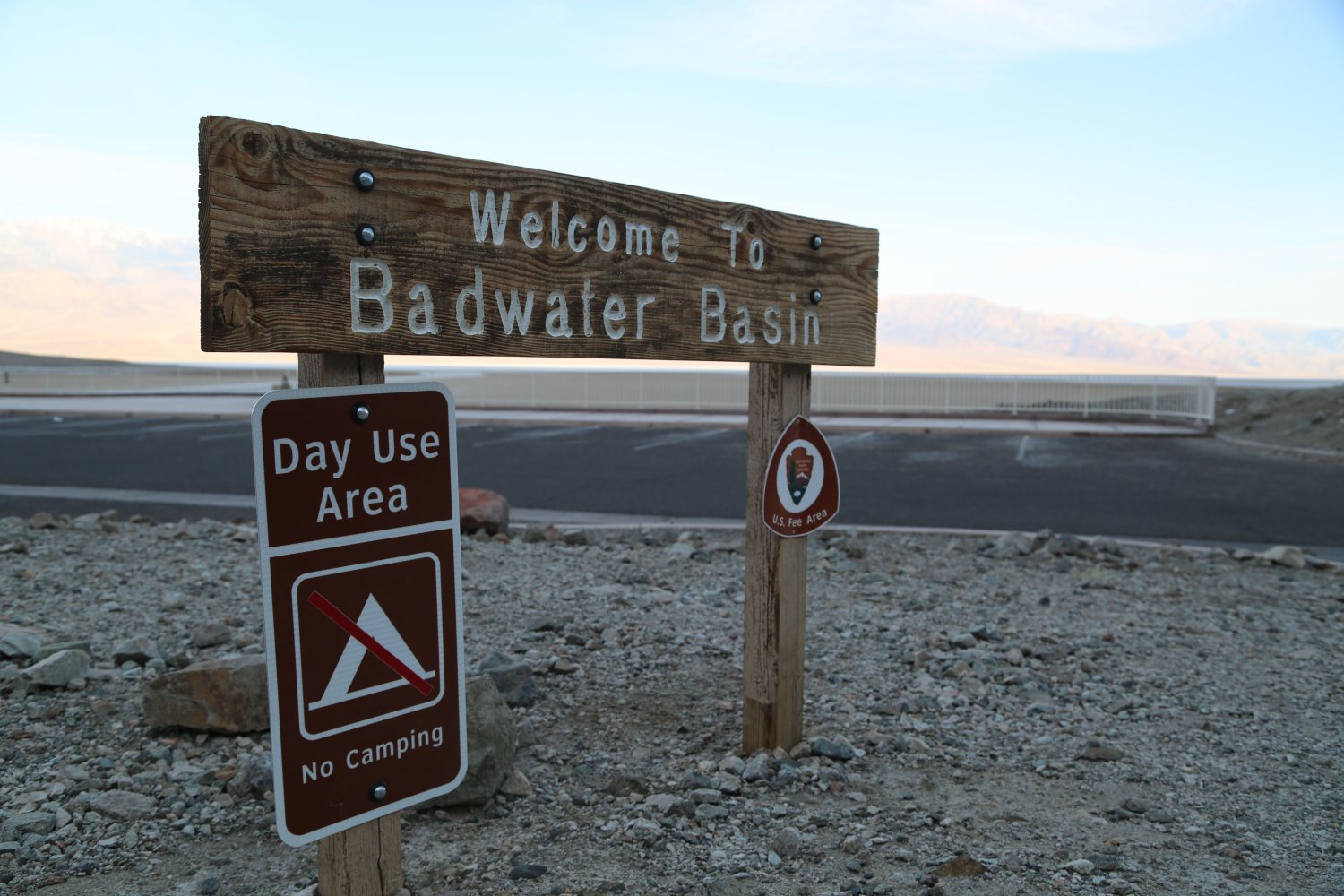
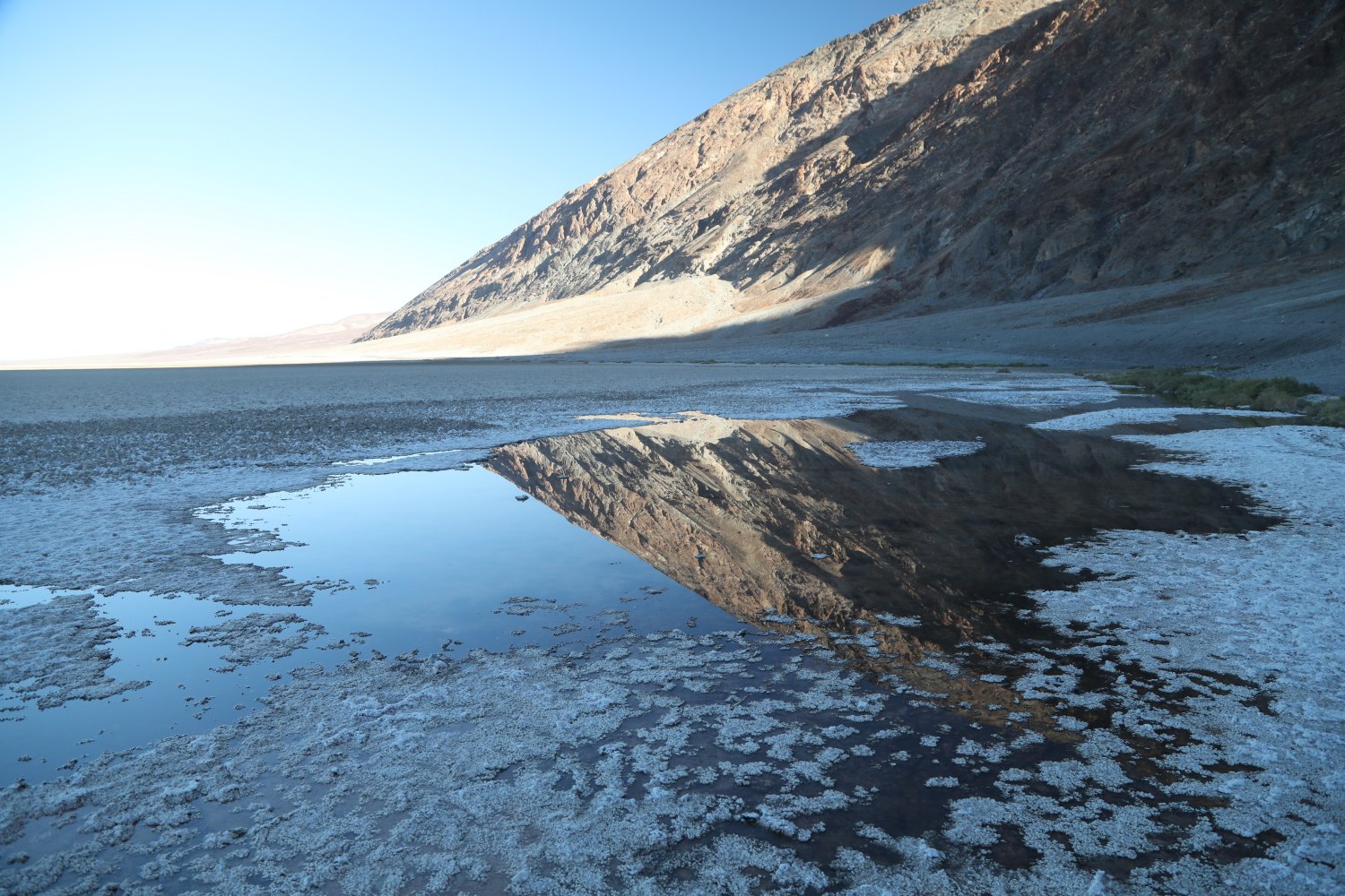
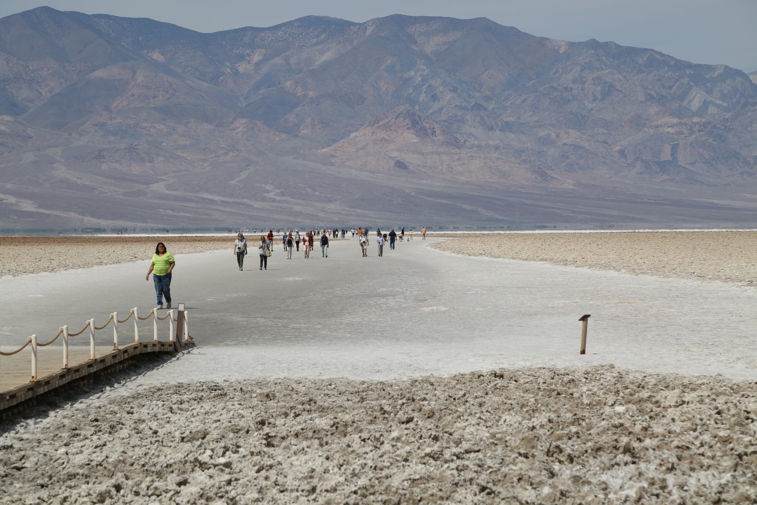
 Badwater is “bad” in the positive use of this word. It is very unique as it is the lowest hottest place in the western hemisphere. Don’t expect to find to many artifacts of civilization here other than bathrooms, a parking lot, an overlook, a boardwalk and a few holes people have dug through the upper salt layer. As you look up at the cliffs behind Badwater you will see a sign way above you that says “sea level”.
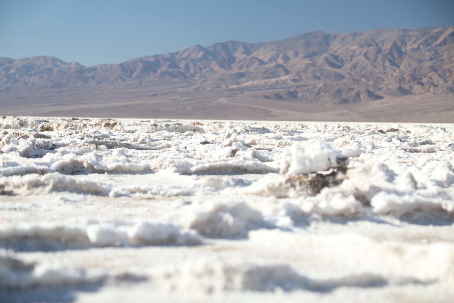
A small boardwalk rises above the salty pools, descriptive signs are strategically placed along this boardwalk. One end of the boardwalk leads out into the salt flats. This very wide trail leads into the heart of the salt. As you walk you will see several holes dug down into the salt – there is water underneath! When you get far enough out into the Badwater salt basin, depending on the time of year, you might find that the salt is so sticky it adheres to your shoes every time you take a step. Those who walkout the furthest (generally 1/2 mile) are rewarded with the most interesting looking salt formations and related crystals.
The drainage leading into Badwater is extensive – nearly 9,000 square miles. Rain on distant peaks eventually brings salts and other minerals to a lower elevation over thousands of years ultimately ending up on this vast plain. Besides salt, calcite, gypsum and borax are found here.
While the official temperature is read at Furnace Creek (behind the visitor center), the temperature at Badwater is usually a degree or two hotter then at Furnace Creek. During one day at the end of June when we visited, the temperature in the park was recorded as more then 129 degrees Fahrenheit – we saw one lady wheeling her infants in a stroller across the salt plane of Badwater in mid afternoon. During another visit, when there was widespread panic about a virus – and much of Death Valley National Park was closed, we saw people camping out in the parking lot (normally not allowed).
And it is from here that every year the Badwater Ultramarathon begins – a exceptionally difficult foot race from the lowest point in North America to the highest point in California (Mt. Whitney). The race is always held in July – the hottest month of the year and participants must satisfy very rigorous pre-qualifications. Starting in 2015 unfortunately, the race was moved from a starting time of in the early am to 8pm.

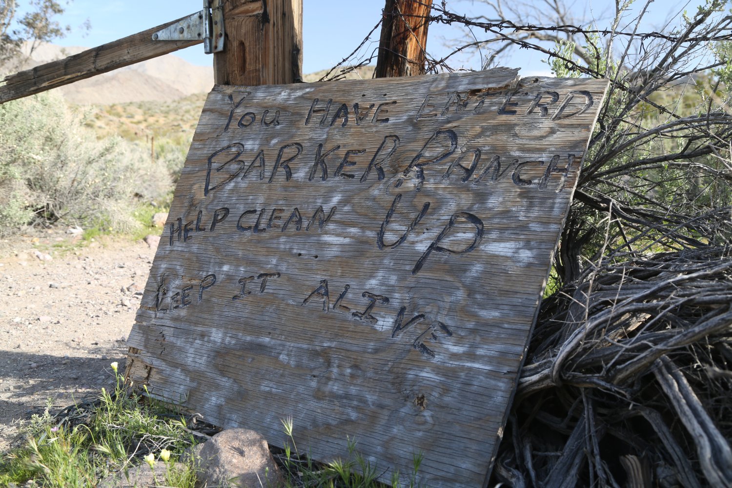
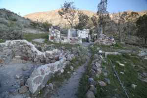
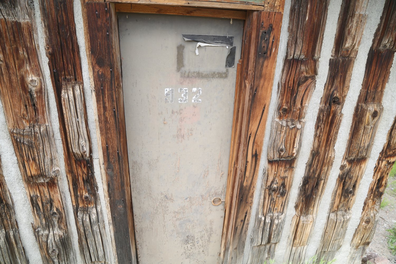
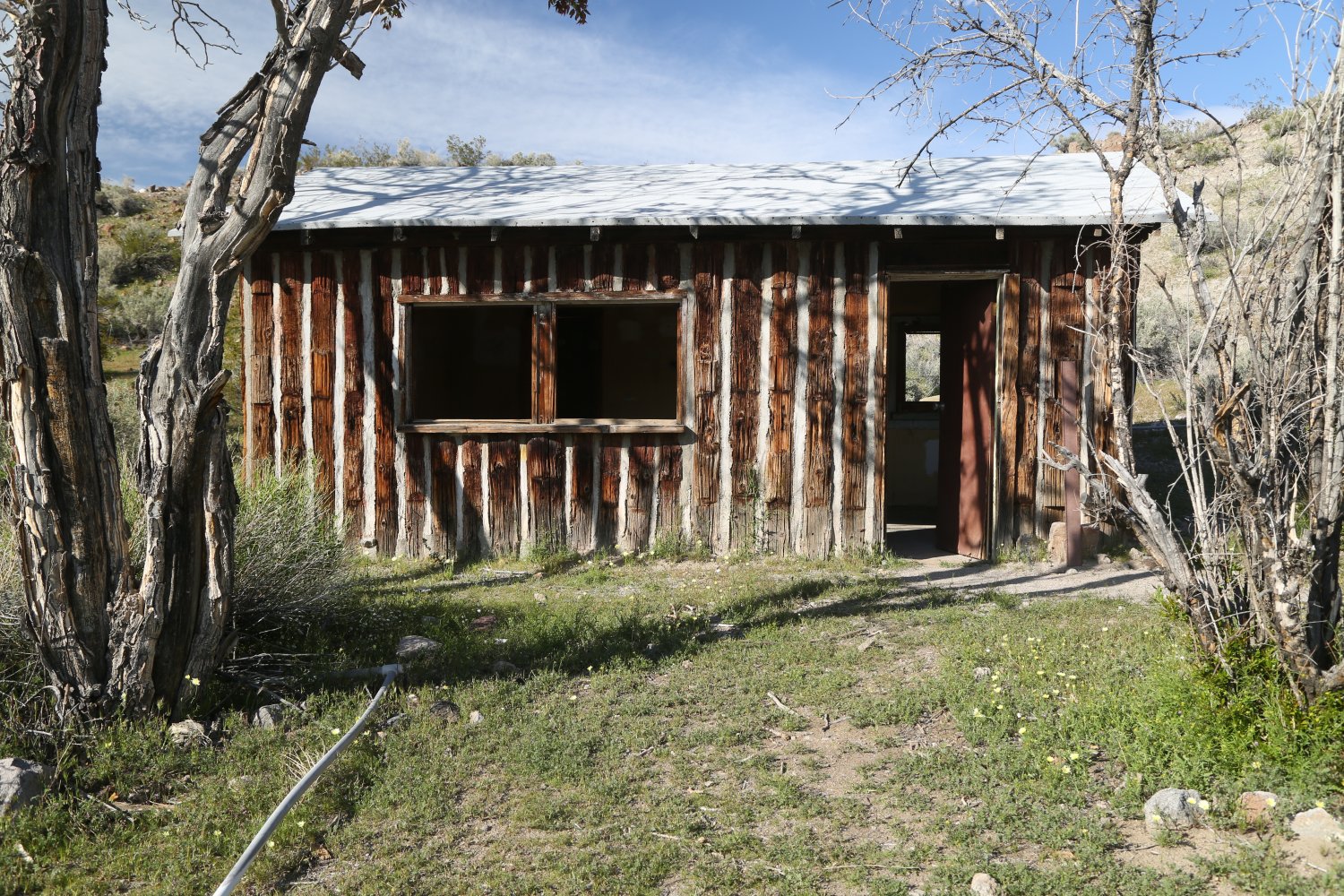
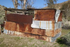
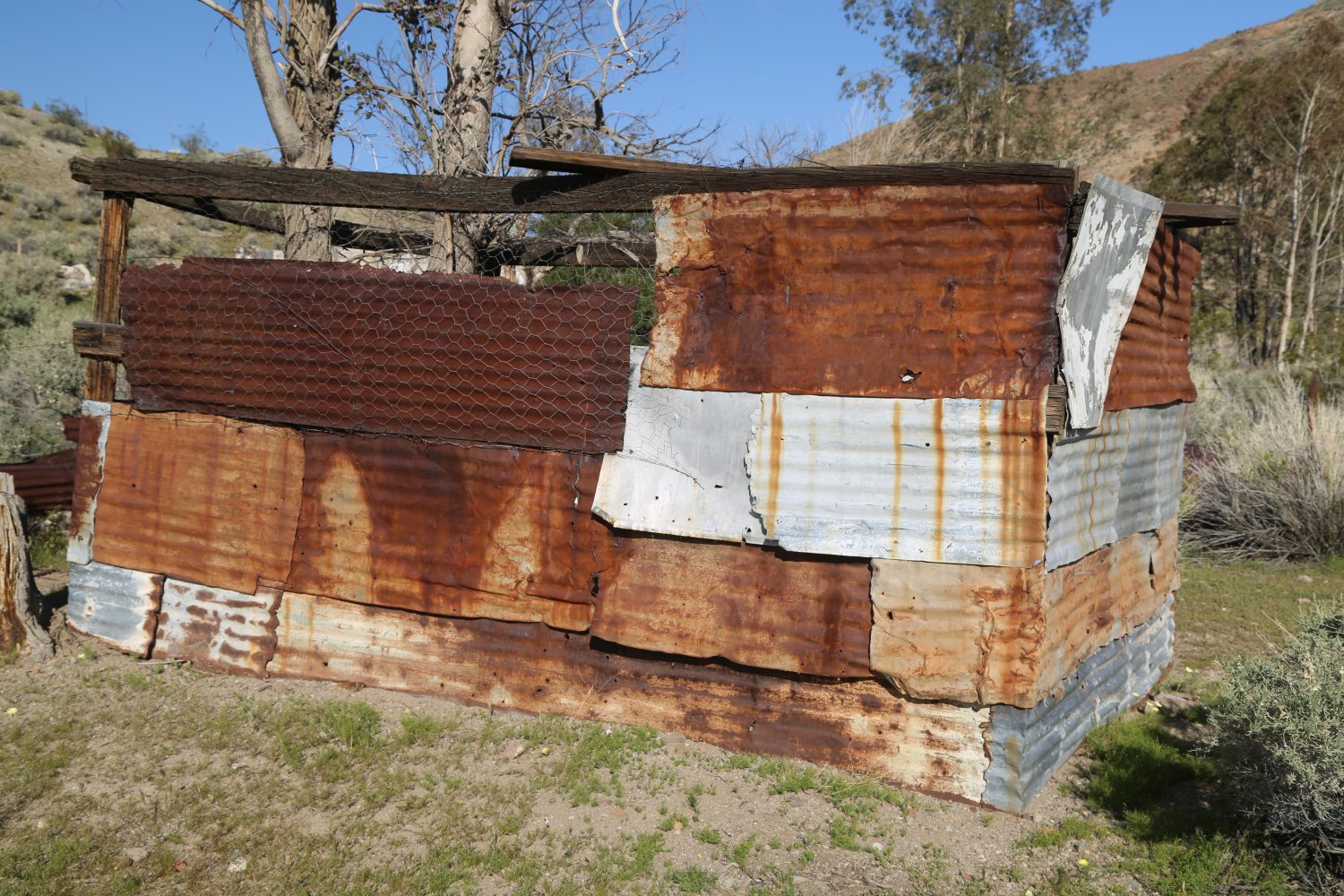
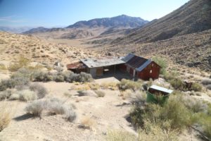
Barker Ranch & Meyers Ranch. Barker Ranch was originally settled in 1939 by Bluch and Helen Thomason (a retired couple from Los Angeles, Bluch was a detective) 2 years after Bluch filed a mining claim on site. The first permanent structure on site was a stone house constructed in 1940/1941. Bluch passed away in 1950 and in 1956 Helen finally sold the mining claim in 1956 to James and Arlene Barker (from Oklahoma). The Barkers built both the wooden/concrete bunkhouse and the stone walled swimming pool in 1957. By 1971 Arlene Barker gave up the rights to the mining claim and the land once again was controlled by BLM – and in 1994 the ranch became a part of Death Valley National Park (when the park was created). Nothing leading up to this point would give one anything unusual to pause over – as mining claims come and go. But the years 1968 and 1969 would forever change the narrative of these two ranches.
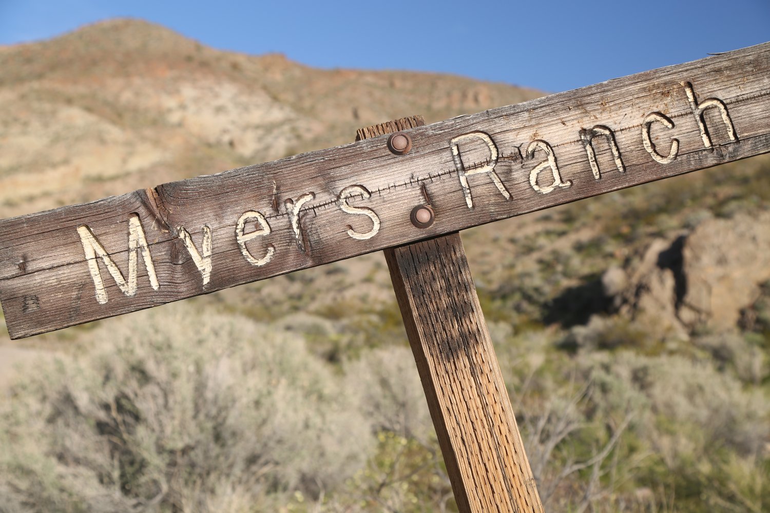
Both ranches are forever linked to Charles Manson and his ‘family’. The Meyers Ranch dates to 1932 when it was founded by Bill and Barbara Myers – who settled the property for mining purposes. Unclear is how their family became owners of the land since this was originally BLM land and when one files a mining claim, they can live on site but they do not own the physical land.
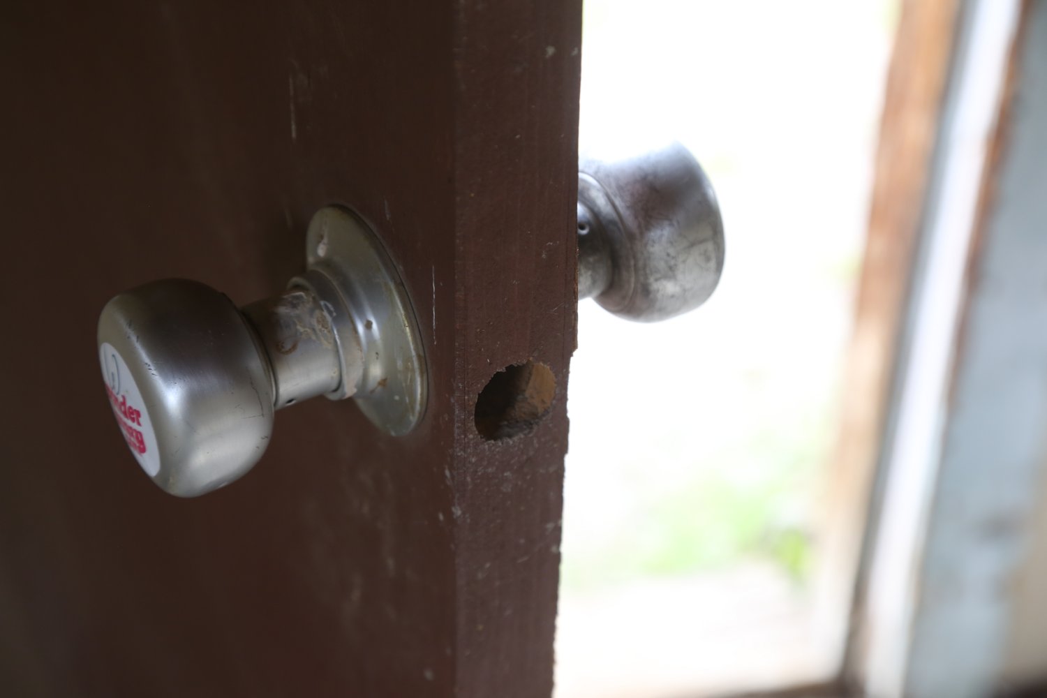
Charles discovered the Meyer’s Ranch through Bill and Barbara’s grand daughter Catherine Gillies – and moved here as the ranch was not be used at the time by the Meyers family. Within easy walking distance, the Barker Ranch at the time was in better condition and Charles and his ‘family’ subsequently moved next door after seeking out permission from Arlene Barker. During combined raids by several law enforcement agencies in October 1969 (for various acts of vandalism including burning a National Park Service tractor) members of the Manson family were arrested. Charles hid in a cabinet under the vanity in the bathroom (facing the remains of the house, this is to the left of the home). An officer made one last pass through the house and spotted some of Charles hair caught in the cabinet showing on the outside and arrested him. However, at the time of his and the rest of the family arrests, law enforcement had no idea about the murders in Los Angeles that Charles orchestrated and family members carried out.
In an interesting arrangement, the 40-acre Meyers Ranch is entirely surrounded by Death Valley National Park, but this parcel is still privately owned by the Meyers family heirs.
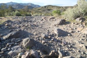
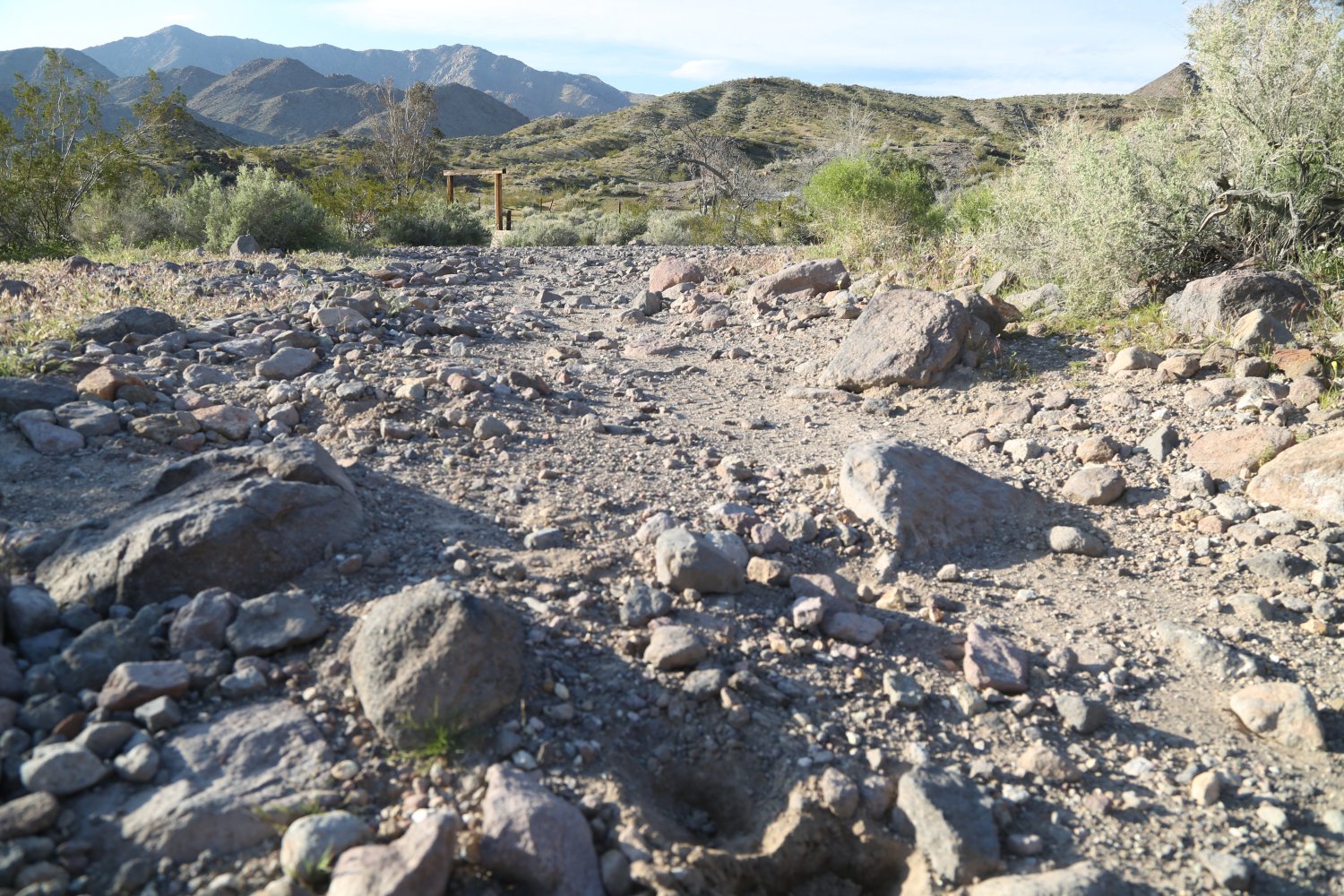
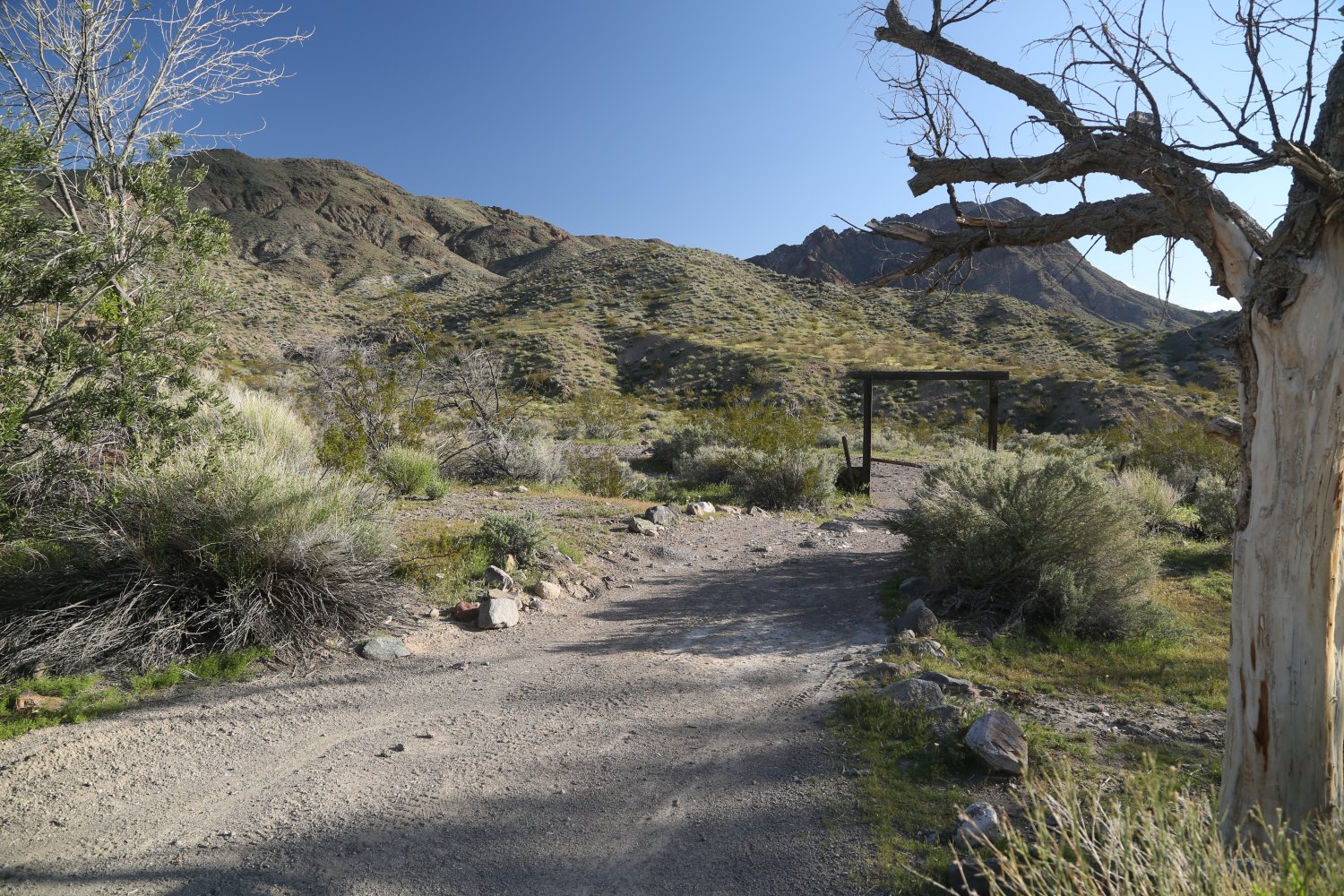
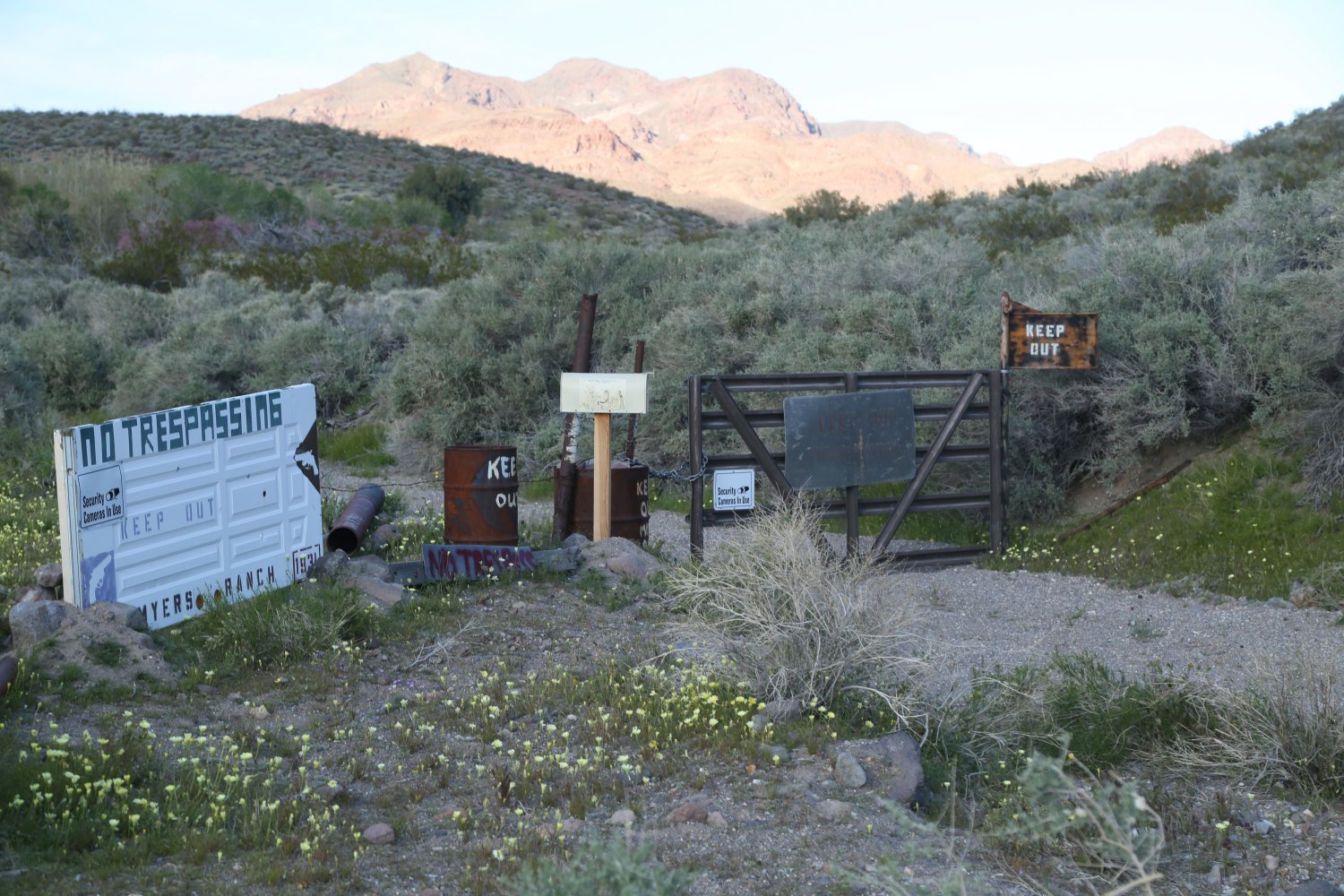
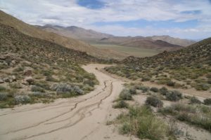
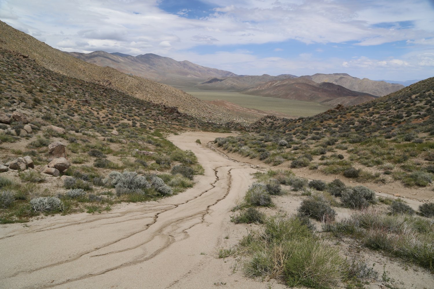
Visitors to Death Valley National Park can visit Barker Ranch – but should not attempt a visit in a 2wd passenger sedan. Barker Ranch can be accessed via two ways – the less demanding route is from Ballarat in the Panamint Valley – past the sometimes seasonal (depending on rainfall) sizable and very shallow Lake Levart (we named it such since no prior name exists for this lake) and up the narrow and rugged Goler Canyon. This canyon features several nasty rocky sections in the road and a number of deep ruts once beyond the canyon. The other way is from Westside Road across from Badwater – cutting through the Panamint Mountains – through Butte Valley and up and over the extremely rugged and serious 4wd only road that passes over Mangel Pass.
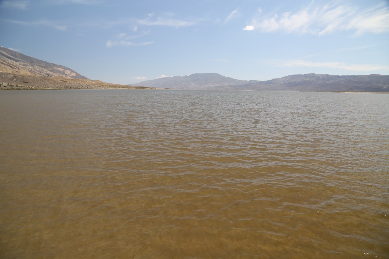
A very full Lake Levart
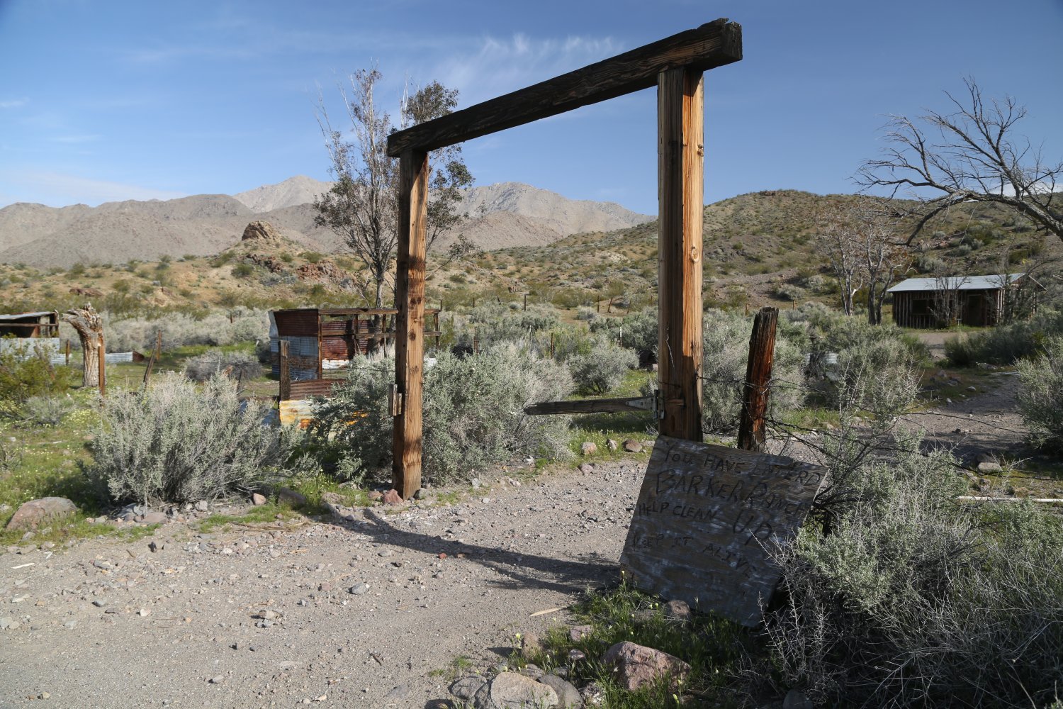
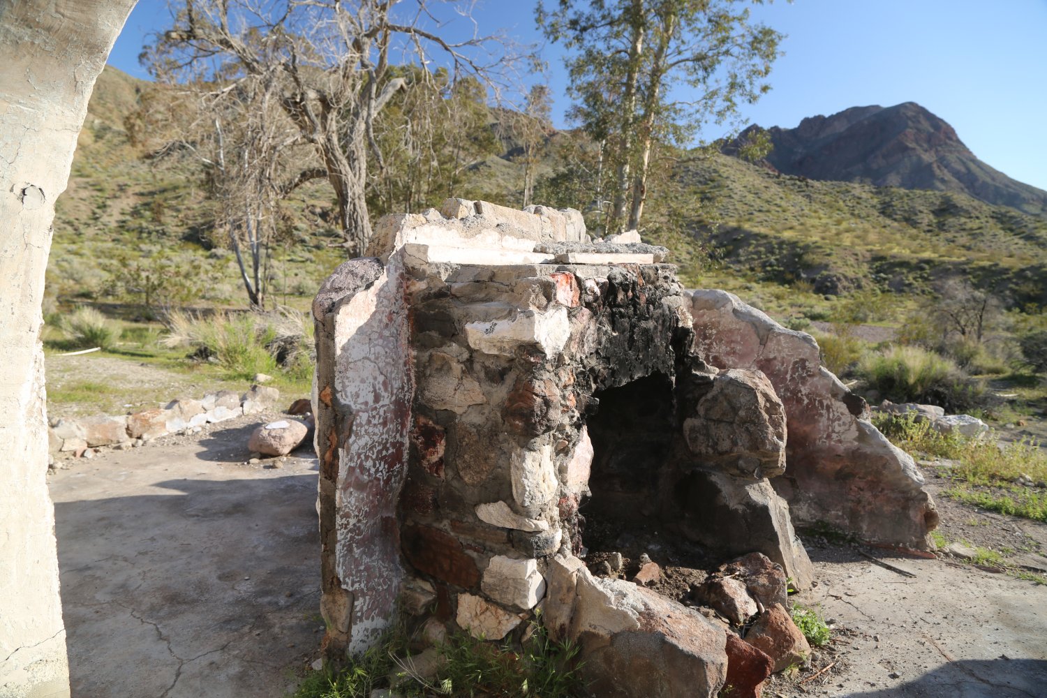
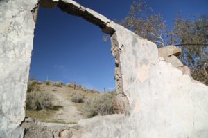
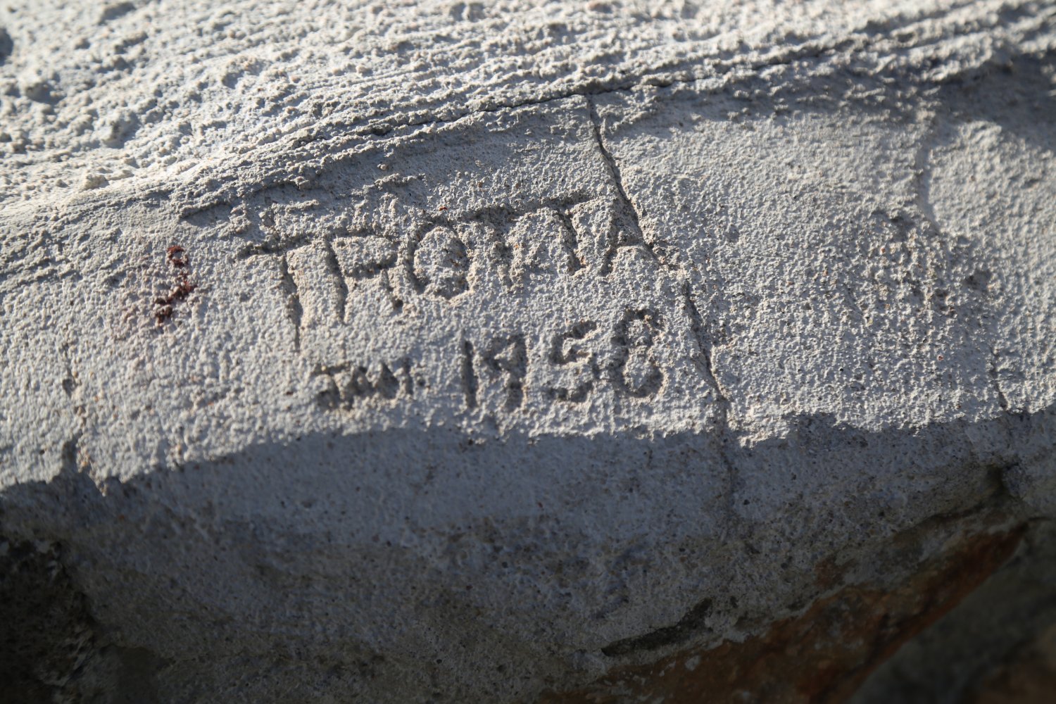
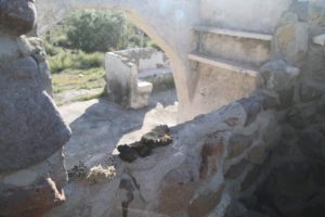
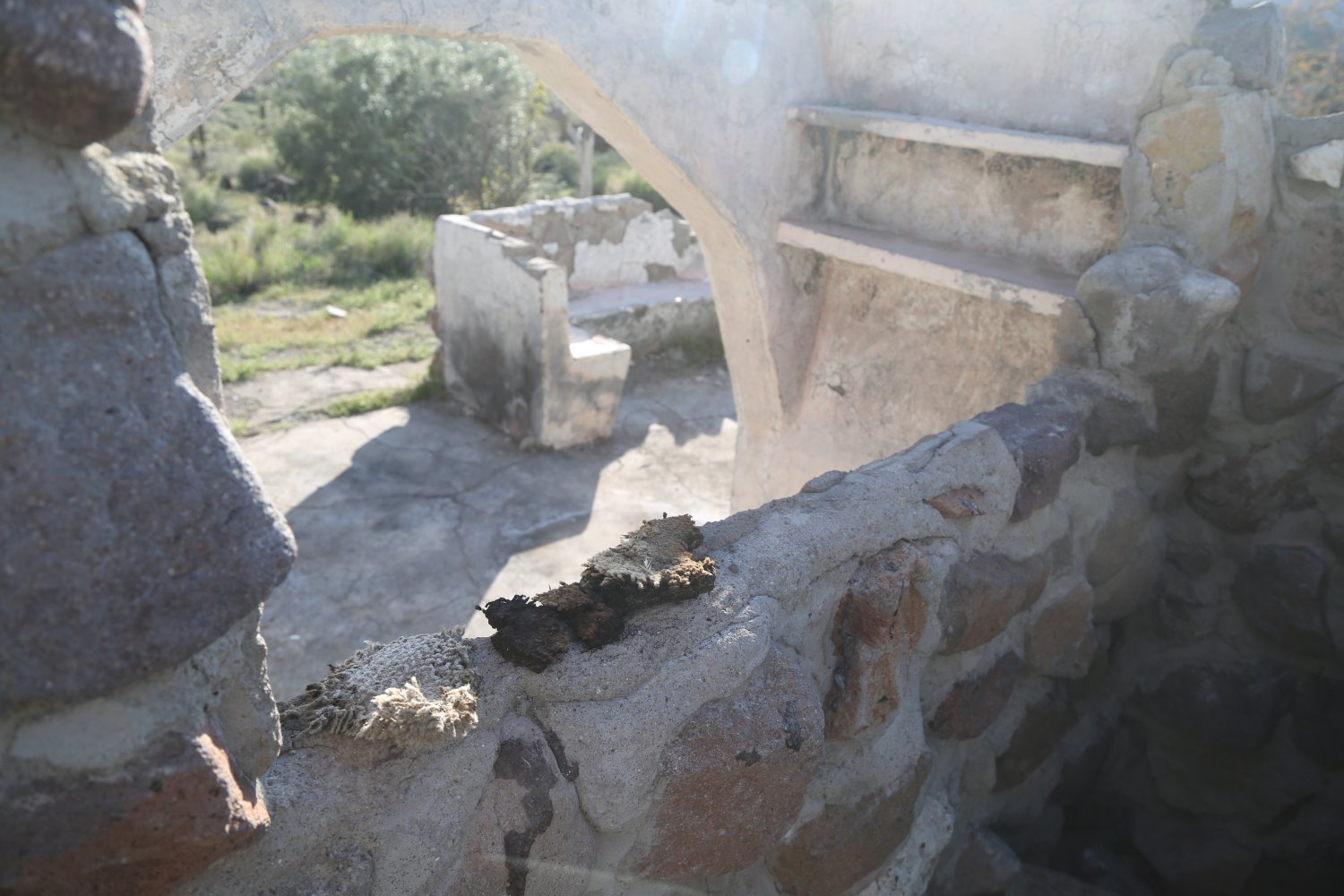
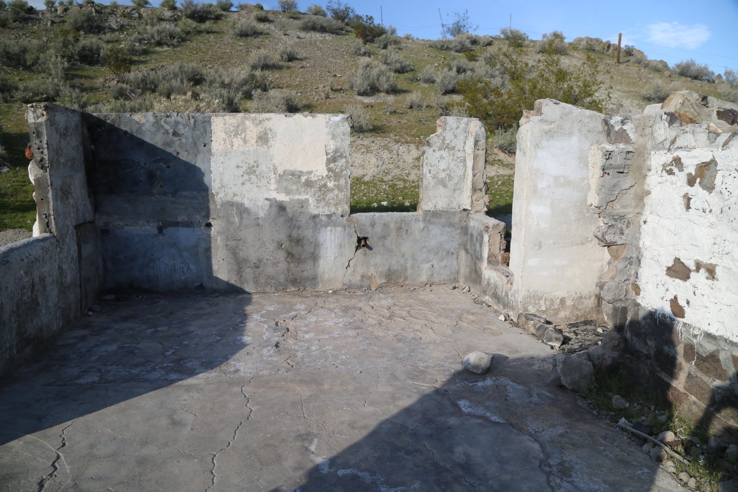
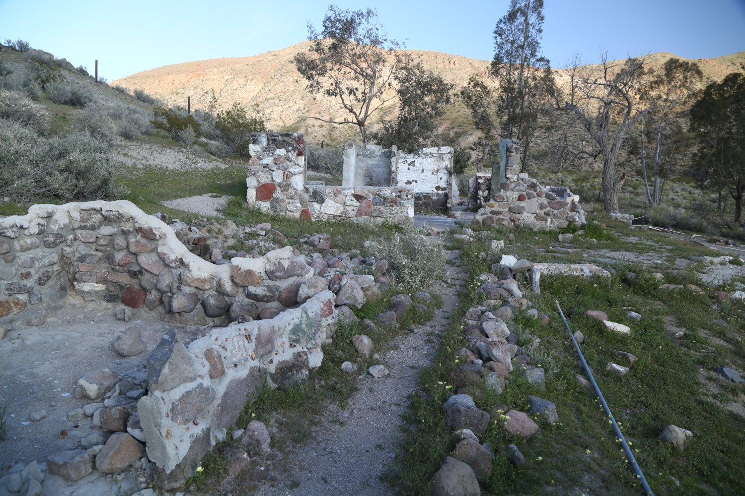
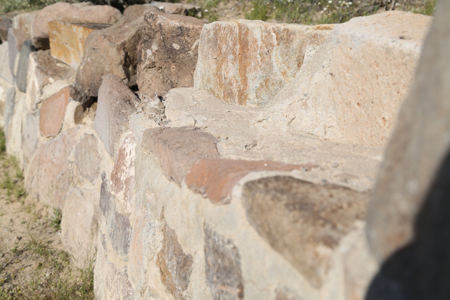
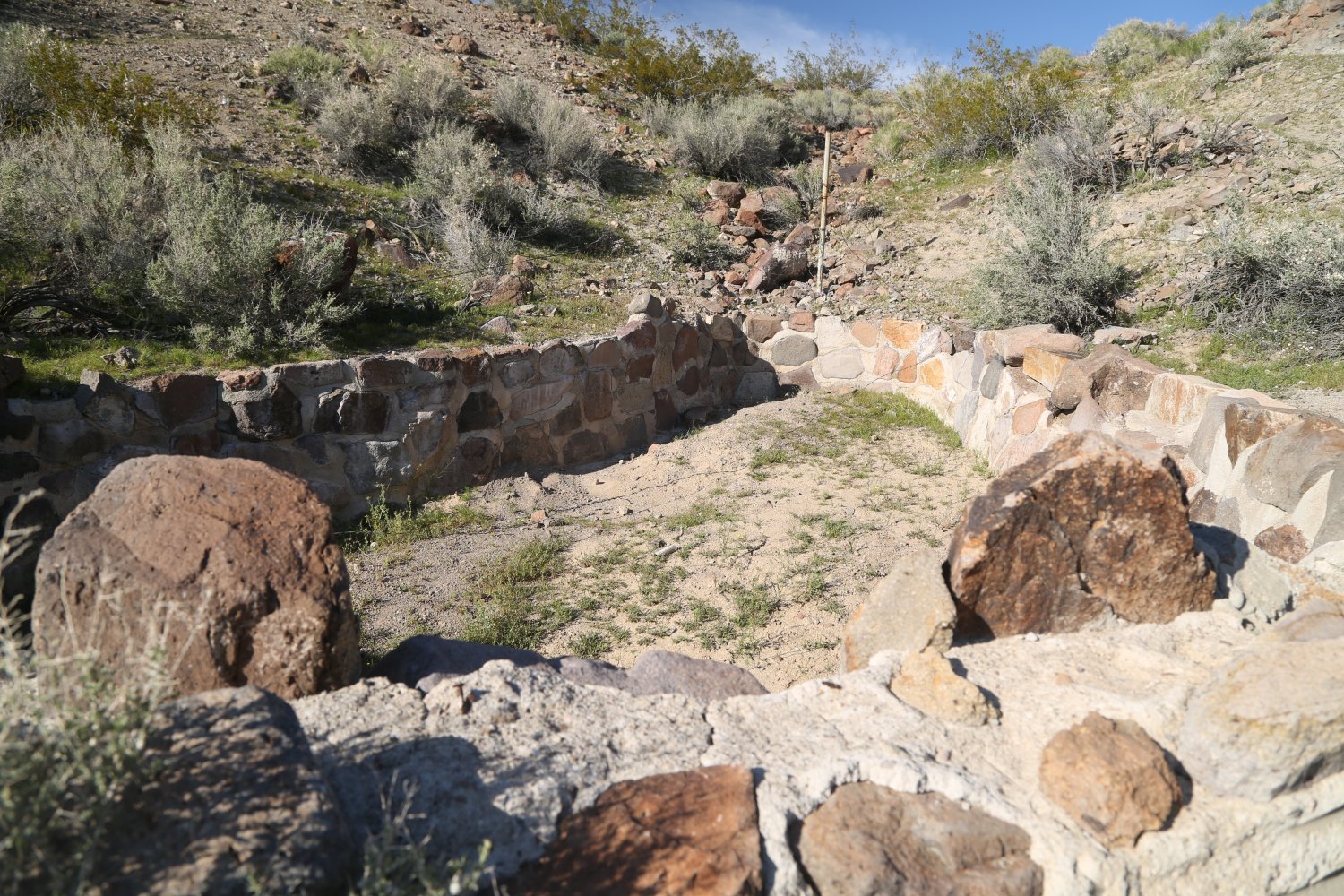
The main stone building at Barker Ranch unfortunately burned down in May 2009 (most likely an accident from an irresponsible visitor) – the National Park Service had recently made improvements to the site so this fire was doubly disappointing – losing both their upgrades as well as the house itself. Today all that remains are parts of the stone walls, the concrete floors, a few arches, one wooden vertical beam, the steps leading up to the house, the fireplace and really not much else. The name, Trotta 1958, is etched into the concrete in the rear of the house – presumably the name of the man who worked on some of the addition to the home around this time.
We have also spotted old pieces of burnt rug during various trips to the site. The Manson bus used to be parked on site but by 1980 was fully dismantled and disposed of. This bus came in from the east over Mangel Pass (back when that road was in much better shape then it is in today – there is no way that bus would ever make the same journey today).
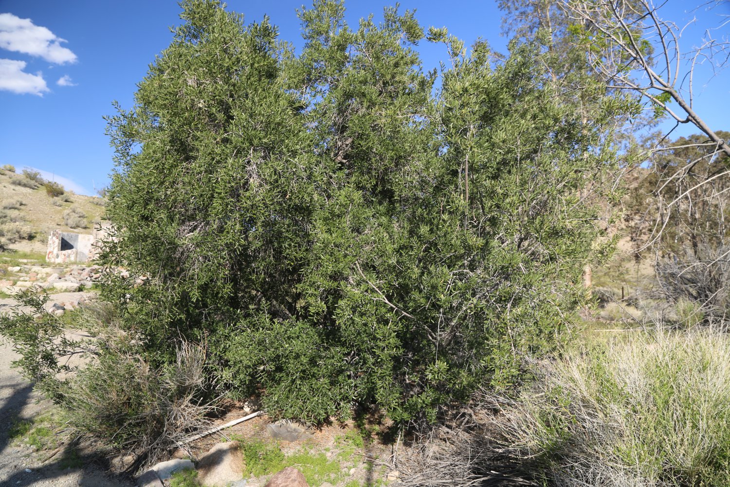
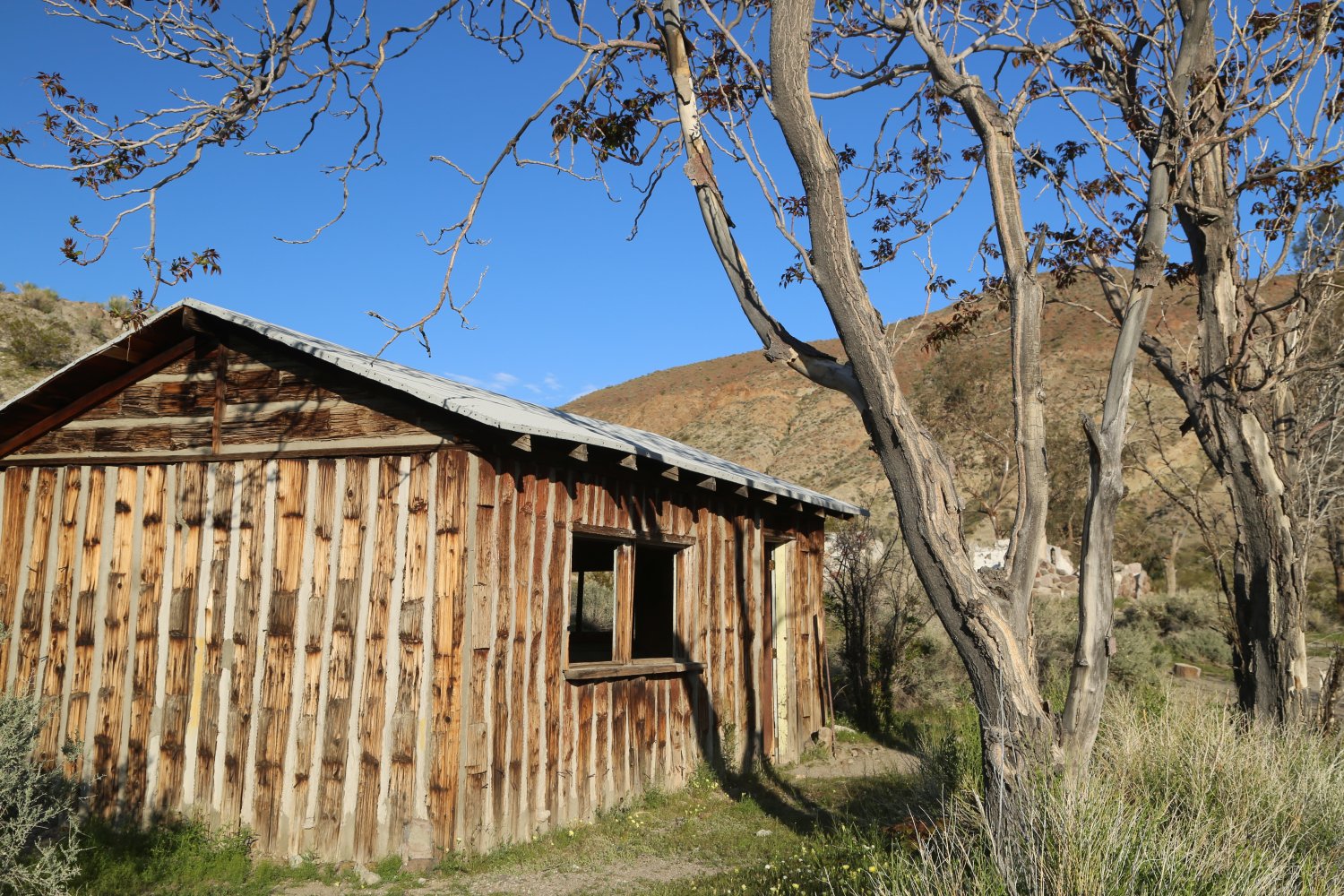
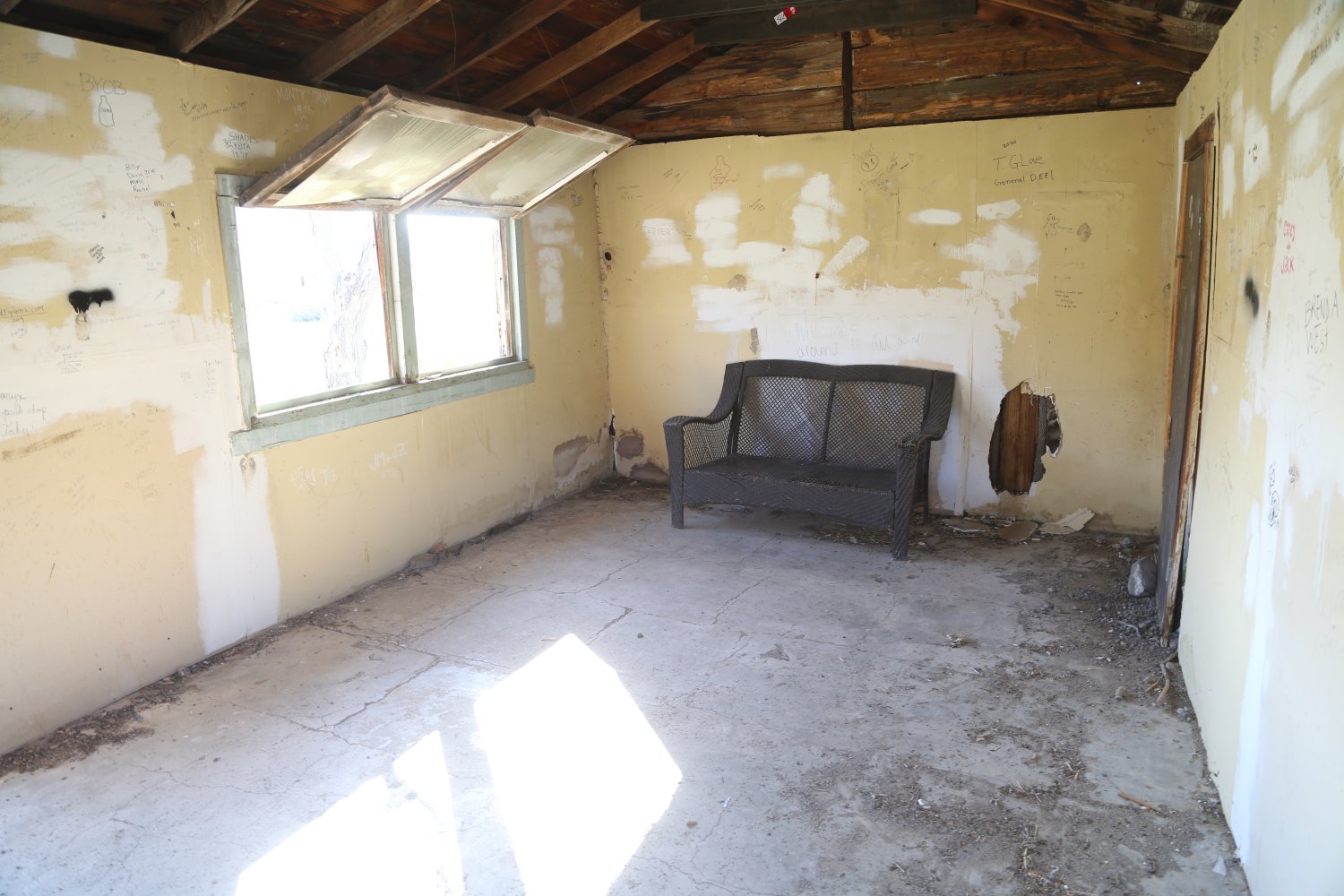
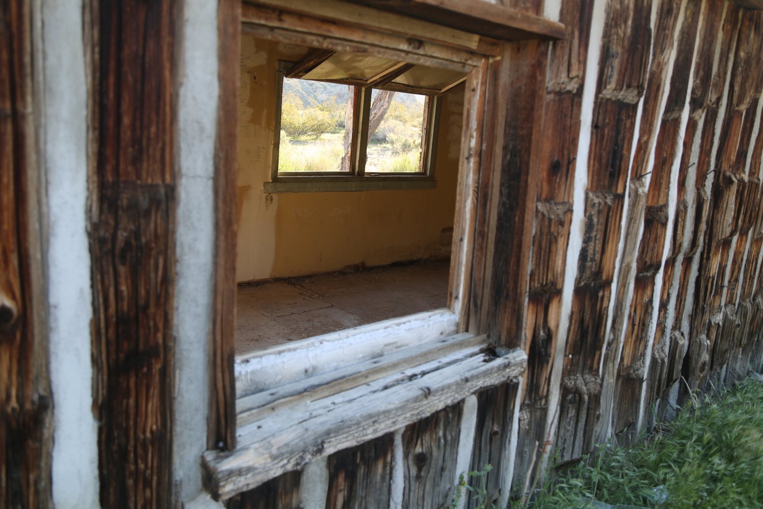
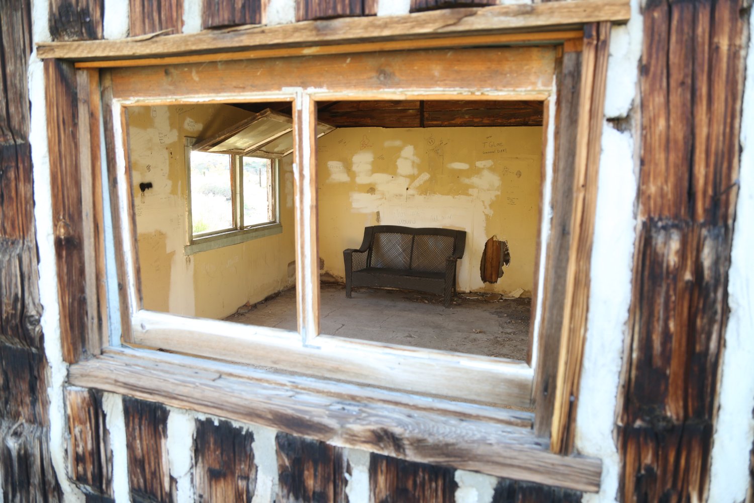
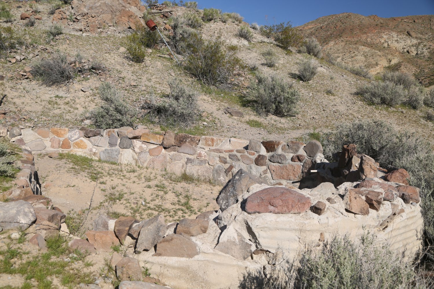
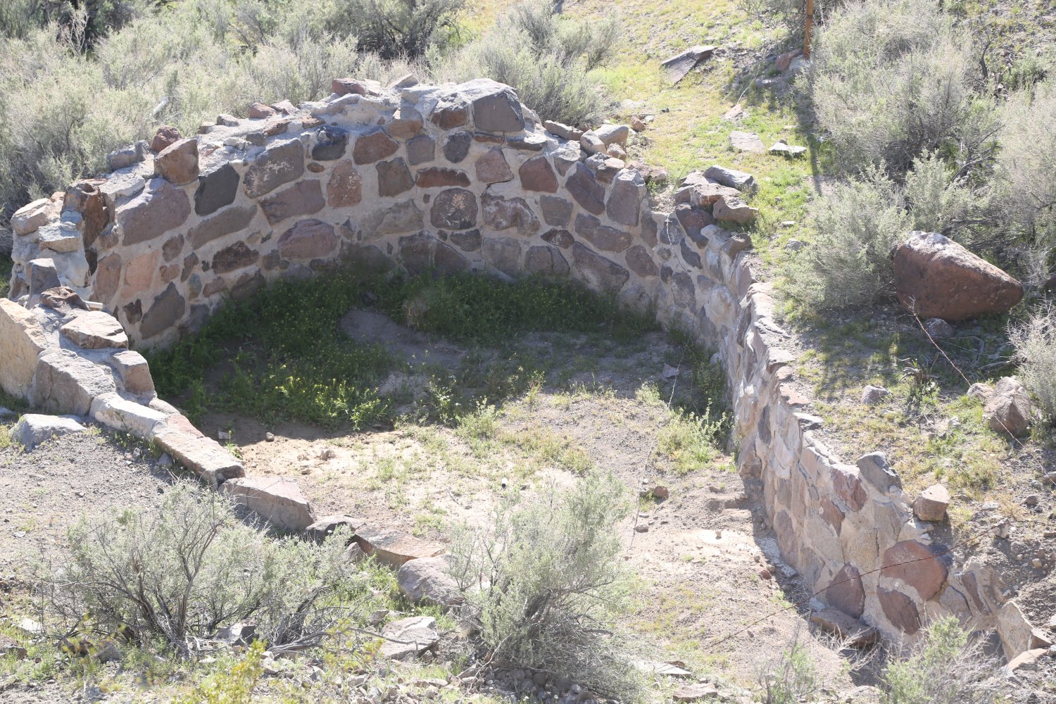
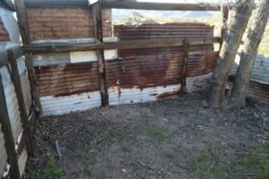
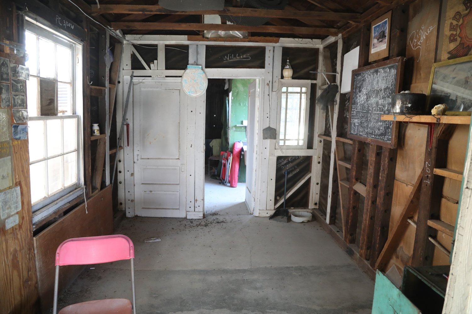
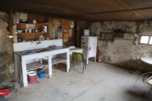
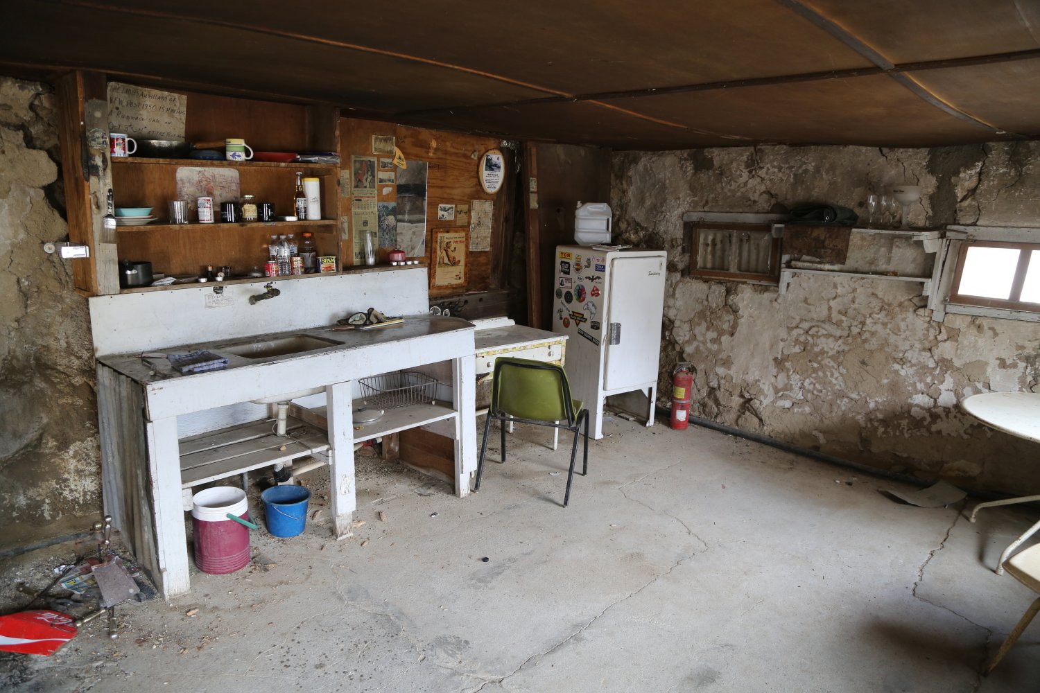
Other highlights include the bunkhouse (in relatively good shape still), the walls now covered with names of visitors and other short statements and the outdoor pool. One can sit on the lowered ledge at the edge of this pool and imagine what it would have looked like full of water rather then in its current condition (partially filled with sediment from run off due to the small wash that empties right into the pool). A chicken coop and another primitive structure are also still standing. And at least two living olive trees – the largest one could use a healthy trimming – and a number of living eucalyptus trees. A small rounded concrete foundation on the eastern side of the house located in the dirt is all that is left of what used to be an outdoor bathtub. Whats left of an old outhouse is located to the west of the buildings – apparently still used by visitors. Also to the west of the ranch is a dirt road the dead ends in a nearby wash – pieces of old cars, other metal debris and possibly the dump used by the Manson family (evidenced by one section covered in rusted old metal cans) are located along this road.
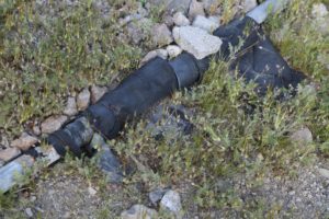
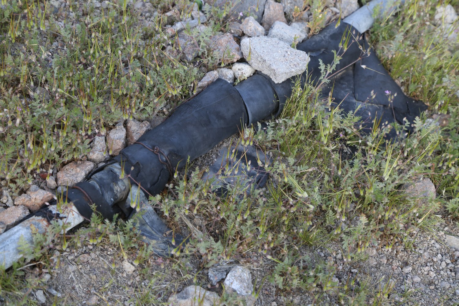
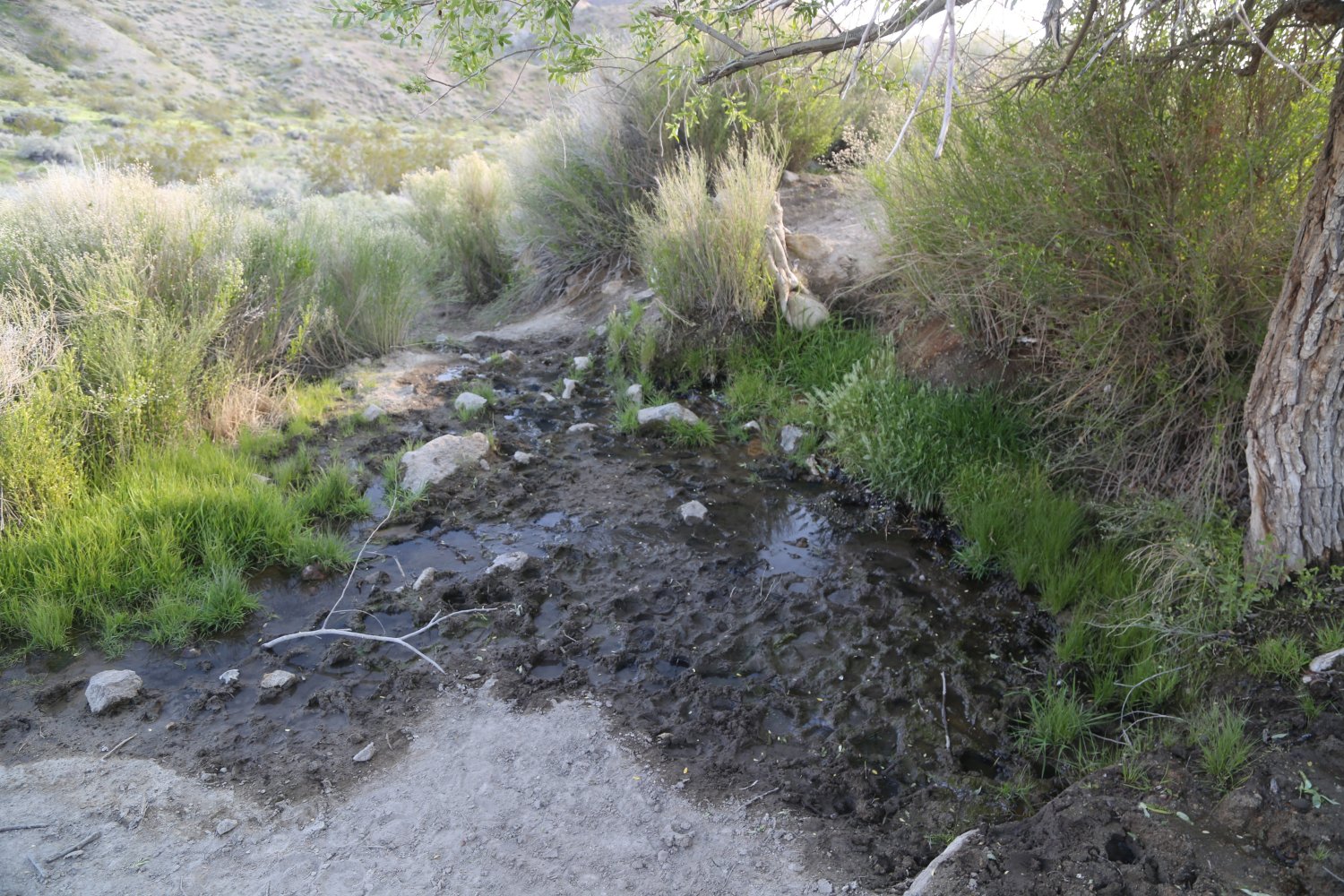
Note all the water pipes scattered about – some plastic and some metal. Follow the plastic lines to the east for a short ways and you will discover the source of water for the ranch – a small seepage spring coming out of the earth.
And as we drove back down through the canyon we had John Denver’s Annie Song on repeat… full blast.
Barker Ranch Entrance + Home
-
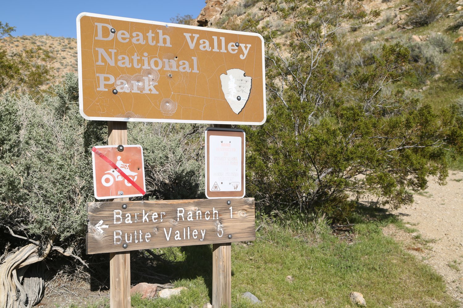
- Entrance to Death Valley National Park – about 1 mile west of Barker Ranch
-
- The rough pull in to Barker Ranch
-
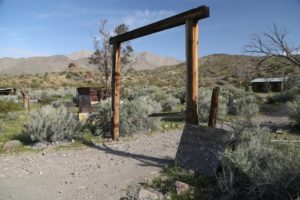
- Barker Ranch entrance
-

- Road entering Barker Ranch
-
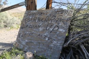
- Keep Barker Ranch clean
-
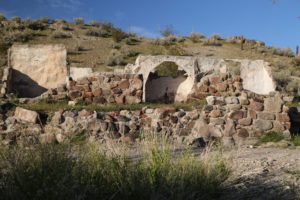
- The original Barker Ranch home

-
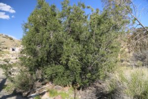
- The healthiest of the two olive trees (very tiny olives)
-
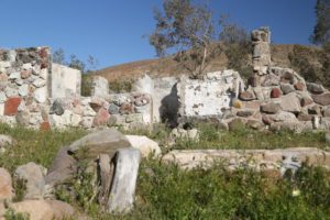
- Main home, Manson was captured on the left side of the house

-

- Fireplace
-
- Arch still standing in main home

-
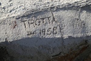
- Trotta, January 1958
-
- Pieces of burnt rug from fire in 2009
-

- Beautiful rocks used in construction of main home walls
-

- Whats still standing of the original home
-
- View of original home
-
- Leaking pipes covered in rubber
Bunkhouse
Swimming Pool
Meyers Ranch
Side Wash Relics

Miscellaneous
-
- Barker Ranch Spring
-
- Chicken coop interior

-
- Chicken coop exterior
-
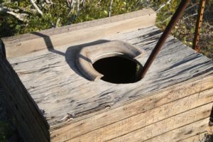
- Old outhouse

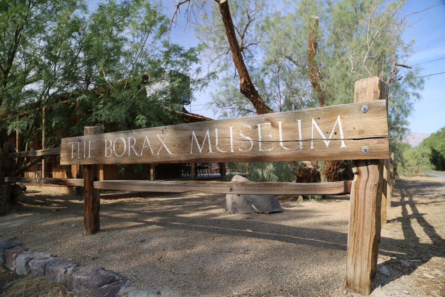
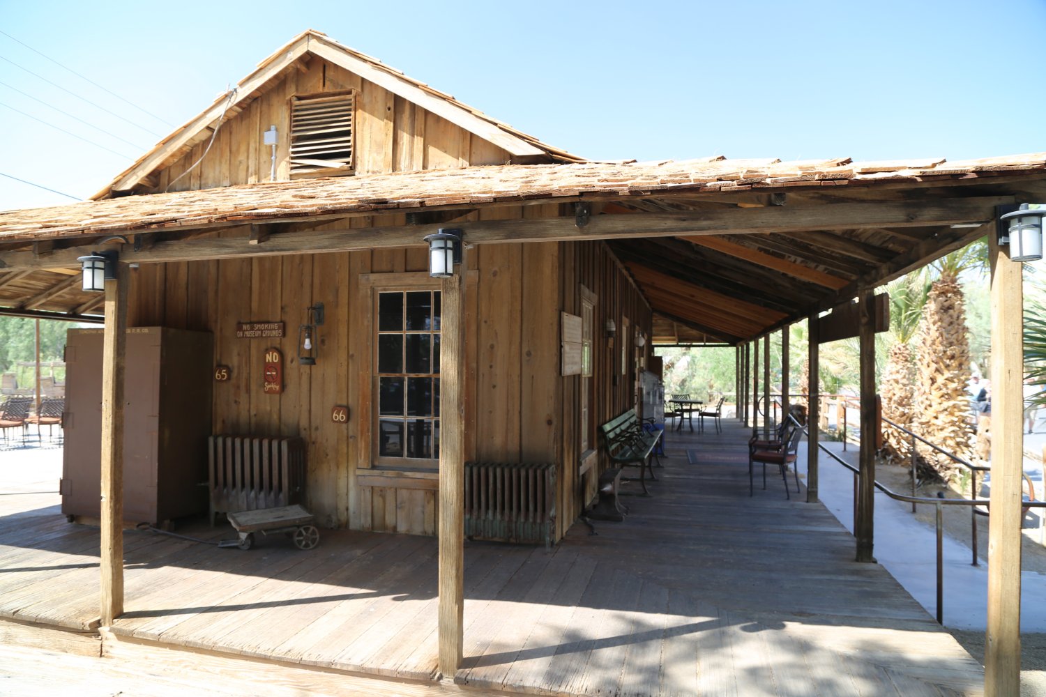
Borax Museum in Furnace Creek is well worth visiting – its a small building with excellent high powered air conditioning. There is no charge. The staff is extremely knowledgeable about the local history, geology, culture and weather of the Death Valley area. There is a good geological exhibit as well as many other Death Valley items both natural and human made.
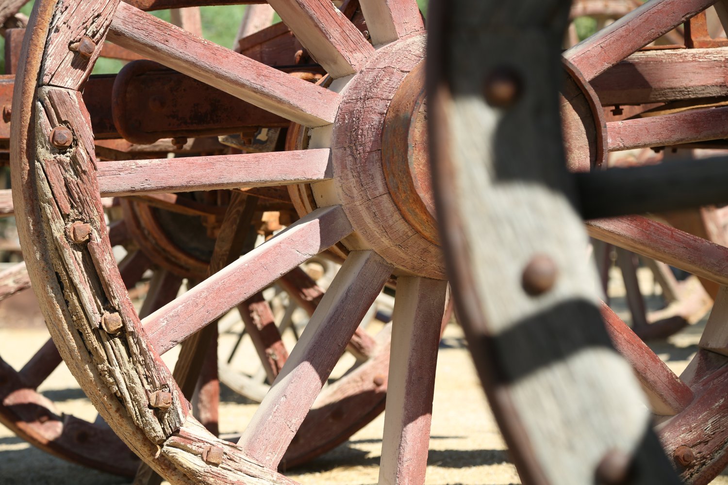
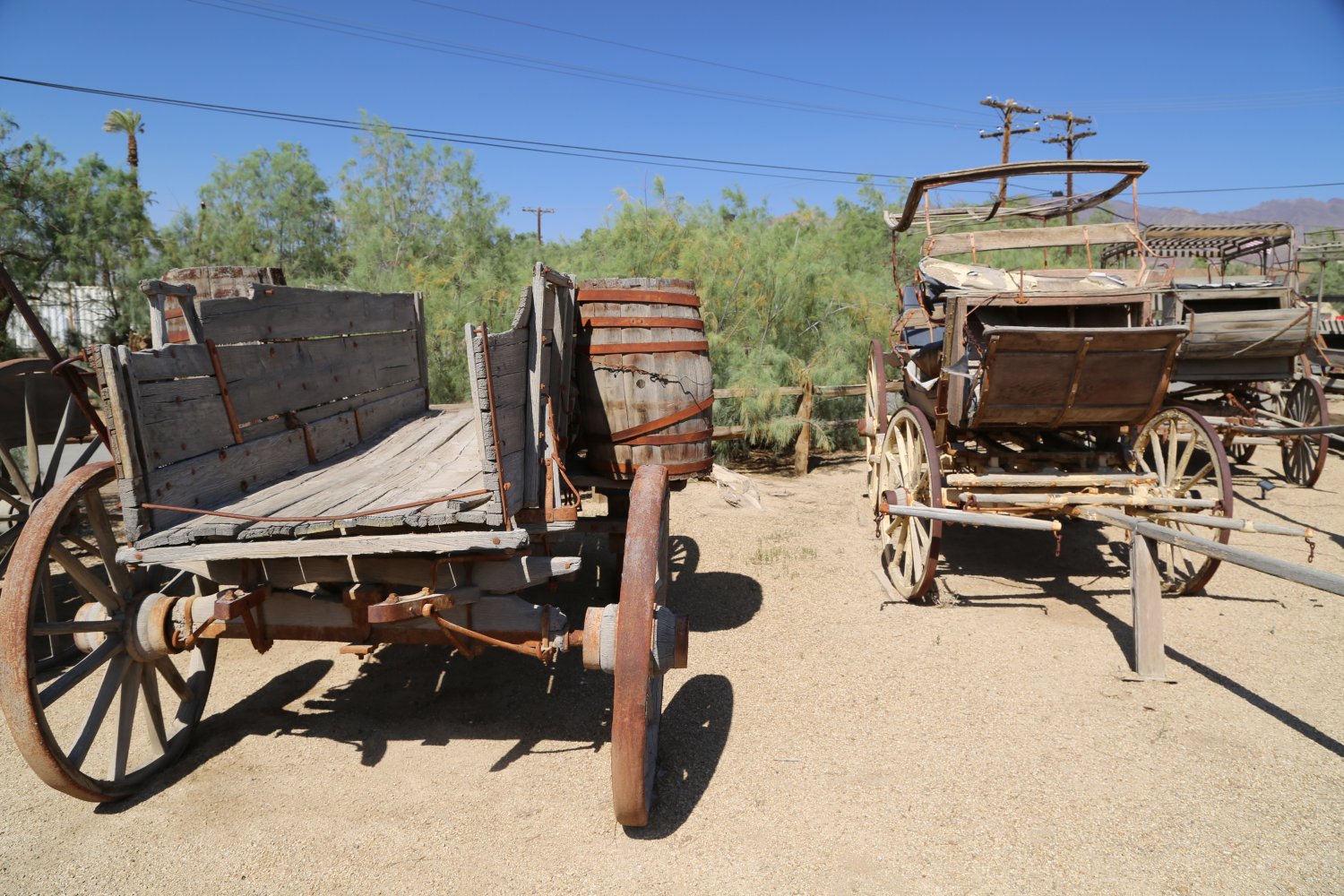
Talk a walk behind the museum – you will discover old mining artifacts and wagons. The back of the museum sits right next to the edge of part of the Furnace Creek Ranch motel – and even in the middle of the summer you will find green grass – as they water it in the morning and it survives the 120+ degree temperatures. While the focus of a visit here is the museum, a small gift shop in the center sells a variety of mineral specimens, some small gold and other rock and mineral trinkets.
This is also the oldest usable building in the park – dating to 1883.


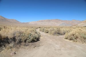
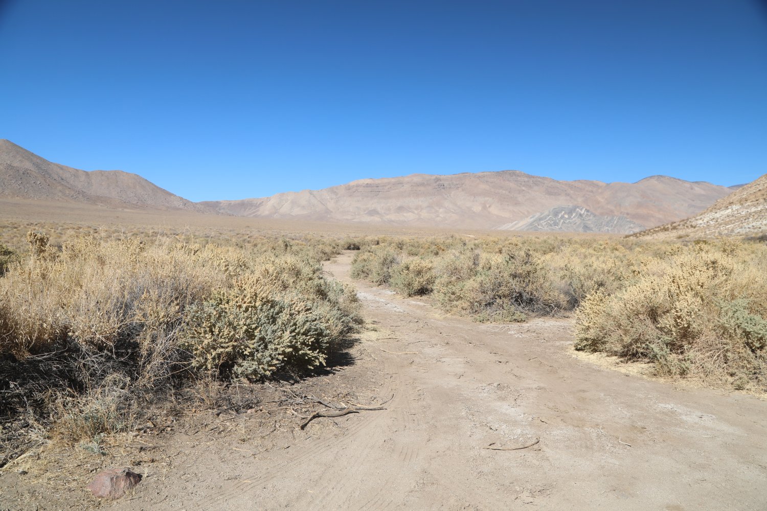
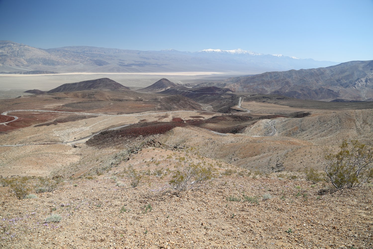
Butte Valley is located east of Panamint Valley and west of Death Valley. Access is one of two ways from Ballarat in Panamint Valley – through Goler Wash and near Barker Ranch and then across the intense and serious 4wd only Mangel Pass – or from Death Valley side on Westside Road – 20 miles in on a rugged very rocky at times road (definitely doable in a Subaru and potentially doable in a 2wd vehicle driven by someone with extensive experience driving on rugged roads).
This valley is one of the more remote parts of Death Valley – in a park already known for remote destinations. Accessible from Panamint Valley – via Mengel Pass – or from Westside Road, the roads are rocky, rutted and very rough at times. This is no place for a 2wd passenger sedan, forget about it. 4wd only with high clearance vehicles. Air compressor. Lower and slower is the motto. Drop the air pressure on the tires and slow things down. On the jeep difficulty rating scale, we estimate some of the sections around Mengel Pass to be a 2.5.
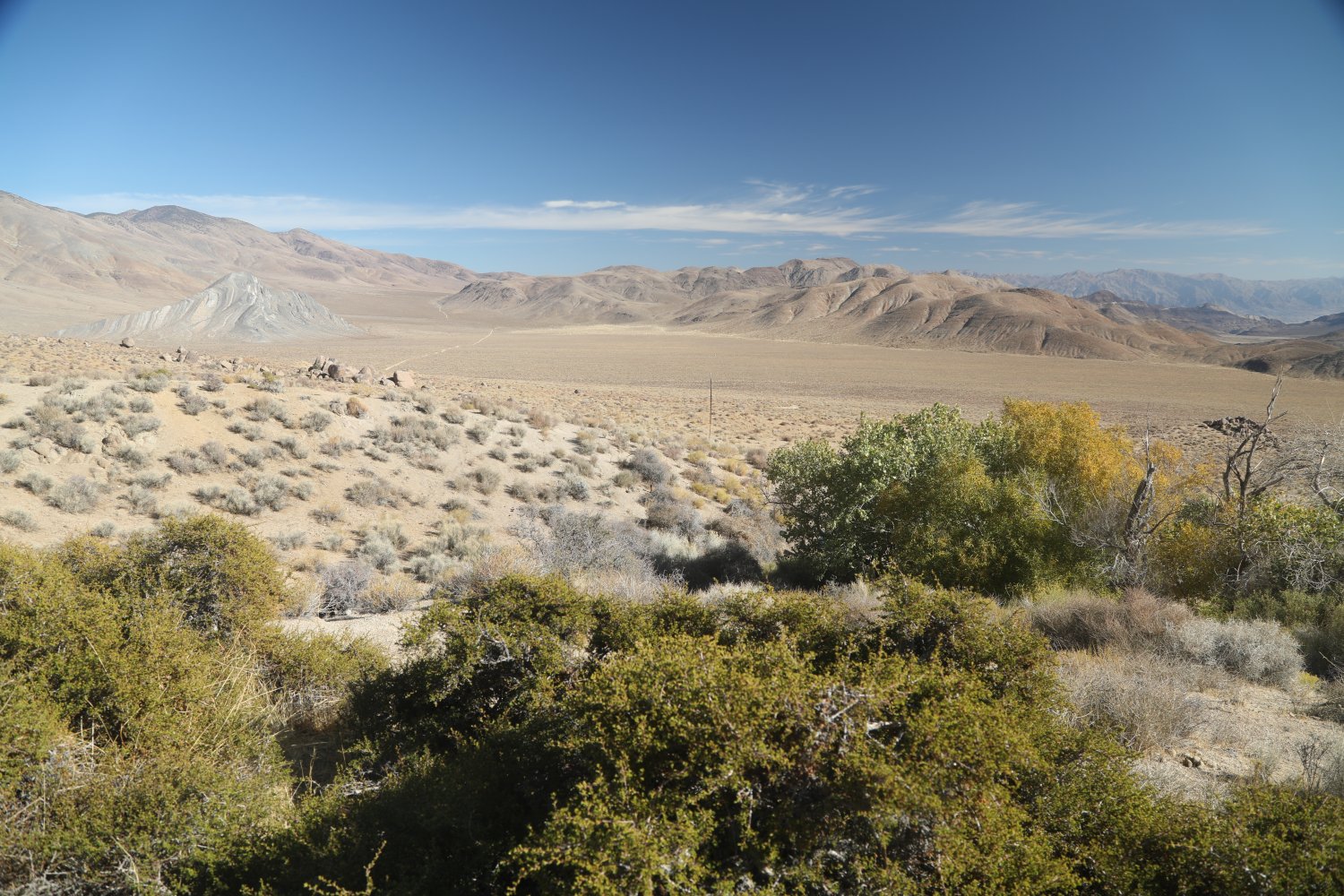
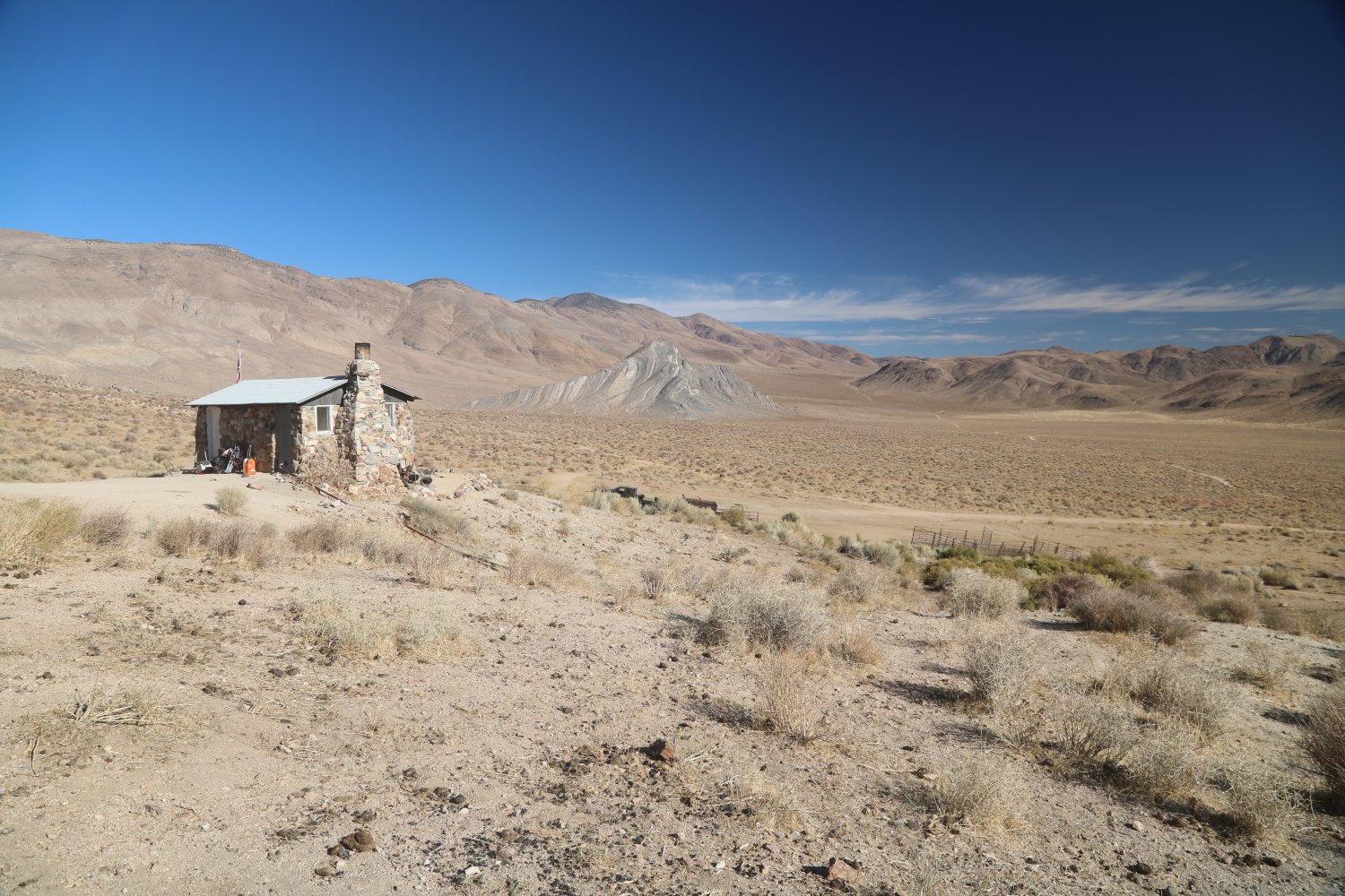
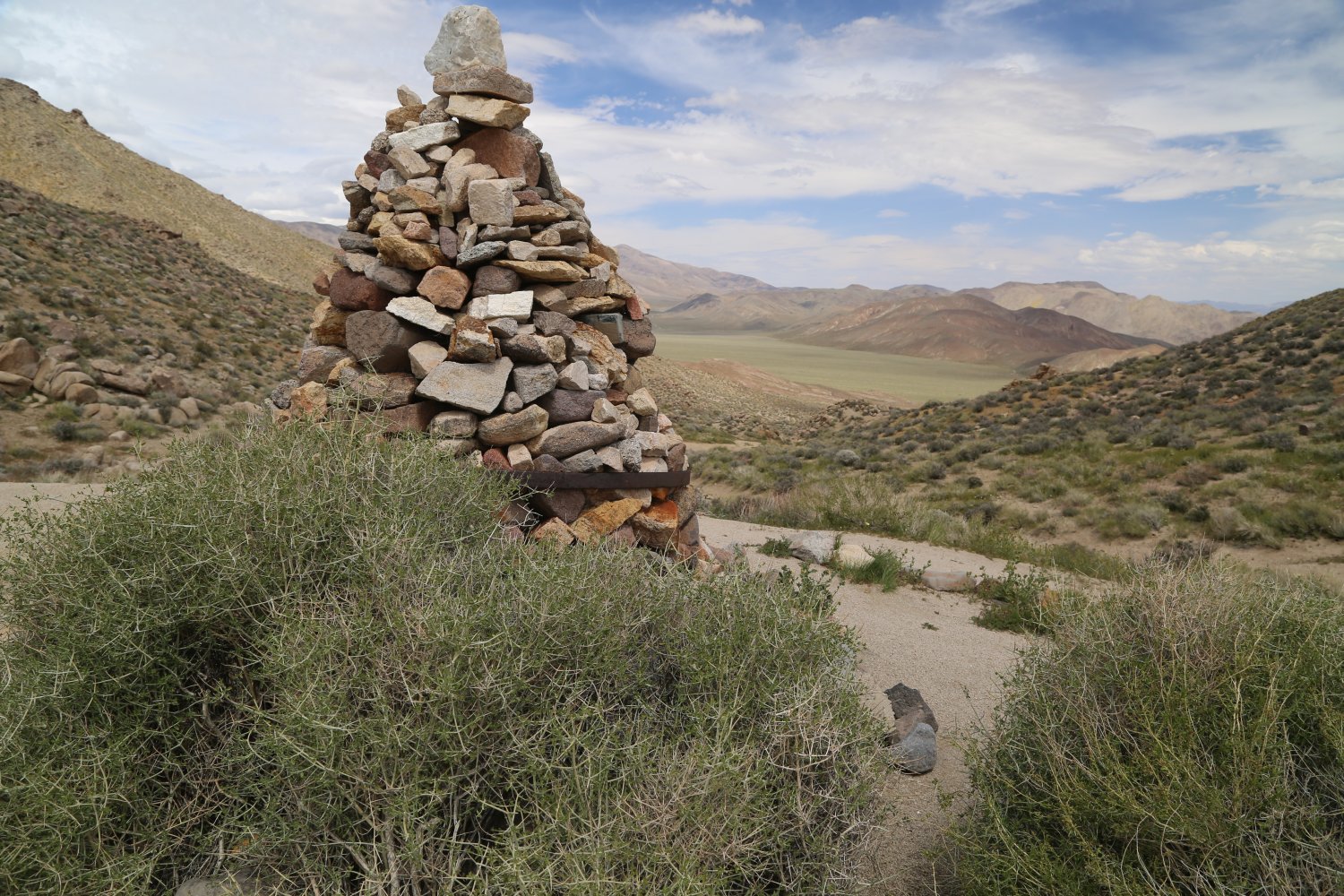
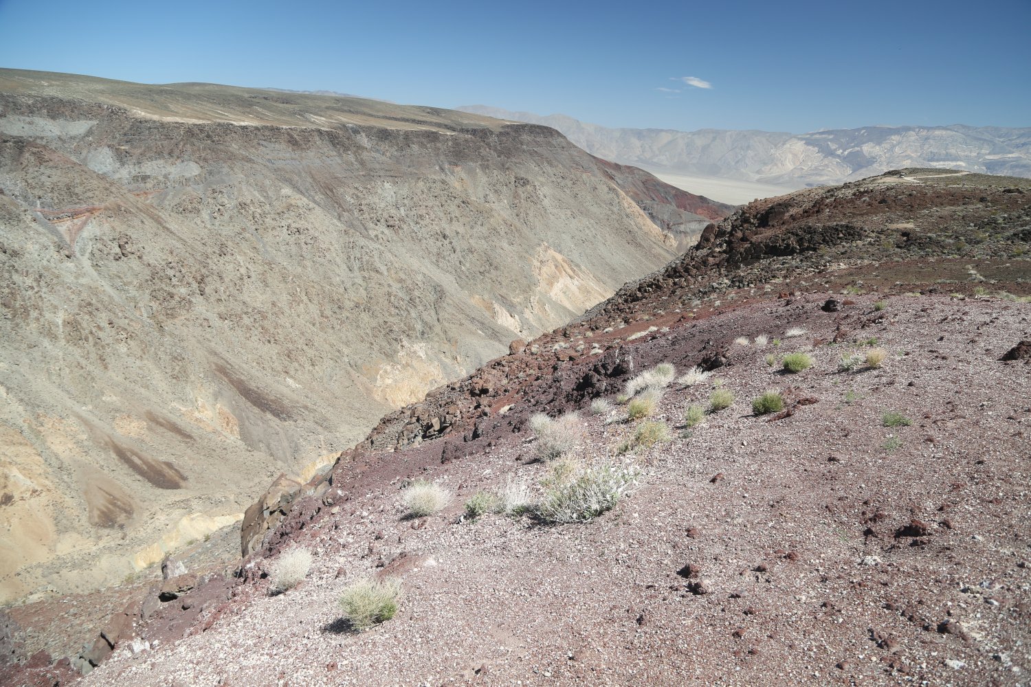
The top of Mengel Pass coming from the west (the route we took during our first visit to the valley) provides a nice viewpoint of Butte Valley – and one can easily see how remote this part of the state is. A rock cairn at the top of Mengel Pass contains the ashes of miner Carl Mengel (1868-1944) and his prosthetic leg (he lost one of his legs in a mining accident). The road down to the the valley becomes even more rugged – soon one has views of the most prominent feature in the valley, the Striped Butte – an interesting geological formation lined with various layers of different colored rocks. With some planning, this butte can be climbed.
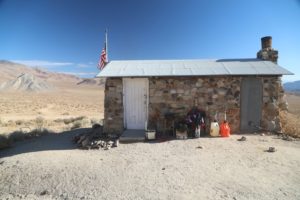
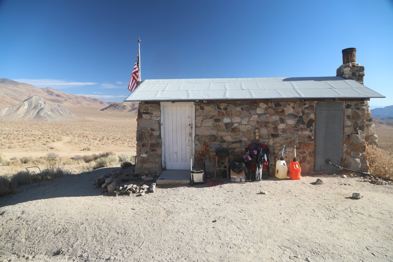
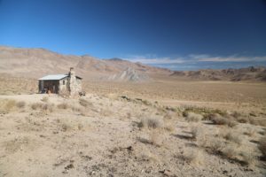
At least three cabins are located in the valley all containing exterior and permanent outhouse type bathrooms (all situated next to very low flowing cold water springs). The geologists cabin is the most prominent and the one in the best condition due to it being constructed of rocks (it was built by miner Asa Russell in 1930). Usually open as a first come, first serve place to sleep – the interior is often stocked with extra water, dried food stuffs and sometimes gas. When the American flag is flying out front – the cabin is occupied. The nonprofit group, Peaceful Valley Donkey Rescue sometimes uses this cabin during their time in the valley capturing wild burros – and if they are there, the cabin will be completely locked, although there may be a chair or two outside that one can use to feast on the remote views looking down upon Butte Valley.
Based on personal experience, once the burros get sight of you, they will continue to stare in your direction long after you have passed by.
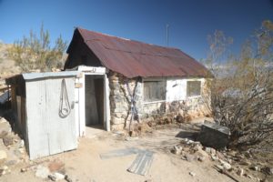
Arguably the most quintessential looking miners cabin is Stella’s-Mengel Cabin – a very short drive across the upper slopes of the valley from the Geologist Cabin. In fairly rugged shape this old cabin is built next to the side of a hill with a tiny spring located just above the cabin. Supposedly originally built by Mormon settlers in the late 1860s, the cabin was once occupied by miner Carl Mengel and later by Stella and Clinton Anderson and after Clinton passed Stella remained living here alone – although her grandson Bobby eventually joined her. No electricity, no phone, no plumbing. Also named for Carl Mengel, a miner in the region whose prosthetic leg (mining accident) and ashes are interred in the prominent stone monumnet at the top of nearby Mengel Pass.
Today the old cabin is often frequented by 4wd enthusiasts – some basic food supplies are sometimes left by visitors including tins of meat. A hoisted flag outside the cabin means someone is staying there at the moment. The spring behind the cabin still runs – and so does the faucet inside albeit very slowly. Several guestbooks are located inside along with a number of old articles about Stella and other mining stories. A second lower cabin was built by Mengel and contains an old stove. This is a very cool spot to whittle away a few hours with a good book (if its not to hot!).
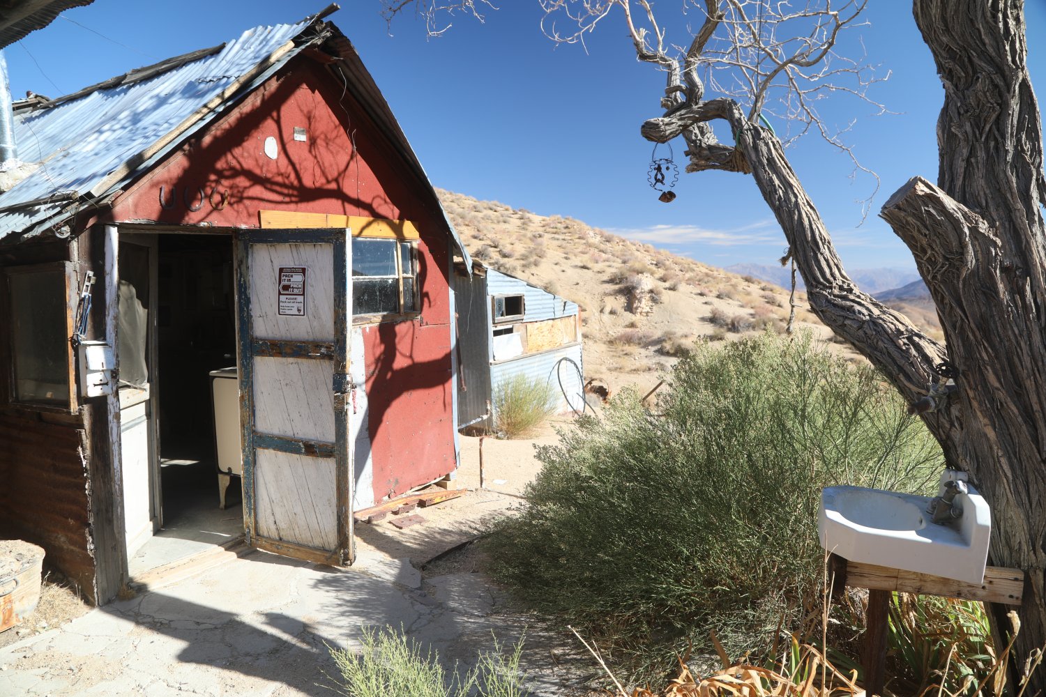
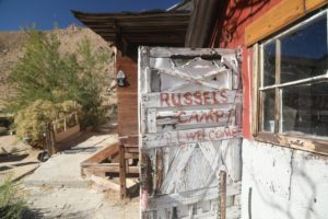
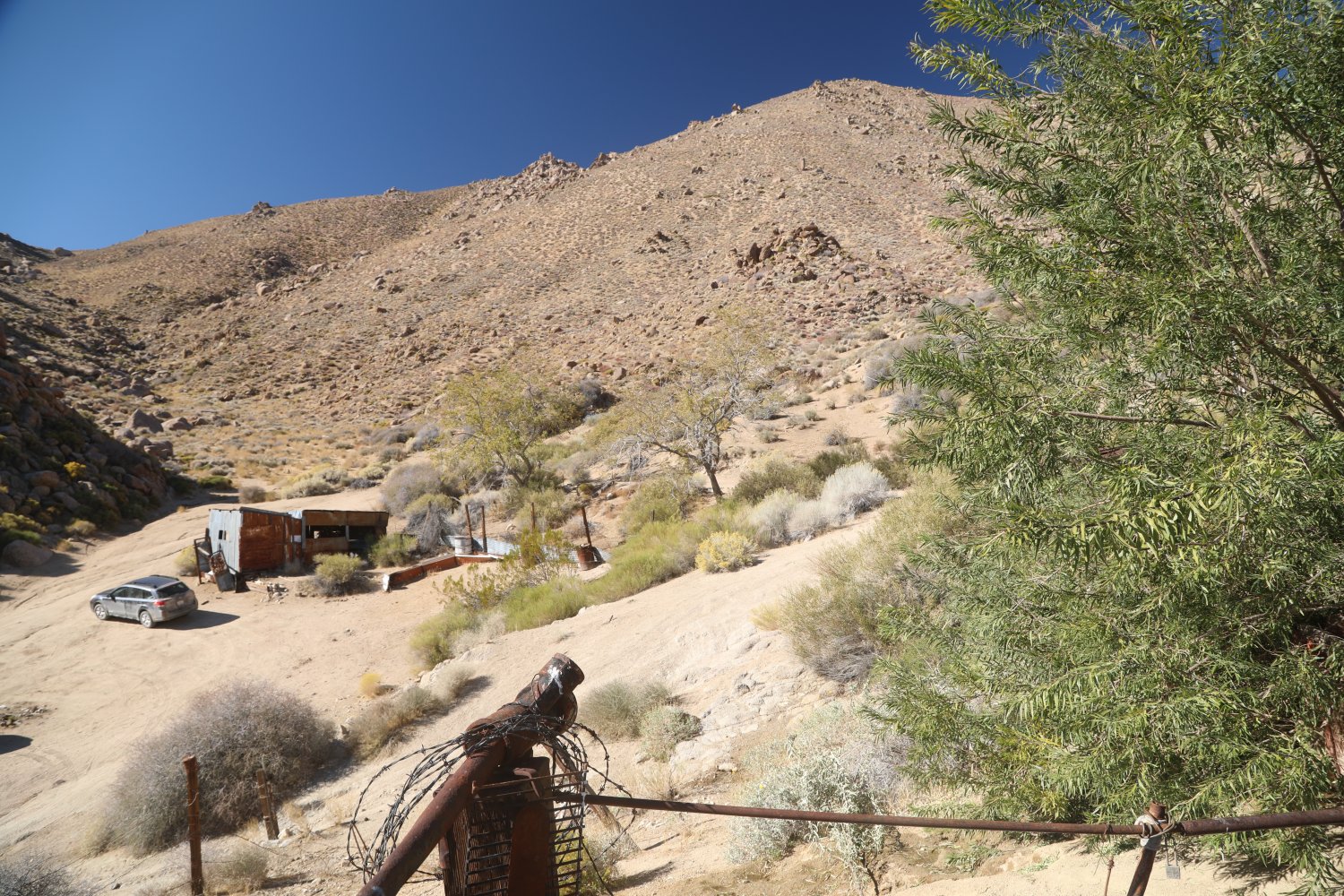
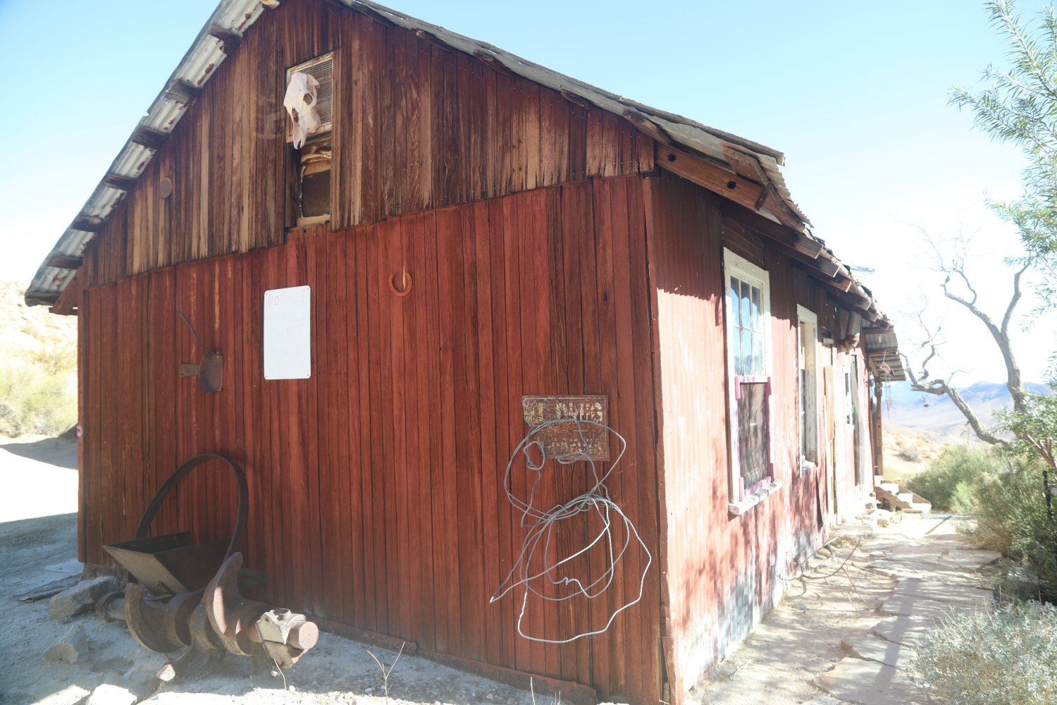
Continuing a bit further from Stella’s Cabin is Russel’s Camp & Cabin (like with the Geologist Cabin, this one was also established by miner Asa Russell) in the early 1930s. This ramshackle collection of corrugated steel buildings is fairly intact and offers plenty of space for the wayward traveler to explore. One specail room worth mentioning is the Honeymoon Suite, room number 77. If one is lucky, one might also find bottles of various desert likker lying around this cabin – some obviously have been partially consumed. Like at the other nearby cabins, the Russel’s Cabin site was carefully chosen next to a spring (which still runs through various piping on the property).
-
- Geologist Cabin
-
- View of Butte Valley from Stella’s Cabin
-

- Outside of Russel’s Cabin
-
- View from lower Butte Valley
-
- Russel’s Camp

-
- Geologist Cabin with Striped Butte in background
-
- Stella’s Cabin

-

- View from upper slopes of Butte Valley
-

- Russel’s Camp
-
- Looking down on Russel’s Camp

-

- Interior of Russel’s Cabin
-
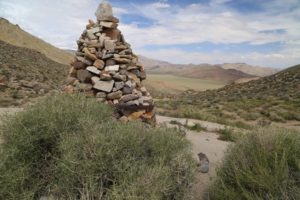
- Mengel Cairn, remains of miner Carl Mengel are inside
-
- Overlooking Butte Valley from Mengel Pass
-
- Interior Mengel-Stella cabin
-
- Old refrigerator inside Mengel-Stella cabin

-
- Inside the Geologist cabin

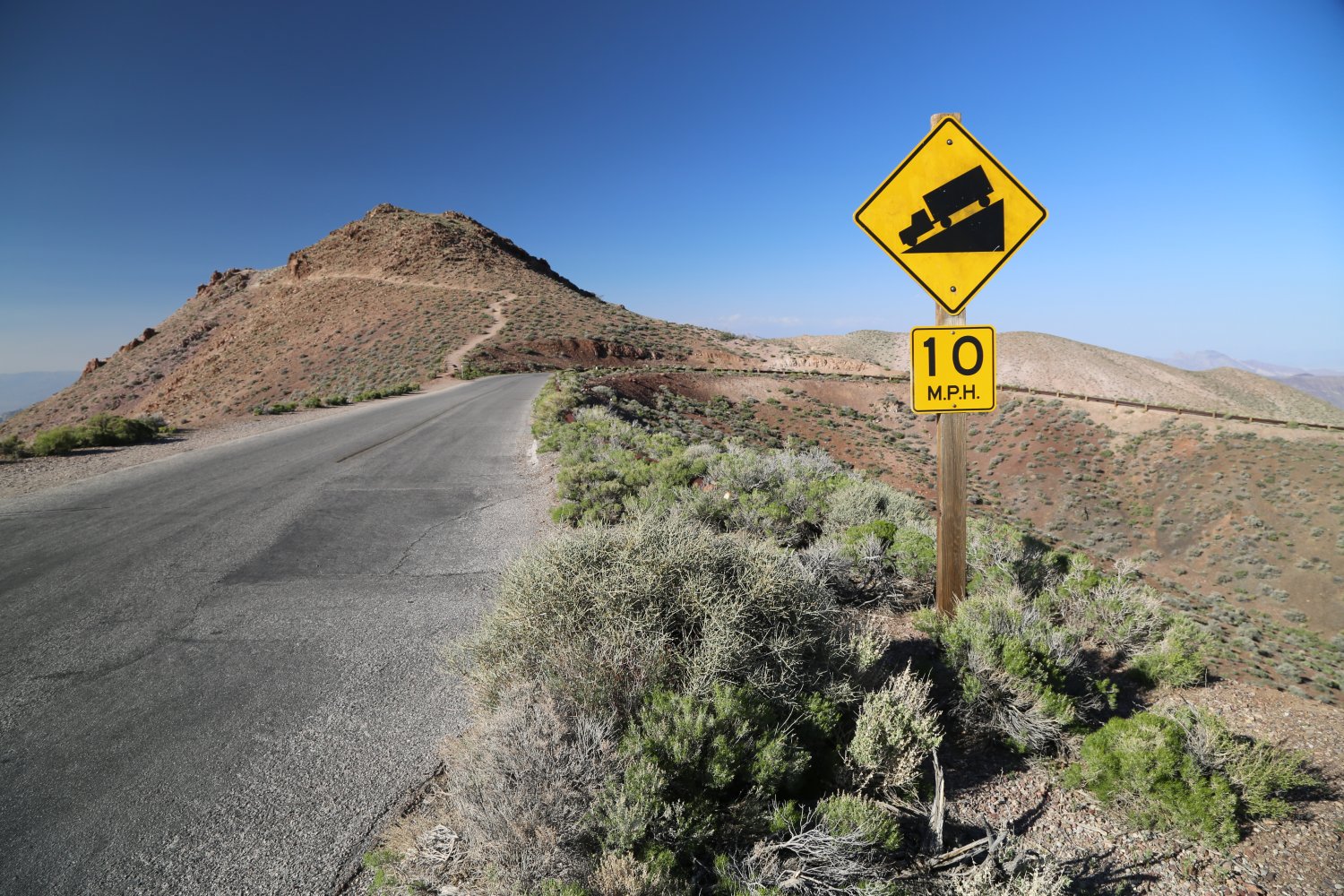
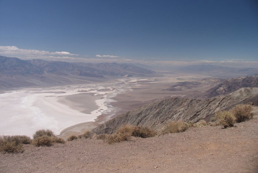
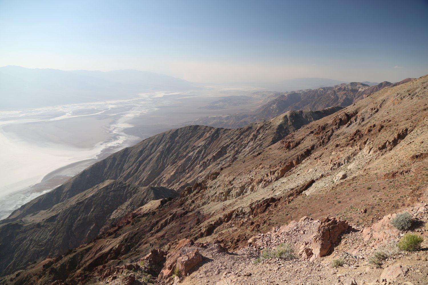
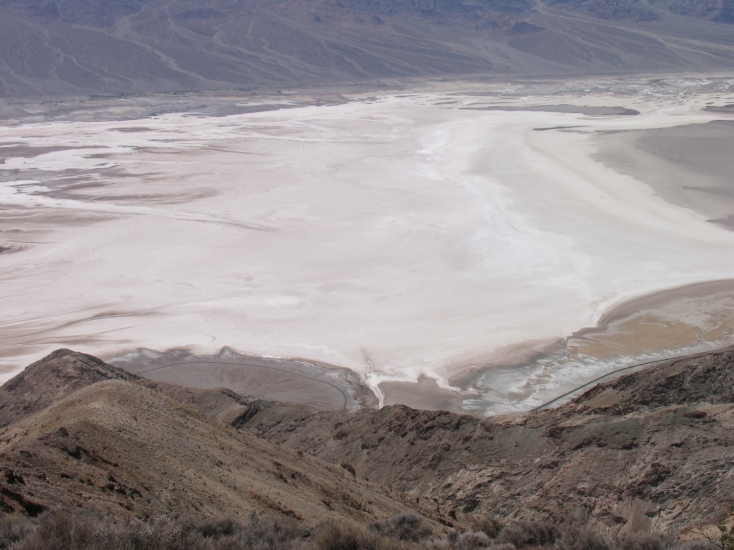
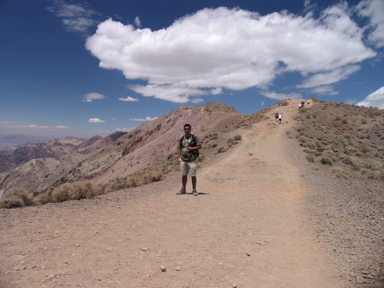
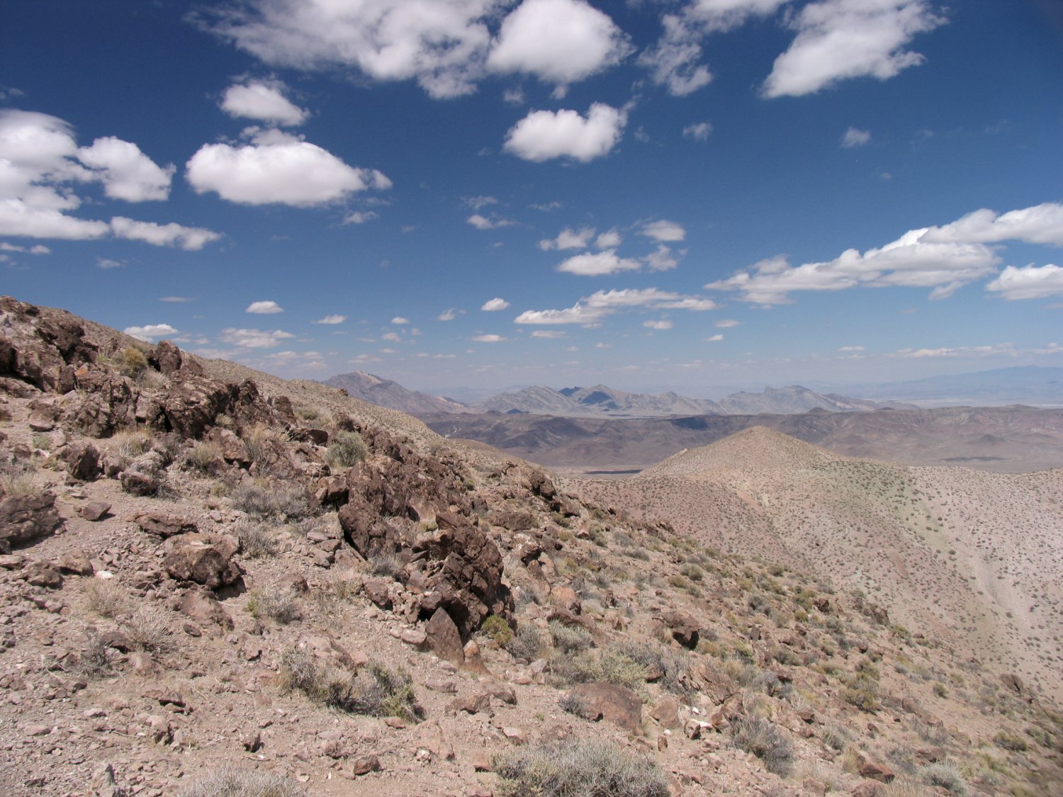
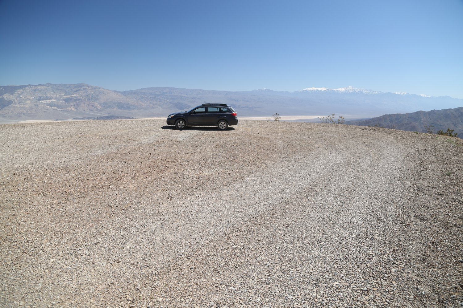
Dante’s View, in our opinion offers the best road accessible viewpoint in the entire park. Death Valley in all her glory is spread out in front of you as are all the surrounding stark mountains.
This road here is paved the entire way – although note vehicles longer than 25 feet are not allowed on the last part of the road. However on the portion of road where trucks are not allowed you will notice a yellow 10mph road sign with a truck oriented in the downhill direction. Ooops.
You will see why no trucks are allowed here when you have to drive the final narrow windy curves that lead to the parking lot. Just before you reach the set of steep curves, you will see a pull out parking lot for larger vehicles to turn around or park. The main parking lot and lookout are located at an elevation of above 5000 feet so it will be noticeably cooler here in the summer than the sizzling valley floor. Several hiking trails lead off on the ridges from the parking lot. View some of our photos below.
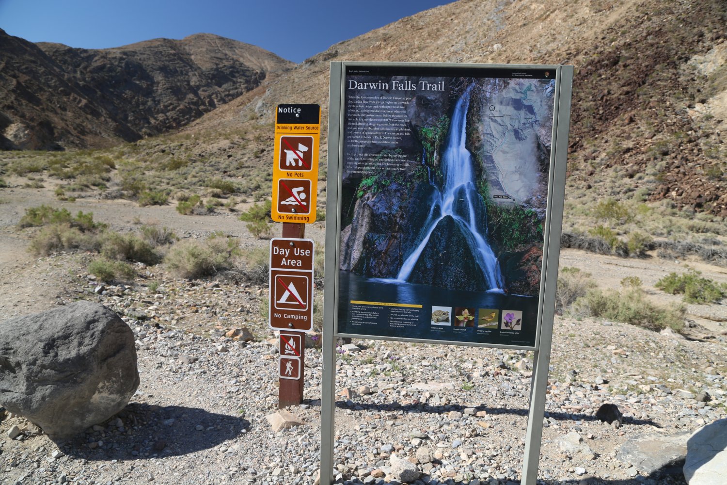
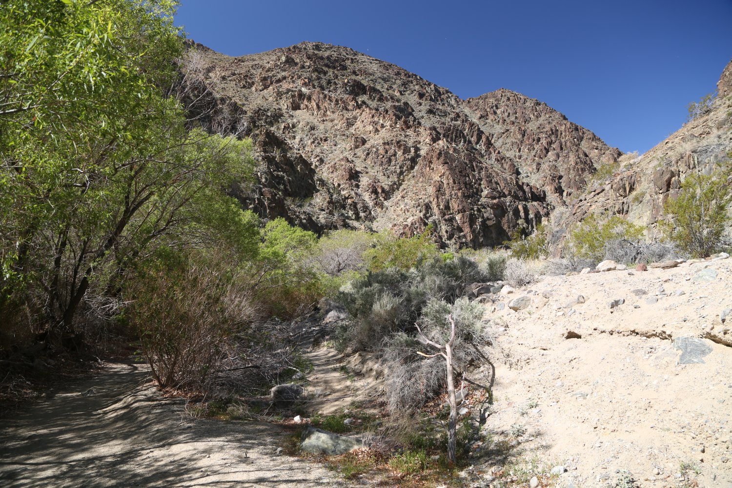
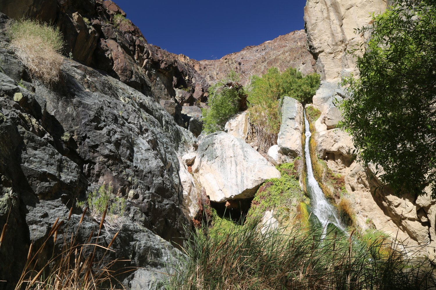
Darwin Falls is named after Dr. Darwin French – an adventurer, miner and ranch who lived in the region. The trailhead is located about a 15 minute drive from Panamint Springs – first take Highway 190 west and then take the unmarked (no sign) dirt Old Toll Road on your left. This improved dirt road is fairly flat with a slight overall elevation gain before reaching the actual trailhead. The small parking lot at the trailhead can comfortably hold about 8-10 cars – we have seen small RV’s up here from time to time – most people back in when parking. Several other smaller parking spaces are located near the main parking lot.
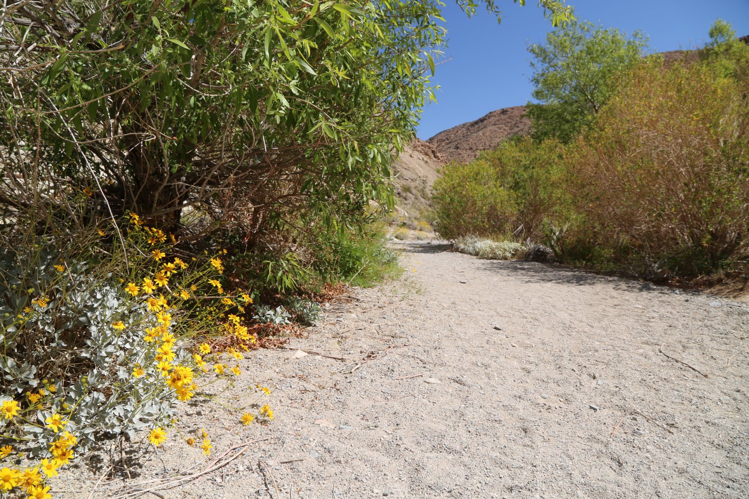
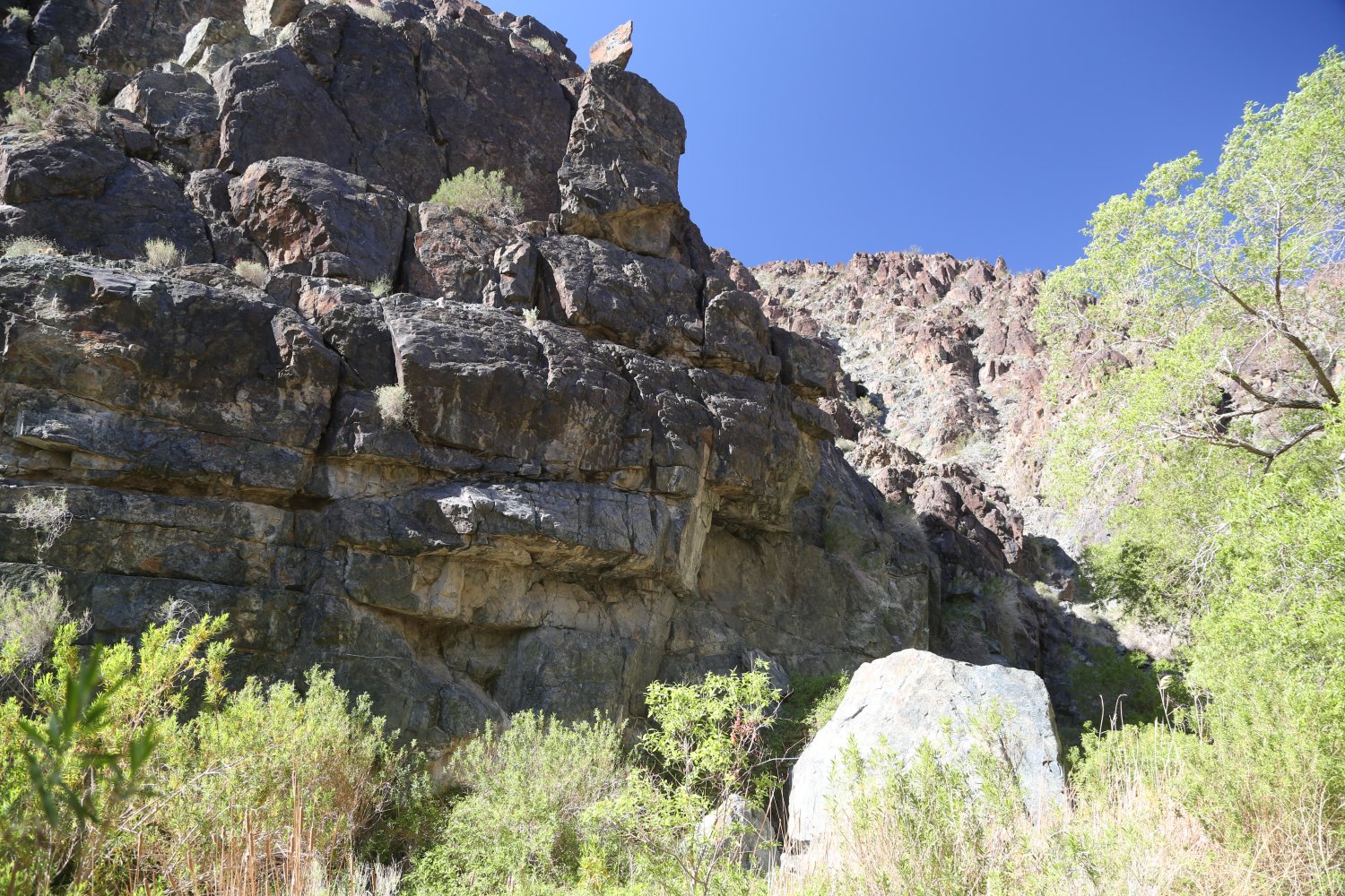
The trail to the falls begins at a fairly flat and wide – usually dry river wash. One will see a pipeline at the edge of this wash on the right side (this carries water from near Darwin Falls to Panamint Springs). Fast hikers can make the one way trip to the falls in about 15-20 minutes – slower hikers allow 30-35 minutes. After leaving the dry wash, the canyon narrows, the trail becomes more defined and hikers pass through a number of willow trees and other plants. The trail is narrow at this point passing by a number of large rocks and making several small stream crossings (typically over branches) before eventually ending at Darwin Falls.
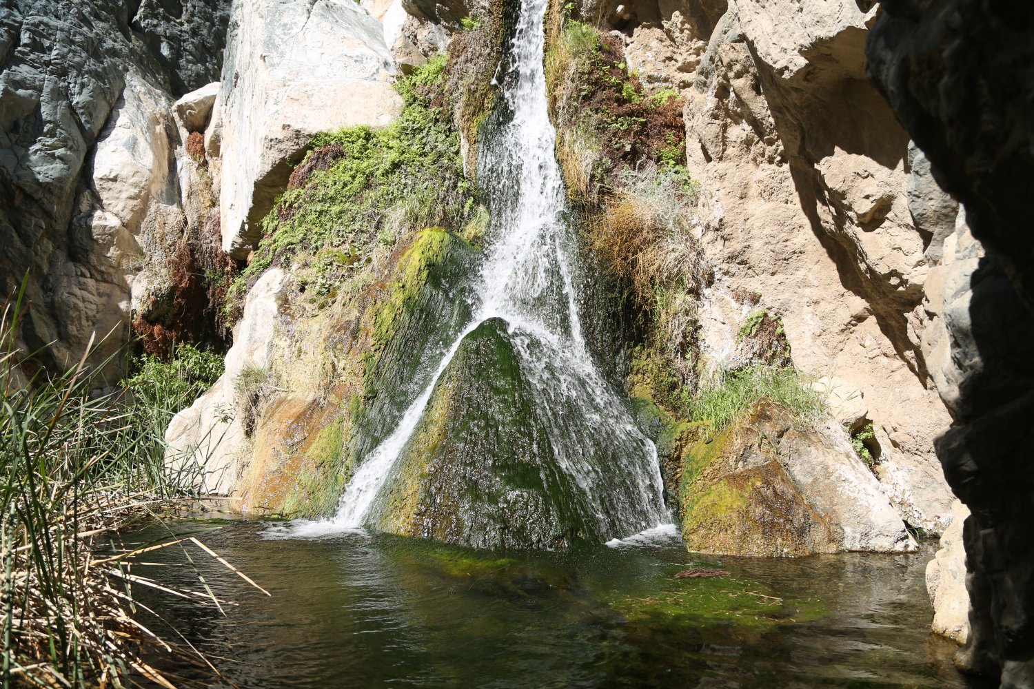
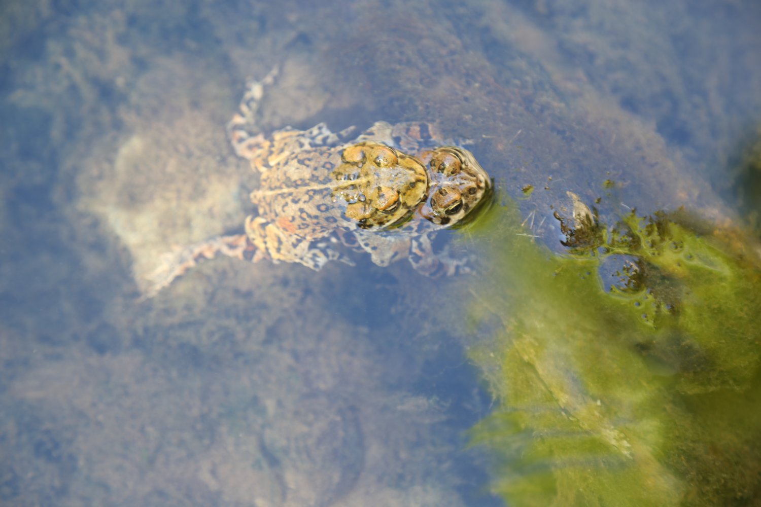
This is a very rare source of year-round flowing freshwater in Death Valley National Park and a treat to visit – especially if one has the falls all to themselves for a period of time. A small pool is located at the base of the falls with several fern grottos above – the water is refreshing and very cold. Noteworthy are the number of sizable frogs that live here – often hopping over the wet ground, sunning themselves next to the pool or mating. We’ve sat here for several hours, remarkably in total privacy before mesmerized by their activities.
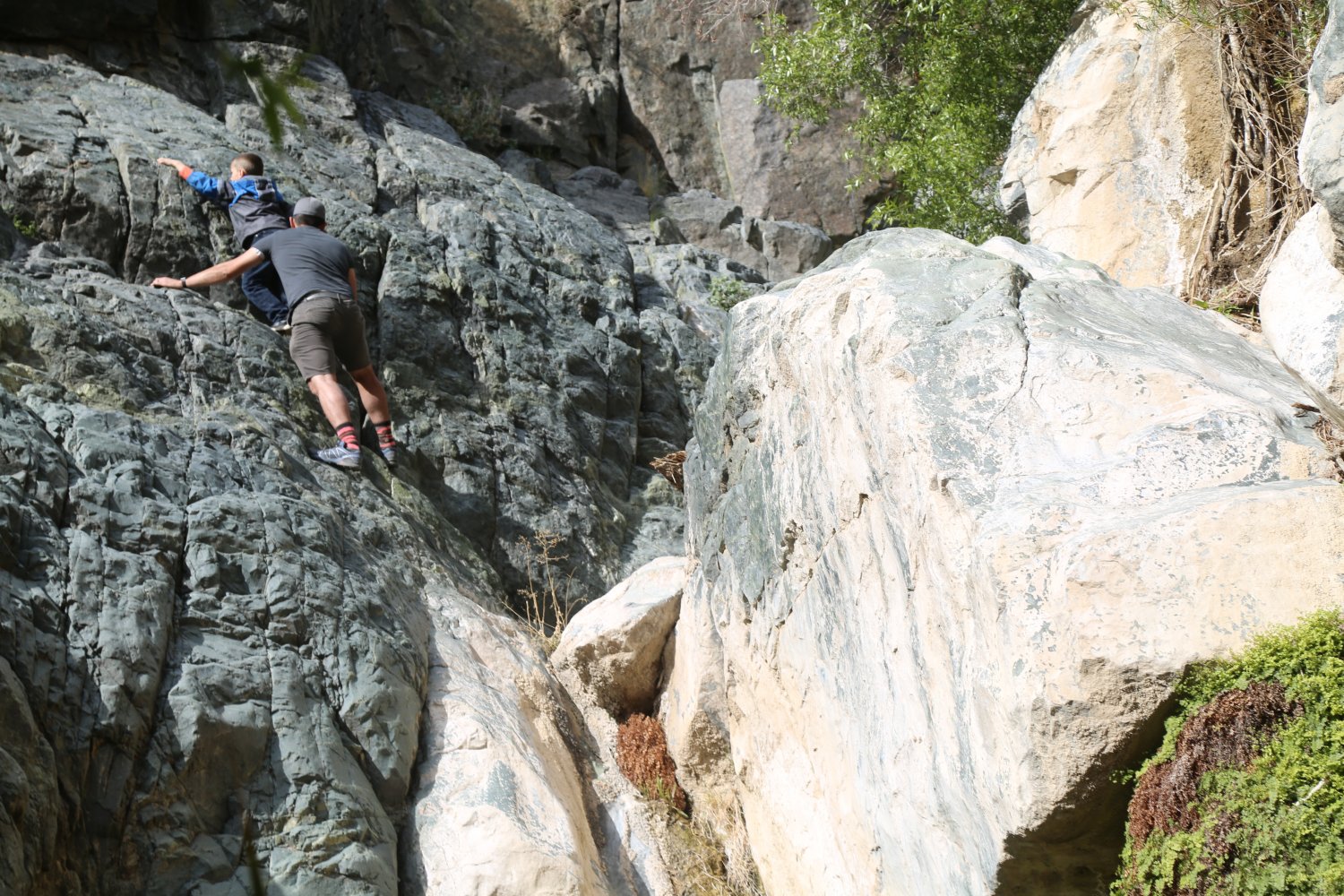
More adventurous hikers can do some bouldering next to and behind the falls – be very careful – some rock climbing and previous bouldering experience is highly recommended as one fall can turn a good day into a very bad one.
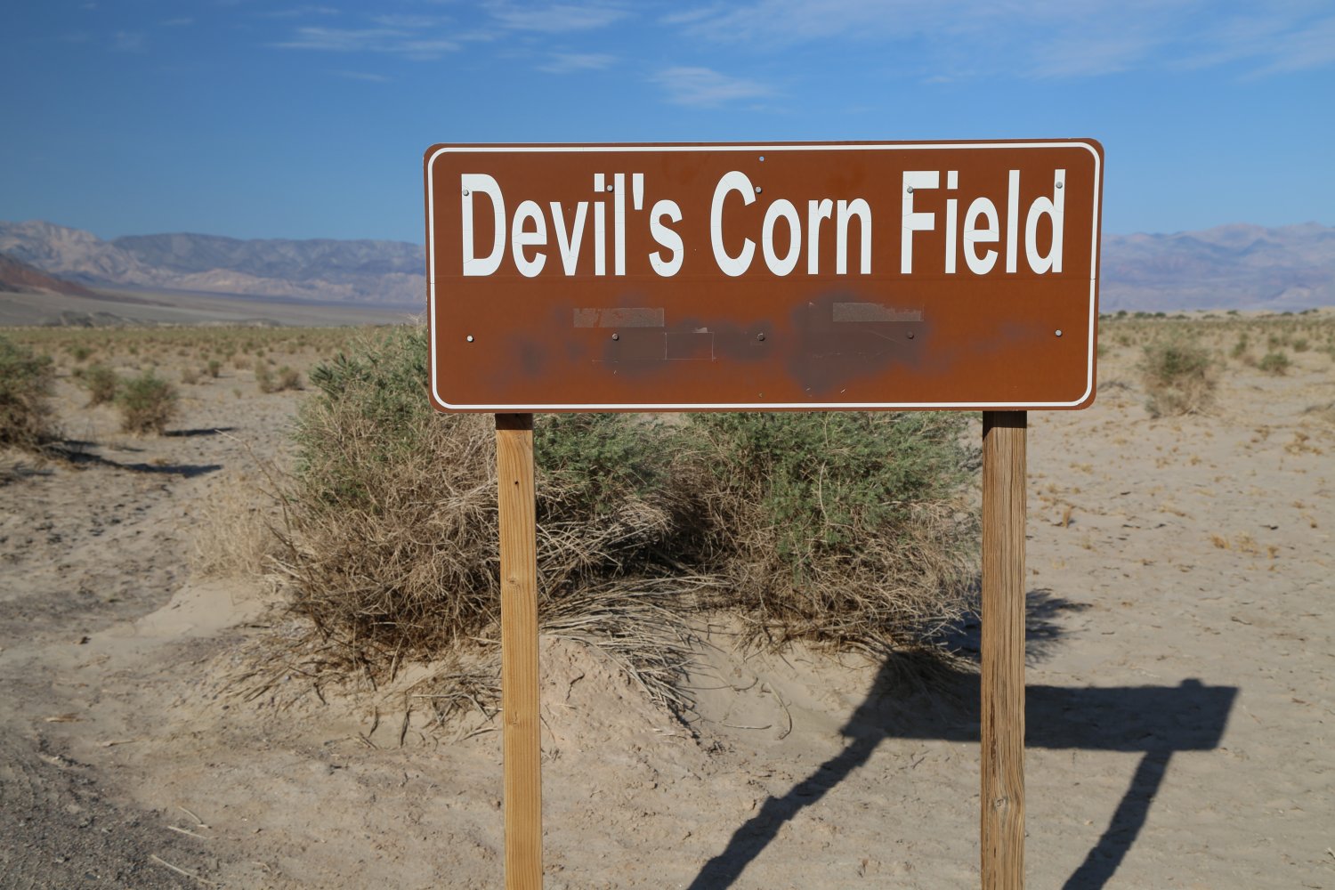
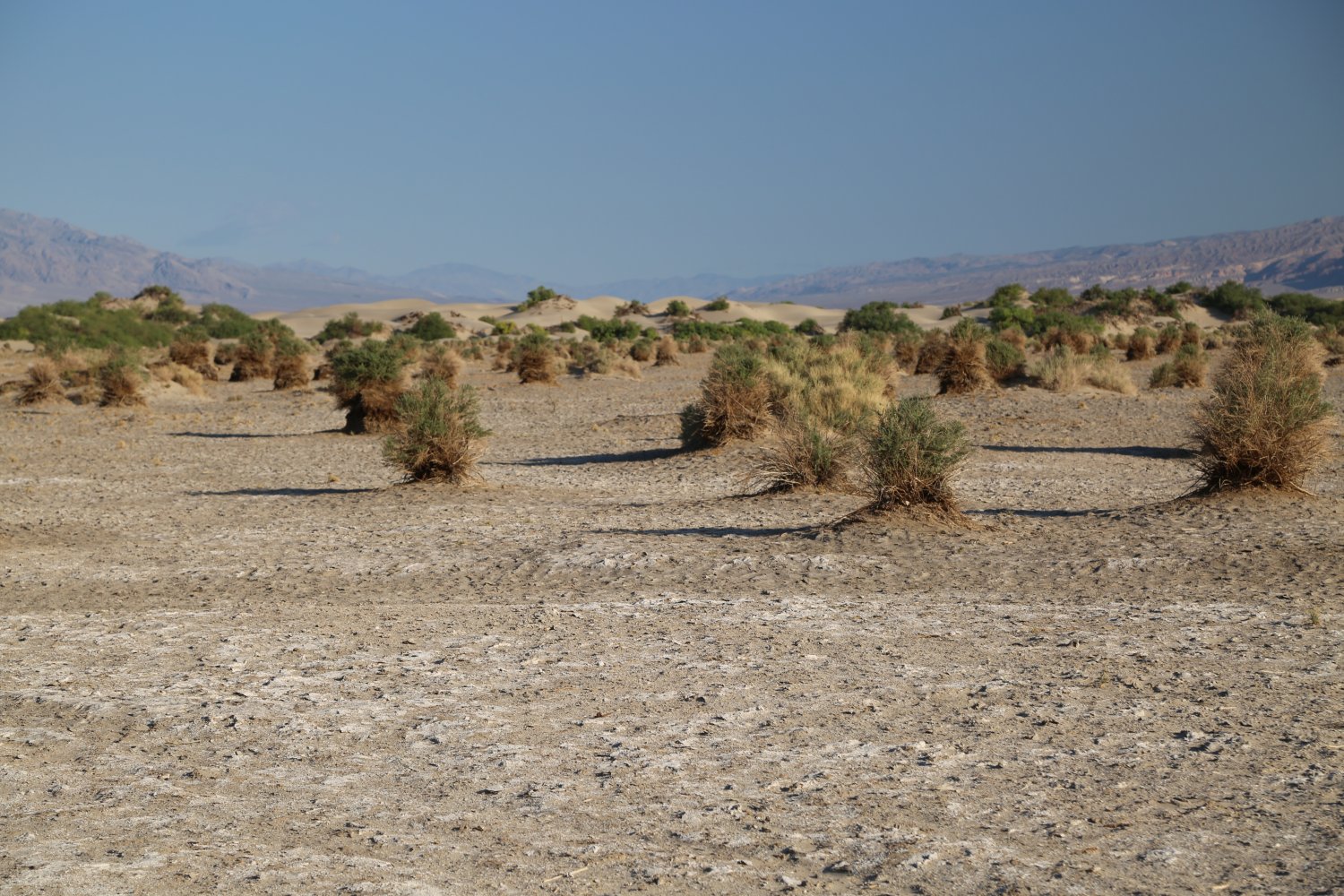
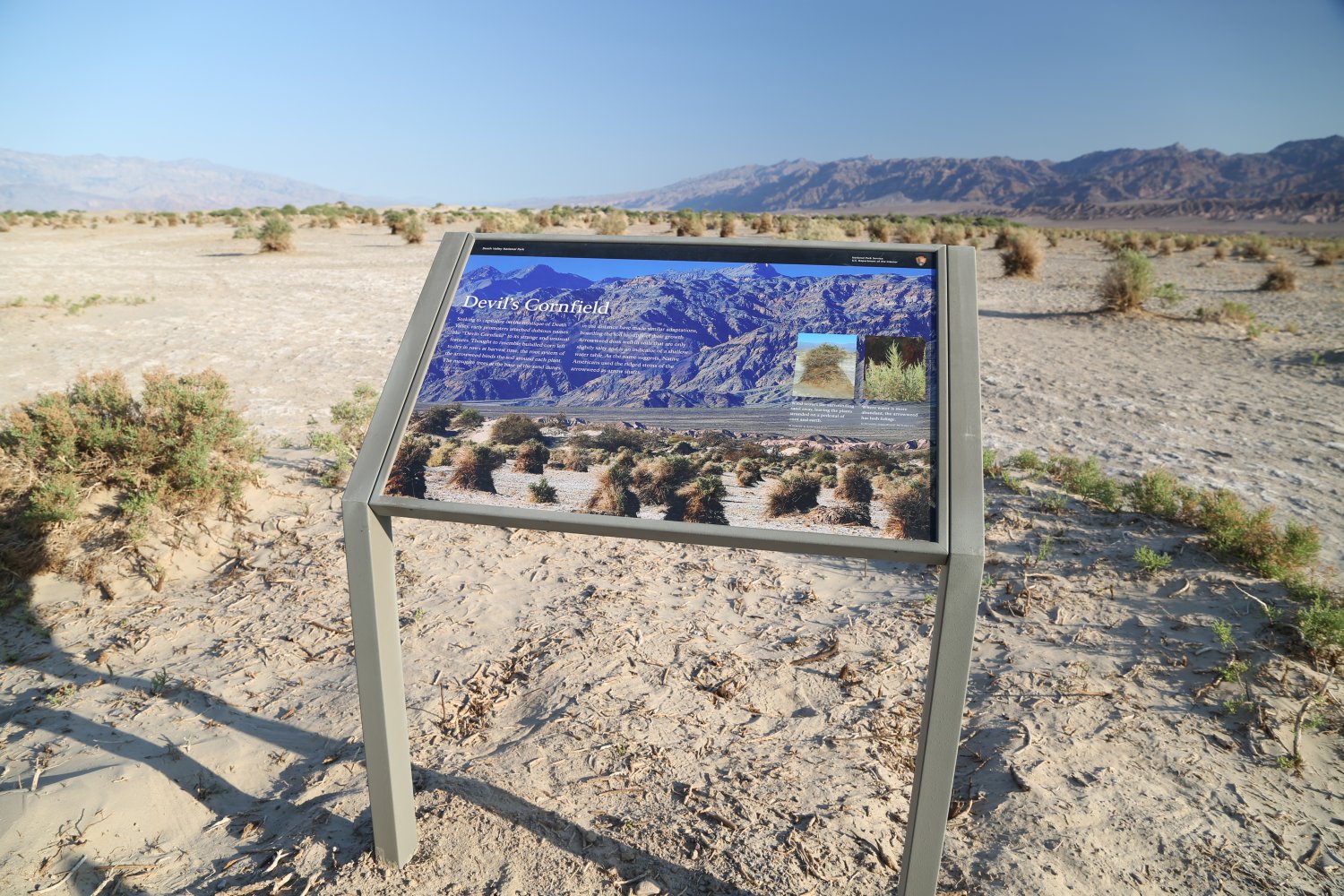
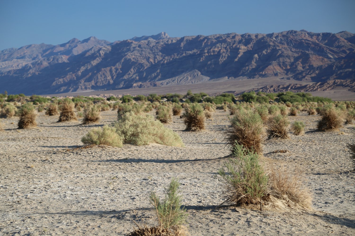
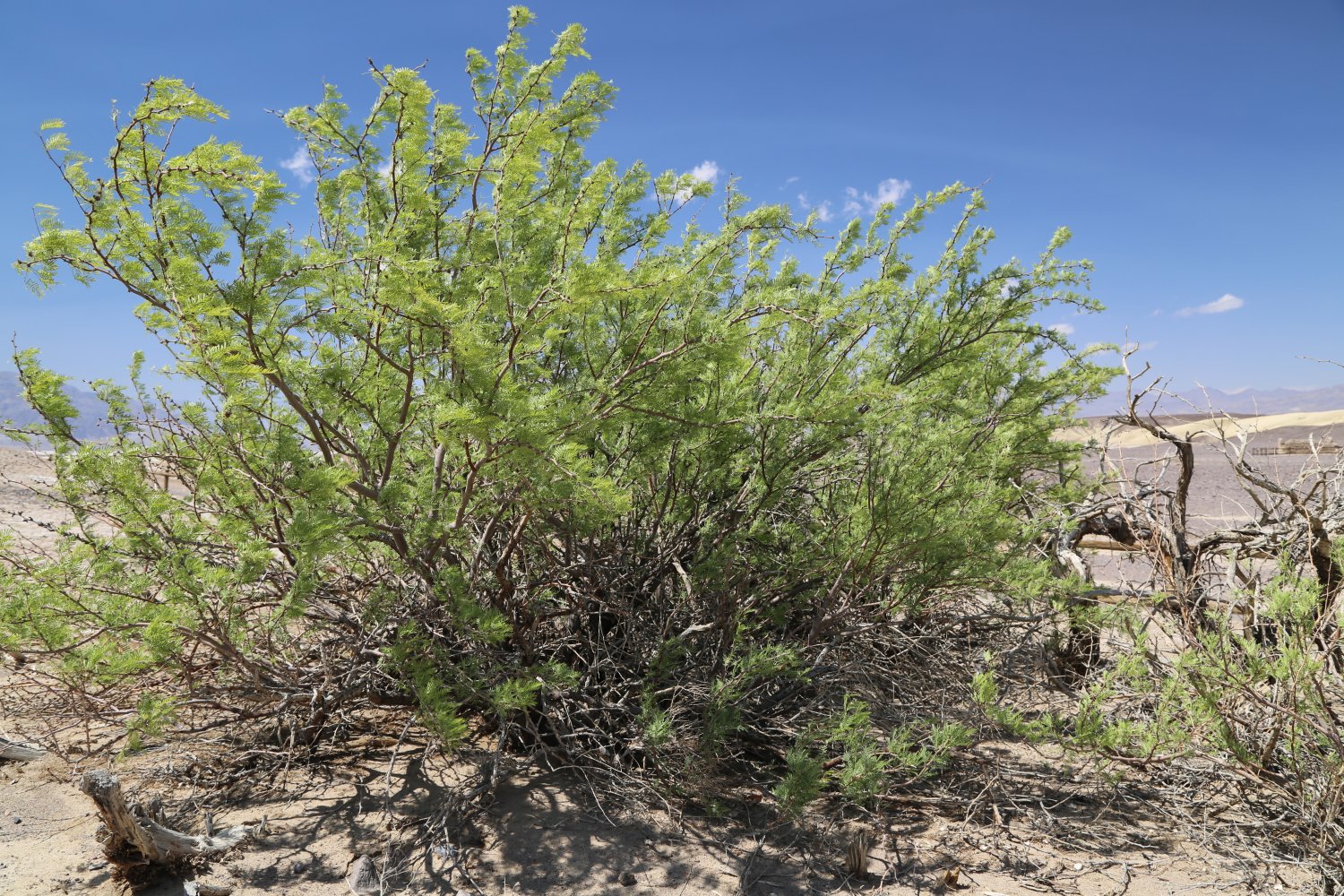
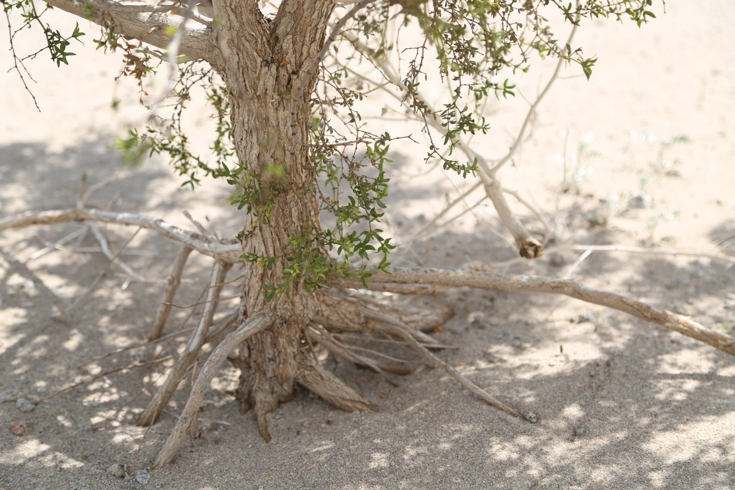
Devil’s Corn Field – the names the early settlers gave some of the natural formations in Death Valley are brilliant. This name stuck over the years and refers to the Arrowweed plants that grow in the flats here – vaguely resembling bundles of harvested corn left to dry in the sun.
Once the Arrowweed plant is established in the soil – over the years wind blows away the soft sand leaving the plant’s root system adhered to the more compact soils – leaving a base of roots and earth with the vegetation growing on top. And true to its name – Native American’s used the stems of this plant for arrow shafts.
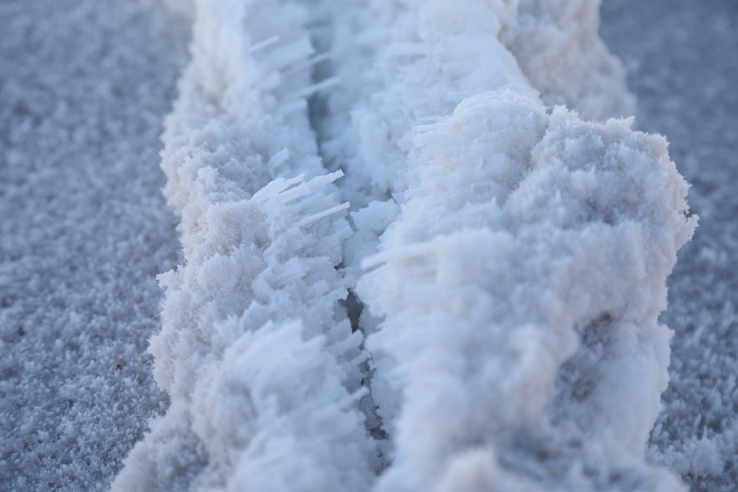
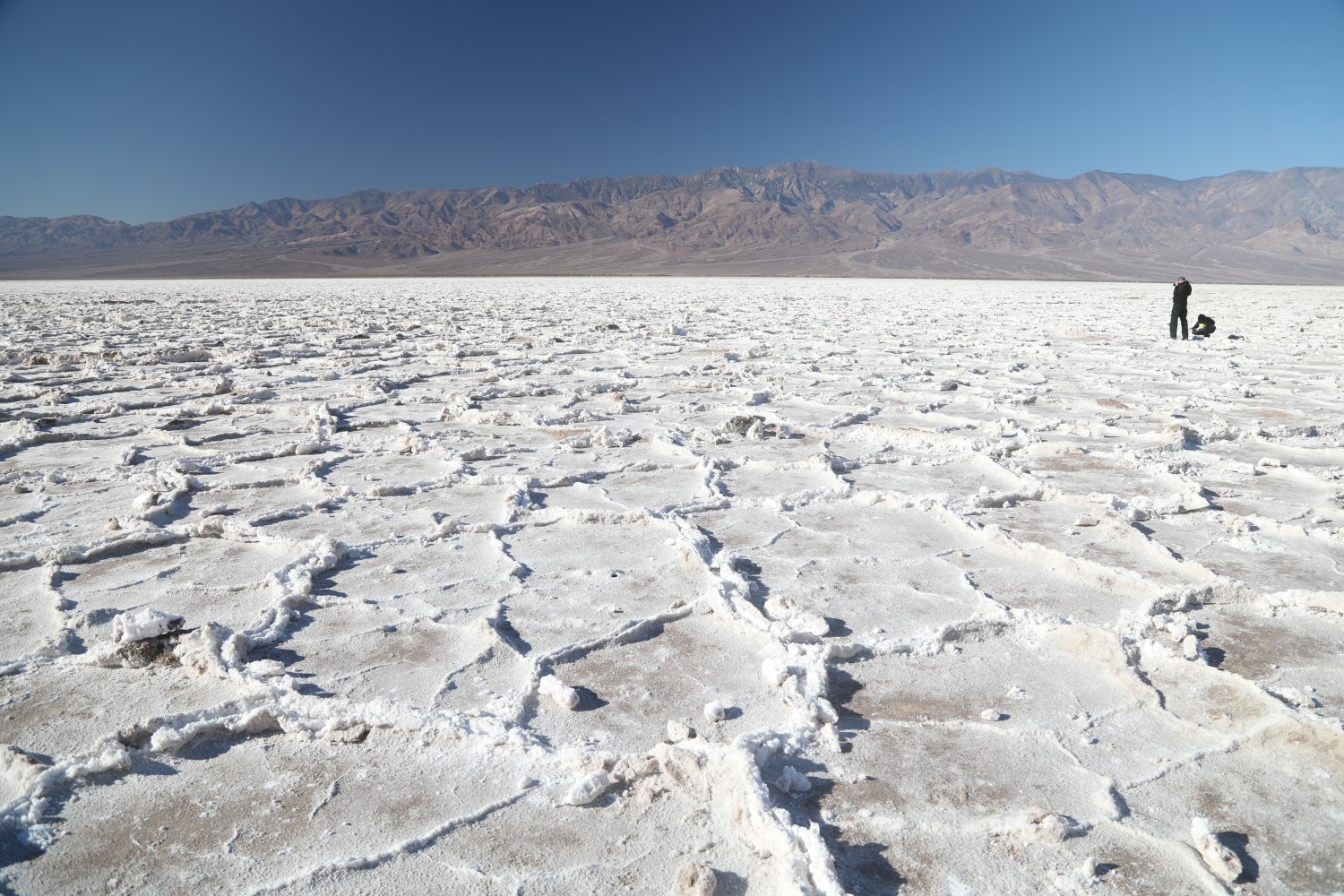
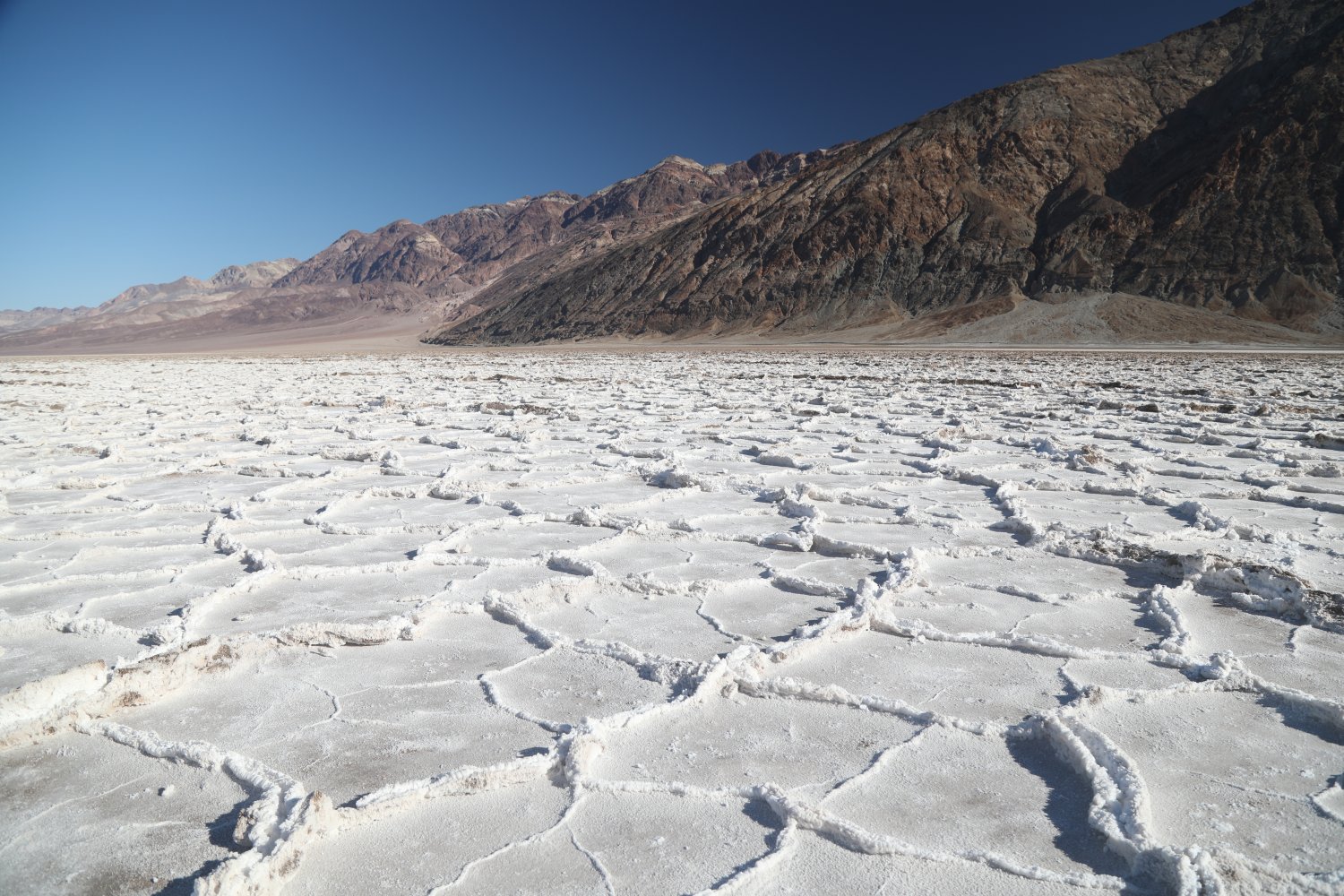
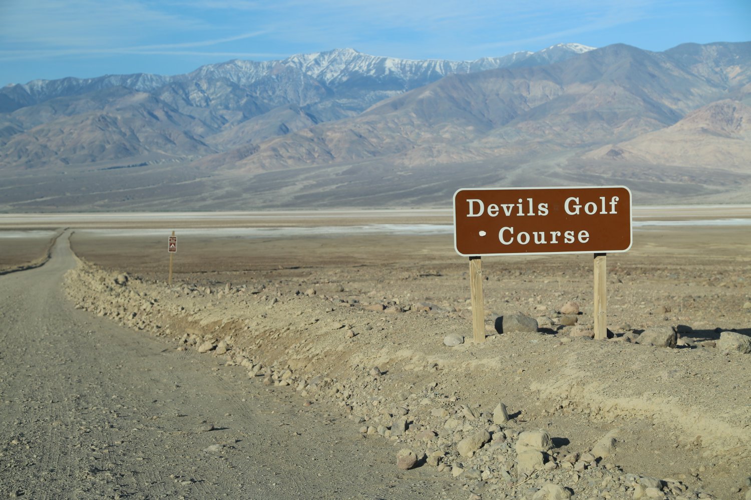
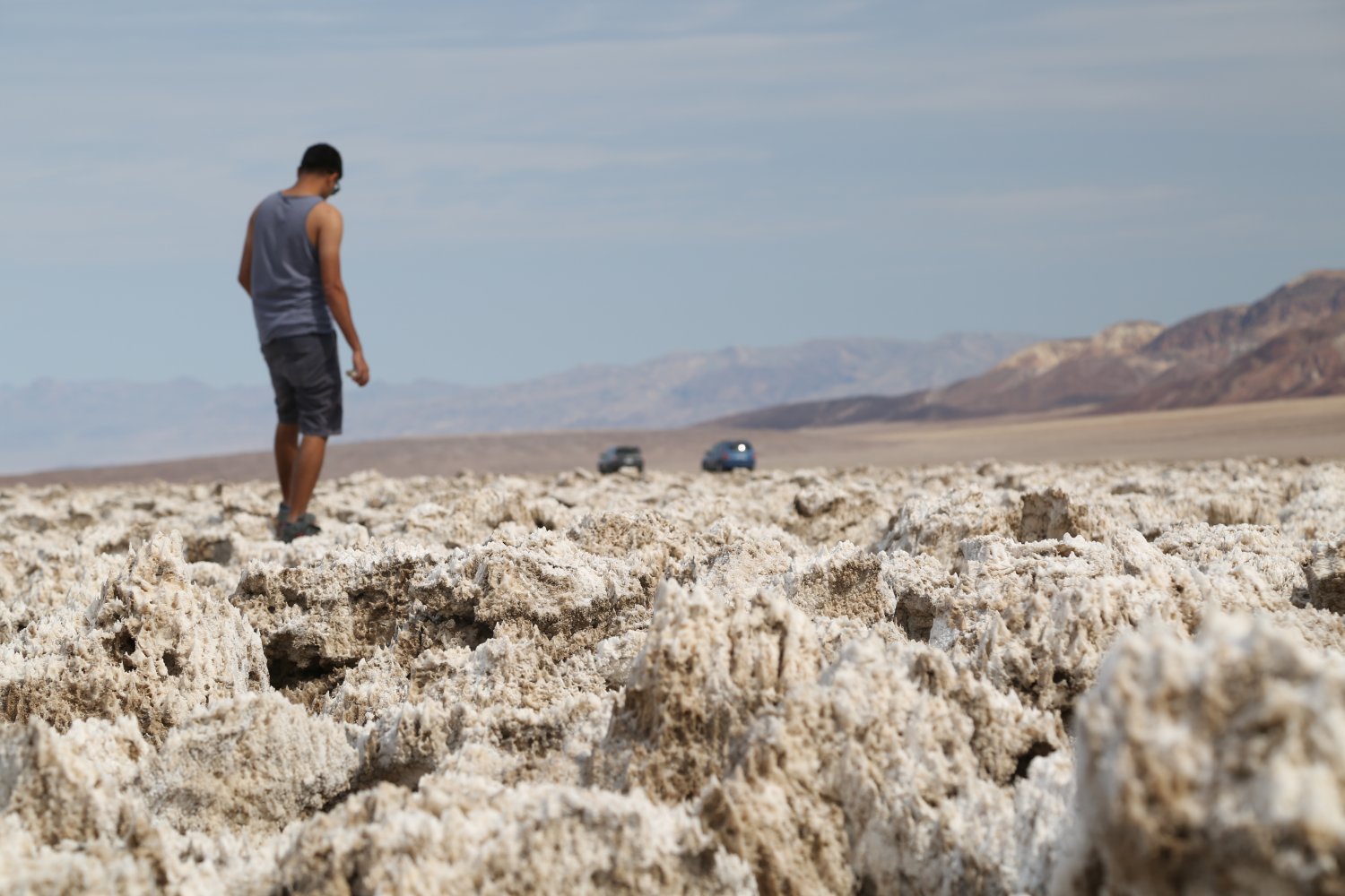
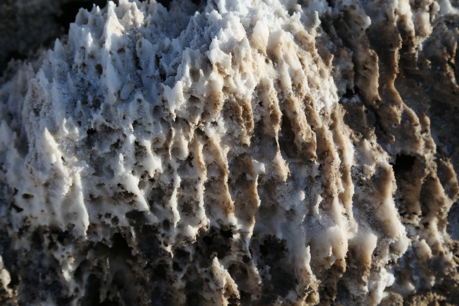
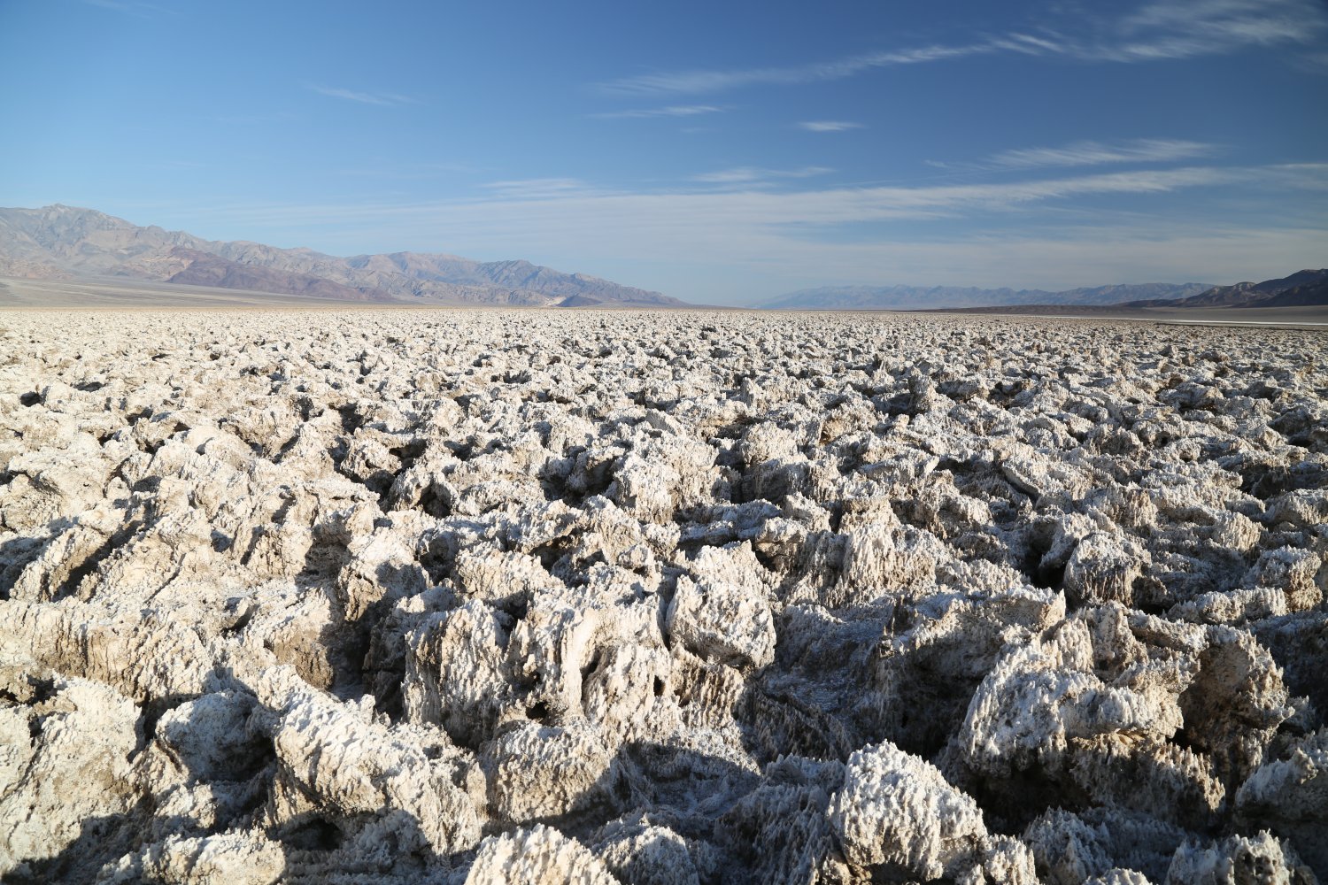
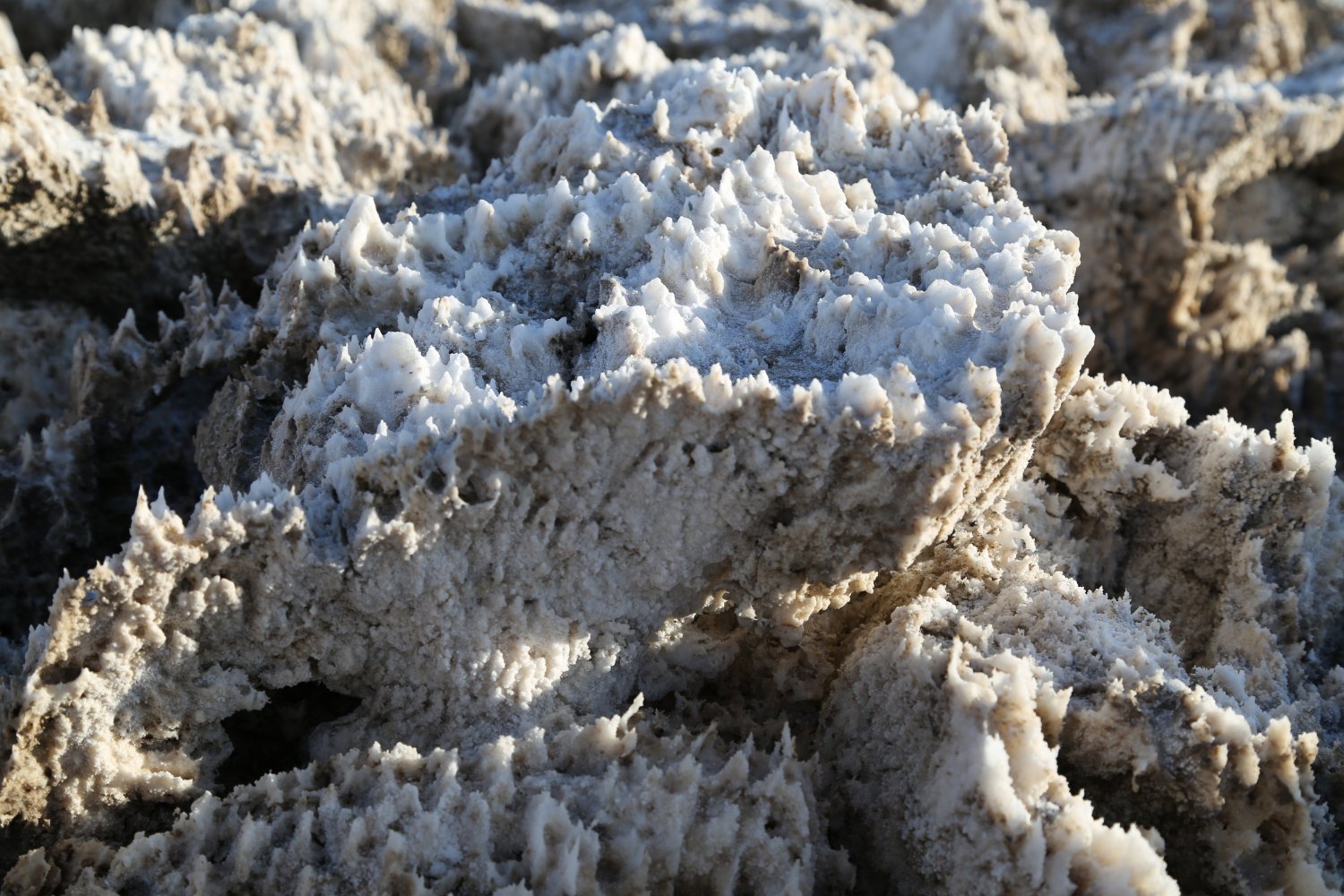
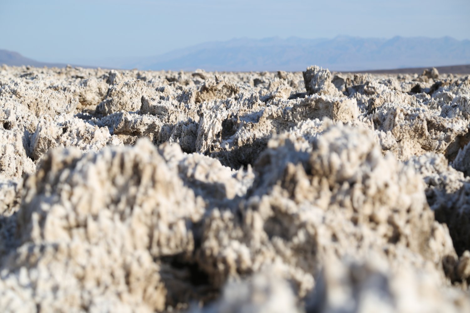
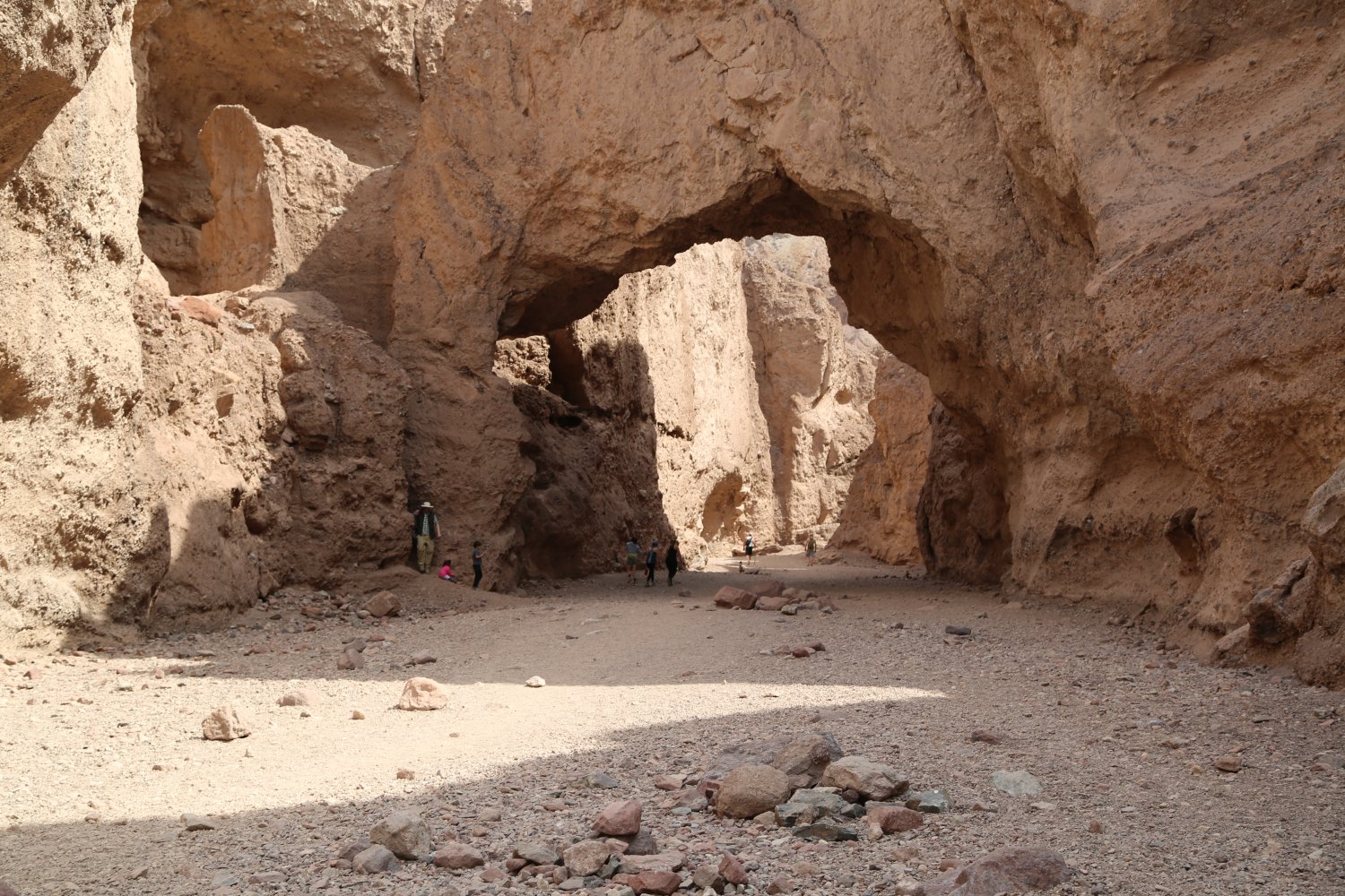
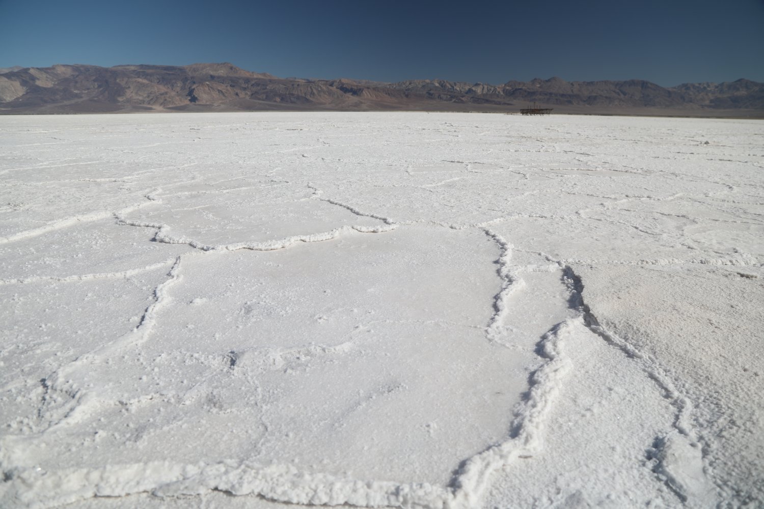
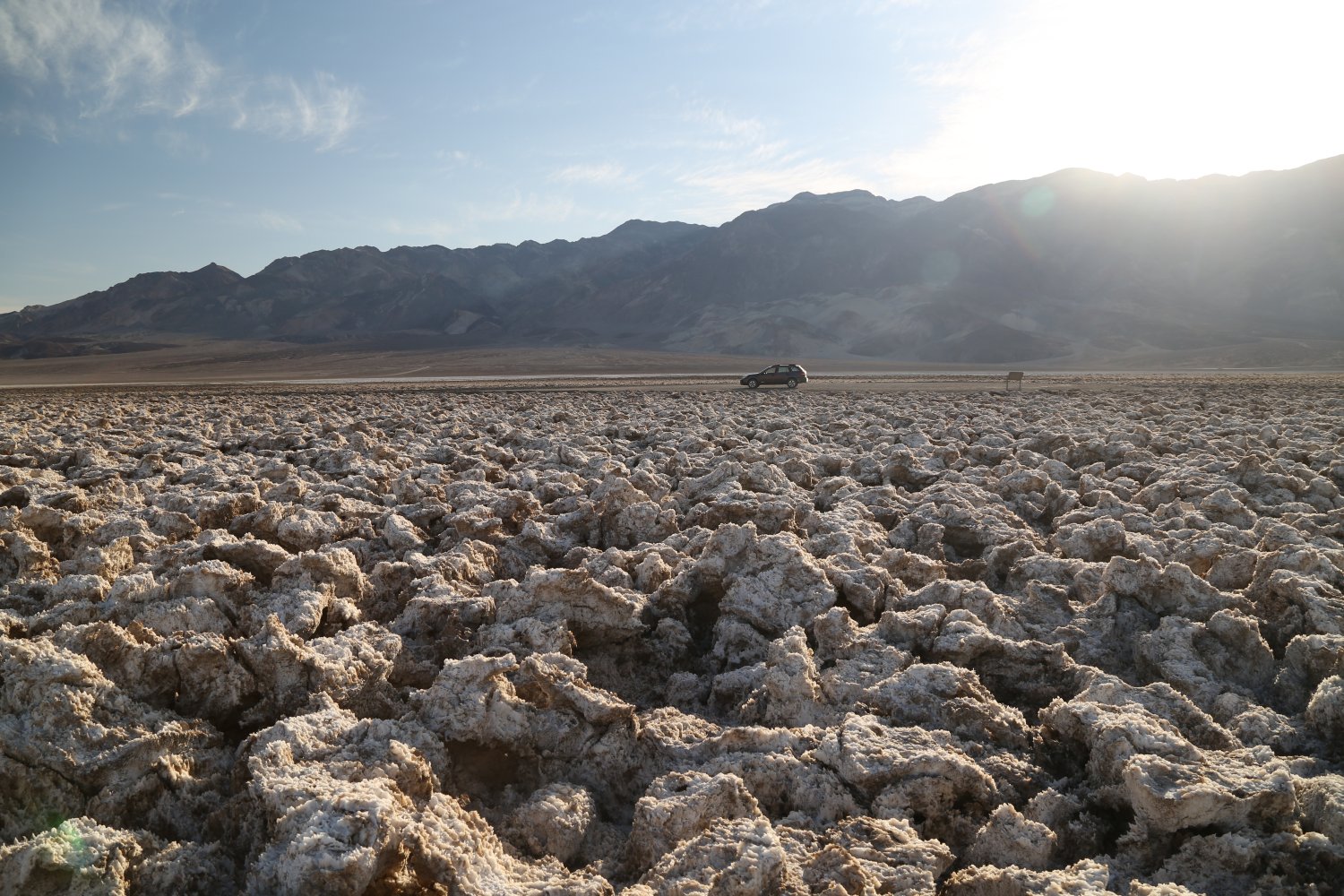 Devil’s Golf Course is located close to the Natural Bridge turnoff and just north of Badwater. It is in the flats (the floor) of Death Valley and is made up of “clumps” of sharp halite salt crystals that jut out above the rest of the valley floor.
Its just a short drive from the main highway on an improved gravel road that ends in a turn around spot – there is no official trail. If you visit during warm weather you may hear sort of a “popping” orchestra as the salt crystal expand and contract because of the differences in temperature. The salt closest to the dirt parking spot has been well trampled and is not as sharp.
A visit here needs to be about the details of the salt yet at the same time taking notice of how vast this salt field is! Looking at the salt up close, one can see all sorts of shapes and edges – there are even some holes that have formed in these salt fields.
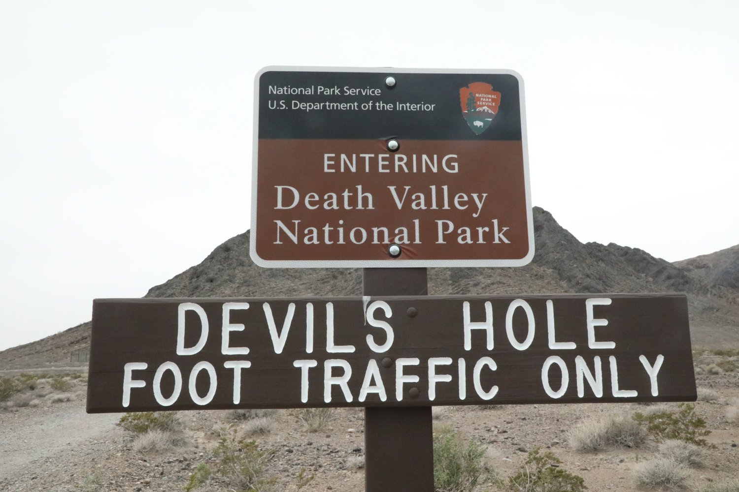
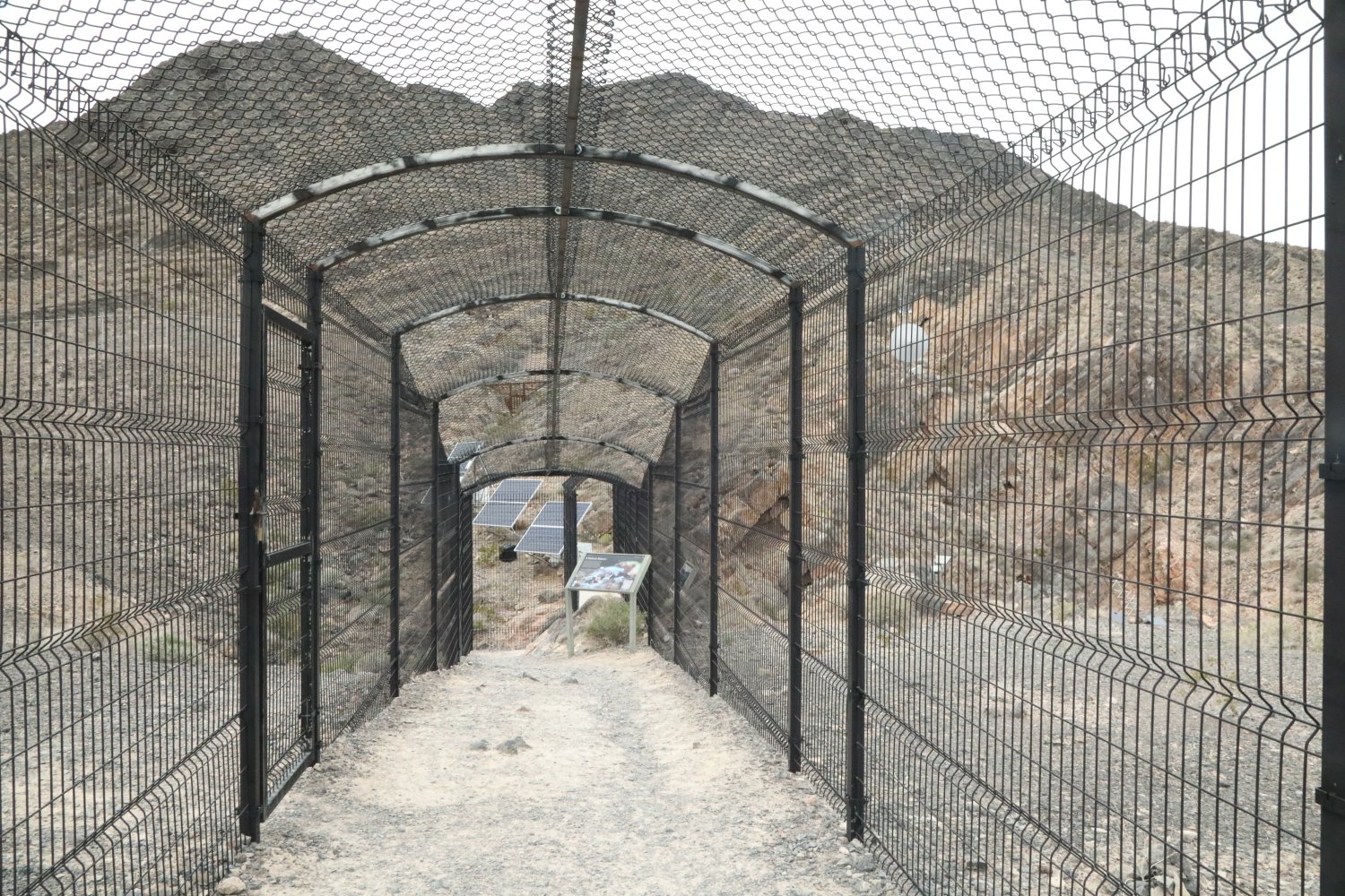
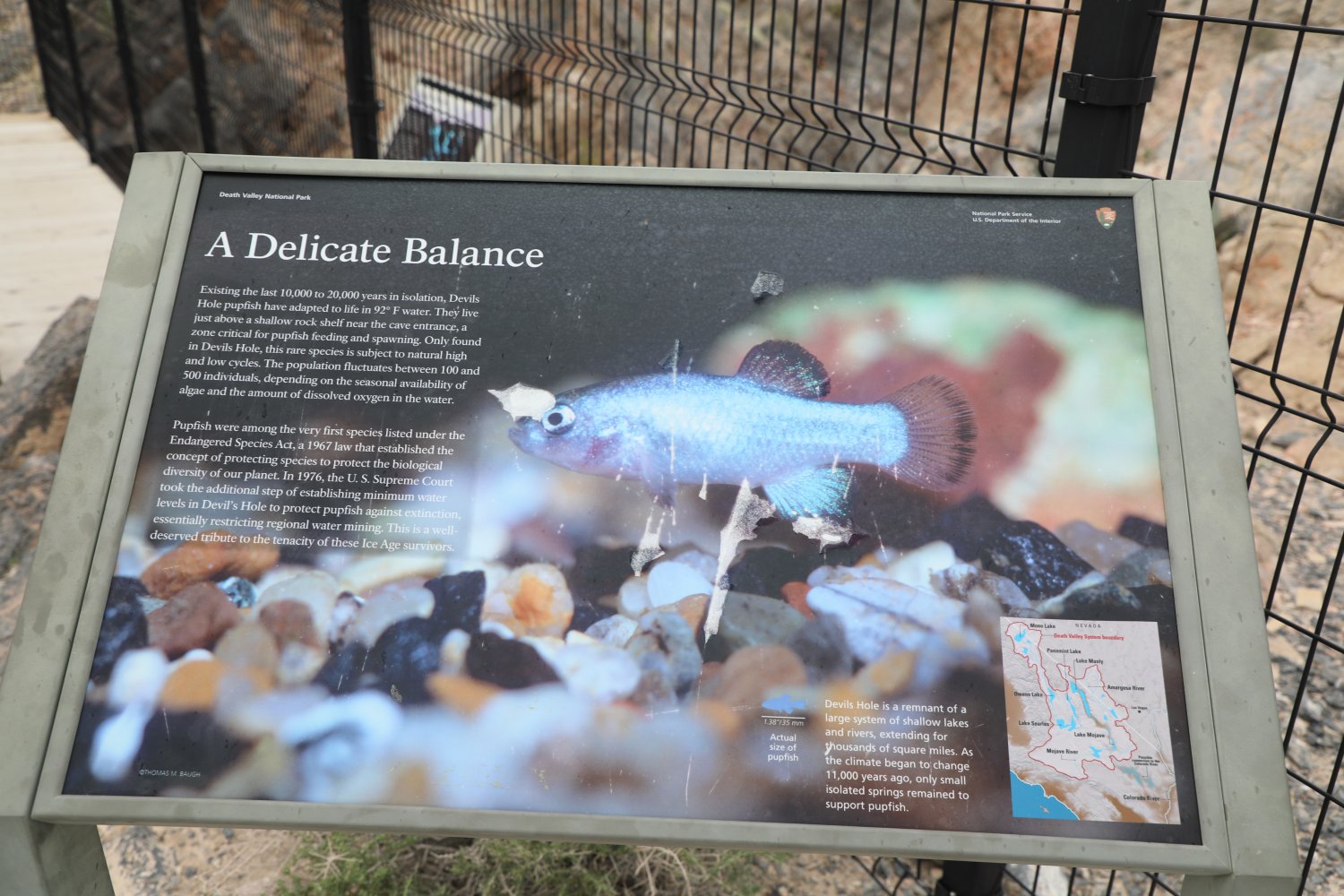
Devil’s Hole . This very unique spot is fortified almost greater than various U.S. Military bases due to its extremely unique nature and the mysterious pull it has over visitors. It is located in Ash Meadows in Nevada; Devil’s Pool is in an isolated tiny fragment of Death Valley National Park. Driving distance is about 50 minutes from Furnace Creek.
Devil’s Hole has been explored by divers down to about 500 feet, but its depth is greater than this. Remarkably and unexplained is the hole’s ability to react to large earthquakes anywhere on the planet in the form of a mini tsunami with its waters creating mini waves up to 6 feet tall, splashing the rocky walls of the hole.
And its waters are home to the rare and endangered tiny Devil’s Hole pupfish which live and spawn in the upper part of the pool.
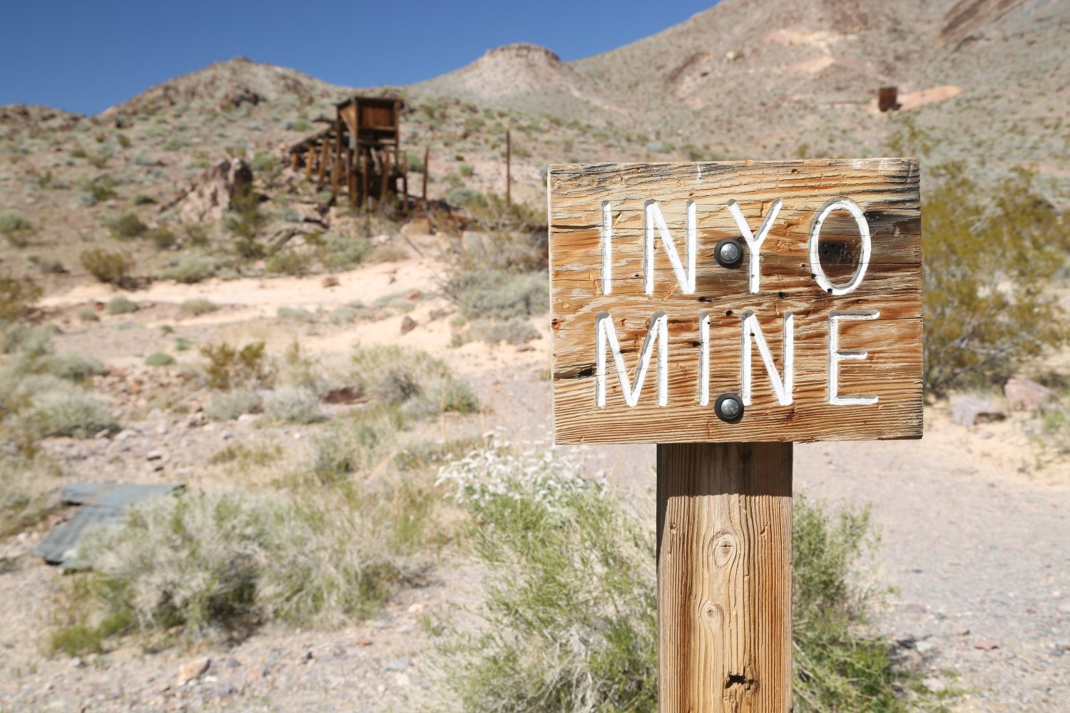
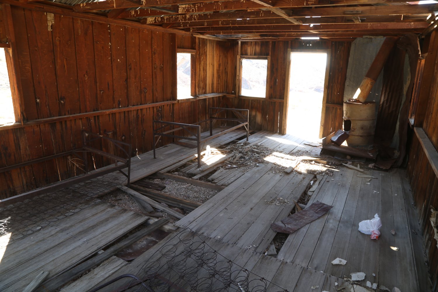
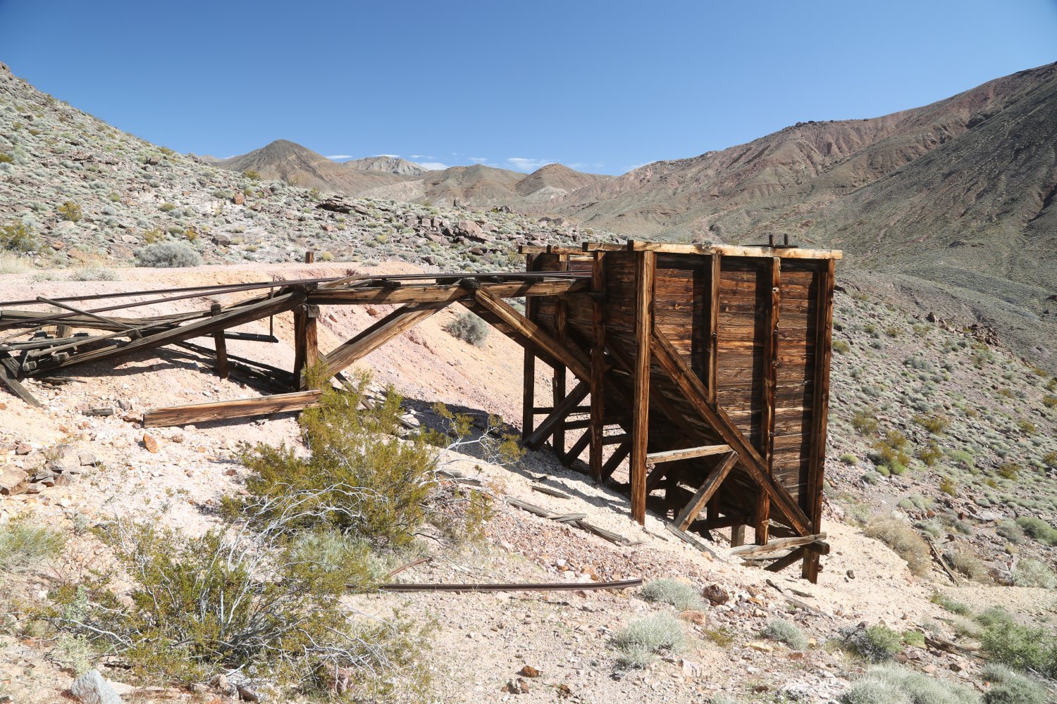
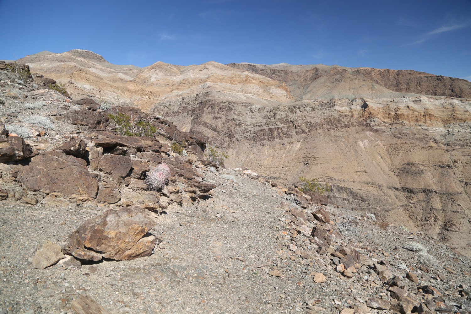
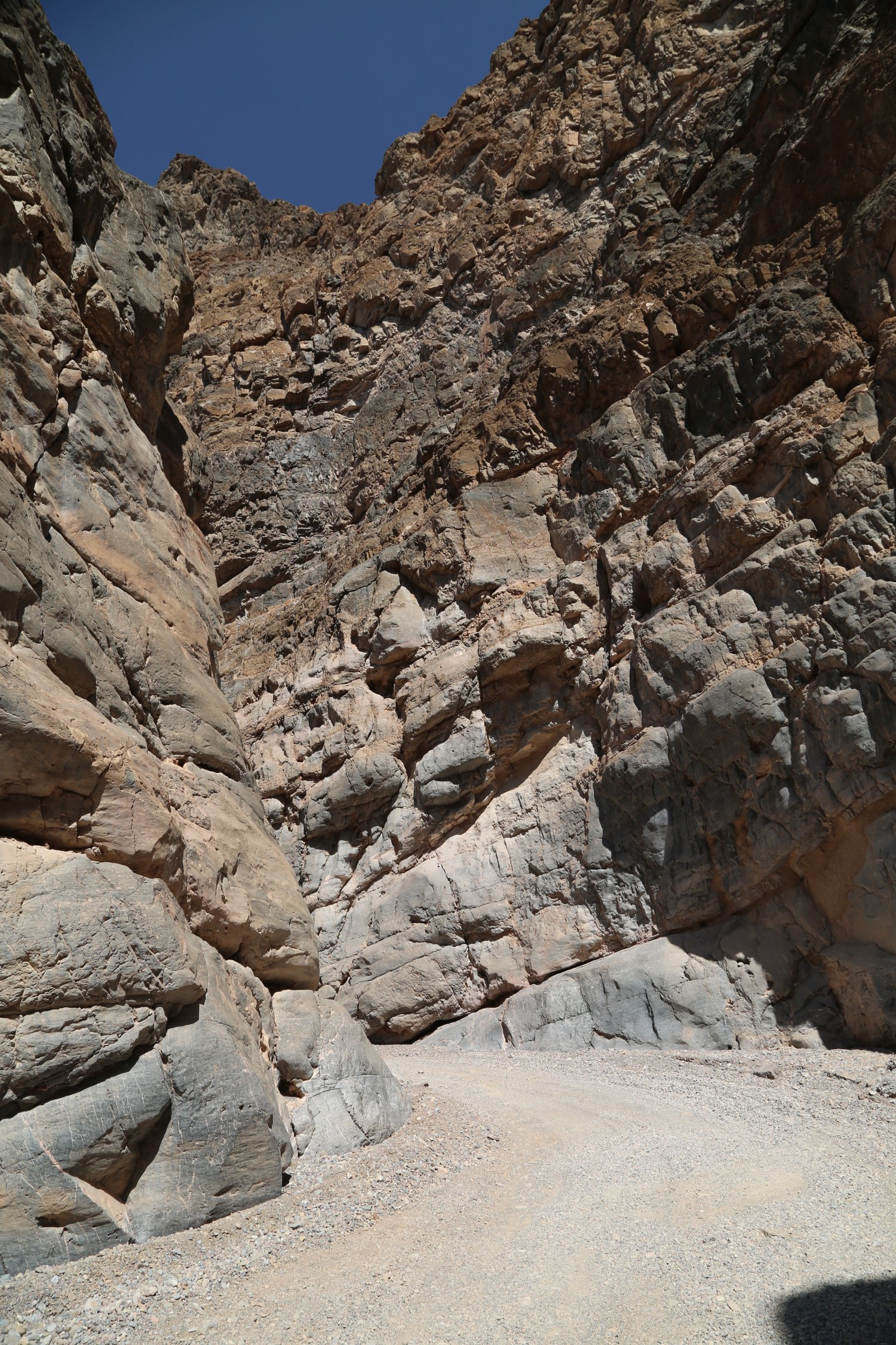
Echo Canyon & Inyo Mine . The entrance dirt road to this little known canyon is located a short drive from either The Oasis At Death Valley or from Zabriskie Point – on the north side of Highway 190. The rocky road is not marked but there is no other dirt road leading off to the north of the highway between the inn and Zabriskie Point. Rising in elevation for nearly its entire run to the canyon – no camping is allowed for the first mile but after that one can car or tent camp alongside the road in any of a number of flat areas. The canyon begins several miles in on the road; the dirt road is passable with an all wheel drive cross over vehicle and theoretically possible in a 2wd vehicle if the driver has significant experience driving high rocky wash roads (the center of this road is often filled with high standing small rocks with lower ruts created by many vehicles over time). There are a few challenging very rocky spots where someone in a 2wd vehicle would want to very carefully and slowly navigate – stopping perhaps to remove the larger of the rocks from the road and walk ahead a bit to scout.
The canyon walls are rocky and very steep at times – the portion through the actual canyon lasts several miles before the road pulls out of the canyon into the surrounding mountainous terrain. Not visible driving into the canyon, but visible driving out is ‘the eye of the needle’ a hole in a rock wall high up one of the canyon walls that casts a sliver of sunlight through to the ground later in the afternoon.
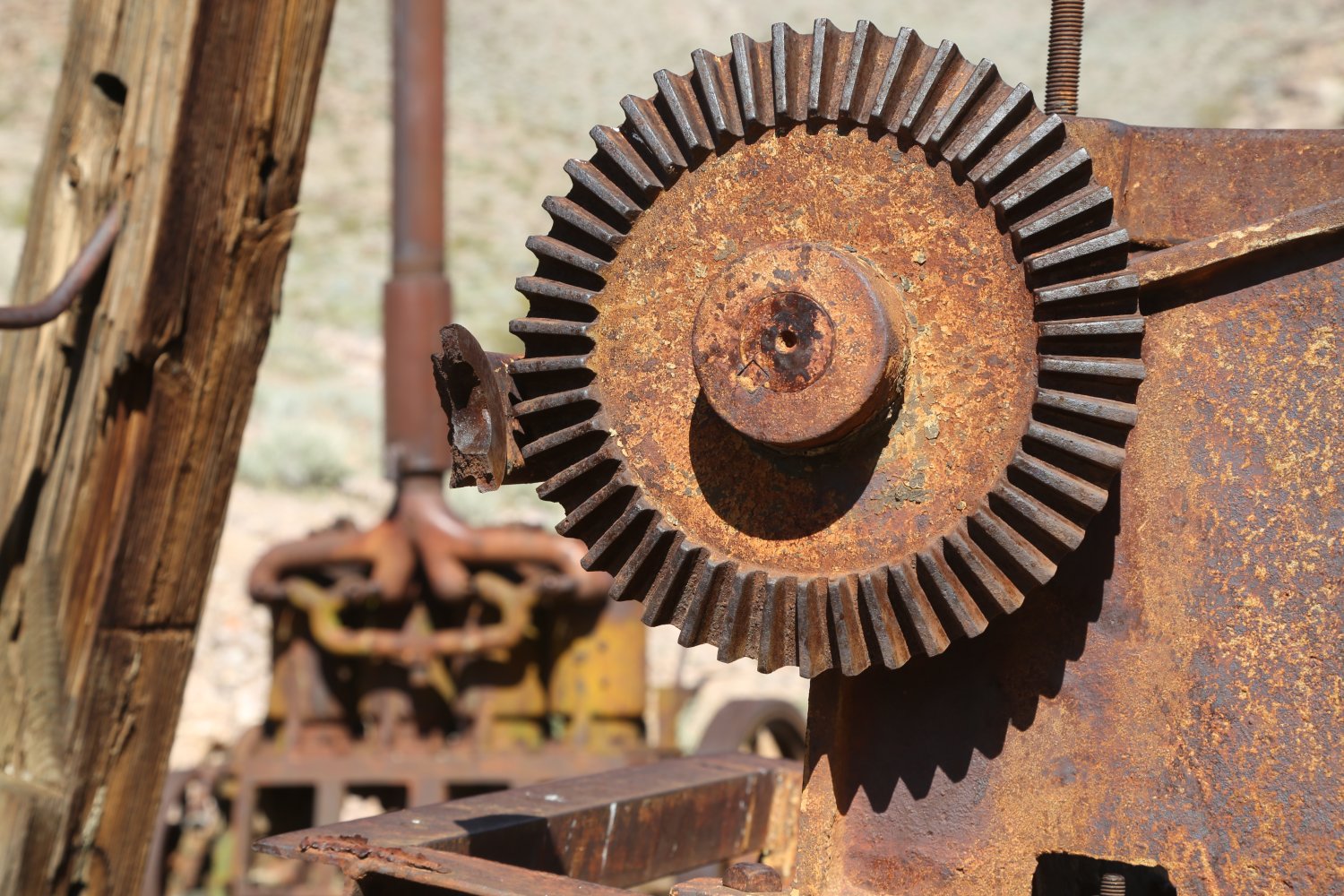
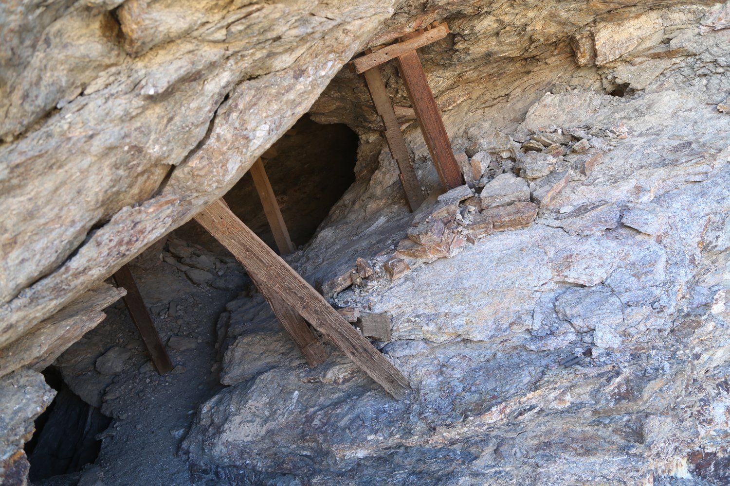
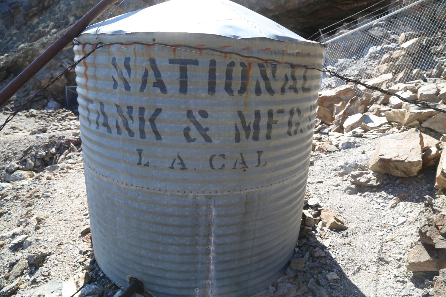
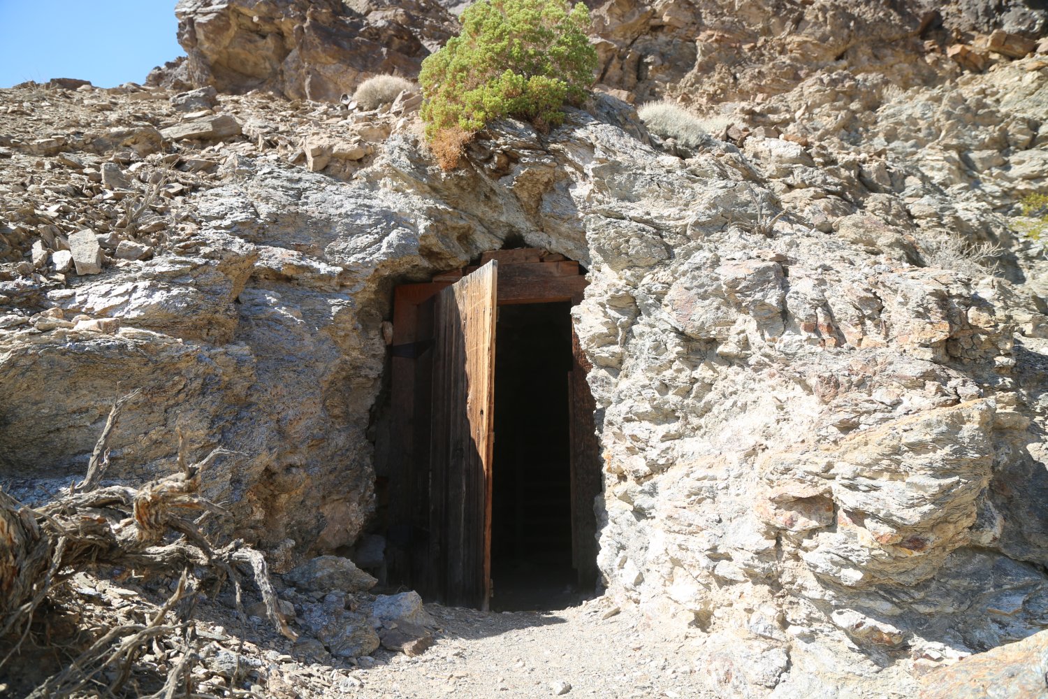
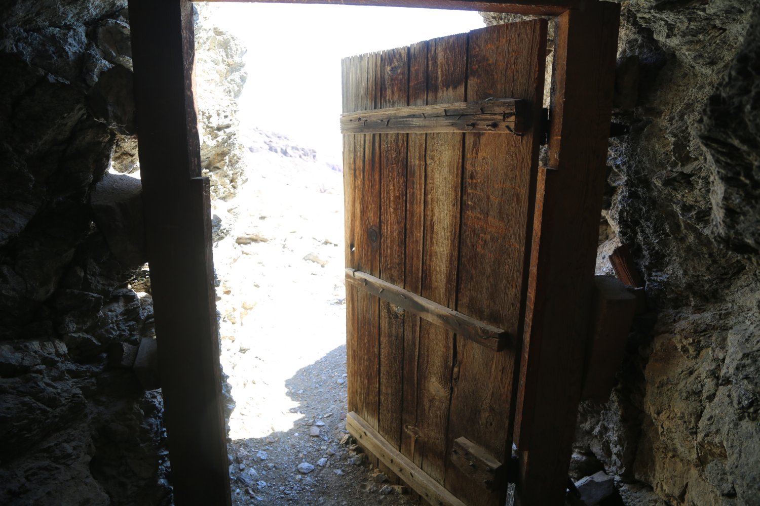
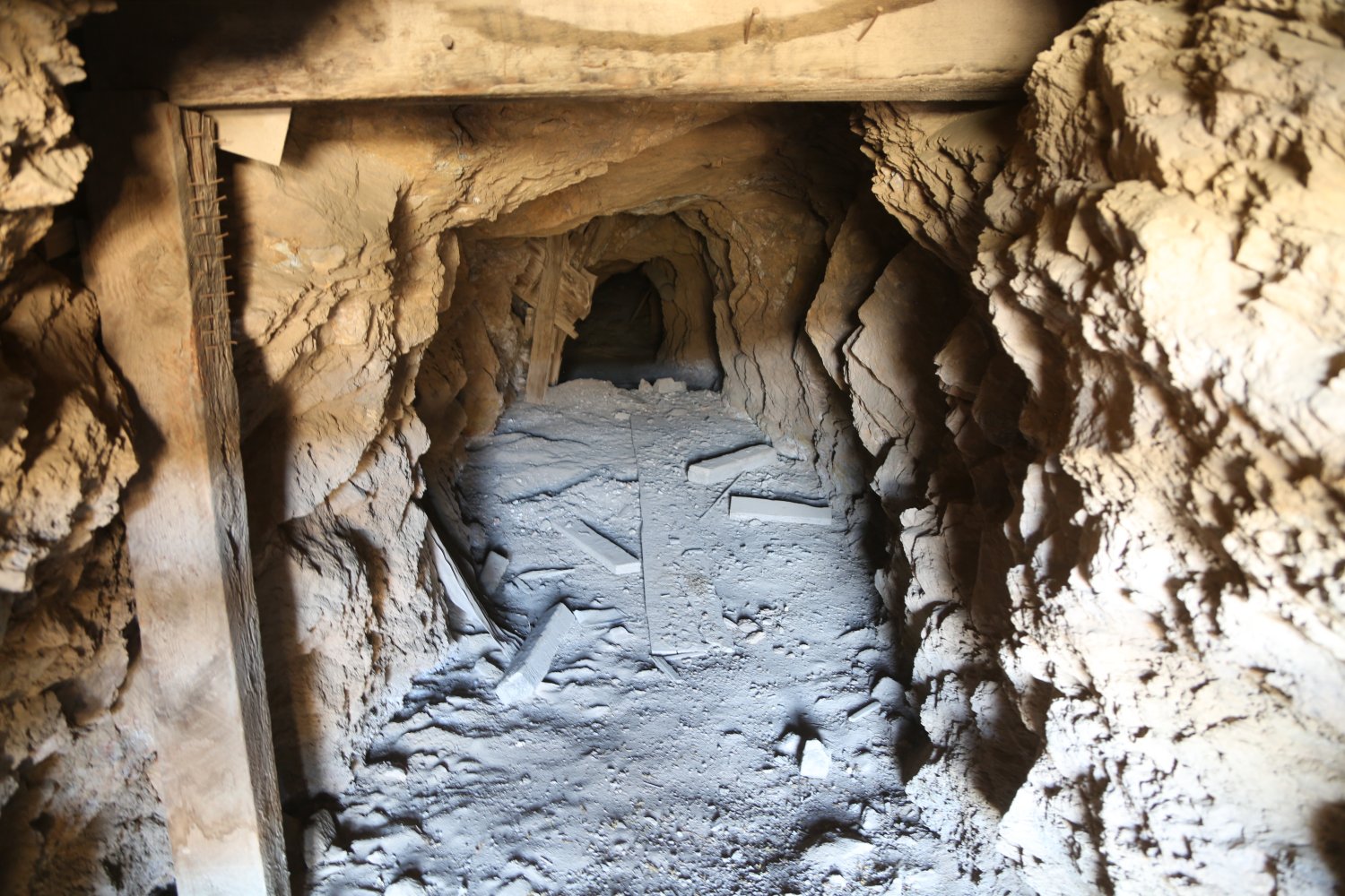
A visit to the hard-rock Inyo Mine is a highlight of this drive – first developed in 1905 the region continued to be explored and was semi-active through about 1940. Today several old wooden mining buildings still stand and some of the metal mining equipment is scattered around the site. Remarkably a number of horizontal mine shafts are still open although it is not recommended to walk inside. One vertical shaft is covered with a metal screen.
The road continues past the mine but ultimately dead ends at a small turn around spot – with the option to continue hiking further east through a usually dry river wash. A very rugged and remote dirt road leads off of Echo Canyon road about 1.5 miles before reaching the Inyo Mine. This road is not publicized but with a jeep or other high clearance 4wd one can actually drive out of the park, cross into Nevada and eventually exit near Amargosa Valley.


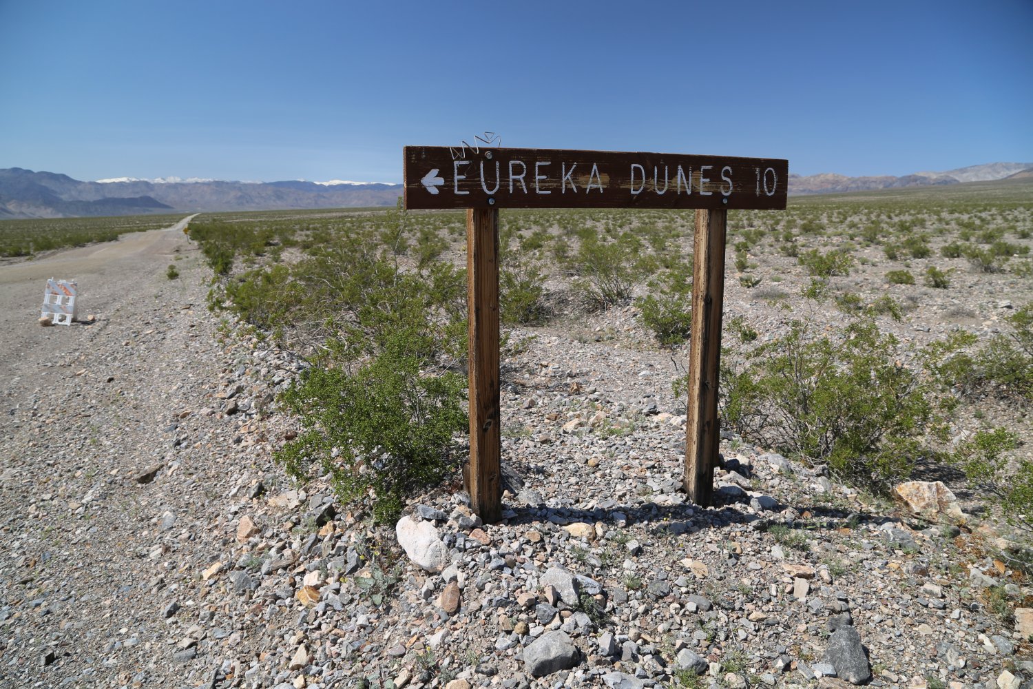
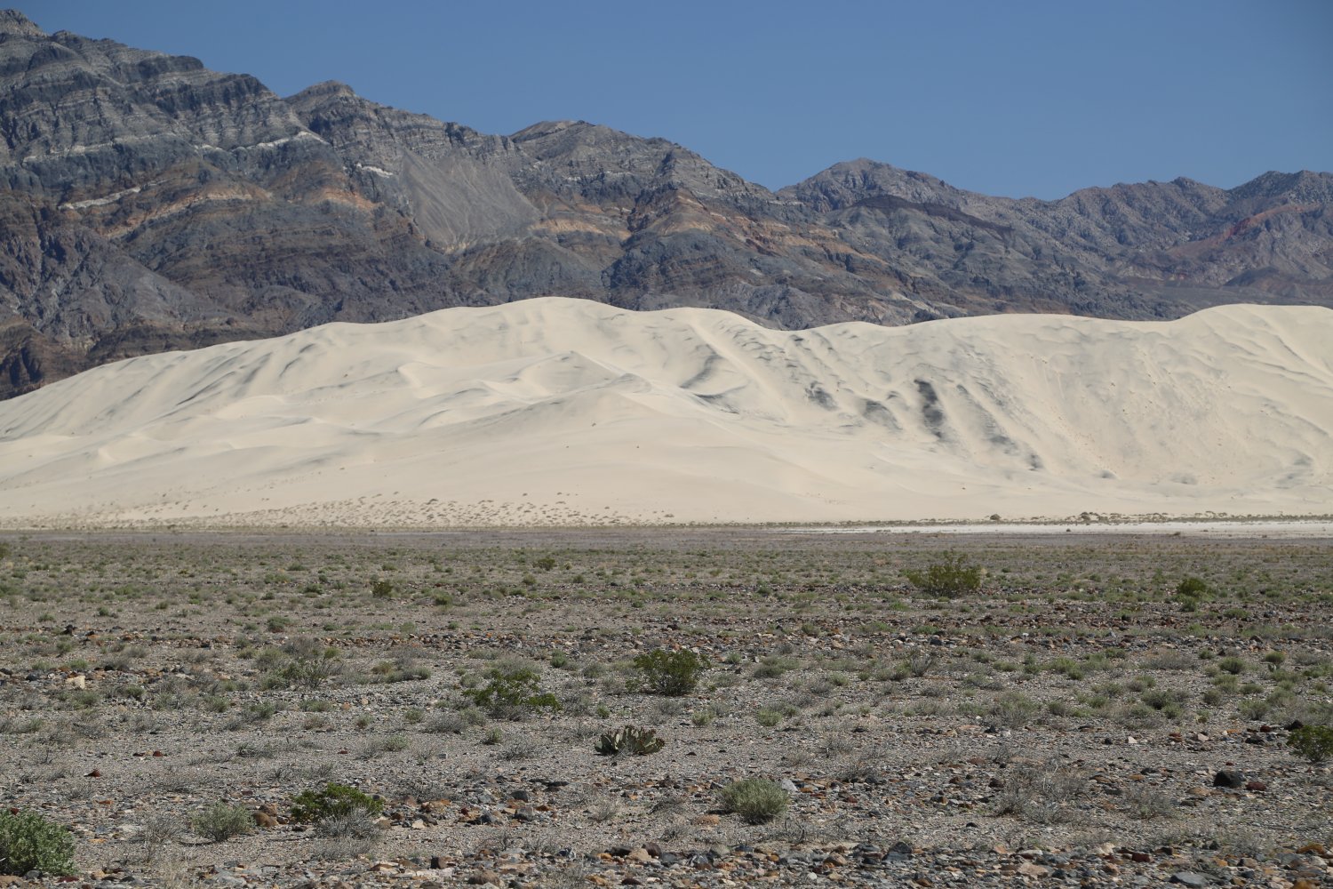
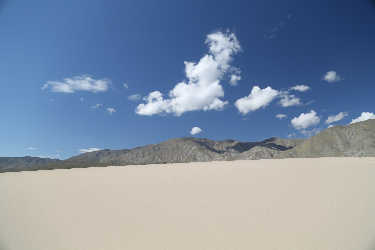
Eureka Sand Dunes – this is a haul to get here – from within Death Valley National Park, the dirt road starts at the paved road that leads to Ubehebe Crater (in the vicinity of Scotty’s Castle). It is approximately 45 miles on almost all dirt roads to reach the dunes. For years we looked at these as a mythical natural creation located in the far reaches of the park – that only experienced 4wd drivers could access only if you have a high clearance vehicle. Absolutely NOT so! While much longer then the road to Racetrack Playa the road offers a much gentler ride without nearly the amount of rocks that one finds on Racetrack Playa road (and we have driven a 2wd the length of the road to Racetrack Playa). As a result, the drive to the dunes is MUCH smoother and easier for a 2wd vehicle. A 2wd vehicle should have no problems making this entire drive. There is even a stretch of pavement about 2/3 of the way to the Dunes.
During a recent drive in dry conditions we found NO sandy conditions on the road – but rather a well packed solid road base the entire way.
For all intents and purposes there is NO cell service this entire drive (although note at some point in the drive, we don’t know when – we did receive some texts and emails – ATT service).
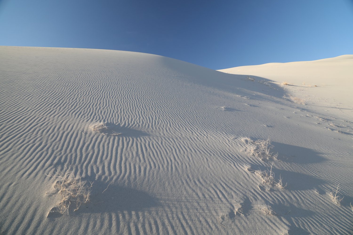
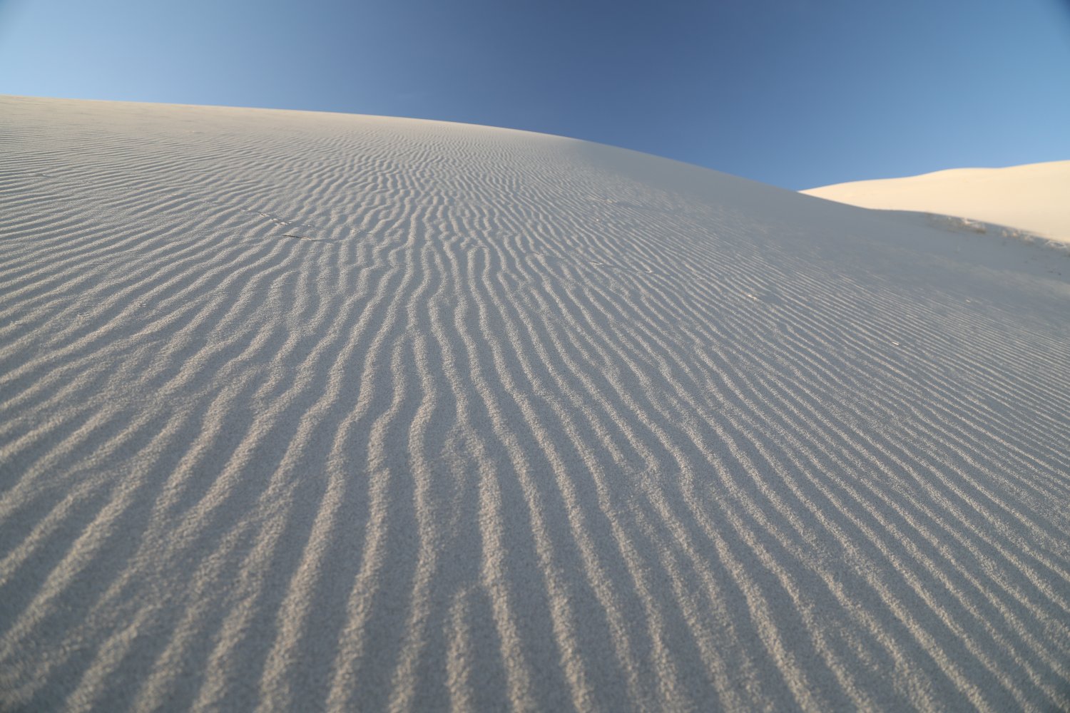
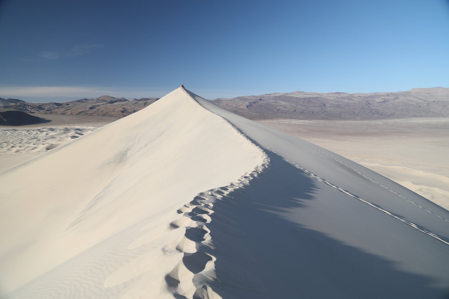
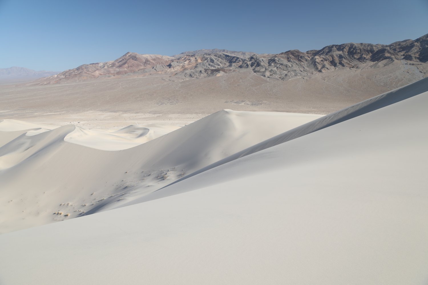
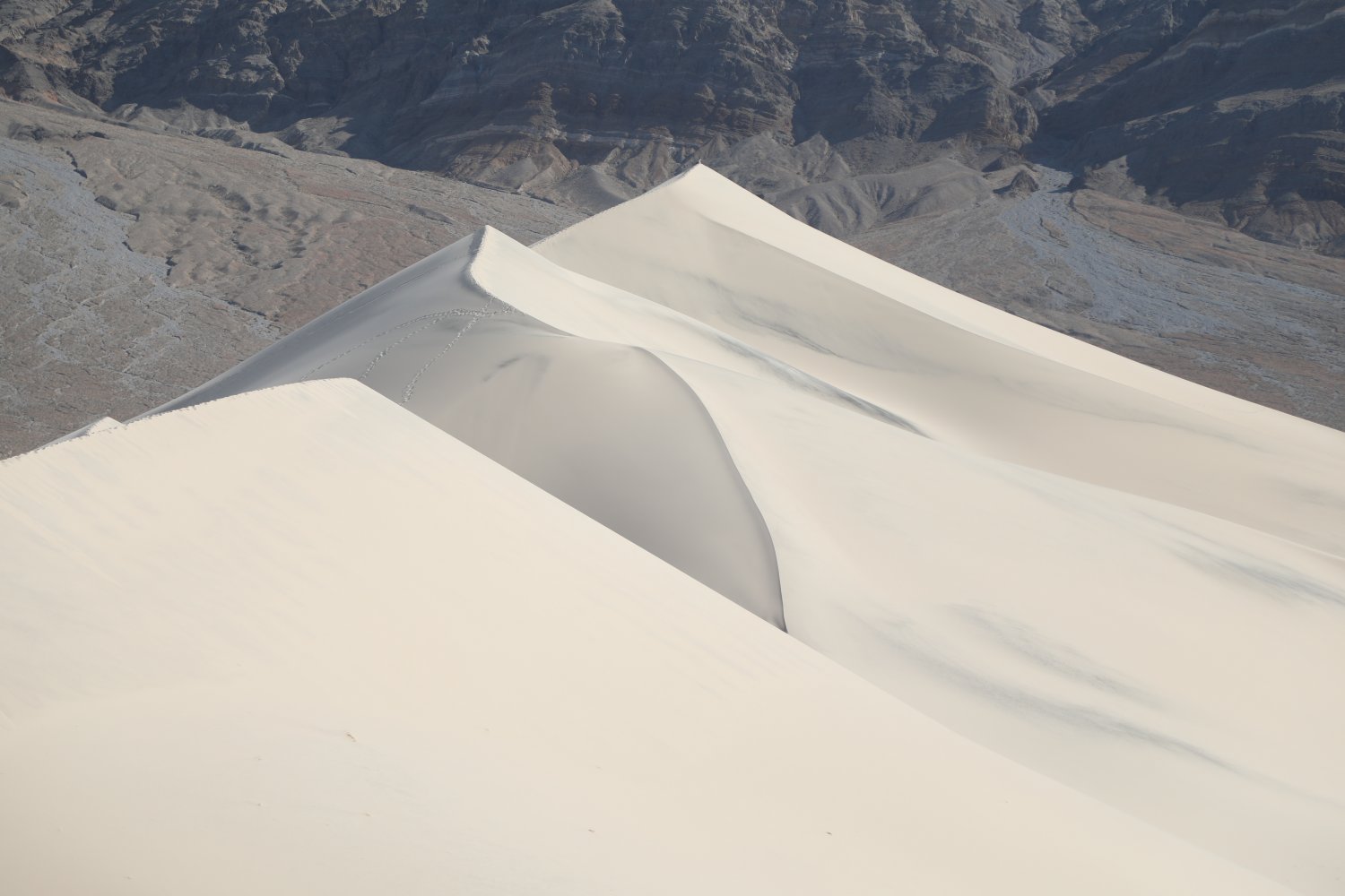
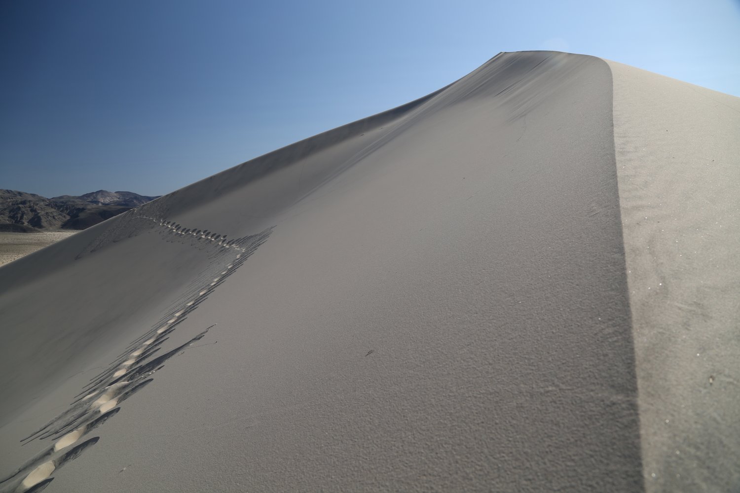
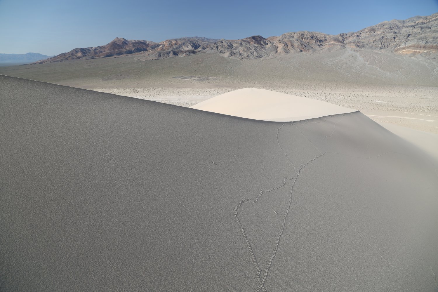
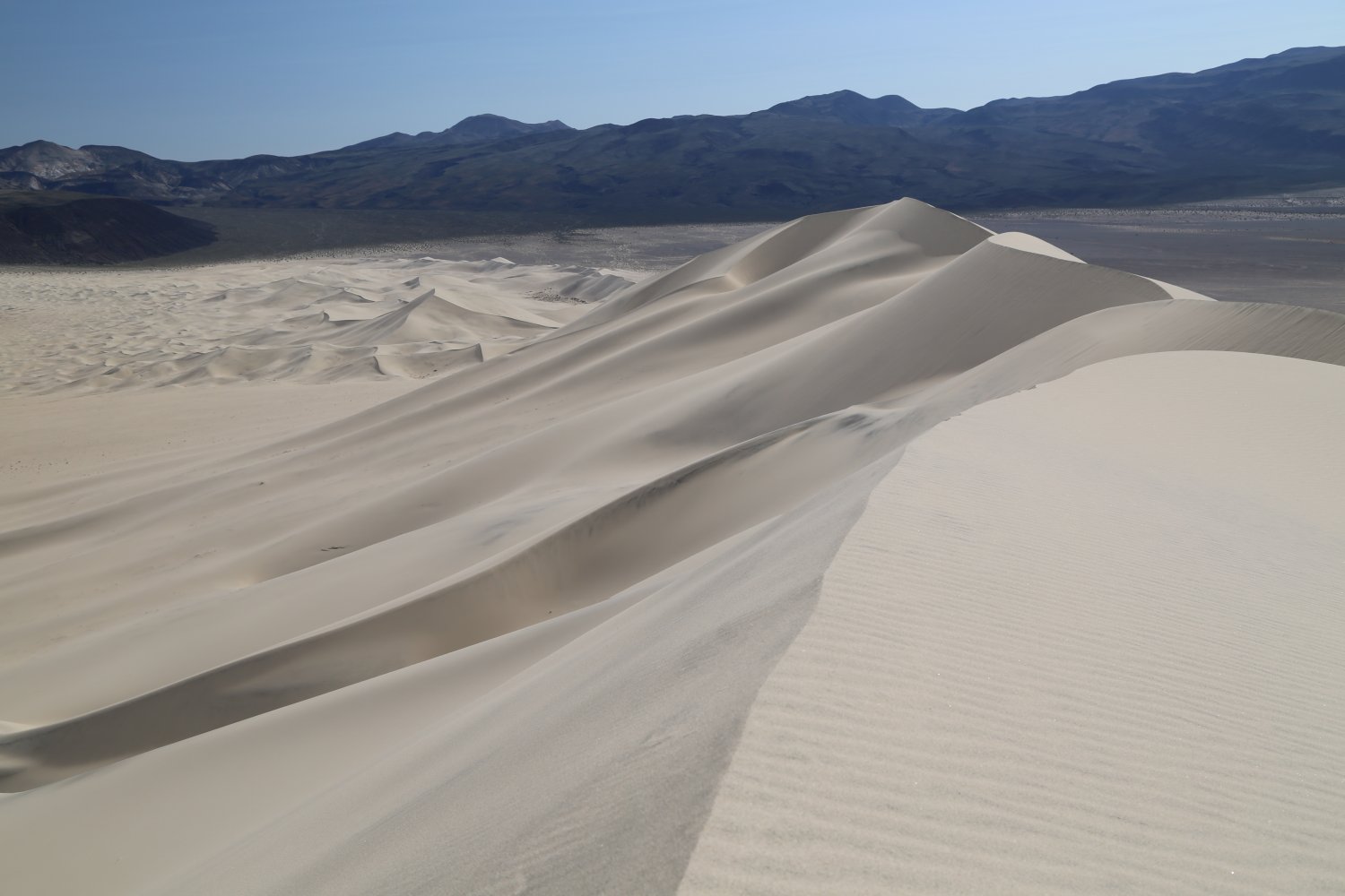
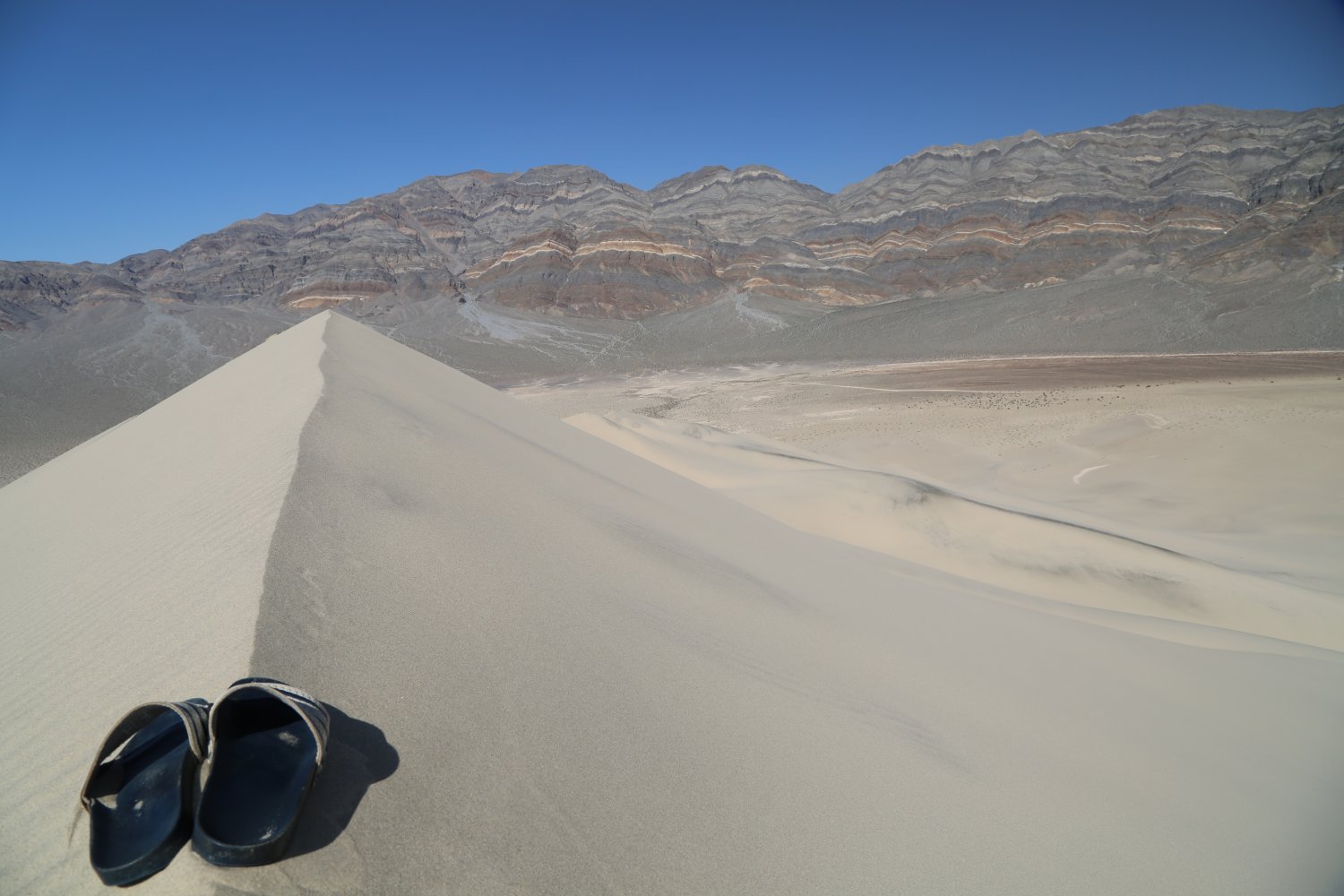
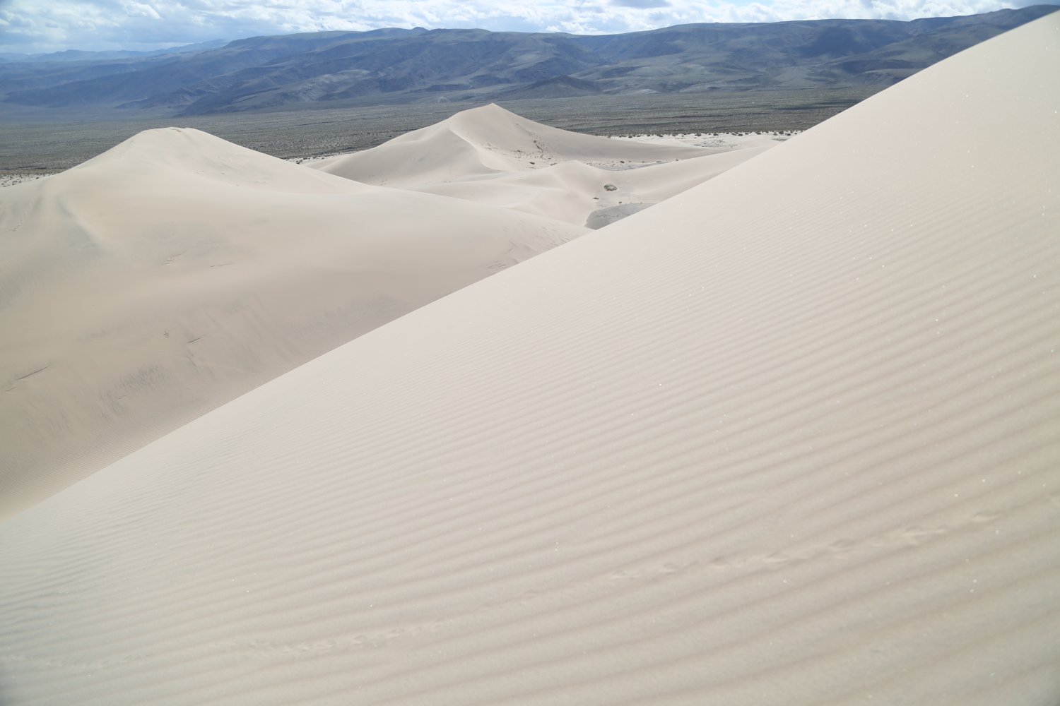
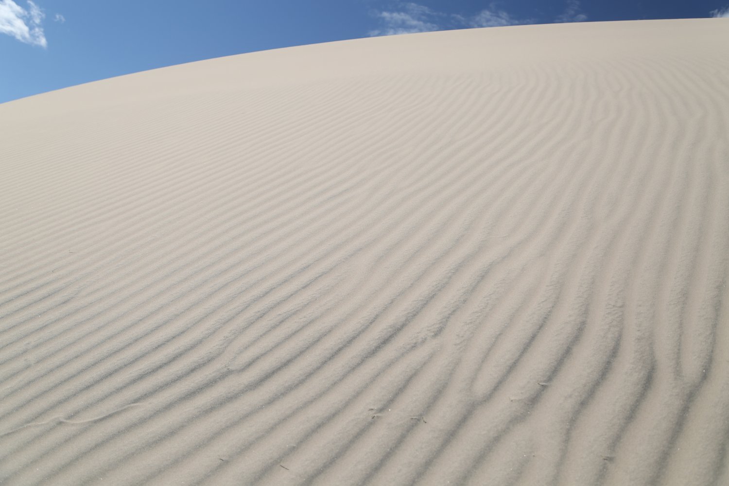
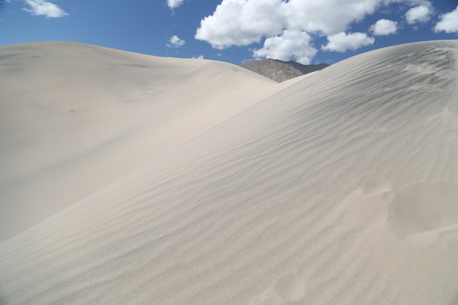
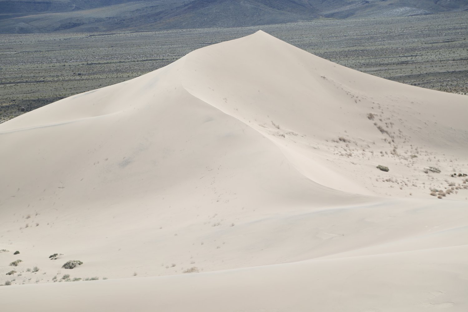
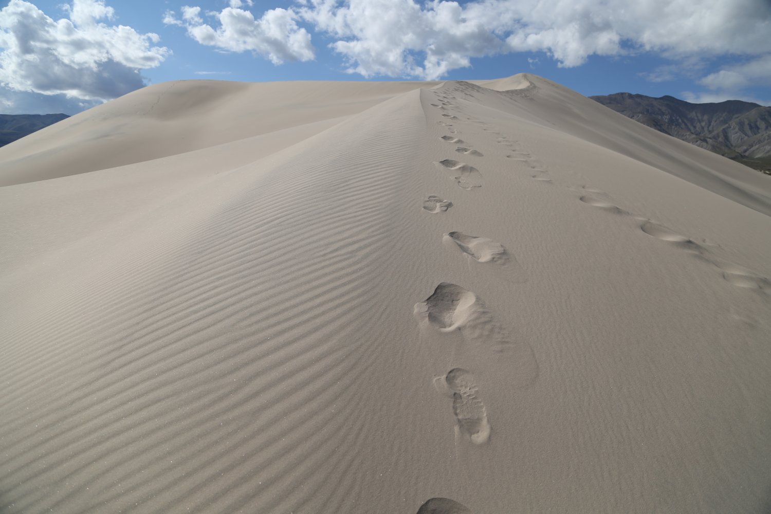
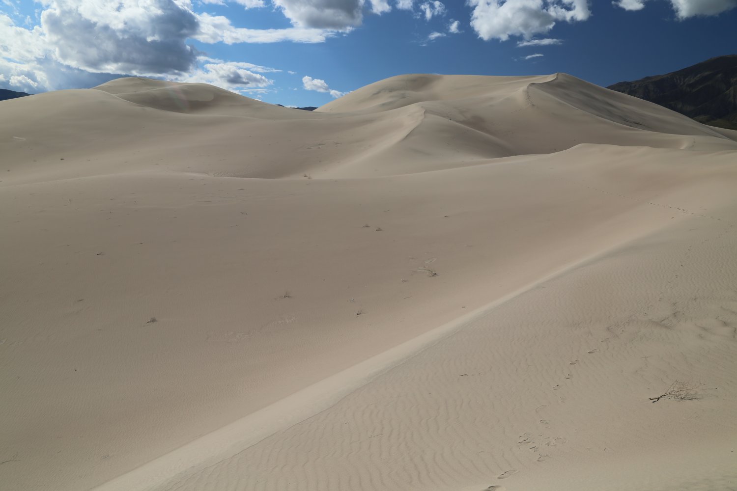
Visually and historically, these are impressive dunes. They are California’s tallest and are estimated to date over 10,000 years. A hike to the tallest sand dune is not an easy feat. There are no trails and from either of the two pull out/parking areas on the north side of the dunes it is a bit of a trek to reach. The tallest dune features super steep sides which often you will slip backwards a bit for every forward motion you achieve. If the sand is not hot – we found it is much easier to climb this barefoot. No sand boarding is allowed, return by foot.
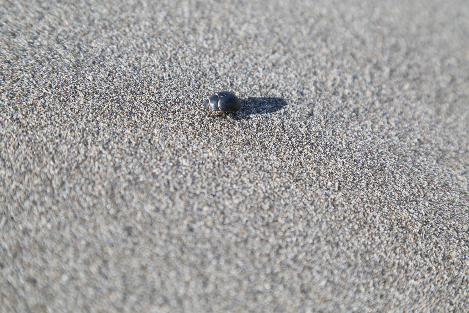
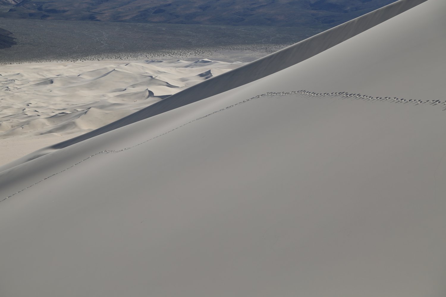
During our climb we spotted a number of beetles (some species of these beetles are endemic to these particular sand dunes) crawling across the faces of the sand dunes leaving extremely long tracks in their wake. The sand may not always be dry (this part of the park receives a bit more rainfall then other parts); during our climb we spotted ‘outcroppings’ of wet sand high up on the sand dunes – digging in a little revealed sand that was quite moist.
As we slid off the backside of the tallest dune we created waves of sand that moved in front of us creating a rather intriguing phenomena – singing sand! The sand was dry and created a sound similar to a low pipe organ or the rumbling of a distant jet engine – changing pitch slightly depending on the volume of sand sliding in front of us and how fast we slid down. When one is sliding down this steep dune the sand truly vibrates as the sound is produced – making your body vibrate as well. This is a very neat experience.
View our video below for this cool natural feature!

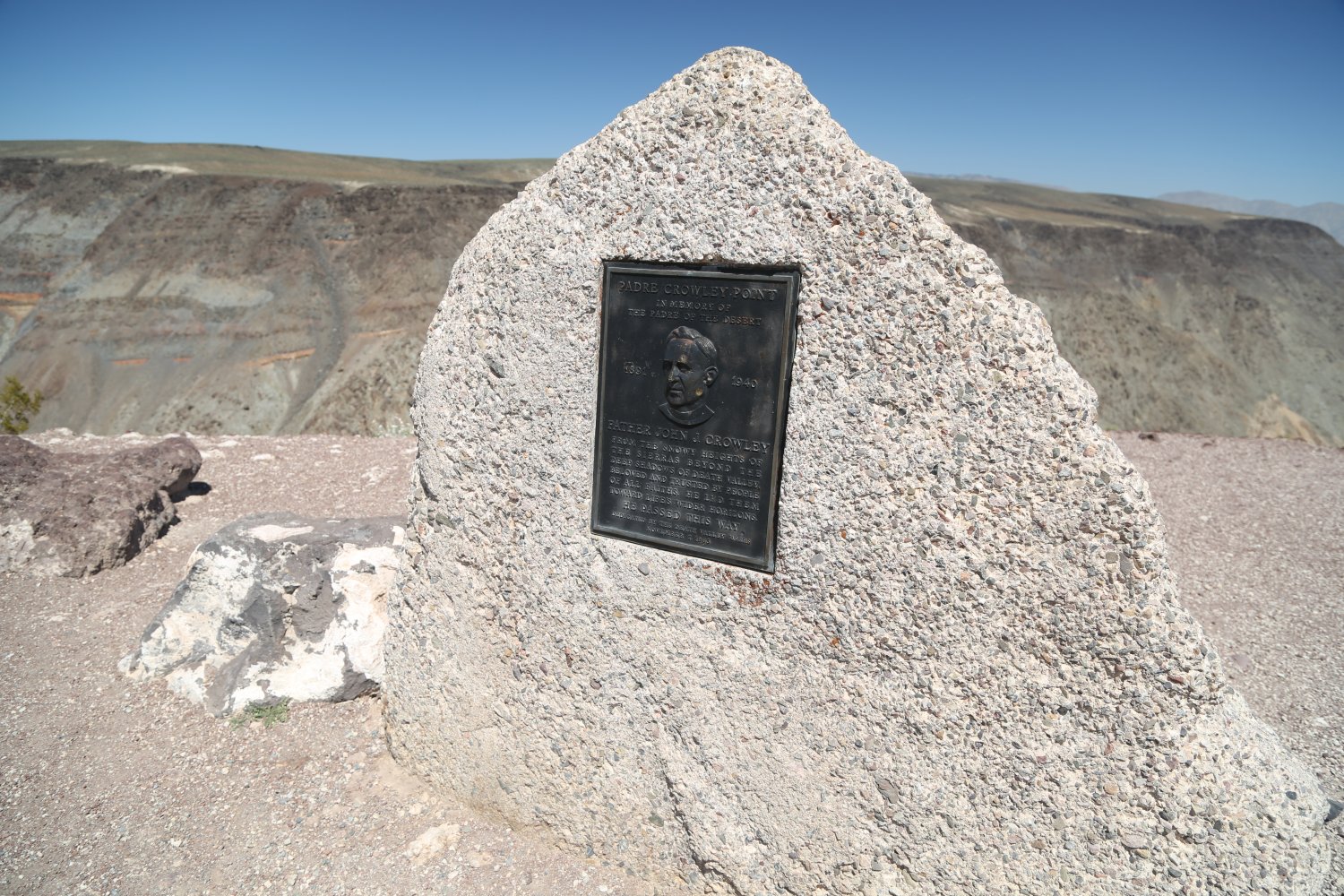
 Father Crowley Overlook is a paved parking lot offering excellent desert panoramic vistas – located about 15 minutes driving from Panamint Springs (along the very windy and steep Highway 190). Named after Father John Crowley a prominent and well-liked priest who once said the first mass on top of Mt. Whitney and was involved in helping mediate the water wars in the Owens Valley. His parish was huge – from Bishop to Barstow and all points in between. A small plaque bearing his likeness is located at the rear of the parking lot. Father Crowley died in 1940 when he struck an animal while driving on Highway 14 north of Red Rock Canyon State Park.
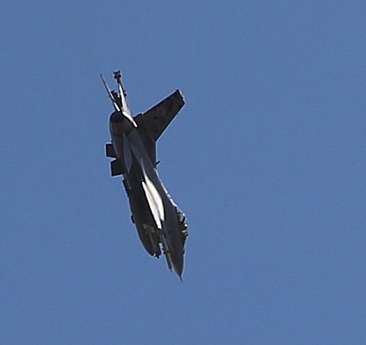
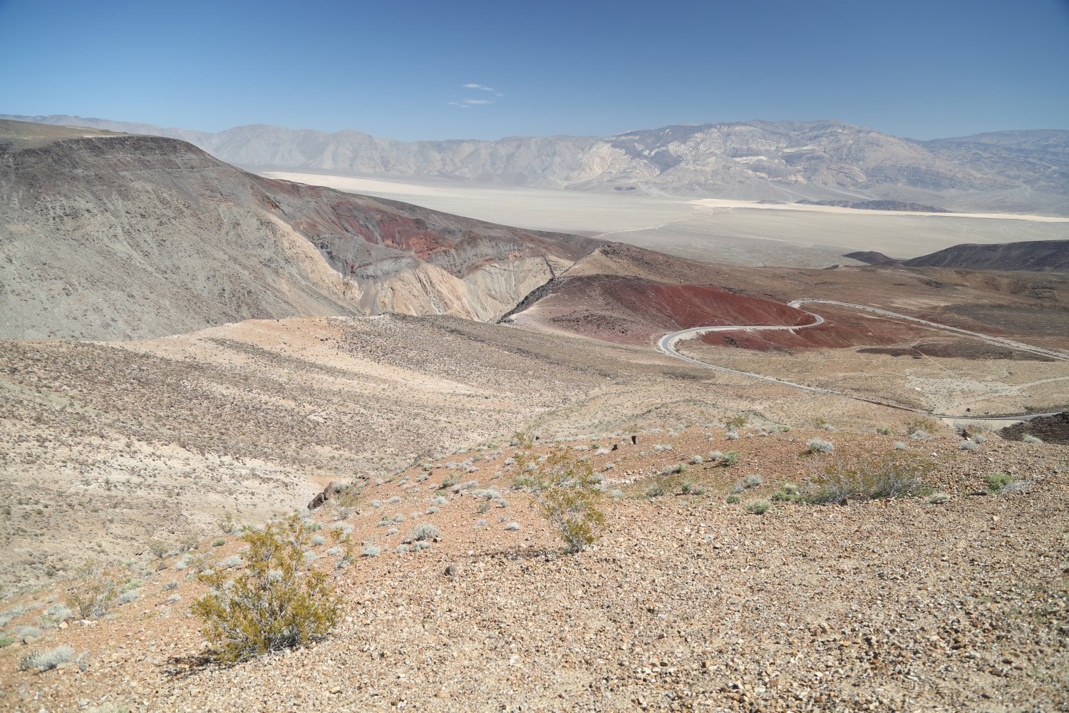
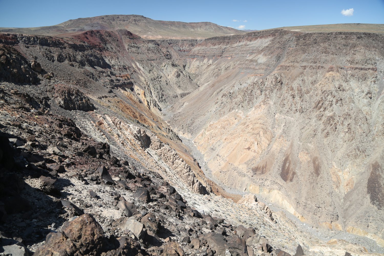
The views from the lookout are not of Death Valley proper (despite being in the National Park) but rather of Panamint Valley – the valley just to west of Death Valley. The canyon one sees from the lookout rim is Rainbow Canyon or commonly called Star Wars Canyon – or referred to as Jedi Transition by the United States Airforce. The canyon features little vegetation but is appropriately named for its myriad of colorful rocks and soil strata.
The lookout is popular with visitors waiting for combat aircraft to streak through the skies either above or below the rim of the overlook (very unusual in that sometimes visitors look down on fighter jets). There is no set schedule for when they fly – although we have noticed that the jets take to the skies earlier in the morning rather then in the late afternoon. there is no mistaking their rumbling sounds as they approach. This is not the only canyon they fly through – nearby Panamint Valley and other surrounding regions are also used for test flights. And a dirt road leads down to another lookout slightly lower – several pullouts are located along this road and are often populated with waiting photographers. Several restrooms are available at the entrance to Father Crowley Overlook.

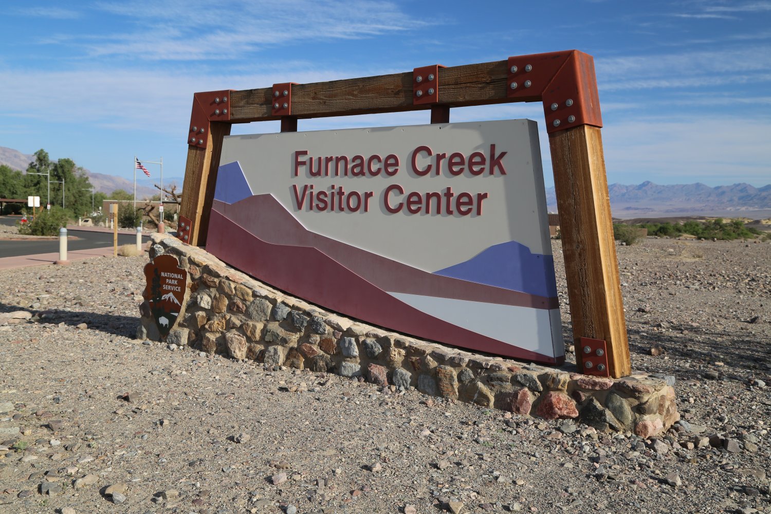
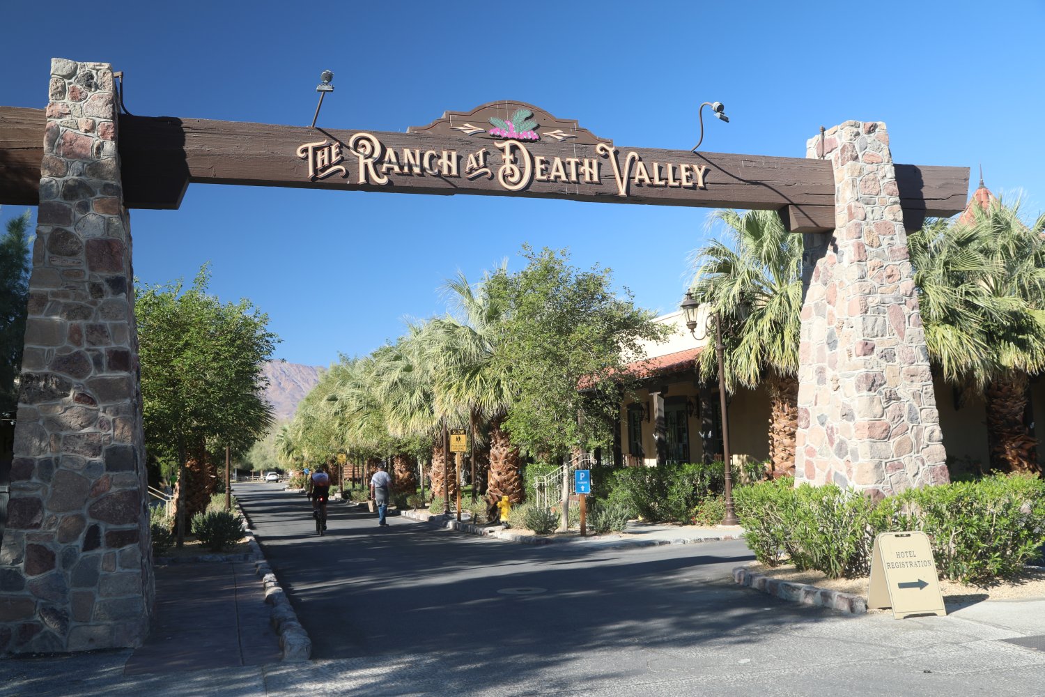
Furnace Creek – this is the hub of activity in all of Death Valley. There are several restaurants here, the world’s lowest golf course (literally), a motel, a swimming pool, a nice museum, a post office a 3000+ airstrip and several other amenities. Consider this place, Death Valley’s oasis!
The Wrangler serves a buffet breakfast and lunch with table service at dinner. The food is a bit above average but the main point is that its all you can eat. Air conditioning is pretty good, bathrooms are not air conditioned very well. The best store and gift shop in Death Valley is located at this ranch. Here you can fuel up on water and supplies including a good selection of souvenirs.
A Chevron gas station is located right next to Furnace Creek Ranch – beware that gas is extremely pricey here…some of the priciest in the state (well… Panamint Springs sometimes has even higher priced gas – on the park’s western border). The entrance/driveway to the visitor’s center (first opened in 1960 and was completely renovated in 2012) is also located next to this gas station. This place has great air conditioning – but in the summertime as with most places in Death Valley the water is quite warm. An impressive (especially when showing temperatures above 120 degrees) easy to read digital thermometer greets visitors on the walkway into the visitor’s center.
Entrance fees can be paid here using the kiosk if you have not done so already. There is a lot of parking and a select number of spots are under impressive looking shade coverings – only several spots have the luxury of being under shade trees. There are rangers on hand to greet you at the main counter as you walk inside. If you have any questions about the park, they are the ones to ask.
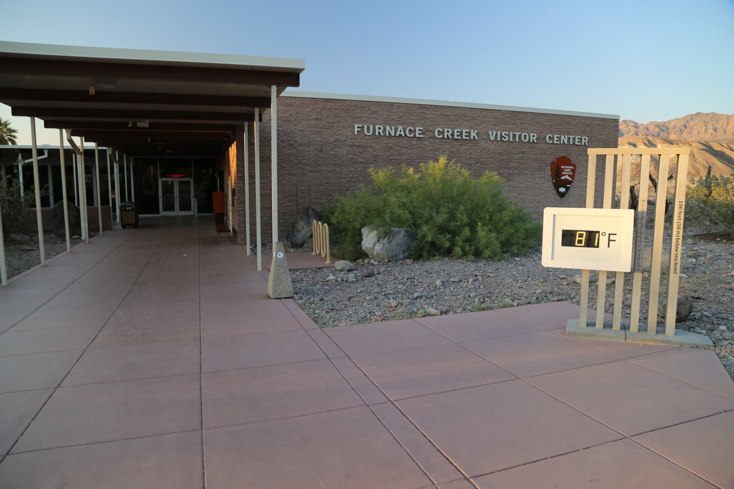
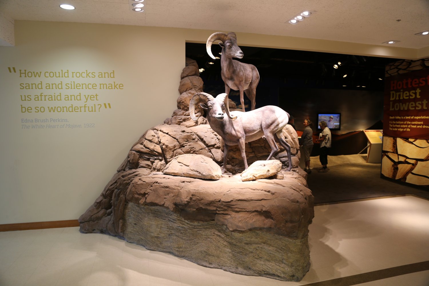
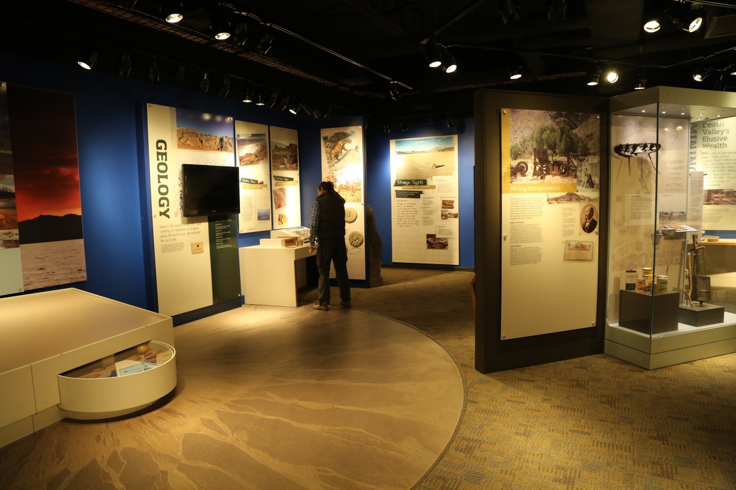
There are three parts to this visitor center. One part of the visitor center contains books, clothing and other souvenirs. The main part of the center contains exhibits and pictures about the history of the park, both cultural and geological. Some of the exhibits will talk to you with a push of the button. The last part of the center is a small auditorium where the park service shows a slide show for free, a few times every hour or whenever there is enough interest. When tour buses pull into the parking lot this auditorium fills up very fast.
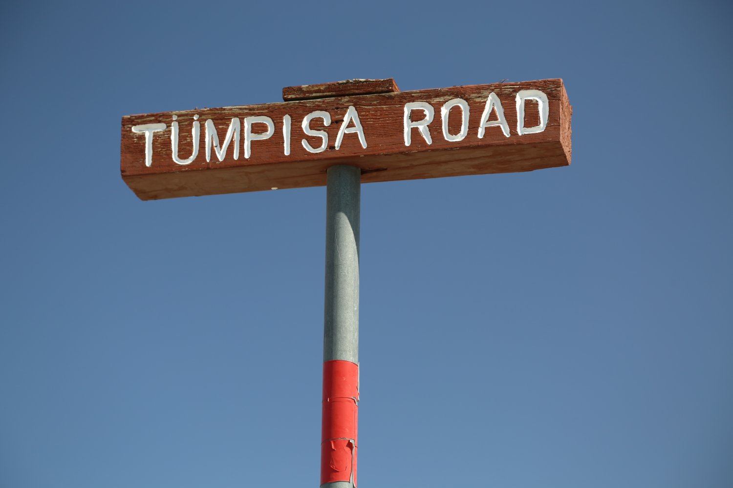
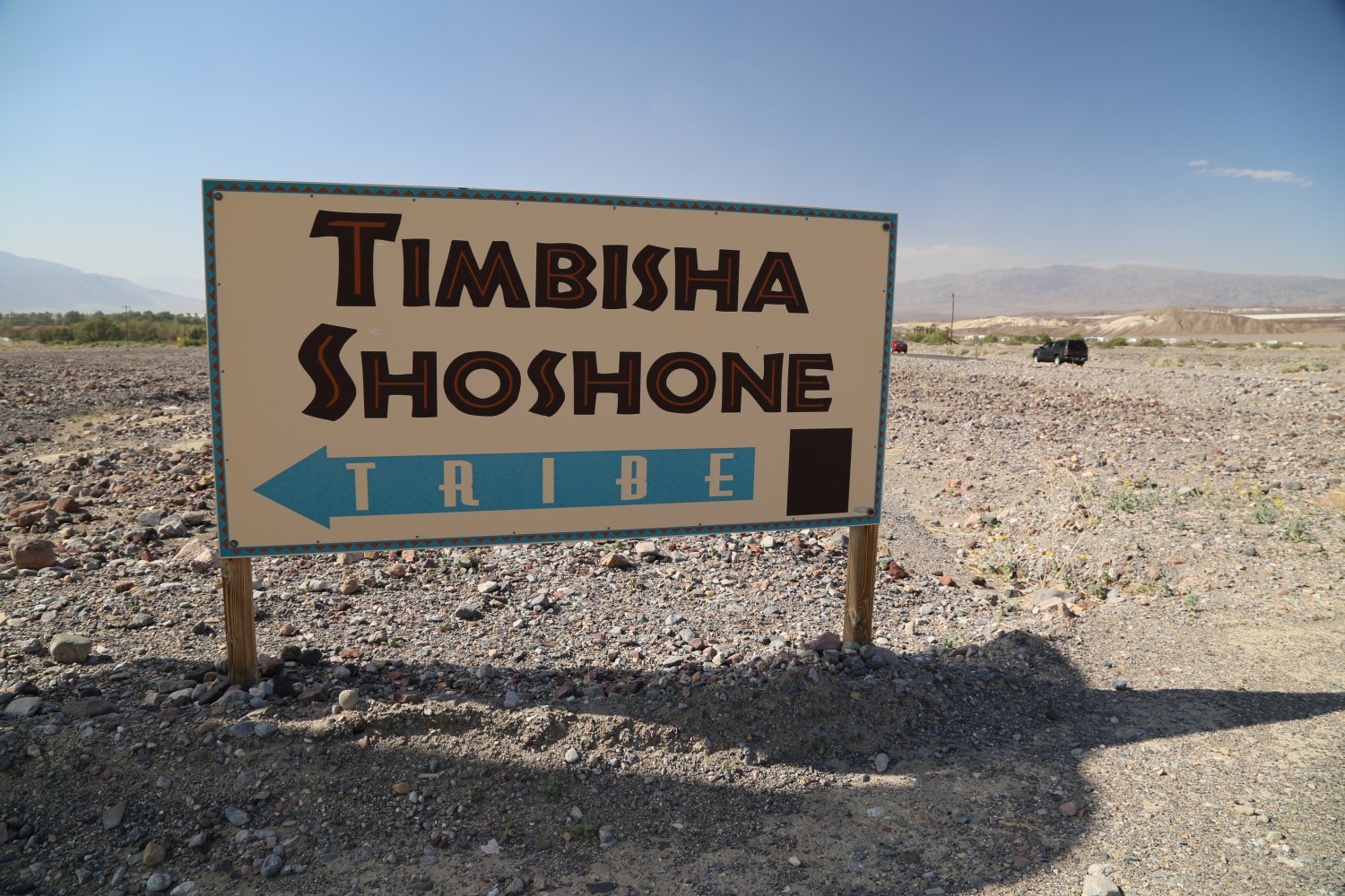
The Timbisha Shoshone American Indians live right next to Furnace Creek. It is interesting to see how some of their homes are built – some of the homes are half constructed of stone brick and join parts of a trailer or wooden house. They have plans to build a tribal museum. And it would be nice to see them better represented in the Furnace Creek visitor’s experience.


 Golden Canyon is located on the eastern side of the road leading to Badwater just a a few miles from Furnace Creek. The trail head is just off the main road at the end of a paved parking lot. The trail leads up the middle of an old canyon – looks like there used to be a paved road up part of this canyon but many flash floods later have almost erased the concrete that used to be here.
Several side canyons wind off of the main canyon – these are great for exploring. The first few side canyons on your left side as you walk up the main canyon soon become extremely narrow and steep as they rapidly ascend from the main canyon. We have been far up these in sandals (which are not recommended due to the steepness and loose rock). You can wind your way all the way to near the top of these narrow canyons and when you turn around you will have spectacular views of Death Valley. If you look down and you are afraid of heights, you might be scared at how steep and vertical the narrow canyon walls are!
It is about 2 miles one way to where the trail ends under the “Red Cathedral” walls. The trail’s end is in a narrow bowl surrounded by steep rock walls. Fortunately there is shade here! Shortly before you reach the end of the trail you will see a sign pointing 1.5 miles to Zabriskie Point. This hike meanders through one extremely barren section of land and shade is pretty much non existent. Should you decide not to hike this trail, Zabriskie Point is accessed via car and a much shorter hike from the parking lot (see the bottom of this page for details) A bathroom and when in stock, brochures are available at the trail-head. This is Death Valley’s most popular hike.


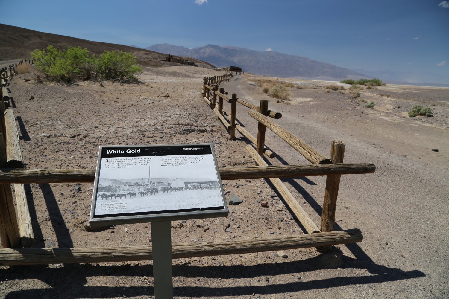
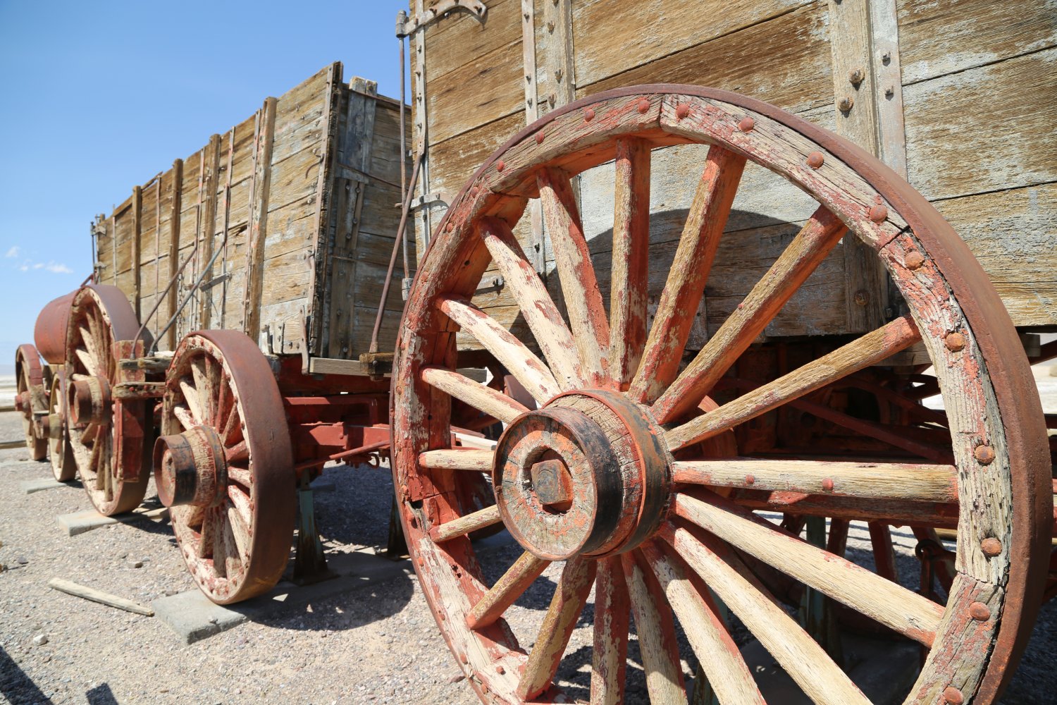
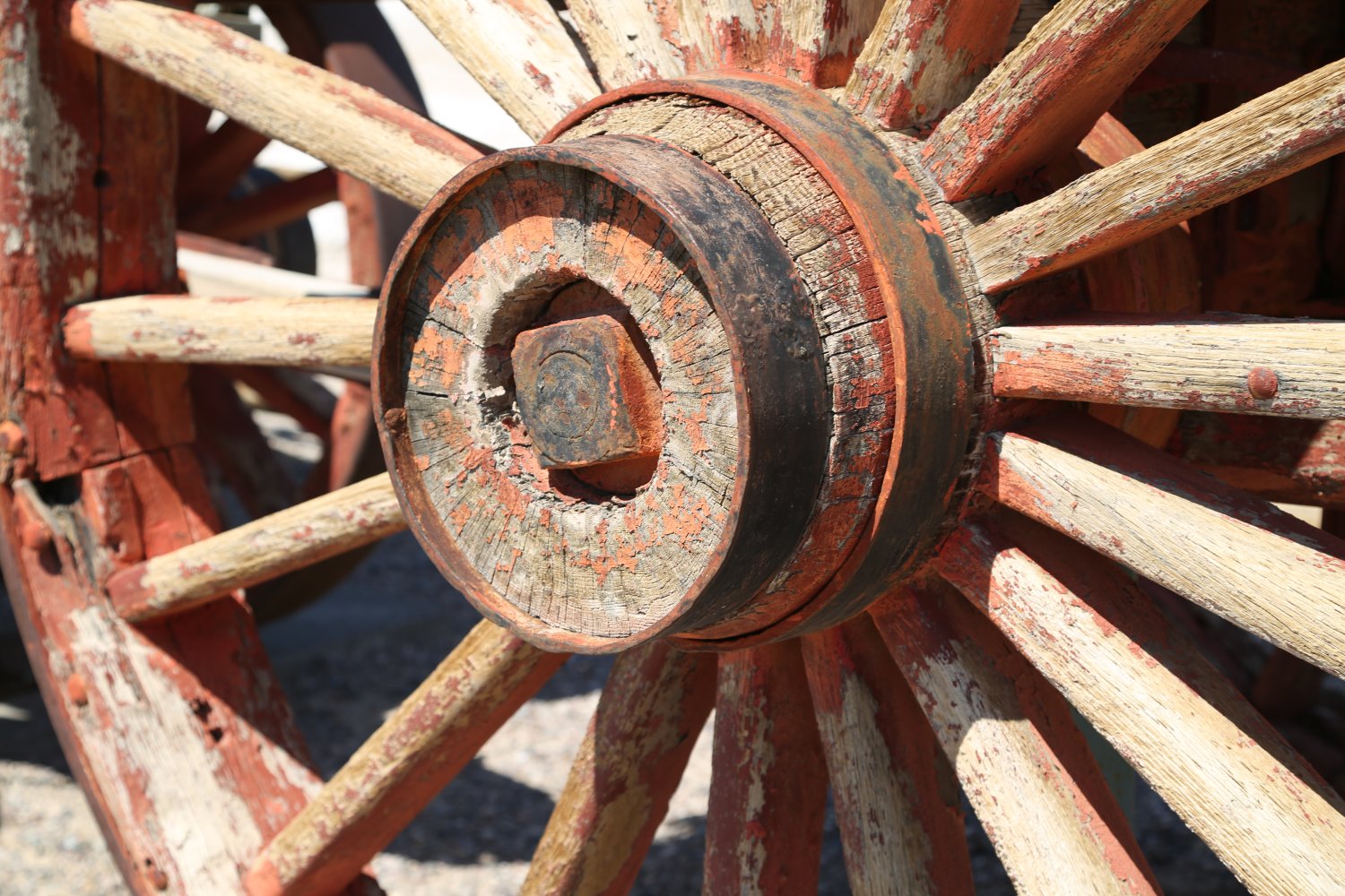
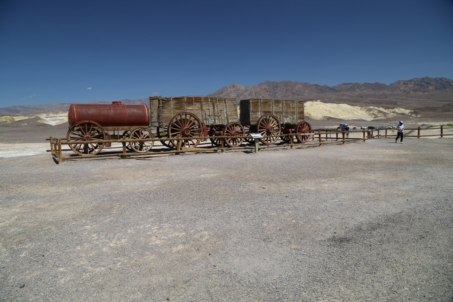
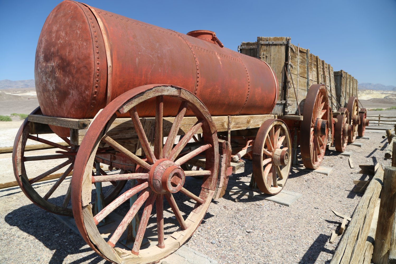
Harmony Borax Works is located about a mile north of Furnace Creek really close to the main road. Drive down a short improved dirt road to reach the parking lot. This is an abandoned partially restored Borax mine which dates from the mid 1880’s. A walking path leads in a circle around some of the equipment.
This mine closed in 1888 after only 5 years in operation. One can still see some crumbling adobe structures on the flats near the mine – where workers lived. Borax was mined for use by blacksmiths, potters, meat packers and even by morticians. For about only 5 years during the mining days, 20 Mule teams carried the product to the town of Mojave (a Railroad Station) to consumers over a stretch of 165 miles of dusty roads – in a train of mules, people and product that stretched well over 100 feet long at times. Estimated visit time 10-20 minutes.
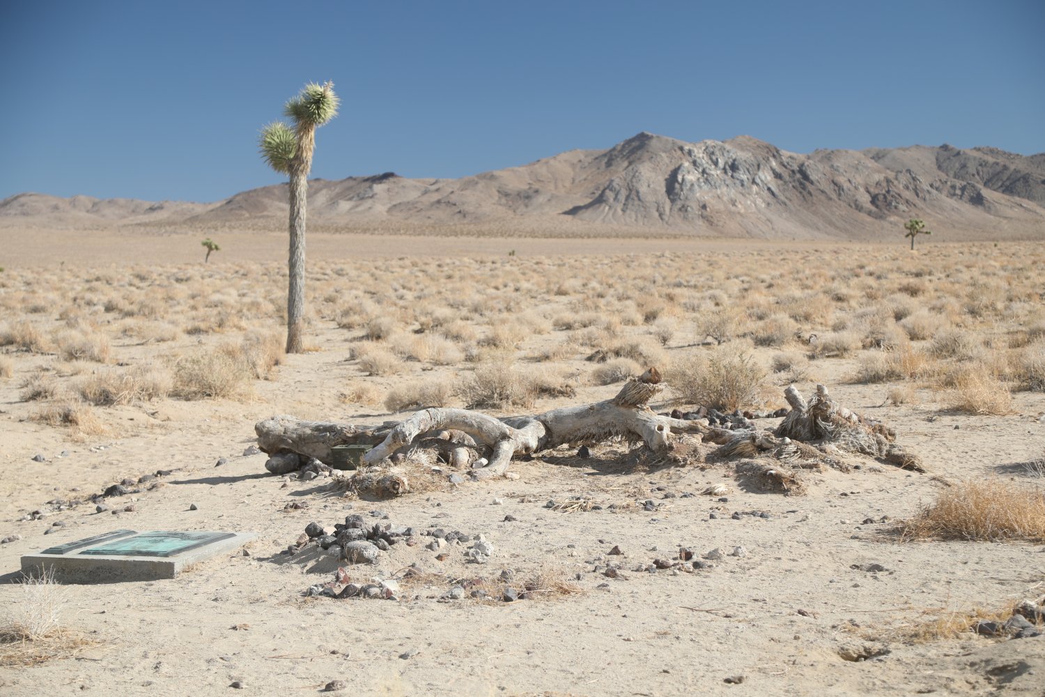
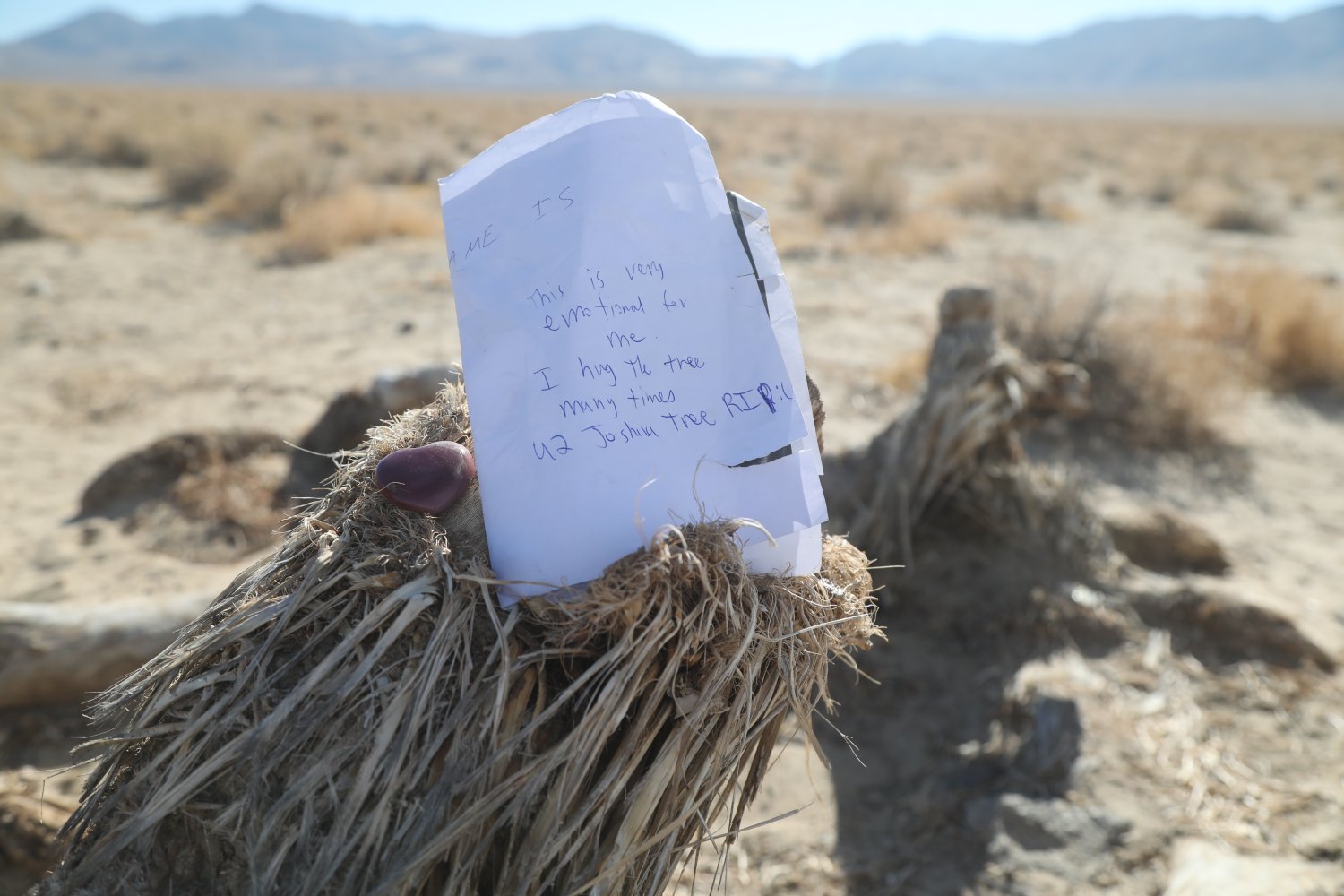
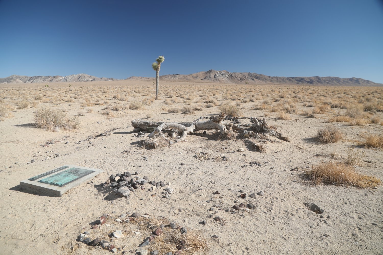
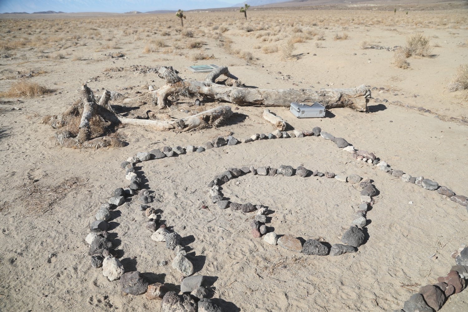
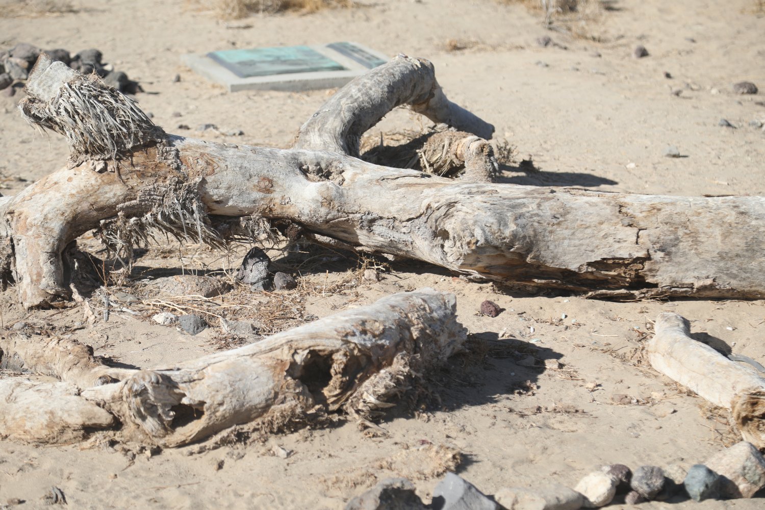
Joshua Tree site, U2 Album. This signficant musical heritage site was used as a backdrop in photos for the now iconic The Joshua Tree album by U2. When we were first introduced to this part of California many years ago, a friend would always play songs from this album. While not inside Death Valley National Park, its within a short drive of the park’s western side – and about a 30 minute drive from Panamint Springs. Its exact coordinates are: 36.330824, -117.745298. The site is within a short walk (5 minutes approximately) of Highway 190 on the north side of the highway. A small pull out area is next to the highway. Several dirt roads also pass by and to the site and one could drive here rather then walk from the highway.
A permanent marker in the ground identifies the site, poigniantly posing the question and song title from the album, “Have you found what you’re looking for”. The now fallen Joshua tree has lost most of its ‘fur’ and sadly died years ago. Surprising the band chose this site for their photography as very few Joshua trees grow here (for comparison there are hundreds of Joshua trees in nearby Lees Flat – within Death Valley National Park) but perhaps the limited number of trees in this part of the desert makes each tree more dramatic looking.
The album was released in 1987 – and over the years this location is no longer a secret. During our visit we spotted several register boxes – each filled with related album mementos, photographs and other notes. And people often create impromptu rock art next to the fallen tree.
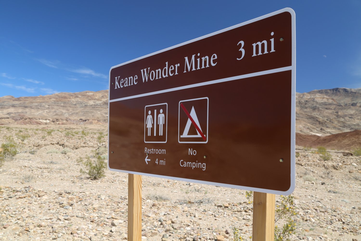
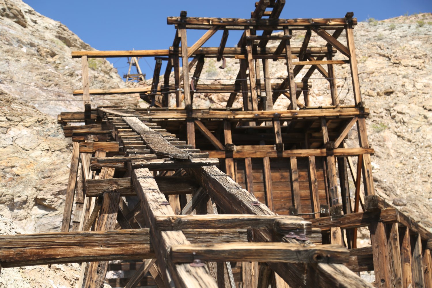
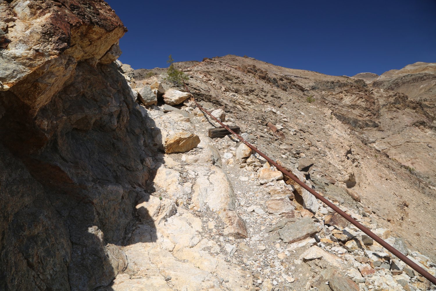
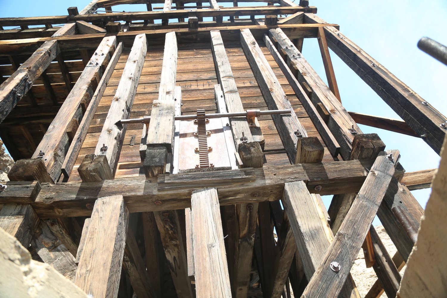
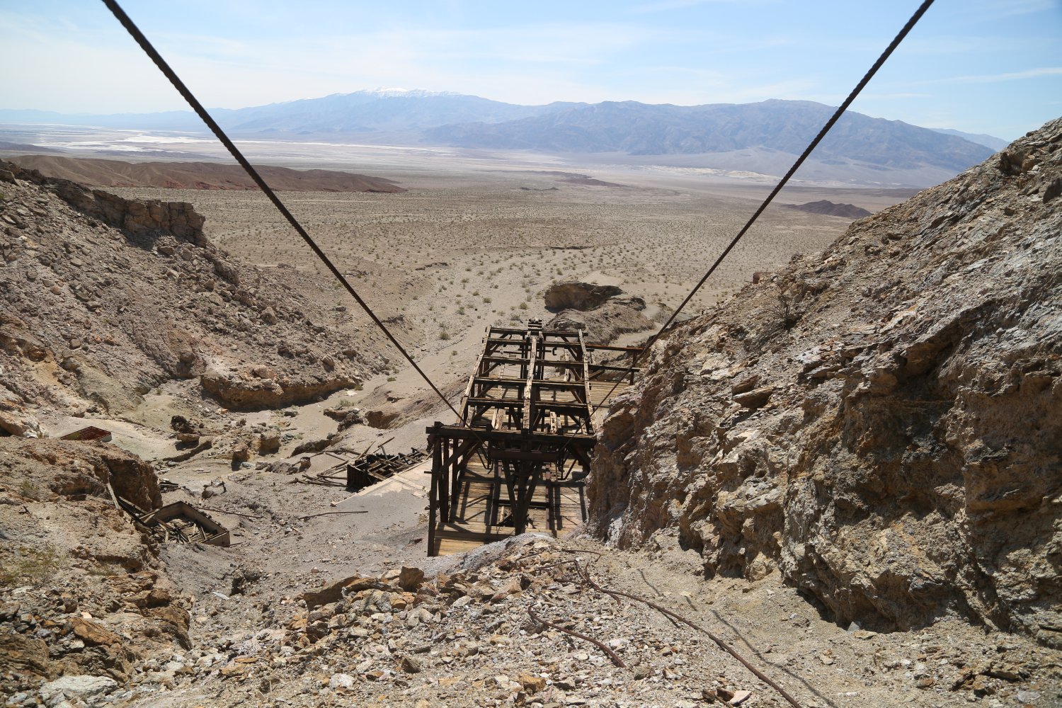
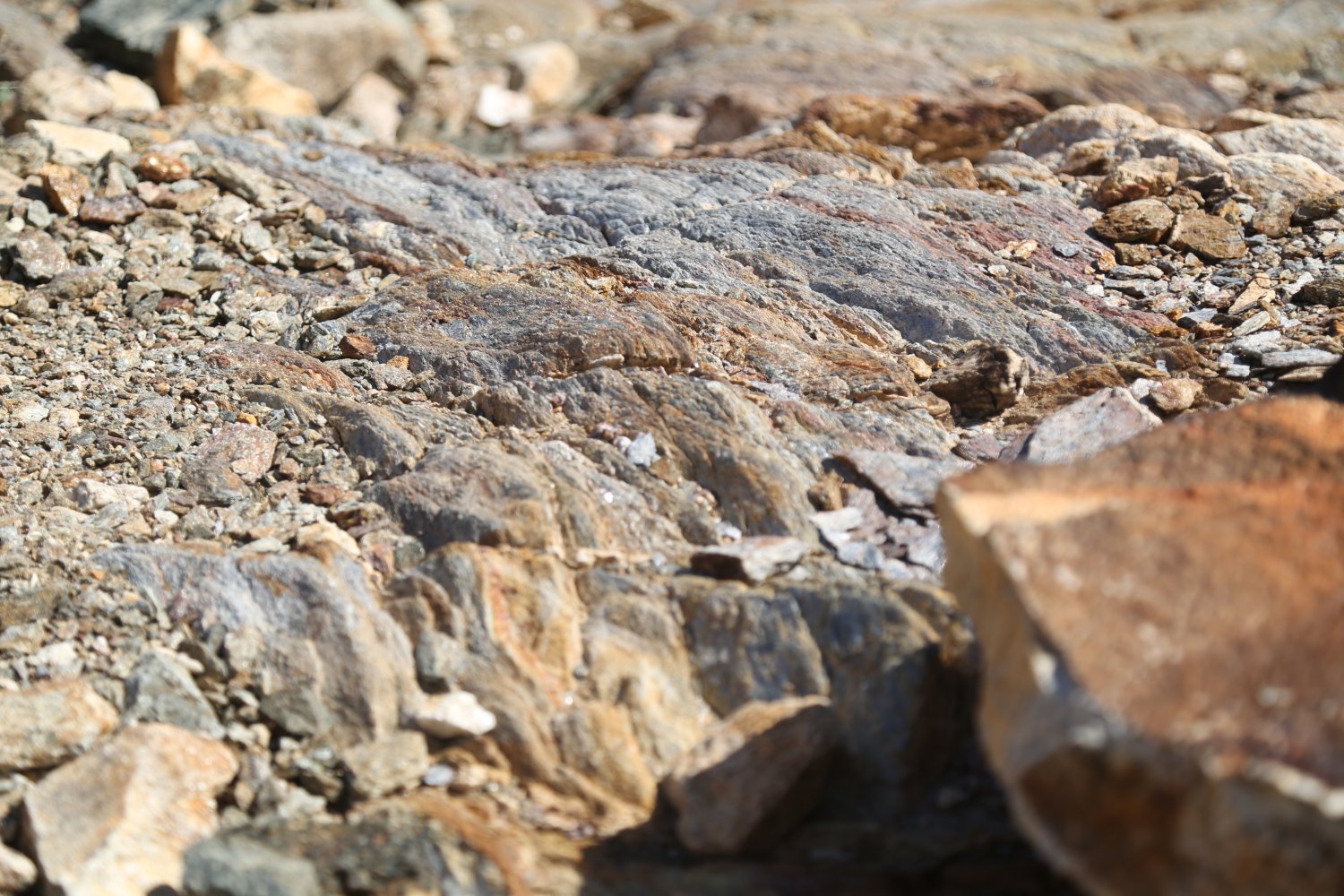
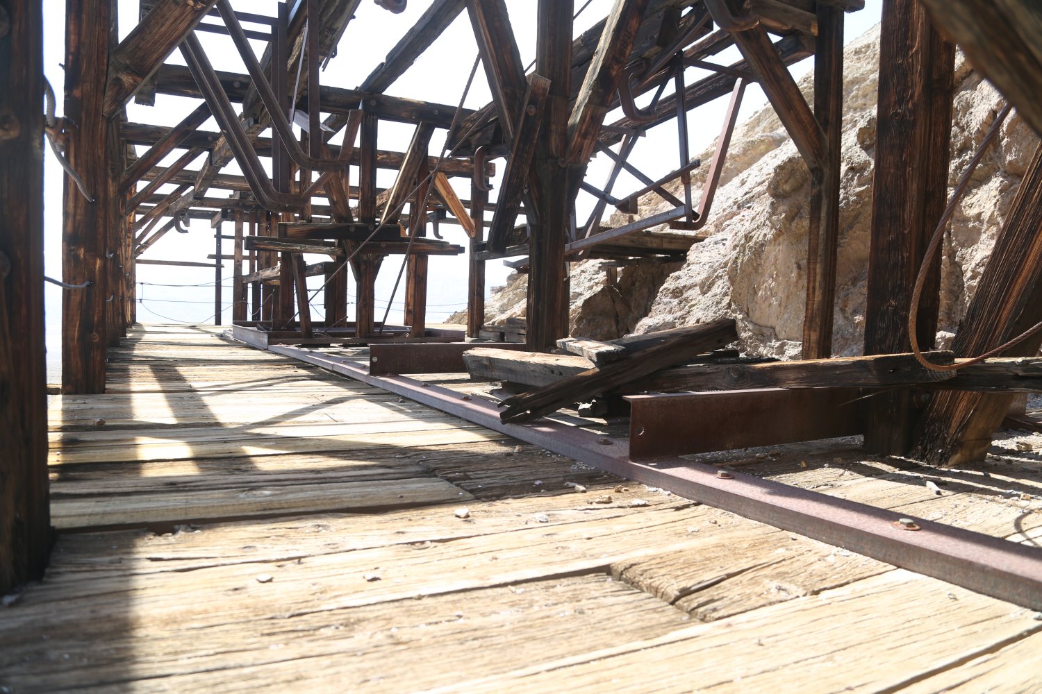
Keane Wonder Mine is located off of the Beatty Cutoff Road (about a 40 minute drive from either Furnace Creek or Stovepipe Wells). The mine is at the end of a 3 mile dirt road – the first part of the road descends gradually from the pavement – before reaching a valley and then ascends until the dirt parking lot well below the mine. The road is improved dirt and certainly passable during dry conditions with a 2wd vehicle. Another dirt road used to connect close to the dirt parking area at the end of the road but the National Park Service has since closed access to this road. One could hike it – its less then a mile and leads to another old mining area.
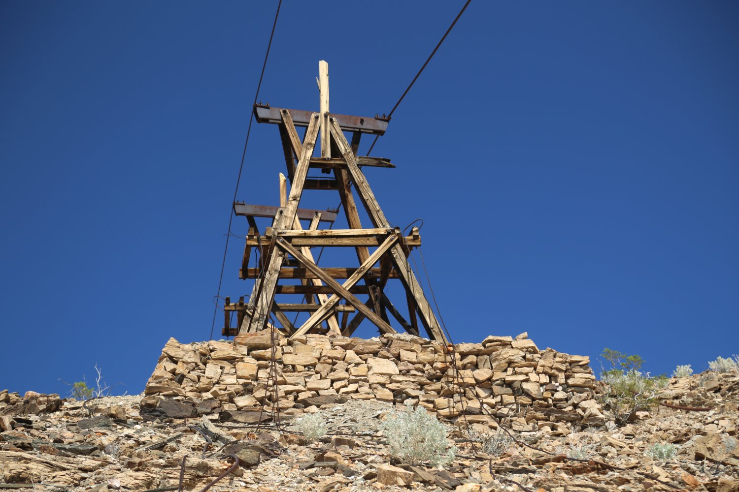
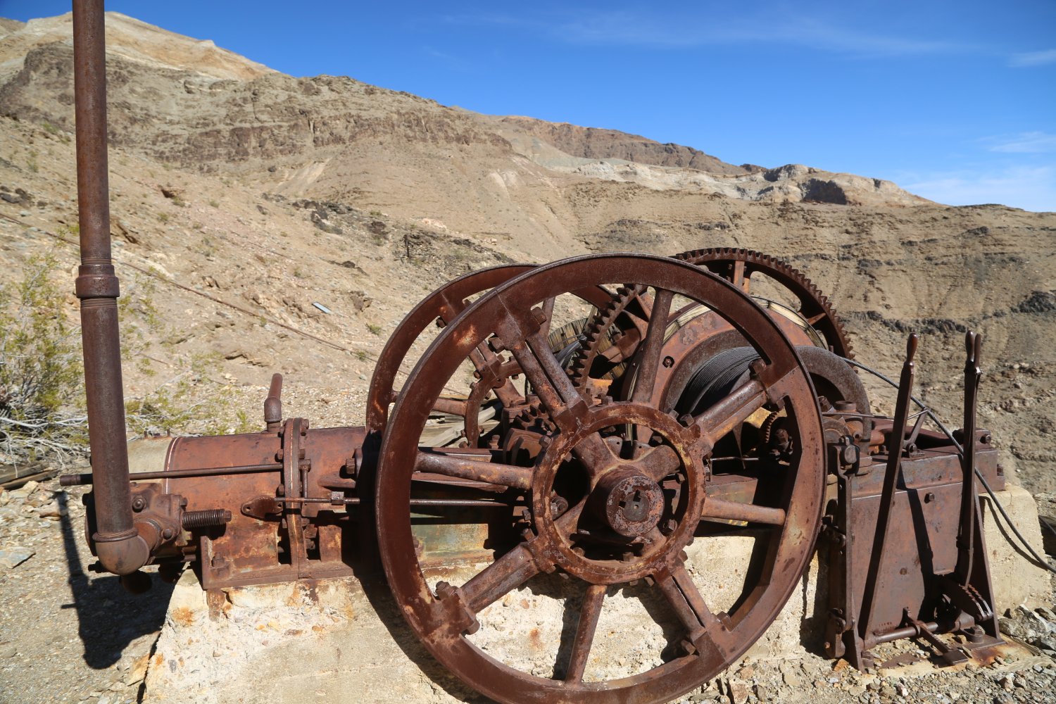
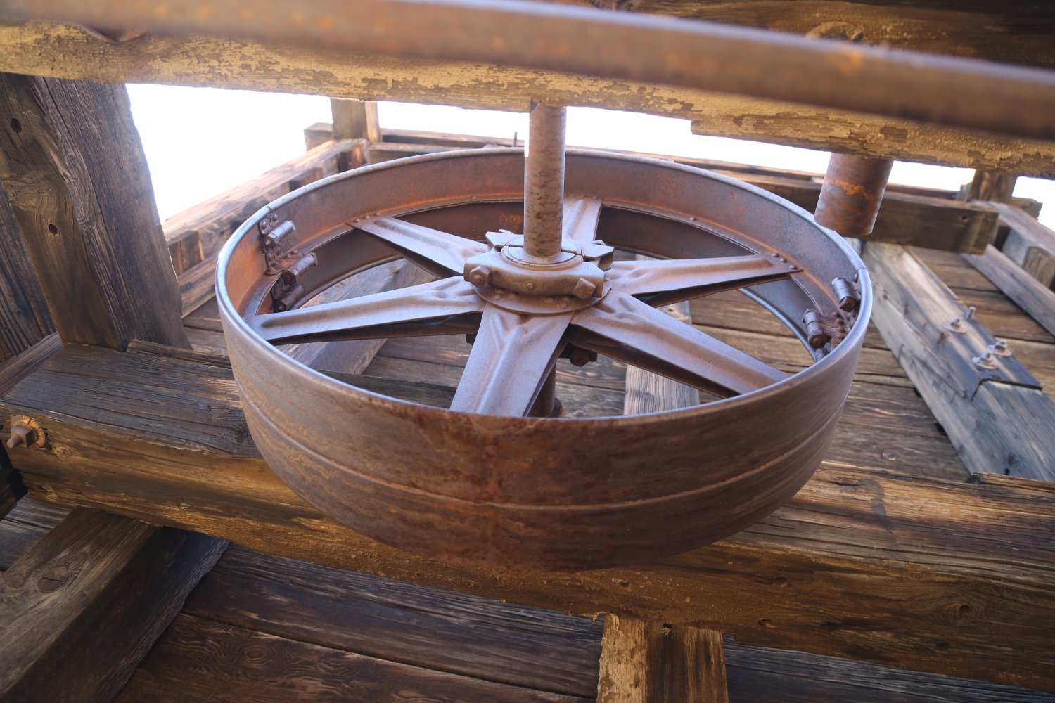
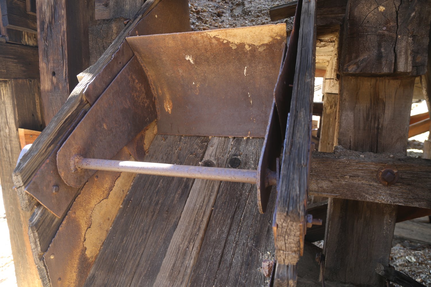
This mine is famous for having an aerial tram used to carry gold bearing ore from the mine shafts (about 0.6 of a mile away) to the processing mill, much lower in elevation. Ore carts used to travel the entire length of the tram. At one point the tram cables cross a long and deep river canyon.
Today some of the tram supports are still standing and one can easily hike to the lower ones from the parking lot (about a 1/4 mile hike, all up hill). Across the canyon three additional supports are still standing and these contain the only still hanging ore cart (a hike in to these supports would be a long and arduous undertaking). A trail leads from the parking lot and immediately ascends rather steeply for what seems like a long ways before eventually somewhat leveling off – this trail runs several miles into the mountains – eventually passing by a number of the mine shafts around 1.5 miles in.
Hiking is in the open with almost no shade along its entire length – unless early in the morning or late in the day when some rock outcroppings above the trail provide some relief. Be prepared for a very steep hike but for some excellent panoramic vistas of Death Valley far below. We hiked an extra 6 miles during our first visit due to hiking in from the Beatty Cutoff Road rather than starting from the parking lot at the end of the dirt road.
The mines were active off and on between 1903 and 1942 when it finally closed for good. This was one of the more successful mines in Death Valley with even a post office for a few years. Without the support of helicopters and modern machinery – the construction of the tram was rather remarkable. The mine was closed to the public for almost 10 years opening again in 2017. Significant safety measures were enacted, primarily covering nearly all of the mine shafts located close to the trails.


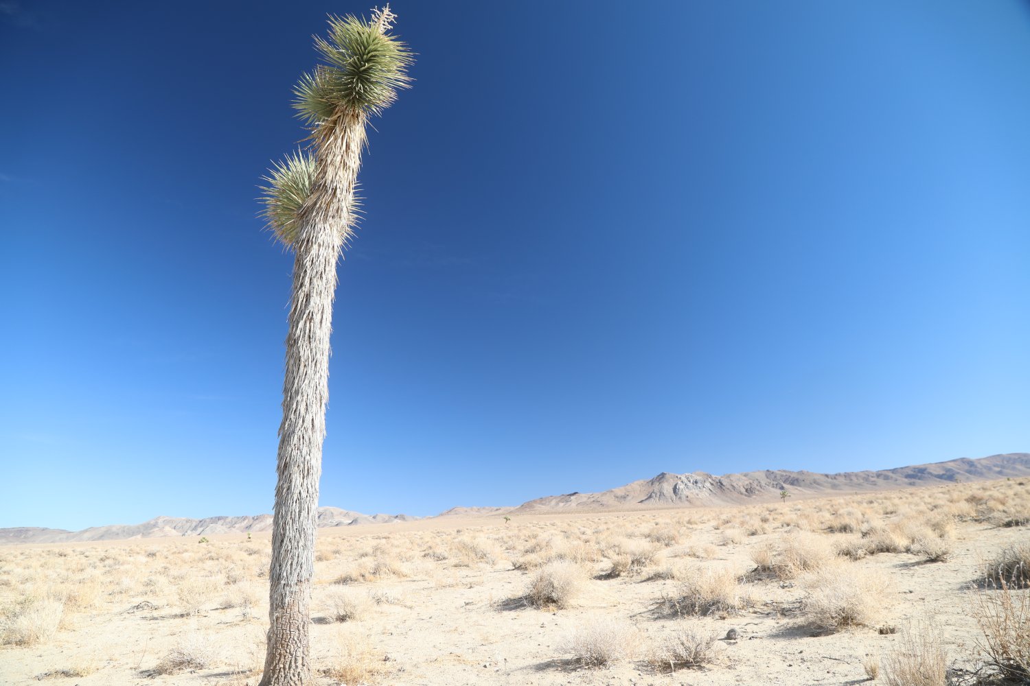
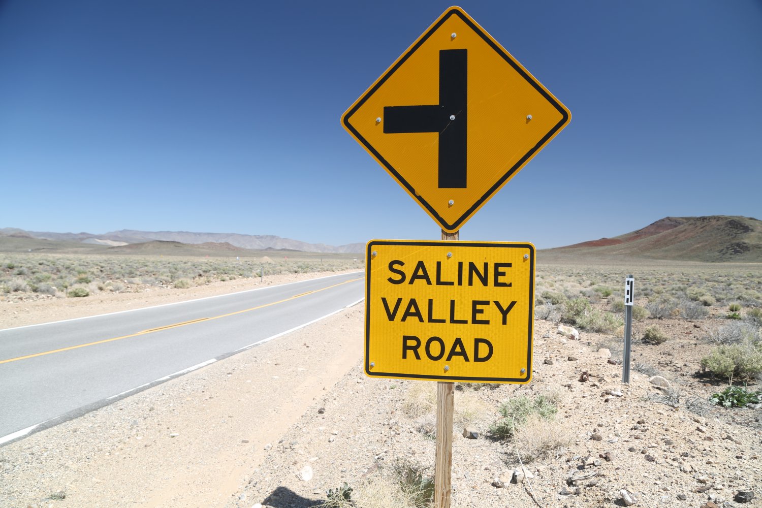
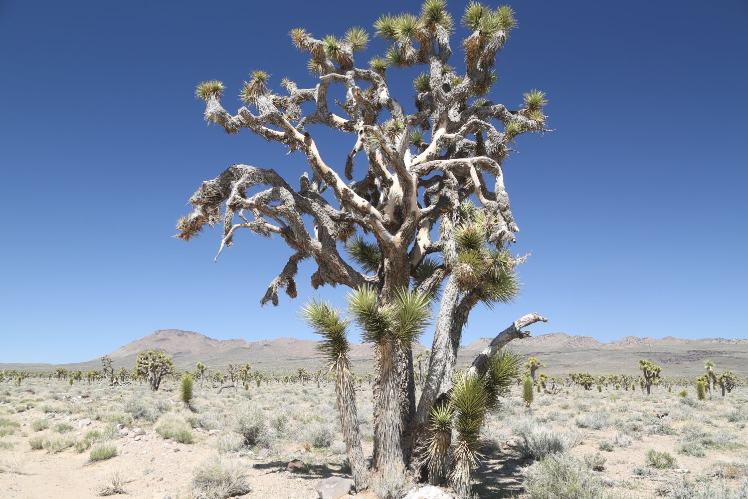
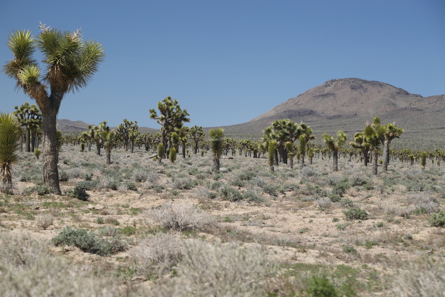
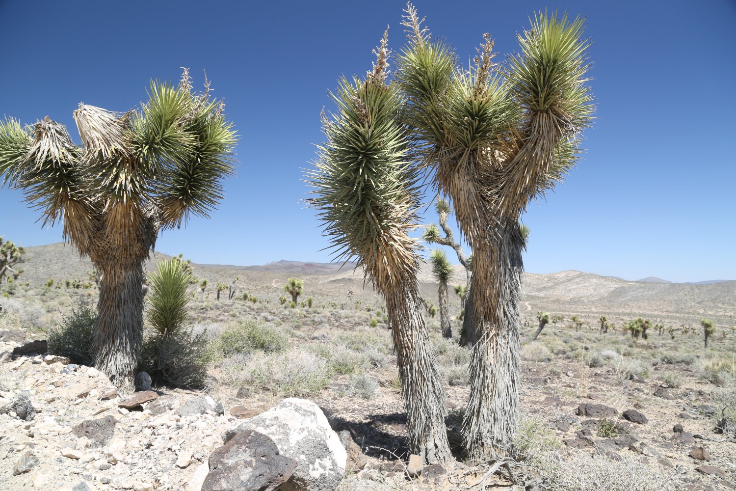
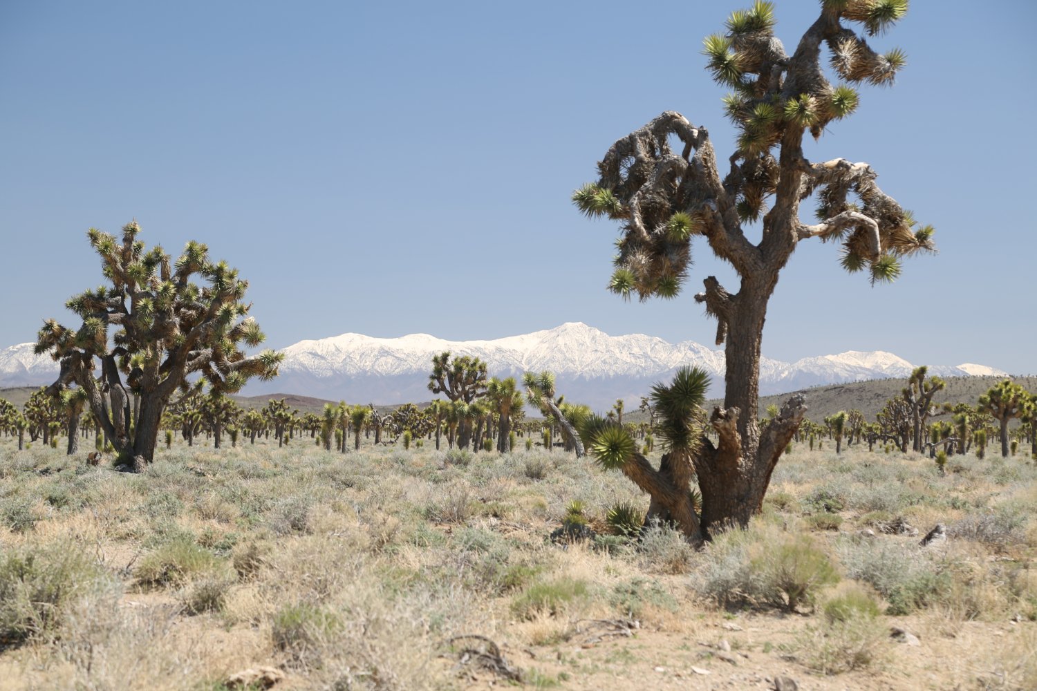
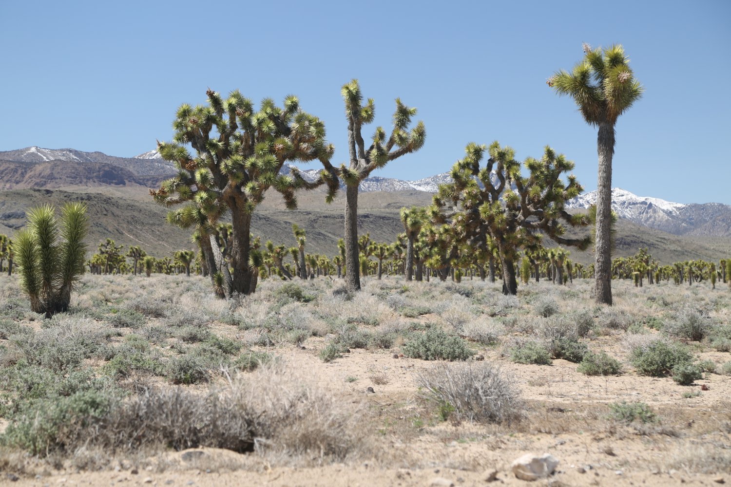
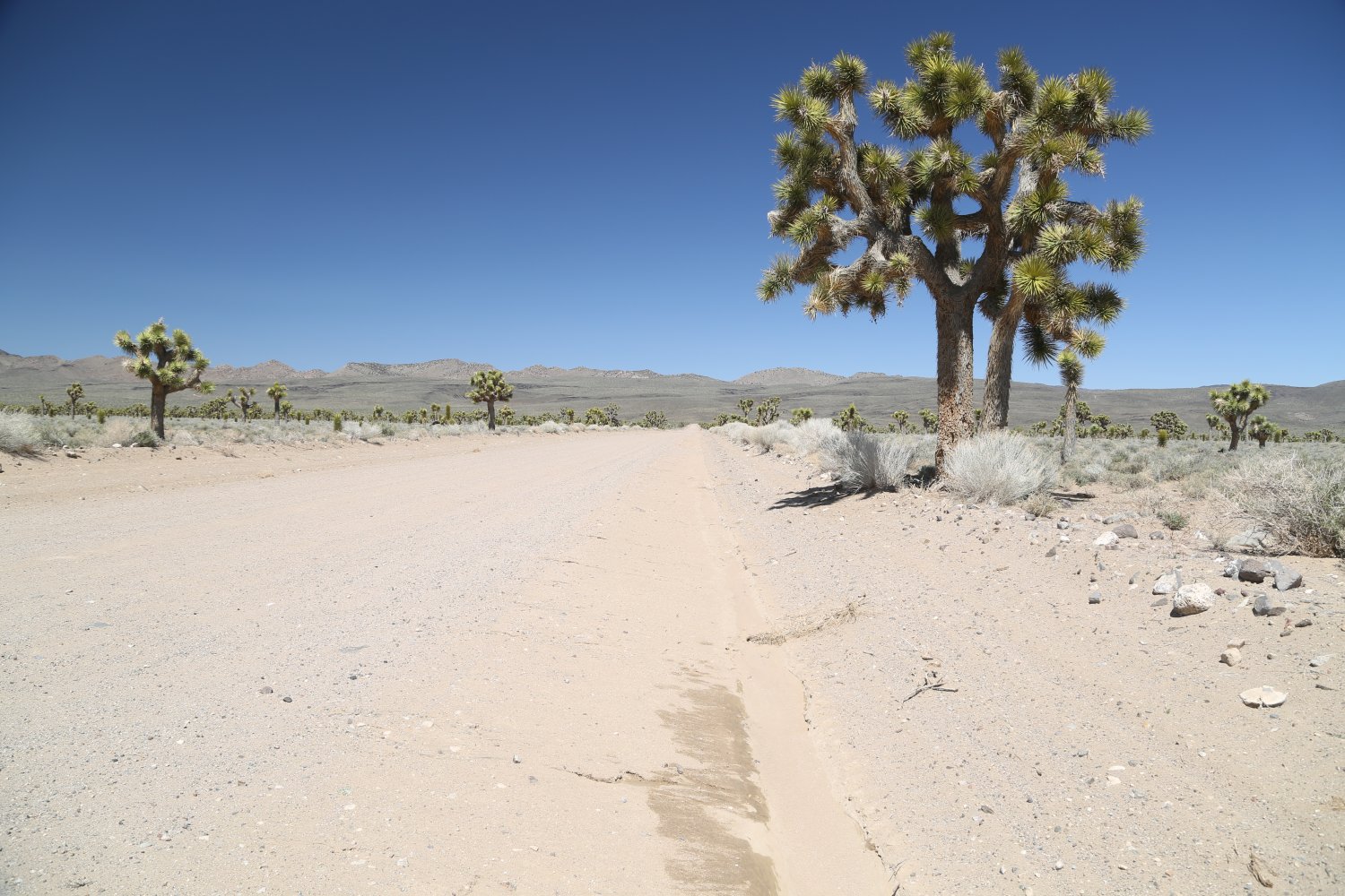
Lee Flat is located about 10 miles in from Highway 190 (about a 20 minute drive) on Saline Valley Road. This is a fairly easy drive – mostly dirt but with some older very worn down pavement sections and should be no problem for a 2wd passenger sedan. Lee Flat contains the largest stand of Joshua trees in all of Death Valley National Park. At Lee Flat the road splits into White Mountain Talc Road while Saline Valley continues. Driving either road will lead one through hundreds of Joshua trees.
It is estimated that as climatic warming continues to increase, Joshua trees will do better at these upper elevations rather then the lower elevations. During our visits we’ve always seen numerous young Joshua trees growing. Despite this being in Death Valley National Park, this is not anywhere close to the warmer sea level elevations on the actual valley floor. As a result it can get bitterly cold here in the winter – especially at night but also during the day.
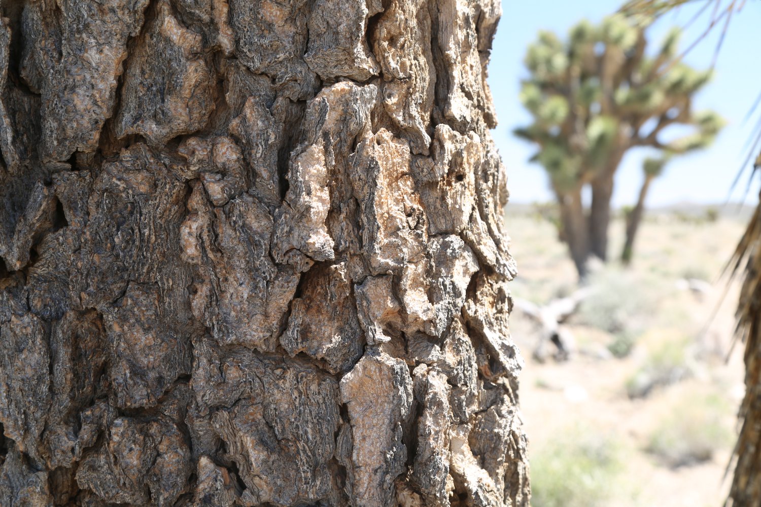
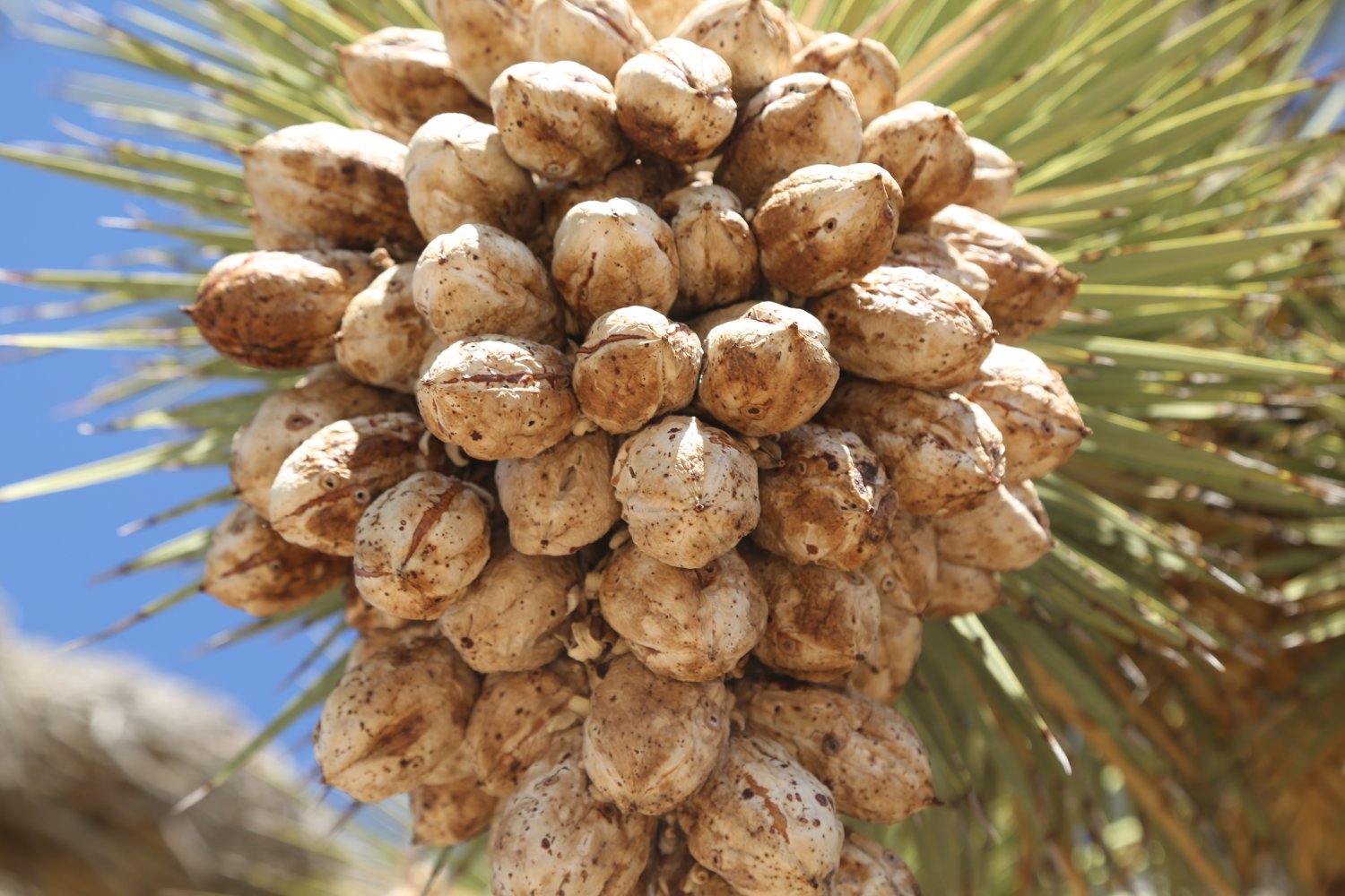
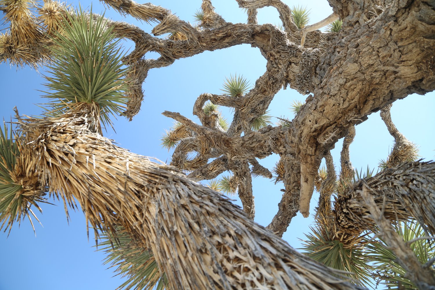
Joshua trees are pollinated by the short-lived yucca moth – and in return the larvae of the moth feed on the fruits and seeds from the Joshua trees. The seed pods are fairly large, white on the outside and when shaken sound like a baby’s rattle. Older Joshua trees have tree like bark and some are quite tall – while the trunks of the younger trees are covered in downward facing spikes. Joshua trees in Lee Flat usually start blooming towards the end of April and into May.
And another Joshua tree piece of trivia – about 10 minutes west of the turnoff from Highway 190 to Saline Valley Road is the old Joshua tree site of U2’s 1987 album “The Joshua Tree”. This site is just outside of Death Valley but simply Google, ‘The Joshua Tree U2 Album Location” and you will find the spot where the now dead Joshua tree lies and in-the-know U2 fans from around the world come to pay their respects.

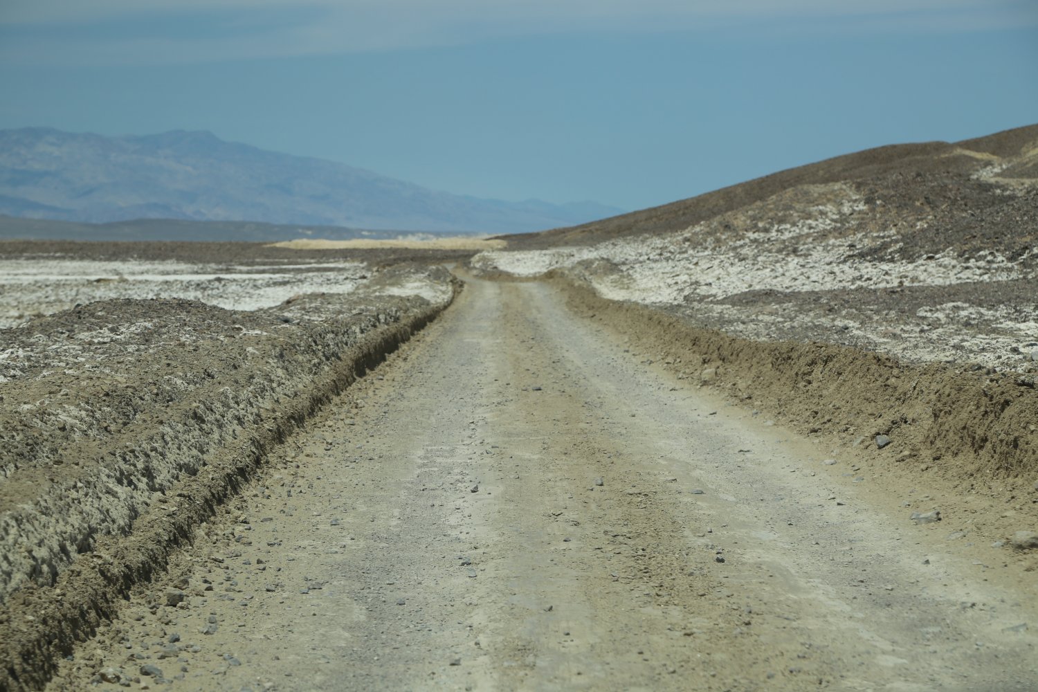
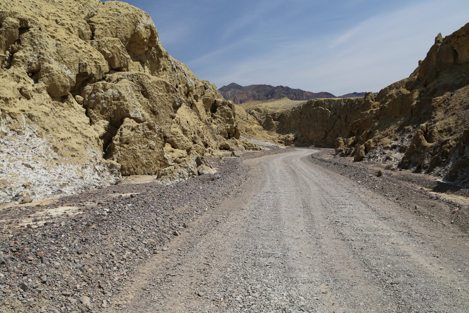
Mustard Canyon is located next to/near the Borax Works. This gravel one way road leads through a narrow gap in some low lying slightly colored barren hills.
Unless you are extremely interested in geology, perhaps a visit here would be best left after you have visited more of the mainstream Death Valley attractions. The ‘canyon’ is not a deep one; it gets its name from the somewhat mustard colored surrounding landscape. Takes maybe 10 minutes to drive through it’s entirety, if that.

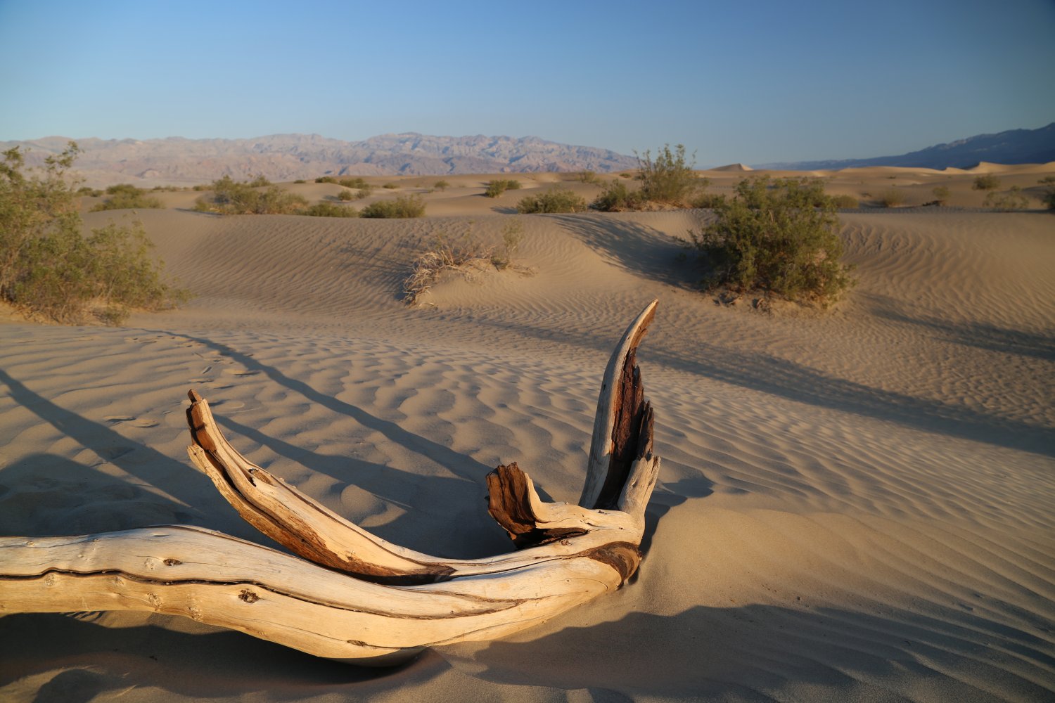
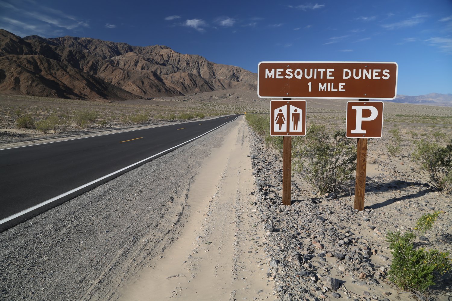
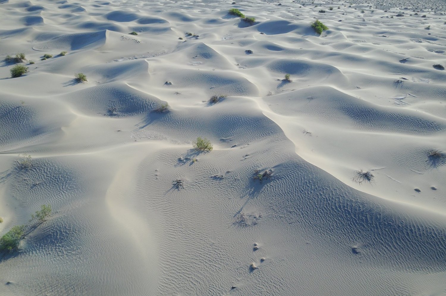
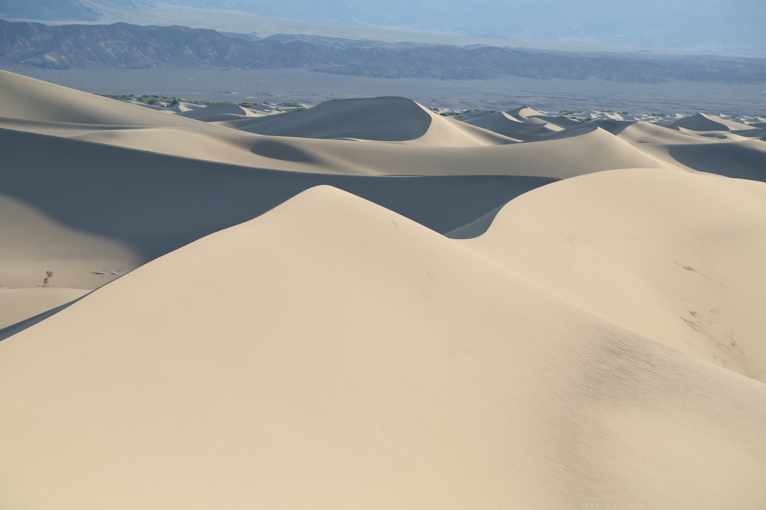
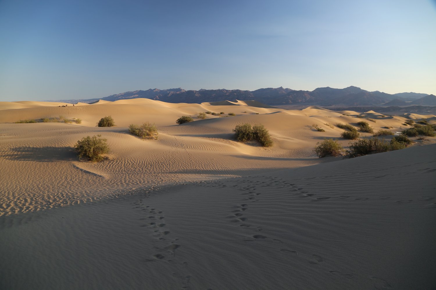
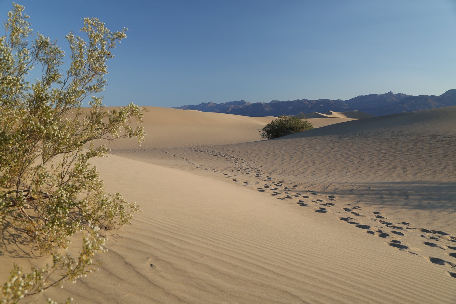
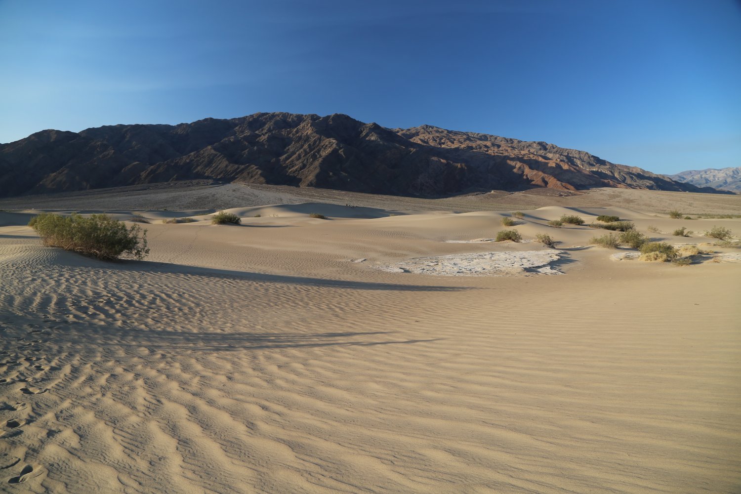
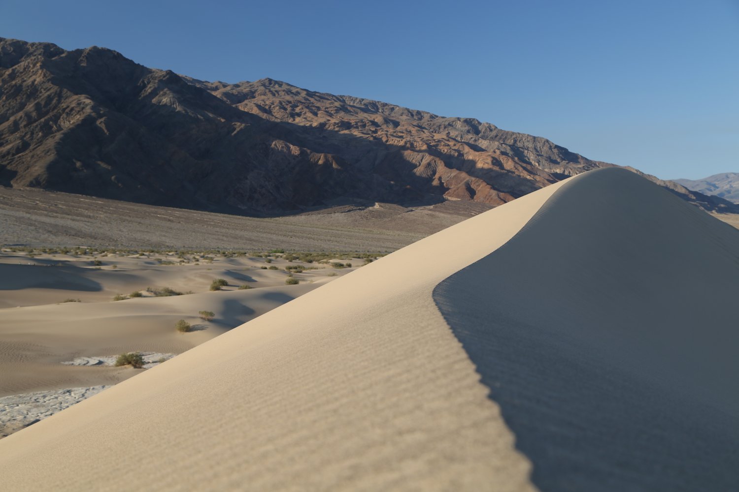
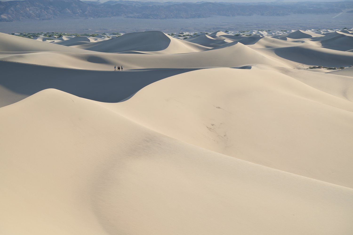
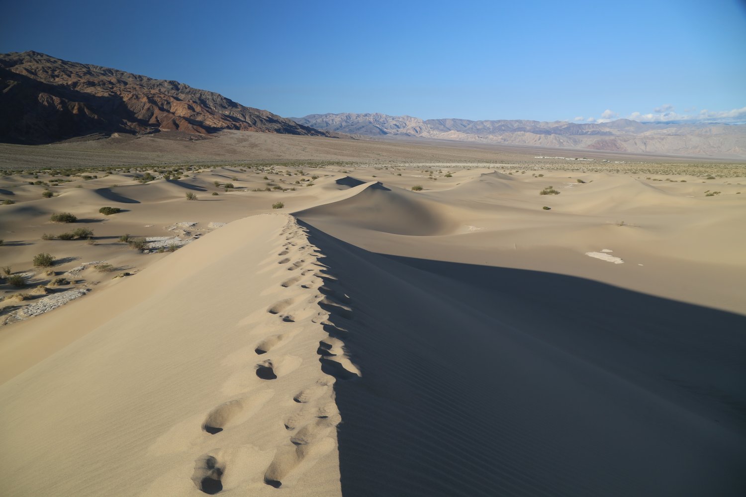
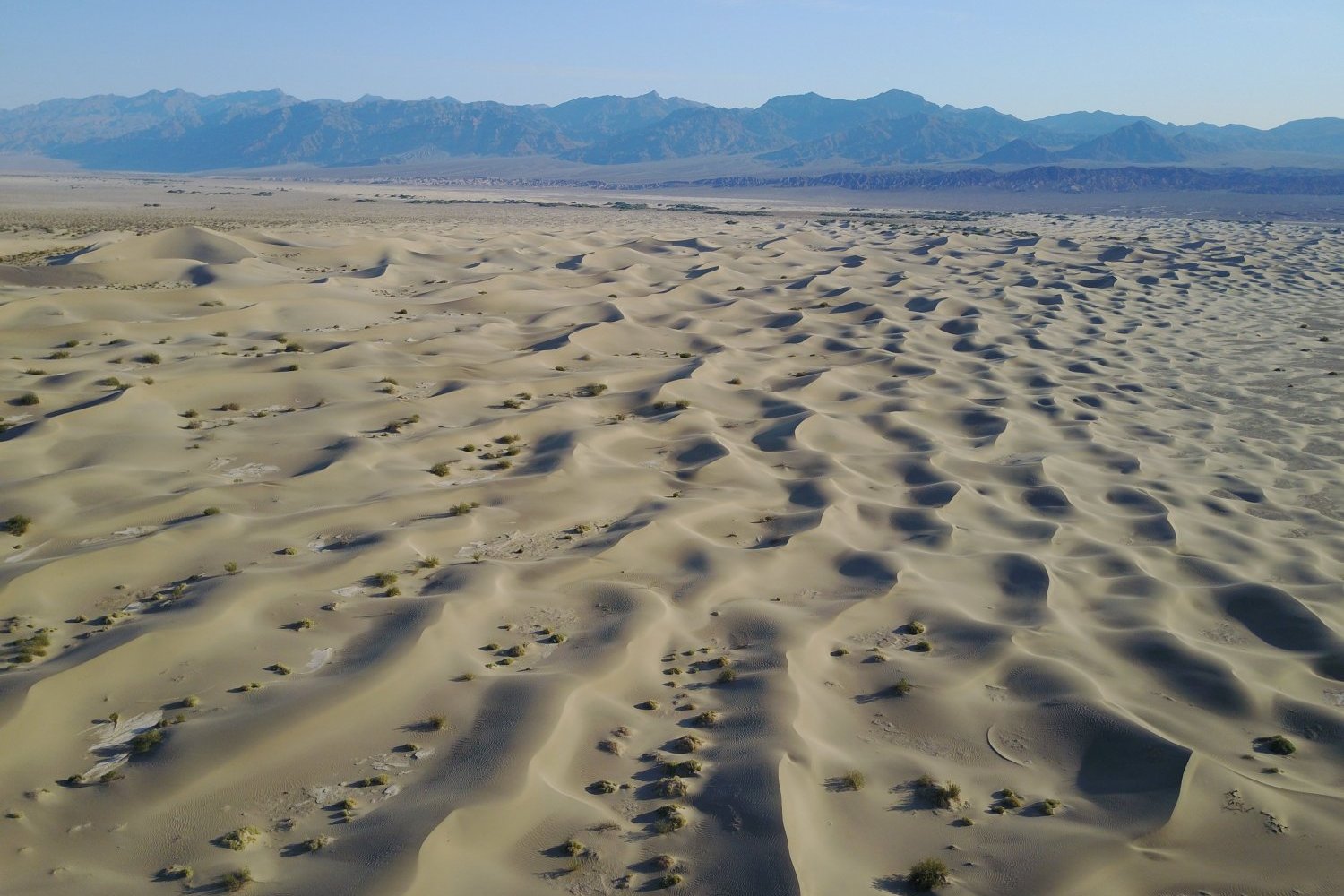
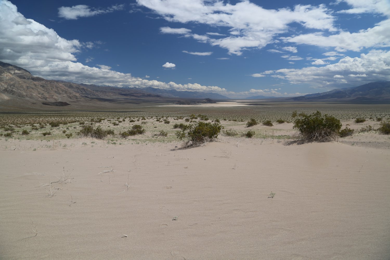
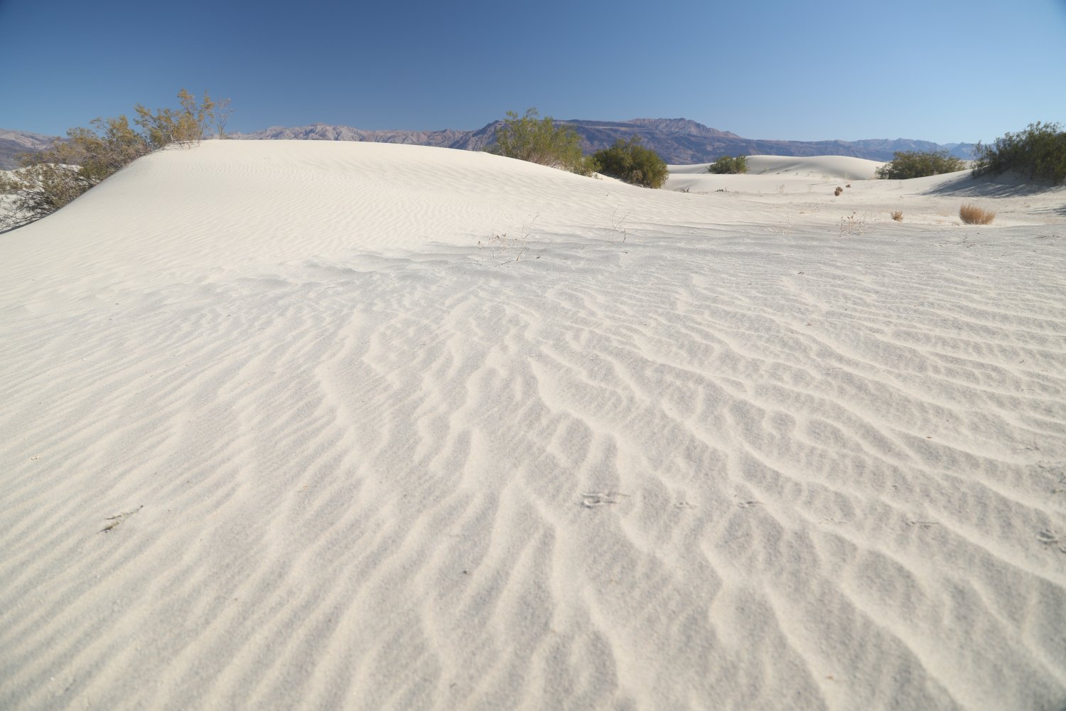
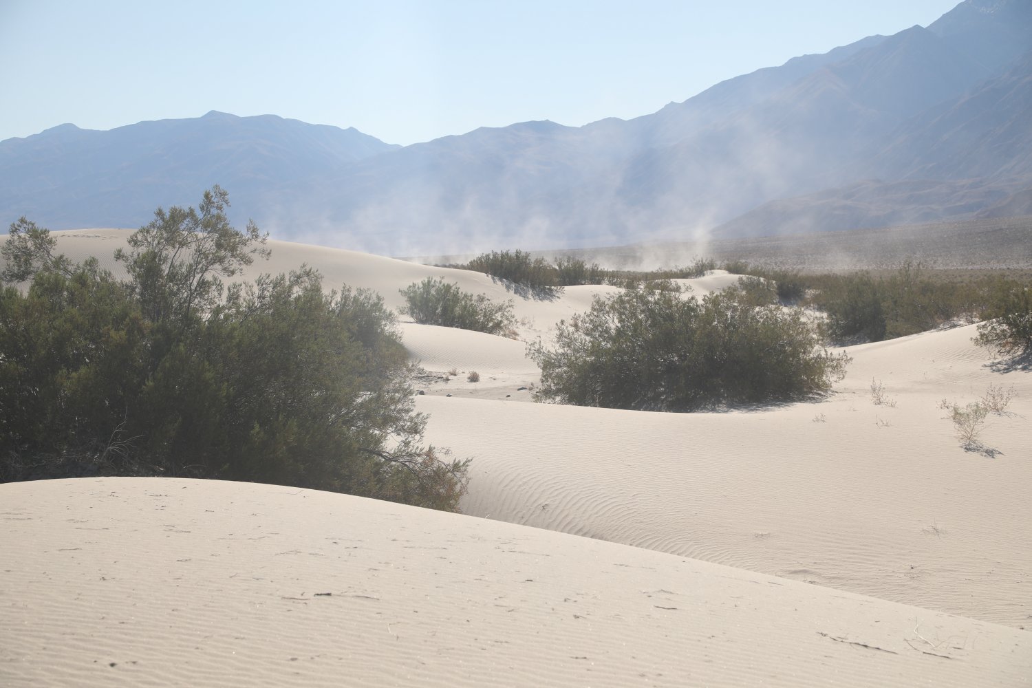
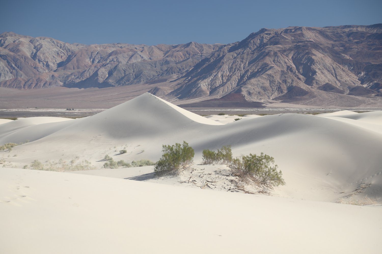
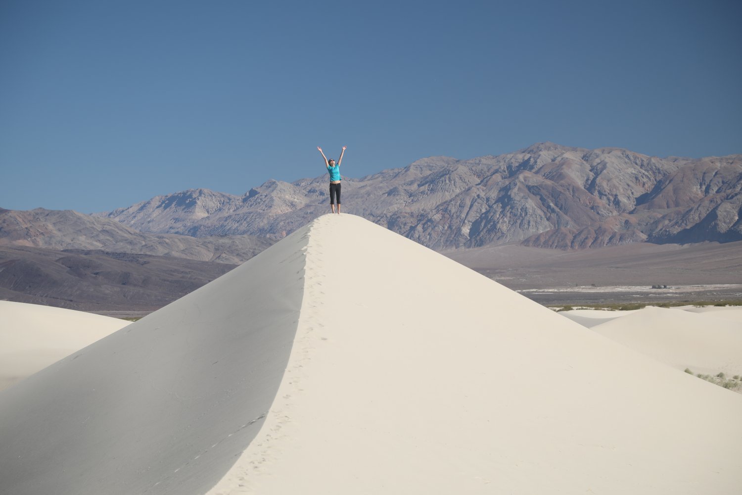
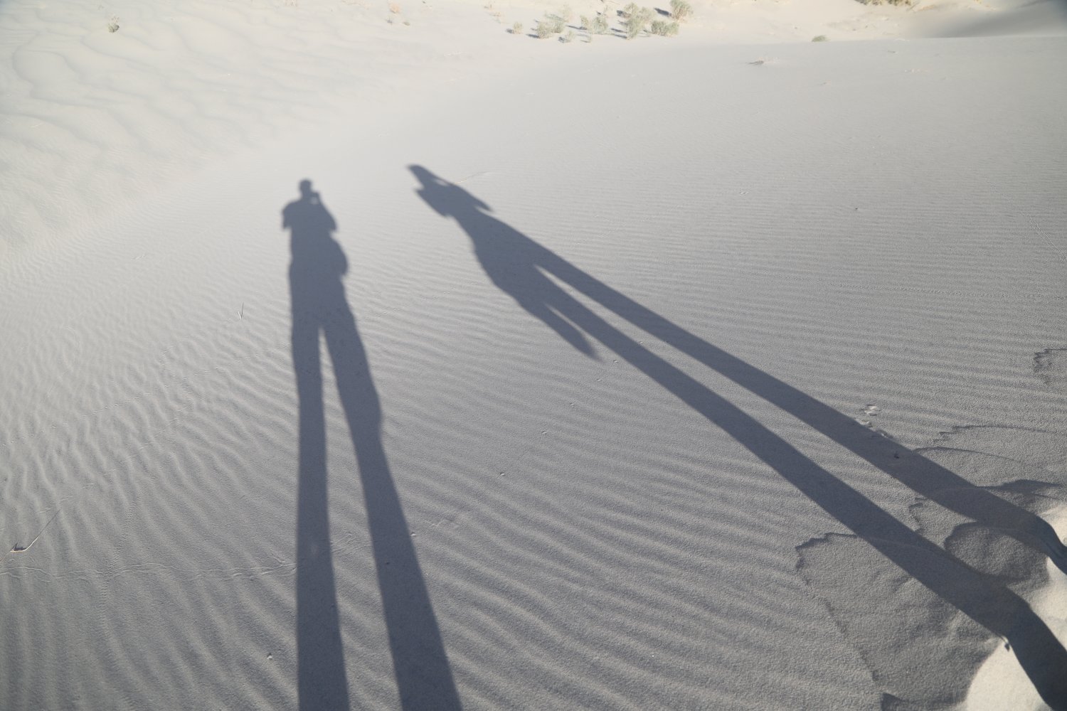
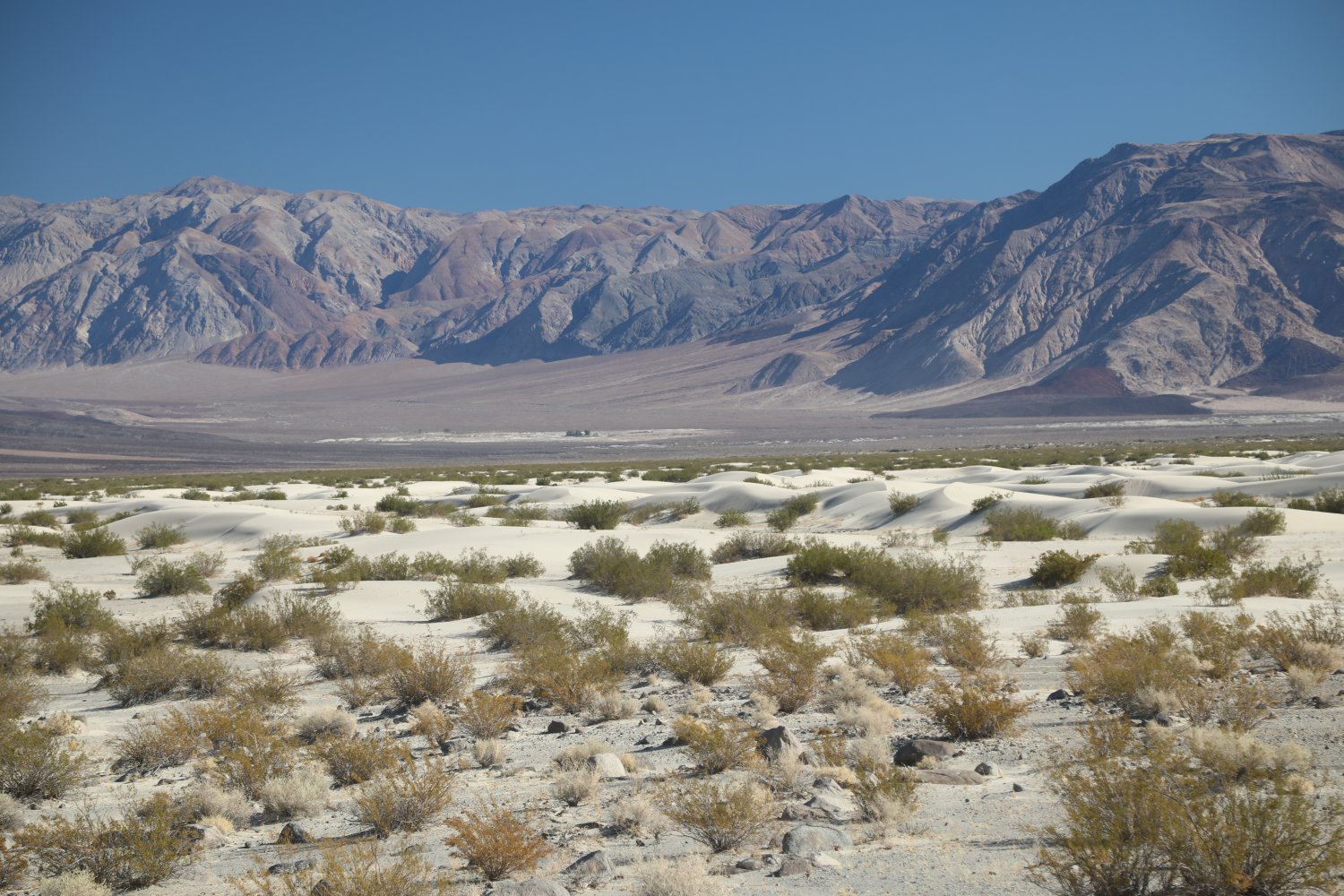
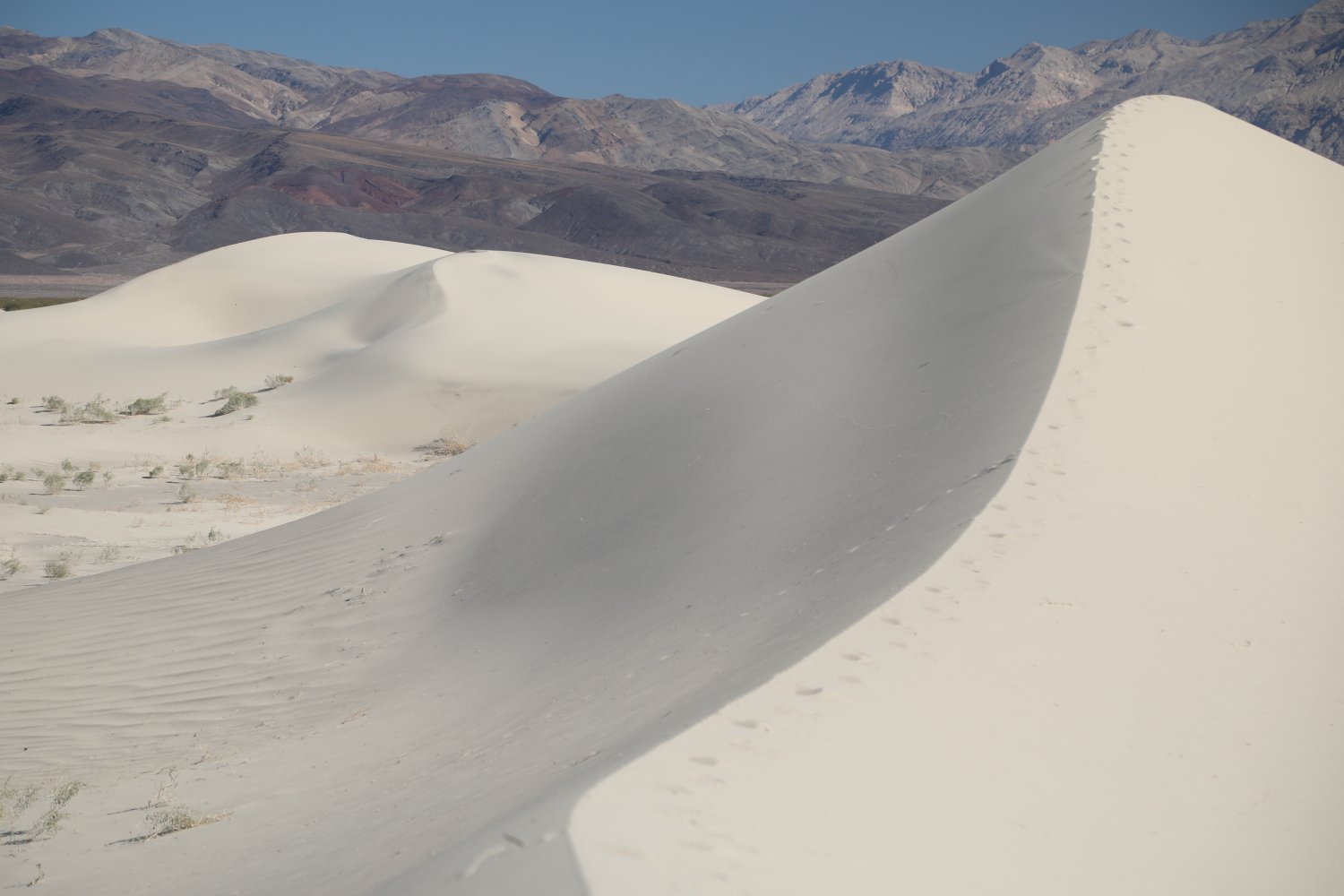
 Mesquite Flat Sand Dunes are located about 2 miles north on highway 190 from Stovepipe Wells – they are located on the northern side of the road. Ample sized gravel shoulders on both sides of the road provide plenty of pull over shadeless parking. You can park here and walk out to the dunes. An established paved parking lot with bathrooms is also located here. To get close to the most impressive dunes expect to walk out at least 45 minutes from the road. The highest dunes approach 100 feet in height and are located about 2 miles from the main road. A 10 minute walk will get most people into the smallest of the dunes – there are no trails anywhere in these dunes.
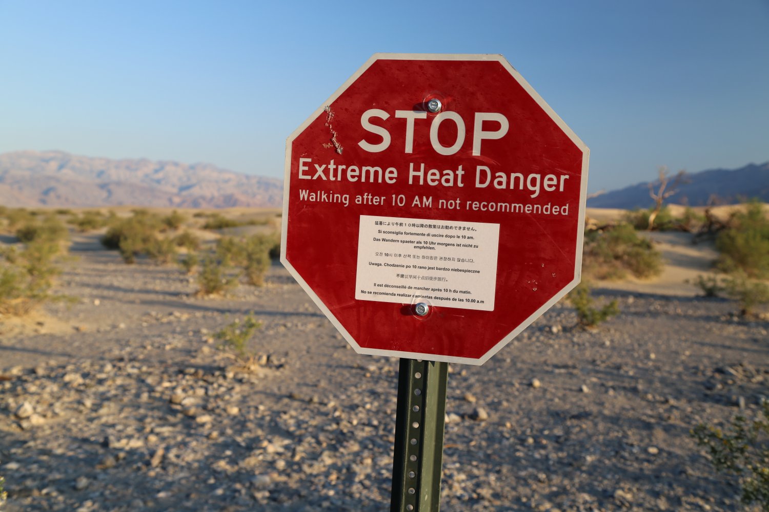
If the weather is hot, be careful about wearing open toed shoes as the hot sand can be very painful on your feet. It is not recommended to walk out to these dunes in the middle of the summer on a deathly hot day. There is great photography out in these dunes especially in the morning or evening ‘golden’ hours. If you are a photographer a couple of things to be aware of; its often windy and blowing sand can cause problems – as well as if you are photographing during the summer months, your camera can get extremely hot, almost too hot to touch (even if you keep it in the shade of your body).
People do hike here a night especially during the summer. Be sure to bring a bright LED or flashlight with enough batteries to last several hours if you do the full hike out to the highest dunes. Also note that sidewinder snakes may be in the area as they sometimes come out at night during the hot summer months.
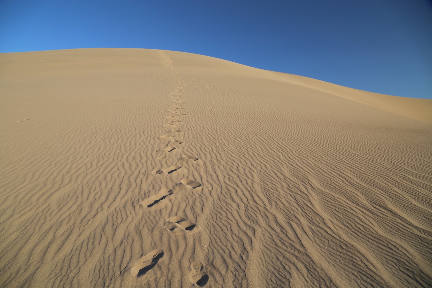
If you are fit and its not overly hot, we highly recommend the walk out to the highest of the dunes. These are quite impressive as they form a pyramidal shape and you can hike up a very narrow ridge of sand with one side plummeting to the valley floor and the other side forming a steep bowl. Its akin to how a climber might feel scaling a steep narrow mountain ridge with drop offs on both sides. You don’t have to climb up the sharp ridge of course – some people climb up the very steep bowl. Either way, you will get tons of sand in your footwear. Great photos and views of the surrounding mountains from the top of these ridges.
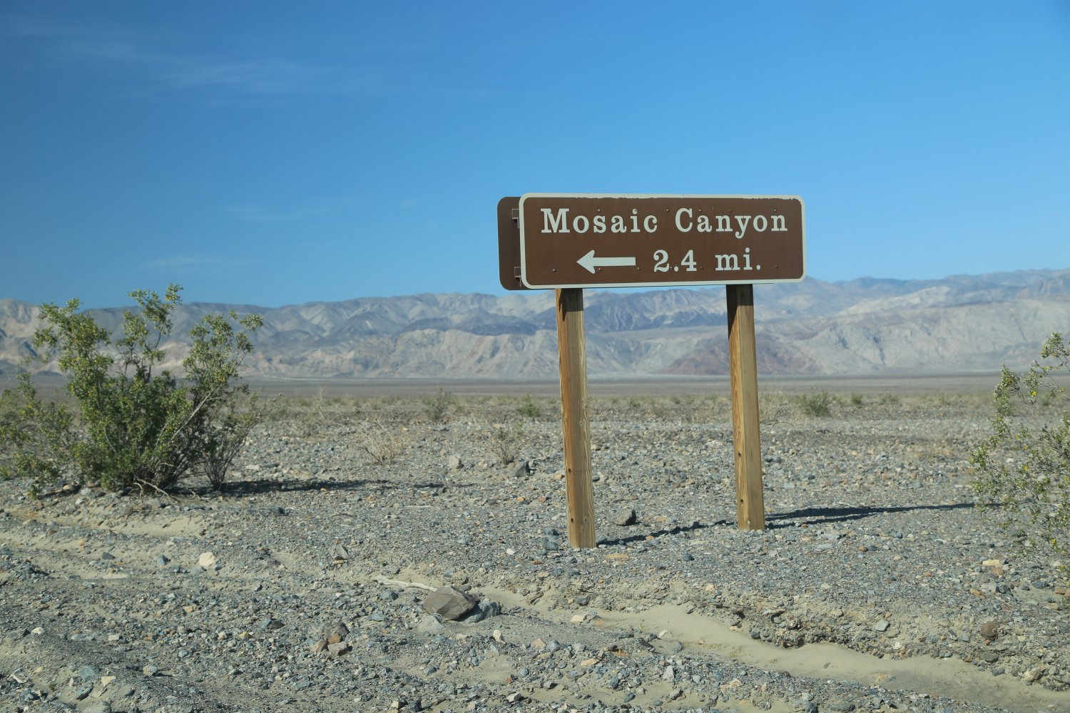
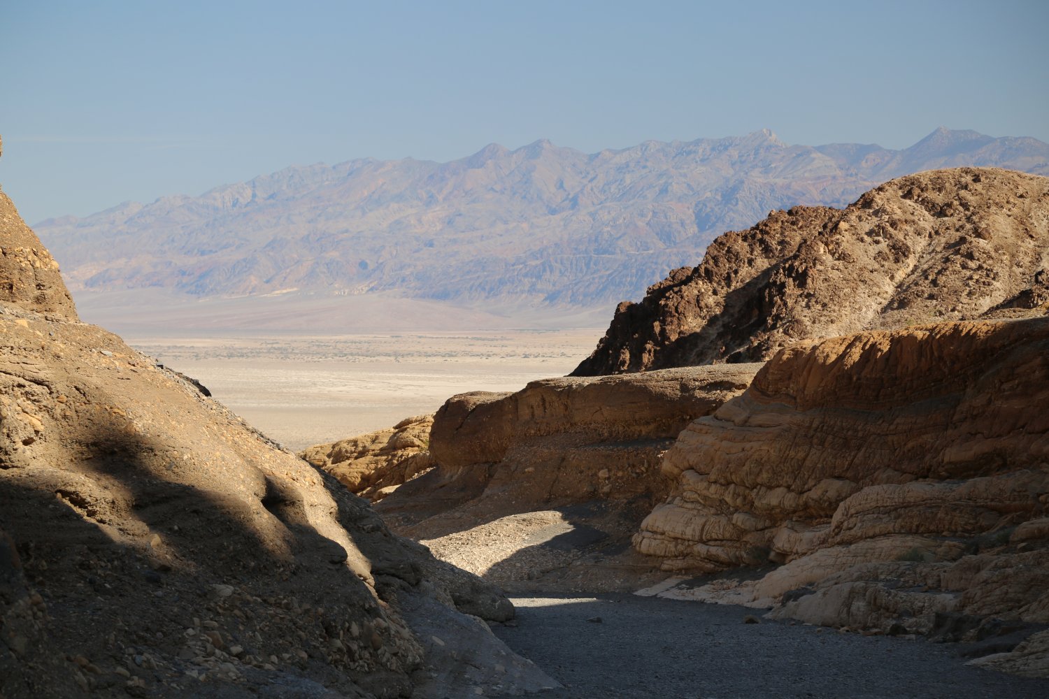
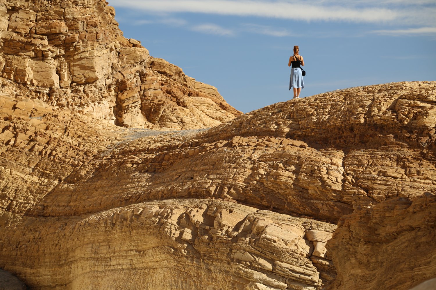
Mosaic Canyon – is easily accessible via Stovepipe Wells Village. As you head west out of Stovepipe Village, the graded dirt road leads up the slopes for several miles before reaching the parking lot and trailhead. Easily passable for a car – we have also seen a number of smaller RV’s up here – although they certainly have to drive the road slower then a car.
The name of the canyon comes from rock that has been embedded into a natural sort of cement creating a mosaic. This hike is mainly up hill – much of the first 1/4 mile is through a narrow part of the canyon where the rock canyon walls have been smoothed over the eons by water flow. The canyon narrows down significantly in this first part of the hike – making for some nice photography.
The total distance one way is about 2 miles – there are a few challenging areas in the canyon as you proceed up the wash – one section features many boulders blocking the main part of the canyon and past this is a steep part of the wash that can be bypassed by taking a small trail that leads up the western canyon slopes.
Bring plenty of water and allow several hours if you decide to make the full hike – however, one can certainly get an idea of the topography and beauty of the canyon within the first 1/2 mile.

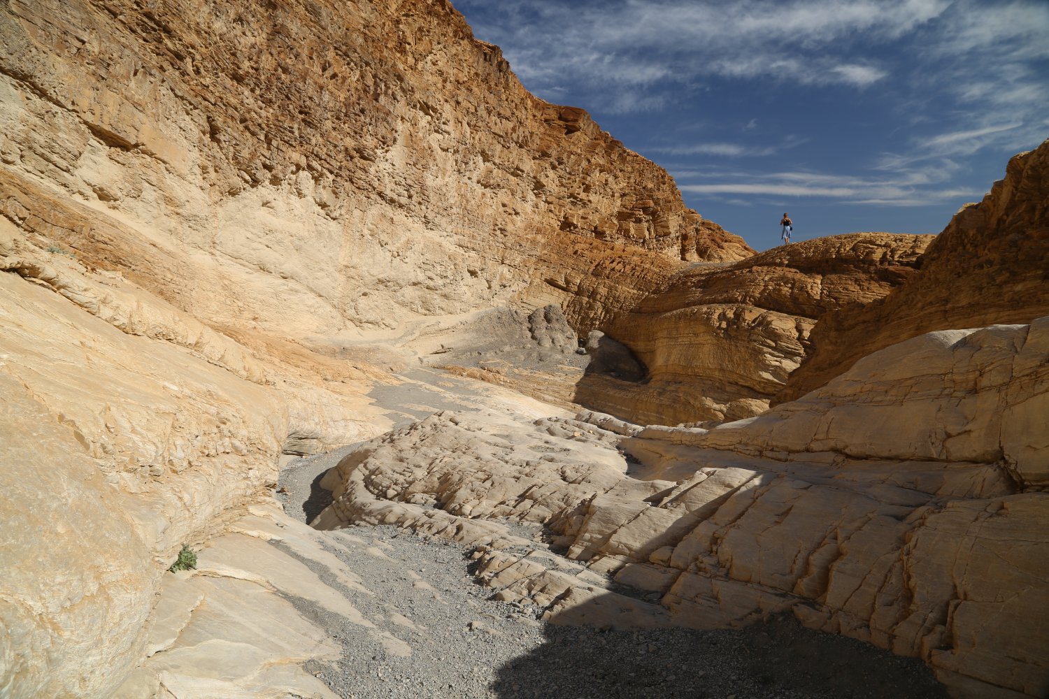
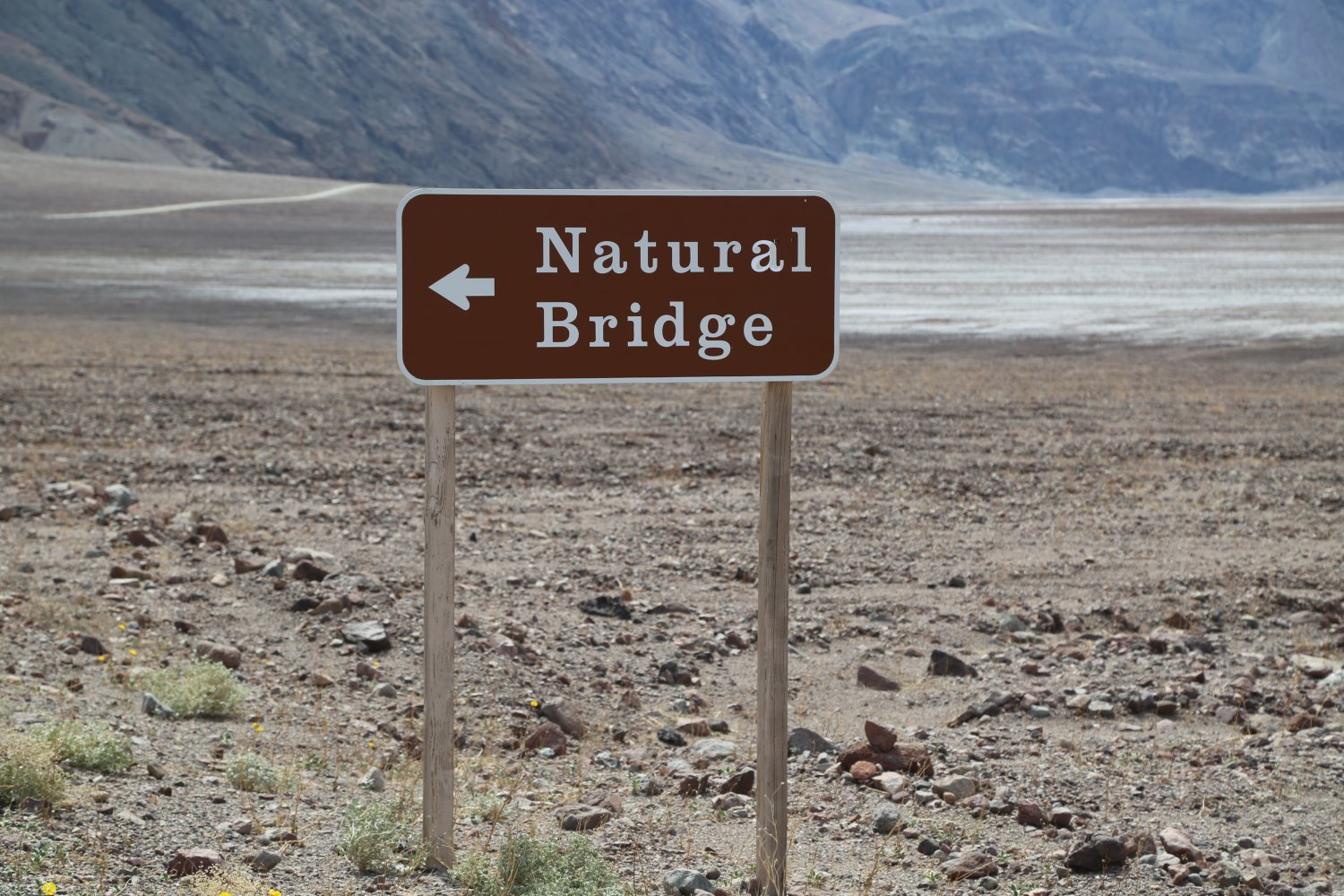
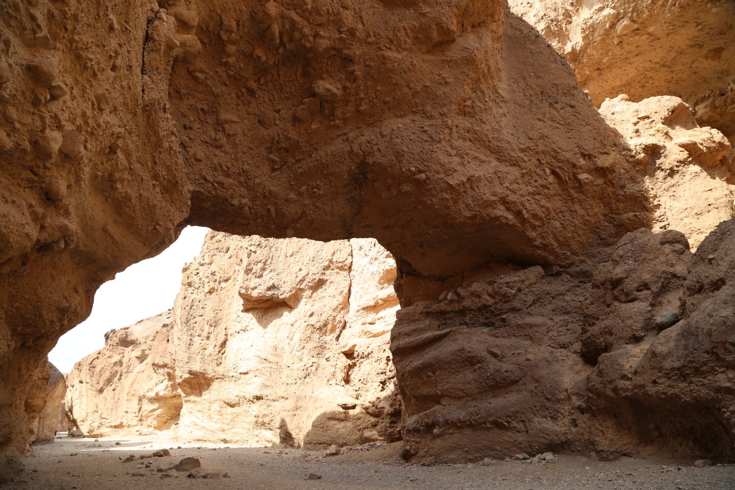
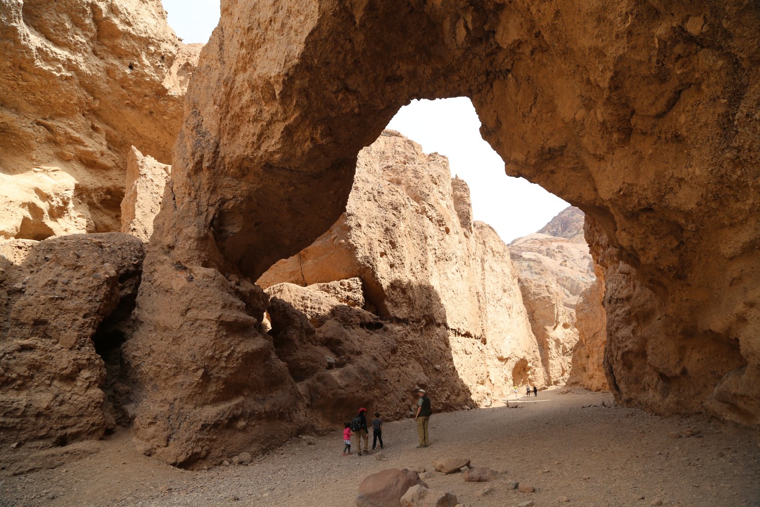
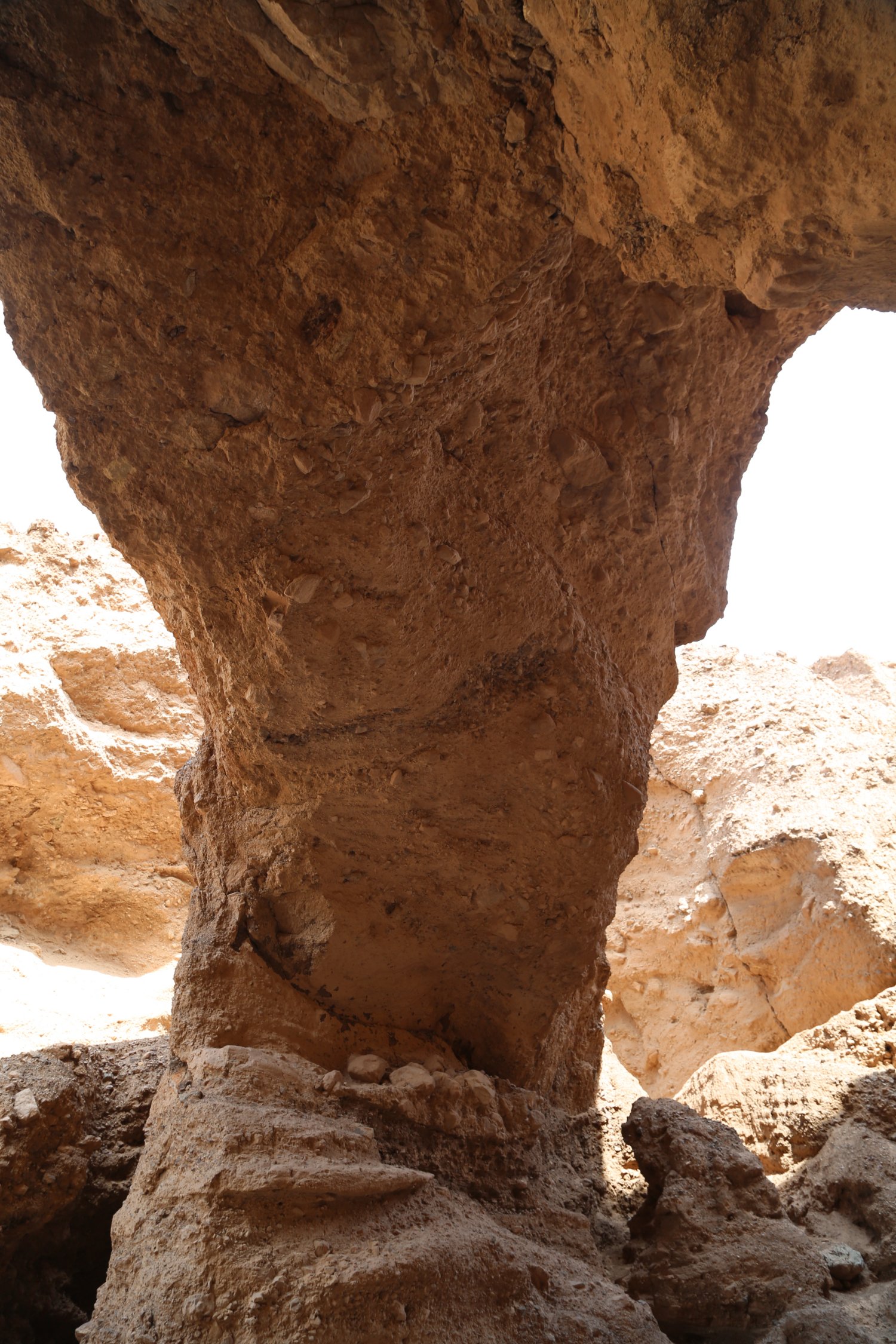 Natural Bridge – the road to the trailhead for Natural Bridge is dirt and about 1 mile in length round trip. Parts of it are quite bumpy and there are some deep holes you have to be careful of but you can certainly get a regular 2wd car to the trailhead. This is located just north of the main Badwater viewing area. One way to the bridge is just under 1/2 a mile on a wide gravel floor of the canyon – the bridge is limestone rock which has been hollowed out at the base. Its massive and doesn’t have the grace that some other more slender elegant rock bridges have.
In any case it towers over the trail – several small steep short side trails try to provide access to the bridge, but fail because of the steepness of the rock walls surrounding it. From the trailhead you have excellent views looking down at Badwater and the salt flats below.
Even if you do not hike the trail to the Natural Bridge its worth driving up here to get a unique view of Death Valley and the Badwater area.
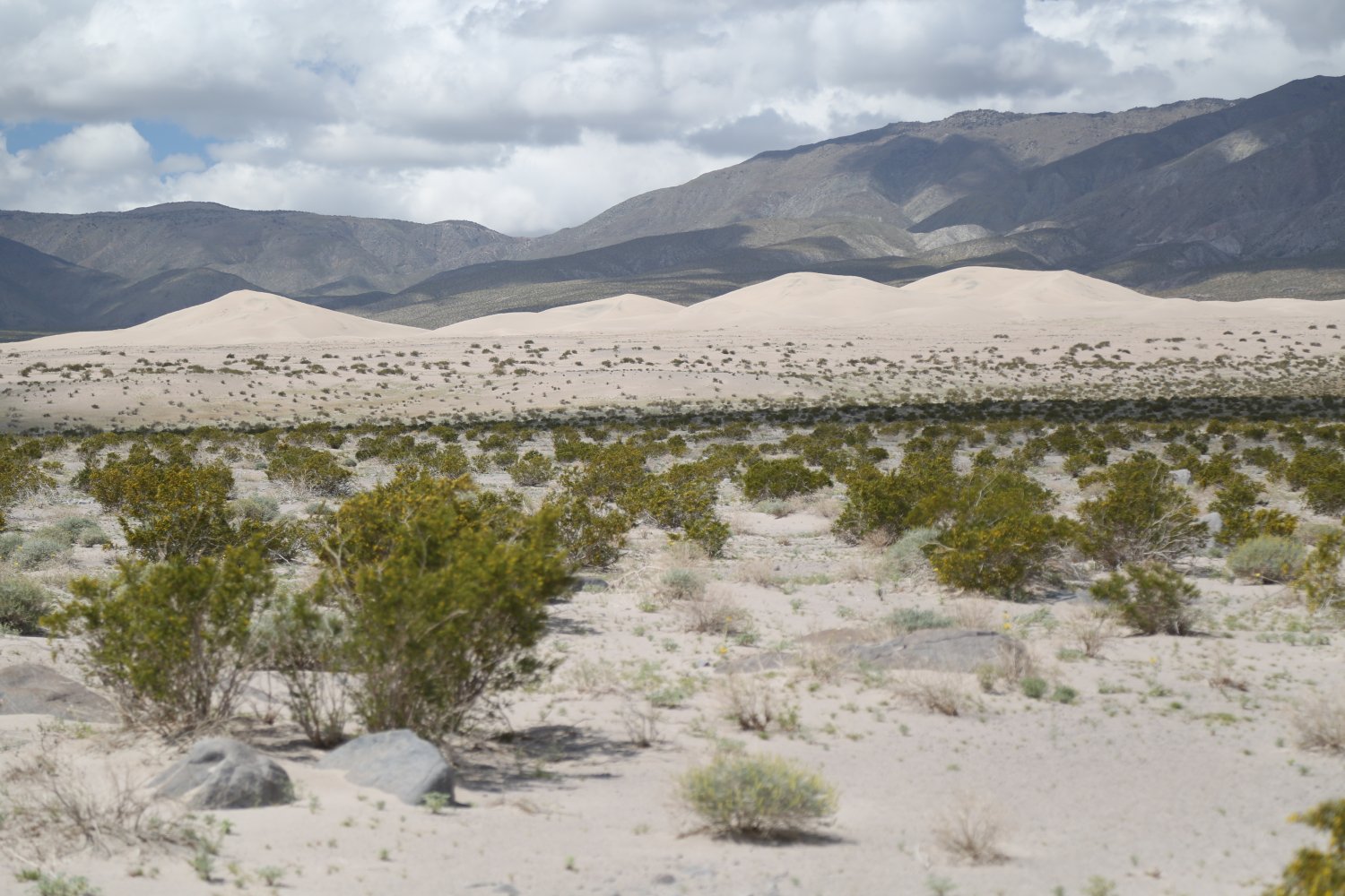
Panamint Dunes. These little visited dunes are one of 5 dunes in Death Valley National Park – the others being the popular Mesquite, the highest – Eureka, Saline Valley and Ibex dunes in the far south eastern corner of the park. The dirt road leading to the trailhead for the Panamint Dunes is located on the northern side of Highway 190 exactly 4.6 miles from Panamint Springs (about a 5 minute drive). There is absolutely no signage for this dirt road (we simply call it Sand Dune Road); it is very very easy to drive right on by and not even see it.
Driving distance from the junction of the dirt Sand Dune Road and Highway 190 to the parking lot and trailhead to Panamint Dunes is about 6 miles (allow 20-25 minutes). A 2wd vehicle can typically make this drive – albeit very slowly due to sections that have quite a bit of washboard. The dirt road continues past the Panamint Dunes trailhead/parking lot and continues up a rocky slope to the edge of a canyon. Once past the parking lot the road becomes very rocky with some rutted sections and large rocks and a 4wd is highly recommended. Eventually the road turns into a dirt wash and enters the canyon just below some old mines and wooden mining relicts on a very steep slope.
Remarkably this is the only road in Panamint Valley north of Highway 190. The obvious reason for this is the surrounding slopes were not ore bearing and therefore few mines were ever developed in this part of the valley.
The total distance from the parking lot to the highest dune is 3.8 miles one way. Initially the trail meanders for a few hundred feet and then after that it branches into multiple rudimentary trails before disappearing completely. This first section of the hike is over some rocky ground. At some point one may see tracks in the sand leading towards the dunes left by recent visitors and you can try to follow those. One’s best primary directional guidance is to just look at the dunes and walk in the direction of their whitish sand. As you’re walking, on your far left you’ll eventually come to what looks like the “tail” of the dunes – the “tail” is covered by a number of creosote bush before it eventually joins the actual sand dunes.
It may not feel like it or look like it, but you’re actually walking almost entirely on an upward slope towards the dunes; take inspiration in this in that you will be walking all downhill on the way back. If you have sharp eyesight you can see your car or other cars in the parking lot from the top of the dunes and other than a few low spots, nearly the entire way to the dunes. We have seen thousands of creosote bushes over the years, but it is a rarity when we spot a creosote with a visible trunk standing above the desert floor (normally they are low bushes on the surface or with any above ground root structures completely covered with sand or desert soil. AT the following GPS coordinate (36.4501740 – 117.4454969) we spotted a small creosote ‘tree’ with a trunk standing above the desert floor. It is on the way up to the sand dunes – so no out of the way walking is needed. If you do visit this tree, take a photo and send it to us – or post your comments in the comments section at the bottom of this page.
The walk to the dunes from the parking lot is entirely through desert terrain. Once you arrive at the dunes its a fairly short walk to the center and the tallest dune (albeit up steep sandy slopes). The GPS coordinates for the top of the tallest sand dune are: 36.4617088 – 117.4553436. Not a popular destination but nonetheless quite impressive. Chances are you will be the only one here. During our visit, we laid down on the ridge of the tallest dune and nearly feel asleep. The solitude is beautiful. So to is the silence.
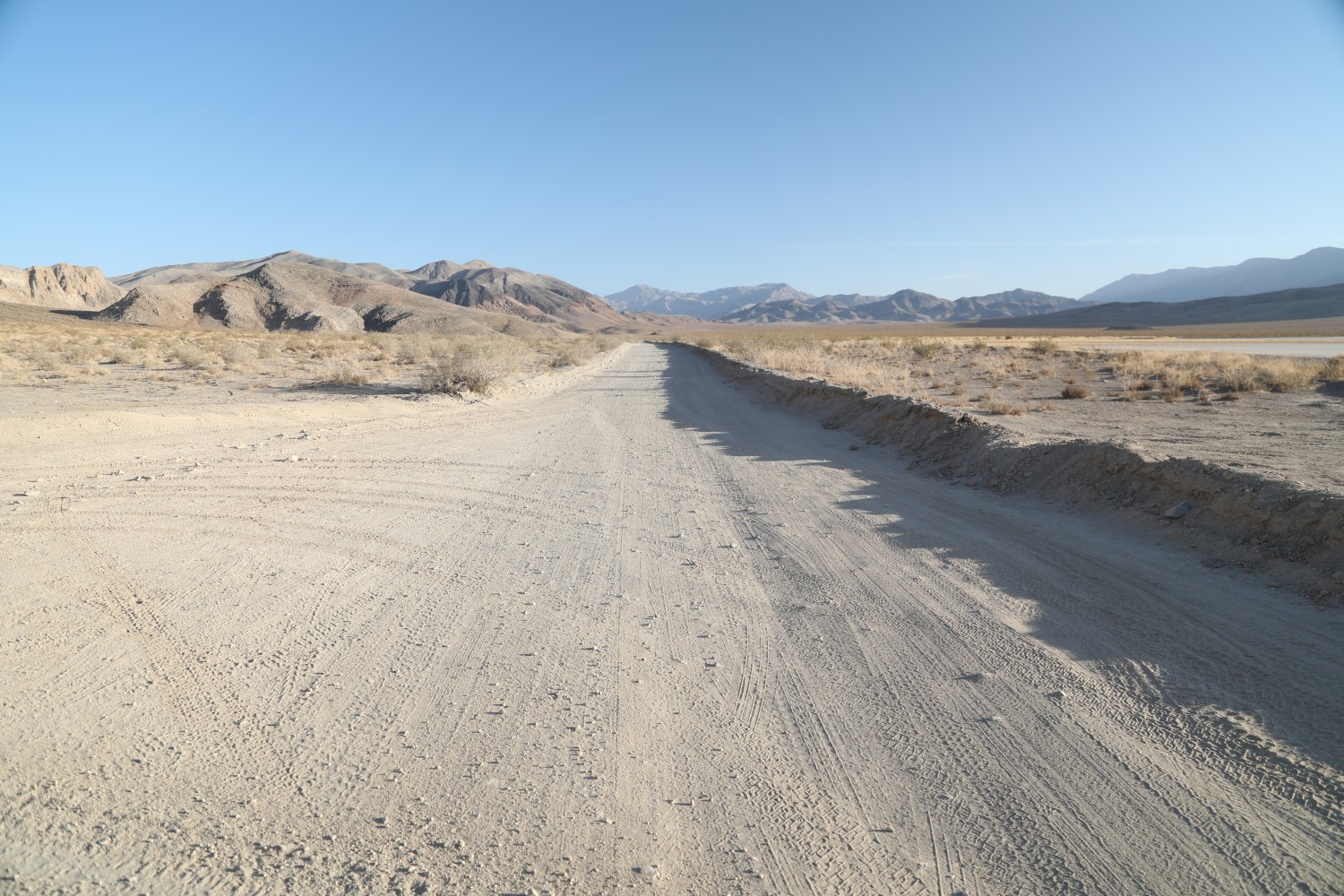
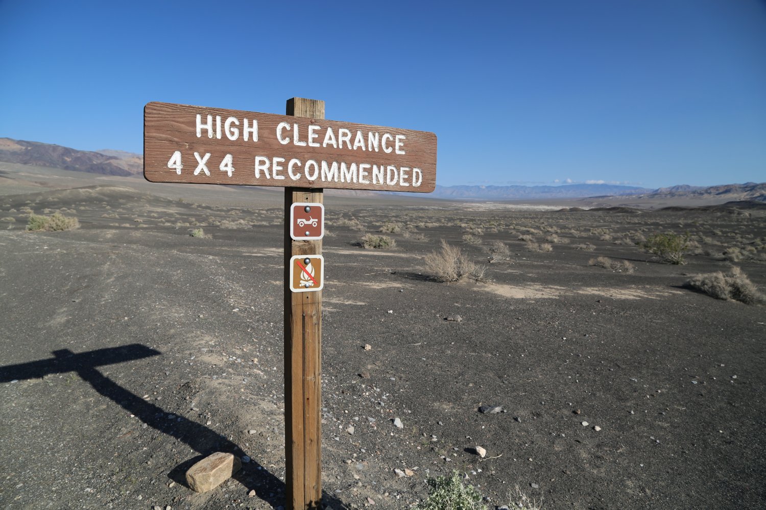
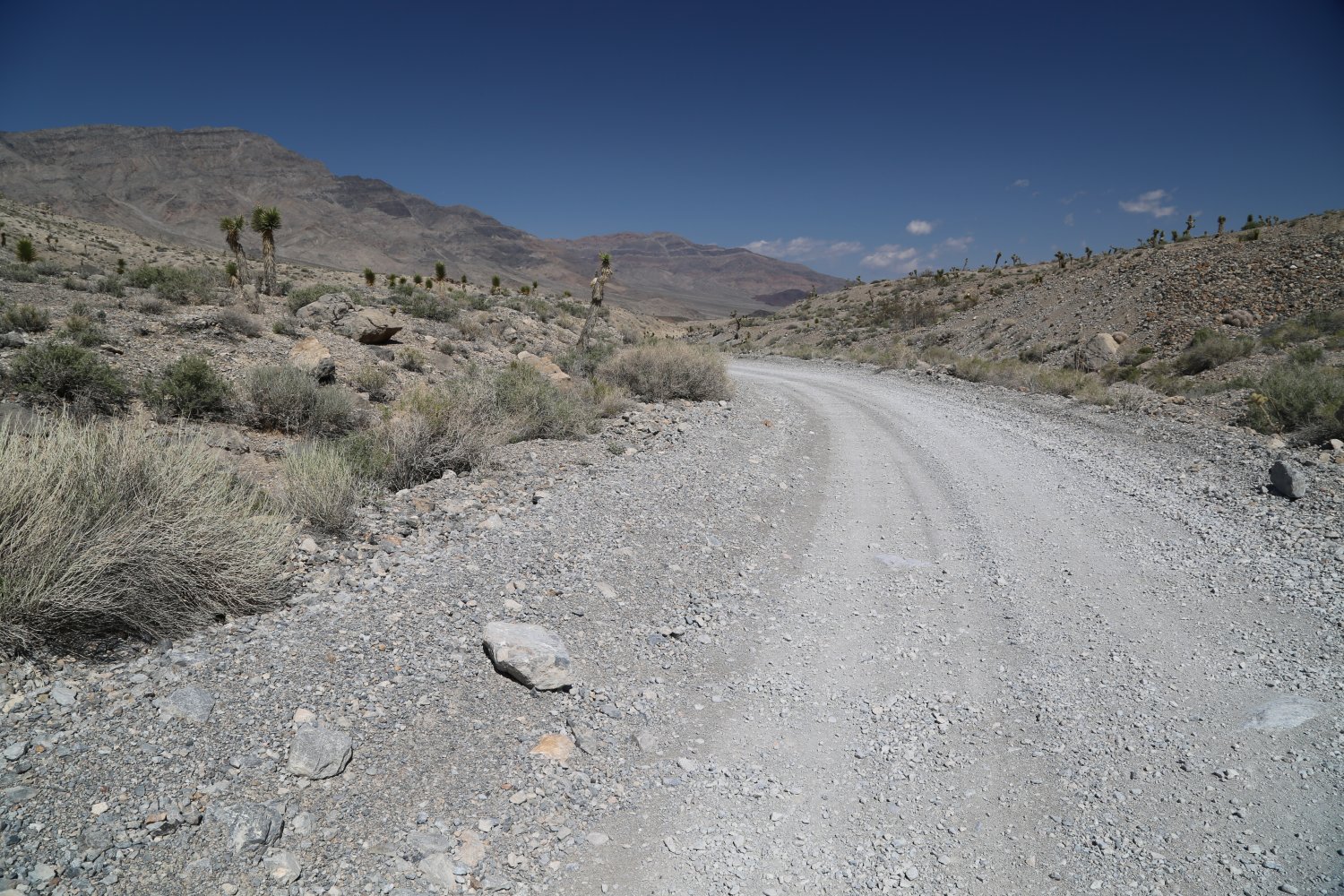
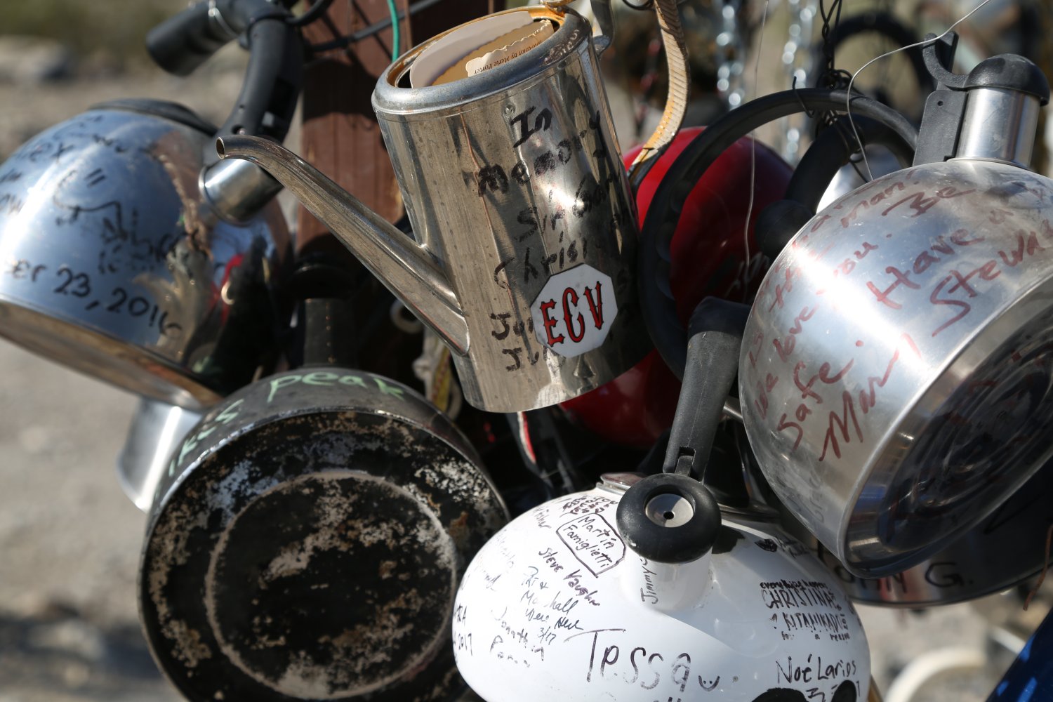
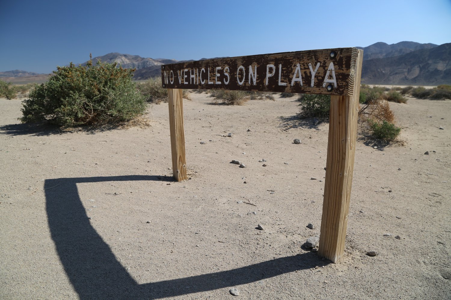
Racetrack Playa is well worth visiting as this is one of the park’s main highlights – it is located in the central part of Death Valley National Park about 35 miles South West of Scotty’s Castle. Many tourists never make it here due to the 27 mile rough isolated dirt road; Park rangers encourage 4wd high clearance vehicles only with heavy duty tires. With that said this is NOT a 4wd road. 27 miles of this distance is on improved dirt roads – during our multiple visits we have NEVER experienced any deep sand – the entire dirt road is on a hard base. Nearly all of this road is extremely rocky – but for the most part these rocks are fairly small.
Contrary to what is published, there is some cell service on this road (we have used it for data successfully) – on sections that make the drop down the grade to the Racetrack Playa. And this is surprisingly with ATT who pretty much has nonexistent coverage in rural California. T Mobile? Forget about it.
Should you want to take a virtual drive of this entire road, you can do so here:
We have taken a regular passenger sedan 2wd car (an older Honda Accord) over the 27 mile dirt road in merely just over 44 minutes. This was timed from below the Ubehebe Crater to the parking lot on the south side of the Playa. That is moving farily quickly and normal drivers will take well over an hour for the same drive. 2wd vehicles can certainly make this drive if conditions are dry, although it helps if you have some prior driving experience on rough roads (IE if you have never taken a 2wd vehicle over a rough dirt road before, this is probably not a good time to start). And this road can be quite rough based on all the small rocks that have accumulated (and there are sharp rocks which can be bad for older tires or thinner tires). If you take a 2wd vehicle on this road, best to take it slow.
There are other roads that one can take to reach the Racetrack Playa – the but all require a 4wd vehicle and some of the roads are for experienced 4wd operators only. The nasty Lippencott Pass provides access to Racetrack Playa from neighboring Saline Valley – but should *only* be attempted by experienced drivers with proper high clearance 4wd vehicles only. One can also cross over South Pass from Saline Valley and take Hunter Mountain Road through Hidden Valley to Teakettle Junction – but note that there is an almost 1/2 mile section of either mud or very deep fine dry powder in Hidden Valley that often only high clearance vehicles will be able to traverse. Unfortunately that section will typically stop most drivers but the rest of Hunter Mountain Road is accessible via a 2wd sedan by someone who has experienced off road driving.
We pulled into the Grandstand dirt parking area as the only 2wd sedan car next to at least 10 SUV’s and other 4wd vehicles. That is an awesome feeling, although this road totally pales in comparison to some of the nasty steep, rocky and severely rutted 4wd roads we’ve taken our 2wd CAR on. The road is narrow in places so be very careful especially around blind turns – much of the year your drive on this road will stir up dust which makes it easier to be seen by moving cars from further away, although there are a number of blind curves in spots. We’ve also driven parts of this road after localized rain showers and we must say its so much nicer and easier to drive when the road has been moistened.


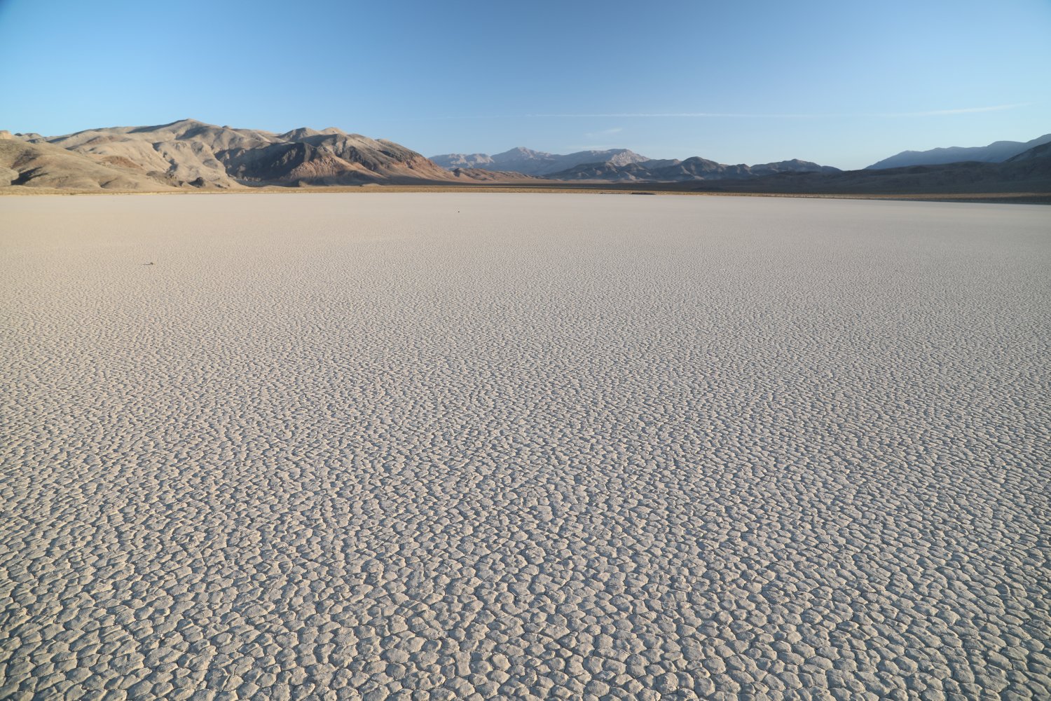

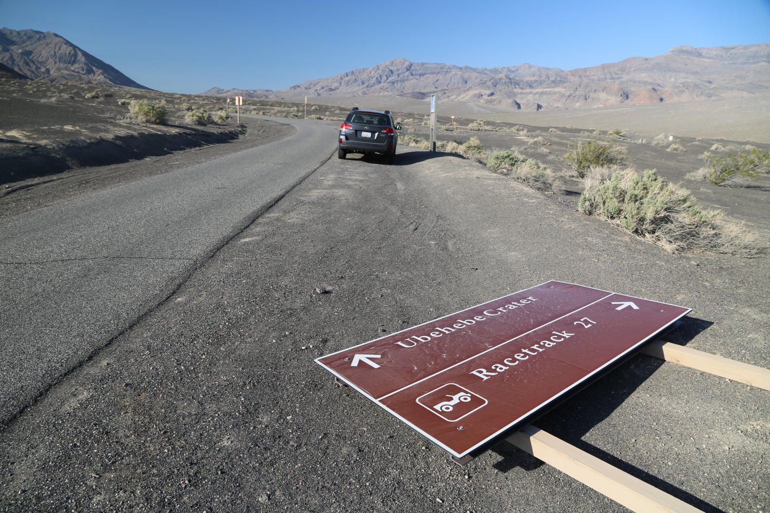
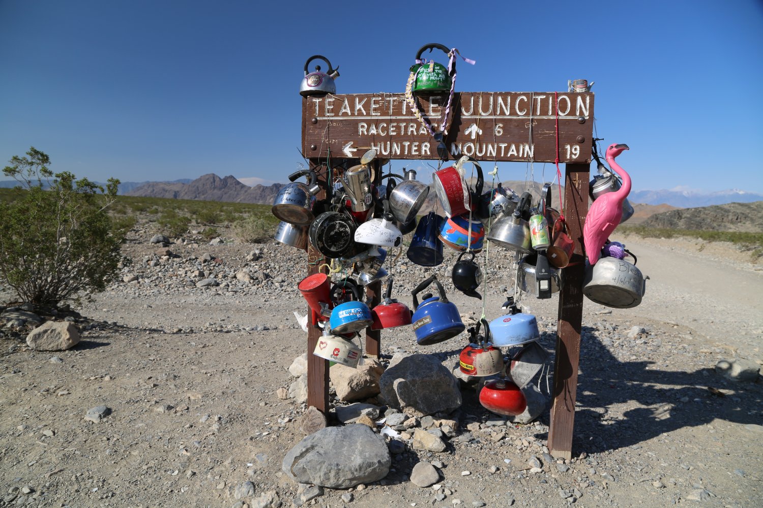
There are no signs from the main road to Scotty’s Castle indicating a turn off for the Racetrack Playa, but your turn off is at the road that leads to the Ubehebe Crater – and instead of going up to the crater via the small paved narrow one-way road, turn onto the dirt road where there is actually a sign for the Racetrack Playa. This is a very scenic location although beware of the extreme heat in the summertime and carry plenty of water. The entire area from the main road to the Racetrack Playa is a few thousand feet higher than the main Death Valley Floor so when its in the high 120’s it may be in the low to mid 110’s in this area! The road hits Teakettle Junction (look for all the real tea kettles hanging from the sign – great photo opp!) and soon thereafter the Playa comes into view.
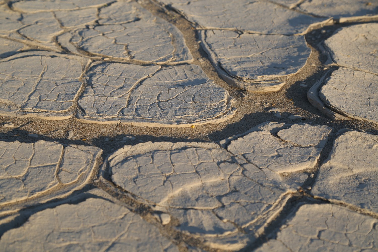
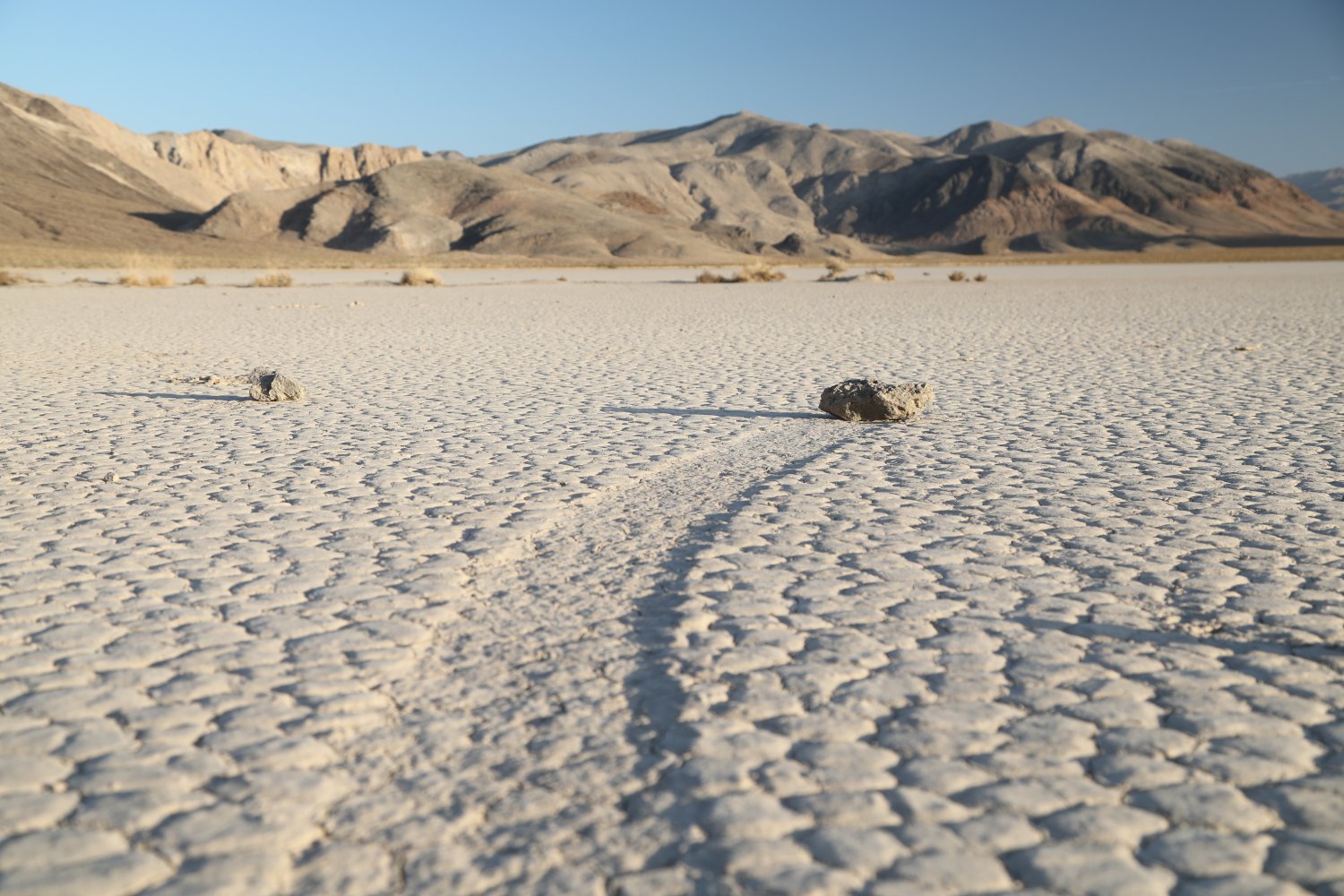
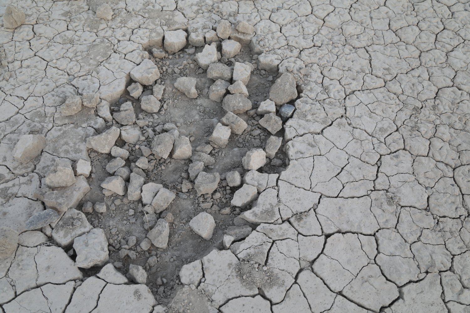
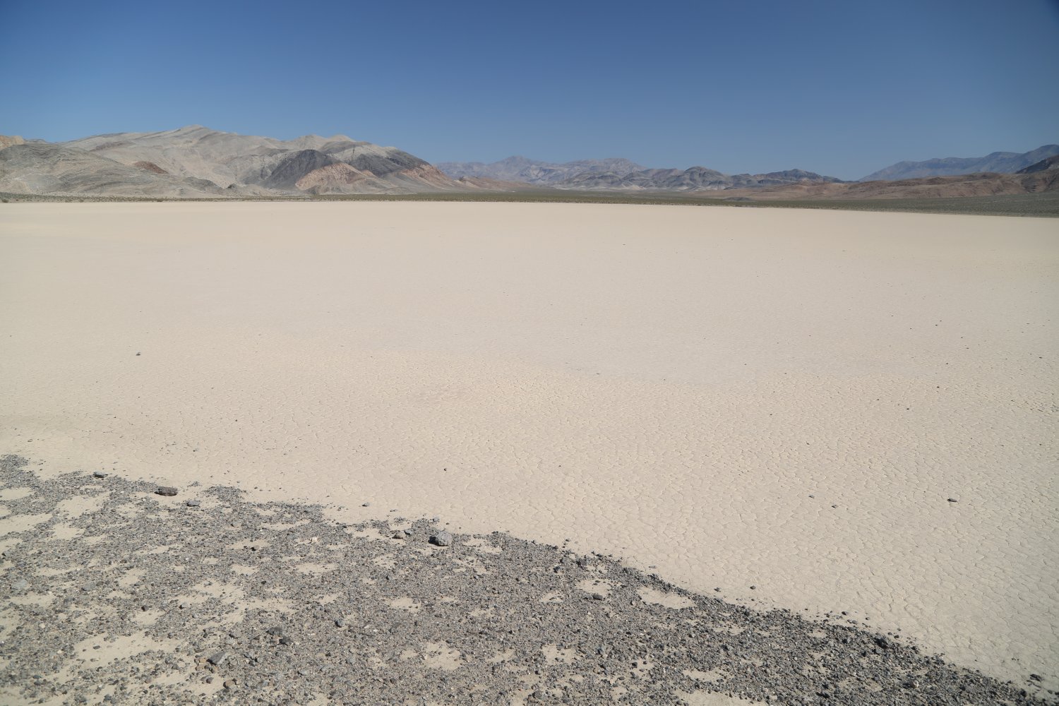
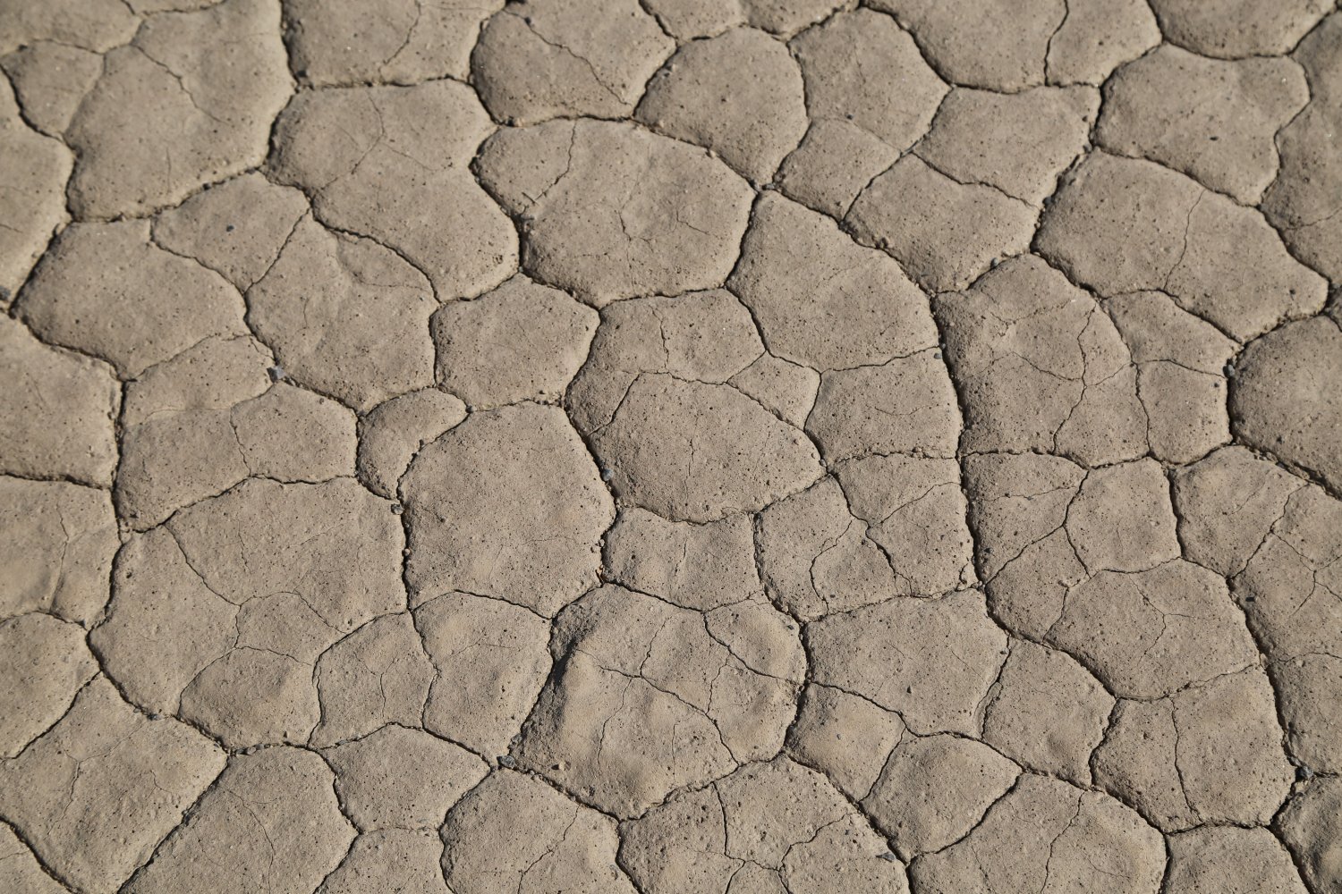
The main feature from afar is the Grandstand – an outcrop of greyish colored rocks that towers above the flat playa floor. If dry, you can walk out to the Grandstand in merely several minutes from the nearby dirt parking space next to the dirt road. You can climb up the rocks and from the upper most part you have great views overlooking the entire playa. It is best to not walk on the playa when its wet as footprints will scar the surface for a number of years. The playa itself is composed of thousands of 3-4 inch hexagonal pieces of dirt – left there from sediment that forms when the water dries up each year. Except for the intrusion of the Grandstand and a few rocks scattered about the only thing you will see on the playa is its dirt surface. Several rocks slightly to the east of the Grandstand look like they may be staged – to visually present an example of ‘moving rocks’. Most likely these are fake and someone carefully curated them here.
The best examples of the famous “moving rocks” are on the south end of the Playa – a small dirt parking lot is located here from which its a 1/4 to 1/2 mile walk to most of the rocks. Unless you want a long walk, don’t waste your time walking from the Grandstand dirt parking area next to the road via the playa to its southern end. This walk only parallels the main dirt road and as mentioned above, there is a parking lot much closer to the Moving Rocks, then the parking area at the Grandstand. Look for the neat trails these rocks leave in the bed of the playa when they move. Some of the trails indicate the rocks have changed directions, some many times as evidenced by their “Z” formations left in the bed of the playa (the tracks are created by events of water and ice combined with high winds). If you are there on a crowded holiday weekend you might have to wait a few minutes in line at the biggest of the rocks.. although often there won’t be many people here at all.
One of the rangers we talked to commented that he has stood on top of the Grandstand Rocks and looked DOWN on military jets flying below him right over the Racetrack!
No camping is allowed anywhere near the Racetrack Playa – the closest camp site is the Homestake Dry Camp within a few miles drive of the playa and a very short drive to the start of the eastern part of the terribly rugged Lippencott 4wd track which leads to Saline Valley.


Saline Valley Sand Dunes. While not the tallest or most expansive of the dunes in the park, arguably they are among the more picturesque and also among the least visited of the dunes due to their very remote location within the difficult to access Saline Valley. Sometimes snow limits access to Saline Valley on the nearby road access over three passes (North, South and Steele pass)There is no official parking spot for access to the dunes – rather visitors can reach them by driving as close as possible on Saline Valley Road and pulling over onto the side of the road and then making a short hike out.
The distances to these dunes looks deceiving – but in actuality from the closest part of Saline Valley Road its only a few minutes walk to the edges of the dunes and a bit further to the tallest dunes. Early morning or late afternoon are good times to visit the dunes, especially for photography with the greater contrast between light and shadows.
These dunes are located a bit south from a large salt plane – which is partially covered with water even in summer. An operation, decades ago brought salt from this lake over the Inyo mountains via an exceptionally steep wooden tram system.


Saline Valley Warm Springs. This is arguably the coolest, best and most intruiging oasis in the entire state of California. If one were to plant a hot spring in the most remote of locations, it would be here – in Saline Valley. Certainly one of California’s most remote desert valleys and one of the state’s longest dirt roads – these hot springs are at least 2-3 hours from any sort of paved road. One can enter Saline Valley via either the North (Inyo mountains) or South passes (Nelson Range). Arriving from the north, the closest paved road is outside of Big Pine off of the 395 – with the beginning of the trek starting at the junction of Death Valley Road and Highway 168 (the road that leads up to Westgard Pass). And Saline Valley Road leads to the warm springs from the paved Highway 190 crossing over the South Pass – cross through the Joshua trees at Lee Flat and climb high into the mountains – at one point motorists are offered exceptional views of all of the Panamint Valley far below.
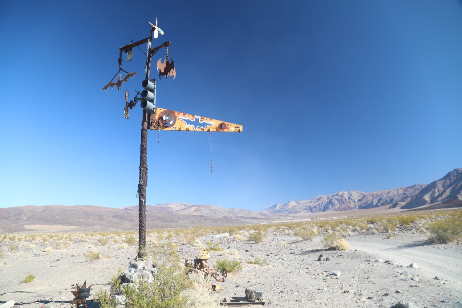
And one can also enter the warm springs from Steele Pass which comes in from the Eureka Dunes – a very much rugged 4wd only road. If one enters the valley from either the North or South Pass they will eventually turn onto Warm Springs Road from Saline Valley road and will pass by an odd welcoming monument – a metal sculpture built of odd parts including chains and a stoplight – with metal bats hanging from near the top.
While the distances are not great, the roads are bad and very slow going at times. Some of the worst washboard (buckboard) we have ever experienced based on years of driving nasty dirt roads in California and Nevada is on Saline Valley Road – south of the warm springs. And this washboard is not for a short ways – rather it continues and continues and drivers have to move agonizingly slow for great distances. However if one has a Jeep with large tires, one can ‘breeze’ right over this terrible buckboard at much greater speeds then lesser vehicles.
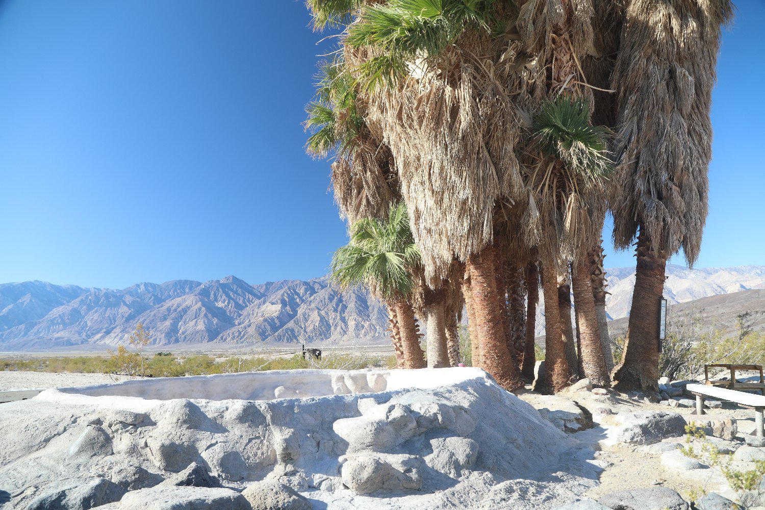
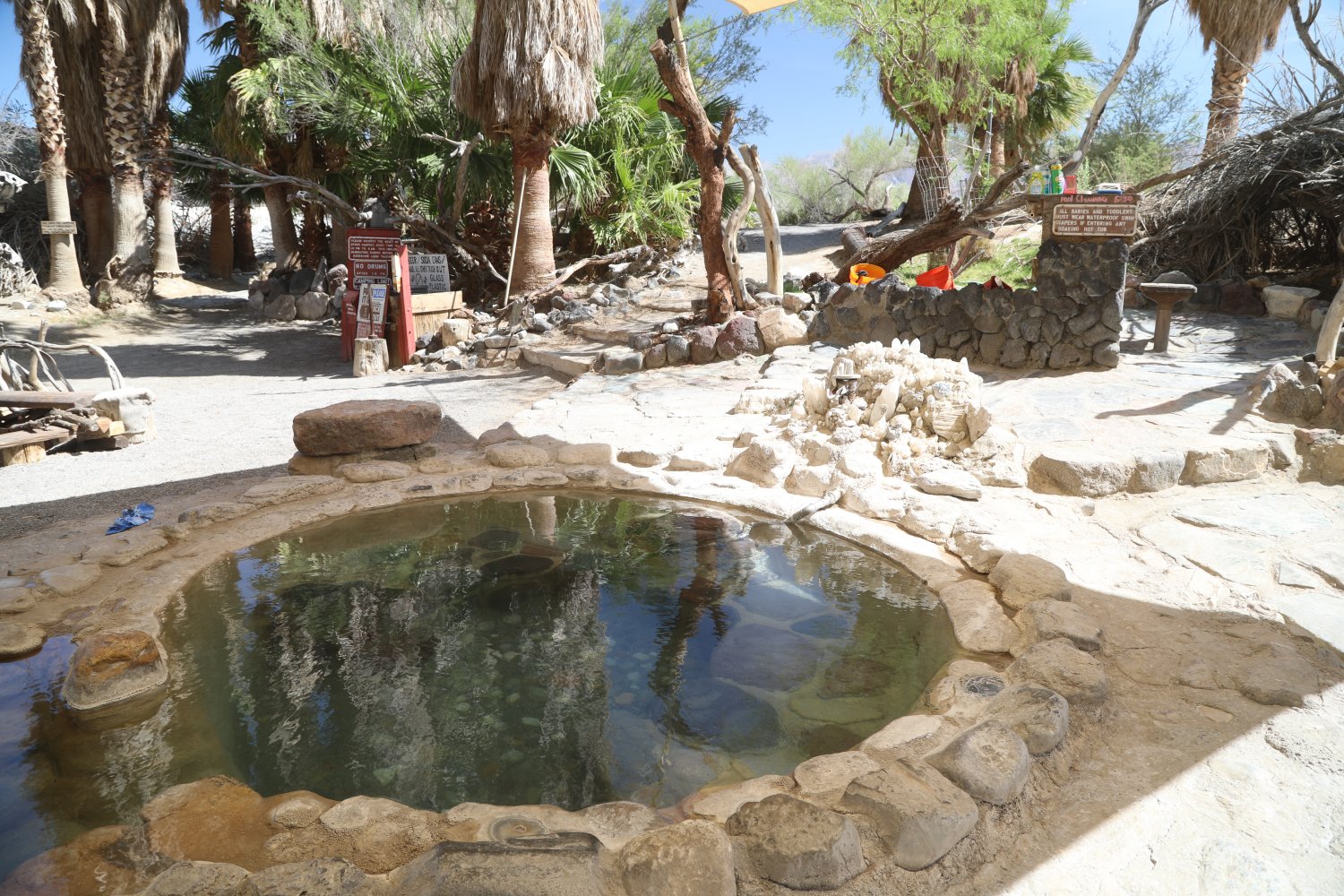
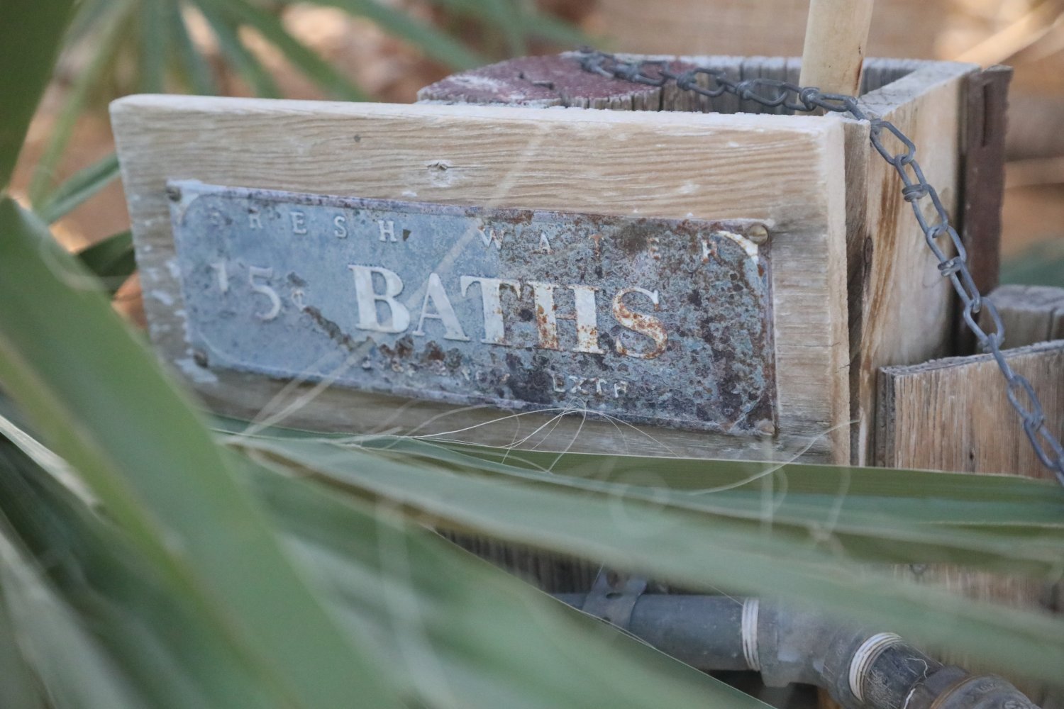
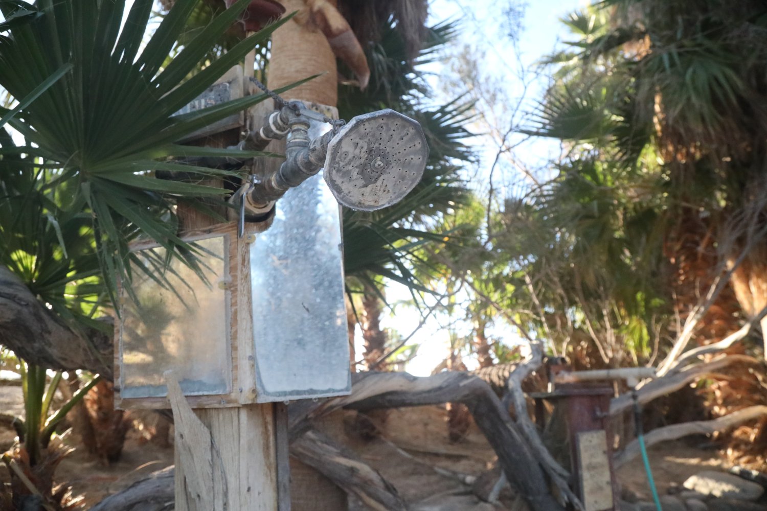
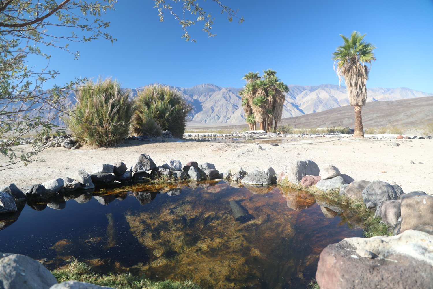
The Saline Valley Warm Springs are actually a series of hot springs all located within the approximate same part of the valley. Over the years the hot springs have been curated into pleasant soaking tubs surrounded by palm trees. Popular at times with those who prefer their hot springs experience in the nude. The primary hot springs has several small ‘pools’ for relaxing and an outdoor bath and a shower right next to the primary tub. Also located here is cute library containing a variety of books in various languages (primarily in English). About a mile away is Desert Hot Spring offering one gorgeous views of the Saline Valley. An outdoor shower is located among the stand of palm trees.
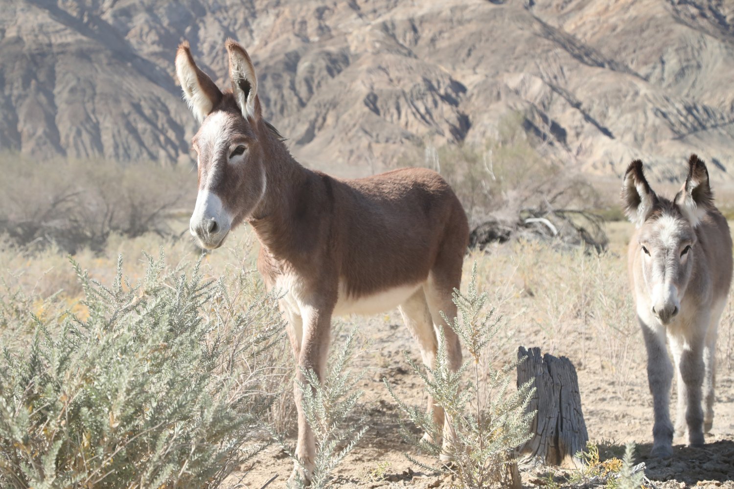
The springs are often visited by semi-wild and in some cases very tame burros. Because of such a remote location, visitors often stay at least a night (but often longer) and camp in a number of camping spaces near the springs. Coyotes like to hang around the springs – and are quick to pounce on open food as soon as campers leave the sites. A number of cute rabbits hang out on the lawn area. And a permanent resident lives in a small trailer next to the hot springs – at the time of our latest visit this is Lee “Lizard” Greenwell.
The vibe here is decidedly funky, casual, relaxing and intriguing – all at the same time, a mostly harmonious symphony far removed from civilization. Its also a contrast in personalities – on one hand a number of nudists frequent the hot springs while hard core OHVR’s cruise by on their way to and from Steele Canyon Pass.


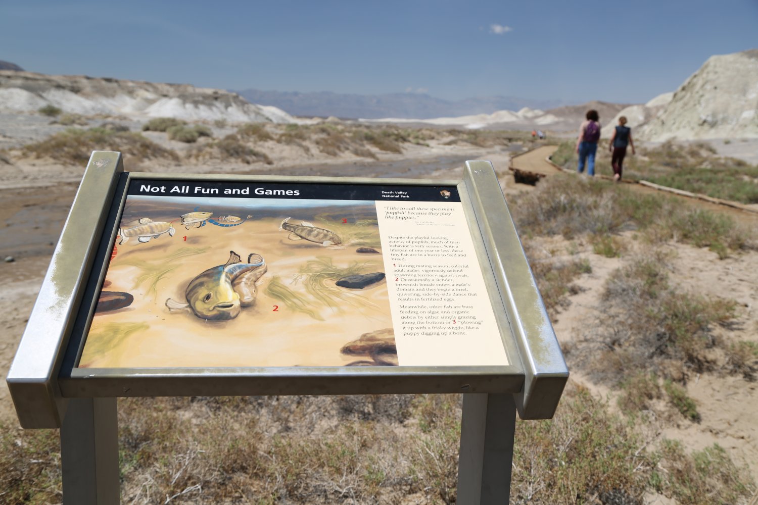
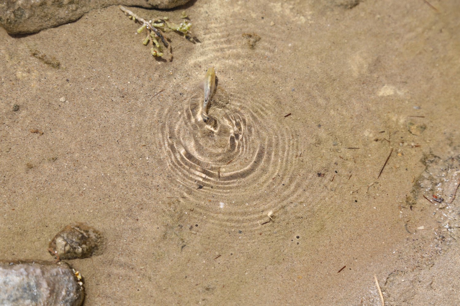
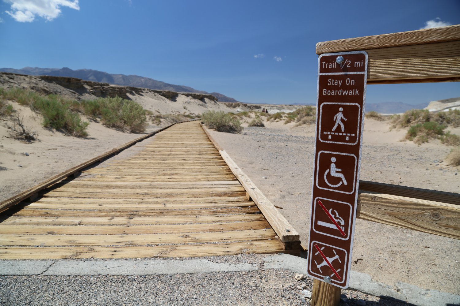
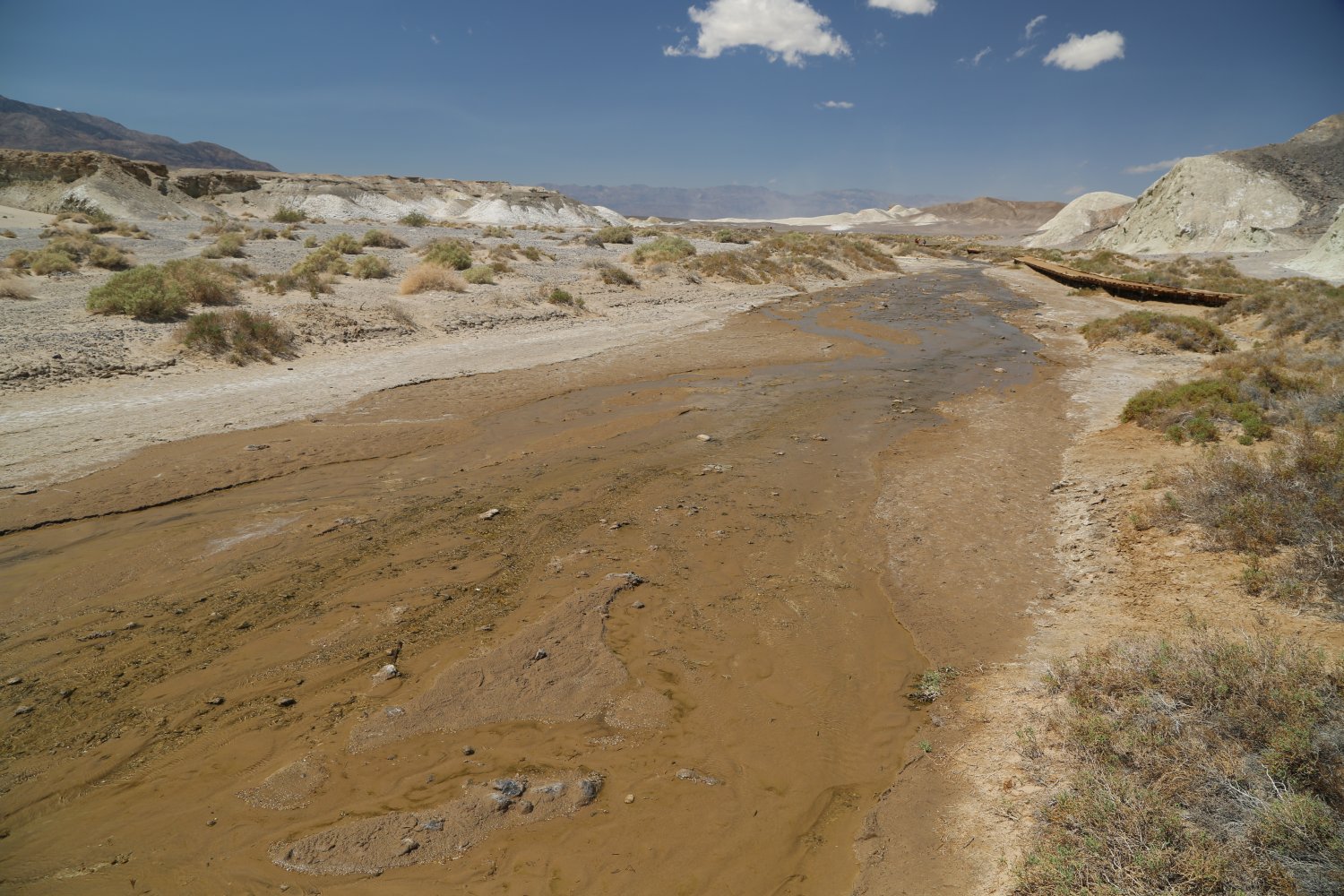
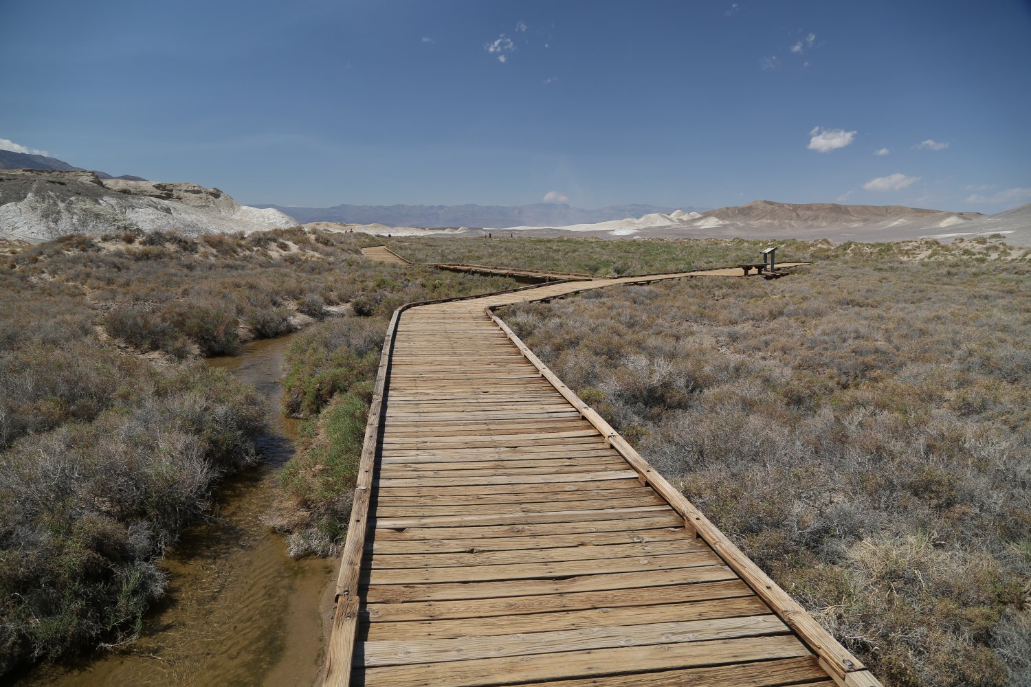
Salt Creek is located on a dirt road (perfectly fine for cars) about 5 miles from where highway 190 meets the road to Scotty’s castle. This is more than 200 feet below sea level. The dirt road is little over a mile one way. A bathroom is located in the dirt parking lot and a short 1/2 mile raised boardwalk trail leads out to the creek. This creek is up to 5x as salty as the ocean and the water gets extremely hot – over 90 degrees F. The creek next to the boardwalk often flows in the wintertime – in the summer it is a different story.
The attraction here are fish – yes fish live in the middle of Death Valley! The creek stops flowing in the summer months and this type of pup fish (Salt Creek Pupfish) retreat to a series of small deeper pools (not accessible or seen from the boardwalk). These pupfish are an amazingly well adapted fish to the harsh conditions of a desert spring. They have adapted over the millennial to saltier and dryer conditions. This is the only location for this particular specie of pupfish in the world, although there are other pupfish species including at Ash Meadows (a bit east of Death Valley National Park).

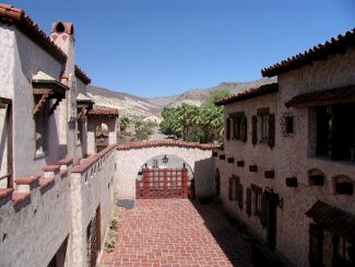
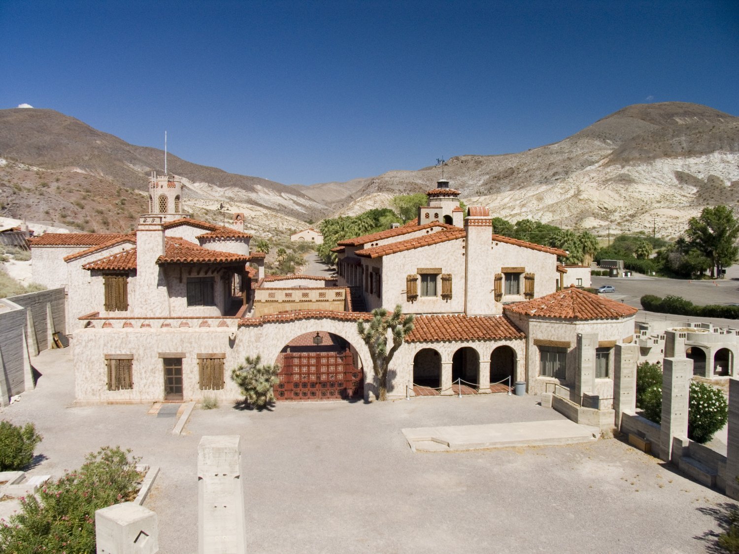 Scotty’s Castle is well worth a visit however because of its location and set tour schedules it requires at least a half day to visit – and you should probably consider a full day especially if you want to take in a few of the other attractions located nearby. In the summer Scotty’s Castle area is often significantly cooler than the valley floor and in the winter they may even get some snow. This castle is set in the middle of an “oasis” due to the several natural springs in the area. It is in a canyon merely 7 miles from the Nevada border. Mesquite campground is about 5 miles from the castle.
Scotty’s Castle is at least an hours drive from Furnace Creek. Billed as “a great place to escape the heat” this is of course true when compared to the lower reaches of Death Valley. However, beware in the summertime Scotty’s castle regularly sees temperatures above 100 and into the low 110’s. When Death Valley is baking in the high 120’s Scotty’s Castle can be in the mid to high one hundred teens F. Ample parking is provided, some spaces are under tall shade trees. A spring is on the premises so you can wet your feet in the water as you walk around the grounds. Once you arrive on the grounds you should immediately go to the ticket office located on the side of the main castle building. The reason for this (especially in the winter months), is that there can be crowds and there are often waiting lines for the tours. The tours are usually given only one time per hour. Once you have your tickets, if you have to wait, you can walk around the grounds visiting the spring, lie around or eat lunch on the nice green grass near the parking lot, visit the gift shop, tour the Stables Classic Car Collection, walk up the hill to Scotty’s grave (you can see the large cross from most places on the castle grounds), or walk up to the chimes tower on top of the hill overlooking the actual castle and grounds. The view from the Chimes Tower is worth the walk as you have a full view over the entire grounds.
Also note the great pool that was never finished – this is a shame it was never finished as standing over the dry pool you can imagine what it would have been like if it was filled with water. Glass port holes look into the sides of this huge pool from rooms/tunnels below Scotty’s castle, there is a bridge that crosses the pool, and there are a series of tunnels one could theoretically swim through if the pool was finished.
Assuming there is enough water on the grounds, which there appears to be, this would be a great modern day project to finish, something that would give Scotty’s castle an additional attraction akin to the Neptune pool at Hearst Castle near Cambria on California’s central coast. Whether this is a project the National Park Service would be interested in remains to be seen. The majority of the pool is definitely already constructed but some remodeling and restoration would of course need to be done as its been many years since its original construction. This was be an absolutely awesome project to be involved with.
 At the time of our latest update, tickets for adults are $30 for the tour of the main castle. Underground tours are also available – they may not run every day in the summer time as there are less visitors then in the winter time. Tours start at 9am and run at least once an hour, but more so in the “winter” months November to April.
To “set” yourself in the time period, pick up one of the 1939 “Castle Chronicles”. This is a reprint of a newspaper set in 1939. Visitors can read about the latest gold strikes, mine fires, the new trans-ocean air service to be started between NYC and the UK, or read about Gandhi’s latest fasting. In addition period ads and prices are listed.
Each tour lasts approximately 50 minutes and is conducted by a guide who is dressed in clothing and has the persona of someone living in the 1930s. The tour starts just outside the castle gates and then proceeds into the main living room. For being constructed the late 20’s this castle was a real engineering marvel. In part, waterfalls kept the castle cool in the summer as the main room had a big waterfall that helped cool the house with the cold spring water. In the tunnels burlap sacks were soaked in water and then hung in tunnels in front of strong fans. This also helped cool the house considerably. On site power was generated and provided electricity for the house. Refrigeration was also provided in the house. You can still see remnants of a solar heating system on the side of the hill overlooking the Castle. A special South/West facing windowed room was available for the winter when things cooled down considerably. The castle also contains many European antiques, furniture and rugs. Johnson sent several of his employees to Europe during the construction to bring back such items. A good collection of Indian baskets is also contained in one of the rooms upstairs.
Scotty’s Castle was named after Walter Scott, or better known as “Death Valley Scotty” He was a “desert rat” who convinced Chicago insurance millionaire Albert Johnson & his wife to give him money to build a desert mansion. Scotty received many visitors to his castle, but always told them he was getting the money to build the mansion from a secret gold mine. In later years Scotty’s Castle was open to the public and you could stay the night and get food also.
Photography is permitted inside the house which is great. Tours lead through all the main rooms of the house including the “big” room, guest rooms, dining room, kitchen and the wonderful 1200+ pipe organ room. This was a 50,000 dollar organ that Johnson installed in the early 30’s – it is still in use today and the guide will have it play a song or two for you.
There is a refrigerated drinking fountain here which is quite rare to find in Death Valley! A small concession stand inside the building which houses the gift shop is also available.
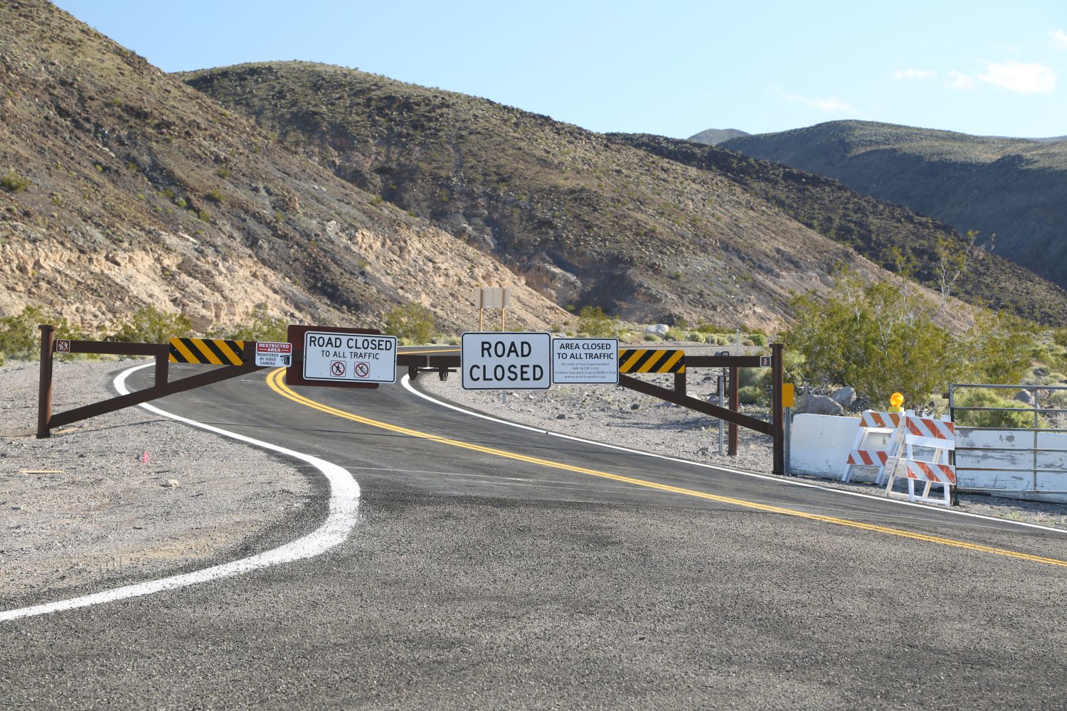
NOTE: Scotty’s Castle is currently closed for 6+ years – a quick but very devastating storm in October 2015 took out the access roads, damaged some of the buildings on the property and created what has become a very expensive project to restore access. It is estimated Scotty’s Castle will reopen again in 2023, 2024 or 2025. However limited Flood Recovery tours of the exterior and the grounds are available on a limited seasonal basis, strictly by appointment.
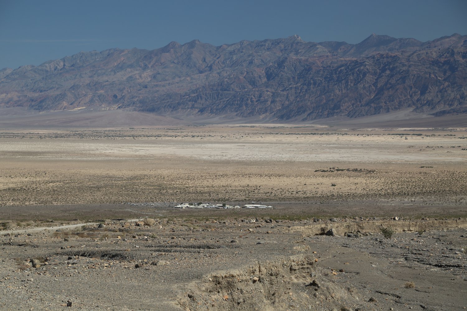
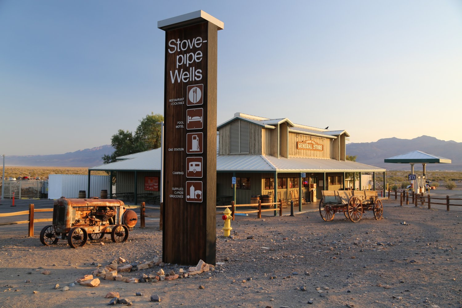
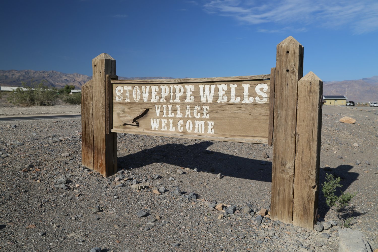
Stovepipe Wells is located almost exactly in the middle of the park from all directions. It is located on the valley floor (basically at sea level) but not as low as Furnace Creek (about 25 minutes drive from there). This small “village” was the original home to tourism in Death Valley – having opened originally in 1926.
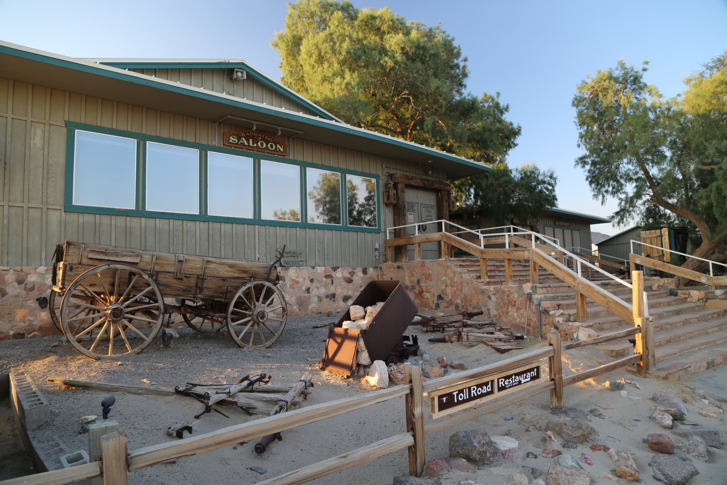
Today Stovepipe Wells contains a general store, a gas station (cheaper prices then at the gas station at Furnace Creek), the ranger station, the Stovepipe Wells Village Motel, a small swimming pool (with nearby covering for shade), a bar and the Tollroad Restaurant. Note that restaurant in the summer usually doesn’t open for dinner until 630pm, but the bar is open earlier for bar snacks and drinks. A jukebox is provided for paid enjoyment.
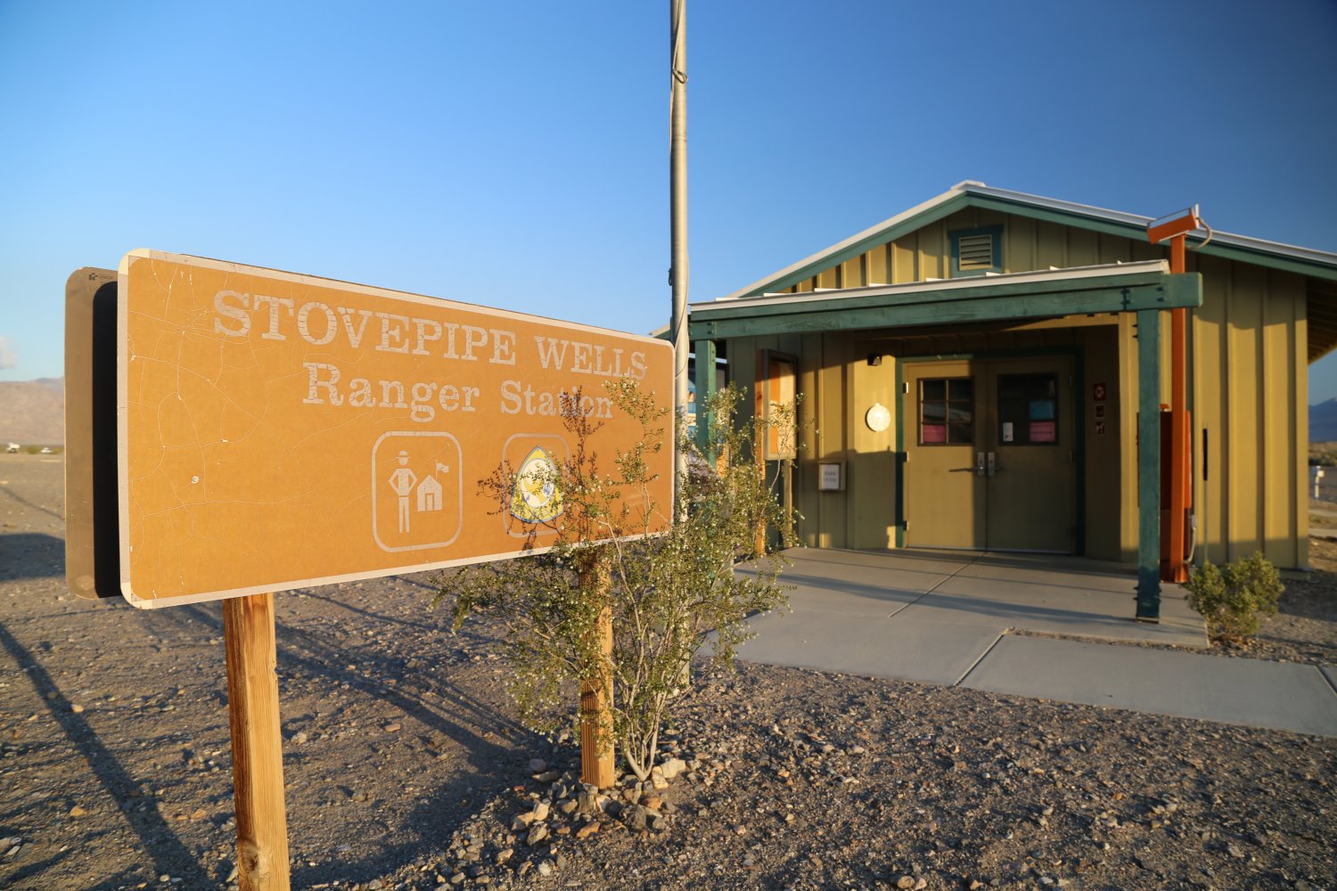
A campground is also located here – little shade provided but within walking distance of the store. Guests entering the park for the first time can use the automated ticket dispenser at the ranger station to purchase and print your 7-day park pass. The same kiosk will also print tickets for the Stovepipe Wells only campground.
Because of its central location within the park, Stovepipe Wells is a good point from which to launch your sightseeing forays. Two gift shops are located here; one next to the hotel registration and the small gift shop across the street (located within the general store). Both have a decent selection of clothing, souvenirs and cold drinks.
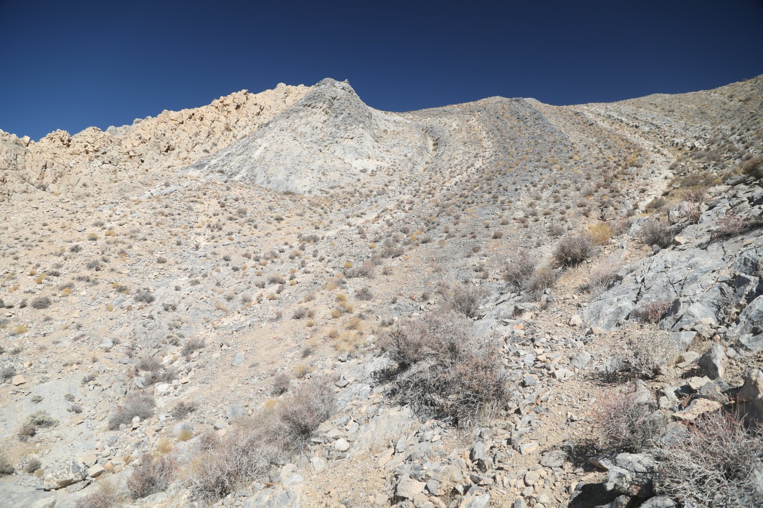
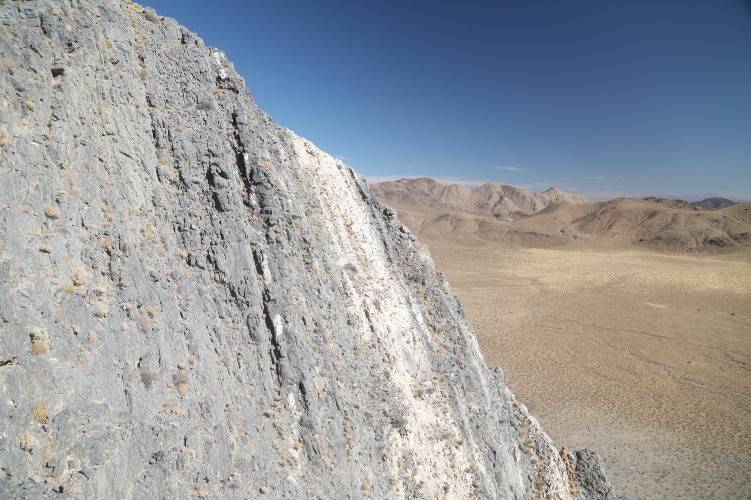
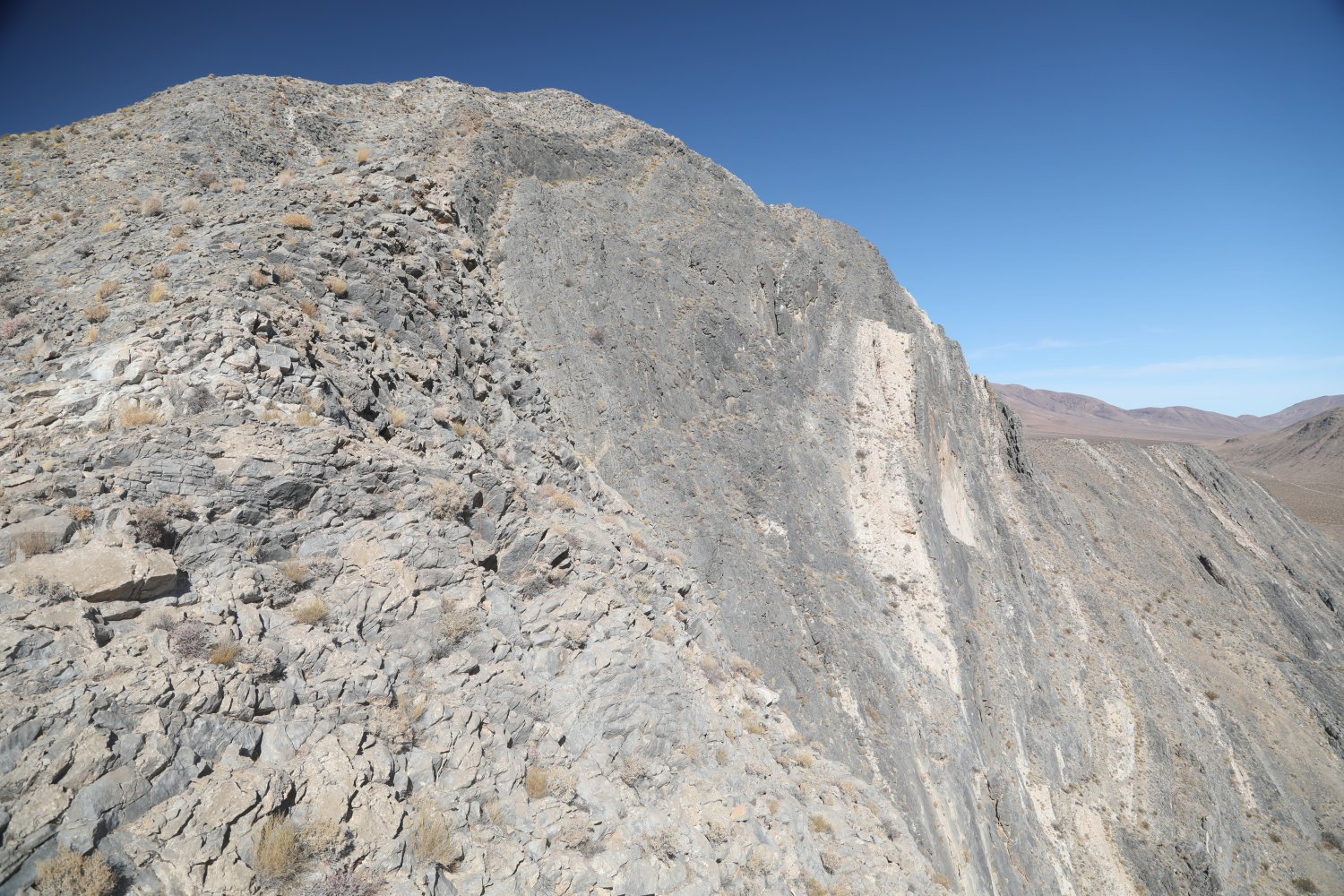
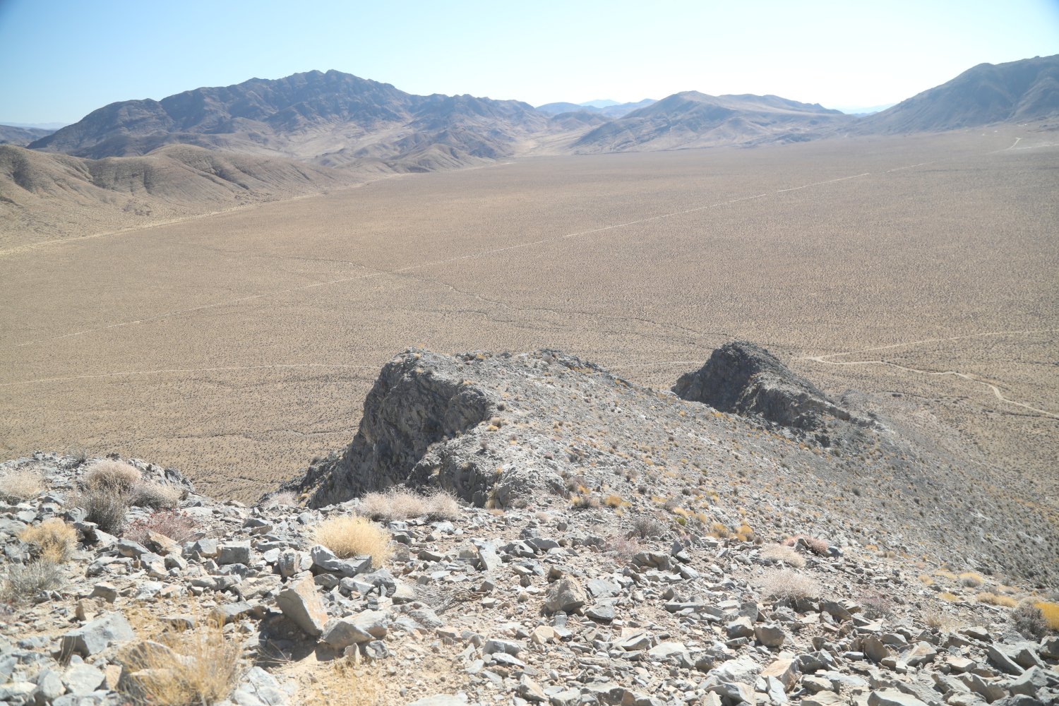
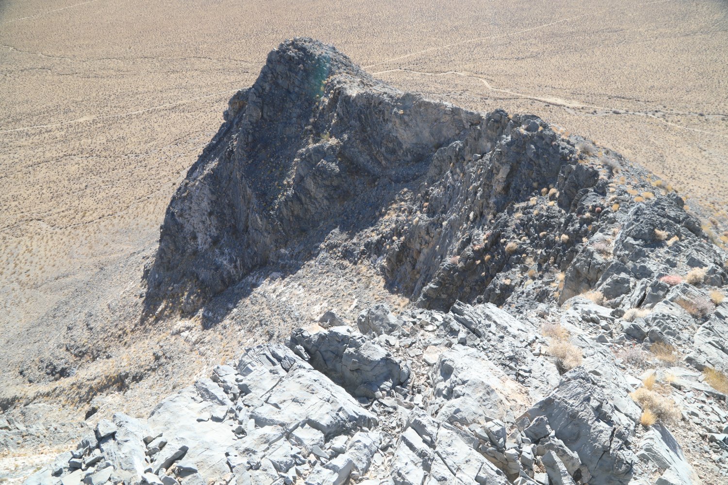
Striped Butte is a prominent rock formation rising out of Butte Valley easily understood why it is named as such when one gazes upon its various lightly colored rock ‘stripes’ the run up and down its sides. Access is via two roads into Butte Valley – from Panamint Valley thorugh Goler Wash, near Barker Ranch and over the extremely challenging Mengal Pass (serious 4wd only vehicles) or from Death Valley and Westside Road (20 miles on the rough and rocky Butte Valley Road).
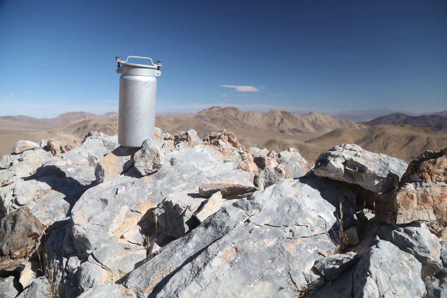
A rugged but passable road leads from Butte Valley Road to a turn around spot about 1.5 to 2 miles in from Butte Valley Road. From here one needs to hoof across its lower rocky slopes eventually reaching the spine of the butte (with a very steep drop off on the other side). If one is in good shape – one can easily make the hike to the summit and back in about an hour or less. At times what looks to be parts of a trail lead up the side of the saddle to the eventual summit. A metal cannister contains a log book, and a few other miscellaneous items.
Elevation top out is 4,477 feet.


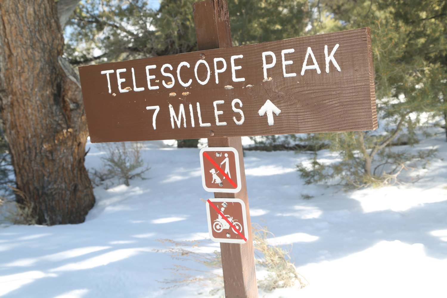
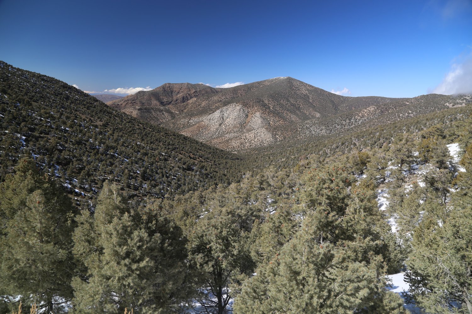
Telescope Peak . From the charcoal kilns at Wildrose a rough steep and narrow road leads to Mahagony Flat Campground (located above 8,000 feet and perhaps the highest campground in Death Valley National Park). This section of the road is often closed during the winter months due to snow. And visitors wishing to hike to the summit of Telescope Peak must park in the dirt parking lot across from the charcoal kilns and hike this road up to to the campground first.
The trailhead to Telescope Peak starts at Mahogany Flats campground. A wooden box contains a trail log – where those can sign their names and write short comments about their hiking experience. The single track trail is 7 miles to the summit passing first through forested areas (pinon pines) before passing through a rare stand of Bristlecone Pine trees closer to the summit. Allow all day to make this round trip hike.
Appropriately named, from the top on a clear day one has expansive views in all directions and can see Mt. Charleston – way out in Nevada and also Mt. Whitney, the tallest mountain in the lower 48 states.
 Titus Canyon – is located off of the road to Scotty’s Castle – via a 2.5 mile graded dirt road that reaches the trailhead/entrance of the canyon. Motorists should be advised that the road in the base of the canyon is one way and cannot be driven in the direction from the Death Valley side. Rather the approach is from Beatty through Leadfield and is a one-way direction until you exit the canyon.
This is one of Death Valley’s most impressive canyons based on it’s very narrow at times base and the sheer steepness of the walls which rise on both sides (up to 500 feet in some sections). It is also one of the largest canyons in the area – draining some 35 square miles of land. Of all the canyons in Death Valley, perhaps this one is the most reminiscent of what are called ‘wadis’ in the country of Jordan.
Pedestrians can walk in from the Death Valley side – paying attention to the fact that there may be off-road vehicles traveling the opposite direction. The trailhead for the nearby Fall Canyon also starts from this dirt parking lot at the entrance to Titus Canyon.


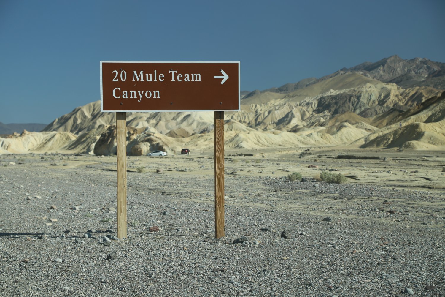
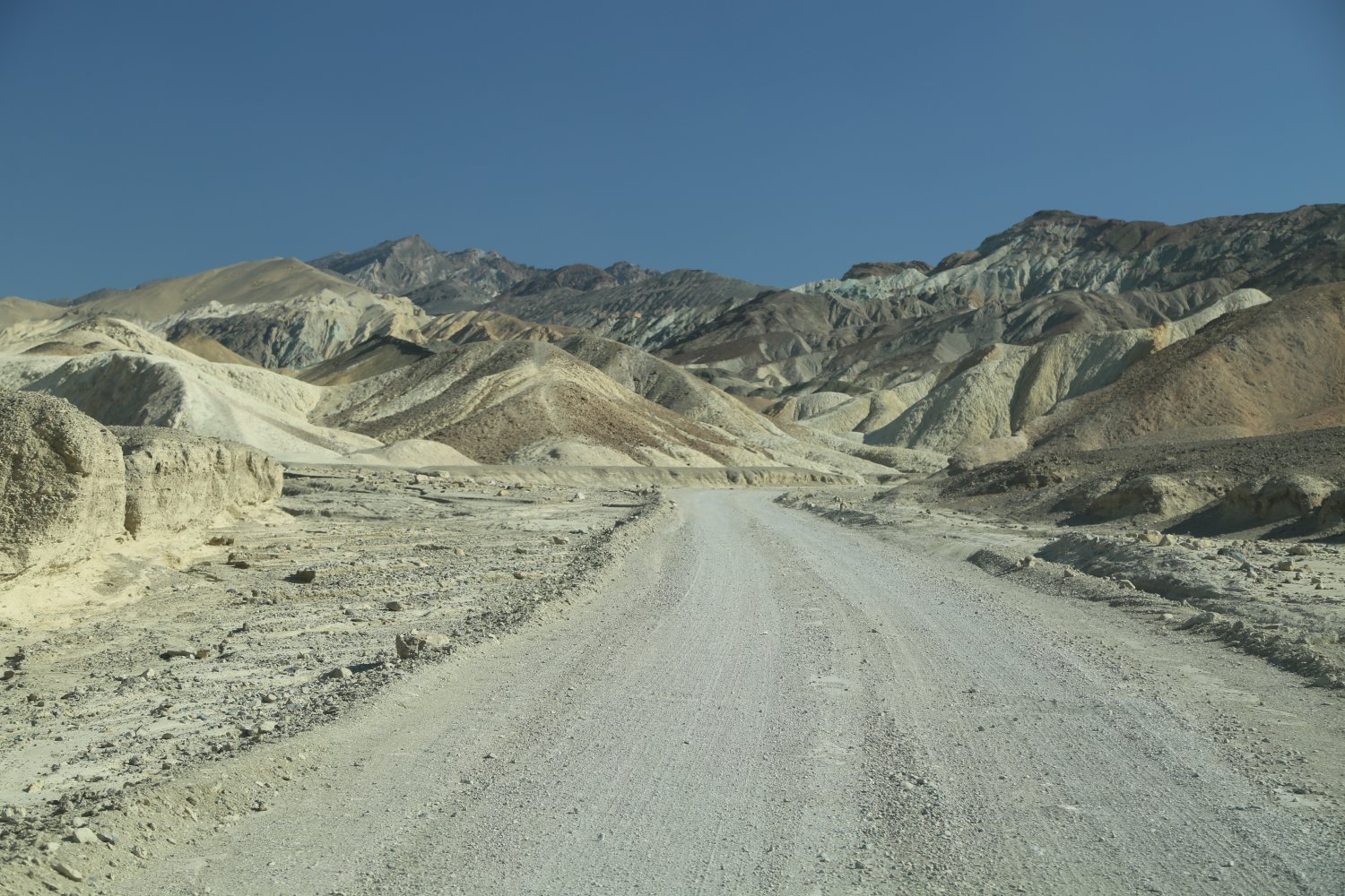
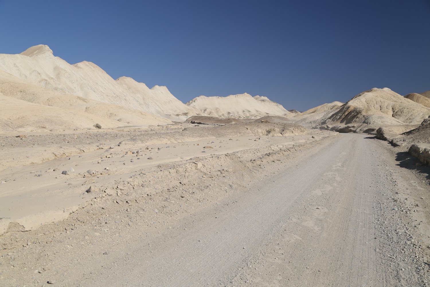
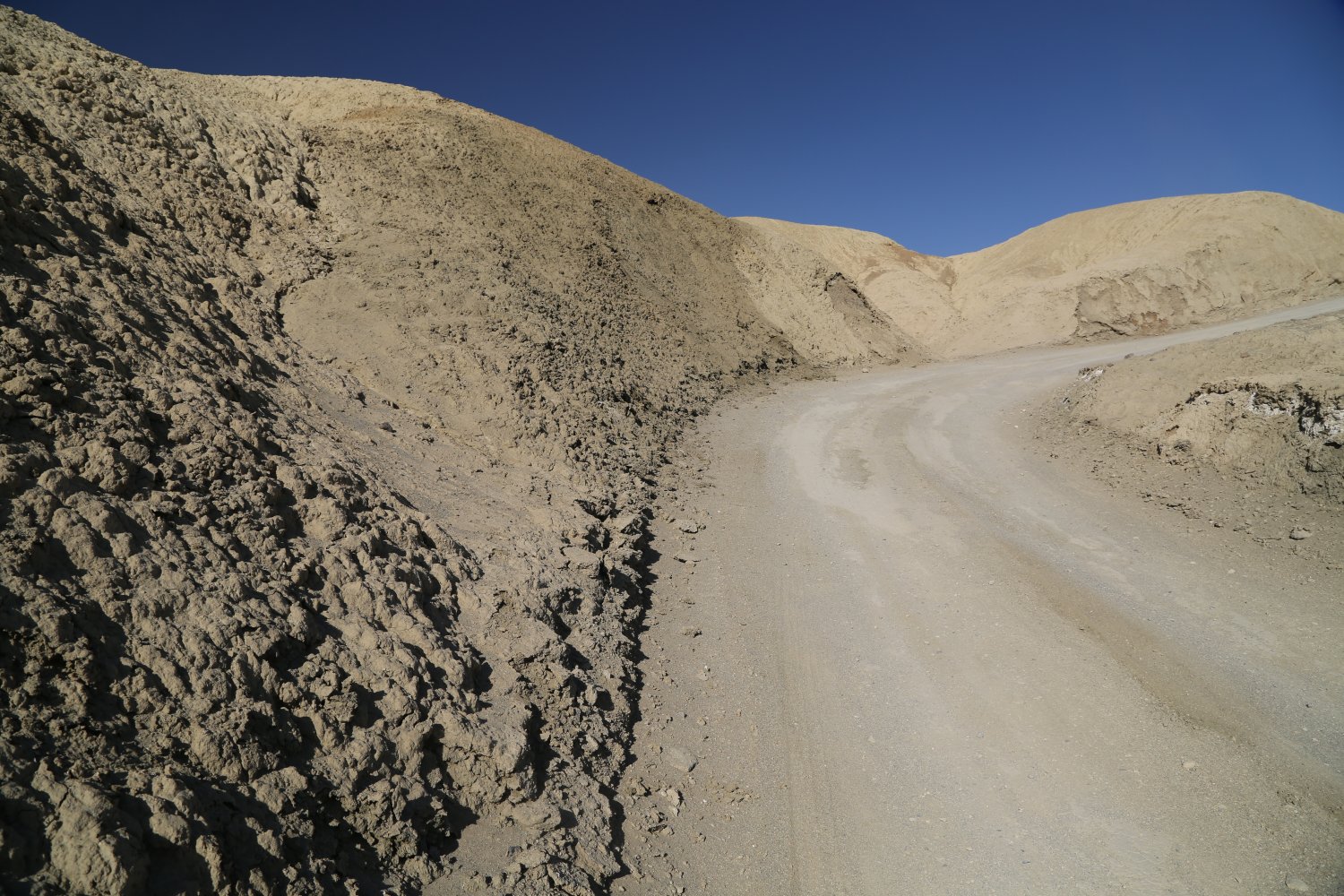
Twenty Mule Team Canyon is a one way 2.7 mile loop located just past Zabriskie Point. This is a very narrow dirt road through a small canyon – it is accessible to most passenger vehicles. Unlike some of the roads in the park this road is not overly rocky as it traverses through mostly smooth dirt – otherworldly stark badlands.
A nice stop is the “mine shaft” – it goes back maybe 50 feet into the hill through rock and it provides what we saw was the only shade along this road. This is not often visited like the nearby Zabriskie point and chances are you will have the road to yourself. Never actually used by the 20 Mule Teams but named in tribute to their efforts hauling Borax during the mining days.


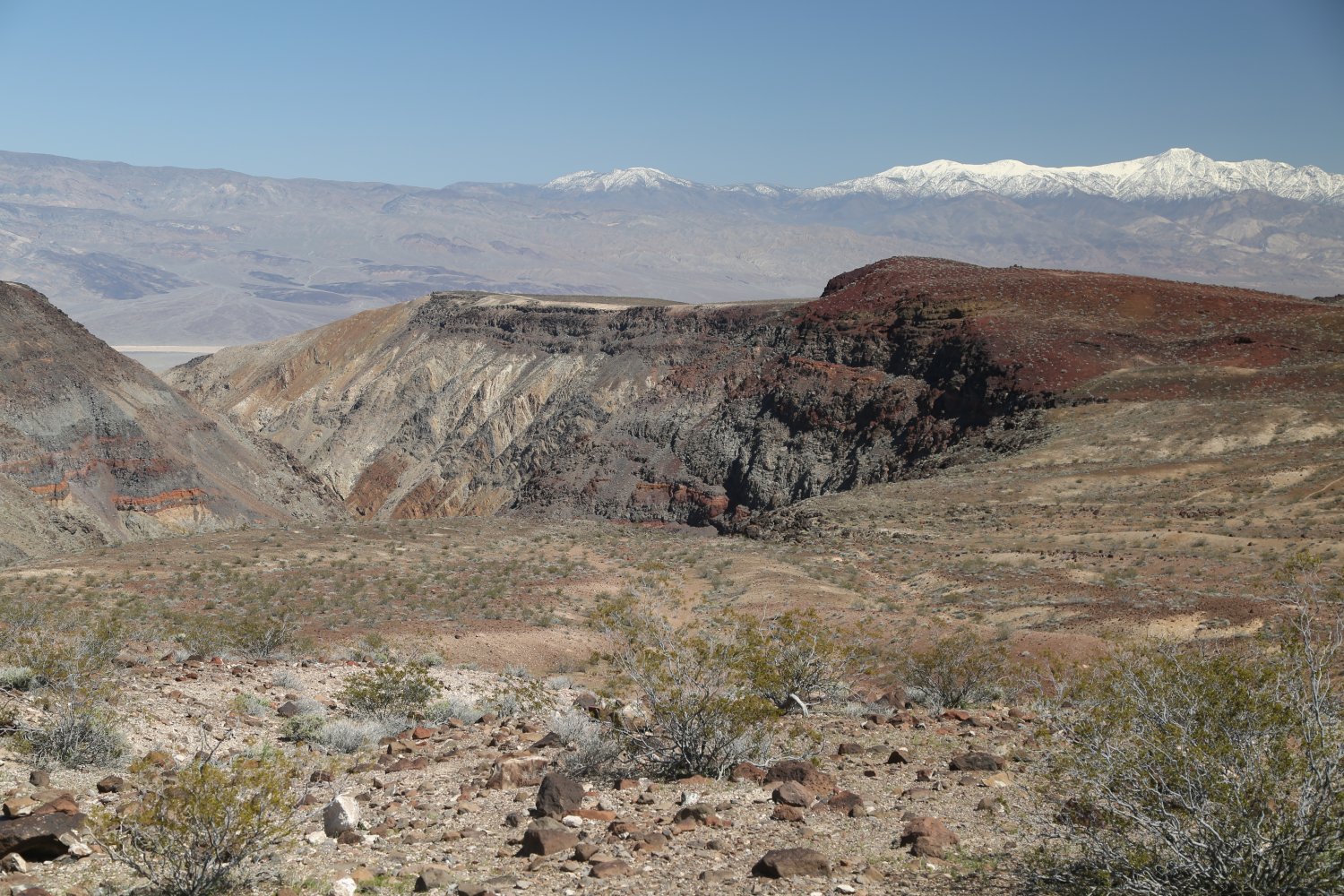
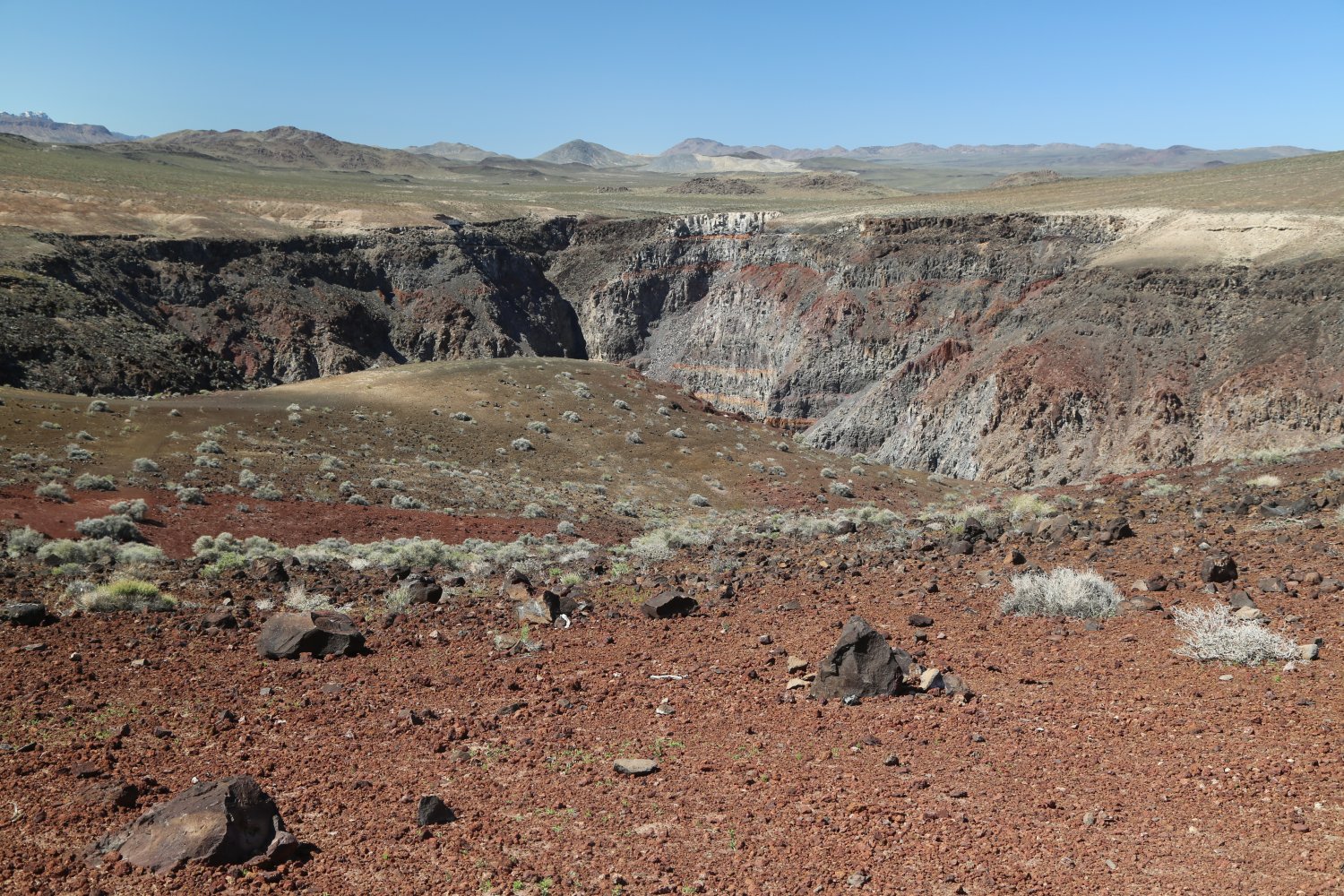
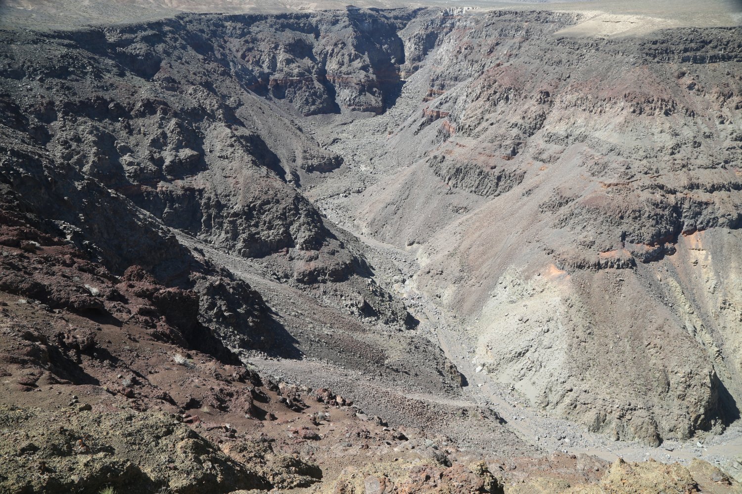
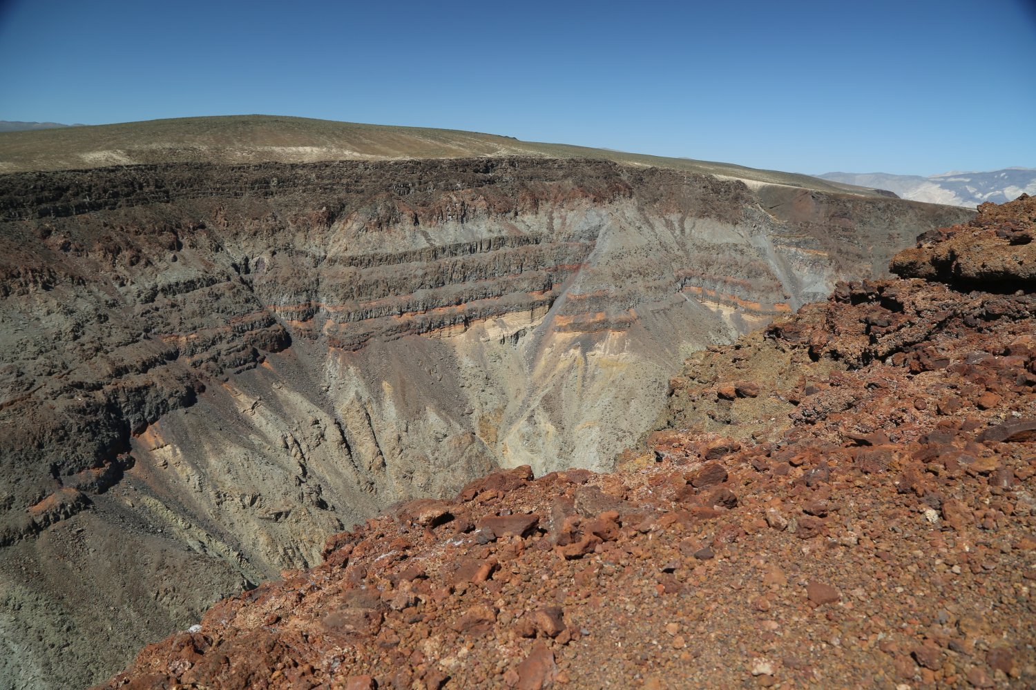
Ubehebe Crater is located in the northern part of the park about a 15-20 minute drive from Scotty’s Castle. The road to this crater is paved -although it is a little rough in places. This 300 year old crater is the remnants of what happened when huge steam explosion in the earth occurred. This explosion spewed a bunch of material outwards and today you can see this in the form of cinders and cinder cones that are in the immediate vicinity.
You can hike to the bottom of this approximately 600 foot crater (1/2 a mile across) but its certainly not a recommended hike in the summer time. The hike out can be quite intense in the heat of summer days, especially as it is a totally shadeless trail. Total hiking distance is about 1.5 miles.
In addition you can hike around the crater rim. If you aren’t up for hiking you can see most of the crater right from the main parking lot. Or if you hike about 1/4 mile higher up the edge of the rim you will be treated to even more spectacular views of the crater and the sprawling desert in the distance.
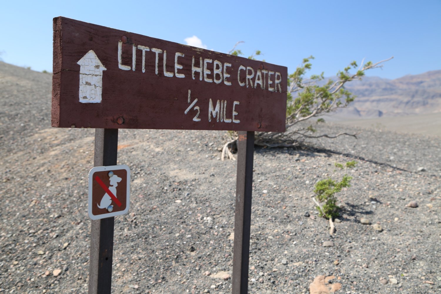
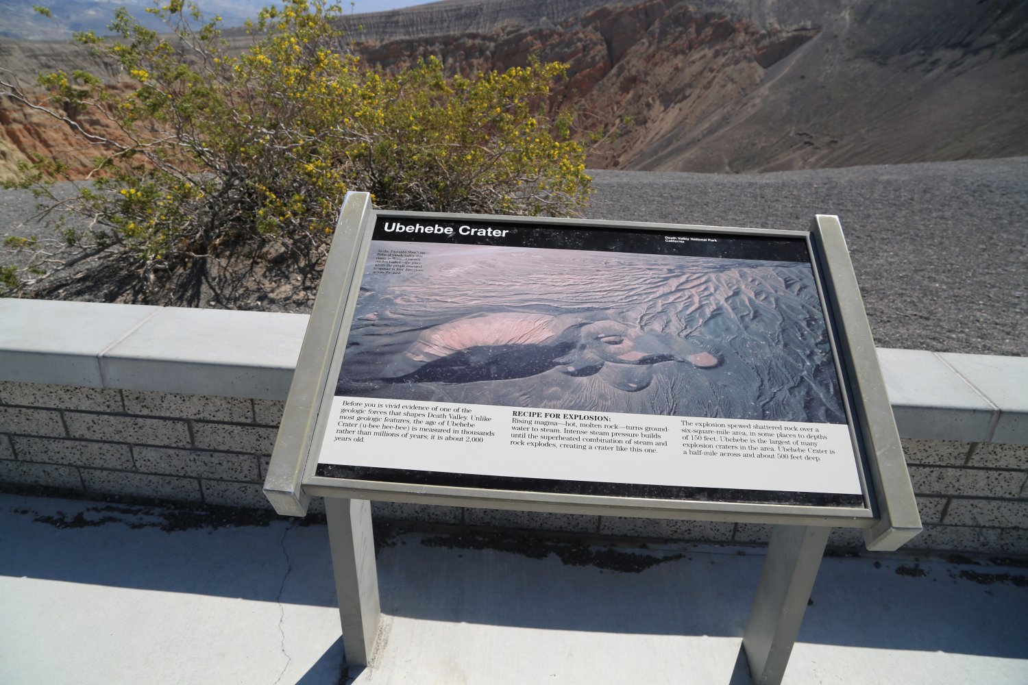
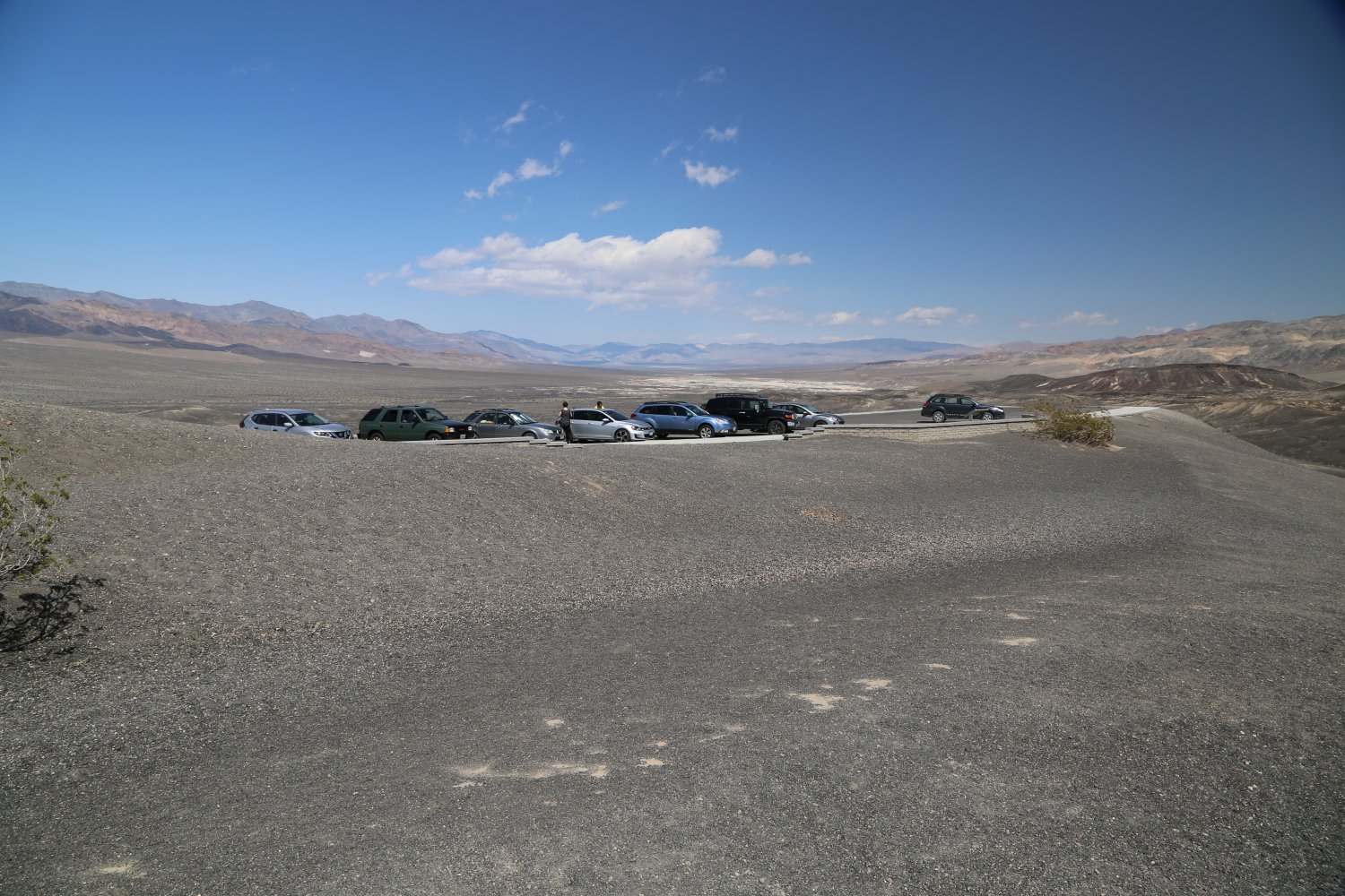
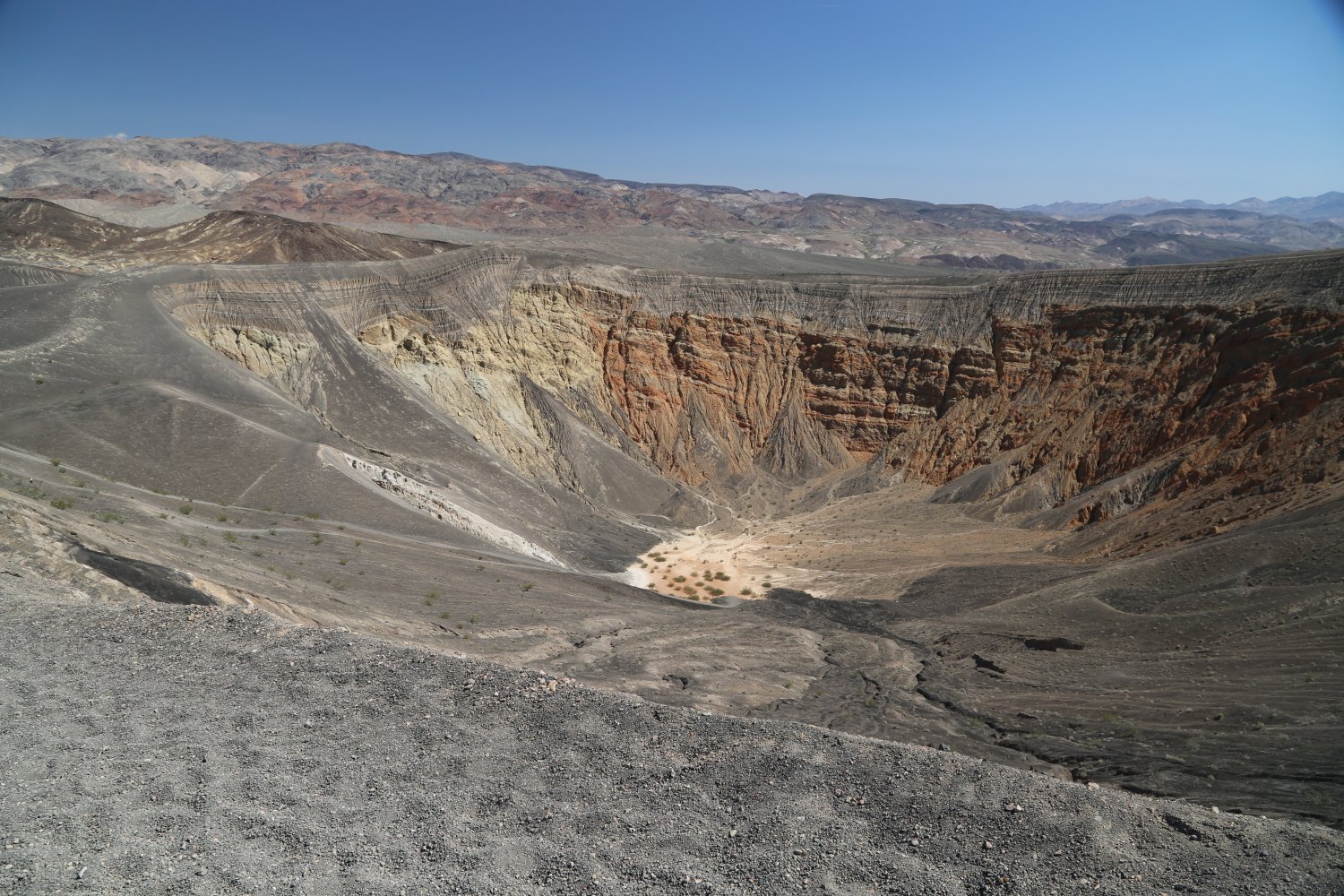
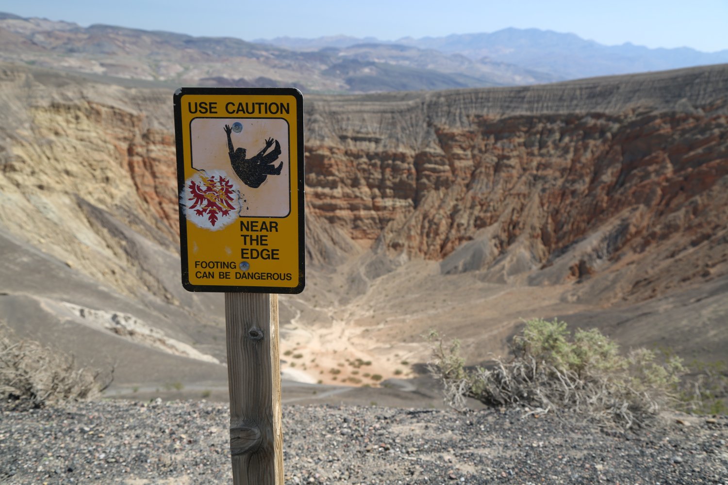

Westside Road is a dirt very flat road that leads off of highway 190 on the west side about 6 miles south of Furnace Creek, just past the dirt turnoff to Artists Drive (which leads off of the east side of highway 190). This is approximately a 40 mile long dirt road – its very suitable for cars (we have driven a 2wd vehicle it’s entire length several times) – although expect some washboard and several bumpy sections of roadway. The National Park Service does grade it ocassionally – and after they do, it is especially lovely to drive. This is a lonely road, depending on the time of year and the time of day or night you may not even see any other vehicles on this road for the entire length.
It leads one on the west side of the valley – passing by the opposite side from Badwater (visitors who drive Westside Road will not see the main Badwater viewing section, located off of Highway 190), but you will still see the Badwater salt flats to the east. The road in fact passes right through some of the white salt flats, and the road in these areas is the smoothest of the entire drive and parts of it feel like you are driving on pavement.
Westside Road passes a few dirt roads leading west into the canyons (most are 4wd only accessible) including the dirt road for the remote Butte Valley located 20 miles from the intersection with Westside Road. In addition, the road passes by several very small springs, including Tule Springs – which tend to mostly be dry. We have never found any flowing water at Tule Springs although there are plenty of Mesquite trees growing here.
Other highlights include the gravesites of two prominent Death Valley characters, miners Shorty Harris and Jim Dayton. They are buried at the following coordinates: 36° 12.453′ N, 116° 52.2′ W. Westside Road also passes by the ruins of a Borax mine.
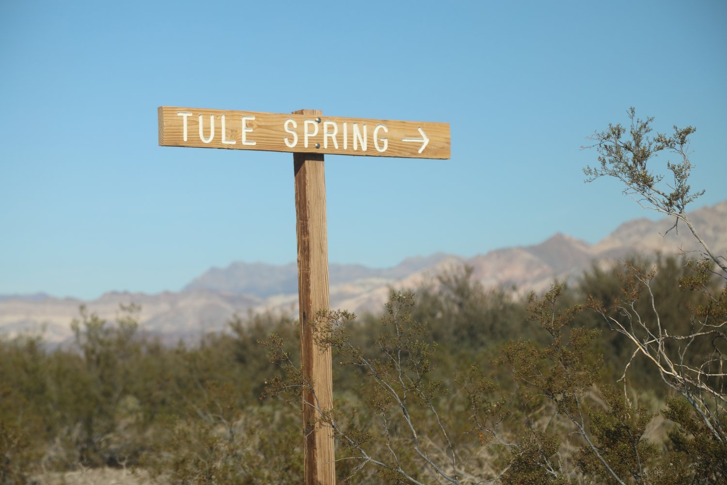
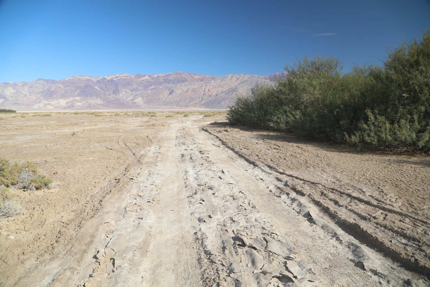


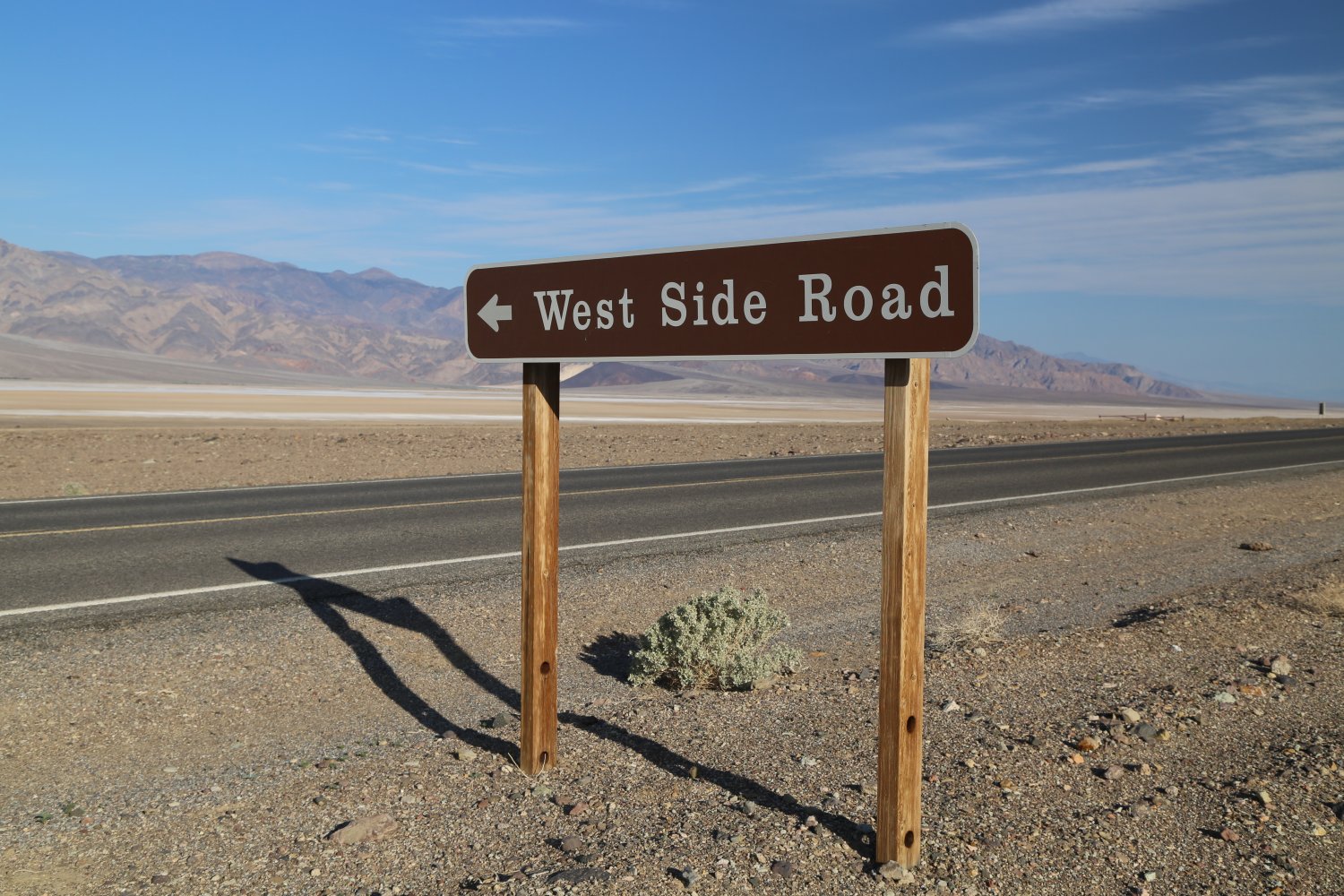
Wildrose Charcoal Kilns are located in the western part of the National Park in the shadow of Death Valley’s highest mountain, Telescope Peak (11,049 feet). These were originally designed by Swiss Engineers and built by Chinese laborers (opened in 1879) to provide fuel for processing silver/lead ore at the Modock Mine smelter (located some 30 miles away). There are a number of these kilns very well preserved and you can walk into any of them.
The walls are still black from the soot and on most days, one can actually still smell the old smoke. The ten kilns are twenty five feet tall and extend thirty feet in diameter. It would take up to two weeks to turn the harvested pinyon pine wood into usable charcoal. If you explore some of the surrounding hillsides, you can still see stumps from trees that were cut down to supply wood to the kilns. This was a lot of work to build – especially considering the distance from the smelter and the fact these were only in use 3 years! Their remote location has certainly helped ensure their preservation.
These kilns are located at about 6,800 feet; in an area that often receive snow in the winter. One year we visited at the end of May and it was snowing here. Weird. Take the paved Emigrant Canyon road after climbing much of the long grade out of Stovepipe Wells to the Wildrose Campground. From there continue on the narrow paved Wildrose Canyon road to where it becomes dirt. Drive for about 2 miles to the dirt parking area right next to the kilns. This dirt road is passable for most vehicles – lots of small rocks on the road but nothing to bad. Drive slow. From behind the southern most kilns there is a 4.2 mile one way trail leading to the top of 9,000+ Wildrose Peak. If you continue driving past the kilns the road becomes much more steep and rugged (4w drive highly recommended – this road often closed in the winter at the gate near the kilns, due to snow), you will reach the 7 mile one way trailhead at Mahogany Flat Campground leading to the top of 11,000+ foot Telescope Peak.

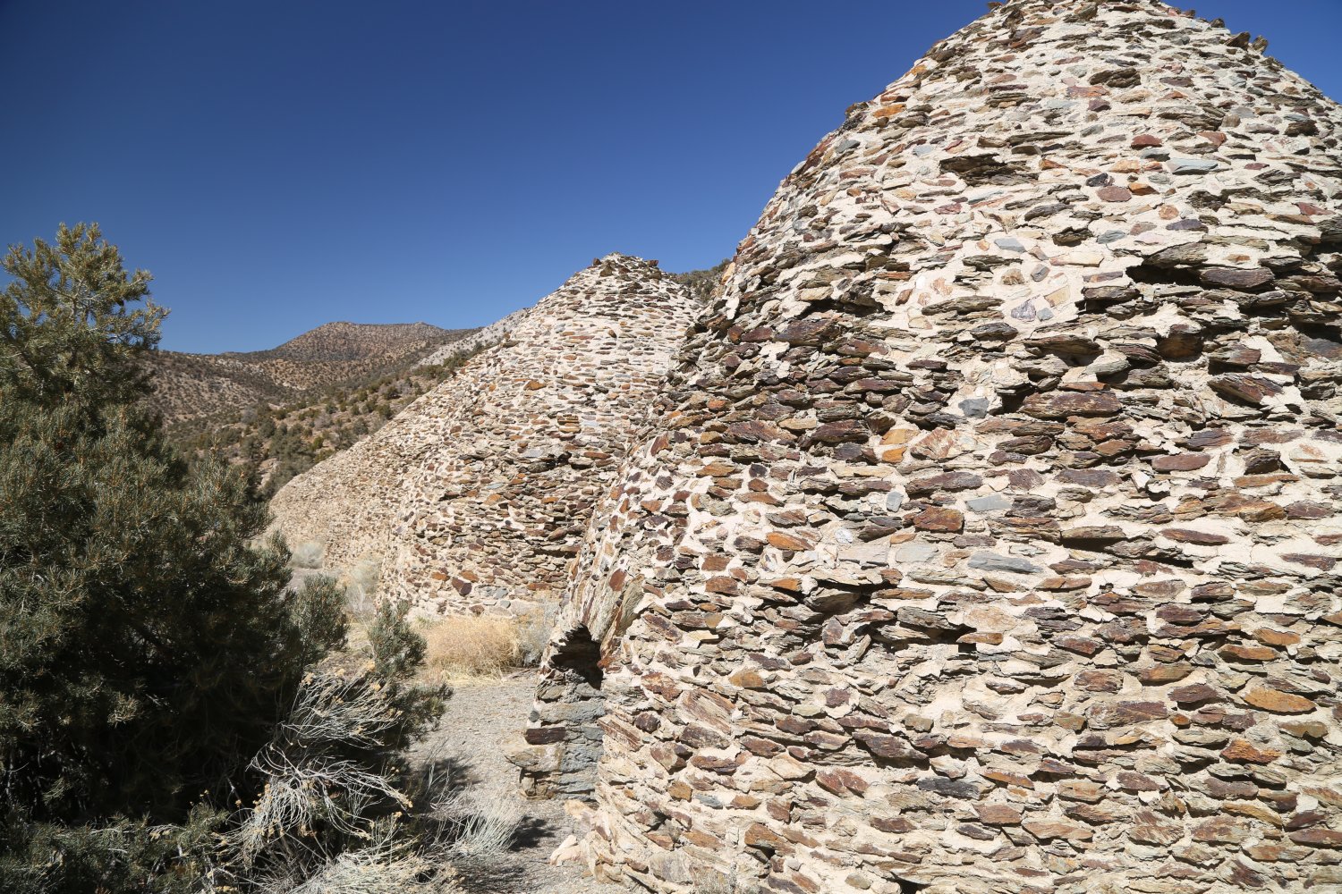
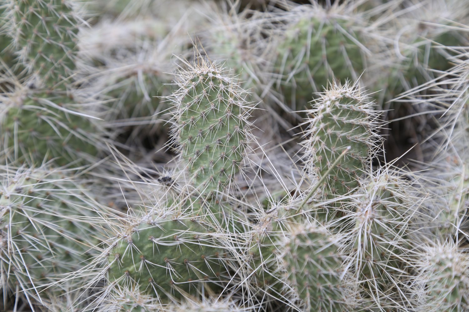

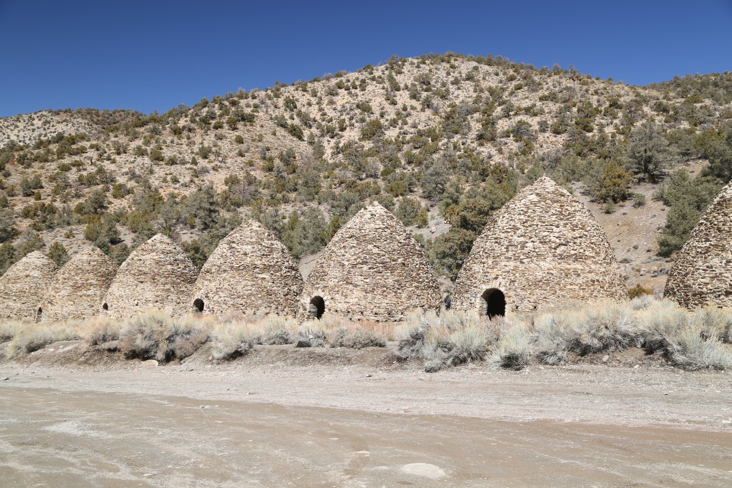
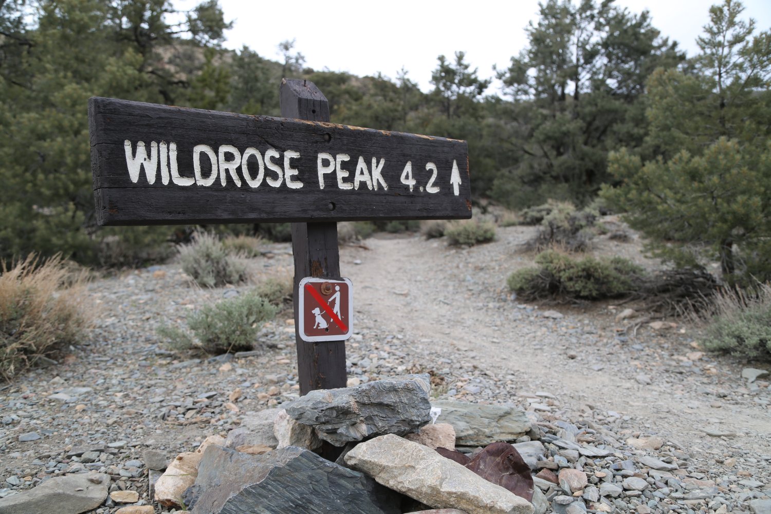
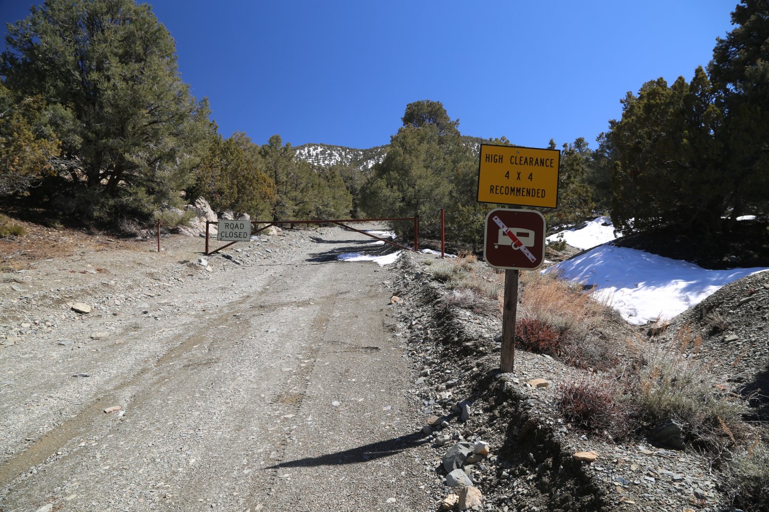
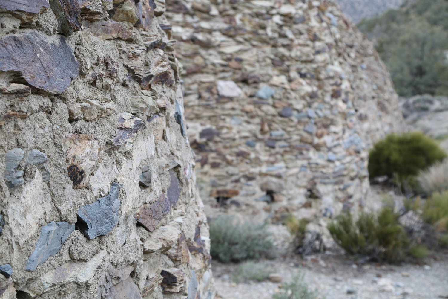
Zabriskie Point can be defined by three words “starkly beautiful badlands”. It is located minutes from Furnace Creek in the hills along the 190 highway. This lookout was first developed by the Pacific Coast Borax Company in the 1920s – it’s namesake came from one of the company’s management – Christian Zabriskie.
A large parking lot with several bathrooms are available. The main viewing section is a short walk up hill from the parking lot. This is one of Death Valley’s most popular stops as it is easy to get to and does not require much hiking. No trees grow here – the multi-colored dirt slopes are dramatically eroded in all directions and you can see parts of the Death Valley floor in the distance. You will see several tracks over these “badlands” – these are trails which lead to various viewpoints. In the middle of summer this can be one stinking hot place to be!
Also of interest: the 1970 film Zabriskie Point was in part filmed on location and select landscape was used on the original U2 The Joshua Tree cover image.
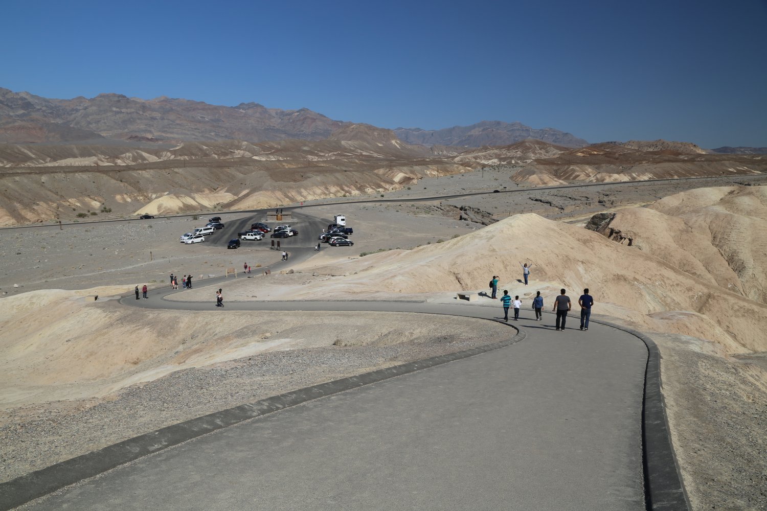
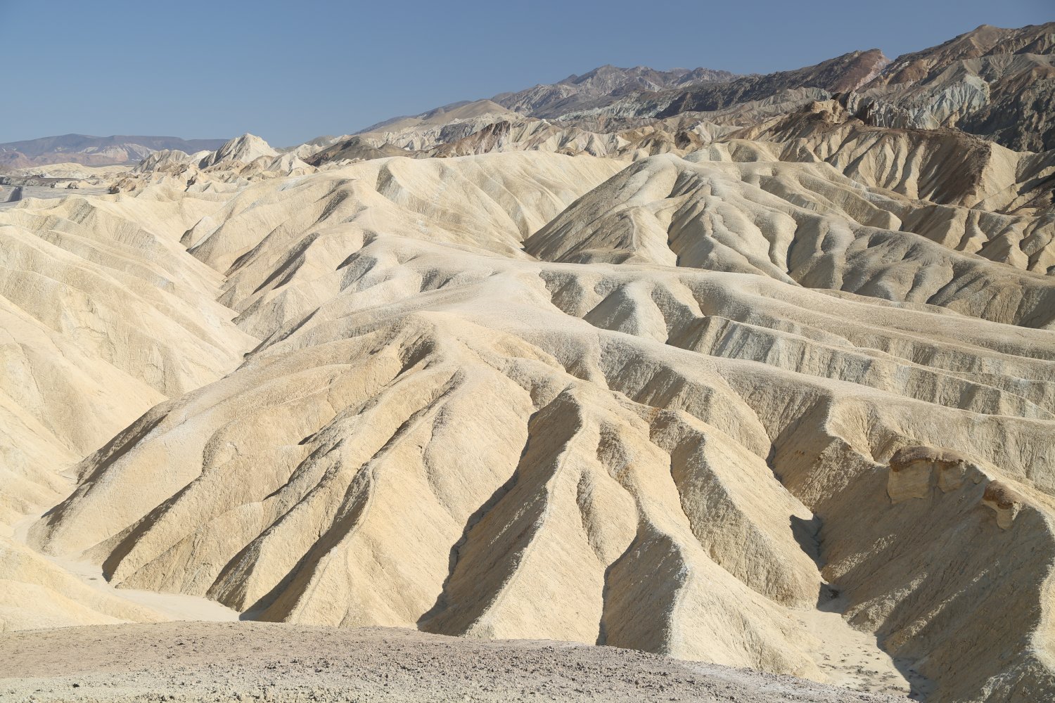
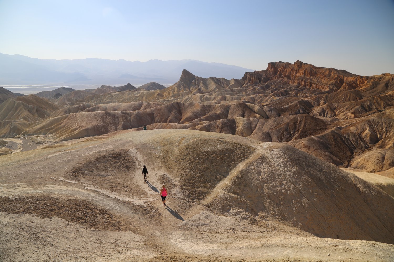
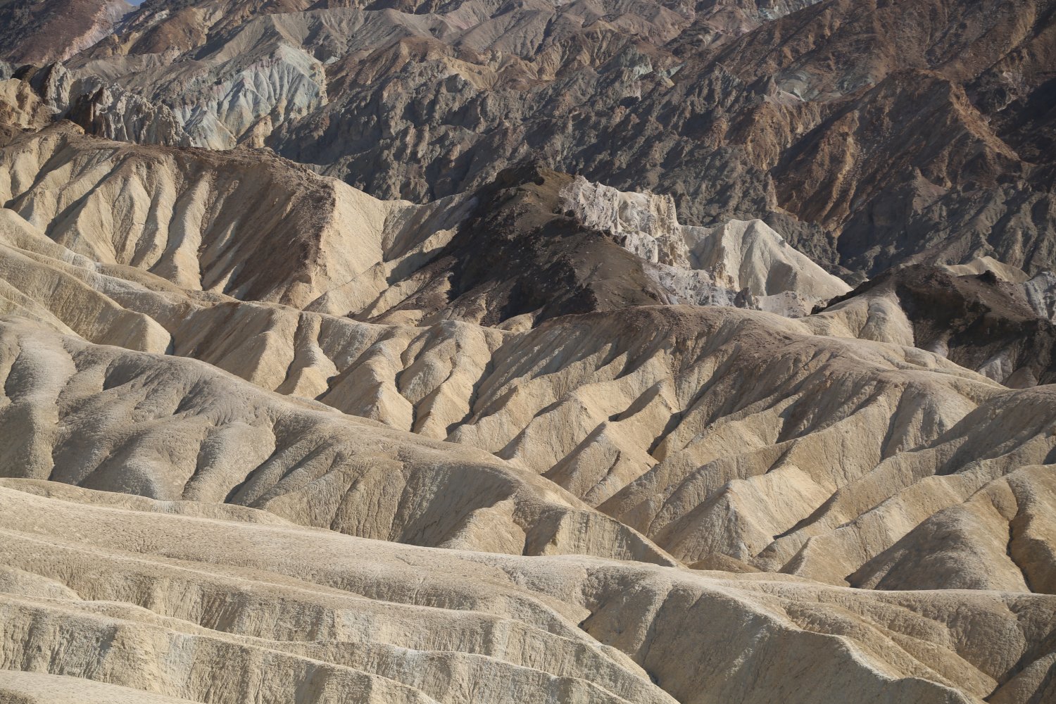
Well written with nice detail. After reading David’s descriptions I would like to visit the other less visited attractions of Death Valley – though during the cooler season. The higher elevation October snow with Pinion Pines looked liked I could readily imagine being there and then warming up in the valley below.