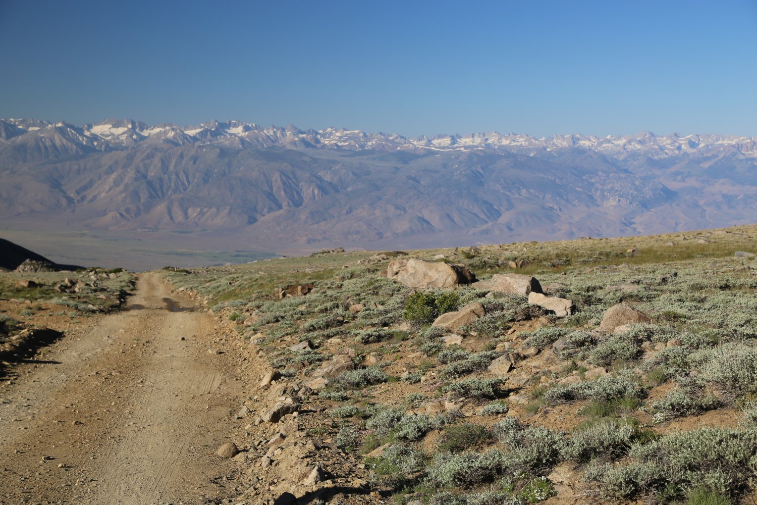
 White Mountain is one of 15 summits in California over 14,000 feet. Along with Shasta it is the only other 14,000+ mountain in California outside of the Sierra Nevada mountains. One of the oldest permanent settlements in North America was located 12,600 feet up one of the sides of White Mountain. This is the highest of the former permanent Indian settlements; there are several encampments slightly lower in elevation. The dirt White Mountain road is the highest road in California. What very well may be the highest section of pavement lies in California above the Patriarch Grove at about 11,500 feet. For quick access to high elevations this is as good as it gets in California! If you live in the greatest Mountains on the Planet – the Himalayas, or even the Andes, the elevation at the top of White Mountain would be considered the “foothills”!
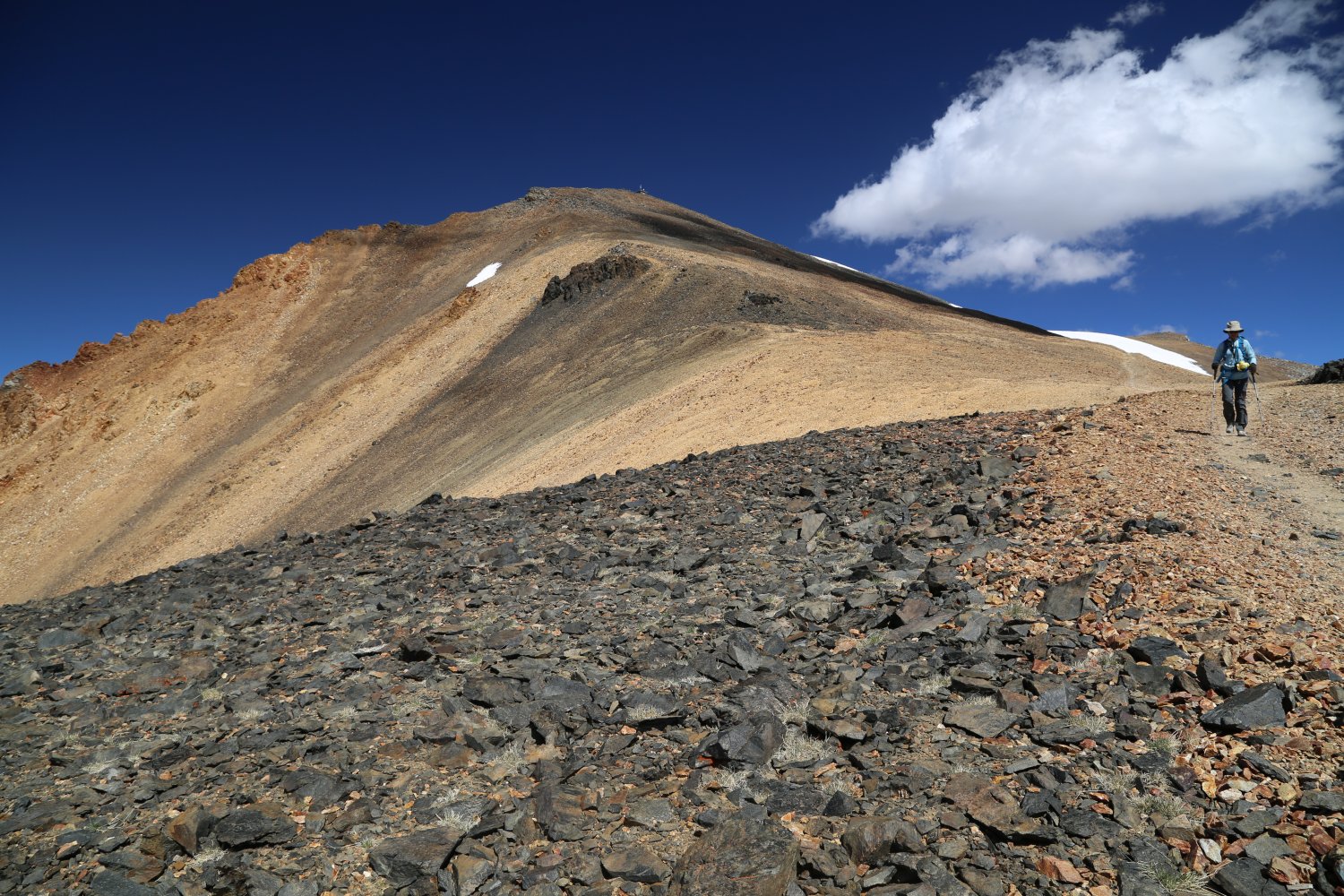
For those being introduced to higher elevations for the first time – this is a good introductory hike to take them on. Having said that, on a cold day late in the afternoon, the hike back to the trailhead from the summit can be among the most lonely, long, stark, windy and cold hikes you will ever do in California. The hike is entirely above 11,500 feet and the dirt road seems to go on forever – across the seemingly barren high slopes leading from White Mountain.
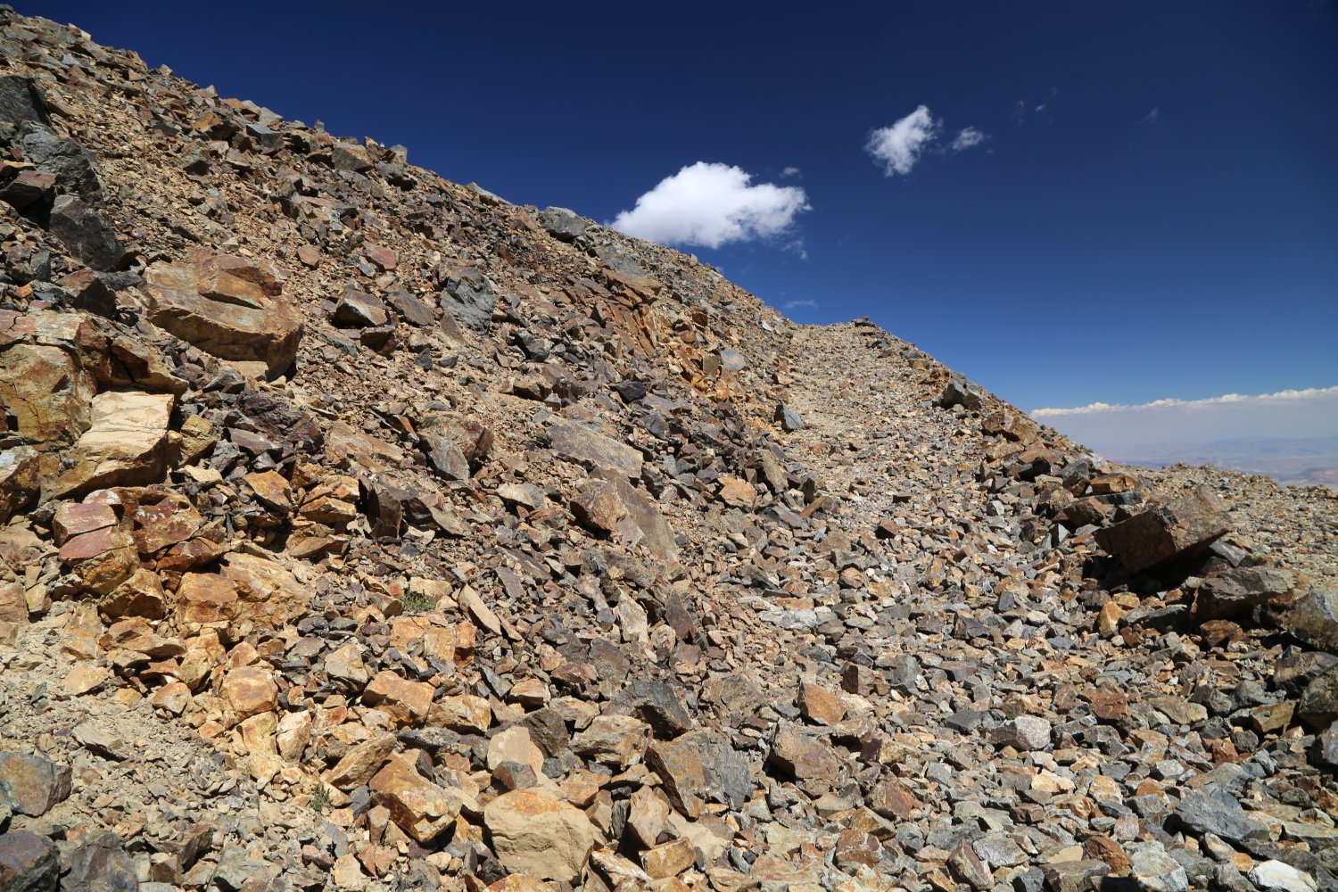
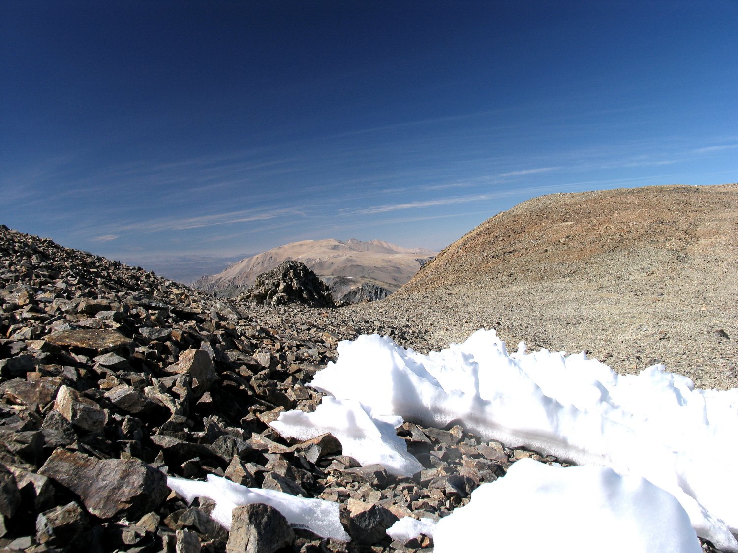
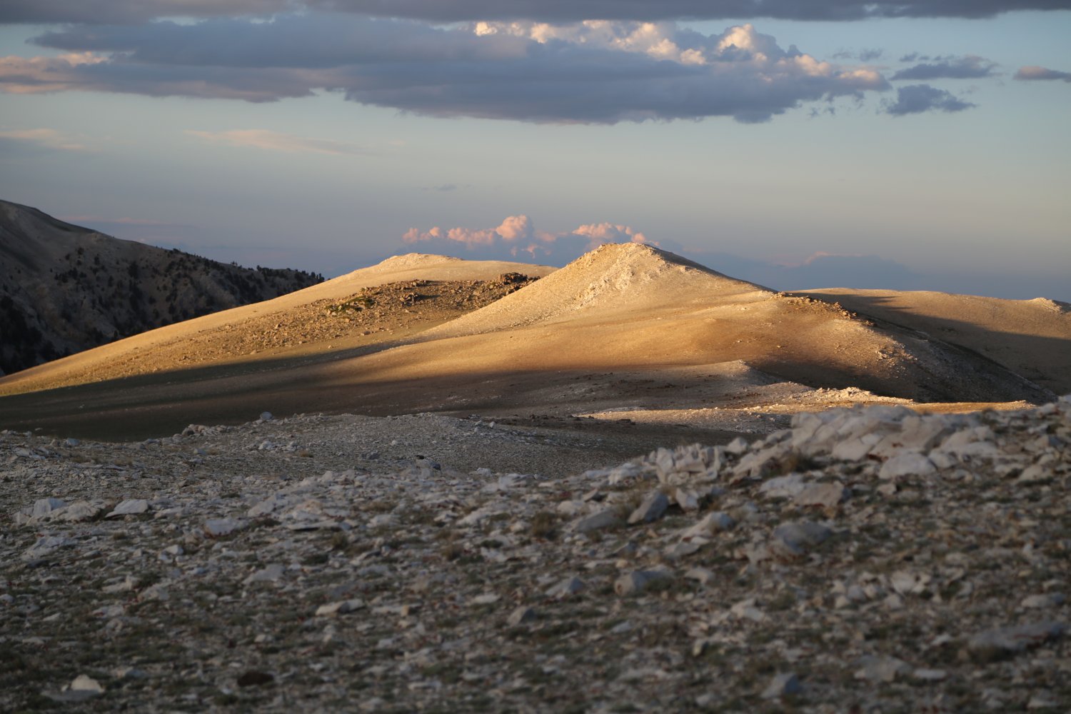
Above about 11,400 feet the much of the visible vegetation disappears replaced by hardy ground hugging plants and plenty of rocks. It is quite barren compared to the Pinion Pine and Bristlecone Pine tree lined slopes from about 7000 feet up to 11000 feet. Below 7000 feet there are few trees present. These lower slopes are covered with sagebrush mixed in with other similar looking small shrubs.
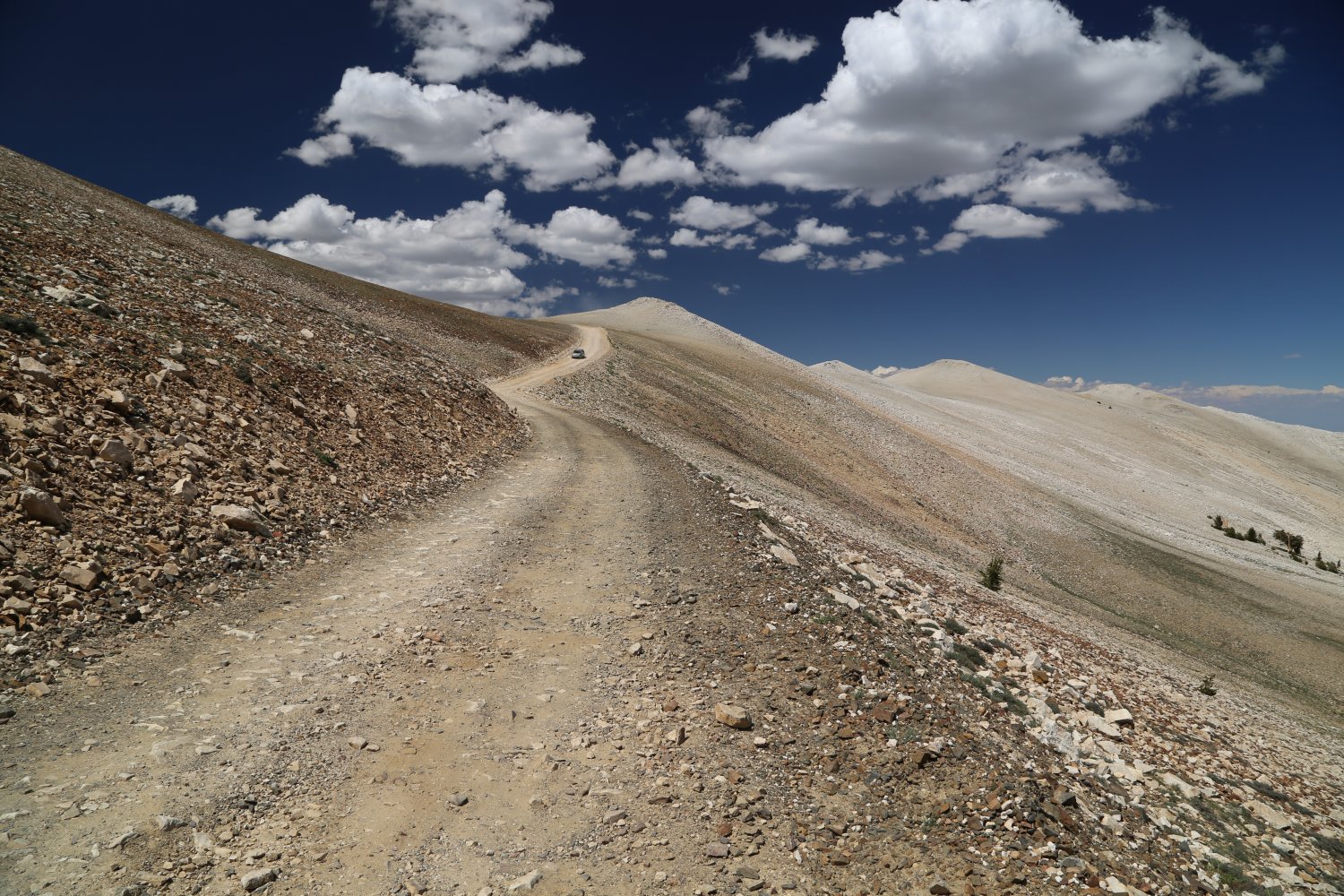
Perhaps the highest pavement in California ~ 11,000 feet near Patriarch Grove
Turn left onto 168 as you drive south on the 395 and drive for about 16 miles until you reach the turn off for the Bristle cone Forest. This turnoff is just past the summit of Westgard Pass (around 7200 feet). NOTE: be extremely careful when you drive back down the Westgard Pass. This is a very steep road and the brakes will easily overheat if you use them too much especially in the heat of the summer. I highly recommend taking your time driving down and gearing down to very low gears. Several times I have seen smoking brakes and smelled the terrible smell of burnt out brakes at the bottom of the pass.
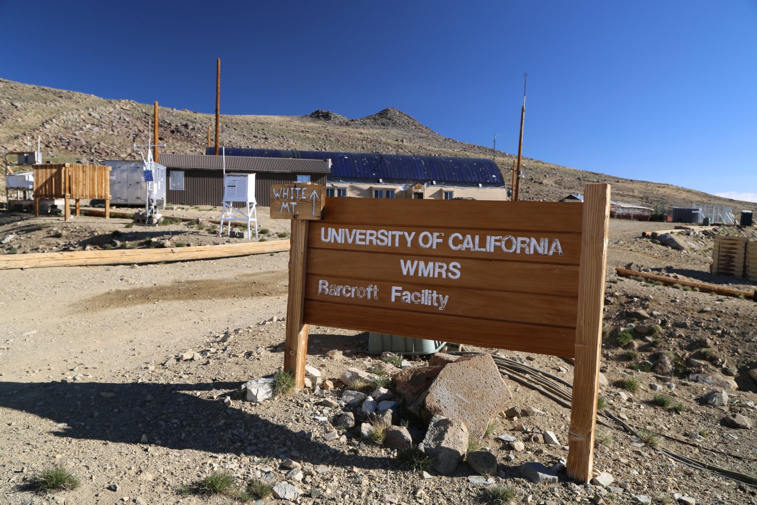
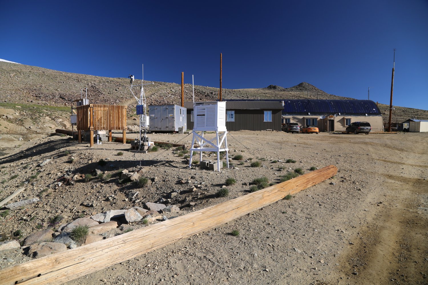
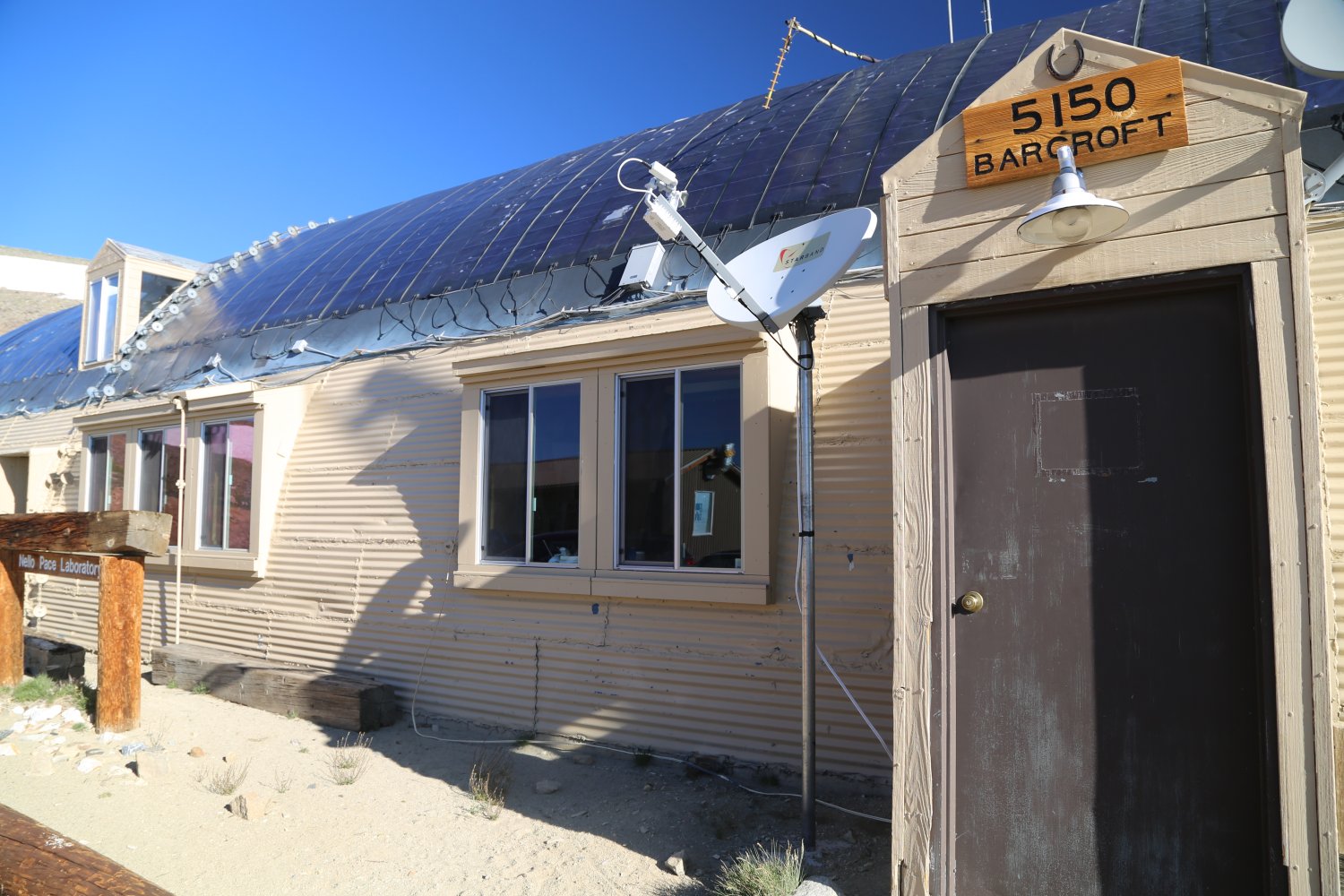
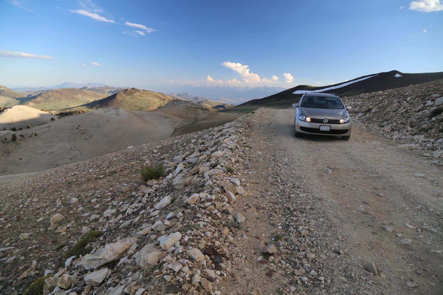
The Bristle Cone Pine Forest road is about 25 miles in length to the very end. Most of the road is gravel and easily accessible by car although you have to watch out for the stray larger rocks that often times are sitting in the middle of the road and or are hidden in the shadows. There is a locked gate at the end of the road 2 miles before the University of California’s Barcroft White Mountain Research Station. Be sure to check out their awesome website as they provide much information and photos of the inner parts of the buildings that most people will never see. Can you believe they have high speed Internet Access at the Research Station and also Internet access at the summit building! The University of California operates the Barcroft Station, The Observatory and the White Mountain Summit Lab. They hold an annual open house in which the locked gate becomes unlocked for 2 days of the year – so check their website for details.
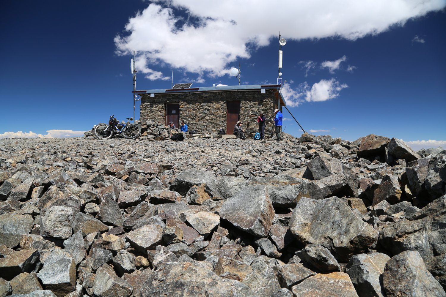
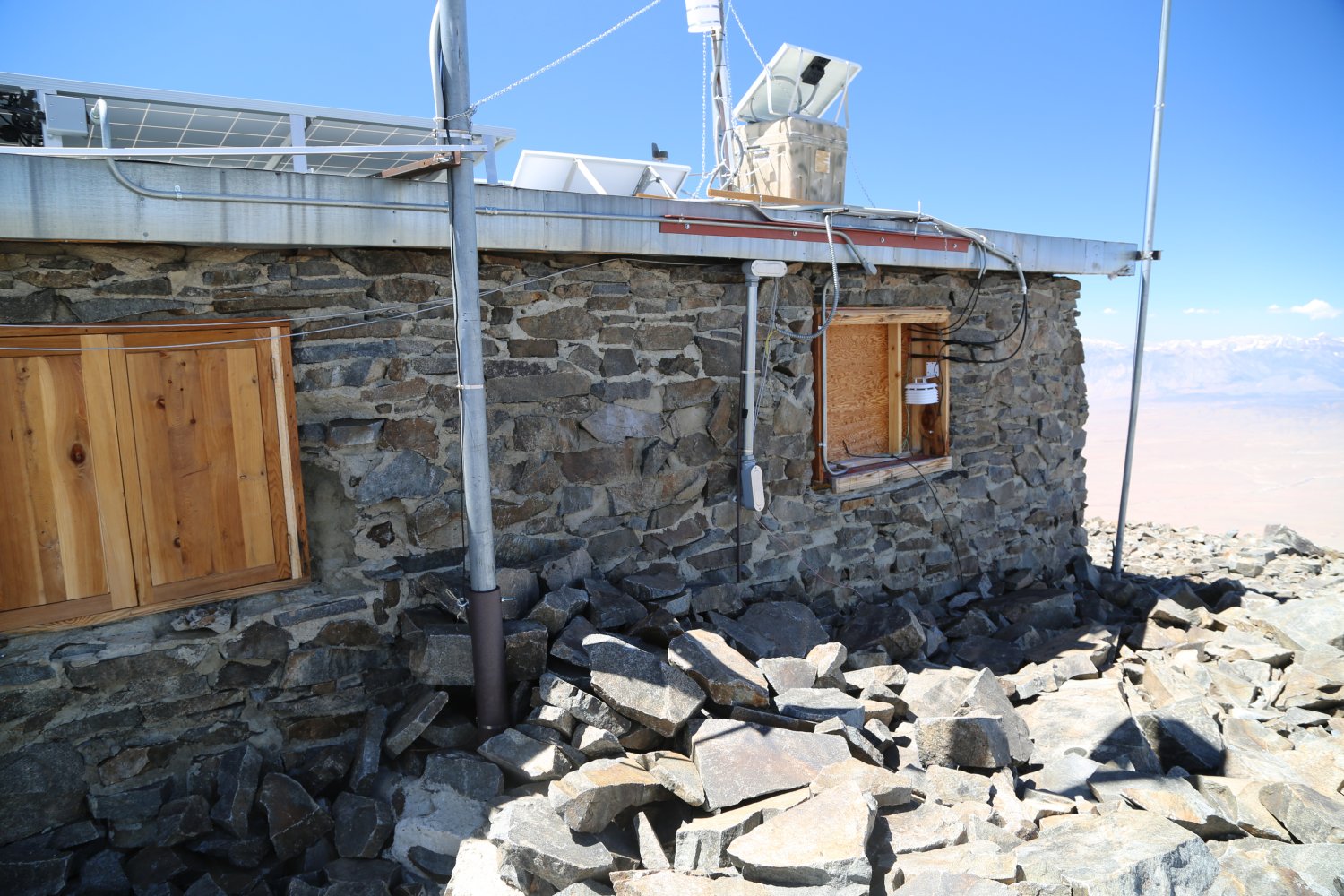
The summit hut on top of White Mountain was built in 1955.
Park you car at the small parking lot next to the locked gate. There is a permanent bathroom located here – toilet paper is usually well stocked. From here you hike along a 4-wheel drive road to the summit of White Mountain. The entire distance from Big Pine to this locked gate is 39 miles. You can also take a 4-wheel drive rough road from Bishop which hooks into the White Mountain road after 15 miles – then you continue on the White Mountain road until the locked gate.
There are several campgrounds located along the road that leads into the Bristle Cone Forest (see the Inyo National Forest Campground Guide for more information about the specific campgrounds). I highly recommend staying at one of these for several nights in order to acclimatize before hiking to the top of White mountain. Dave’s Pick is the The Grandview Campground which is located about 5 miles from the main Bristle Cone Visitor Center at about 8600 feet. This is a large campground (no water or garbage facilities) spread out over several acres among the Pinon Pine trees. First come first serve – several dollar donation requested. The campsites are fairly well spread out among the trees so you have some privacy. Sometimes astral photography occurs at this campground at night so you are requested to keeps lights to a minimum. Bathrooms are located on site.
You can also camp out at the locked gate at the end of the White Mountain Road which is about 11,500 feet in elevation. You cannot camp outside of the campgrounds in the actual park but the locked gate is technically outside of the park. Look for a number of very fat Marmots running around near the locked gate.
The total hike to the top and back to the locked gate is 14 miles. The first time I attempted White Mountain I made the mistake of trying to hike to the summit in the middle of the night without the proper gear. Even in the summertime this can be one of the coldest areas in California, with temperatures often down to 5 to 10F or even colder at the higher elevations. The temperature was getting down to around 25 degrees F at above 11,500 where the locked gate is. I was there in the middle of July, supposedly the warmest time of the year there, and the temperature was getting down to 10F around 14,000 feet.
 Be Prepared for altitude and cold weather. If you do not have the proper gear do not attempt to climb to the summit.
If you are not acclimatized do not attempt the summit. See the Altitude section in Dave’s Nepal article for more information.
I left the the small parking lot for my summit attempt at 7pm. The Barcroft White Mountain Research Station run by the University of California is located at about 12,500 feet on the side of the trail leading to the summit of White mountain. It is 2 miles to the station from the locked gate – with a relatively challenging climb – allow about 1 hour to hike this distance.
Studies on the effects of altitude on organisms are one of the focuses of the station. At the time they were testing the effects of the high altitude on pregnant sheep and in the summer there are normally sheep in the sheep corral. These sheep must not get much attention as when you stop in front of their corral they often will all turn around and look at you in unison! This facility is located 2 miles in from the locked gate. Their are several buildings, a large Quonset hut – and below the road a small water supply fed by a spring which leads to the buildings via a long pipe. As far as I can tell there is no other visible summertime water source anywhere in this area and its probably the spring here which is why the Barcroft facility was originally built here.
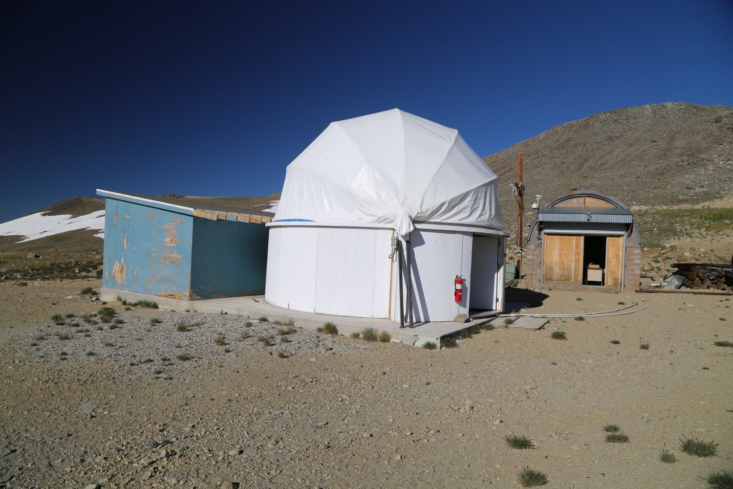
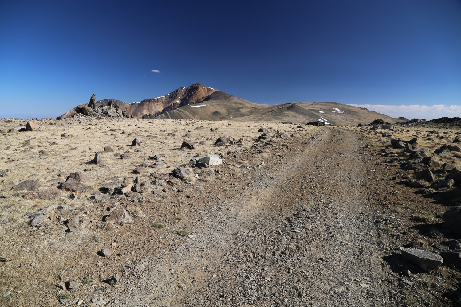
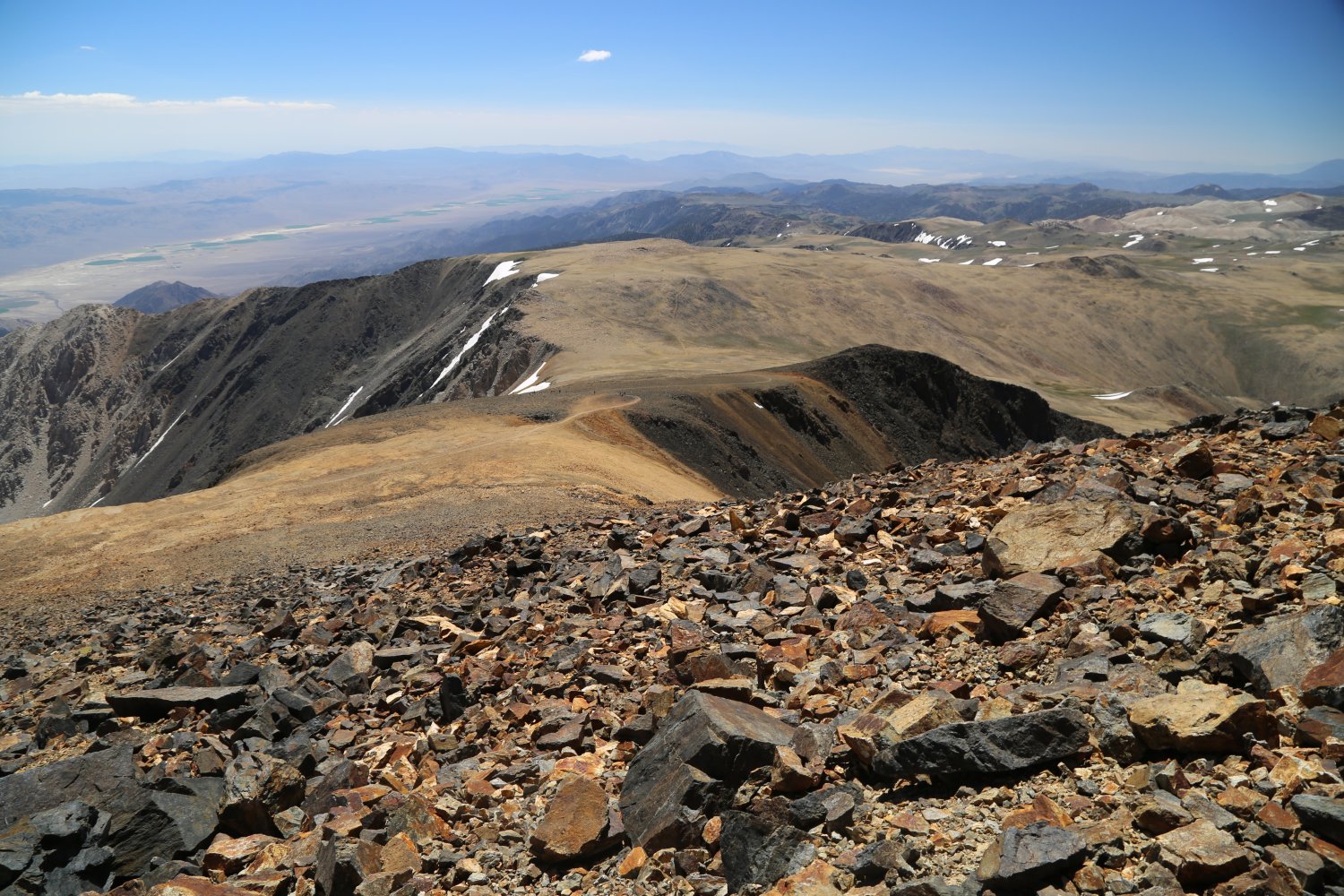
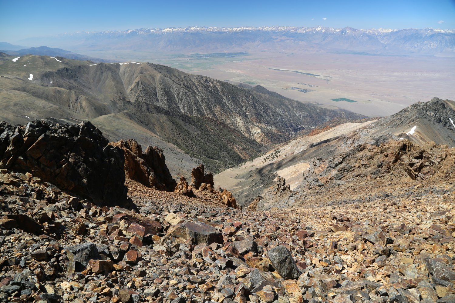
The road remains in good shape with a relatively gentle slope to it (a car could easily drive it) from the locked gate until the research facility. However, once you hike past the research station the road remains passable by 4 wheel drive but becomes a bit more rocky and steep. Once you pass the research station you climb up to a ridge where you will find a locked domed observatory, some antennas and miscellaneous metal lying around – located at about 12,800 feet. From there you will hike along a gentle but usually windy slope. You will next drop down quite a ways, the dirt road meanders across a sprawling barren valley before ascending up to the “saddle”. This is the furthest point that employees of Barcroft research station will drive their vehicles. From the saddle, frustratingly you drop down yet again before the final excruciating summit push. Finally the road becomes more of a very rocky trail and you will begin the final ascent to the peak via a series of numerous switch backs.
 After hiking two hours I arrived at the research station around 9pm. I had spent a day camped at 6000 feet the night before, but other than that, I was not very well acclimatized. From previous high altitude experience I knew that I needed to hike very slowly in order to not be bothered by the high altitude. At this point I was still comfortable despite the rather strong cold wind blowing. I kept going.
Four hours later I was still going. It was now 1am and the 1/2 moon had almost set, the wind was blowing about 40 mph and the temperature was hovering between 10 and 15 degrees F. I was on the final ascent to the top when I became so cold that I had to stop and cover myself with an emergency blanket and a sleeping bag that I had brought. There is painfully little cover along the trail at that elevation so you are hiking along cold exposed rock where the wind can do what it wants with you.
After scrambling around madly (at about 13,800 feet due to the effects of the altitude, the cold, and no cover I finally found a small rock outcropping on a small ridge. By laying low behind this rock ridge I was able to get out of most of the wind, but not all of it. I attempted to cover myself under the sleeping bag and the emergency blanket, but only had partial success. My hands were so cold I could barely grasp anything, and the wind was so strong that it kept blowing the sleeping bag and the blanket off of me. This was not good and if I continued in my current state I would soon have hypothermia. I was beginning to shiver uncontrollably and from previous experience I knew that I had to do something or I would soon not be able to walk out of there under my own strength.
 By this time the moon had set and all I had was starlight to see the dimly lit trail. I quickly wrapped myself in my sleeping bag and the emergency blanket. However, in my haste to start heading down the mountain after an aborted summit attempt the emergency blanket somehow blew off of me. I noticed that it was missing about 5 or 10 minutes later.
Seeing this, at the time I thought it was critical that I find it. I walked back up the mountain and spent about 1/2 hour looking for it, wasting energy that I did not have. This was a crucial mistake for I could have used this energy to get down the mountain. Later on, I would see that I would not need the emergency blanket.
After my unsuccessful try at finding the blanket (the wind would have carried it far way – for some reason I did not think of this when I was searching for it) I headed down the mountain. I was on the nervous verge of slipping into hypothermia the entire way. When the trail would climb I would be fine, but as soon as I stopped to rest which was quite often, I would become extremely cold.
The hours between 2 and 4am were extremely cold, dark and lonely. I kept hiking and finally saw a faint light appear in the western sky around 4:30am. The research station was the greatest thing to see at about 6:45am when the cold whispers of the suns first strands began to climb over the horizon. I reached the locked gate and car at 8:15am. From the time I had left the locked gate the prior evening to the time I arrived back, I had been hiking straight for 13 hours in cold terrible hiking conditions. I was fortunate to make it back. I promptly fell asleep in the car, however, only after turning the heat up to “maximum”.
AUTHOR’S NOTE: Dave re-attempted White Mountain two months later and successfully reached the summit. This second hike was in the day this time! He has since reached the summit of White Mountain 4 times. The fourth time was on a bicycle – any future attempts will most definitely be on a bicycle. Parts of the final summit push can be extremely rocky and steep and therefore difficult to ride on a bicycle (you might end up walking part of this). But being on a bike for the descent is a wonderful feeling knowing you can race down the mountain and be back at the locked gate in about 60 to 90 minutes.
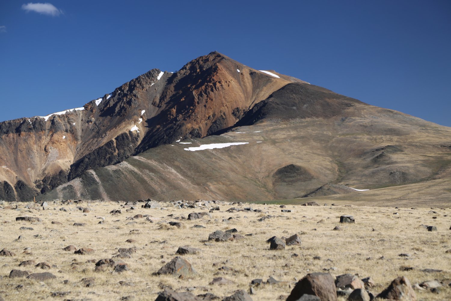
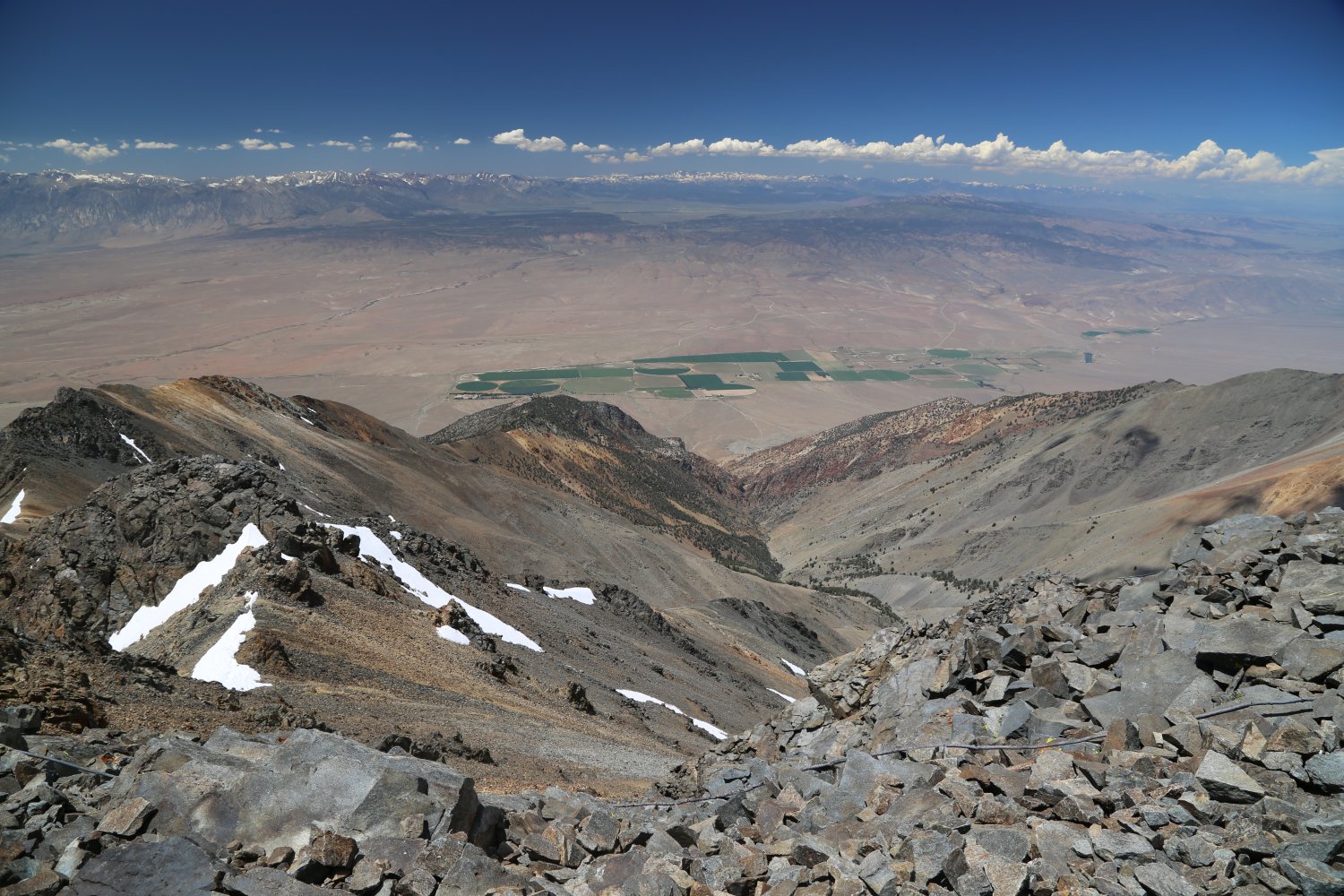
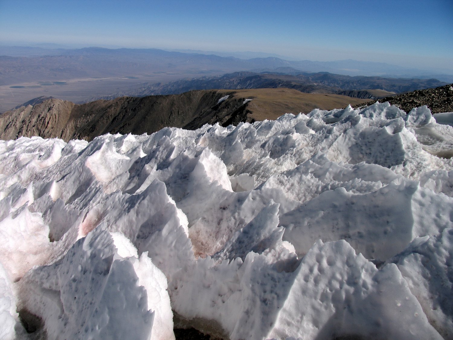
On a clear day the views from the summit are spectacular – to the west the Owens Valley thousands of feet below you framed by the jagged peaks of the Eastern Sierra – to the north the starkness of the White Mountain range continues and to the south east a glimpse into Death Valley and the faded white of the Eureka Sand Dunes.
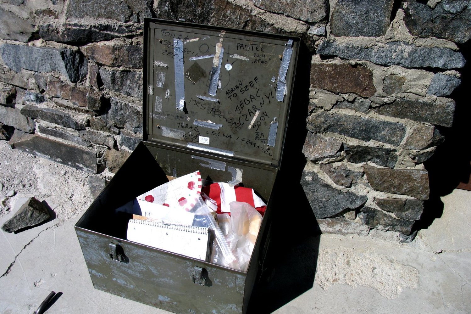
The summit register contains a small book where you can sign your name with your summit date plus a sign you can hold up for photos indicating the altitude. A small rock partially built cairn is located next to the summit hut. On several occasions, late in the afternoon – we have seen people setup camp here for the night.
When we first were introduced to White Mountain many years ago – it was still relatively unknown with few hikers on the trail and often a good chance of being on the summit by yourself. In recent years, we have seen many cars, tents and people hanging out at the parking area at the locked gate (summer weekends being the busiest).
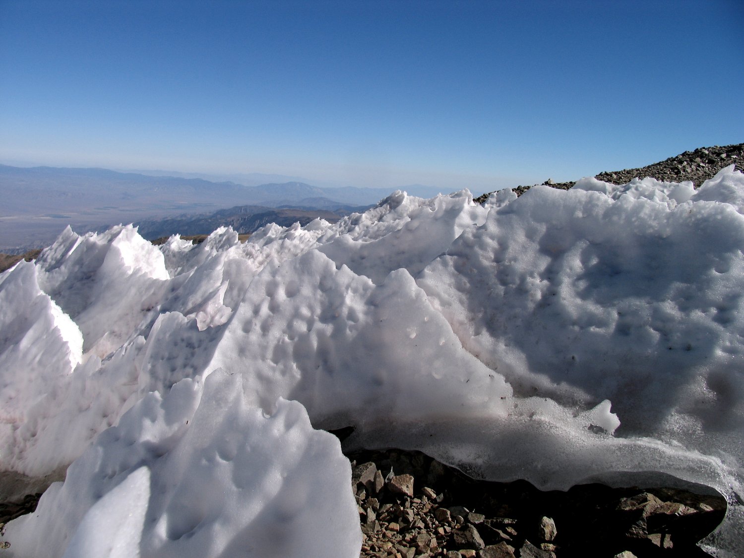
White Mountain Penitenties near the summit, at about 14,000 feet
Other Photos


Interesting report…glad you made it back before freezing to death. I am very curious about where you found the information re “one of the oldest permanent settlements in North America at 12,600′ up one side of White Mtn…” I am a Cental Sierra historian and am most curious to read source materials about Native American occupation in the Whites.
I would be most grateful if you would point me in the right direction.
Happy Trails,
Sharon
Sharon – it was in one of the tourist brochures I collected a long time ago – also referenced on Wikipedia here: https://en.wikipedia.org/wiki/White_Mountains_(California) – you might want to reach out to the Paiute-Shoshone Cultural Center in Bishop: http://www.davestravelcorner.com/guides/bishop/paiute-shoshone-cultural-center/