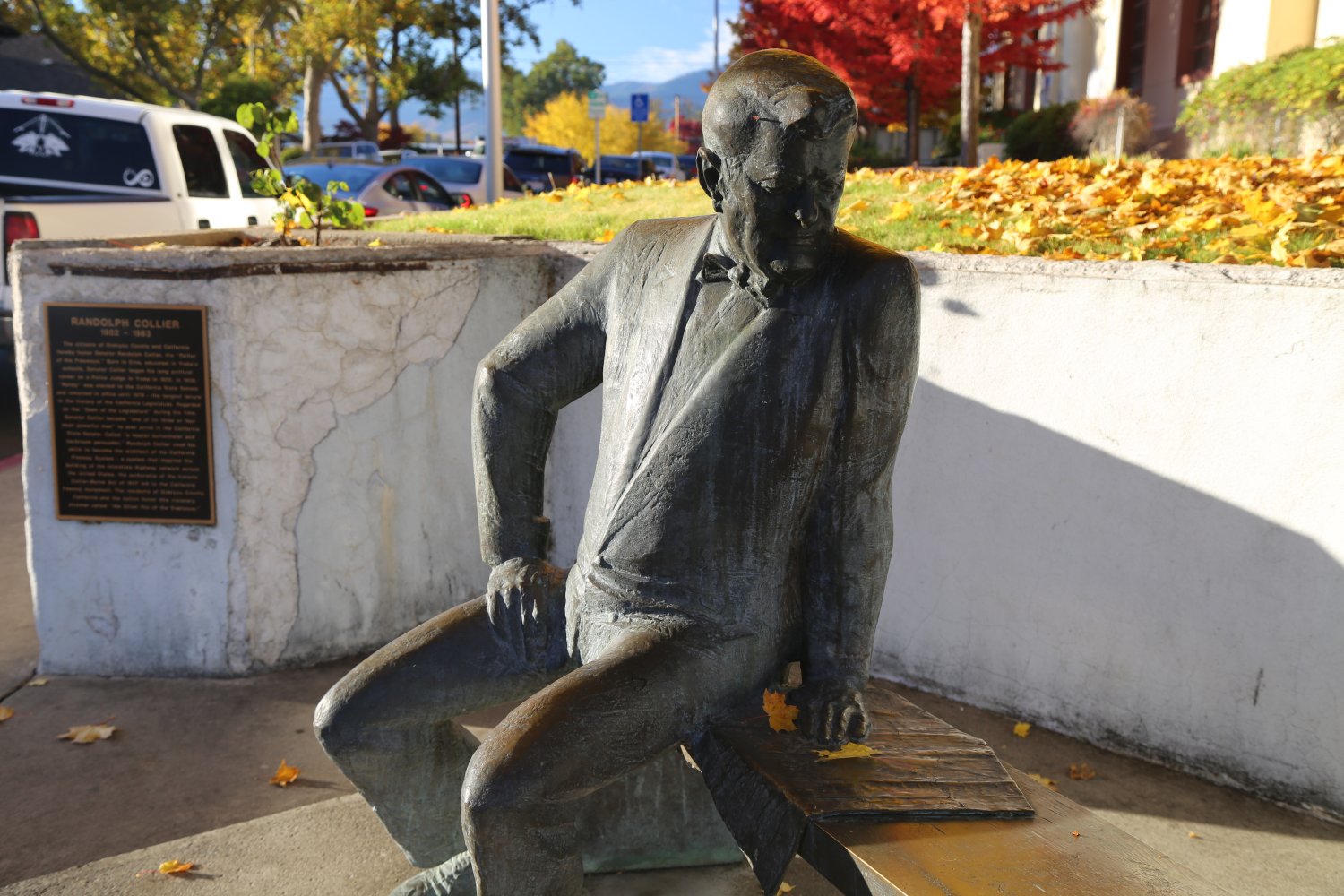
Statue, Randolph Collier, Father of the Freeways –
Yreka, CA
For those interested in freeway history, look up Randolph Collier (northern California native) who is often dubbed ‘the father of the freeways‘.
Purchase The Freeways of Los Angeles for only $2.99 as a Kindle Book on Amazon !!
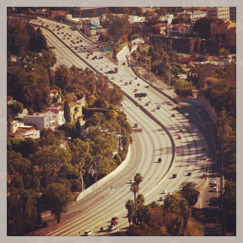
Another feather in the cap of the Los Angeles Freeway system! We stand alone at the top: www.inrix.com/scorecard
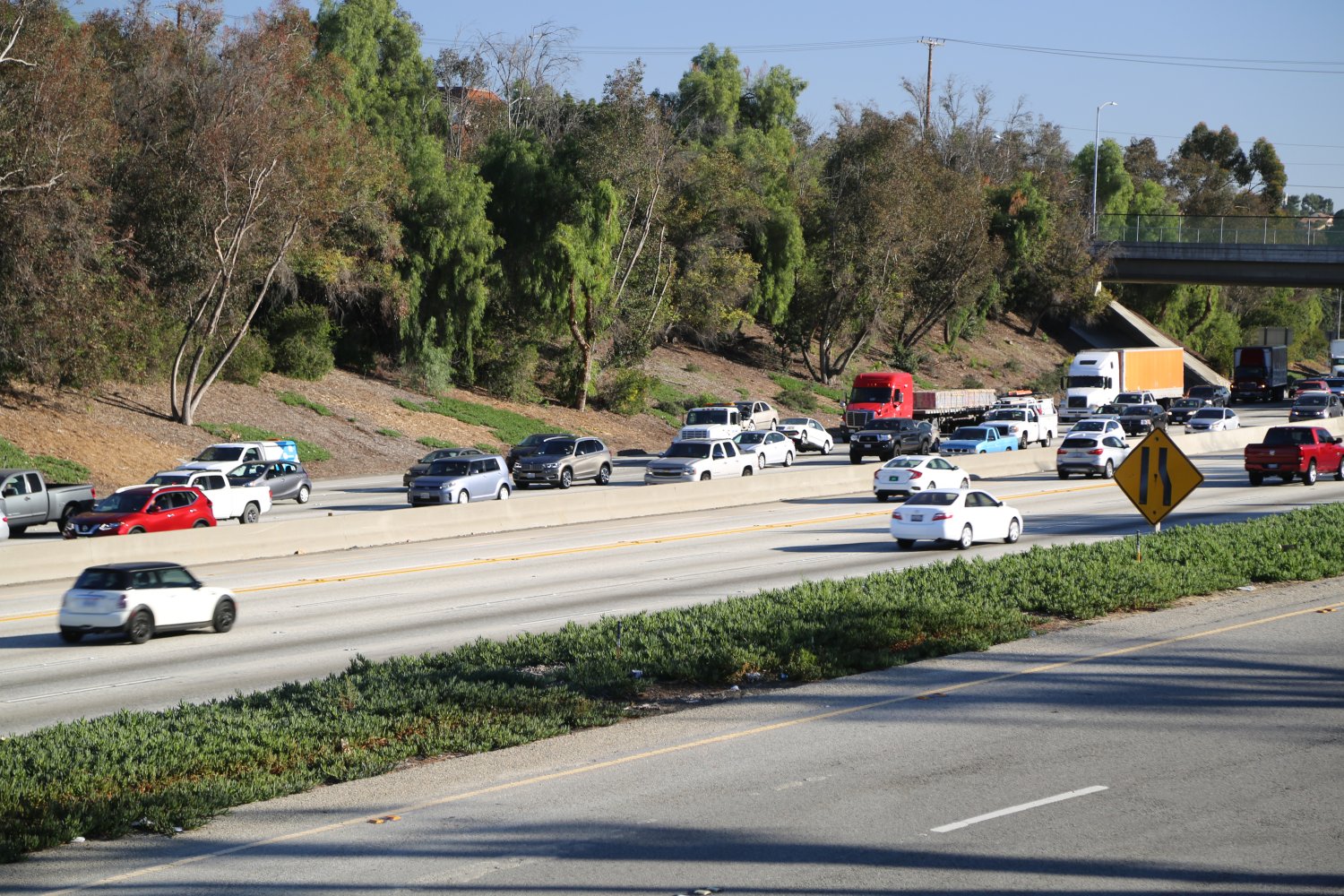
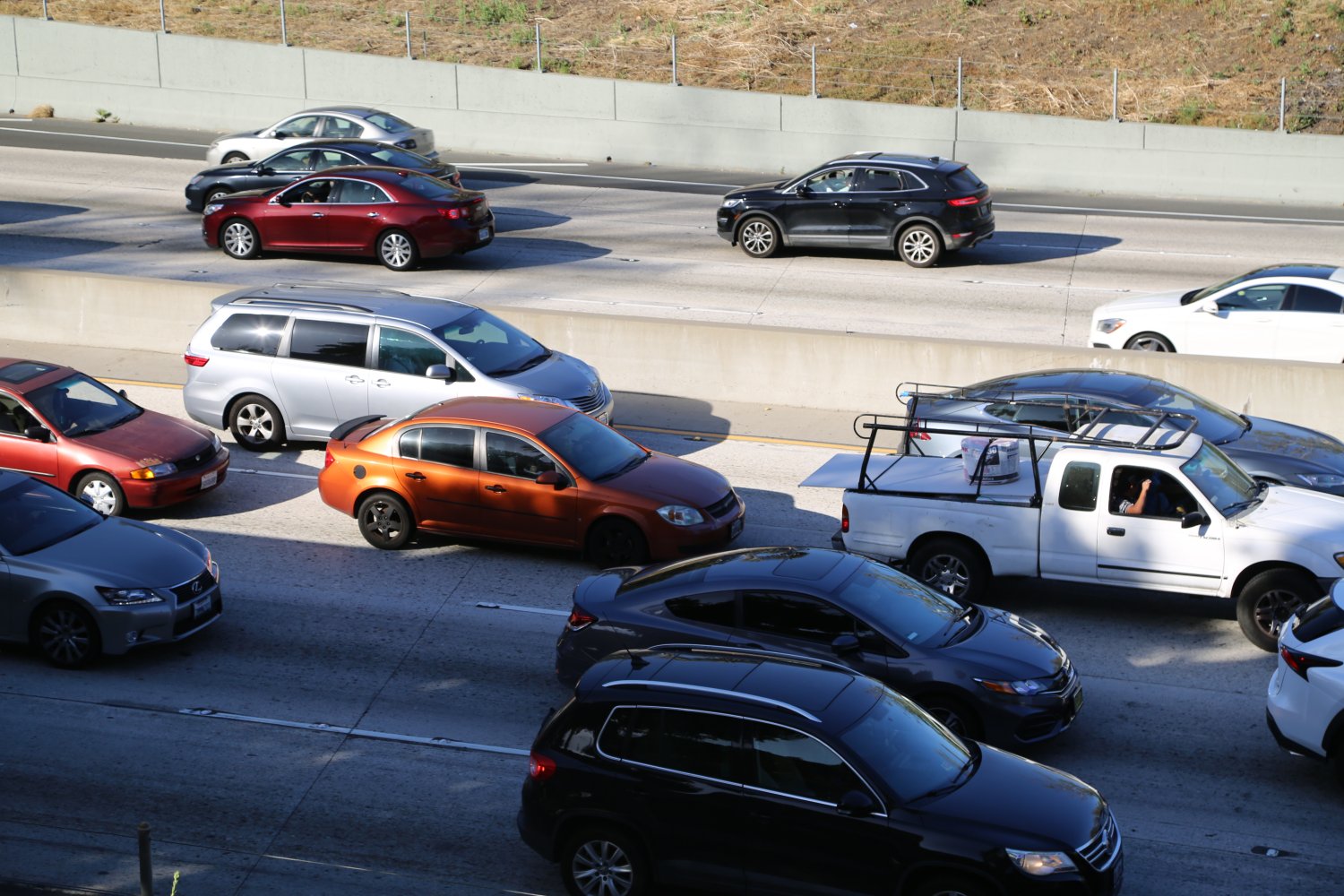
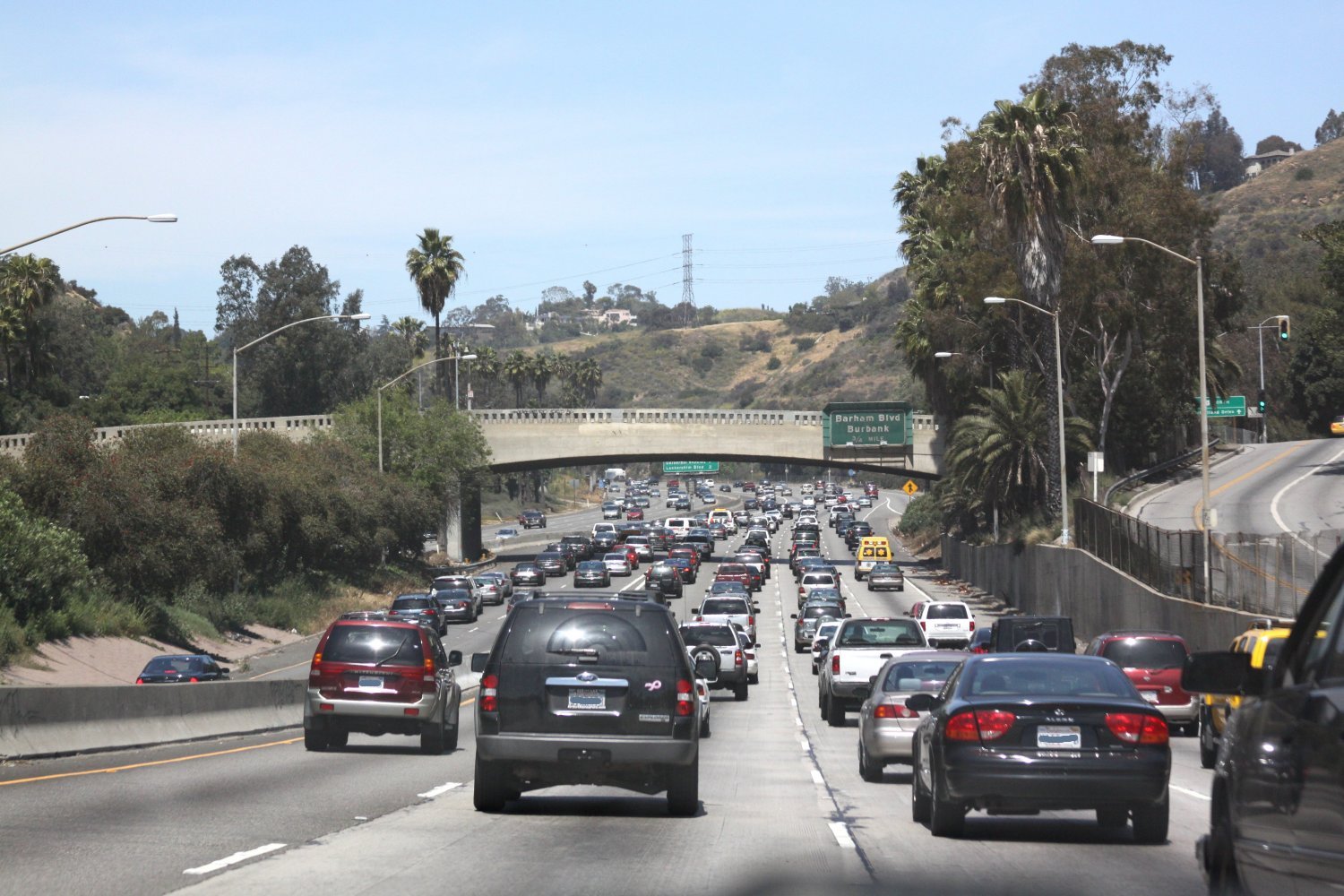
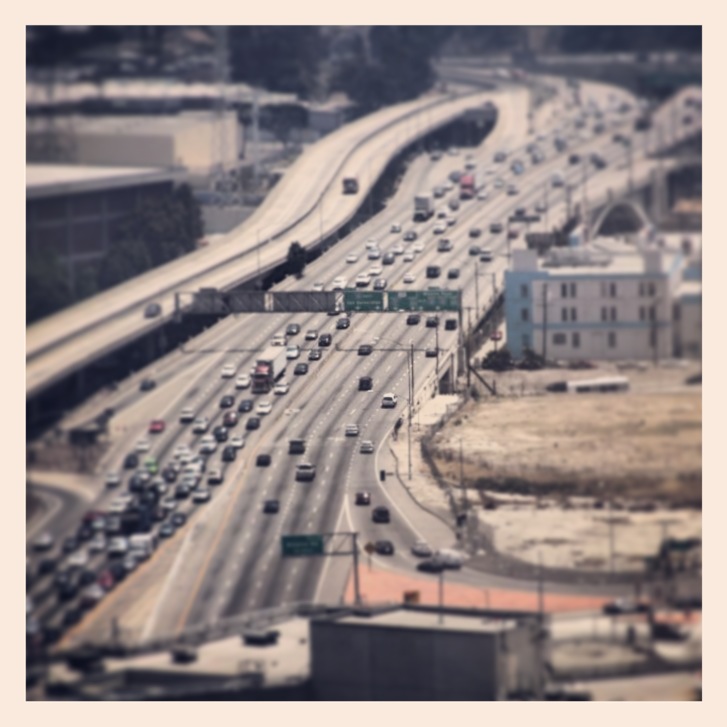 When there is little traffic on the freeways, typically extremely late at night but during the day as well depending on which freeway in question and the time of day, they work wonderfully – you can zip around from city to city, from freeway to freeway just like that. However, the freeways can also be terribly crowded – ever spent some time crawling over the 405 from the Getty Center north to the Valley? Ever spent time sluggishly moving towards downtown on the 101 to the 110 Four-Level Interchange? How about the crazy 91 freeway stuck in the non toll/non carpool lanes – Santa Ana Canyon? On any number of area freeways you can experience horrific traffic. If you have experience driving the LA area freeways you will know exactly what we mean. The Freeways are the arteries (often clogged) of transportation across the LA basin.
AC/DC’s 1979 song, “Highway to Hell” can be an appropriate tune to listen to at times while driving Los Angeles freeways. Fortunately this song often makes appearances on KLOS, 95.5 FM.
Here in the Southland, the car is King. We even have a number of museums open to the public in the region devoted to the automobile including the Automobile Driving Museum, Marconi Museum, NHRA Motorsport Museum, The Nethercutt Collection and the Petersen Automotive Museum.
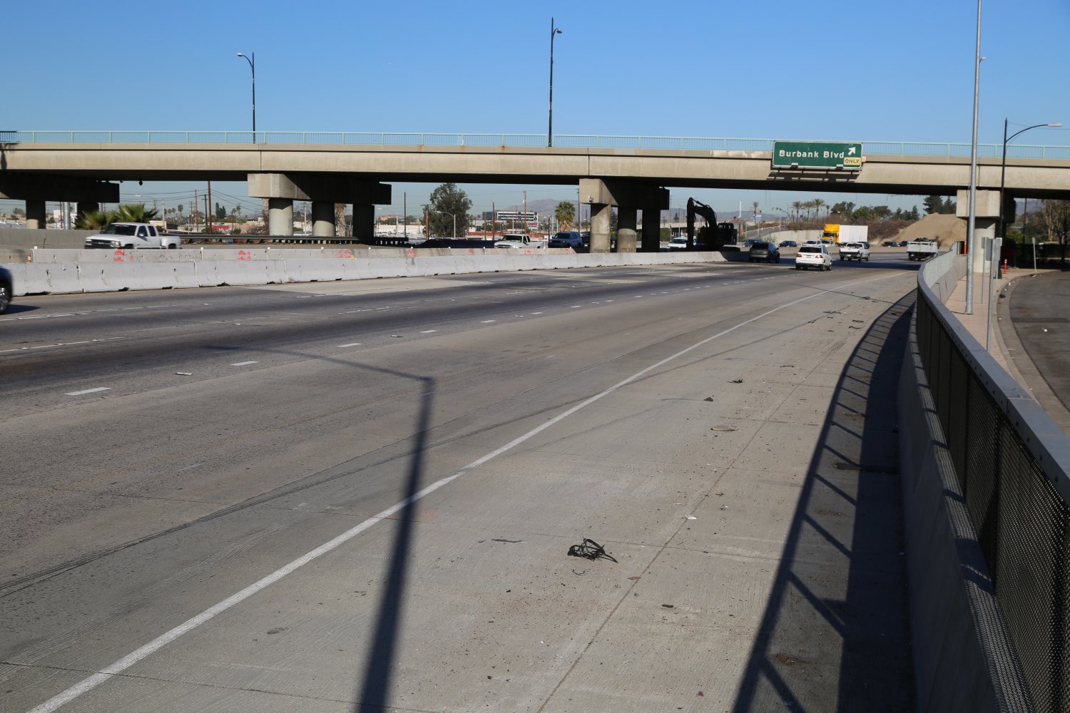
When referring to Southland freeways people use “The” in front of the freeway name – i.e., “the 10” or “the 405”. In addition all the freeways have personal names just like many fruits and vegetables have common names to help identification among the masses – when the scientific names are too complicated or esoteric to grasp. For example the 710 is called the Long Beach Freeway. If a freeway is long enough it may have several names, for example the 101 is called the Ventura Freeway and the Hollywood Freeway or the 110 is called the Harbor Freeway and the Pasadena Freeway — it all depends on which part of The 101 or the 110 you are referring to. As you can see, if the same freeway has several names depending on its location, it is very important which name you give someone if you are providing directions. During the weekdays freeway driving can be especially slow during the commute hours – typically in the mornings from 5:00am – 9:30am and then again in the afternoon from approximately 3:00pm – 7:00pm. However some of the more traveled freeways rarely see much traffic relief and are quite crowded most of the day. When there is not much traffic the freeways work wonderfully.
An orgasmic spot for LA Freeway enthusiasts. PARKED on top of the 105 HOV 105E connector to the 110N!
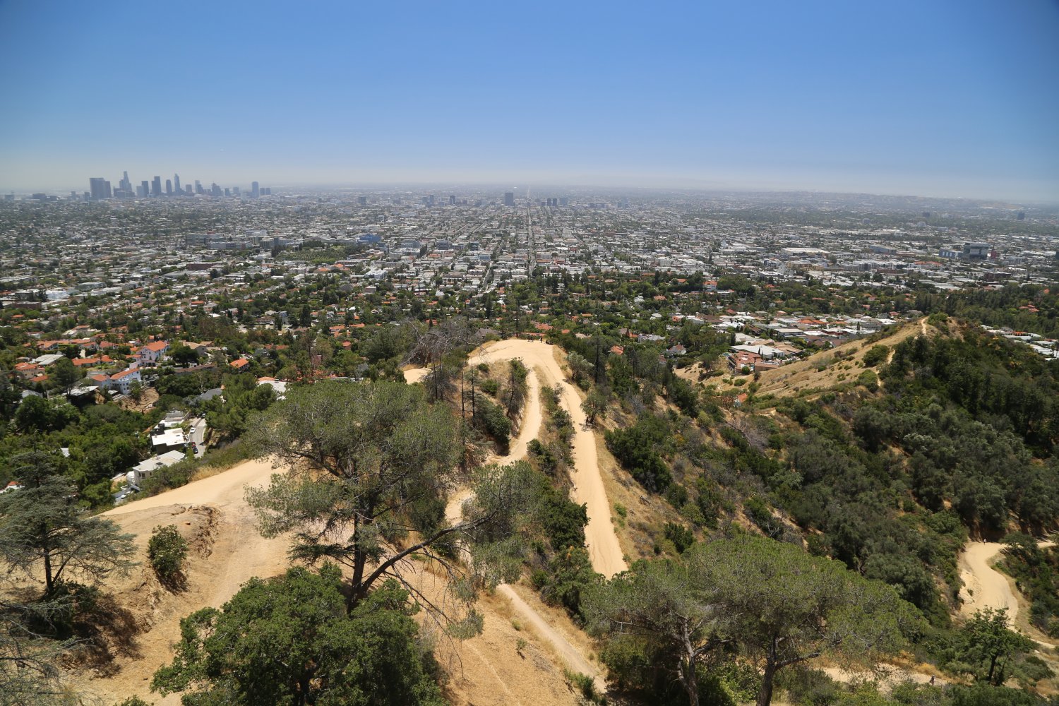
Great view of Los Angeles from Griffith Observatory in the Hollywood Hills
Driving in Los Angeles is somewhat different than other parts of the country in that the freeways can be huge, speeds intensely fast, and 24/7 carpool lanes (HOV – High Occupancy Vehicles) are the norm. When traffic is light on the freeways, many of the freeways will move along at 80 to 85mph even though the posted speed limit is 65. I’ve seen highway patrol, either motorcycle or car, on freeways and cars hardly even slow down and are still definitely driving much faster than the posted speed limit. Los Angeles is a city of drivers – “why walk when you can drive” seems to be the motto here which somewhat makes sense considering the great distances between things. However Los Angeles has a continuously developing metro along with a Metro Link system serving a large area of the Southland. (Visit our Public Transportation section for more details).
Sensory Distress Syndrome (SDS) – the difficulty of being able to return to one’s equilibrium or state of being due to a hyper alertness created from driving the Los Angeles freeways. This syndrome can effect people after driving the Los Angeles freeways due to their uniquely fast speeds, volume of traffic, massiveness of roadway, freeway connections, and sheer scope of dealing with this entire area freeway system – View more LA Freeway Definitions Here!
Surface streets in and around Los Angeles often contain wide fast moving boulevards such as Venice, Wilshire, Santa Monica, & La Cienega among many others. Traffic flow on these can be just as crowded as the freeways at times. One nice feature of the main surface boulevards is the oversized street name signs. Traffic flow is always stopped by stoplights and large intersections on these boulevards. Some of these boulevards are the same width or larger than what would constitute a “large” freeway in another city.
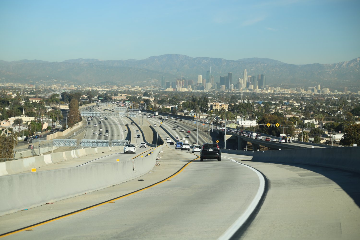
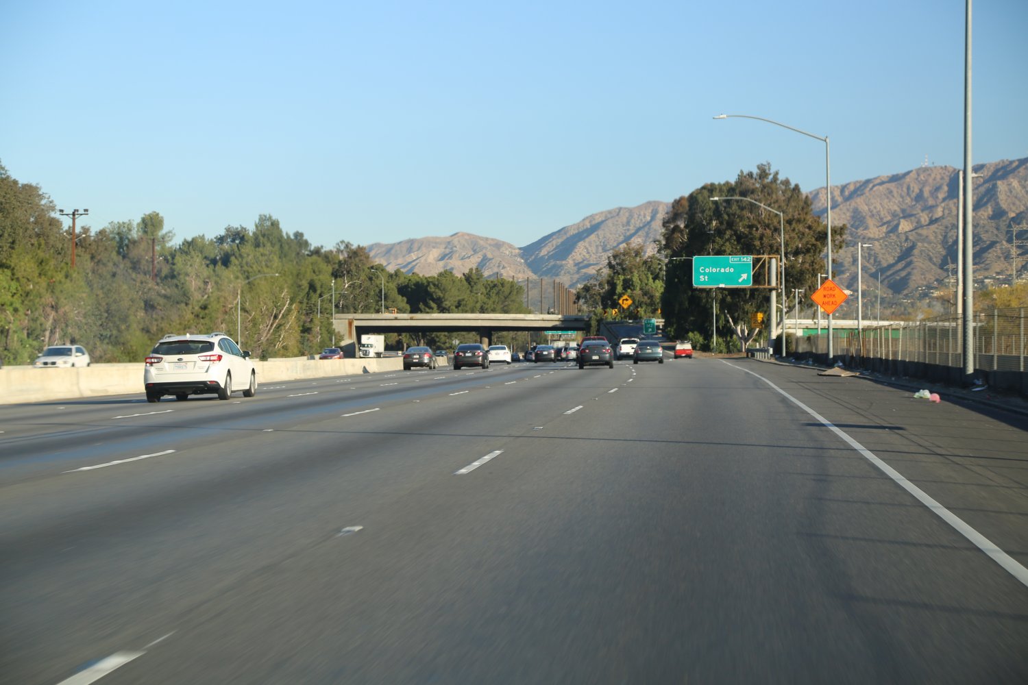
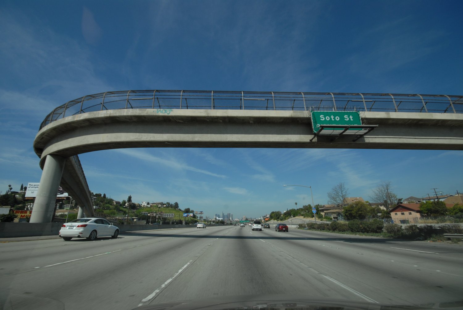
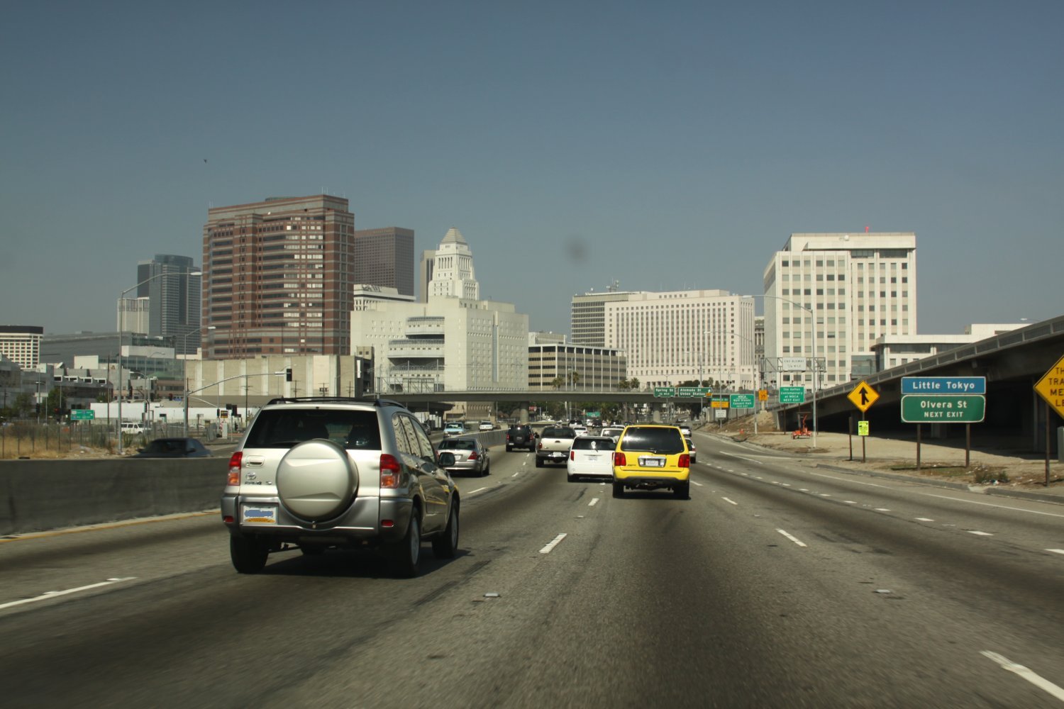
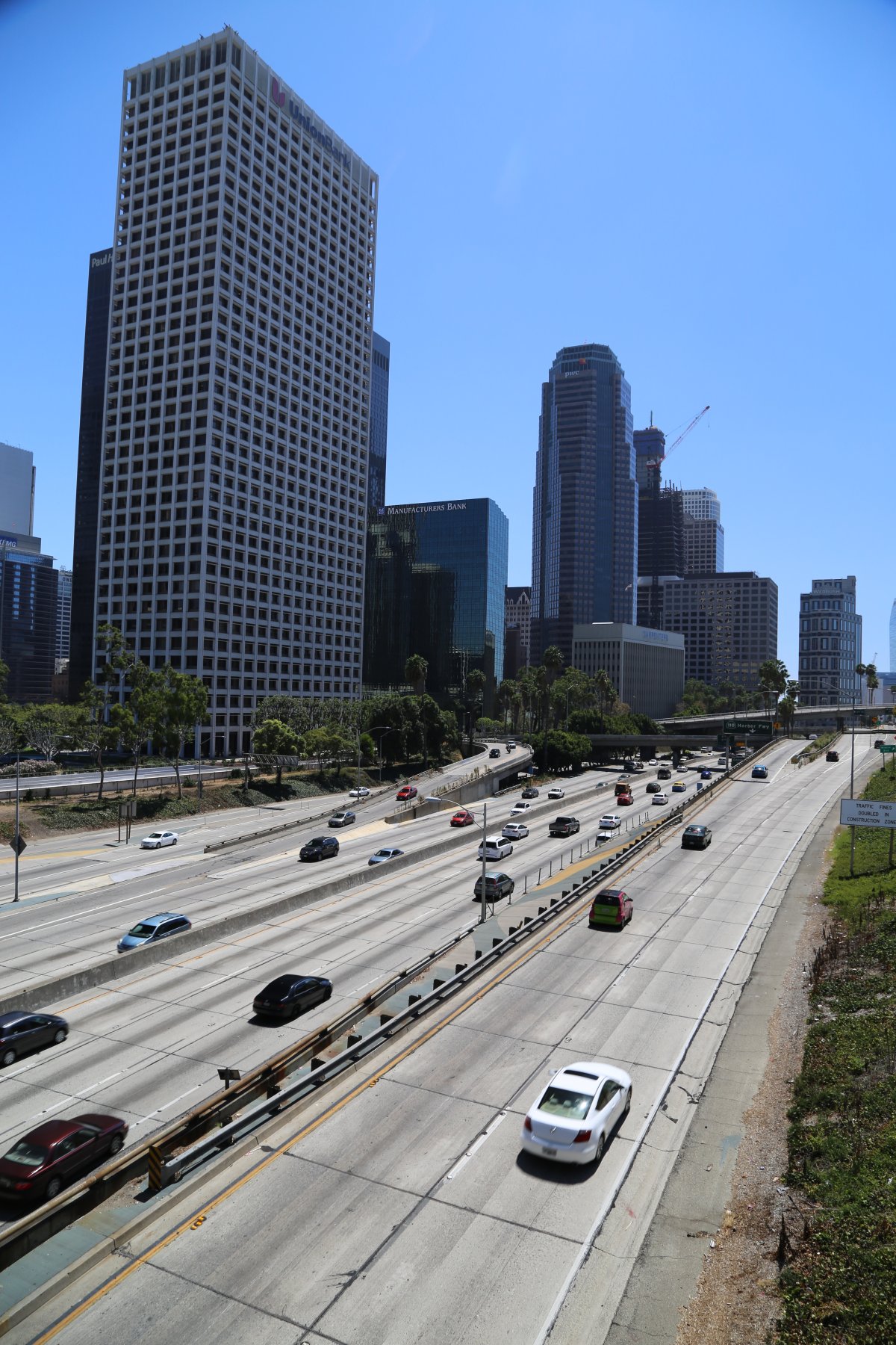
 Several of the major freeways in the area run through or around downtown Los Angeles including the 5, the 10, the 60, the 101, and the 110. All four of these freeways come together in quite an engineering feat called the East Los Angeles Interchange. This is one of the busiest freeway interchanges in the world. The freeways near and around downtown seem like they can be busy regardless of the day or night. We’ve driven into downtown at 2am in the morning on a weekend night and there is still a mass of red lights in front of us heading towards downtown. A good time to drive the “freeway ring” around downtown Los Angeles is early Sunday morning. If traffic is light (and it usually is Sunday mornings) you can drive entirely around downtown hitting several major freeways (including the 10 freeway) in about 15 minutes. Every LA freeway buff has to drive circles around downtown in light traffic!
One of the most stressful parts of driving the freeways of Los Angeles (especially when they are busy) is trying to figure out which lane(s) to be in when switching to a new freeway at major freeway intersections. There are many freeway intersections in and around downtown (major freeways) and you have to really stay on your toes to make sure you remain on the correct freeway to reach your final destination (or simply use a voice navigation system). Having to cross multiple lanes of traffic to merge, exit or enter, and having freeway exits sometimes exiting to the right and or sometimes to the left makes driving in this region challenging. This is especially true for merges involving the 10, the 110 and the 101 freeways near downtown. Here is a good example of this: the 10 east to the 110 north; you have to be in the left 2 lanes to exit the 10 freeway. To complicate matters once you are dumped onto the 110 N you must get over to the left immediately to stay on the 110 or you will be unmercifully hung out to dry and will have to drive by all the stacked up traffic leaving you no option but to exit the freeway into downtown. Navigation around downtown Los Angeles would be quite a challenge even if you were the only car on the freeway. Imagine if you were the only car on the LA Freeways around downtown. What fun! Good times!
In part due to the large size of the Los Angeles metropolitan region, the area’s fascination with the automobile, and clever engineers, there have been a number of advancements and “firsts” in regards to the freeway systems. A couple notable achievements in the south land are California’s first freeway, (the 110, Pasadena Freeway), the area’s first 4-level interchange (downtown), leading the nation in building totally separate from the rest of the freeway carpool (HOV) lanes, and building the area’s first totally fully automated toll-way system (the 91 Freeway).
CARPOOL (HIGH OCCUPANCY VEHICLE – HOV) LANES
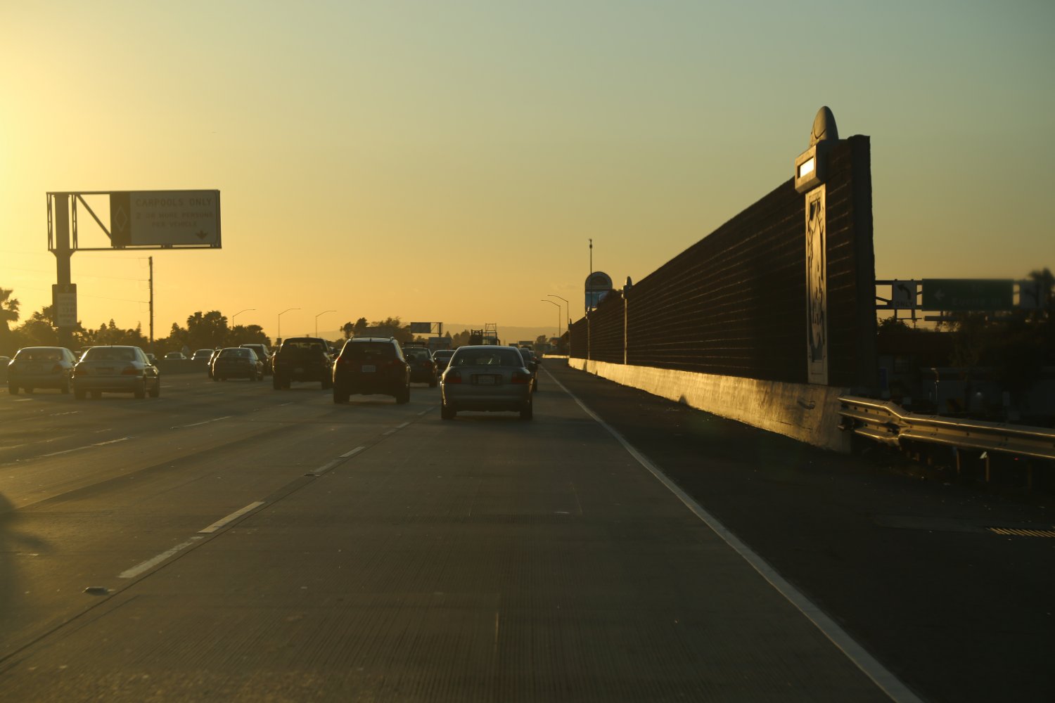
are among the most advanced in the world in Los Angeles and Orange Counties – more so in Orange County. The double and triple yellow stripes painted on the freeways break into white dots at certain exits so that car poolers can enter and exit the carpool lanes. Carpool lanes in the Los Angeles area differ from other metropolitan areas in that they are normally 24/7 reserved for cars typically carrying 2 or more passengers (unborn fetuses do not count unfortunately – should children under the age of 16 count, as they cannot yet drive – the debate rages on). You are supposed to stay in the carpool lanes until the yellow stripes break for the white dots – and there are signs telling you which breaks you should exit the carpool lane before you get to major freeway intersections or exits. Oh, and note that many times the car pool lanes do in fact work wonderfully however sometimes you might find that carpool lanes can be slower than the regular lanes at certain times of the day – i.e. commute hours – especially if you have a slow driver in front of you. (good example of this is sometimes on the 5 freeway in Orange County).
The first HOV lane opened along the 10 Freeway between El Monte and downtown Los Angeles and serviced buses only. It wasn’t until 1976 that this portion of the 10 opened to carpoolers with 3 or more passengers per vehicle. For about 20 years HOV lanes weren’t really developed in LA. It wasn’t until the early 1990’s that HOV lanes started to be added to the freeway system in larger mile quantities. Today over 500 HOV lane miles exist in LA County.
Freeway stack at the 405 and 105
The famous Four-Level 101/110 Stack
Freeways with long sections of carpool lanes run for miles and miles – when you see the congestion on the regular lanes of these particular freeways you will know why there are car pool lanes. The exception being when you have a crowded car in front of you doing the speed limit when the regular lanes are zipping by at 80+mph.
In certain situations, such as during early morning commute when there is an accident causing a severe stop and go for a specific distance, we notice single drivers often will sneak into the HOV lane to try and save time. We have noticed the vehicles doing this mostly have dark tinted windows.
LOS ANGELES & ORANGE COUNTY FREEWAYS
The freeways listed below are found in the greater Los Angeles and Orange County metropolitan areas. Dave has driven on all of these freeways – some of which, too many times. The most common names are listed for each freeway, but note that some portions of these freeways have other official names.
Note the following designations listed next to each freeway name: I = Interstate; SR = California State Route; US = US Route.
Read on for individual freeway information organized alphabetically by number.
At a Glance
Common Name: Pacific Coast Highway
Direction: North and South, 655 miles
Boundaries: Leggett-N, Dana Point-S
Carpool Lanes: N/A
Year Founded: 1919
The 1, (SR-1) called the Pacific Coast Highway or PCH for short, isn’t really a freeway, rather it takes on many forms during its coastal journey. It is a windy two lane road in places, in other places its more of a high speed Boulevard and expressway with stop lights and in short sections it has been built to freeway standards. PCH is mentioned here as it is a famous artery connecting the LA and Orange County area beach towns. It is a true coastal highway and actually runs up and down much of the length of some of California’s most beautiful coast line.
PCH gains in strength and has its most influence on the urban areas next to the ocean. Depending on it’s location, this stretch of highway assumes a number of different names. It becomes a dominant force starting up north in Malibu, winds its way past the Santa Monica Pier then pops into the Manhattan, Hermosa, & Redondo beach towns – goes inland and loses its beach identity a little as it winds away from the ocean and is slowed down by a frustrating amount of stoplights as it cuts across the Palos Verdes Hills Peninsula. Then it really becomes a center point for activity in the beach towns from Long Beach through Huntington Beach, Newport Beach & Laguna Beach down to San Clemente in the south. The centers of many small towns along the 1 are located on both sides of this road.
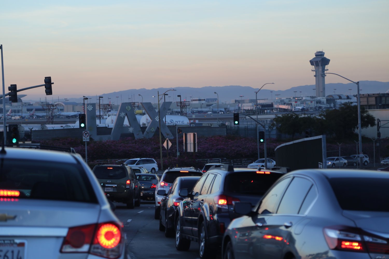
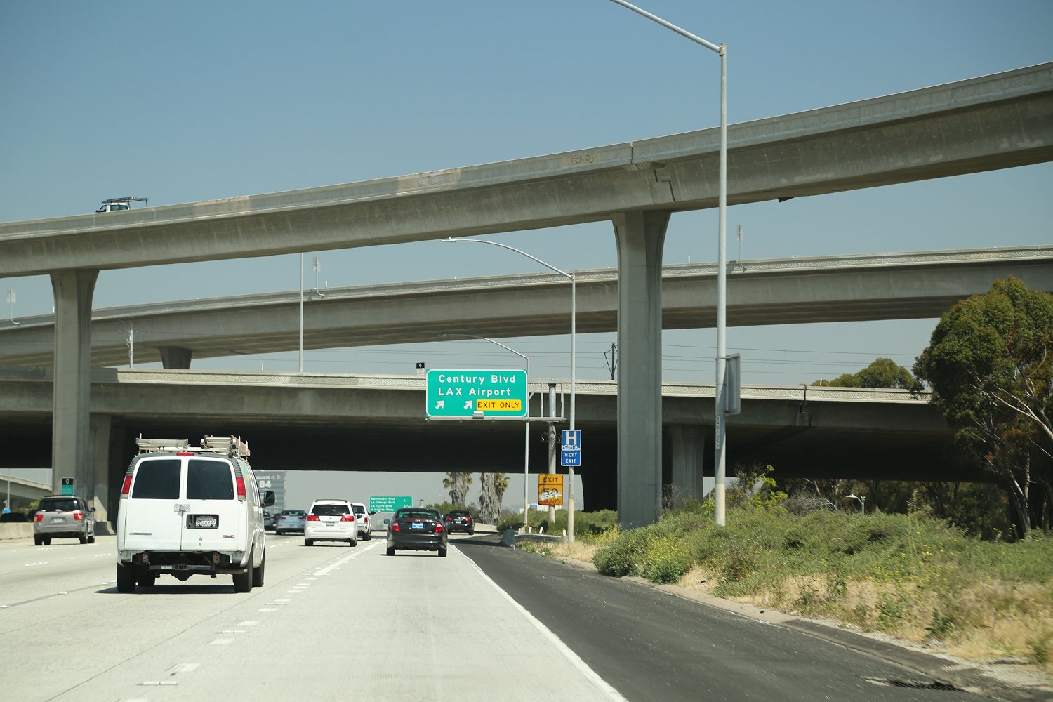
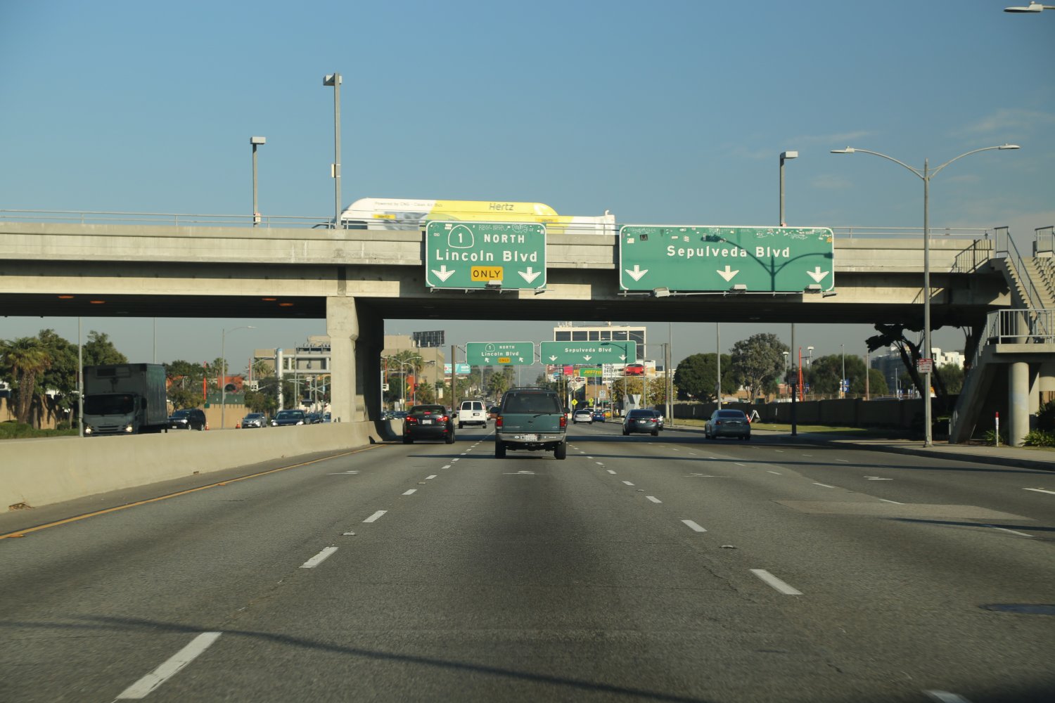 There are great views of downtown Los Angeles, especially at night driving northbound on the 1 on a hill in North Manhattan Beach (next to the Manhattan Beach sign). The 1 goes through the Sepulveda Tunnel which actually runs under two runways at the LAX airport. As you exit this tunnel you may be treated to a banking plane merely several hundred feet away moving at a high speed about to land – as the runways are right next to the 1 in this location! Along with Century Blvd, Highway 1 is the primary access route to LAX (called Sepulveda Blvd. along this stretch).
The PCH has been immortalized in a number of songs covering various genres from Classical to Jazz, to Oldies to Rock.
At a Glance
Common Name: Glendale Freeway
Direction: West and East, 87 miles
Boundaries: Santa Monica-W, Glendale-E
Carpool Lanes: N/A
Year Founded: 1934
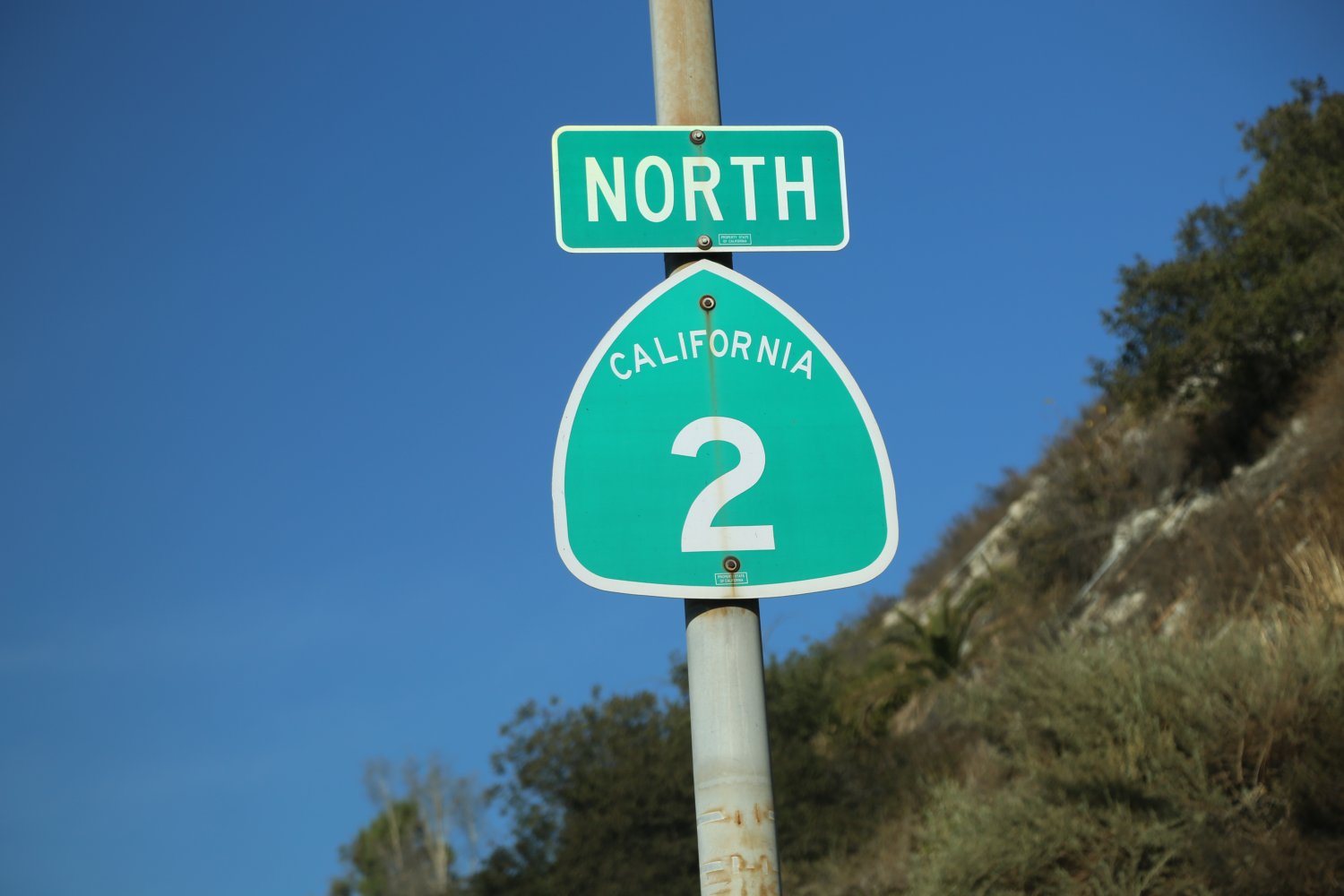
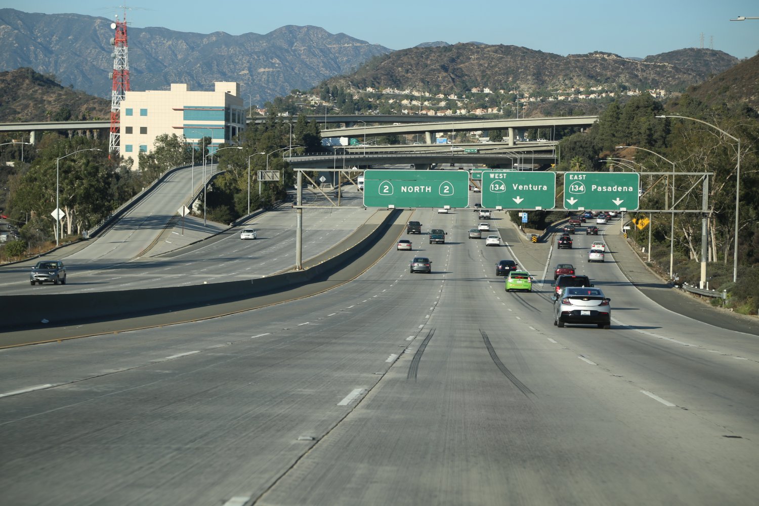
The 2 (Glendale Freeway) is one of the shortest freeways in Los Angeles and is part of State Route 2 which actually runs for a much longer distance. This is a modern freeway with a surprising number of lanes (between 4-6 depending on location) between the 134 and the 5 freeways.
This northern section also feels more rural than the southern part as it passes through undeveloped hills just before it hits the 210 freeway. The freeway portion of State Route 2 runs north from near Dodger Stadium and Elysian Park (just north of downtown) crossing the 5 and the Los Angeles River, then the 134 and finally terminating at the 210 where in the city of La Canada Flintridge it becomes Angels Highway and continues as a 2 lane road up into the mountains of Angeles National Forest. From Glendale this is usually the fastest way to get to the 210 freeway and compared to other nearby freeways – is often rather empty.
 Getting on the southern part of the freeway (where it starts) in Echo Park is often challenging (especially if you are coming from the 101) as access to the southern start of this freeway is via crowded city streets – several of which converge onto N. Glendale Blvd and N. Alvardo Streets (which are the final roads leading to the freeway entrance). Traffic can also backup as the freeway drops down and ends at Alvarado Blvd.
Interestingly, original plans for the Glendale Freeway were supposed to route it through Echo Park all the way to the 101 Freeway. Because this will never connect (due to all the residential neighborhoods and businesses between the start of the 2 Freeway and the 101, the full potential of this freeway will never be fully realized.
Part of this freeway has been featured in several movies including an overpass that “collapsed” during the 1974 film, “Earthquake”. The 2 is a fairly fast and direct north-south route between the 101 and the 134 freeways.
At a Glance
Common Name: Golden State / Santa Ana Freeway
& other names depending on location
Direction: North and South
Boundaries: Canada Border-N, Mexico Border-S
Carpool Lanes: 2 places, short strip in LA County
between the 118 & the 14 and all of the OC
Year Founded: 1947
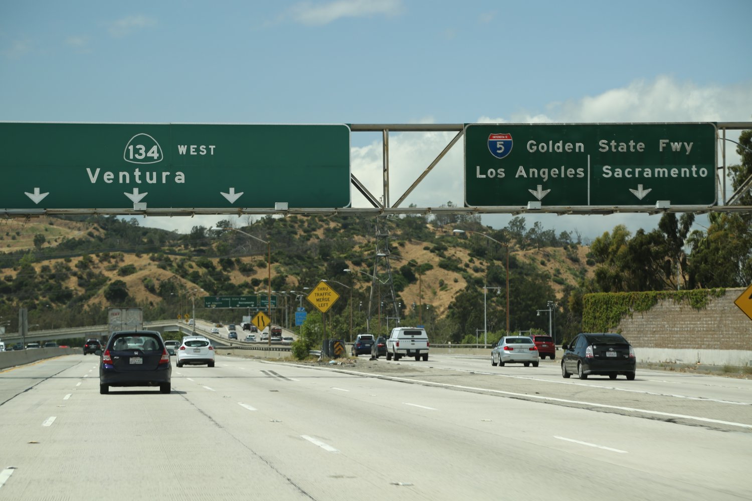
The Great 5 (I-5) has two names in the Los Angeles and Orange County metropolitan areas -the Santa Ana Freeway from about downtown south and the Golden State Freeway to the north of downtown. It spans from Canada to Mexico and runs right next to downtown LA on its run to the border. This is a major player on the LA and Orange county freeway scene. In Orange County, the 5 becomes one of the biggest super freeways in the world, with many lanes in both directions. This part of the freeway is an absolute amazing sight to see especially when both sides are clogged bumper to bumper and lane to lane with traffic.
This freeway can also be used to make a very quick exit to the north out of Los Angeles (when traffic is reasonable). North of downtown the 5 fly’s right by Six Flags, Magic Mountain (the large theme park) and exits the LA area near the town of Santa Clarita. After this, the 5 shoots over the often windy Grapevine through the Tejon Pass (4,160 feet) and is four lanes in both directions all the way until the 5 and the 99 split in the extreme southern end of California’s great Central Valley – the fruit basket of the state.
 Those four lanes are definitely needed at times as the far right and second to the right lanes are commonly home to very slow trucks going over the at times steep grades. Also note that both the north and south bound direction of the 5 freeway for about 4 miles (between Santa Clarita and Pyramid Lake) are totally separate from each other and at one point you can look across at a far ridge to see the other lanes of traffic. Both directions actual invert on one another so that the north bound lanes are well to the left of the south bound lanes. As a side note, if the weather is warm a quick stop at Pyramid Lake for a swim is always a welcome respite from the summer’s heat.
North of Los Angeles, the HOV (carpool lanes) on the 5 starts/ends right around the 14 Freeway intersection (these have been extended north of the 210 in recent years). If you drive south on the 5 your first “LA Freeway moment” will occur just after the 14 freeway intersection and before the 210 intersection, made possible by a major freeway widening leaving a wide and impressive swath of pavement and lanes. You first realize the power and intensity of the Los Angeles Freeways in this particular area of the 5 freeway.
On the 5, northbound – just south of Downtown, near Santa Fe Springs – you will see lots of Graffiti written on the signs and concrete overpasses.
Its always amazing how detailed the graffiti is in places that no normal person could ever reach without a ladder or climbing ropes!
One downfall of the 5 is just south of Los Angeles there is *no* carpool lane in either direction (parts of this freeway near the town of Downey are just three lanes) until you hit Orange County, just north of Fullerton (much needed freeway widening progress and construction finally was completed in this stretch). There you will find at some point 2 carpool lanes totally separated from the rest of the lanes! Most county lines are indicated by small freeway signs – not this county, along the 5 look for the fancy “Welcome to Orange County” sign built to the side of the freeway! During some traffic patterns it is like a breath of fresh air once the lanes open up in Orange County and you hit the “super freeway” section. At this point there is a lot more space and you can often escape from all the traffic because of the extra lanes. Also note that for about a mile near downtown on the 5 North there are only 2 lanes for about a mile. The 5 is also the main access freeway to visit Knott’s Berry Farm and the original Disneyland in Orange County.
Note the following 5 exit challenges. Many freeway exits on the 5 are located on the right side of this freeway. However, several exits to be aware of that leave the 5 freeway from the left are the 5 north to the 710 Freeway north and also to the 101 north. Further south in Orange County on the 5 south, be aware that there is no exit to the 55 Freeway north and close to downtown on the 5 North there is no exit for the 710 South. Also of significance on the 5 south near downtown and the 10 freeway exit is the following: if you want to stay on the 5 south near the 10 interchange do not be in the far two right lanes, especially during rush hour as traffic will stack way up and you’ll be hung out to dry with the right lanes often flowing fast to the exit onto the 10 freeway. To continue on the 5 south around this freeway interchange you need to be in the two lanes in the middle left of the freeway.
Note that the 5 and the 10 freeways are actually one freeway together for about a mile next to downtown Los Angeles before the 5 continues north to Canada and the 10 begins its great trek across the entire length of the USA.
At a Glance
Common Name: Santa Monica / SB Freeway
Direction: West and East
Boundaries: Santa Monica, Jacksonville, FL-E
Carpool Lanes: From 605 to Downtown,
also near Pomona east
Year Founded: N/A
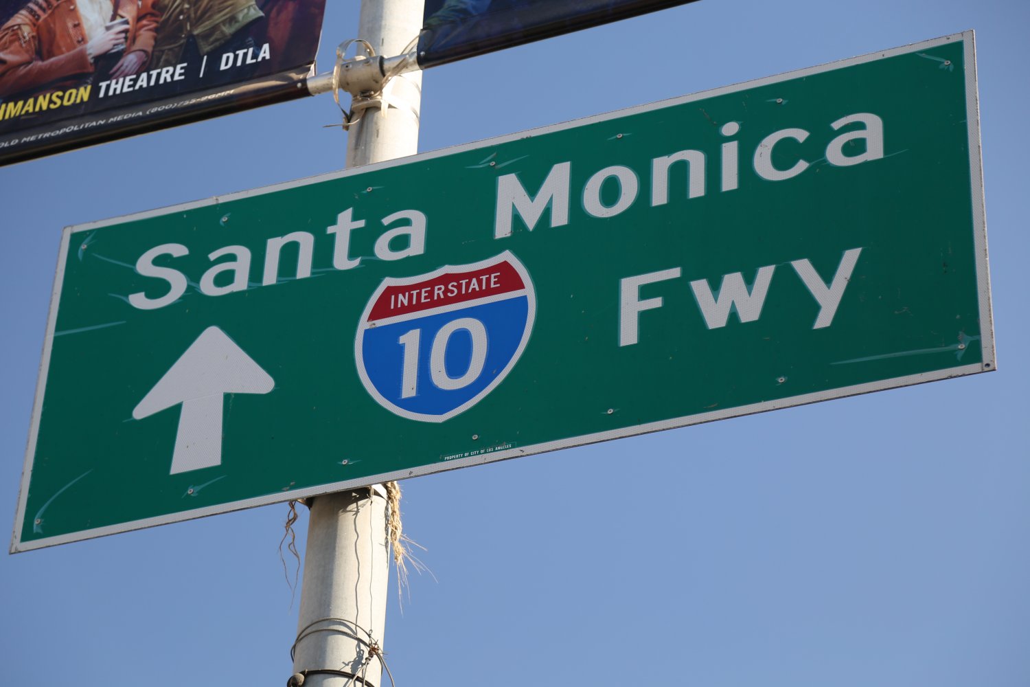
The 10 (I-10) is called the Santa Monica Freeway or San Bernardino Freeway depending on which section you are referring to. It is also named the “Rosa Parks Freeway” west of downtown Los Angeles. “Santa Monica Freeway makes a country girl blue…” an old country song sung by Shelly West and David Frizzell certainly would make someone from the country “blue”!
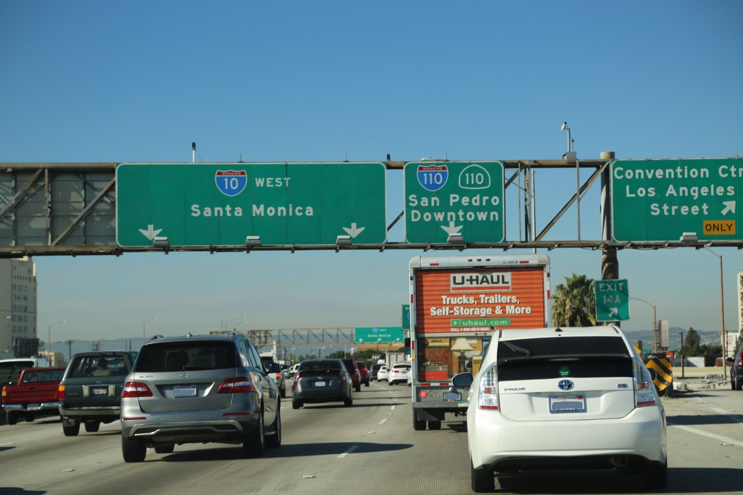
This is a major traffic artery for Los Angeles. The 10 officially starts or ends (depending on the driving direction) at the famous Santa Monica Pier and heads pretty much in a straight line due east towards downtown, passing fairly close to Exposition Park and USC before continuing right by Staples Center (Sports Arena) and LA Live (entertainment mega-center) before continuing east. The 10 takes on many forms in and around downtown – it is not a straight freeway from east to west in this area. As a result if you are not familiar with this section you must pay close attention as there are many freeway intersections around downtown to contend with especially where three great Los Angeles freeways come together (the 5, the 10 and the 101).
Note: to merge onto the 110 North from the 10 East near downtown you *must* be in the far left two lanes – often well before the actual merge as traffic tends to backup on this part of the 10. It can be a common mistake here to be in the far right lanes thinking that you can merge both directions onto the 110 but that is not the case. To merge to the 110 South – you will need to be in the far right lanes.
 There is one section of the 10 driving westbound where this freeway breaks into three different sections all going the same direction. This is found right by the 110 intersection just before the exit to Koreatown on South Vermont Avenue.
10 HOV info: Note that the car pool lane on the 10 west starts just west of the 605. This is a very unusual car pool lane for Los Angeles. Rather than the 2 person minimum 24 hours a day, this car pool lane is restricted to vehicles carrying at least 3 passengers weekdays between the hours of 5-9am and again from 4-7pm.
All other times this carpool lane defaults to the normal 2 or more passengers per vehicle restriction. There are no other car pool lanes in the Los Angeles and Orange County metropolitan areas that we are aware of with this type of restriction. Also note these lanes are Metro Express Lanes and you will need to have a FastTrack Transponder in your vehicle before even entering these lanes (same as parts of the 110 and the 91 freeways).
When you drive the 10 west towards downtown Los Angeles you will see a sign indicating a HOV/Fastrak exit to the 101 freeway (you must have a Fastrak transponder to use this exit). When this lane is empty of traffic this is truly a remarkable freeway exit – it is very long and completely separate from all the other freeways in the area until it merges with the 101 N. As you drive it, you feel totally isolated from the rest of the Los Angeles freeways – yet you are so close to downtown!
Also of interest is that the first HOV Lane in Los Angeles County opened between El Monte and downtown Los Angeles in 1973 on the 10 and for three years was just for buses (known as the El Monte Busway). In 1976 it opened to carpools of three or more persons.
 The 10 cuts through Pomona, & then Ontario before skirting San Bernardino and then heading out of the LA area, continuing its journey all the way across the United States before hitting the Atlantic Ocean in Jacksonville Florida. Along with the two northern freeways the great I-80, and the 90, the 10 is the only other freeway to go from coast to coast in the USA.
Perhaps you are making the long trek across the USA on the 10 – your first fleeting glimpse of the tallest buildings in downtown Los Angeles on the 10 west will be right near the 710 intersection.
There is nothing like driving the 10 (or any LA freeway) at 2 and 3am in the morning through Santa Monica and Los Angeles area with all windows down and a warm breeze blowing through your car. Most major traffic is gone and you have the satisfaction of knowing that in merely a few hours this freeway will be clogged with traffic. In our opinion, the maximum “fun window” for driving the LA freeways fast as the speed limit allows is from about 2am until 4am. This is very addicting. Throw in Hotel California playing as loud as the car speakers will allow and you have an almost religious experience.
 Or if you want to experience a lighter than normal traffic day during daylight hours choose a major holiday to do your driving. We recommend Easter Sunday; one year we hit parts of all the major LA and Orange County freeways on this single day! Don’t even think about doing that on a workday.
Note that the 10 West to the South 405 exit is a one lane only exit at times despite having the space for 2 lanes for the entire exit.
Those who drive the 10 Freeway day in and day out most likely will agree that this freeway could seriously use a coronary bypass!
Memorable Los Angeles freeway moments in time would certainly include driving on the dramatic 110 N connector to the 10 west during rush hour – exiting the 110 after an arduous slog north equivalent to running with heavy weights on your legs in thick gooey mud surrounded by thousands of cars in both directions and then reaching the 10 connector off ramp as miraculously the only vehicle in site, able to slow down and enjoy the moment with no cars on your taillights – circling slowly past the great convention center below you looking back at the lights of downtown Los Angeles.
At a Glance
Common Name: Ontario / Mojave Freeway
Direction: North and South, 15 miles
Boundaries: Nevada-N, San Diego-S
Carpool Lanes: Sadly, none
Year Founded: N/A
The 15 (I-15) is a major freeway, called The Ontario or Mojave Freeway depending on its location. It also has other names outside of the LA Metropolitan region. The 15 cuts through Riverside and San Bernardino and eventually hits Las Vegas if you drive north east on it. During busy holiday weekends parts of the freeway can really back up especially around the Agricultural checkpoint (between Baker and Barstow – well east of Los Angeles proper) where it seems like most of the time there is someone standing at the gate waiving cars through. Having merely two lanes from east of LA to Vegas can definitely be problematic.
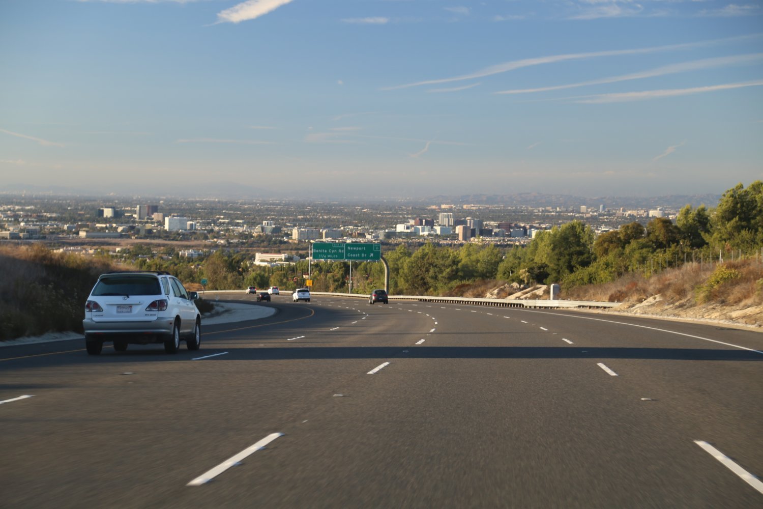
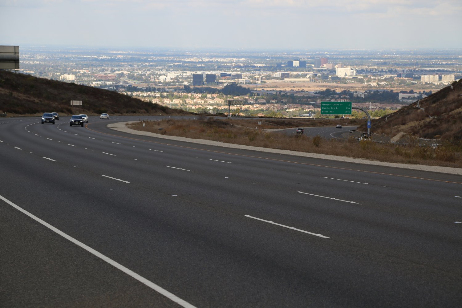
 The 15 is the dominant north/south freeway in the Inland Empire and a major connector to San Diego in the south. As a result of its location this freeway is not in LA proper although it touches the far eastern suburbs of Los Angeles and part of it is contained within the greater LA metropolitan area. On a clear day driving north on the 15 north of the 10, there are some excellent views of the San Bernardino Mountains, especially in the winter when there may be snow on top.
The 15 forms a half circle in its brush with the Southland urban area east of LA. The 15 when moving is a very fast freeway.
There is hope among truckers of putting in a truckers only lane along a good portion of this freeway. We can definitely see a need for this having driven the two lane part of this freeway numerous times. Note that traffic tends to become congested around the 215 intersection just north west of the city of San Bernardino.
At a Glance
Common Name: Garden Grove Freeway
Direction: West and East, 15 miles
Boundaries: Long Beach-W, Orange-E
Carpool Lanes: Yes, entire freeway
Year Founded: State Highway from 1934
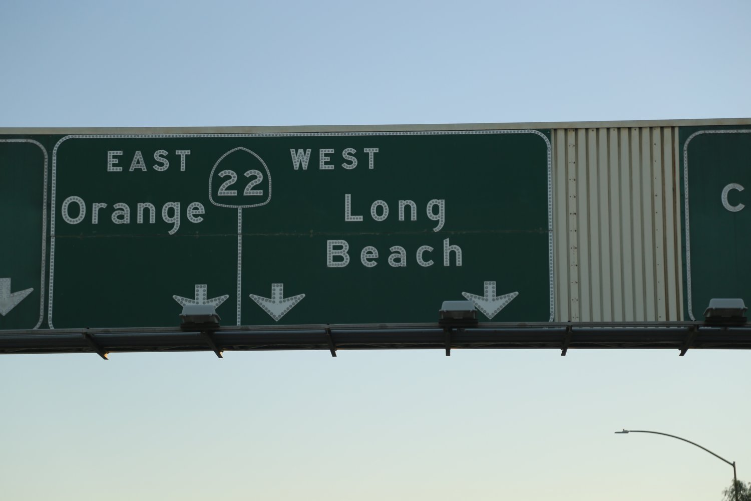
The 22 (SR-22) called the Garden Grove Freeway is essentially an east/west connector freeway running between most of the major freeways in Orange County including the 405, the 5 and the 55 Freeway at the City of Orange. Besides the dominant 91 Freeway to the north, the 22 is Orange County’s only other major East/West freeway. The similarities don’t end there; also like the 91 Freeway which starts out on its western end as a city street, so does the 22. East 7th Street runs all the way through Long Beach before becoming the 22 Freeway.
While this is a very short freeway (one of the shortest in the LA and Orange County metropolitan region), it is an extremely vital one. The 22 cuts across many large long boulevards that also touch the 5 and 405 freeways. This is a fast, premiere modern Orange County freeway when traffic is light.
 Major construction was finished on this freeway including the addition of a car pool lane in each direction as well as some pleasing artwork in the stone walls that surround both sides of this freeway. This is not your ordinary Los Angeles & Orange County car pool lane, rather its based on the type of car pool lanes commonly used for years up in the San Jose Bay Area.
While it is restricted 24/7 to car poolers these are continuous access car pool lanes meaning vehicles containing more than 1 passenger can enter and exit the car pool lanes as they wish, rather than waiting until specific entry and exit points. This is the first freeway in either Los Angeles or Orange County to have these type of car pool lanes.
The 22 is a a very difficult freeway to photograph from above. It is a dominant freeway – meaning it runs above surface streets rather then surface streets being built over the freeway like is common on older freeways.
The 22 is also one of the freeways to form part of the infamous “Orange Crush”, a notoriously crowded section of freeways (also the 5 and 57 freeways) and surface roads near the city of Orange. Near the 5 intersection look for the famous Crystal Cathedral just to the north of the freeway.
There are several freeway defects that are part of the 22. One of the most glaring is there is no exit to get on the 5 South as you drive on the 22 East (between the 57 and the 5 freeways). In addition, as you drive the carpool lane west on the 22, there is no carpool lane only exit to either the 5 south or the 5 north – you need to exit the carpool lane and head to the far right of the 22 freeway to use the regular lanes for exiting onto the 5 in either direction.
At a Glance
Common Name: Costa Mesa Freeway
Direction: North and South, 18 miles
Boundaries: Anaheim-N, Newport Beach-S
Carpool Lanes: Yes, entire freeway
Year Founded: State Highway from 1931
The 55 (SR-55) freeway is called the Costa Mesa Freeway and runs from Newport Beach crossing the 405 and the 5 before finally hitting the 91 Freeway near Yorba Linda. This is a fairly short freeway as far as LA freeways are concerned and was originally a 4 lane highway first built in the early 1960’s after many years as a smaller state highway. It runs in an approximate north-south direction. From the 405 to the southern Beach cities you actually jump on the toll 73 Freeway but exit on the 55 before the actual toll kicks in. Did you know that the 55 was home to Orange County’s first carpool lane? This was built in merely 1985. It is hard to believe that it has only been 30+ years since Orange County has embraced car pool lanes!
Today the northern stretch of this freeway between the 5 and the 91 Freeway, boasts 5 lanes in each direction (including the carpool lane). Like the 10 Freeway which is located north in LA County, the 55 Freeway also ends in a beach town. At the end of this large freeway you quickly come to city stop lights (the freeway becomes Newport Blvd) and cross a variety of other boulevards before hitting the PCH (Highway 1).
 If you continue all the way on Newport Blvd after leaving the 55 Freeway eventually you will drive out onto the Balboa Peninsula which deposits you into the quintessential realm of southern Orange County’s wealthy beach living. You will see big homes, big boats and a beautiful bay.
The 55 is a direct route for these southern Orange County beach cities to major freeways including the 405, the 5 and the major 91 Freeway further to the north (connecting to the Inland Empire) and as a result this freeway can be quite clogged at times.
At a Glance
Common Name: Orange Freeway
Direction: North and South, 24 miles
Boundaries: Glendora-N, Santa Ana-S
Carpool Lanes: Yes, entire freeway
Year Founded: State Highway from 1931
The 57 (SR-57) Freeway is called the Orange Freeway and runs from the 5 near the city of Orange up through Anaheim crossing the 91, & the 60, before finally terminating at the 210 (Foothill Freeway) at San Dimas. This is one of the major state highways in this particular part of Orange and LA counties and is part of one of the locally well known traffic bottlenecks at times. The 57 forms part of what is called “the Orange Crush” appropriately titled as this often busy freeway interchange is located next to the city of Orange. The Orange Crush involves neighboring freeways including the 5 and the 22. In addition a number of on and off ramps help add to the complexity of this particular interchange. You can think of this interchange as Orange County’s answer to some of LA County’s worst freeway interchanges! However if there is little traffic on this freeway it can be an extremely quick option to go between Orange County and the San Gabriel Valley.
 Carpool lanes start/end around Tonner Canyon Road in the 57 hills near the 60 Freeway intersection. Driving northbound on the downside of the hills in this part of the 57 (on a relatively clear day) affords one nice views looking north towards the San Gabriel Mountains.
The 57 fly’s by several well known sports venues including Anaheim Stadium with its big landmark “A” sign located in the parking lot, as well as nearby Honda Center, home to the Anaheim Mighty ducks professional hockey team.
The 57 splits these two sports centers in half with one center located on either side of the freeway. The Richard Nixon Museum and Presidential Library is located on Yorba Linda Blvd off the 57 Freeway north of the 91 Freeway. Raging Waters, the water “rides and slides” theme park is also located almost at the end of the 57 Freeway, just north of the 10.
Existing carpool connector ramps are still fairly rare in the Los Angeles and Orange County metropolitan region, however a number of new ones are in the planning stage. These connector ramps are physically separated from the main freeway and are for carpool use only. The 57 is unique as presently it is the only freeway in the southland with two carpool connector ramps, one at the 60 Freeway in the north and one at the infamous “Orange Crush” on its southern end.
At a Glance
Common Name: Pomona Freeway
Direction: West and East, 70 miles
Boundaries: Los Angeles-W, Beaumont-E
Carpool Lanes: Mostly east of the 605
Year Founded: State Highway, 1964
The 60 (SR-60) Freeway is one of the major east/west freeways in the LA basin. It can be extremely crowded at times and even that is an understatement. This is one freeway that we try to avoid at all costs during rush hour. It is called the Pomona Freeway and starts/ends just south of downtown and runs all the way east to the 91, ending just east of Riverside at the great 10 freeway. It serves part of the San Gabriel and Pomona valley communities. Depending on your location in the LA area this might be the freeway of choice for heading out to Palm Springs (via the 10 Freeway). In 2007 major freeway construction was completed near where the 91, 60 and 215 converge in the city of Riverside.
 The more recent freeway expansions in this area and the very tall bypass have helped mitigate the terrible traffic that is often found near this interchange.
The problem with all the traffic on the 60 is this freeway serves dual functions; it is a major commuter corridor between downtown Los Angeles and many communities in both the San Gabriel Valleys and further east to Riverside and San Bernardino. In addition, the Federal Sub-system of Highways has designated the 60 a Super Truck Route so as a result you have many trucks using this freeway mostly serving the ports of Long Beach and Los Angeles. Note that there is no connector from the 60 west to the 5 south. Also the 60 and the 57 freeways actually run together as one freeway for about 2 miles near their intersection.
At a Glance
Common Name: Corona del Mar Freeway
Direction: North and South, 18 miles
Boundaries: Costa Mesa-N, Mission Viejo-S
Carpool Lanes: None in LA County
Year Founded: Initial section, 1978, 1996 the rest
The 73 (SR-73) is a wonderful toll road (however, note that not the entire length is a toll road) that provides a fast modern freeway shortcut experience between the 405 and the 5 freeways in southern Orange County. Orange County is without a doubt the toll road leader in California and this is one of their shining accomplishments.
As you exit the 405 note that you can drive for about 3 miles before you actually enter the toll section of this freeway. This was the original part of the 73 freeway first opened in 1978 and called the Corona del Mar Freeway. The first exit (1.25 miles in) driving southbound is the fairly short 55 Freeway which ends as a stop lighted highway in Newport Beach. Exits along the toll portion of the 73 are equipped with overhead transponders which track your exit and bill your Fastrak account accordingly.
 This is a fast freeway and because of the fairly high tolls is a much lesser traveled road than some of the nearby public freeways. Note that as of May 12, 2014 Orange County did away with all cash machines at all toll roads including the 73. You can use your Fastrak transponder to pass through the former toll plaza where the cost of each time you enter will be added to your Fastrak account. If you do not have a Fastrak account you must login to www.thetollroads.com within 5 days (used to be 48 hours) and pay your toll there, otherwise be subjected to fines.
If you have a FasTrak transponder in your car you will save you a bit on the cost of the toll fare.
The 73 is also well known in California freeway lore as being the site of where the poor giraffe loses it’s head due to Alan’s incompetent driving skills in the film, The Hangover III. This giraffe still lives on at Saddlerock Ranch in Malibu (as of our last update).
Notable views include driving south bound just past John Wayne airport as you start climbing into the San Joaquin Hills – on a clear day there are excellent vistas in your rear view mirror of numerous parts of urban Orange County. As you drive north bound before you reach the location of the exit transponders overhead – there are nice views of Saddleback Mountain to your east. Much of the 73 winds through a surpringsly landscape that is mostly rural Orange County – (with some fancy subdivisions creeping to close to it’s flanks).
Despite an easy to drive not very crowded freeway (even during rush hour) if you have to drive to Los Angeles in the afternoon – in the back of your mind you are always thinking about the junction of where the 73 hits The Monster (the 405).
At a Glance
Common Name: Marina Freeway
Direction: West and East, ~ 3 miles
Boundaries: PCH (1)-W, W. Slauson Ave-E
Carpool Lanes: No
Year Founded: 1964 as a highway
 The 90 (SR-91), called the Marina Freeway is the second shortest freeway in all of Los Angeles (about 3 miles) behind the shortest freeway, the 103 in Long Beach. As a result of its far western coverage and short distance it does not often see the extreme congestion that some of the area’s larger freeways have. This freeway also resumes as the Imperial highway to the East and runs through several Orange County communities such as Yorba Linda and Anaheim Hills.
The 90 starts as an expressway right near the Marina at Marina del Rey and turns into an official freeway near Ballona Creek (like other creeks in Los Angeles, its a “paved” creek – for flood control reasons) – it then crosses the only major freeway in its path – the 405 before dwindling out at West Slauson Ave in the small community of Fox Hills. While it is named the “marina freeway” the freeway does not actually touch the “marina” – starting about a 1/4 mile East of the water.
At a Glance
Common Name: Riverside Freeway
Direction: West and East, 59 miles
Boundaries: Gardena-W, Riverside-E
Carpool Lanes: Yes, all of LA, OC, & almost
off of its length in Riverside County
Year Founded: 1930’s as a highway
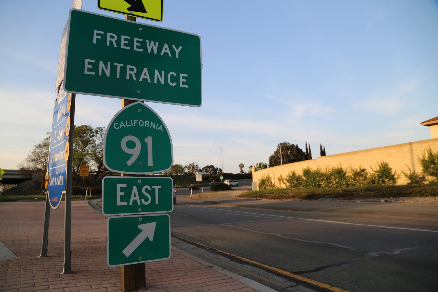
The 91 (SR-91) Freeway, called the Riverside Freeway, the Gardena Freeway or the Artesia Freeway depending on its specific location, begins not as a freeway but rather as Artesia Blvd (with lots of stoplights) in Hermosa Beach on the Pacific Ocean. It becomes a major freeway at the 110 interchange in the town of Gardena and follows a pretty much straight east-west route through Anaheim and then Corona, before heading north east up to Riverside where it is finally buried at the 10 Freeway and turns into the 215. Like the 210, the 10, and the 60 freeways, the 91 is a major east-west artery in the LA area. It is the direct link between Orange and Riverside counties and is one of the most congested freeways in the Southland. There is a carpool lane on most of this freeway. Parts of this freeway between Orange County and Riverside have a carpool lane plus 1-2 “Express” lanes accessed by FasTrak – a toll only separate part of the freeway which parallels the main part of the 91. There are 6 or 7 lanes in either direction on the 91 in areas.
 This is a very busy freeway and during rush hour, despite the toll lane usage increase, these lanes typically move much faster than the regular lanes. The toll lanes run for about 10 miles – unfortunately not far enough, but these lanes usually save a lot of time. You must be a paying member of FasTrak to use these lanes – cash will not work. When you sign up for FasTrak, you are given a transponder which you put in your car and it is read by the machine as your zip through the Express Lane gate & debits your account every time you use the Express Lanes.
We are aware of only two freeways in the Los Angeles and Orange County metro areas that contain special car pool lanes for 3 or more occupants per vehicle. One is on the 10 Freeway heading towards downtown Los Angeles at certain times (no toll) and the other is one lane within the 91’s toll section.
Three people in your car allows you to travel for free or at a healthy discount (depending on peak travel hours).
 The 91 toll section is part of Orange County’s fairly extensive toll road system. If you take the 241 south from the 91 you will notice that this toll road hits several more toll roads – there is also the 73 toll freeway located more towards the ocean part of Orange County. Southern & Central Orange County is the center of toll freeways, highways and roads in California.
At the border between the following counties: Orange, Riverside, and San Bernardino the 91 passes through what is sometimes a traffic nightmare called the Santa Ana Canyon. This is where the 91 and the Santa Ana River pass through the Santa Ana Mountains.
More information about the Express Lanes and the 91 Freeway is here: www.91expresslanes.com. This site provides a real time map of the 91 Freeway and adjoining freeways. Sections of the freeways are sectioned off by how many miles per hour the traffic is moving! (i.e. increments of 0-15mph, 15-30mph etc).
At a Glance
Common Name: Hollywood Freeway
Direction: West and East | North and South
Boundaries: Thousand Oaks-W, Downtown LA-S
Carpool Lanes: None in LA County
Year Founded: N/A
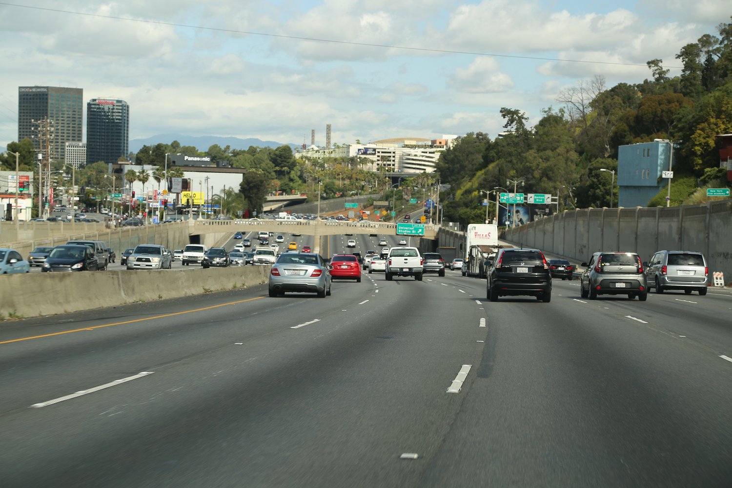
The 101 , (US-101) one of Los Angeles’ most famous freeways actually ends in downtown after going by Hollywood and Thai Town. It is called the Ventura Freeway north west of LA and then when it gets close to the downtown area it is called The Hollywood Freeway – as it pretty much bisects Hollywood and North
Hollywood. Also note the 170 extension freeway is also called the Hollywood Freeway. This very historic freeway is called El Camino Real or King’s Highway during the section between the San Francisco Bay Area and Los Angeles.
 It was originally built to connect the 21 California Missions. Note: there is no carpool lane on the 101 north of Los Angeles and as a result traffic at times can be terrible – throw in a few accidents near the 101/405 interchange and you have a disastrous commute.
The 101 forms the south end of the “San Fernando Square” – a square of major pavement that runs through the San Fernando Valley (the 118 on the north, the great 405 freeway on the East, the 101 on the south, and the 27 (Topanga Canyon Blvd) on the west side. (place mouse over colored text above for description).
Driving on the 101 south to the 5, you must be in the right lanes to get onto the 5. The connection freeway (technically) still the 101) from the 101 to the 5 continues as two lanes for about a mile and then drops you right onto the busy 5 south. This freeway runs up and down the west coast of the United States but the absolute end of the 101 is located where it meets the 5 near downtown Los Angeles.
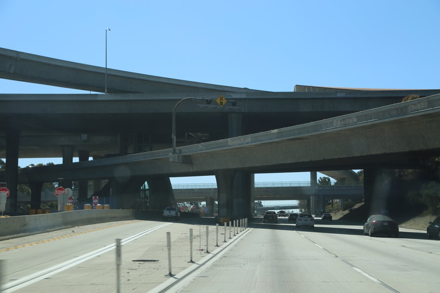
One of the huge freeway interchanges in the Southland occurs at the 101 and the 110 – where there are four levels of freeways all coming together at one place! This is simply called the “Four-Level Interchange” and was the world’s first 4-level interchange. In fact within several miles of this interchange you can find a few of the most major LA freeways (the 10, the 5 & the 710).
 Note: If you are driving south on the 101 and want to jump on the 110 South near downtown after you have exited the 101 (just past the Four-Level Interchange), there are two ways you can do this. For the more adventurous you have to immediately move over as far left as you can – this involves jumping across 5 or 6 lanes of traffic which because of the extremely short distance is difficult to do with or without crowded conditions. Fun times in downtown!
For those who would rather take their time or if traffic is totally backed up in this area like it often is, stay in the right lanes and follow the signs to Wilshire Blvd. There is an on-ramp back onto the 110 just before Wilshire Blvd so that you never actually leave the 110 Freeway. The total distance from the 2 freeway merge to the onramp just before Wilshire is about 1 mile.
Note: where Mulholland Drive merges into the 101 North at Cahuenga Pass there is a solid white line seperating the merge lanes from the main lanes of the 101 freeway. This solid white line extends nearly to the pass – indicating traffic cannot merge between the sets of lanes until this solid white line ends.
The 101 runs all the way up through Northern California, Oregon and Washington – at times reaching out and touching the coastline after running inland for many miles. The 101 hits the coast closest to Los Angeles just south of Santa Barbara and just north of Ventura. Here is a website which contains news, general info and photos covering all of Interstate 101: www.101cafe.net
At a Glance
Common Name: Terminal Island Freeway
Direction: West and East, 1.6 miles
Boundaries: Sepulveda Blvd., Seaside Avenue
Carpool Lanes: No
Year Founded: 1984 as a highway
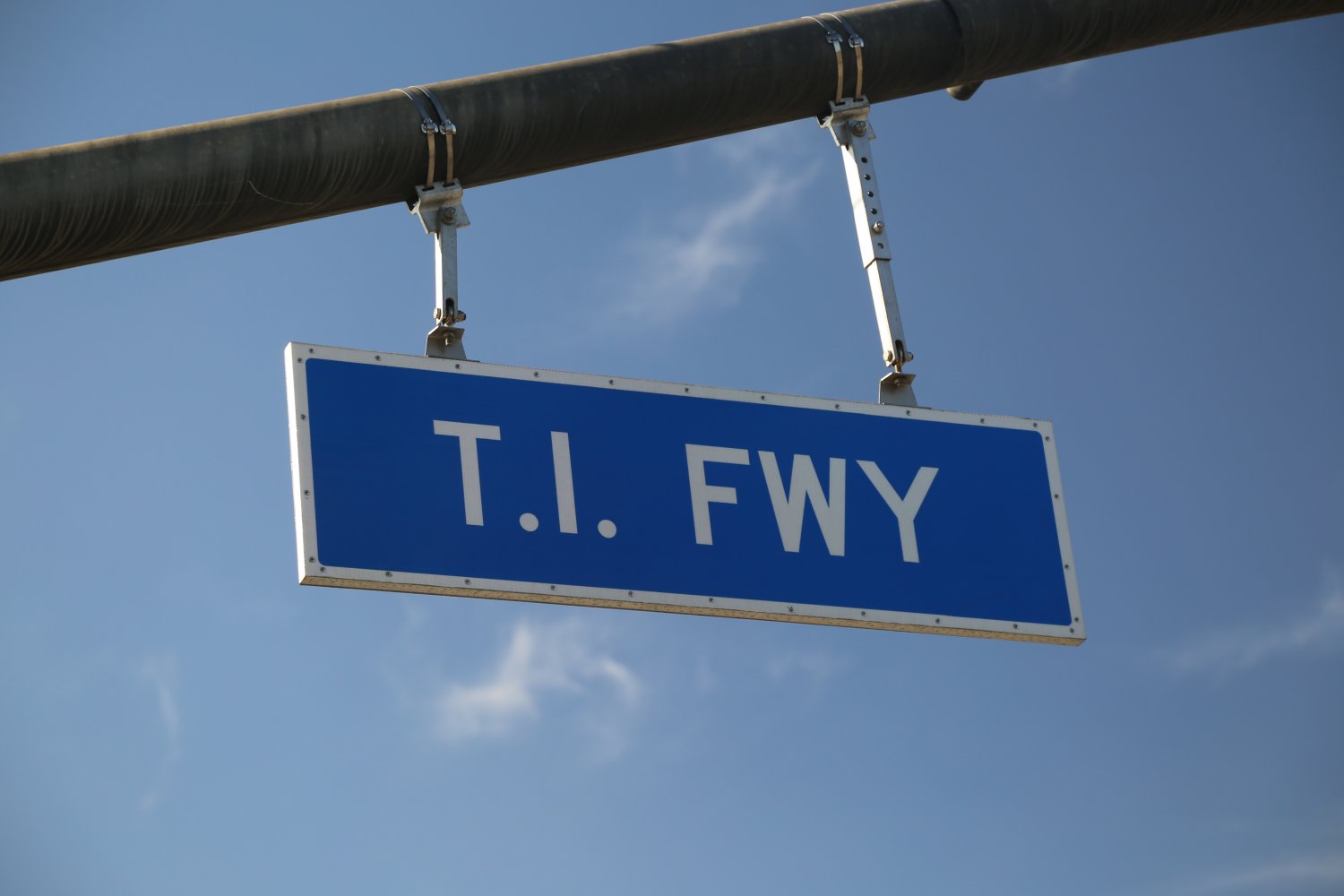
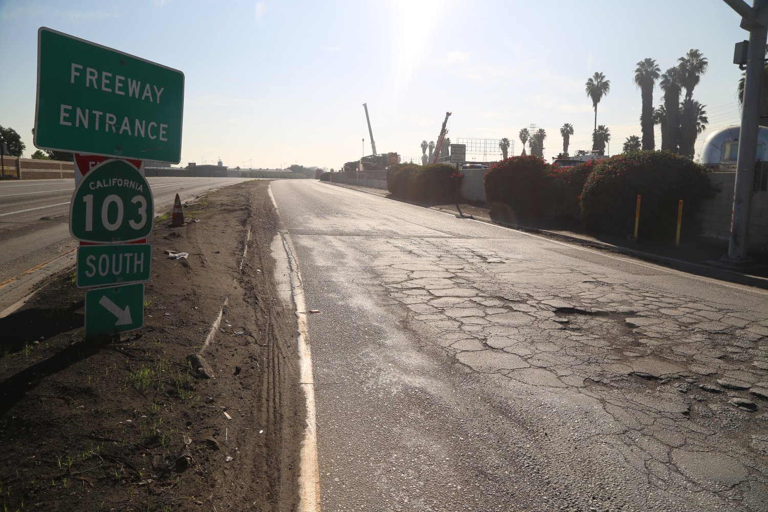
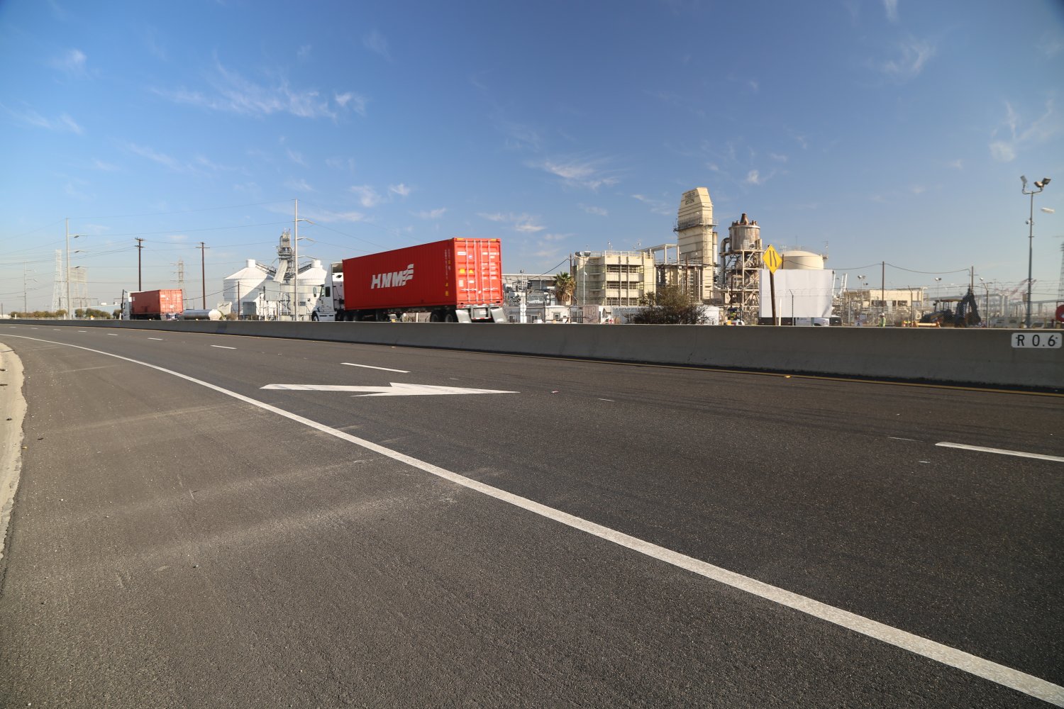
The 103 (Terminal Island Freeway) is the shortest freeway in Los Angeles, coming in at merely 1.6 miles! While it is the shortest freeway in the county, it is located in a highly industrialized part of Long Beach and is a significant and almost always very busy thoroughfare for heavy duty trucks making deliveries to and from the port of Los Angeles and the Port of Long Beach. And despite it’s short length it actually crosses through both the city of Los Angeles and the city of Long Beach city limits.
The 103 begins in the north where LA’s longest blvd ends (Sepulveda Blvd) and W. Willow Street begins. Running in a general north to south direction it crosses the PCH (Highway 1) in an impressive cloverleaf, crosses the water over Commodore Schuyler F. Heim Bridge (can be raised to let larger ships through the Cerritos Channel) and eventually terminates at Seaside Avenue. What is highly unusual in the Los Angeles freeway system is the 103 does not connect to any other freeways.
The history of this freeway is somewhat convoluted due to name changes over the years and differing plans for it’s route construction. It was originally planned to extend to the 405 and the 710 interchange (about 1/2 mile from its northern terminus). In what is a clear and focused attack on the LA Freeway system talks and a conceptual phase have begun to potentially decommission this freeway and turn its space into walking trails and a local access road, among other features.
And like other LA Freeways, depsite its diminutive size the 103 has been featured in a number of prominent films including Terminator 2: Judgement Day, Mr. & Mrs. Mrs. Smith and the Fast and the Furious.
At a Glance
Common Name: Century Freeway
Direction: West and East, 19 miles
Boundaries: El Segundo-W, Norwalk-E
Carpool Lanes: Yes, entire freeway
Year Founded: 1993
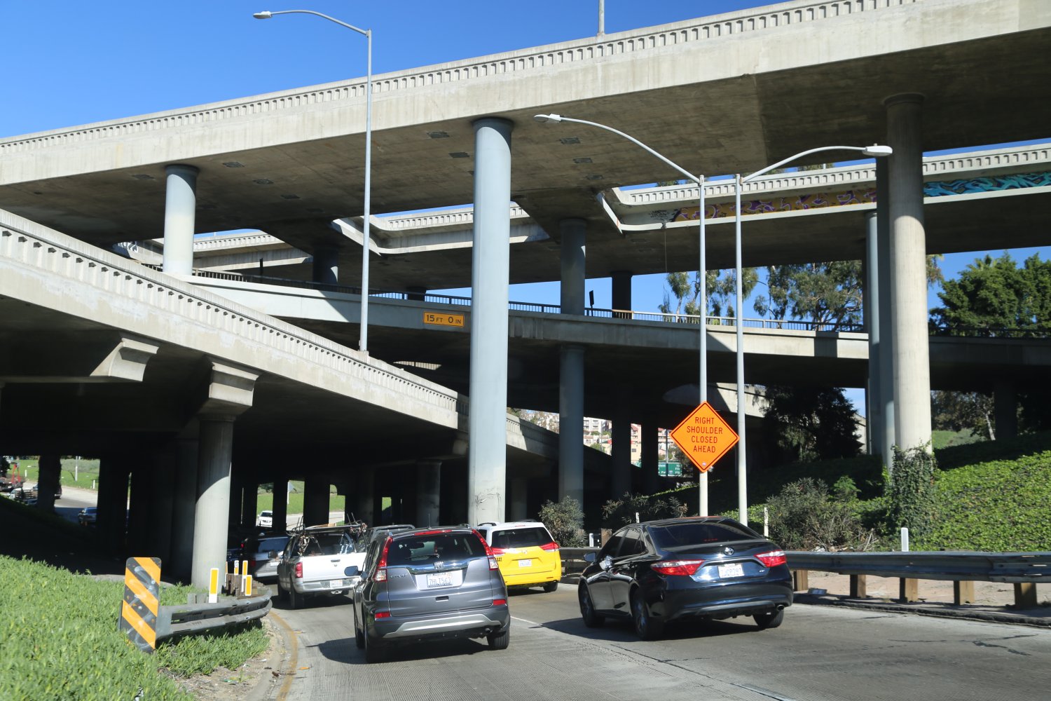
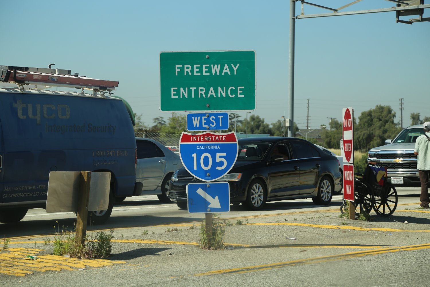
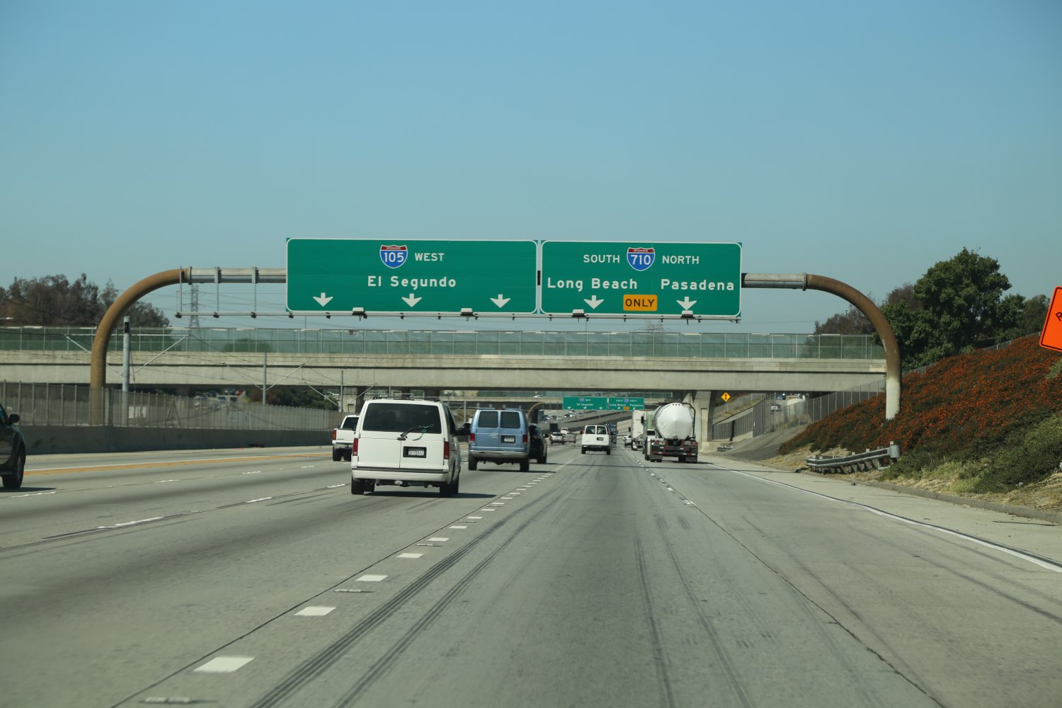
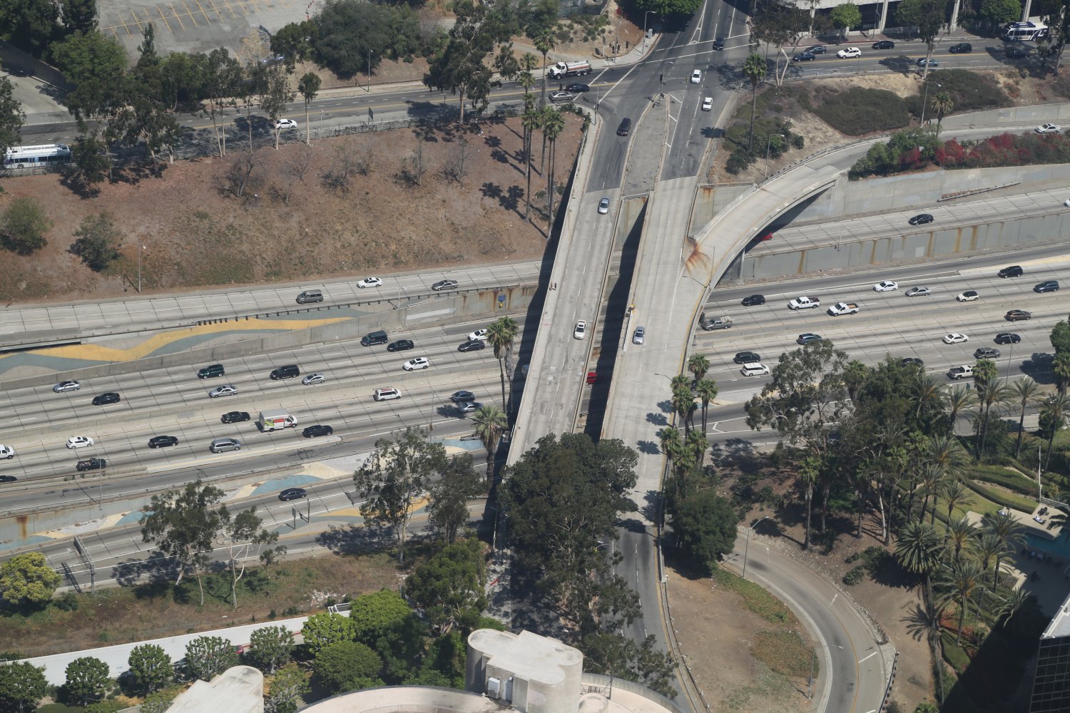
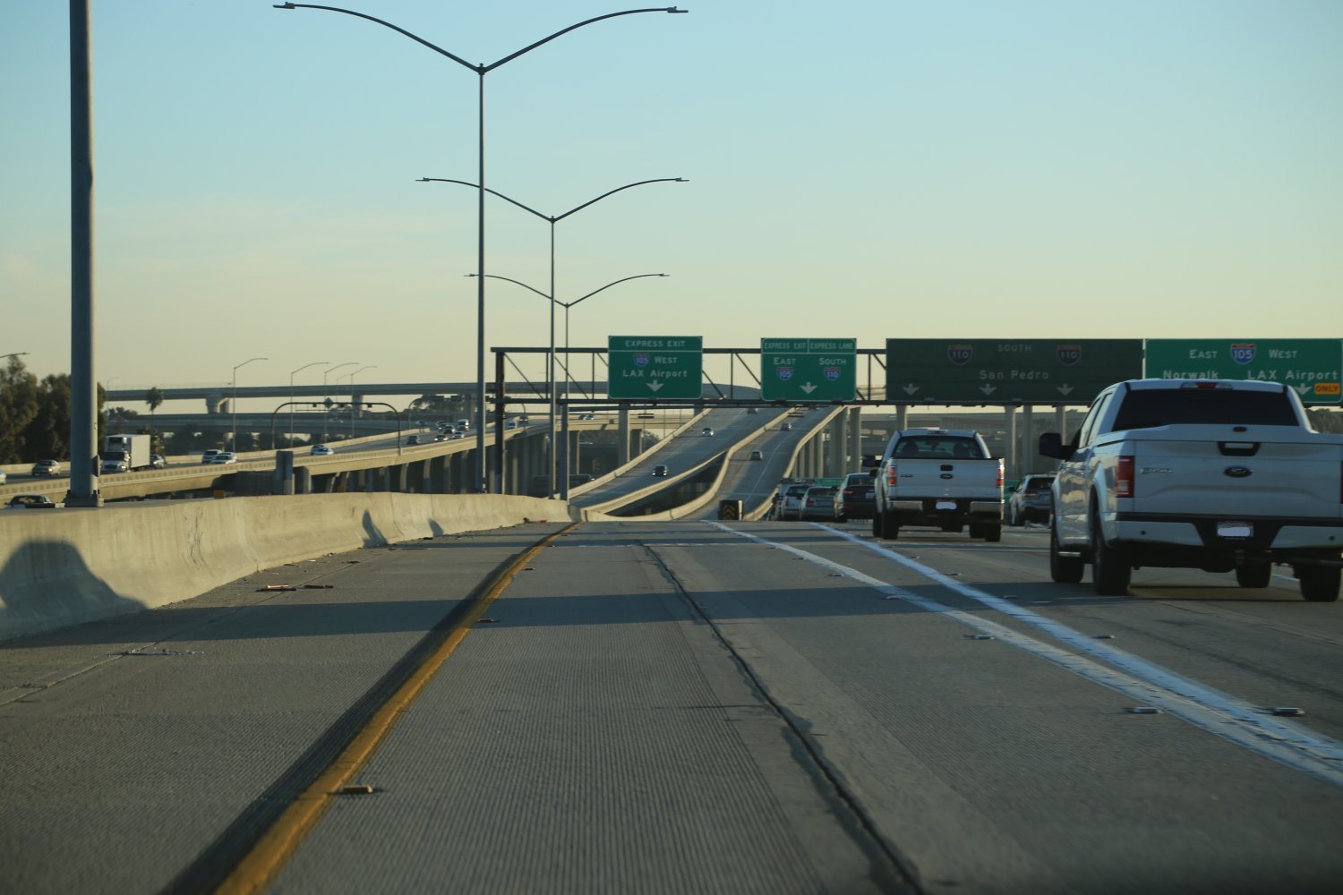
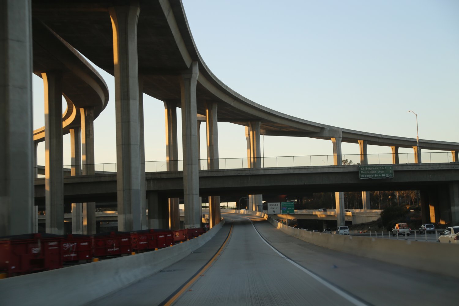
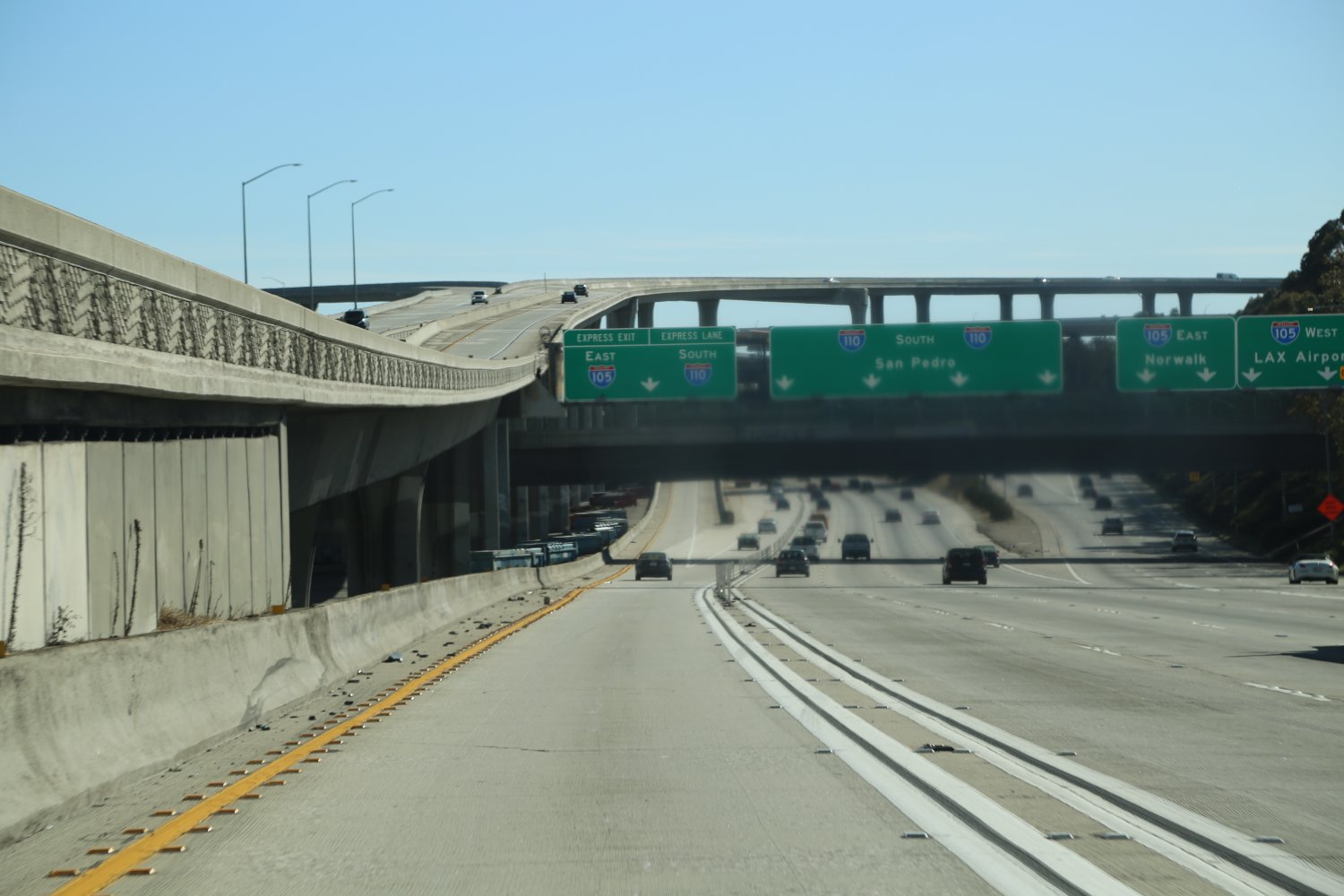
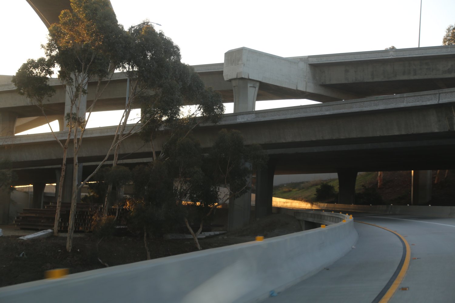
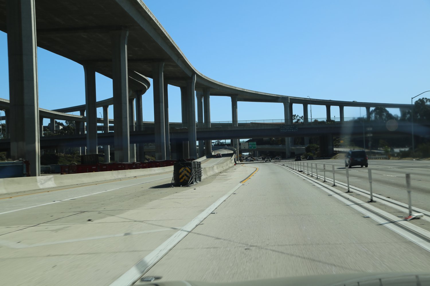
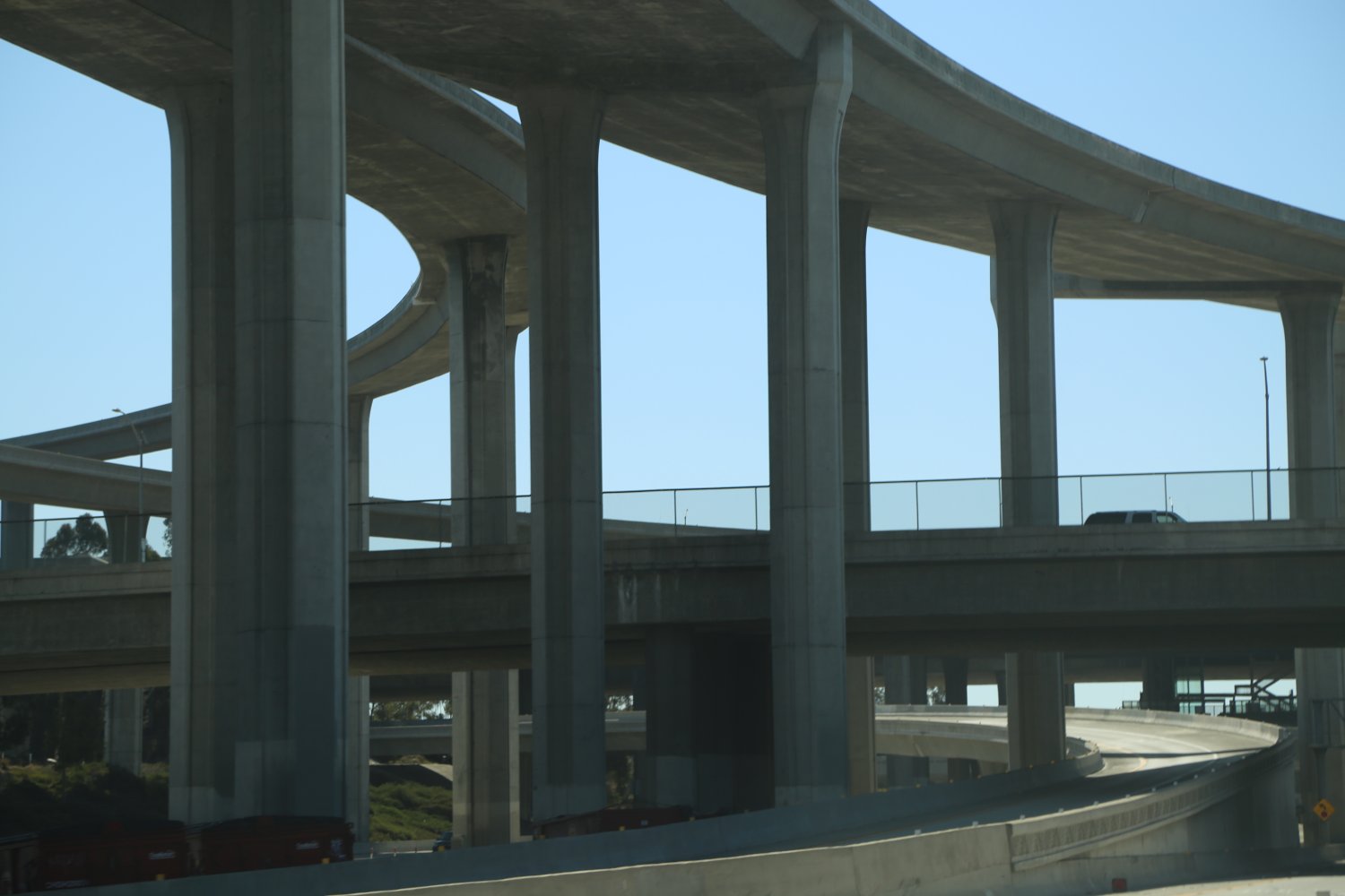
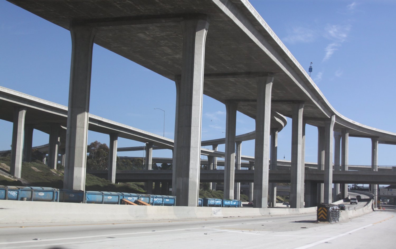
The 105 (I-105) called the Century Freeway is Los Angeles’ Airport’s “own freeway” although it runs west-east for about 20 miles and ends at the 605 Freeway near the city of Bellflower, which is well east of LAX (LA’s International Airport). While the 105 is a fairly short it crosses 4 major north south freeways and just misses hitting the 5 Freeway at its eastern terminus. The 105 starts right at LAX and as you come out of the airport you quickly jump on this freeway. The 105 helps create the amazing Judge Harry Pregerson 5-level freeway interchange in its swath east of the 405 at the 110 intersection.
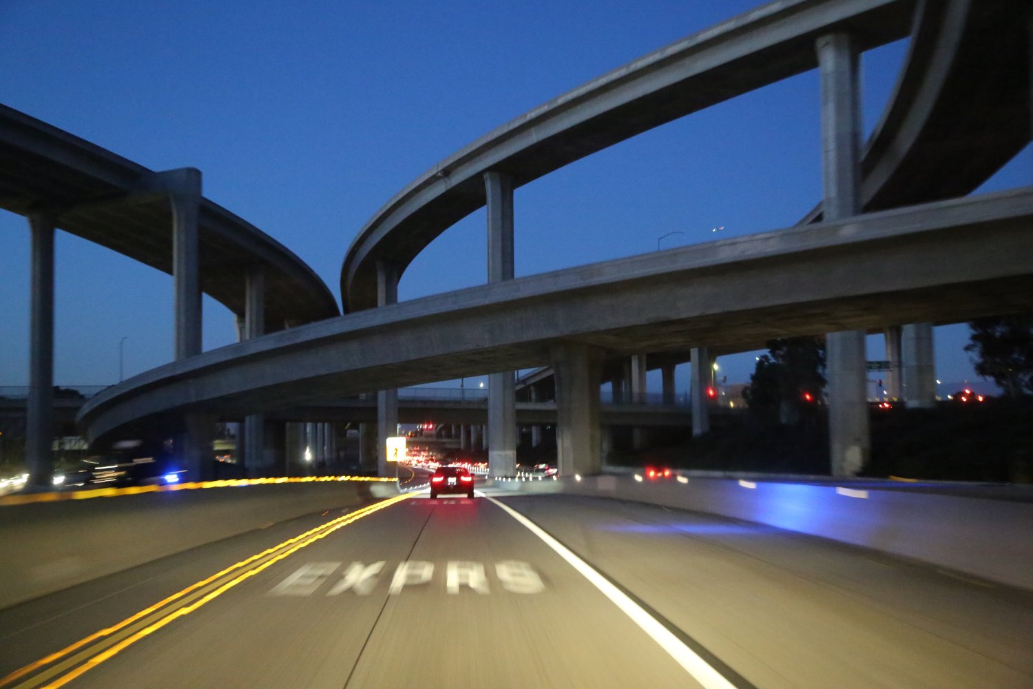
This intersection as viewed from the 110 Freeway is truly a sight to see and is a must visit for any LA freeway buff. For reference a 5-level freeway interchange is one major mass of concrete with a bunch of raised levels; this interchange is the biggest one we know of, at least in California! It includes separate carpool lane connectors (HOV), metro tracks and the towering Harbor Transitway, a section of often raised pavement that is reserved for carpoolers as well as in specific locations, contains a separate lane for buses. The highest lane in this 5-level interchange is a carpool (HOV) lane which towers 130 feet above the ground!
 This 5-level freeway looks the most impressive from the ground level. We’ve driven the uppermost Fastrack HOV numerous times and while tall and creating a vary long swath over this interchange its not quite as impressive as from the ground level. The Fastrack HOV lanes on the 105 East actually extend about one mile past the intersection with the 110 before this lanes reverts back to normal HOV.
Its also interesting to note when you are driving the 105 in either direction and you take the exit for the 405 Freeway South there is a mile plus stretch of “no mans freeway” – a two lane section that is the actual connector between these two freeways. A nice tunnel is also part of this connector experience when you drive West on the 105 and take the 405 South exit. These connectors are somewhat unusual because of their length – most freeway connector exits are much shorter in length.
This freeway is relatively new having only opened in 1993. Here is a bit of 105 Freeway trivia: the childhood home of which Southern California band was torn down because it sat in the path of this freeway? Answer: the child home of the Beach Boys was torn down in the mid 1980’s to make way for this freeway and today there is a historic monument in the shadow of one of the 105’s walls commemorating this spot. A great Los Angeles based movie which involves this freeway is Speed, starring Keanu Reeves and Sandra Bullock. This movie was filmed on the 105 just prior to its opening.
At a Glance
Common Name: Harbor/Pasadena Freeway
Direction: North and South, 32 miles
Boundaries: Pasadena-N, San Pedro-S
Carpool Lanes: Only in approximately the middle
Year Founded: 1930’s as highway
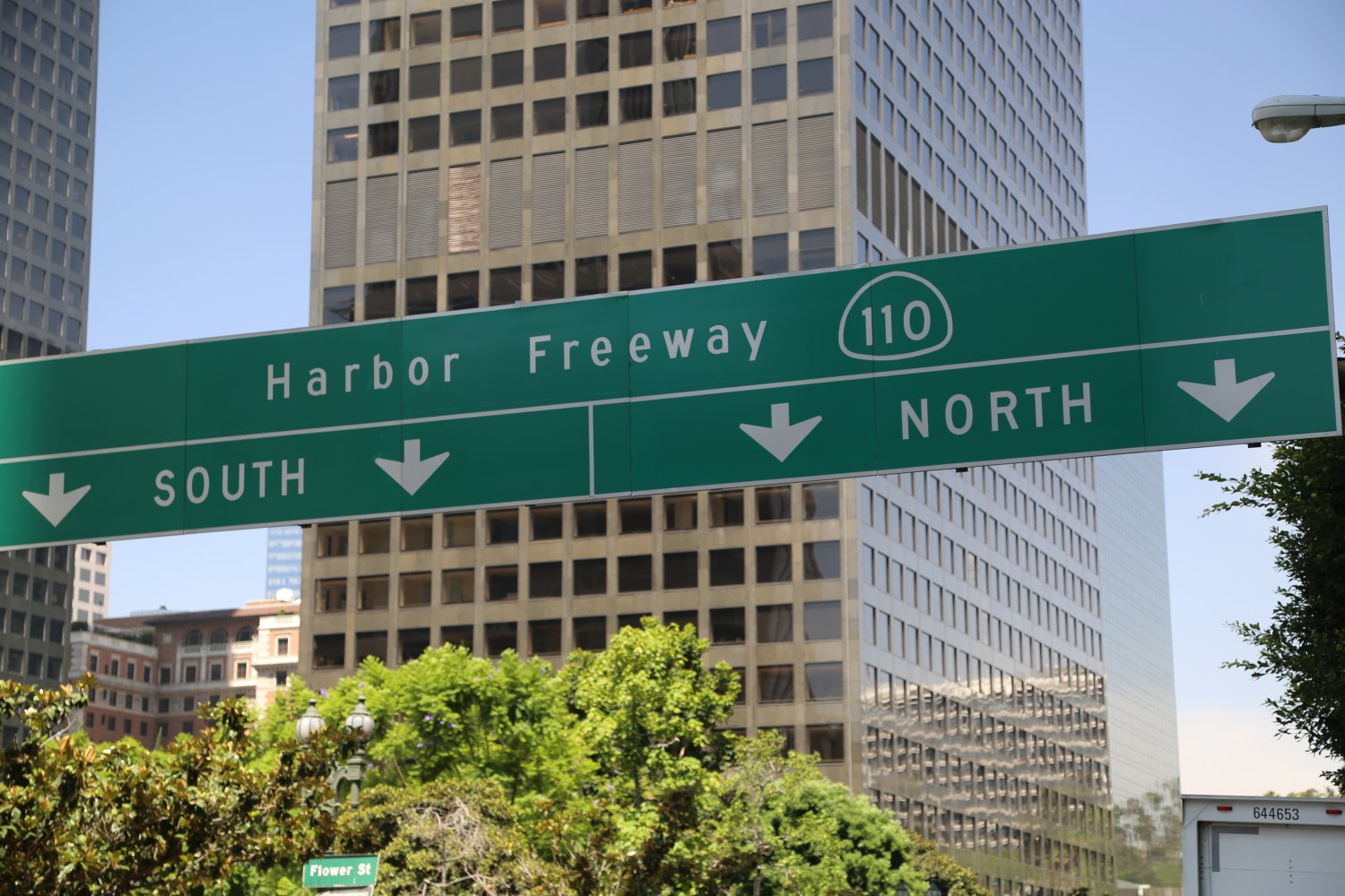
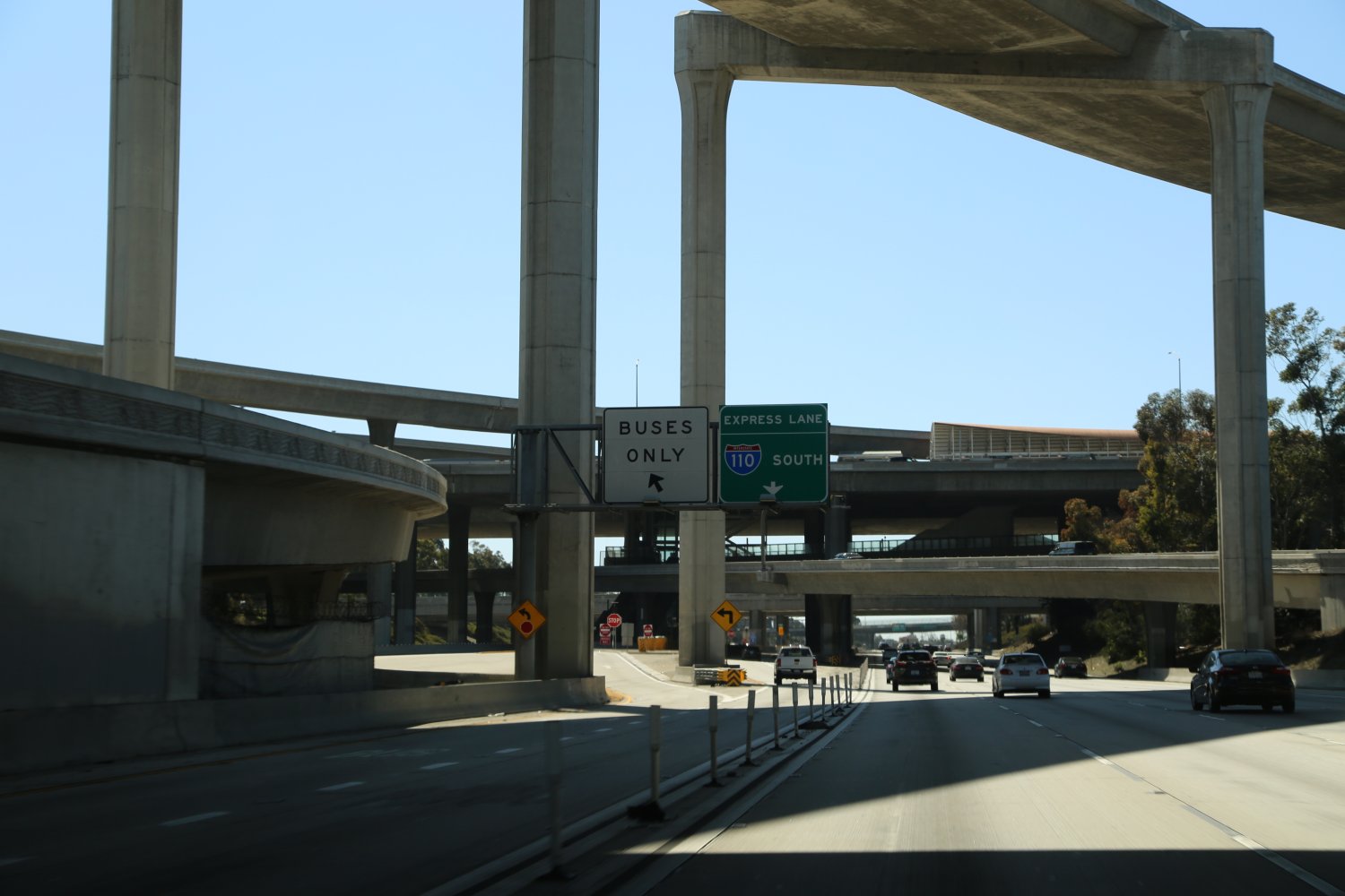
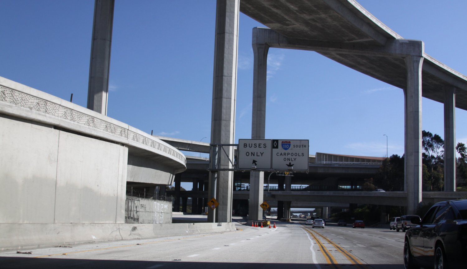
The 110 (SR-110) called the Harbor Freeway or Pasadena Freeway (depending on which section you are referring to – north of the 10 is the Pasadena, south of the 10 is the Harbor) is the oldest freeway in Los Angeles, and California for that matter (parts of it date from 1940 as a freeway) and as a result north of downtown, some of the lane sections are quite narrow. It was not built to handle today’s traffic, car sizes or freeway speeds. In fact a number of entrances north of downtown along the 110 are stop signs! Since parts of this freeway are quite windy and people tend to drive it rather quickly this can make for extremely challenging freeway entrances. This freeway also goes by the names “110 Parkway” and the “Arroyo Seco” as Arroyo Seco in Spanish means “dry creek” and this freeway generally follows along a dry ravine north of downtown. Our own license plate makes reference to the 105 freeway but this is one of our favorite LA freeways to drive – especially north of downtown with little traffic, or in the carpool lanes south of downtown.
If cities had freeway hearts, the 110 forms the heart of Los Angeles.
This freeway is synonymous with Los Angeles and is one of the freeways Los Angelenos love to “hate”. It also forms part of two of the most major masses of concrete in the southland, the interchange merely called the “Four Level Interchange” and a massive 5-level interchange where it meets the 105 freeway.
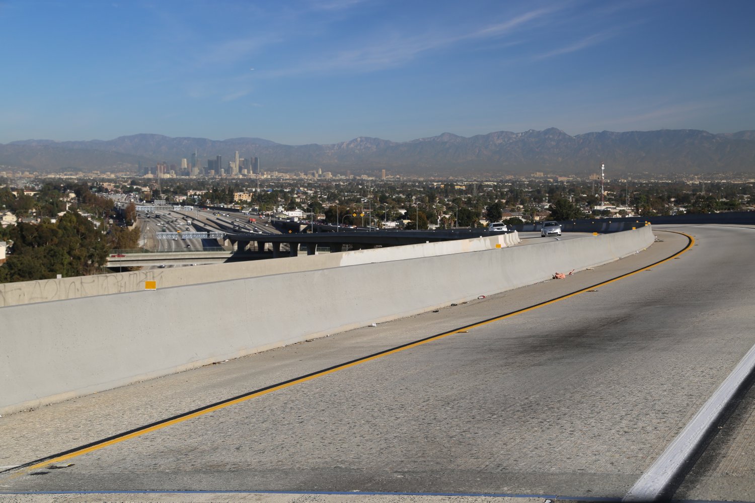
 On the busiest sections of this freeway, almost 350,000 cars pass over its concrete daily. This freeway runs right next to downtown Los Angeles, passing Dodger Stadium and Elysian Park on its ride to Pasadena. On a clear day there are excellent views of downtown and when we drive people northbound towards downtown for the first time the windows roll down and they hang out with video cameras rolling! Yea, LA freeway driving doesn’t get any better than this! Want an intimate view of the 110 from downtown. Check out the steps from the Sixth Street overpass for intimate views of the 110 North. You walk right down to the edge of the freeway. For freeway lovers this is about as good as it gets – especially during rush hour.
The 110 north of downtown is quite windy with narrow lanes in places and if traffic is moving fast you have to really concentrate to stay in your lane. It then passes under the great 5 Freeway and starts to dwindle out as it becomes Arroyo Seco Blvd (Old route 66 – Get your “kicks on Route 66”) at which point it is no longer a freeway and you have to deal with stoplights. The 110 Freeway dies in Pasadena. Note that driving on the 110 south towards downtown the one lane exits for the 101 and the 5 Freeway come up very abruptly on your right hand side and if you are “flying” down this freeway towards downtown and want to make your exit onto one of these two freeways, use caution and slow down.
LA’s only 5 level freeway interchange is where the 110 meets the 105 Freeway; this is truly an impressive site to see in person. The Carpool lanes are built at the highest level on this interchange – from the top on a clear day there are excellent views overlooking the Los Angeles basin. A metro stop is also located in the “middle” of all this concrete. We always slow down here on purpose (not because of heavy traffic which is common – we are always in the car pool lane) just to marvel at the massive concrete that surrounds the center of this intersection.

The 110 south of downtown has excellent carpool lanes for several miles in both the north and south direction north of the 405 Freeway. In fact there is a separate carpool lane freeway in the median section that contains 2 lanes totally isolated from the main freeway! The 110 North just South of downtown actually has one short section with 3 Express (Hov) lanes. This part of the 110 freeway is called the Harbor Transitway and it runs for 11 miles. This section of roadway is toll only accessible; you need a transponder in your vehicle – visit https://www.metroexpresslanes.net for more information (Triple A discounts are given – transponders from other regions such as FasTrak in Northern California will work – but you will pay the same rates as solo drivers even if you are carpooling). These special lanes actually start on the 105 right before it crosses over the 110.
On Friday afternoon rush hour heading south – we have seen a good majority of this car pool lane fairly empty while traffic is stacked up 5 across in the normal lanes.
The Harbor Transitway rivals any of the prime carpool lanes in Orange County. This part of the freeway takes an additional step – there is even a bus lane for short sections. If you are heading north on the 110 towards downtown and are in the car pool lanes and you want to stay on the freeway, be sure to move back over to the right onto the main freeway (probably much more crowded than the 2 car pool lanes) as the car pool lanes end, rather than staying all the way to left which will quickly exit onto surface streets towards downtown. Want to see prime undeveloped real estate within minutes of downtown – check out the large median dirt strip on the northbound 110 near where it hits the 101.
On the 110 North the freeway gains more power at the 91 when it acquires 2 more lanes in its slog towards downtown.
Additionally, one of the disaster merges in LA is from the 110 north onto the 5 Freeway. This is a complete traffic meltdown at times during peak traffic periods from the 110 North to the 5 so as a result the left lanes can backup for a long ways and if cars try to ‘lane rip you‘ (a term coined by Dave referring to cars that merge in front of you at the last minute rather than waiting in the backup) close to where the one lane leaves the 110, often some drivers will honk vigorously in frustration.
The following photographs are of the most impressive stack in the entire Los Angeles freeway system, the 110 and the 105 interchange. This is a 5-level freeway stack.
The oldest freeway in Los Angeles has some modern technology currently found nowhere else in LA! Look for the blue “lane lights” (called Smart-stud, each “stud” in the pavement is composed of high-intensity LED lights) in the tunnel of the 110 North where the one or two lanes leaves for the 5 freeway. These lights can be turned off and on as needed. When the blue lights are on *only* the far left lane can be used to exit to the 5 freeway (this is to help prevent the “lane rips”). When the blue lights are off, either the far left or the 2nd lane from the left can exit to the 5 freeway. When driving, initially you will see one row of blue lights warning to get over if you need to, then there are two rows of blue lights and this means do not cross the lanes.
In this same section of the 110 N there are digital signs next to the permanent freeway signs which indicate if just one or two lanes can be used to exit onto the 5 North. There are three of these digital signs spaced out along this part of the freeway.
The 110 is well engrained in the cultural urbanity of Southern California. This freeway has its own radio station which broadcasts important updates and urgent matters – if you find yourself driving this freeway tune your AM radio to 1610. There is even a clothing line named after the 110! Check out www.110south.com But perhaps most fascinating of all is “The 110 Project”, an opera performed by the Los Angeles Opera about the story of several communities located along this freeway. The musical score was even inspired by freeway sounds. Nice!
At a Glance
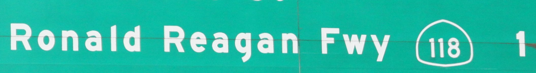
Common Name: Ronald Reagan Freeway
Direction: West and East, 48 miles
Boundaries: Ventura-W, San Fernando-E at 210
Carpool Lanes: Yes, all of LA County
Year Founded: 1964-1979
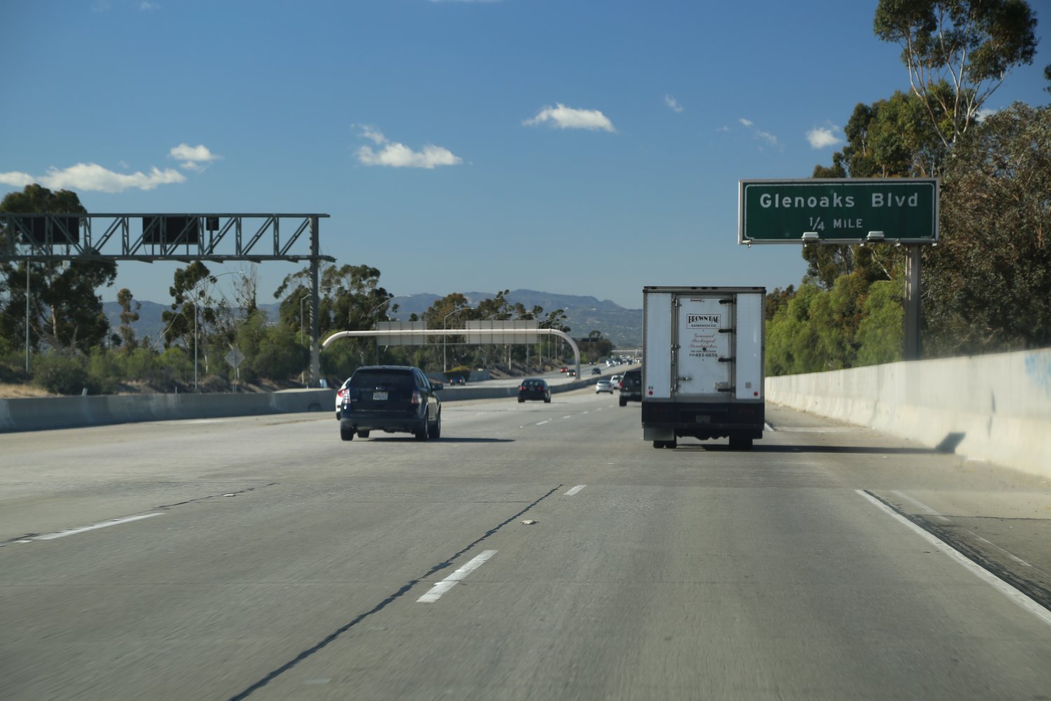
The 118 (SR-118) is a fantastic freeway when its moving – which starts/ends at the 210 Freeway and runs east/west through Simi Valley and the huge San Fernando Valley. When compared to San Fernando Valley, Simi Valley is not nearly as developed. The 118 is named the Ronald Reagan Freeway and appropriately runs near the hillside home of the Ronald Reagan Presidential Library & Museum. This freeway is the northern Anchor of the San Fernando Valley and the “San Fernando Square” (place mouse over colored text for description). It becomes the 23 as you head west and then runs south and connects up with the great 101 Freeway in Thousand Oaks.
 Much of the western part of the 118 is 2 lanes however carpool lanes do start well before you head up the Santa Susana Pass into the San Fernando Valley (east bound – carpool is also available westbound). Speaking of this pass, the old road that crosses over the pass lies parallel to the fast moving 118 and when we have extra time driving in the east bound direction we will jump off on Topanga Canyon Blvd and wrap around to the old Santa Susana Road which heads back up the pass parallel to the 118.
There is an exit near the top of the pass if you are driving in the west bound direction. There are some great hikes here with views of both Simi and the San Fernando Valley as this pass forms the divide between these two major Los Angeles valleys. The pass also forms the county line between LA and Ventura counties; look for the Los Angeles city limits sign near the pass and if you are driving by fast, the string of digits indicating the city’s population will just be a blur!
At a Glance
Common Name: Ventura Freeway
Direction: West and East, 13 miles
Boundaries: N. Hollywood-W, Pasadena-E
Carpool Lanes: Yes, entire length
Year Founded: 1964
The 134 (SR-134) called the Ventura Freeway is an east/west artery that leaves the 101 and hits the 5 and then connects at the 210 “corner” where the 210 completely changes direction. This intersection is right where the north part of the 710 “defect” is situated (see 710 for more information about this freeway oddity). Also part of this freeway is named after Barack Obama.
The 134 is an extension of the Ventura Freeway, which is also the name for part of the 101. If you are driving from north of LA to Orange County or vice versa this is typically a faster freeway than using the 405 especially during rush hour. That’s not to say this freeway doesn’t get packed; it certainly does as it is one of the connectors between the huge San Fernando Valley over to the San Gabriel Valley and near Pasadena.
 At almost its halfway point the 134 skirts the edge of Griffith Park and crosses the 5 Freeway. This interchange is called the Gene Autry Memorial Interchange as the Gene Autry Museum of Western Heritage is located nearby as well as the Los Angeles Zoo.
As far as freeway names go this freeway is located in a confusing area due to several freeway name overlaps. It is called the Ventura Freeway but so is part of the 101. It is also of the shortest freeways around. Carpool lanes run both directions. There are few freeways in the LA area that contain intersections with no access between each freeway. The 134 is one of them, at least in one direction. As you drive west there is no exit to get onto the 170 South. As a result take the exit for North 170 for about 1/2 of a mile, get off at Magnolia, go under the freeway and then get on the 170 South. Conversely, there is no interchange from the 101 North to the 134 East.
At a Glance
Common Name: Hollywood Freeway
Direction: North and South, 8 miles
Boundaries: San Fernando-N, Hollywood-S
Carpool Lanes: None
Year Founded: 1964
The 170 (SR-170) is one of the shortest freeways in the LA metropolitan region. It is similar in length to the also very short Glendale Freeway – Highway 2 but neither freeway is as short as the regions shortest which is the 103 Freeway in Long Beach – the Terminal Island Freeway. For you LA freeway buffs, this could be the winning answer to that trivia question! However understanding the naming system on the 170 freeway can be somewhat confusing. First of all this freeway is divided into 2 sections. The northern most section is entirely the 170 running from the 5 in the north down to the 101 in the south. However when it meets the 101 it joins and these two freeways are one in the same until technically the 170 Freeway ends at the junction of Santa Monica Blvd and the 101.
 To further confuse the situation the part of the 170 that runs in tandem with the 101 are both called the Hollywood Freeway. The intersection of the 101, 170 and 134 freeways is simply called the “Hollywood Split”. See our definition section for more information on this term.
The 170 runs past its most notable landmarks when it has the power of the 101 Freeway to carry it along.
These landmarks include Hollywood itself, Universal Studios and the Hollywood Bowl. Drive by in the afternoon during the Academy Awards, look over to the side at Hollywood and see all the helicopters hovering. The northern part of the 170 runs past North Hollywood and what is one of the largest Thai Temples in the USA.
At a Glance
Common Name: Foothill Freeway
Direction: West and East, 86 miles
Boundaries: San Fernando-W, Redlands-E
Carpool Lanes: Yes, all of LA County
Year Founded: 1964, highway from the 1930’s
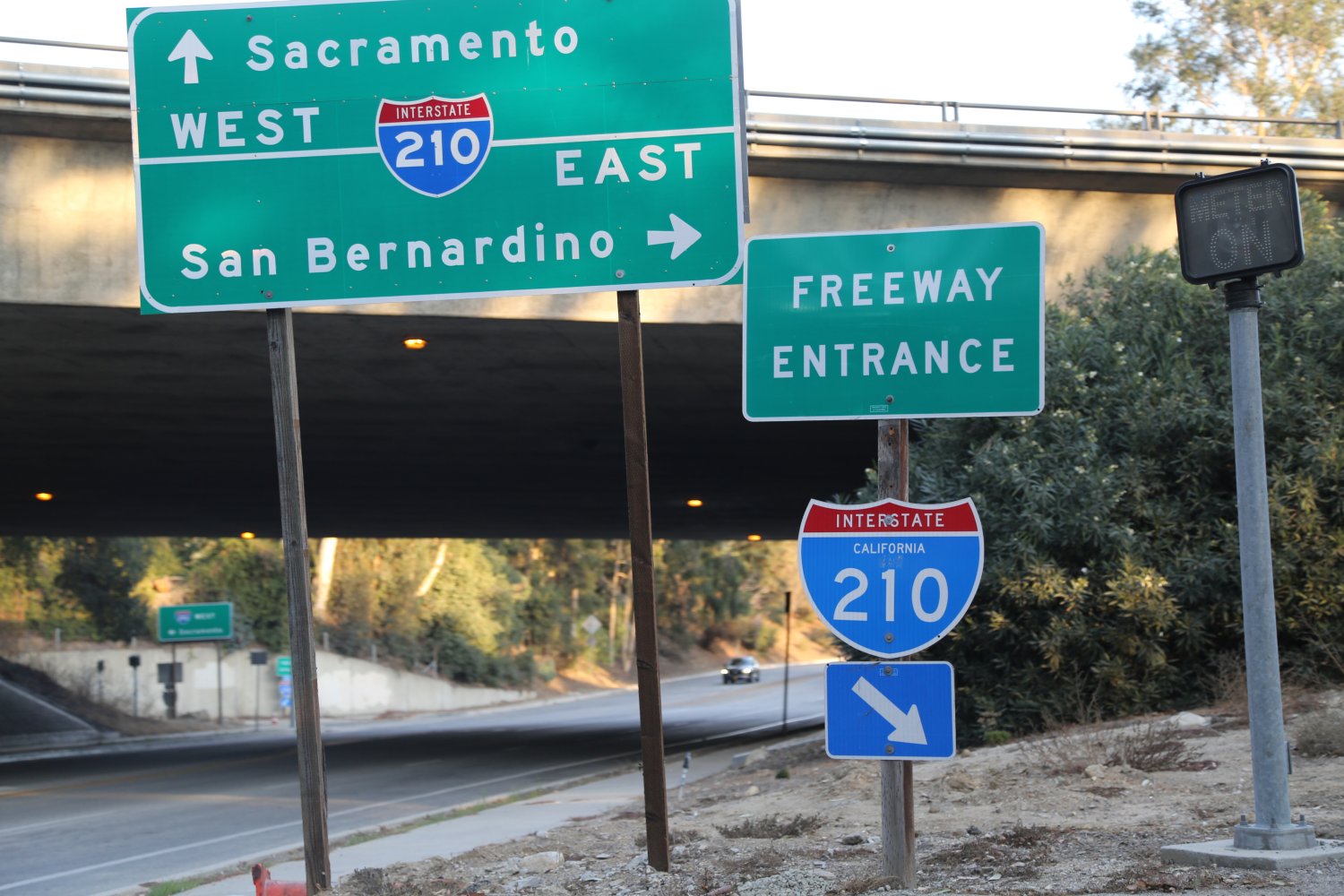
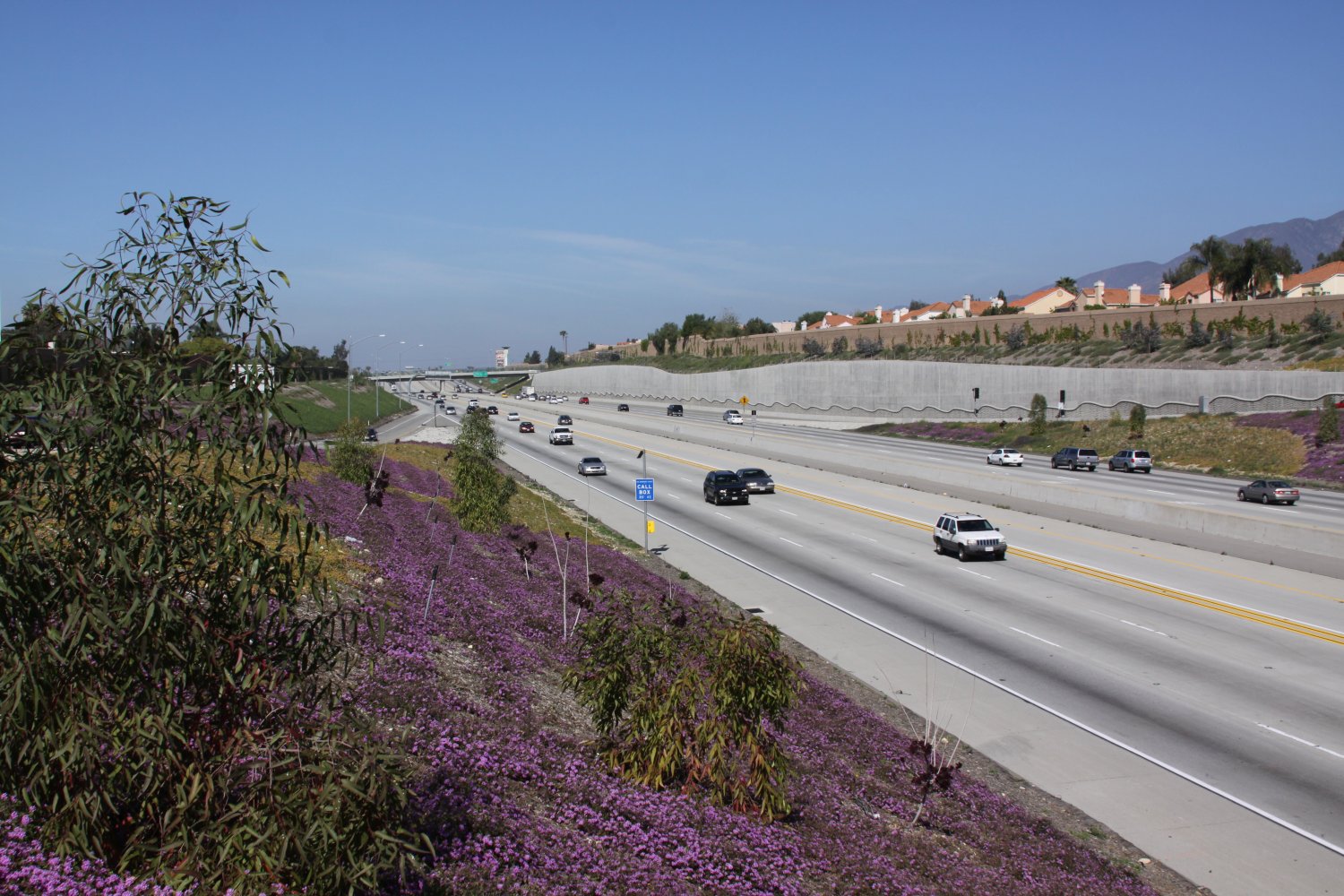
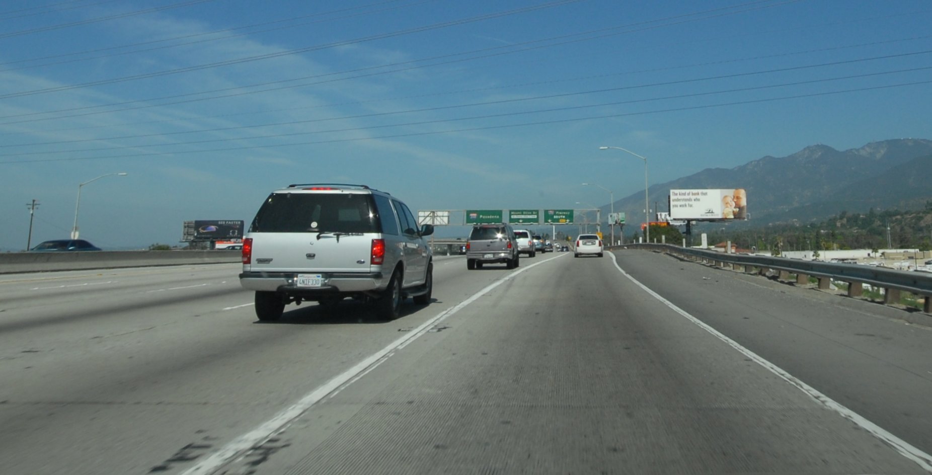
The 210 (I-210) called the Foothill Freeway is a very long freeway and winds through mountains, the foothills and urban settings. It passes exits to a variety of landmarks including the LA Arboretum, the Huntington Museum and old town Pasadena where the famous Rose Parade is held every year on nearby Colorado Blvd. Its name stems from the fact that almost its entire length is located at the base of the nearby San Gabriel Mountains and Angeles National Forest. This freeway also runs nearly the original route of the original “freeway” into California–Route 66. As you drive anywhere on the 210 around Pasadena look to the north at the highest mountain – that is Mt. Wilson (elevation 5,710) which contains the Mt. Wilson Observatory as well as nearby “media center”, a part of the mountain home to a huge collection of antennas and other broadcasting equipment.
 During winter and early spring days you may be treated to spectacular snow capped views of this and nearby mountains. The “drive to the sky” as we like to call it, Highway 2 leads off of the 210 Freeway at the town of La Canada Flintridge and eventually winds its way up towards the Mt. Wilson Observatory. This is a great road to “get away from it all” when you find yourself on the 210 with some extra time to kill and are ready to escape the incessant traffic.
Look for the Metro’s gold line running in the median of this freeway approximately between Pasadena to Arcadia.
The 210 jumps off of the 5 in the San Fernando Valley and is LA’s most northerly East West freeway. As you are driving south on the 5 this is truly the first greater metropolitan Los Angeles freeway you come to. Construction is finally finished on its most easterly section and it now connects up with the 10 & 30 freeways near San Bernardino. Look for the only West Coast Miller Beer brewing facility with its huge fermentation tanks just east of the 605 intersection. You might be treated to suds of beer overflowing some of the tanks and of course the smell of hops.
 Due to the picturesque backdrop of the San Gabriel Mountains located directly to the north of this freeway, the 210 has been used in a number of commercials, TV shows and movies including the Transformers.
As you drive the 210 East and reach the city of Pasadena, the far two right lanes are where you need to be if you want to continue on the 210 E at the 134 merge. At its eastern reaches, this state-of-the-art freeway becomes more old school and turns into three lanes just east of San Bernardino but then truly “wimps” out and becomes merely 2 lanes as it reaches the city of San Bernardino.
At a Glance
Common Name: San Diego Freeway
Direction: North and South, 72 miles
Boundaries: San Fernando-N, Irvine-S
Carpool Lanes: Entire length except section
N & S of the 10 and in Costa Mesa, Orange County
Year Founded: 1964
The Great 405 (I-405) called the San Diego Freeway (or alternatively we often refer to it as the MONSTER) is one of the main north south arteries for LA and is one of the most well known LA freeways. This is in fact, one of our favorite Los Angeles freeways, although to say any LA freeway is a “favorite”, especially this one, quickly invites argument from anyone who has to drive these freeways day in and day out or at night. In fact this is one of the most crowded freeways in the world and is the most crowded freeway in Los Angeles; as a result, traffic patterns can really vary. For example traffic may backup for a mile around a major intersection or boulevard and then streamline itself and move at the speed limit for a few minutes.
The northerly part of the 405 is in the San Fernando Valley off of the 5 and leads in a southerly direction until it meets back up with the 5 freeway just south of Irvine in Orange County. During busy hours the 405 dumps its many victims onto the 5 north, clogging the 5 for several miles. The 405 starts at the 5 southbound – of which there is a 3-lane exit (interestingly enough, no HOV lane for about the first mile). Note that because of the sharp angle that the 405 hits the 5 near the town of San Fernando, there is no exit for the 405 South on the 5 North.
The 405 crosses many of the areas’ well known east/west freeways.
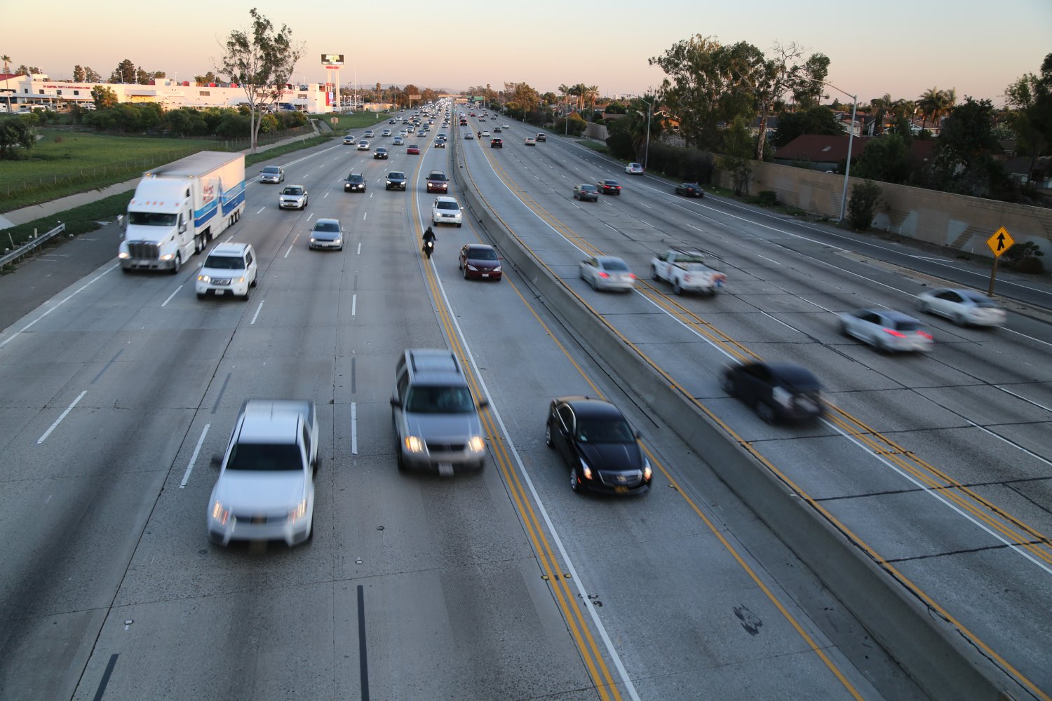
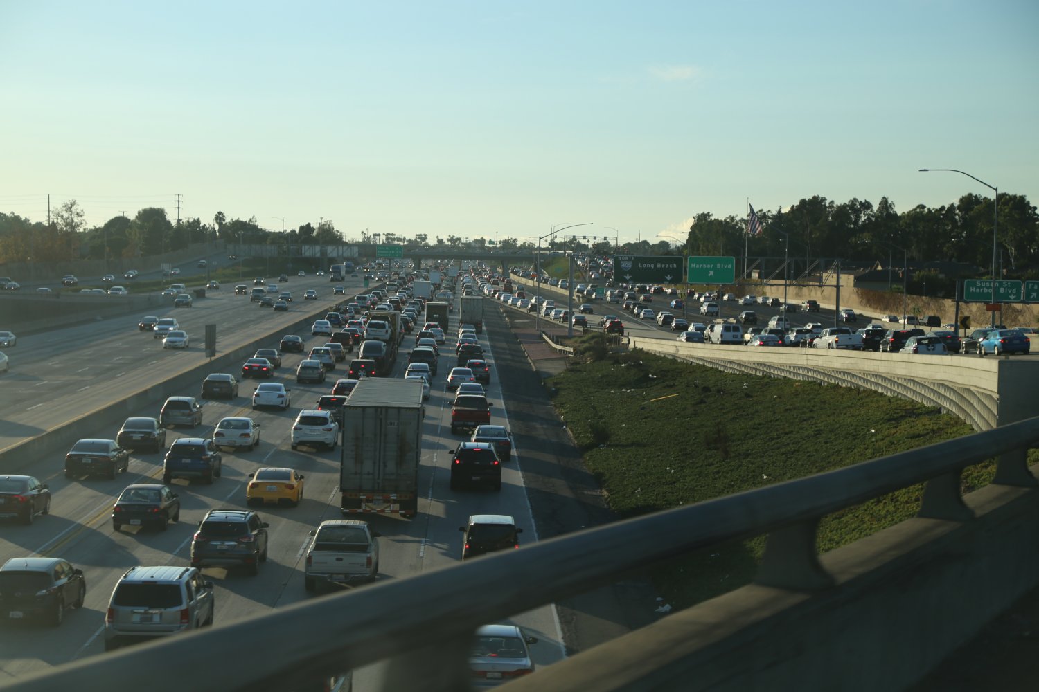
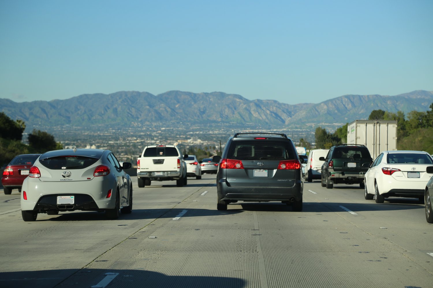
It passes by the Getty Center and the Skirball Center which are good landmarks for this freeway, just south of the Sepulveda Pass before you get to the Santa Monica Blvd turnoff.
It is a major artery between the San Fernando Valley area, the City of Los Angeles and the southern cities including Long Beach and the Orange County area.
A nice view from where you can appreciate the power of this freeway is from the outside walkway on the “north” building at the Getty Center. From here you look straight down on the 405 and see it winding through the Sepulveda Pass area. It is like an angry river constantly roaring but never overflowing its banks. Looking for another excellent viewing location of the 405? Look no further than outside on the second floor of the Howard-Hughes-Promenade shopping complex about 3 miles north of 105 Freeway.
Traffic on this monster of a road can be bad regardless of the time of day or night. After driving the 405 and leaving Los Angeles it is always a major shock and an adrenaline “come down” to be on “small” 2 or 3 lane freeways.
On the southern part of the 405 just before it crosses over the 55 freeway you can jump on the 73 which is a nice time saver if you are driving down to southern Orange County or to San Diego. After a few miles the 73 becomes a toll road and is toll almost until you reach the 5 Freeway. The 73 more recently opened and is a nice clean modern freeway. Driving south bound on the 405, you would also take the 73 to the 55 if you want to visit Newport Beach.
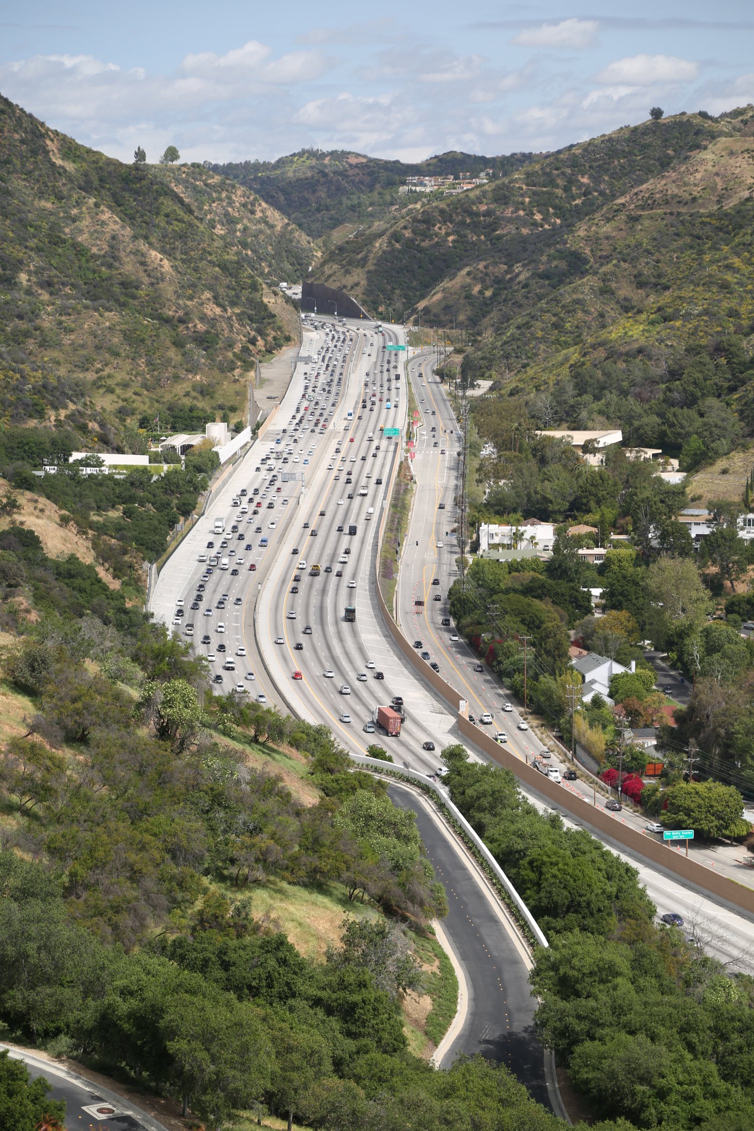 Note that if you are driving north on the 405 from Orange County, the carpool lane ends between the 105 and the 10 freeway junctions. Recent construction has extended the carpool lane in both directions for a few miles & has slightly helped traffic flow. Plans are also in the works to ensure that the last remaining non carpool section of the 405 is built with carpool lanes so that this entire freeway will have carpool lanes on both sides.
The 405 North merge with the 101 is now 2 lanes and at times has somewhat helped ease what used to be horrific congestion. Once you actually merge onto the 101 the 2 merging lanes are kept separate from the rest of the freeway for about 1/2 a mile to help with traffic flow. Another interesting freeway intersection is 405 North to the 22 East. Rather than having a freeway merge ramp you actually exit at Cyprus Ave – stop at a stoplight and then continue through to the actual 22 freeway onramp. Wierd!
On a bike ride in Orange County one fine spring day, we stopped on an overpass (next to University Ave) directly above the center divider in the middle of the 405 Freeway. It was incredible the feeling of power and energy that came from this swath below us with cars racing by at 80+ mph. On such a clear warm day, after a year of good rain the grass was green all around us and snow covered the highest of the San Gabriel’s in the distance. This is 405 Freeway watching at its best!
Between where the 405 crosses the 118 and the 101 look for the large Budweiser plant on the west side of the freeway. Want to see the 405 featured in a short action comedy, appropriately titled “405, The Movie”, visit: www.405themovie.com
Please note: the 405 has finished undergoing a number of major construction and widening projects – most notably near the “hump” that is Sepulveda Pass and at the Sunset and Wilshire Blvd Intersections.
This was an intense construction project in one of the most crowded parts of Los Angeles. During rush hour, there was so much traffic backed up on surface streets that humans replaced traffic lights – and traffic was hand guided through intersections. Here is an example of the type of congestion in this area – around 5pm on a weekday we waited 30 minutes to inch along about 1/3 of a mile – on side streets and then on Sunset Blvd. One could go nuts during certain times of the day, just trying to get between Sunset Blvd and Wilshire Blvd – site of much major construction. With construction finished, traffic on this section of the 405 is as bad as ever!
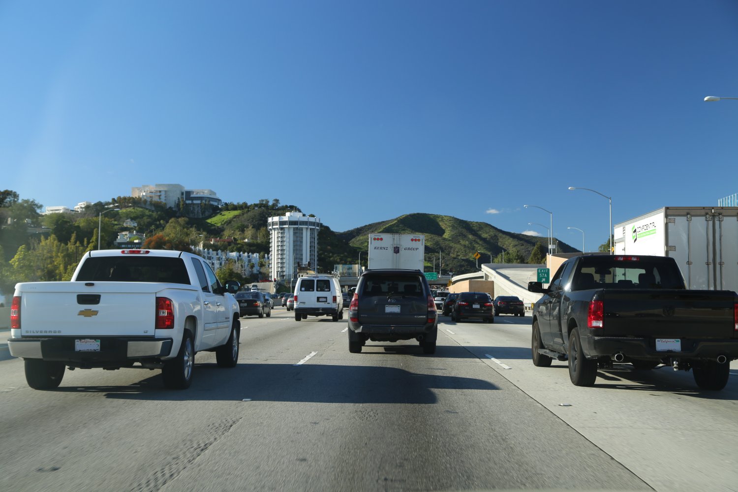
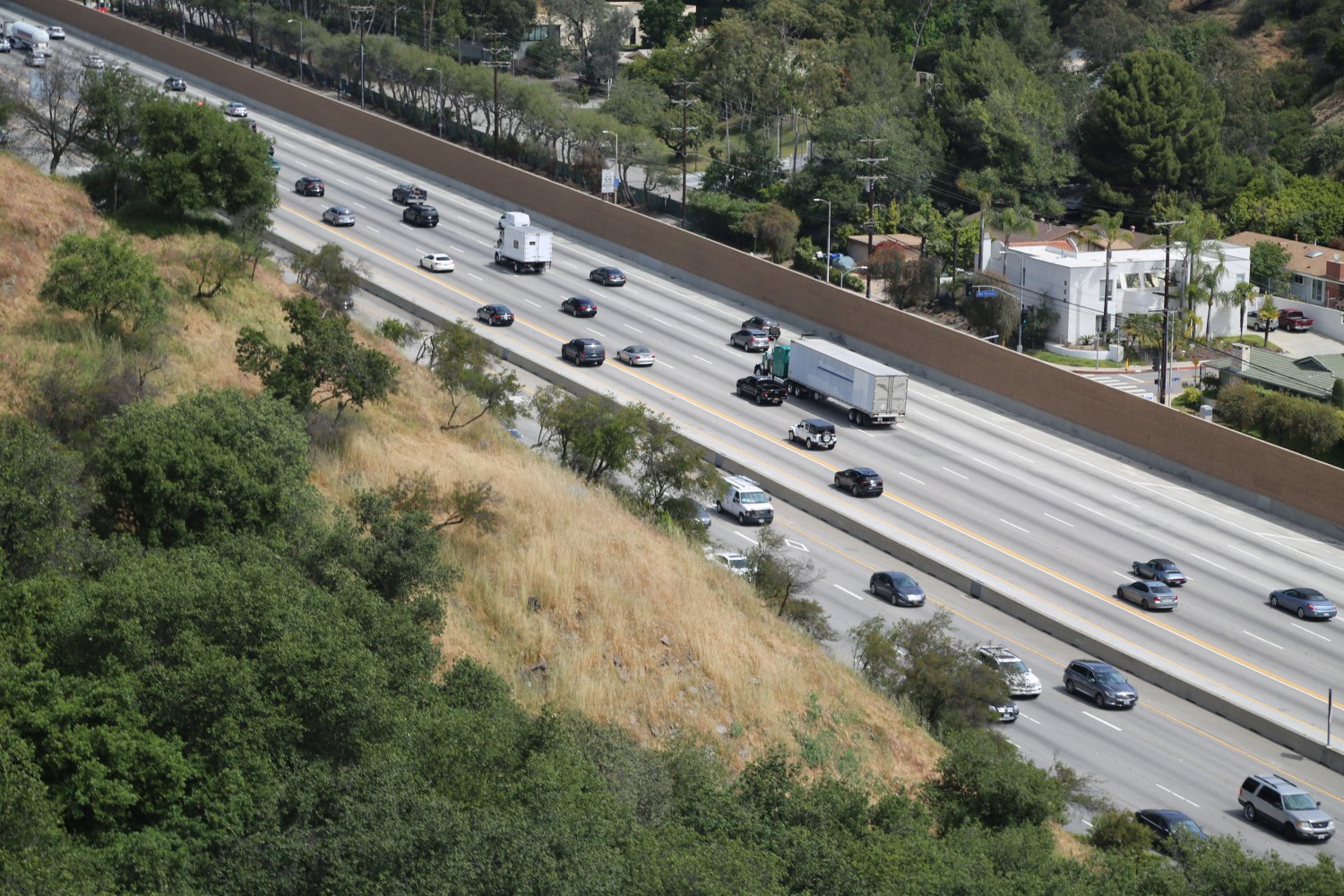
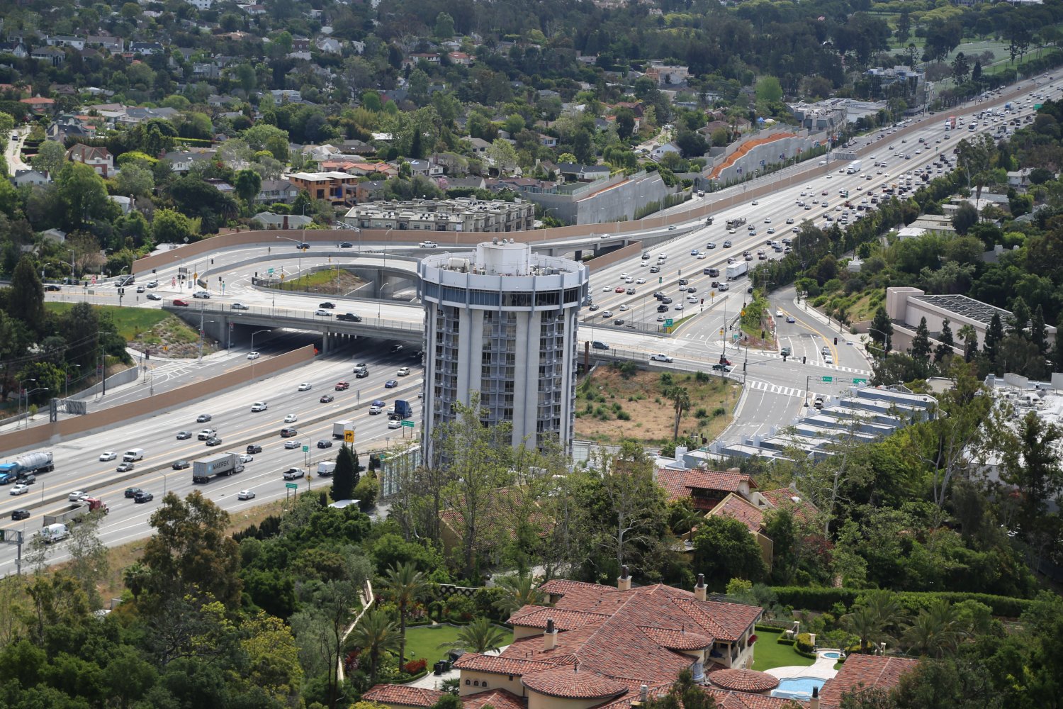
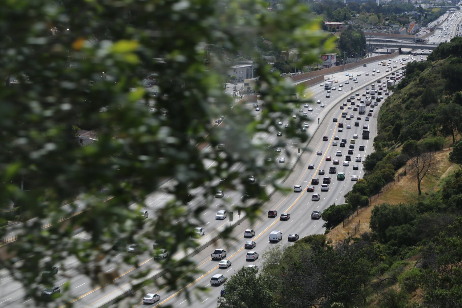
At a Glance
Common Name: San Gabriel River Freeway
Direction: North and South, 27 miles
Boundaries: Irwindale-N, Seal Beach-S
Carpool Lanes: All south of the 10 intersection
Year Founded: 1964, highway from the 1940’s
The 605 (I-605) called the San Gabriel Freeway starts almost right at the 405 Freeway, not far from Long Beach and ends slightly north of the 210 Freeway in the town of Duarte. Note that there is no car pool lane north of where the 605 intersects with the 10. During commute hours we’ve seen the carpool lane fill up pretty well (south of the 10) but its definitely still a faster option then the regular lanes. The freeway is appropriately named as it sits near a plethora of similar named items from the city of San Gabriel to the San Gabriel River which parallels much of this freeway. In the northern section you can see a bunch of dry riverbed and other river cobble off to one side.
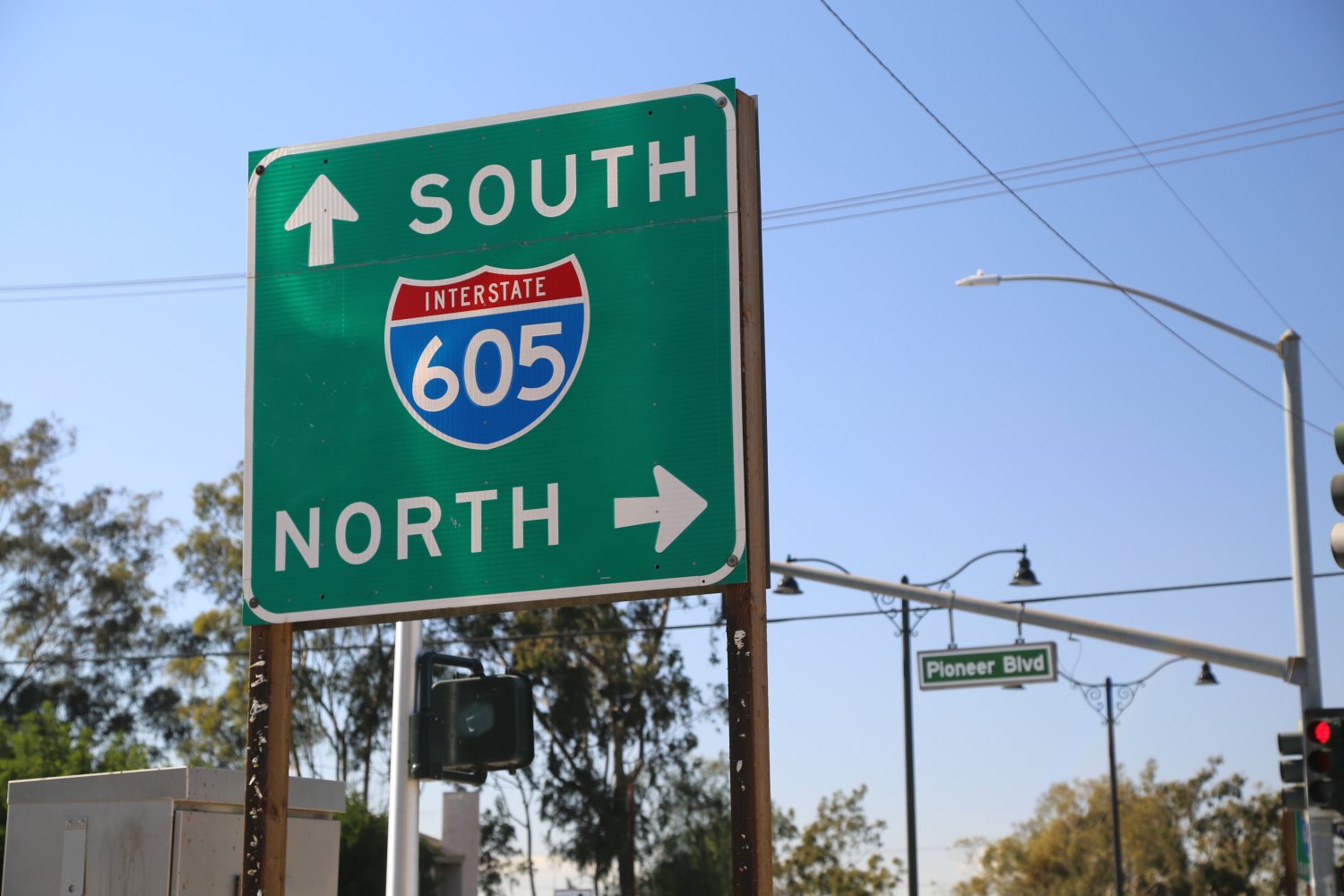
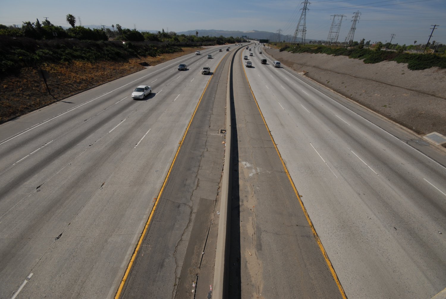 Along its journey it passes towns such as Pico Rivera, Whittier, El Monte & Baldwin Park among others.
One large obstacle stops this freeway from continuing in its north easterly direction and that is the large San Gabriel Mountains which tower above its northern section. As you reach the end in the north this freeway splits into a Y – where you can head either east or west on the 210 Freeway. As you drive the 605 North it is the two left lanes that merge to the 210 West and the two right lanes that lead to the 210 East.
Just before you reach this Y you will see a bunch of whitish rock stacked up on the east side of the road. This forms one of the borders of the Santa Fe Dam recreation area. When moving the 605 is a very fast north-south freeway.
NOTE: In 2015 a new overpass was constructed from the 605 South to the 10 East. This has been a huge improvement over the terrible immediate merge that you have to make after exiting the freeway and crossing three lanes of traffic to reach the one lane the leads to the 10 East. This new overpass is the eye in the “sky” and bypasses all the current merges.
At a Glance
Common Name: Long Beach Freeway
Direction: North and South, 23 miles
Boundaries: Alhambra-N, Long Beach-S
Carpool Lanes: None
Year Founded: 1964, highway from the 1930’s
The 710 (I-710) called the Long Beach Freeway is appropriately named as it starts right next to Long Beach. The 710 could also be called the “La River Freeway” as it, without deviation, follows the course of the LA River throughout most of its length until just before the 5 Freeway where the 710 and the LA River split directions. Along with the 110 Freeway the 710 helps feed the entire Port Complex area which includes Long Beach Harbor and the Port of Los Angeles, which are *major* International shipping destinations for the West Coast of the USA. As a result, this is a very “industrial” freeway – when you get close to Long Beach you will see many trucks on this freeway and if you are driving a car you may be the minority vehicle on this freeway. Even in the late hours of the day one side of this freeway may be stop and go traffic with trucks piled up next to each other.
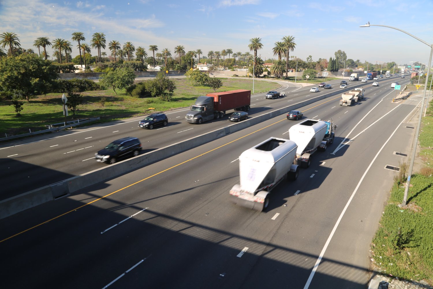
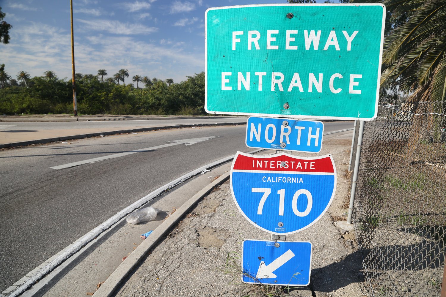 As the 710 nears the Long Beach Harbor the freeway veers off in three directions with each of the smaller branches extending to the water. The main branch of the 710 ends near the famous Queen Mary ship. The 710 and the 110 are considered “feeder” freeways (place mouse over colored text for description) as many supplies from around the world reach the harbors here and are fed into the Southland and elsewhere beginning on these two freeways.
This is a freeway that has an unusual section in the northern part of its reaches. We call it the “710 Freeway Defect” and yes its annoying when you are driving south bound on the 5 and there is no connector to the 710 Freeway northbound.
A small approximately 1 mile stub of this freeway has actually been built which connects to the 134 and 210 freeways. This is about 3.5 miles north of where the other part of the 710 ends just north of the 10 Freeway. So there is about 3.5 miles of surface streets and residential communities lying in the path of the two ends of this freeway! Plans are still in the works to somehow complete this missing link to join both parts of this freeway. This short stub of the 710, if not completed will remain the “great urban artifact” as John Dutton says in his essay, “The Life And Death of Great American Freeways”.
ADDITIONAL RESOURCES
The greater LA area encompasses a huge area – and spans several large valleys. Both Los Angeles and Orange County maintain excellent Transportation Authority websites.
The Los Angeles County Department of Transportation: www.ladottransit.com
— Also visit: www.metro.net and Metro Link: www.metrolinktrains.com
Surface Road Real Time Conditions:
The Orange County Transportation Authority: www.octa.net
More information about Orange County’s toll roads is found here: www.thetollroads.com including instructions for what to do if you *miss* paying the toll!
The California Department of Transportation (Caltrans) is an invaluable resource:
District 07: LA and Ventura Counties: www.dot.ca.gov/dist07
District 12: Orange County: www.dot.ca.gov/dist12
Caltrans also maintains a number of live traffic camera’s in select locations on Los Angeles & Orange County freeways. Visit: www.video.dot.ca.gov. In addition they provide lookups of real time freeway conditions here: www.dot.ca.gov/cgi-bin/roads.cgi
The best AM Radio station for traffic updates every 10 minutes on the “5’s in the Los Angeles area is the all news format, KNX AM 1070. This is a powerful AM station – for example at night from Oahu, Hawaii, 2000+ miles from Los Angeles we have been able to hear KNX coming in on our cheap rental car radio. Visit: www.knx1070.com and click on the traffic link.
The website, Interstate Guide is an invaluable resource for additional freeway specific information. Besides Dave’s personal knowledge and first hand experience with LA Freeways, Interstate Guide in part was used for additional research. Visit www.interstate-guide.com for more information. Additionally this next site has a 3-digit freeway lookup guide on the left side of the page; there is lots of good historical information about not only LA freeways but US freeways in general. www.kurumi.com/roads/3di/index.html.
Benny Chan has photographed LA Freeways from the air – some of his photography are displayed here:
LA FREEWAYS IN FILM
Considering Los Angeles is home to the major motion picture industry it is not surprising that a number of LA freeways have been featured in movies. These are just a select few in which LA freeways make appearances.
La La Land (2016)
Hangover III (2013)
Drive (2011)
2012 (2009)
The Soloist (2009)
Crossing Over (2009)
Hancock (2008)
Collateral (2004)
Training Day (2001)
Speed (1994)
Falling Down (1993)
L.A. Story (1991)
To Live and Die in L.A. (1985)
Earthquake (1974)
SigAlert is a great resource for updated traffic condition on all major freeways in the Southland. Dots on a map indicate current driving speeds including regular and carpool lanes. Accidents and road debris have their own symbols and particular descriptions. www.sigalert.com This website updates within mere minutes of when freeway problems first occur. Sweet!
As Loudon Wainwright III sings, “We came out here to dump all our dreams – Of making it big but we’re stuck in a sig alert nightmare – That’s just how it seems”.
WILDLY POPULAR LOS ANGELES STREETS
The following well known city streets have been popularized in movies, songs or Television. Because of this these streets are Icons for the Southland; they are larger than life. These streets are very wide, often called Boulevards and usually run for miles. Typically they can be very crowded and usually feature numerous stoplights.

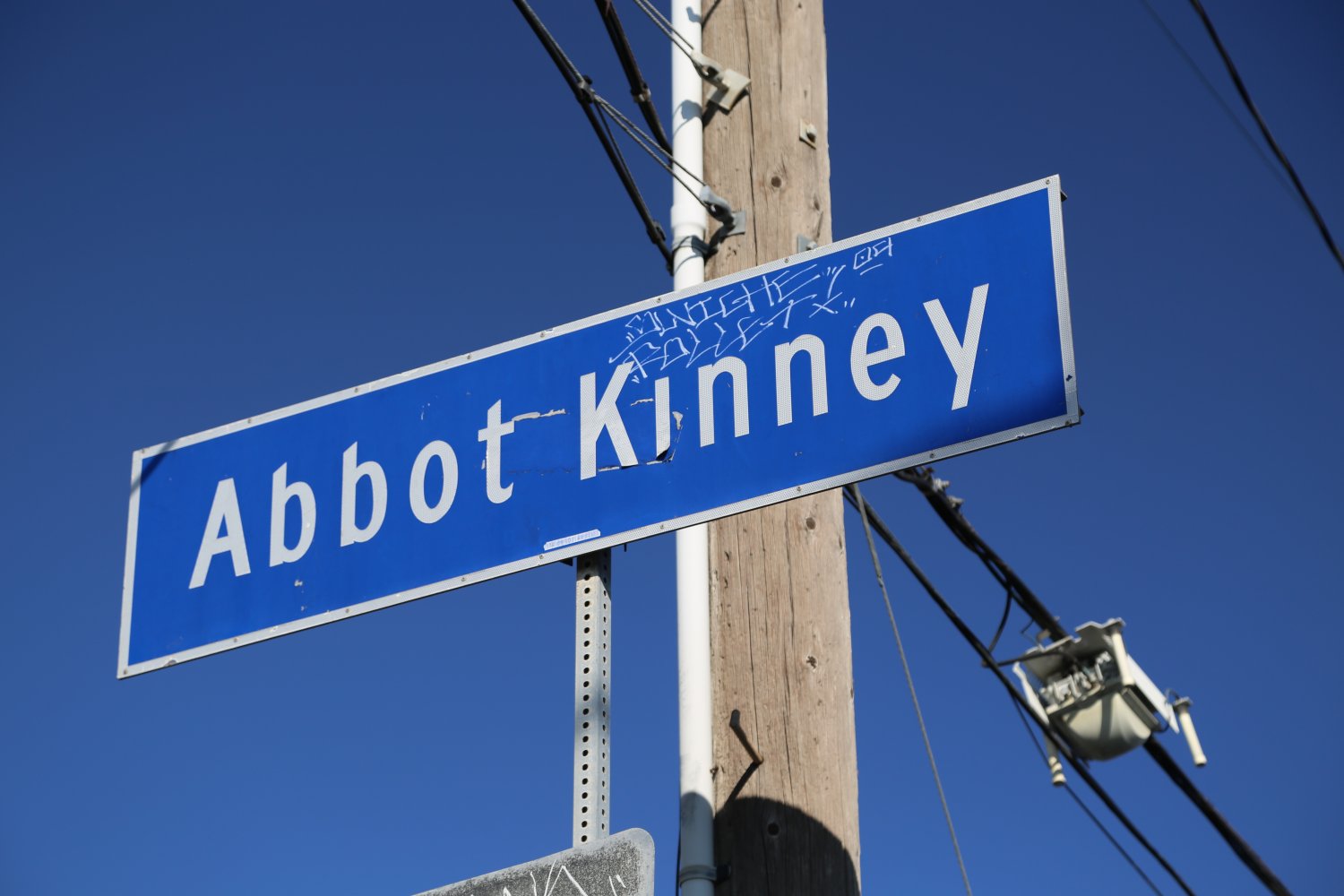 Abbot Kiney Boulevard , (named after a local developer and the ‘father’ of Venice) is a street so famous it has its own website and PR firm. Length wise, definitely one of the shortest of the famous LA streets. This blvd starts several blocks up from the beach in Venice, crosses the iconic Venice Blvd and ends at Washington Blvd. Abbot Kinney cuts through town at an odd angle compared to most of the rest of the streets here. The heart of Abbot Kinney Blvd is about a mile in length. This blvd has been called “the coolest block in America” by GQ.
Walking here one spots a mix of eclectic shops, antique stores, fashion shops and plenty of restaurants. And beautiful people. And unlike some parts of town the street attracts both locals and tourists who ply the sidewalks with their shopping prowess. Parking is along the boulevard or on side streets. Some blocks are more coveted then others judging by the serious lack of parking spaces at times.
Definitely worth parking the car and spending time walking up and down both sides of the street ducking into shops as interested. Or if you are up for a bit more exploring – use one of the bikes in the Bike Share parking sections along the blvd.
There are several special times to see and be seen on Abbot Kinney. The annual Abbot Kenney Festival is held on the last Sunday of September – essentially a mile long party with several hundred tented vendors, live music and activities for children. And the Abbot Kinney First Fridays turns part of the blvd into a street festival with music, food trucks and more people then normally frequent this busy blvd.

 Colorado Blvd is a major Los Angeles artery that runs in a general east-west direction located north of downtown Los Angeles It traverses from Griffith Park through Glendale and Pasadena and ultimately ends in the community of Monrovia. Most known for its iconic status in Pasadena due to being on the route of the annual Rose Float Parade held every January 1st. It begins with some power – as the Colorado St. Freeway exit, a sizable piece of concrete that leaves the 5 Freeway, crosses over the Los Angeles River before joining W Colorado Street on its long trek eastward. It touches or crosses several freeways including the 2, runs right next to the 134 and eventually crosses the 210 splits into Colorado Blvd and Colorado Place before ultimately ending at Shamrock Ave next to the Recreation Park in Monrovia.
Arguably the heart of Colorado Blvd is through old town Pasadena (part of the old historic route 66). Passing through block after block of retail and restaurants Colorado Boulevard also passes close to a number of prominent Pasadena attractions including the impressive Pasadena City Hall and the Pasadena Museum of California Art. And both the Norton Simon Museum and the pretty campus of Pasadena City College are both located on Colorado Blvd.
Colorado Blvd is rooted deeply in the hearts of those who follow the Rose Parade every year. The first parade dates from 1890 and was formed to show those living in “cold weather” just how nice the Pasadena weather was in the middle of winter. Today this parade is a widely televised event and seats are highly coveted.
The part of Colorado Blvd that is on the race route typically closes to through traffic early in morning or sometimes the night before. People start camping on the sidewalks the night before and often stay up all night with excitement building until the first float rolls by in the am. The actual parade is broadcast live across the country on a number of networks – and is the one time each year that millions of people get to see Colorado Blvd.
Colorado Blvd was was mentioned in Jan and Dean’s 1964 song The Little Old Lady from Pasadena with a lyric that included the line, “the terror of Colorado Boulevard“.
The visually intriguing Colorado Blvd Street Bridge was built in 1912 and is known for its impressive arches – we always see the bridge as we drive the 134 freeway east bound before reaching the city of Pasadena. A popular spot for TV and movies – over the years has been used as the start of the Amazing Race Season 21 and was in an episode of Full House. Also known as the ‘Suicide Bridge’ due to the number of people who have jumped to their death from the bridge.
 Figueroa Street is one of the longest streets in all of LA County – in the south it begins at the intersection of Harry Bridges Boulevard in San Pedro next to the 110 Freeway. It runs all the way up to downtown Los Angeles essentially following the 110 freeway passing some prominent landmarks along the way including Exposition Park and the University of Southern California (USC). In downtown Figueroa passes right by the Los Angeles Convention Center, Staples Center – makes an appearance next to the appropriately named Chick Hearn Court, passes by the Grammy Museum, is only about a block over from Bunker Hill and cuts right through many prominent downtown streets eventually becoming a one way street for a number of blocks.
Some prominent hotels are located along its flanks in downtown including the Westin Boneventure Hotel and the historic Hotel Figueroa. It is an easy street to walk on in downtown with wide sidewalks and often plenty of pedestrians along its sidewalks (not always the case in Los Angeles). Several metro lines run along it’s path downtown including the Green and Silver Lines.
There are several breaks in its path – its northern terminus is right next to the 134 Freeway in the community of Eagle Rock. Interestingly part of Figueroa Street was once part of the US Route 66 including one of LA’s prominent freeway landmarks the four Figueroa Street Tunnels (now the 110 Arroyo Seco Parkway). Its total north south distance is approximately 30 miles.
This street is named for General Jose Figueroa (who was the governor of Alta California in the 1830’s). However it’s original name was Calle de los Chapules or in English, ‘Grasshopper Street” presumably by early settlers who noticed an abundance of grasshoppers in the area.
In anticipation for the 2028 Olympics a “My Figueroa” beautifcation project was conducted between Figueroa in downtown and Exposition Park in which improved pedestrian access was added as well as additional bike lanes – more trees were planted and sidewalks were widened.
 Florence Avenue begins its journey across the southern part of Los Angeles at the intersection of W. Manchester and Aviation Blvd near LAX and runs all the way through to Whittier where it becomes Mills Drive at the intersection of Telegraph Road.
The intersection of Florence and Normandy in South Los Angeles became well known in 1992 during the Los Angeles Riots when truck driver Reginald Denny was pulled from his truck and beaten at this intersection. This was also a stop on one of the LA Gangland tours (a no longer operating tour company that brought people into the heart of gang territory in Los Angeles). And the Florence 13 Gang took its name from the street.
Florence Ave runs through a diversity of lower income housing neighborhoods all the way to it’s eastern end which is surrounded by wealthier neighbhorhoods. Alongs its eastern/western run it crosses under several prominent freeways including the 5, the 110, the 605 and the 710. The LA Metro operates several stations along Florence including the Blue Line Florence station and two other stations which are a part of the Crenshaw/LAX line.
While Florence passes through many residential neighorhoods there are a number of other prominent spots along its path including the Inglewood Park Cemetery, the Los Angeles River and a number of shopping centers.
In a piece of intriguing history the oldest still operating McDonald’s is located on Florence Ave at Lakewood in Downey. Like all other McDonald’s one can order a hamburger and fries but unlike other McDonald’s one can walk next door to the tiny museum on site explaining the history of this storied franchise. We have visited this McDonald’s and have a write-up with photos on our LA Museums page found under this guide.
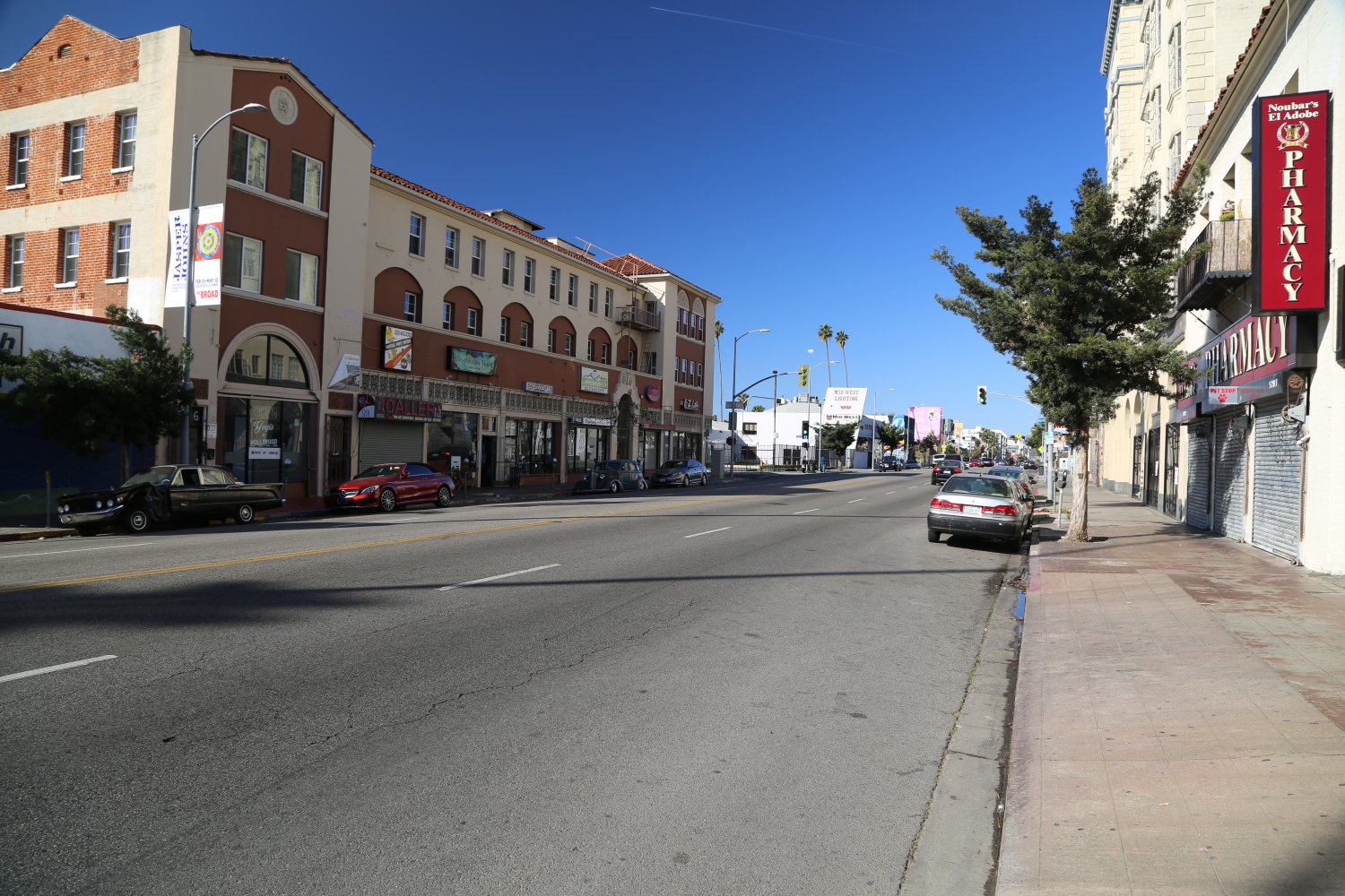
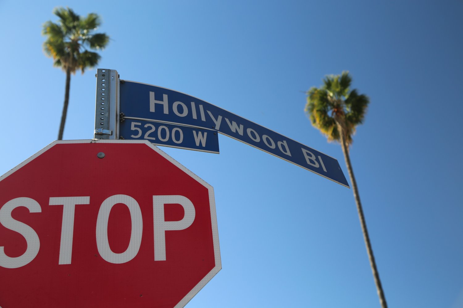 Hollywood Boulevard is the primary street through the heart of Hollywood – not to be confused with Hollywood Way in Burbank to the north although this shouldn’t be a source of confusion for most visitors due to general unawareness that Hollywood Way even exists. Hollywood Boulevard is a wide street chock full of famous landmarks, buildings, movie history and during much of the day – lots of traffic. The famous Hollywood and Vine intersection is well-known due to its long affiliation with radio and movie related businesses. This boulevard has been featured in a number of television shows and movies – including in Pretty Women with Richard Gere and Julia Roberts.
The underground Red Line Metro serves several stops up and down Hollywood Boulevard including one of our favorites, the Hollywood and Vine stop in which thousands of old movie reels line the ceilings. The Hollywood Walk of Fame is a popular attraction – stars are outlined in a gold color and are embedded in the sidewalks, each star contains a celebrities’ name. The touristy part of Hollywood Boulevard can be insanely crowded especially during special events such as movie premiers and yes there are a number of exclusive parties that take place here. A fair amount of tourist buses (especially the double decker ones), stop in central Hollywood. The Dolby Theatre and huge shopping complex, home to the Academy Awards is just down from the famous Chinese Theatre (which is a still functioning movie theatre).
The star handprints in the open air courtyard in front of this theatre are immensely popular. Hollywood Blvd also runs through several interesting neighborhoods, specifically Thai Town and Little Armenia.
Hollywood Blvd actually becomes a small residential street in the hills past Laurel Canyon Blvd on its western end.
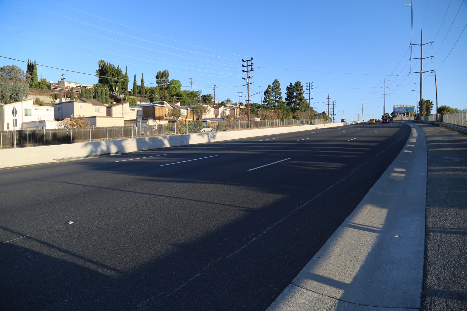
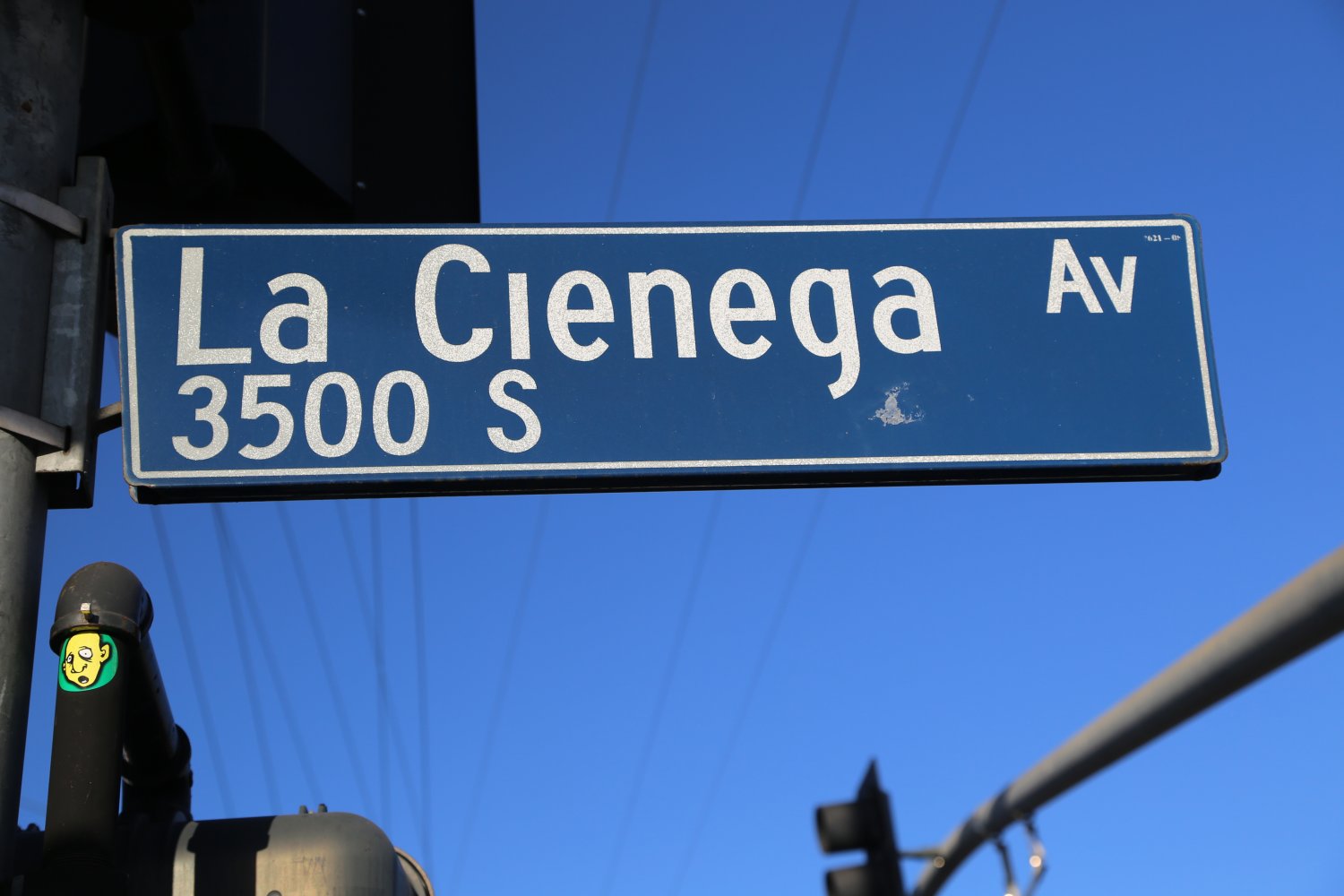
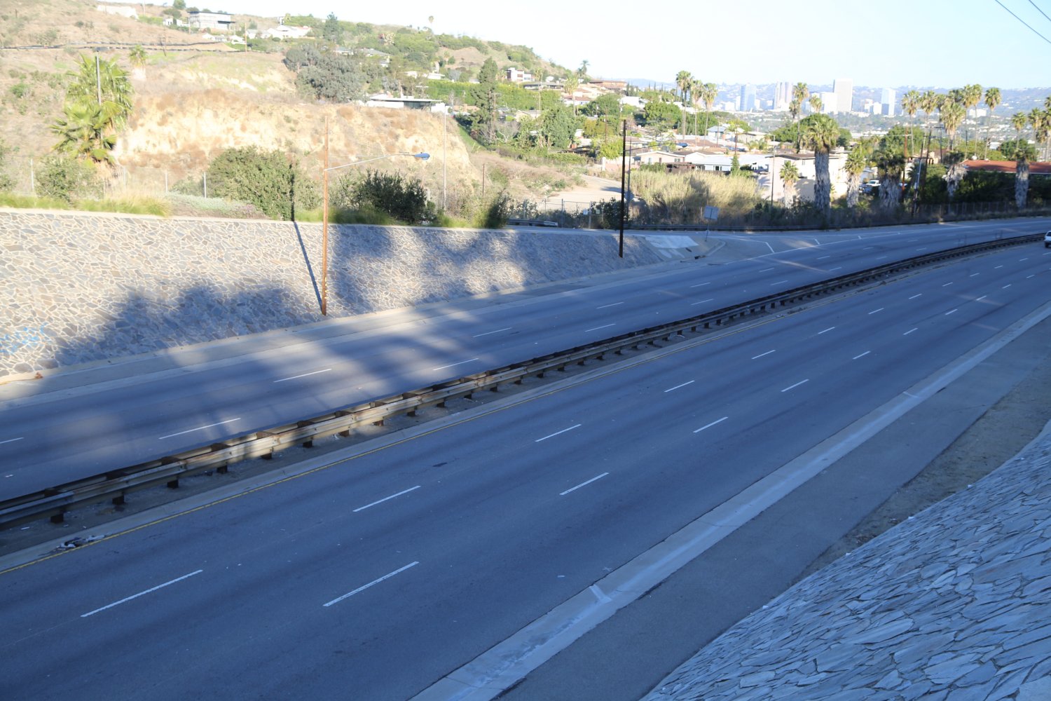 La Cienega Boulevard is one of the most major thoroughfares in Los Angeles that is not a freeway. Course at times, folks use parts of it like a freeway! And perhaps that is not surprising – originally it’s northern section was built in 1949 and was planned to be included in the Laurel Canyon Freeway (what is now the 170 Freeway). Today along parts of its almost direct north to south run, there are up to 6 lanes and in places has the appearance of being a freeway (especially south of the 10 where it was actually built to freeway standards in the late 1940’s). Like along freeways, call boxes were actually installed along parts of La Cienega in the 1970s.
Mexican land grants were very common in California for many years – La Cienega takes it’s name after one such grant called Rancho Las Cienegas (today is in the area known as West Los Angeles). La Cienega translates from Mexican into English as ‘the swamp’ and rightly refers to what was a marshland as part of the Los Angeles River flood plain (which used to run through this part of town prior to a *major* diversion in 1825).
La Cienega starts right at Sunset Blvd in the north and terminates in the south at W. El Segundo Blvd right next to the the western side of the 405 Freeway. Seems longer then in actuality – it’s total run through the city is about 13 miles. But at times and in places La Cienega attracts major traffic jams like bees seeking hives. With little traffic one can make the entire north to south drive in about 30 minutes. With traffic it can take well over an hour++ to make this drive.
If trying to get to LAX from the West Hollywood area sometimes La Cienega can be an alternative route compared to the usually crowded freeways. La Cienega crosses three major freeways – the 10, the 105 and the 405.
Because of the wide diversity of geography and cultural landscape La Cienega passes through – there are numerous landmarks along its borders including Restaurant Row next to Beverly Hills, the Design Quarter, a number of prominent film and broadcasting offices including The History Channel, The Academy of Motion Picture Arts & Sciences and radio station offices of KABC and KLOS – and what is perhaps the most visited and prominent shopping mall in Los Angeles, the Beverly Center.
Because La Cienega runs north south – it passes across numerous other major Los Angeles arteries including Santa Monica and Wilshire Blvds.
Perhaps the fastest part of La Cienega Blvd is the divided stretch with few stoplights south of Rodeo Drive and next to the Kenneth Hahn State Recreation area. Oh, and you also pass by a bunch of “bobbing donkeys” here – as part of the Inglewood Oil Field. And closer to LAX you can’t help but miss seeing the giant donut on the corner of La Cienega and Manchester Blvds – this is the iconic donut for Randy’s Donut shop.
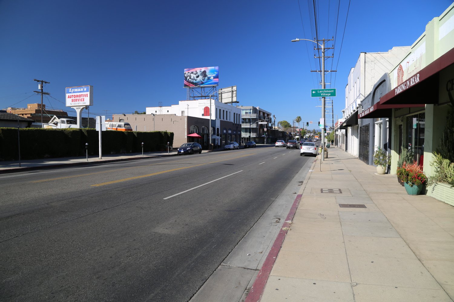
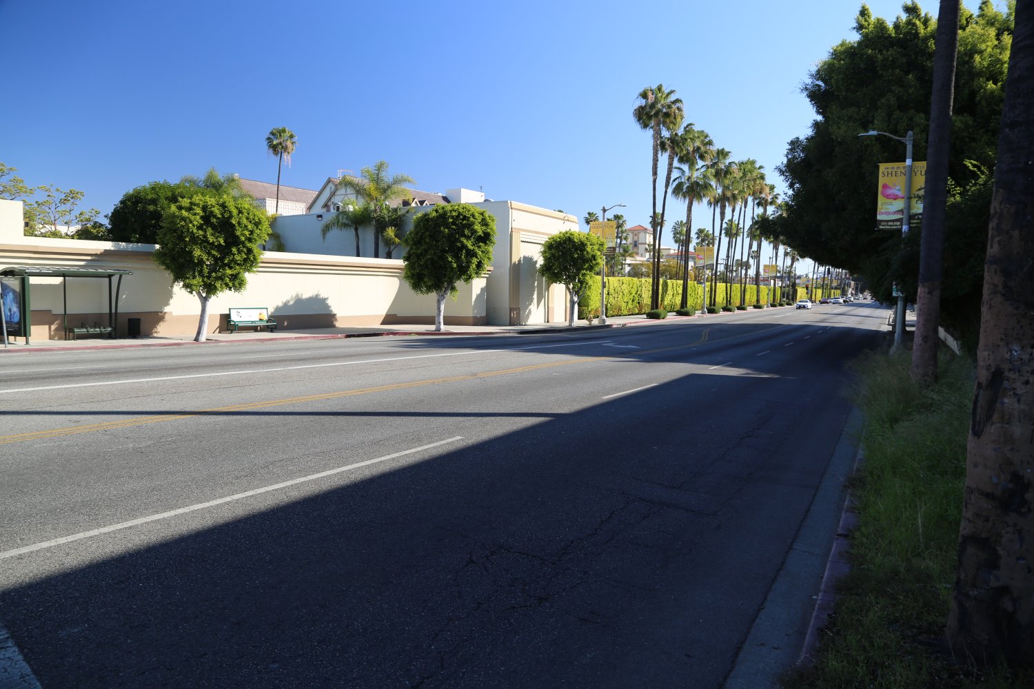 Melrose Avenue is synonymous with shopping, fashion, television and the movie industry. A number of well-known fashion houses are located along this street including Marc Jacobs, Oscar de la Renta and Ralph Lauren.
Melrose has a heady start, finding its beginnings in the west (not far from Santa Monica Boulevard) surrounded by the elite communities of Beverly Hills and West Hollywood. It then runs east all the way to the 101 Freeway where it runs under this famous freeway and ends just east of the 101 at North Hoover Street. The western part of this avenue contains some very eclectic boutique clothing and apparel shops. It is best to explore this area by walking. There is good shopping and people watching!
The 1990’s television soap opera Melrose Place was named after a part of this street close to where it starts in the west. In addition the movie Melrose Place is a story of young adults living near Melrose Ave in West Hollywood.
Also of interest; Paramount Studios is the only major Hollywood studio still located in Hollywood proper and it is situated along Melrose. Tours can be arranged here by advance notice.
Have you ever eaten at a Johnny Rockets? The original restaurant of this 50’s style franchise was founded along the middle part of Melrose Ave.
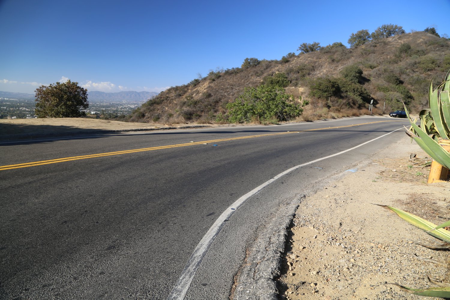
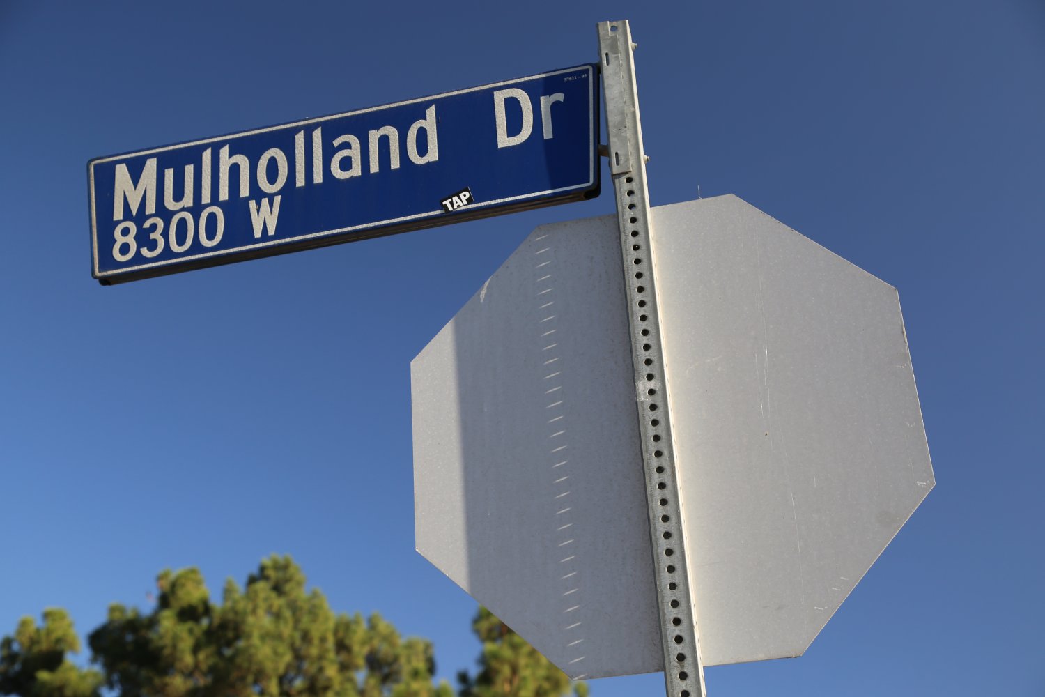 Mulholland Drive is well worth driving especially when it’s a clear day over LA and perhaps you want a respite from the craziness of the 405 or 101 freeways. A drive here affords one excellent views. As REM lead man Michael Stipe sings in the song Electrolite, “If I ever want to fly. Mulholland Drive. I am alive”.
Nothing could be truer – this is the inspirational drive to the sky over LA. Take Mulholland off of the 405 Freeway from the Skirball Center. You will wind up on the top of the ridges of the Santa Monica Mountains and Hollywood Hills overlooking the entire San Fernando Valley in one direction and then over into Los Angeles and west toward the ocean.
This is a scenic drive and is a 100% change of pace once you leave the congested freeways. There are several lookouts from the top with parking and hiking trails for the outdoor urban enthusiast. You will have views looking down onto very fancy mansions. In fact the surrounding real estate is among the most expensive and exclusive in the world and a number of famous celebrities live within close proximity of Mulholland Drive.
For the “back door” into Hollywood take Laurel Canyon Boulevard off of Mulholland Drive, otherwise continue down to the Cahuenga Pass where Mulholland Drive comes out not far from the Hollywood Bowl & the 101 Freeway. If you continue on Mulholland past the turnoff for Laurel Canyon you will come to the Universal Studios Overlook. Parking here is on the side of the road and on a clear day affords one excellent views into “the valley”. Pick out the freeway below, the Bob Hope airport in the distance and the studio lots of Universal Studios.
Before you start heading down the ridge to the 101 be sure to stop at the Hollywood Bowl overlook. On a clear day you can easily look out over the entire Los Angeles basin and pick out landmarks all the way across including downtown, which looks like you can reach out and grab it! There are great views of the 101 from here as well. That prominent house perched on the other side of Mulholland from the overlook spot was built by basketball legend Wilt Chamberlain and is now owned by Director Ron Howard.
Mulholland Drive has also been featured in a movie by the same name.
 Olympic Boulevard finds it’s beginnings at the intersection of the one way San Julian Street in downtown Los Angeles and runs all the way almost to the beach in Santa Monica where it briefly touches the end of the 10 Freeway before hitting 5th Street in downtown Santa Monica. Closer to downtown Olympic runs through neighborhoods with numbered streets. Olympic used to be called 10th Street in this part of town but appropriately was renamed Olympic in recognition of the 1932 Summer Olympics celebrated in Los Angeles (incidentally these Olympics were the 10th time the modern Olympics had been hosted and Los Angeles was the only city to place a bid for these particular Olympics).
Interestingly not every section of 10th Street was renamed – there are still small portions of disjointed 10th Street stubs near Hancock Park and in the Fashion District downtown.
We often find parts of Olympic are less crowded then some of the more popular blvd’s to the north (of which it runs parallel to for long distances including Pico Blvd and Santa Monica Blvd) – the reason being is that Olympic does not pass through as many of the major sections of town or near popular landmarks. Olympic often skirts the edges of the center of towns.
Because of its long distance it does run through a variety commercial zones and some residential neighborhoods including Century City and the fringes of Koreatown. Some of the most prominent landmarks are located along its borders in downtown Los Angeles including past the busy LA Live and the nearby Grammy Museum.
It is either 4 or 6 lanes depending on which part of the boulevard you are on.
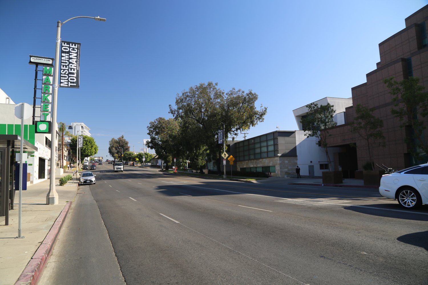
 Pico Boulevard is one of Los Angeles’s great boulevards – running from the beach in Santa Monica (starting at the Ocean Front Walk) as a tiny street which in no way resembles the power of this boulevard and all it’s traffic at times on most of the rest of it’s run to downtown Los Angeles. It ends downtown at South Main Street at the edge of the Fashion District.
It crosses over or under three major freeways during it’s swath including the 10, the 405 and the 110. It gains prominence as a major Los Angeles street in century City and while it doesn’t collect some of LA’s most major landmarks (like Wilshire does to the north) it does run by a number of prominent attractions including Santa Monica High School and Santa Monica College, Fox Studios, the prominent Museum of Tolerance and the LA Convention Center.
In addition, it runs through some of LA’s most diverse neighborhoods including Koreatown, Sawtelle (Japan), near little Tehrangeles and through several Jewish neighborhoods. And it passes through many neighborhoods and industrial parts of the city – places of business that Los Angeles or any city really is known for, including restaurants and automobile services.
Interestingly when it reaches the part of town near Koreatown and numbered streets begin – there is no 13th Street – rather Pico Boulevard takes the place of this presumably unlucky street number.
This boulevard even has their own neighborhood council – the P.I.C.O Neighborhood Council helps connect communities along its reaches.
And in typical LA fashion, Pico Boulevard has been mentioned in numerous songs and even made a fictional appearance in one of the Terminator movies.
 Rodeo Drive, one of Beverly Hills most famous attractions is an exclusive collection of high priced well known urban fashion shops (clothing, jewelry, purses, & other boutique stores). Conveniently located off of one of Los Angeles’ most prominent thoroughfares, Wilshire Drive. The actual length of Rodeo Drive is approximately 2 miles but the iconic part of the drive is merely 3 blocks packed with sophistication and pricey lifestyle choices. Rodeo Drive is continuously from Sunset Blvd to Wilshire Blvd where it continues again a very short distance down Wilshire as South Rodeo Drive – where it ends at South Beverwill Drive.
As a luxury destination, Rodeo Drive can trace its roots back to 1967 when Fred Hayman (otherwise known as the father of Rodeo Drive) opened Giorgio Beverly Hills – the first high end shop on Rodeo Drive. This was followed by Aldo Gucci opening a store a year later. Today a number of accessible yet super high end name brand International recognized brands have shops here. At one point Chanel even opened up a year long popup wine salon for their St. Supery Wines, based in the Napa Valley.
The worst mistake a tourist can make when referring to this famous street is to pronounce Rodeo with no accent – the emphasis and accent should be on the second syllable, pronounced like: Row day oh – rather then Row Dee Oh. Or if you want to simply make a statement as a modern day urban hipster, dress in cowboy jeans, with cowboy boots complete with a head turning cowboy hat and randomly ask people on Rodeo Drive, the following, “how is your day on Row Dee Oh Drive going”.
Want to see shirts for thousands of dollars – that is not hard to do – simply by ducking into certain shops along the three block high-end section of Rodeo Drive. And these premium shops are not just confined to this short section of Rodeo – rather a number of blocks in all directions feature luxury products. This area surrounding Rodeo Drive is known as the Golden Triangle.
The entrance and exits to the raised shopping area on Rodeo Drive are via stairs that lead up to the actual shops – several of the highest real estate blocks somewhat resemble a movie set. Dressy clothing not required to walk through this area although it certainly helps when seeking to see and be seen (and of course plan your wardrobe carefully before visiting – drooling over the Instagram moments that you will soon capture). Be sure to use the #onlyonRodeo. Also consider bringing a small purse size dog – the smaller the better.
Very popular with tourists from around the world. So popular in fact, Rodeo Drive maintains its own website, www.rodeodrive-bh.com and active social media presence. Plenty of parking surrounds Rodeo Drive including metered spots, parking garages (some of which provide several hours free of charge). Note that many of the streets surrounding Rodeo Drive (in the Golden Triangle) are one way streets.
Even Frank Lloyd Wright got into the action on Rodeo Drive – he designed the building at 332 N. Rodeo Drive.
Two primary luxury destinations along Rodeo Drive are Two Rodeo Drive (an outdoor shopping center with a strong faux European flair and feel) and The Rodeo Collection a 4-story luxury boutique mall. And two iconic hotels in the area are Beverly Wilshire and The Beverly Hills Hotel and Bungalows.
And if you are in town on Father’s day weekend, and enjoy luxury automobiles (who doesn’t) stop by Rodeo Drive for the Concours d’Elegance to drool over these automotive masterpieces. You know Robb Report will definitely be here.
 Santa Monica Boulevard is part of State Route 2 and is a major Los Angeles boulevard. State Route 2 takes on many forms and names and runs through both urban and natural settings. It starts in the city of Santa Monica as Santa Monica Blvd near the beach and runs all the way through Los Angeles to the 101 Freeway where it ends its run as Santa Monica Blvd. It then continues as part of the 101 for a few miles becoming Alvarado Blvd and then Glendale Blvd before it resumes its easterly path as the short Glendale Freeway between about the 5 and the 210 freeways.
What was Santa Monica Boulevard then runs for many miles north east of Los Angeles until it hits state route 138 not far from Victorville. This is truly the sea to sky road as from the ocean near Santa Monica it leads all the way through city streets to the Angeles Forest past Mt. Wilson and into the San Bernardino Mountains.
There are many stop lights on Santa Monica Blvd and it can take over an hour to drive from Santa Monica to the 101 freeway. This street is one of the major thoroughfares through the communities of Beverly Hills and West Hollywood.
Because its orientation changes slightly between the 405 and the 101 freeways many of the major boulevards in this part of Los Angeles either cross or come very close to touching Santa Monica Boulevard. One of its busiest intersections is near the 405 freeway when it crosses Wilshire Boulevard. Many unique shopping districts are also located along its edges. It is interesting to note sometimes how many lanes are on LA freeway exits onto boulevards. This is a major moulevard and an example of an exit that turns into 5 lanes before reaching the boulevard is the northbound exit off of the 405 to Santa Monica Boulevard.
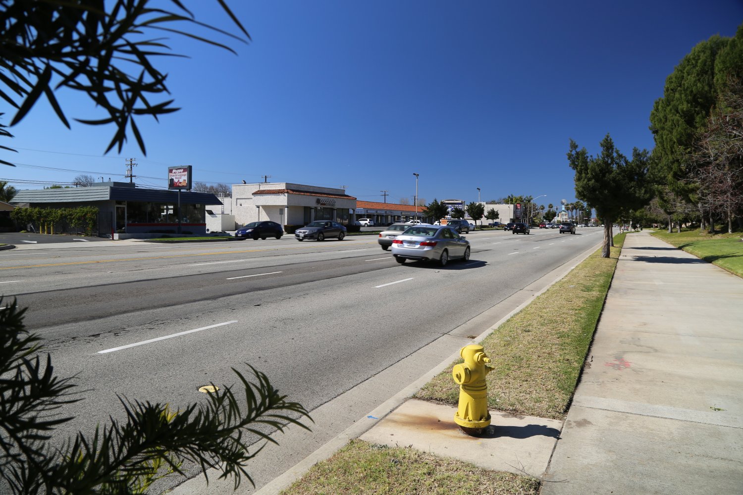
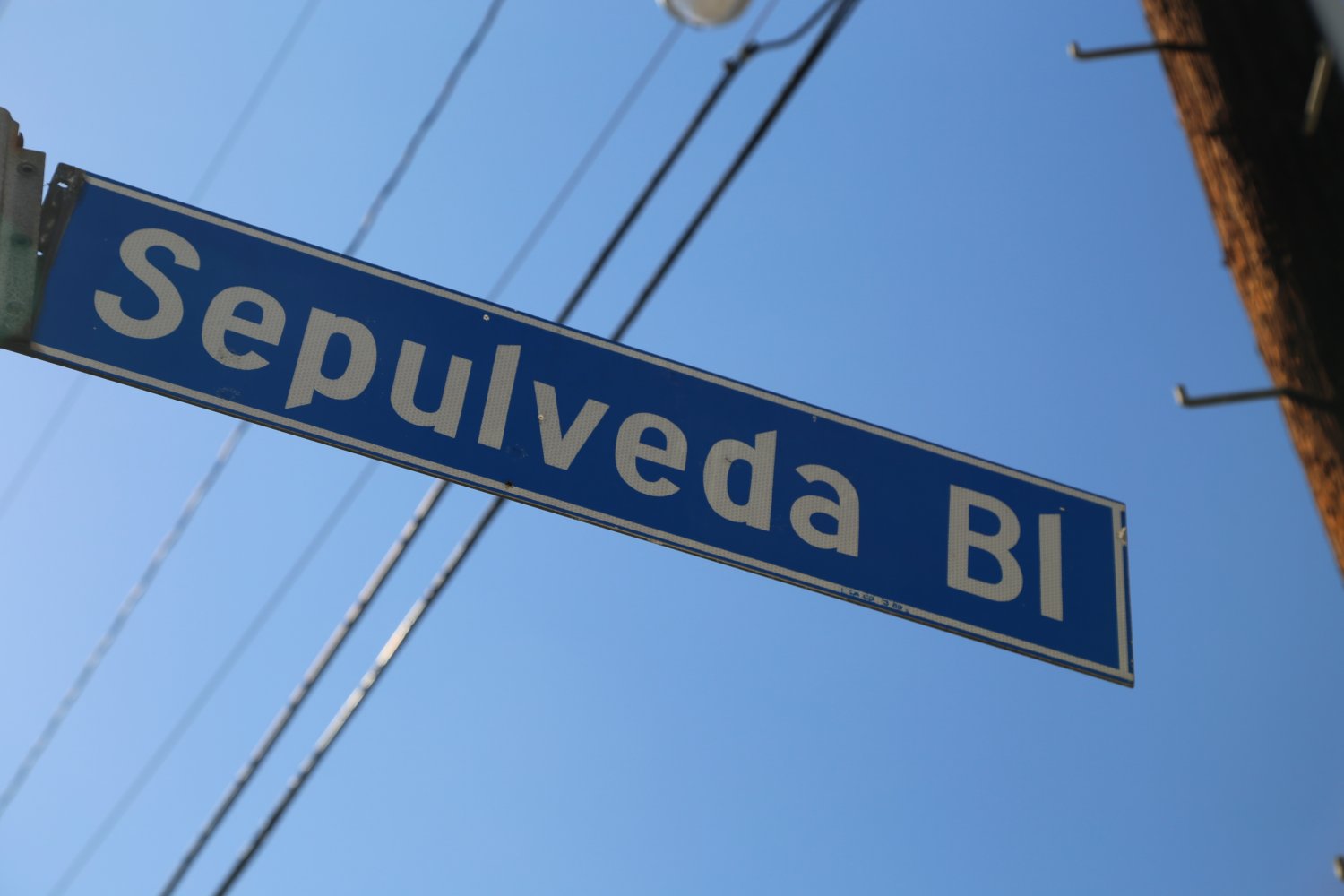 Sepulveda Boulevard is certainly one of LA’s most interesting animals. It’s run is tremendous – nearly 43 miles from where it starts at the intersection of Willow Street and the 103 Freeway (Terminal Island Freeway) all the way up to the valley (San Fernando) as an entrance ramp to the 405 Freeway next to the gravesite of Lenny Bruce. At nearly 43 miles, remarkably this is the longest street in the city and county of Los Angeles. Because of its great distance it passes under numerous freeways in the Los Angeles basin.
And one could make the fabulous argument that Sepulveda Boulevard extends even further – which it does – from Willow Street it continues as the same uninterrupted stretch of pavement eventually turning into Katella Ave (a major thoroughfare for Orange County) which after a few more iterations on street names becomes Santiago Canyon – then Jamboree which ultimately turns into Park Ave and crosses over Balboa Island before completely ending at the tiny Collins Island off of Balboa Island. That my friends is an amazing stretch of the same roadway (no freeway) that is more then 75 miles in length that truly brings you through the heart of Los Angeles on city streets. If you have an extra day, this would make for an interesting drive. We have driven Sepulveda numerous times – just not the entire length…yet!
At times Sepulveda becomes the PCH (Highway 1) and in one of it’s more interesting paths – it runs under two of the runways at LAX through tunnels. In Redondo Beach Sepulveda is signed as El Camino Real. In it’s southern path it runs through a number of beach towns including Redondo Beach, Hermosa Beach and Manhattan Beach.
Visually Sepulveda Boulevard seperates itself from the pack when it runs parallel to the 405 and along with the freeway crests the summit of Sepulveda Pass – not a major pass in terms of altitude (1,129 feet) but a very well known one, nonetheless. Sepulveda Boulevard along this section is often used by locals who do not want to drive the 405 Freeway. And note that Sepulveda Boulevard crosses the 405 in several spots between the 101 in the north and the 10 in the south. For much of it’s northern run it is never far from the 405 freeway.
Interestingly there is a stub of Sepulveda not connected to the main Sepulveda that runs as a frontage road parralel to the west side of the 5 freeway just north of where the main Sepulveda joins the 405 freeway. Prior to the construction of the 405 and 5 interchange, this stub connected to the rest of Sepulveda. Today this stub is only about a mile in length.
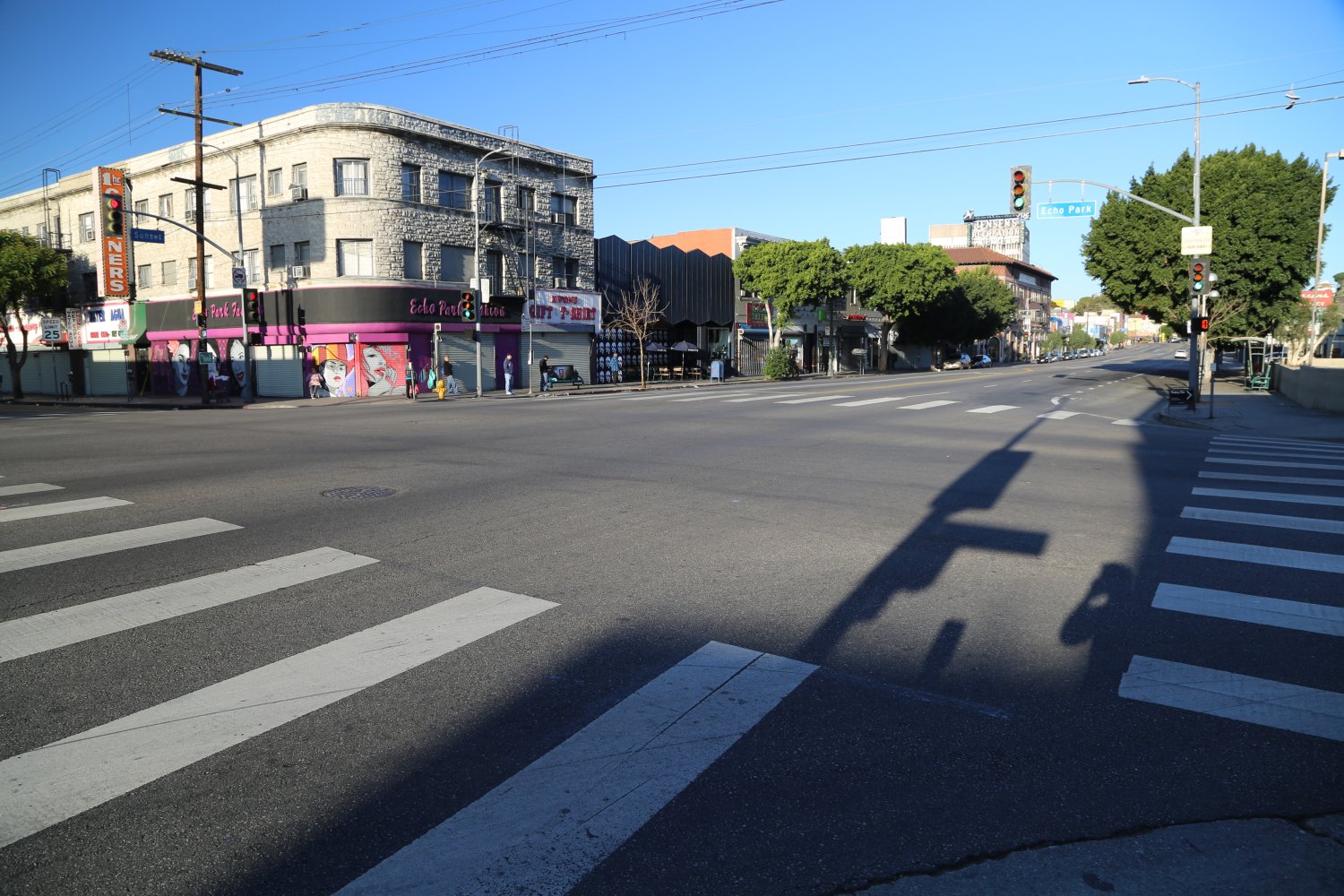
 Sunset Boulevard is one of Los Angeles’s most recognized streets – it has been popularized in song, television and in movies including a movie from 1950 of the same name. With a name like this, it certainly runs in an east/west direction and in the evening you can see the sun setting over Sunset Blvd. It is one of Los Angeles’ icon streets. It is a fairly long boulevard starting just south of the Getty Villa in Pacific Palisades where it leaves PCH (Highway 1) and heads east all the way to downtown Los Angeles.
During normal traffic it will take at least an hour to drive from the coast to the 101 Freeway. However note that this boulevard is one of the most crowded in Los Angeles and AC/DC’s 1979 song, “Highway to Hell” should be this roads’ theme song. The western part of Sunset is very windy and runs through some very swank posh neighborhoods. Not to be outdone by the residential luxury of its western arm, the Sunset Strip in West Hollywood is a 1.5 mile area that is best known for its cutting edge night time entertainment as well as attracting well dressed beautiful people. This area is also California’s largest gay community outside of the Castro in San Francisco.
Sunset Boulevard runs past notable sites including UCLA, Hollywood High School, the headquarters of the Directors Guild of America and several well known nightclubs including The Viper Room. The historic “theatre district” which features a number of blocks of live theatre houses is also along Sunset.
The residential areas above the Sunset Strip contain some of the most exclusive and secluded homes in Los Angeles (not to mention stunning views on clear days and yes there are plenty of clear days over Los Angeles!). Sunset also runs next to the fancy Bel Air district, behind UCLA and close to the entrance of the former Playboy Mansion.
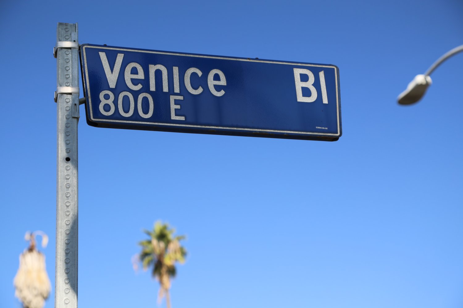 Venice Boulevard appropriately ends in the city of the same name which compared to the rest of the boulevard is seperated into North and South Venice Boulevard for about a mile running from Venice Beach and the Ocean Front Walkway until both parts of Venice Blvd rejoin at Abott Kiney Blvd. Venice Blvd actually ends in a parking lot across from Venice Beach about 4 blocks south of the famous current location of Muscle Beach. Visually the end of Venice Boulevard and the start of Venice Boulevard are dramatically different.
On its trek west it crosses past three major freeways including the 405, the 10 (where traffic can be terrible in both directions) and the 110. It is such a major boulevard that it has earned it’s own California State Route designation (Highway 187) once it crosses pass Lincoln Blvd. When it reaches closer to downtown and the numbered streets – it was originally known as West 16th Street.
It crosses by some notable landmarks on its run from downtown Los Angeles including through Culver City passing right by one of the most unusual museums in all of Los Angeles, the Museum of Jurassic Technology, a Kaiser Permanente in West LA and the Rosedale Cemetery. Venice Blvd passes through numerous neighborhoods during path across the city. And it also passes by two of our favorite Farmers’ Markets in town – the Venice Farmers’ Market and the Mar Vista Farmers’ Market.
Its start is interesting – it eventually begins as Venice Boulevard when it crosses into S. Main Street next to the 10 Freeway on the southern edge of downtown Los Angeles. But this stretch of roadway does not start there – it simply begins as an off-ramp from the 10 westbound and quickly becomes E. 16th Street.
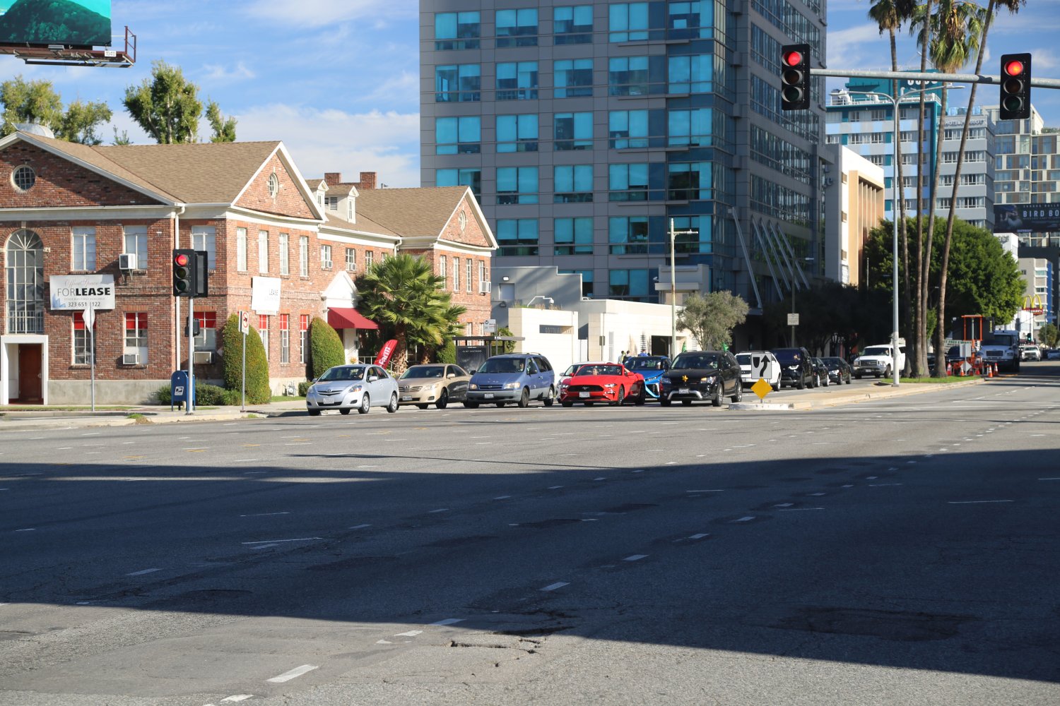
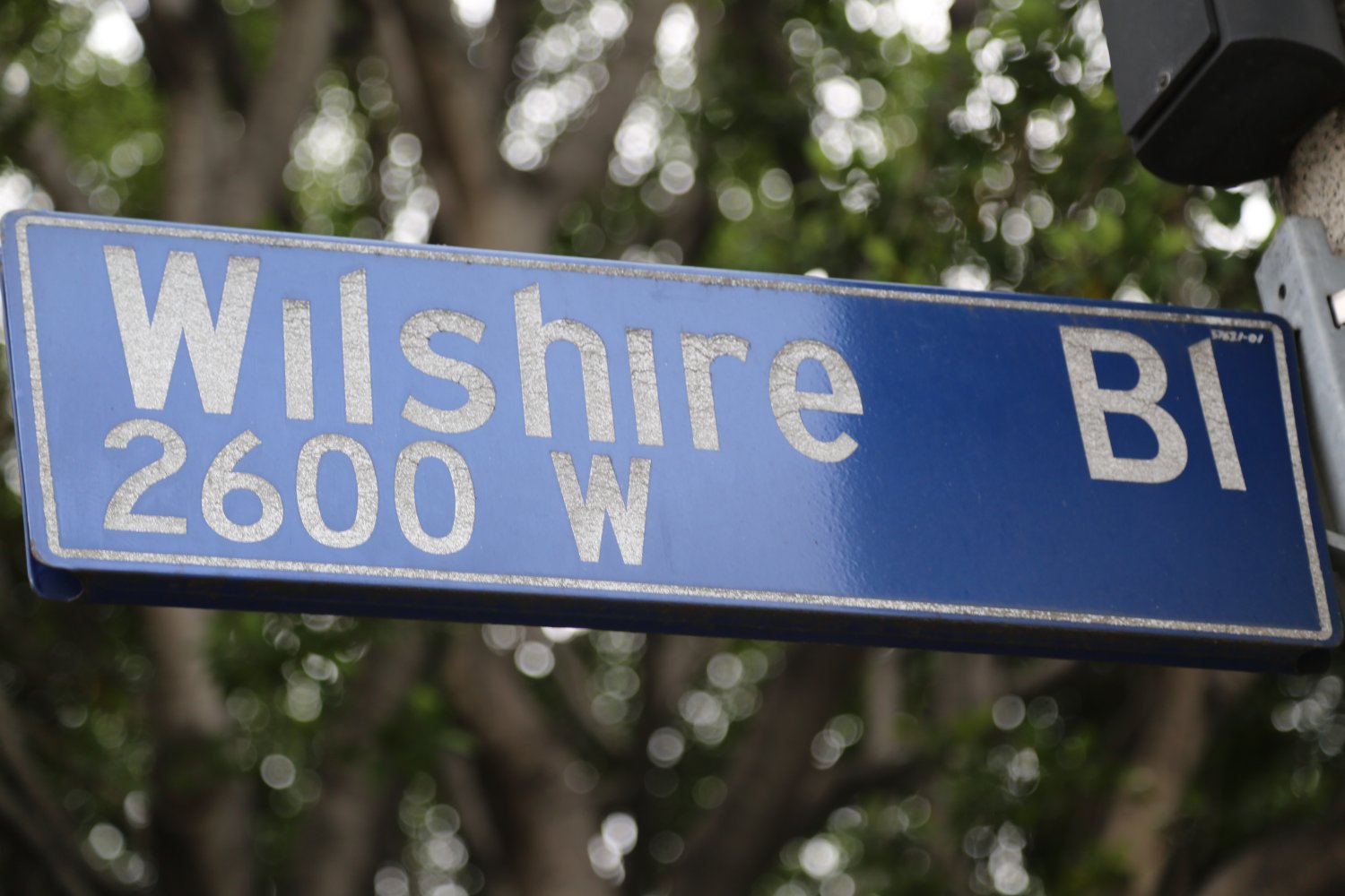 Wilshire Boulevard is one of the largest and most well known of the LA Boulevards. It is named after Henry Wilshire a farmer, real estate developer and gold miner. What is now part of Wilshire used to run through his grain fields in merely the 1890’s. If only he could see it now! It runs all the way from Santa Monica, crosses under the 405 Freeway near Westwood and UCLA (can be extremely congested in this area) and then runs past Beverly Hills. It continues east and heads through Korea Town before turning south and ending right in downtown Los Angeles.
Parts of the Wilshire swath contain some of the most densely packed urban areas in all of Los Angeles. The part of Wilshire where it crosses under the 405 near the Los Angeles National Cemetery is especially often jammed with traffic.
Other prominent features along this popular strip are Rodeo Drive, the Petersen Automotive Museum, La Brea Tar Pits and the LA County Museum of Modern Art. About halfway down Wilshire is the famed stretch called “Miracle Mile” indicated by signs on both sides of about a mile of roadway.
This part of the boulevard was originally developed for the automobile with what were new innovations at the time including oversize street signs, dedicated left hand turn lanes and the first timed traffic lights in the United States. This was a prominent area in Los Angeles and is still an extremely affluent part of town.
We have casually strolled across Wilshire Boulevard in Koreatown after late night parties on weekdays in the 1am and 2am hours. At this time of night the freedom of taking a stroll in the middle of Wilshire (while admittedly somewhat drunk) is an incredibly freeing feeling – especially when you reflect on how crazy crowded this boulevard is during the daytime.
FREEWAY DEFINITIONS
Definitions Geographical
- Inland Empire – is a general term used to describe several areas in the southland, namely San Bernardino and Riverside counties. These counties are “inland” away from the coastal regions of Los Angeles and Orange Counties.
- So Cal – short for Southern California
- The Southland – is a broad geographical region that is most commonly used by Northern Californian’s to refer to describing the geographical region Southern California. This is a term that generally applies to Southern California.
- The Valley – is what locals say when they are referring to the San Fernando Valley. This is a large very urbanized valley north west of downtown and is almost entirely surrounded by hills and mountains. This is a huge population center for the city of Los Angeles. The Los Angeles River also starts in the San Fernando Valley.
Definitions – General Freeway Terminology
- AIS Site (Accident Investigation Site) – these are special sites located on certain LA freeways where vehicles involved in accidents can be taken to so as not to interfere physically or visibly with freeway traffic flows. Often they are separated by the rest of the freeway by a tall fence so as to block the view.
- Car Pool Lanes, also referred to as HOV & Commute lanes, in the Los Angeles and Orange County metropolitan regions are lanes or merging ramps on the freeway generally restricted to vehicles carrying 2 or more passengers 24 hours a day, 7 days a week. With the exception of only one freeway in the area, these car pool lanes are all restricted on where you can exit and enter. The car pool lanes are generally separated from the rest of the freeway with double or triple painted yellow lines and in some cases are physically separated from the freeway.
– Continuous Access Car Pool Lanes – these are lanes on a freeway for vehicles carrying 2 or more passengers and drivers can exit and enter these lanes as they wish.
– Limited Access Car Pool Lanes are for vehicles carrying 2 or more passengers but restrict where you can exit and enter the lane. - Child Freeway – first coined by Dave – this is still part of one freeway but is a minimum of two lanes separated from the main freeway by a physical divide which eventually connect back again with the main part of the freeway – not very common. A good example of this is the 10 West just past the 110 intersection
- Congestion Pricing – a fee based on the current level of traffic as determined by Traffic sensors. Pay after you enter – the 110 south of downtown is a good example of this as is the 10 just east of downtown.
- Commute Lanes – refers to HOV lanes/Carpool lanes that are open at certain times of the day for cars that contain two or more people, usually early morning and then again in mid to late afternoon during “rush hour”. This term is generally not used in regards to Los Angeles freeways as nearly all HOV lanes in Los Angeles and Orange Counties are restricted use 24/7. This term is more commonly used for other freeway systems (such as in the San Francisco Bay Area) where HOV lane use is time sensitive – in that these lanes are open during “commute” hours for 2 or more people and during non commute hours, single drivers may use these lanes.
- Control City – this is a city or multiple cities posted on freeway signs usually found near freeway junctions. They indicate cities that are located on certain routes in advance of where the sign is located. Believe it or not, there is actually a book that lists all “control cities” in the USA available from American Association of State and Highway Transportation Officials.
- Dominant Intersection – coined by Dave – for our purposes this term is used to describe the one part of the freeway that passes over another freeway at the intersection of the two freeways. The higher freeway in this case would be the “dominant” freeway at that particular intersection.
- Entrance Awareness – originally coined by Dave and refers to the marking of the pavement of lanes right before they enter the freeway alerting drivers which lanes enter which direction of the freeway. These are usually white arrows with the direction of the freeway painted on the pavement ie, “NB 405 Only”.
An alternative directional branding system is the use of the actual colored logo of the freeway on the pavement of the lanes that enter the freeway. A good example of this is the 105 logo that is displayed right on the pavement of the lanes of select surface streets right before entering the 105 freeway near LAX airport. - FasTrak – this is an electronic toll collection system that lets drivers electronically pay tolls without stopping. You are sent a “transponder” which mounts in your car – when you pass through the entrance to a toll section your transponder is automatically read and the toll amount is debited from your account. The transponder will beep right immediately after passing under the sensors.
- Feeder Freeways – this term was first coined by Dave to describe the 110 & 710 freeways. It refers to freeways that service ports and are freeways that contain an unusual amount of truck traffic, especially close to the ports that they service.
- Flyover – refers to a high level overpass that is built above the main overpass lanes.
- Freeway Defect – this term first coined by Dave can be used to refer to a number of flaws in freeways that may be tied to hurdles that are monetary in nature, involve difficult engineering or for social reasons . Examples include “freeway stubs”, extremely sharp freeway intersections with no connections or HOV lanes that do not connect on their own to intersecting freeways.
- Freeway Stub – a short piece of freeway that “hangs off” another larger freeway – this short piece of freeway is part of the main freeway but is broken by surface streets – an excellent example of this is the stub of the 710 that “hangs” off off the 210 but does not connect with the 710 and is broken by the surface streets of Pasadena
- Gore Point – is the triangular section of roadway/land created where roads/freeways split or merge together
- Hazard Light Thank You – a term first coined by Dave is usually reserved for tight last minute merges when a courteous driver lets someone go in front of them by holding back slightly behind the car in front of them. This may most commonly happen at major freeway intersections. The merging driver then uses his or her hazard lights (briefly) after merging to let the driver behind them know their appreciation. Best seen at night for full effect.
- Hit and Split – a car accident in which one or more drivers/cars involved in an accident flee the scene of the accident, same as “hit and run” but “hit and split” sounds better.
- HOT – stands for High Occupancy Toll, and are HOV (carpool lanes) that allow single passenger vehicles to drive in them, provided they pay a toll. The most common example of this in the LA and Orange County metropolitan region is on parts of the 91 Freeway.
- HOV – stands for High Occupancy Vehicles (also see Car Pool & Commute lanes above) and are lanes, ramps or other transportation facilities that in the LA & Orange County metropolitan regions typically are reserved for 2 or more passengers, 24 hours a day, 365 days a year. Motorcycles can use these lanes as well as clean energy vehicles (i.e. Prius), but only if they have been issued a special sticker. According to the Los Angeles Metro, California has about 40% of the nations’ HOV lanes with the greater LA and Orange county metropolitan regions containing about 70% of California’s HOV lanes. Note that infants and children count as passengers, but that unborn fetuses do not.
– HOV Connectors – these are HOV only lanes and or ramps that are found at freeway intersections connecting one freeway to the next. - Inverted Lane Exchange – a term coined by Dave that describes a crossover of each side of the freeway to the other side. A classic example of this is on the 5 north of Los Angeles where the northbound traffic crosses over the southbound traffic – as a result, the northbound lanes end up being on the left side of the south bound lanes .
- Lane Rip -a term coined by Dave referring to cars that merge in front of you at the last minute rather than waiting in the backup where freeways merge together. Typically lane rips are found at intersections in lanes waiting to merge to another freeway and “lane rippers” often cause other drivers to honk in frustration.
- Metering Lights – are traffic signals that blink red and green (no yellow), located on a number of onramps entering the freeways. These are commonly in use during heavier traffic times (but may be in use all the time) and typically only allow one car onto the freeway per each sequence when the light changes to green (however depending on the location may allow up to 3 cars per green light).
Each freeway entrance with metering lights typically has 2 lights – one facing oncoming cars on the onramp and one facing sideways to the first car waiting in line. Some 2-lane freeway entrances with two metering lights actually rotate the color (green to red) based on each lane letting only one car from one lane enter at a time – rather than the lights for both lanes changing to the same color letting both cars juggle for position while entering the freeway. Note that carpool lanes often (but not always) don’t have to stop for metering lights when entering a freeway. - Parkway – is a rather ambiguous term used loosely depending on the situation and geographical region. It can be defined in part by speed limit and number of lanes in each direction – a parkway typically has speed limits lower than a normal “freeway” (max of 55mph) and contains at least 2 lanes per direction. The 110 North (Pasadena Freeway) is an example of this.
A “parkway” can also be referred to high speed boulevards that cross other surface streets with stoplights – and have speed limits of 45 to 55 miles per hour but not higher – there are a number of these in Orange County – Alicia Parkway, Alton Parkway etc. Other related words include boulevard, byway, expressway, freeway, transitway and highway. Confusing eh?! There is certainly some commonality between all of these but it is the differentiating factors that are difficult to define. - Planning Time Index (PTI) – is a number that indicates how long it will take to drive a certain distance on a freeway. For example a PTI of 2.00 means a drive that normally takes 30 minutes will take 2x as long, in this case 60 minutes. A 2013 study by the Texas A&M Transportation Institute found Los Angeles has a PTI of 4.95 during rush hour times.
- Sig Alert – is a term that originated with the Los Angeles Police Department and today refers to any obstruction on a freeway that ties up at least 2 lanes of traffic for 2 or more hours. SigAlerts are posted by the California Highway Patrol on their website here: http://cad.chp.ca.gov and you can find more information including the latest southland traffic alerts here: www.sigalert.com
- Smart-stud – is a road marker guidance system which is made up of bright LED lights embedded into the pavement to control how lanes are used. A good example of this in Los Angeles is on the 110 N, north of downtown right at the intersection of the 5 Freeway.
- SOV – stands for Single Occupancy Vehicle and describes vehicles that carry only one person.
- Stack Interchange – is a junction between two or more roads – in our case we refer to stacks as freeway junctions. What we call the “super stack” is a 5-level interchange of which there is only one example in Los Angeles. There are several 4-level stacks as well as shorter level stacks in the Los Angeles and Orange County metropolitan areas.
- Symphonic Attack – coined by Dave. As it relates to freeways is an engagement of horns by two opposing drivers. A classic scenario could involve a driver that has run out of room to merge onto another freeway and is trying to squeeze his/her vehicle into the proper lane to execute this merge despite the fact that this lane is already backed up with vehicles. A driver already in the lane starts honking as the car outside of the lane is honking in its attempt to enter the lane.
- Tolls – in order to drive in specific lanes on a freeway or an entire freeway you must pay a fee. Fees or “tolls” vary depending on length or possibly even time of day (i.e., peak traffic hours). Toll roads in the southland are typically found in central and southern Orange County.
- Traffic Break – one or more local Police or CHP vehicles will weave back and forth on a freeway to create a “break” in traffic. This is done for several reasons – to create a space within traffic to give emergency vehicles space and time to move an accident vehicle off the freeway or for a situation on the freeway that is causing traffic to abruptly stop.
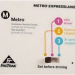 Transponder – this small device is meant to be adhered to your windshield and is part of the FasTrak system. It allows you to pay drive in Toll Lanes on certain freeways. There are three settings on the device – 1. solo driver, 2. 2 person carpool and 3. 3+ carpool. The toll you pay depends on how many people are in the vehicle and how crowded the lanes are at any particular time (congestion pricing).
Your particular transponder is tied into your account (accessible online) where you keep money. Camera’s installed at the entrances and along these express lanes will record your entry and deduct the correct amount from your account based on every time you use these lanes. You will need this device to enter some lanes on parts of the 10, 91 and the 110 freeways.
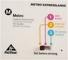
Definitions Los Angeles Specific
- East Los Angeles Interchange is a major 4-level stack interchange about a mile east and south of downtown Los Angeles where 4 major area freeways come together including the 5, the 10, the 60 and the 110.
- El Toro Y – is the “Y” geographically formed by the intersection of the 405 and 5 freeways in Orange County next to the now closed El Toro Marine Corps Air Station
- Four Level Interchange – this major freeway stacked interchange involves two of LA’s powerhouse freeways, the 101 and the 110 and is located directly north of downtown Los Angeles. All lanes became fully operational in 1953. This is as the name indicates is 4 levels and was the world’s first 4-level stacked freeway interchange. Also referred to simply as “The Stack” View historic photos
- Freeway Service Patrol – is a team of special tow truck drivers patrolling all over the freeways of Los Angeles. Their mission is to keep traffic flowing as smoothly as possible and their services are free of charge for incidents like running out of fuel, dead battery, flat tires and other miscellaneous auto problems. If stranded or in trouble one a freeway in Los Angeles County, simply dial 511 from your mobile phone and say “motorist aid”. Look for the truck with the logo containing the words, “Metro Freeway Service Patrol”
- Harbor Transitway – is 11 miles long and is located in the median section of the Harbor Freeway (110) south of downtown Los Angeles. It is reserved for car pool (HOV) vehicles only as well as buses. This transitway forms part of the LA’s only 5 level stacked interchange where the 105 and the 110 meet. Part of this transitway also has a separate lane for buses apart from the 2 lanes for carpoolers.
- Hollywood Split – is a very confusing 3-part freeway interchange located north of Hollywood and involves the 101, the 170 and the 134 freeways. The confusion comes in part based on the naming system of the three freeways involved. The Hollywood Freeway includes a part of the 101 south of this interchange and the stand alone Hollywood Freeway (170) north of this interchange. Ventura Freeway includes a section of the 101 west of this interchange and the 134 east of this interchange. In other words, the freeways entering this somewhat diagonal “T” interchange do not keep their same names as they continue through to the other side of this “T”.
- Orange Crush – is a major freeway interchange that involves the 5, 22 and 57 freeways, located near the city of Orange in Orange County. This is a notoriously congested area.
- San Fernando Square – is a term coined by Dave indicating the square of major pavement that runs through the San Fernando Valley (the 118 on the north, the great 405 Freeway on the east, the 101 on the south, and the 27 (Topanga Canyon Blvd) on the west side.
- Santa Ana Canyon – is where the Santa Ana River and the 91 Freeway pass through the Santa Ana hills. This can be a major bottleneck on the freeway when traffic is busy or when an accident occurs in this section.
- Sepulveda Pass – is an 1,130 ft (344 m) pass through the Santa Monica Mountains that connects the San Fernando Valley to the north to the greater Los Angeles Basin via the 405 freeway.
- Sensory Distress Syndrome (SDS) – the difficulty of being able to return to one’s equilibrium or state of being due to a hyper alertness created from driving the Los Angeles freeways. This syndrome can effect people after driving the Los Angeles Freeways due to their uniquely fast speeds, volume of traffic, massiveness of roadway, freeway connections, and sheer scope of dealing with this entire area freeway system
-
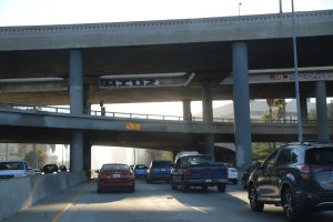
- The 110 S near downtown
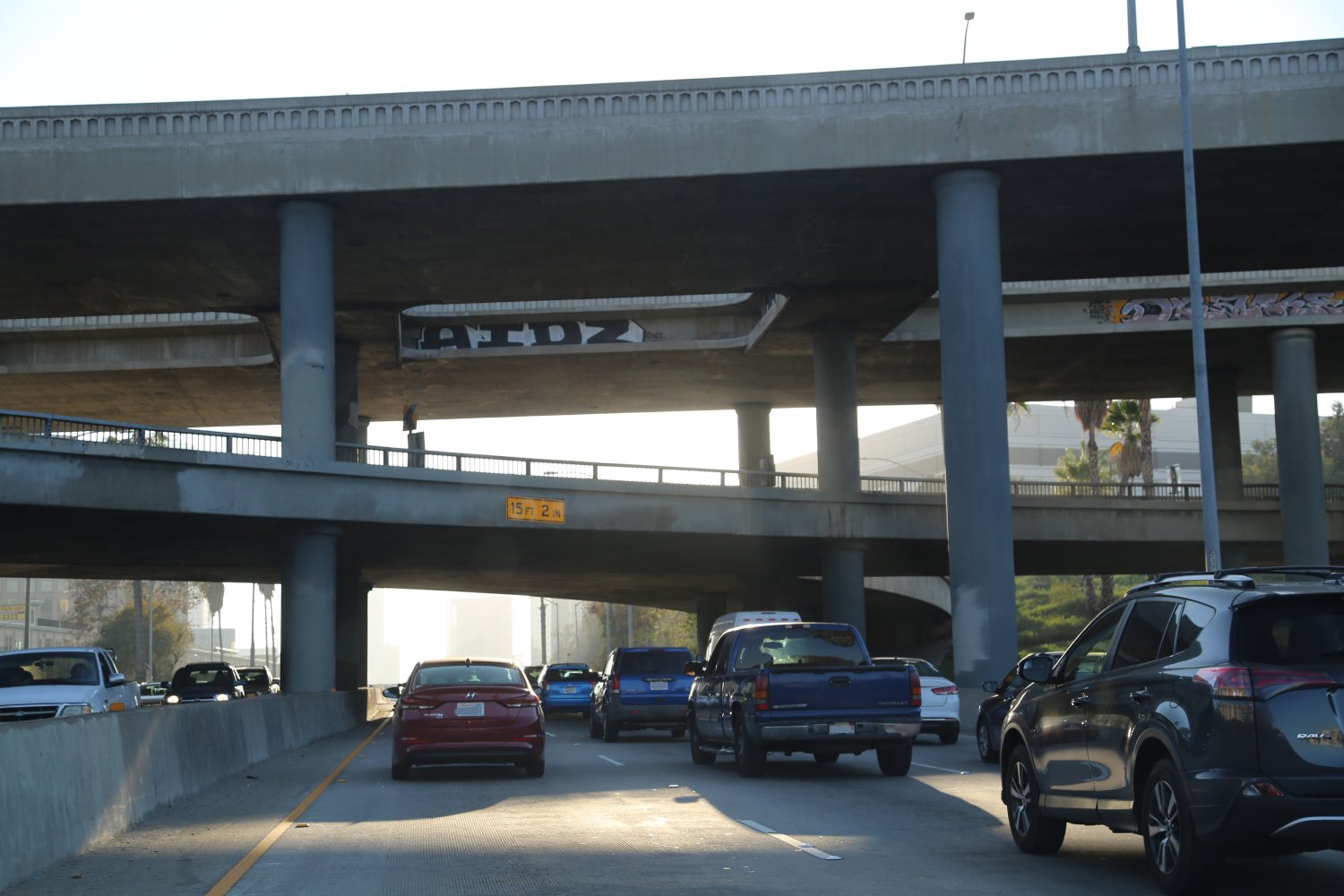
-
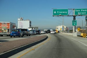
- Entering the 10 West from downtown

-
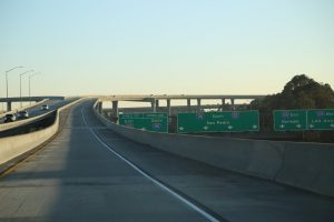
- The great 110 to 105 HOV connector ramp
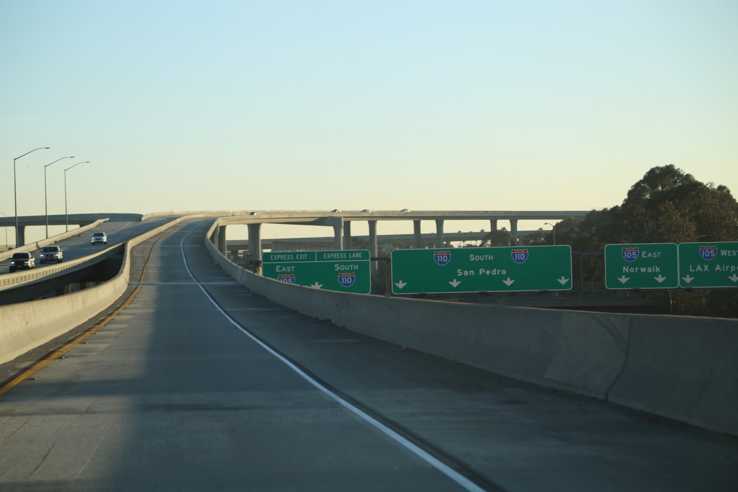
-

- Driving next to downtown LA
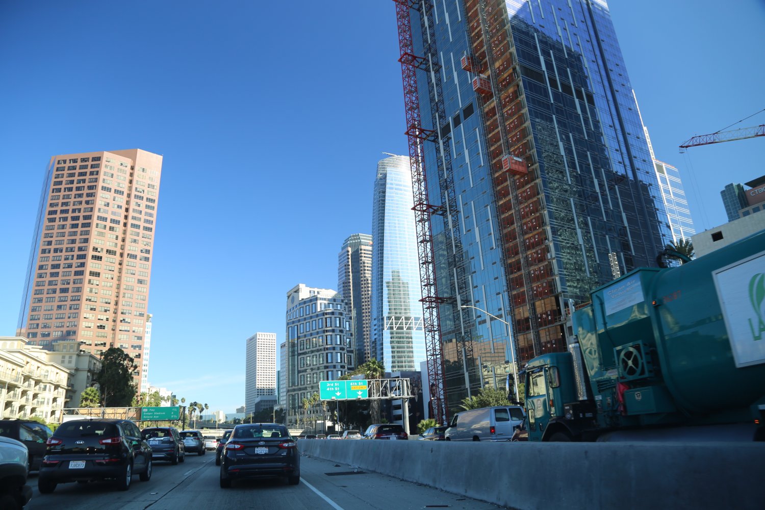
-
- ‘Speed’ Approaching one of the Sepulveda Tunnels

-

- Gridlock both sides, the 110
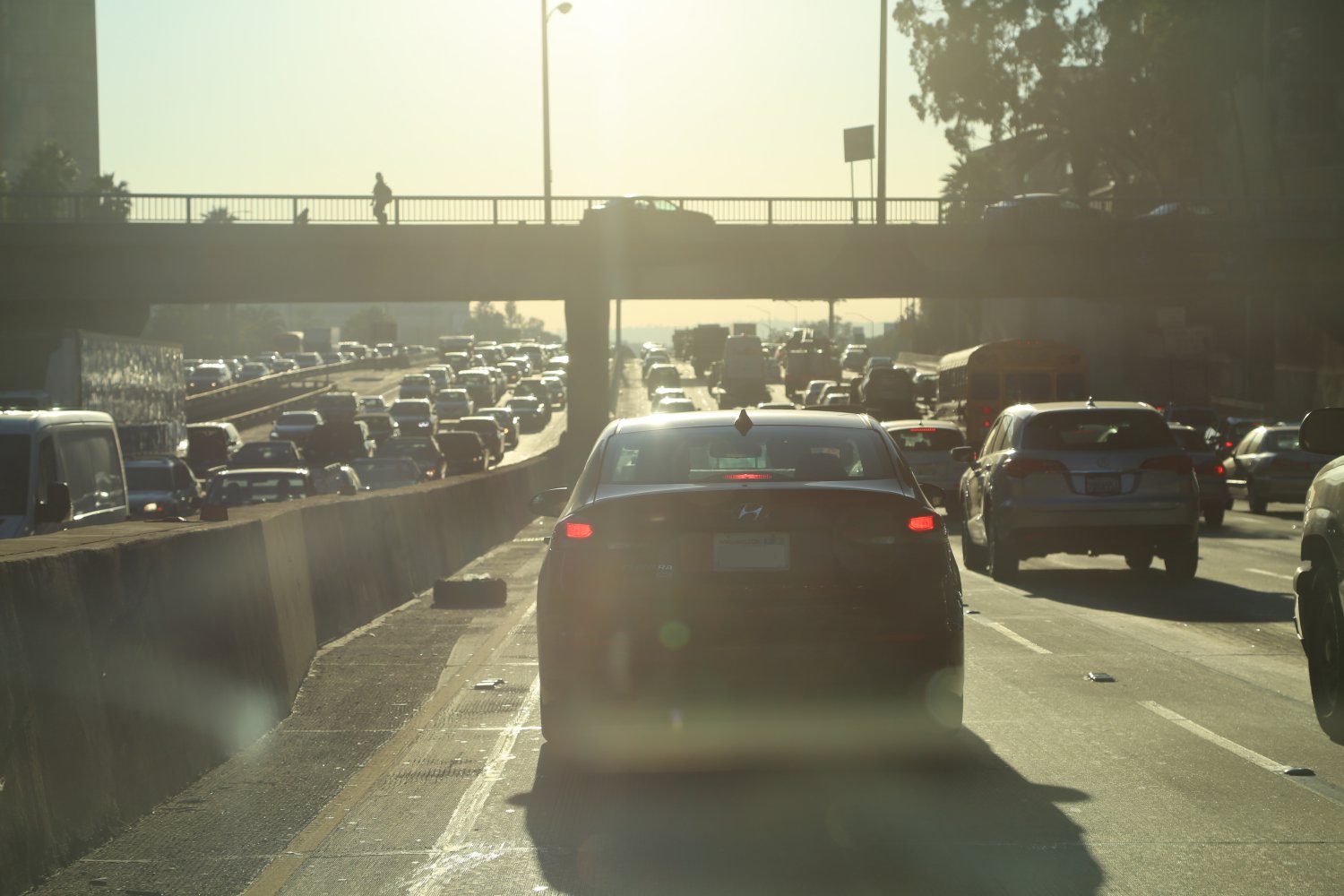
Thank you for taking the time to read about the Freeways of Los Angeles and please add your comments below!
is there a 5 fwy north off the 22 east
The 405 construction is crazy – going to be very glad when this is over. So many side exits and entrances are affected – traffic is absolutely a nightmare here and near the construction swath at certain times of the day.
The 22 runs for about 4 miles *east* of the 5 in Orange County. So yes the 5 runs north and south of the 22 – since the 22 runs East / West
I’m looking at putting together a collection of Los Angeles Freeway art – any nice pieces of art associated with any freeways you recommend?
If I take the 10 freeway east out of downtown and towards Palm Springs, what portion of that includes carpool lanes?
Any reactions or comments on this years’ “trial” period of converting the 110 Harbor Transitway south
of downtown from HOV lanes to HOT lanes – ie converting to pay per use ie toll? Congestion pricing. My concern is I assume you will have to have a FasTrak transponder in your car to use these like on the 91 and that eliminates *thousands* of visitors to town who will not be able to take advantage of these lanes which in no way helps alleviate congestion…..
1 year trial? Perhaps – but its probably here to stay. Out outset, not a fan of this at all -but will be interesting to see if helps alleviate congestion around downtown. Similar system to the HOT on the 91 I assume. How is this going to impact traffic?
http://www.metro.net/projects/expresslanes/
What freeway or what do i take to drive on the coastline to see all the beaches
Unfortunately Google had the bright idea of removing their Comments service for non blogspot websites so we lost a bunch of comments about the LA Freeways. Lets hope Disqus sticks around longer. Looking for any LA Freeway stories here – updates or any comments relating to the Los Angeles Freeways 🙂
Mike – you would want to take the 1 or Pacific Coast Highway (PCH) – it goes through Santa Monica in the north and runs all the way through the beach towns in Orange County, south of Los Angeles. Its not always right next to the water but is def the best road with general north south access to LA and Orange County beaches.
As a daily driver on many of the freeways in metropolitian LA, I have ome to think of it as a sentient being, it sometimes seems to think and respond. Drivers can tell if there is a traffic jam or slow down somewhere inthe grid by activity or cluse the system gives you. can not logically describe it, once you live here long enough you just feel it. It really is an amazing entity when it is moving at high speeds and fairly free flowing. I have experienced passes of several cars in what looks like air craft on a carrier fliight deck manuvers (ODM) on deck manuvers, cars moving right ad left and passing within inches of each other to change lanes at sometimes 80 plus miles per hour. Another harrowing quirk of the system on the 10 and other portion of the grid is the crossover exit and enterance ramps. With cars exiting the 10 to get off and cars interspersing with them to get on the 10, usually speeds are in the 25 – 30 mpg, sometimes the crossing patterns occur at much higer speeds. It is a real rush at night to sucessfully make a smooth manuver.
I always recommend new drivers nevr look at thealluring lights of the opposing traffic at any time, you an have slow downs that occur within seconds on your freeway, and if you look away for seconds fro the red lights in front, it can be tragic.
Another quirk, in a state with such beautifull weather, everyone in greater LA drives with their windows up. Back east, as soon as weather gets nice windows come down, not here.
Thanks you Sir…
Bob – great introspective on the LA freeways – thanks for sharing. I like your comparison to the air craft carrier flight deck maneuvers. That is perfect – I know exactly what you are talking about. The high speeds, exactly.
Your right about driving with windows up – thats something I’ve always personally rejected as much as possible when I’m driving. in LA or wherever its warm. I avoid using the AC as much as possible – although when I was camping in Death Valley in mid July – it was a challenge to be sure.
~ Dave
If I take the 10 freeway east out of downtown and towards Palm Springs, what portion of that includes carpool lanes?
Jane – sorry I didn’t see your first post – this link gives a good idea of existing, under construction and future carpool (HOV) lanes for the LA Metro region: http://www.metro.net/projects_studies/hov/images/hov_map.pdf
The map is a few years old but gives a general idea – there are good carpool lanes east of downtown. Hope this helps.
~ Dave
Any comments on the new switcheroo on Nov 10th for the 110 and its HOT lanes – toll based on congestion for approx 11 miles south of downtown? Congestion pricing….
Carmageddon II coming up for the 405 south of the 101 – anyone going to be around to take some pictures of the empty 405 freeway!
Part of the 10 Freeway east of downtown just went live for the Metro ExpressLanes – anyone going to use this every day – any comments about the new change?
Very good article “Los Angeles, CA – The Freeways”. Road pics are awesome. Thanks for showing.
just found this. it’s pretty accurate. I think we use “the” in front of our freeways because we spend so much time on the freeway. It’s become a “place” we stay at, thus making it a proper noun. =)
That is correct – the LA Freeway culture! Do you live here?
Thanks for the mention Herman! ~ Dave
David thanks for such a comprehensive guide, can only imagine how much time this must have taken- we’re bookmarking it for our trip to LA 🙂 Cheers
Vid – no problem. Yes, I’ve been working on my always growing LA guide for many years. My list of places to review, new experiences in town – etc is always longer than I can keep up with!
Any idea what the speed limit is at the western end of the Glendale Frwy (2)? Coming onto the 2 east/north bound (towards LaCanada) from Glendale Blvd. in Echo Park until the junction of I-5, is it all 65? There aren’t any speed limit signs.
That is a good point, I’ve driven that southern section of the 2 a number of times – usually “out of the gate” going northbound – people usually hit 65+ immediately – it is probably 65, but I’ll try to find out for sure.
Can anyone guess the total amount of vehicles traveling all LA Area Interstate highways on a SUNDAY of the week from 6 am to 6 pm???
I am relocating from the Inland Empire to LA in the next few months which unfortunately will result in commuting to and from LA during the dreaded rush hour traffic. I have already experienced this traffic and I am not looking forward to it. I am hoping the commute will not last too long until I get settled in and can finally just stay in LA (in the Pico-Robertson area)
I will be living in LA and then commuting to the Inland Empire via the 10 freeway. Sometimes my work schedule allows me to get to work at 11am to 8pm. But other days, I will have to be at work from 8am to 5pm. Meaning that to get back to LA, I will be fighting the traffic. I can wait it out for a few hours after work but there may be days (especially on Fridays) where I will have to start driving back at 5pm, and thus the rush hour traffic dilemma. My question is… could there be a potential alternate route where I could avoid the BIG traffic congestion in downtown LA by taking an exit, driving on the streets passing the big freeway merging and then getting back on the freeway? Has anyone done this before? Or are the streets in LA equally as congested?
Lily – unfortunately this sounds like a nightmare of a commute – I hope you wont’ be doing this too long – at least when you have to work the 8am – 5pm days. There is still plenty of residual rush hour traffic on the 10, even in the 10am hour. Sometimes during the worst of the rush hour traffic I use either Pico or Olympic to move from west of the 405 and then cut up and over to the Hollywood Freeway (the 101). This is often faster than sitting the parking lot on the 10. Depending on where you go and time, the 60 to the 710 could work but maybe not – the 60 is notorious for truck traffic and the 710 doesn’t even have a HOV lane.
I guess you could take Pico to downtown and then jump on the 10 – I suppose it would be faster during some time of the day when the 10 is stacked up – just not sure how much more it would be. Some people would rather sit in traffic then deal with stop light after stoplight – I dunno. Not an easy one.
As I say above, the 10 could seriously use a coronary bypass.
I will be driving from W. Katella, Anaheim, CA back to San Jose, CA. on a weekday around 10 AM. The suggested route is I-5. But knowing the traffic on I-5, is there any other freeway that I can take that is less congested than I-5.
The 5 is by far the most direct way back to San Jose – especially since you will probably already be close to its entrance on W. Katella. One thing you have going for you is leaving at 10am. You will certainly hit some traffic near the LA County Line where the construction is and the lanes shrink to 3, however based on alternative freeway routes, going up the 5 is still going to be your best bet. I think if there is going to be bad traffic that day/time it will be on the 5 south of downtown, but I really don’t think it will be that bad. If there are any problems north of downtown on the 5 at that hour (check sigalalert.com) you can use the 170 N as an alternative route which meets back up again with the 5.
Very nice work. Detailed information which can be really useful for those not particular with these specific roads!
Lily there is no tried and true ONE route to avoid traffic out of downtown… Pretty much every artery out of East LA (10, 60, 710, 5, 110) sucks on Friday afternoon.
I’ve never done it myself, but I would recommend trying either Valley Bl or Telegraph Rd which runs east/west through most of the San Gabriel Valley. The closer you can get to the 57 before getting back on the 10, 60, or 210, the better off you’ll be.
This is an experimental process… I used to go to UCLA while living in Santa Clarita. I never wanted to bother with the 405 so I took surface streets the entire way. When I realized the door-to-door trip was taking nearly 3 hours, I figured I would try the infamous freeway. Much to my surprise, even though the traffic stopped at times, it still moved better and was much less stressful than dealing with stop lights and multiple winds and turns on surface streets, not to mention the total travel time wasn’t much more than 2 hours.
Just know you ALWAYS have an option on (or off of) LA freeways. There is just never any guarantee that the way you decide to go will be the best. NEVER a guarantee. You always have to bring a lot of patience and a little faith to any drive during rush hour times in Socal.
Thanks Randy – well said about bringing patience and faith! Always nice to meet other LA Freeway enthusiasts! I’ll check out your site now.
Hello, Dave! It’s nice to get an overview of all the freeways; not just the ones we use daily going to and from work.
I do need your help in taking a route to go to the Hollywood area from the 10 W, but bypassing the section of the 101 N that is most congested. Usually the congestion starts at the 101 N/10 W/E junction near the Soto St. Exit, and then when you pass the 101 N/110 N/S junction, it starts opening up.
If it were not for the heavy traffic, my usual route of 10 W, 101 N, Exit Hollywood Blvd. is nice in its straightforwardness. Thanks in advance!!! 🙂
Rosa – thanks for stopping by and sorry for the delay. I’m on the road in northern Kyrgyzstan and haven’t always had much net or if i have, its not that great. I’ve done the 10 E to the 110 N to the 101 N to HW Blvd E many times. The HW East exit off the 101 is almost always refreshingly empty – everyone wants to go West to main part of Hollywood.
I think it depends on the time of day that you drive this route. I’ve played with surface streets to get to HW Blvd – cutting up on various Blvds from the 10 but most of the time it seems the freeways are the quickest. However during rush hour I’ve found that from the 405 at least cutting over on say Olympic or Pico is faster than fighting the craziness of those multiple freeways to get to HW Blvd. I’ve found Fairfax to be a good north south connector – but that brings you to the west side of HW Blvd. Anyhow, just a few thoughts – there is no easy answer to this!
I need to get from Orange County to The Museum of Natural History on a Friday leaving OC at 4:30pm. Any advice? Freeways to avoid? Thank you!
Melissa – this is a tough question b/c that is a tough time to make that trek north from the OC. The 405 can be a monster – with bursts of speed for short distances and then agonizing slow downs for longer distances – especially around other freeway interchanges. If you have Fastrak – you could use the HOV lane on the 110 N from about the 105 intersection (regardless of of whether you are single driver or not). Depending on where you are leaving in the OC, the 405 N to the 110 N is the most direct to get to the LA Museum of Natural History. I would reference Google Maps or SigAlert prior to leaving to see if there are any major accidents on that route.
Hi Dave! I love your LA Freeway guide! I’m a Del Mar native and commuted to LA for a couple graduate programs about 10 years apart from each other, so I’ve seen some of the evolution of traffic on our freeways. I haven’t driven up to LA for this or that in a few years. I need to drive from Del Mar to the Fashion District to buy stuff for my business. It should take about 3-4 hours to do my shopping. The stores are open from 9am to 4pm M-F and Saturdays they close at 1pm. Any suggestions for best time/day to go? Thanks!! 🙂
Hy, Dave!
It’s nice to get an overview of all the freeways; Thanks for sharing
Hi Dave,
I have to be at the courthouse in downtown L.A. (11 N. Hill Street) at 8:30 a.m. on a Thursday and plan to fly in early that morning. Which airport would allow me to drive to the courthouse faster that time of day: LAX or Burbank? And what route would you select?
Thank you very much in advance for your responses.
Ron – sorry for not getting to this sooner. If you have FasTrak (the transponder that goes in your vehicle allowing you to use the HOV lanes as a single driver) I would def go LAX on the 110. You can also use the flyaway bus to Union Station – about a 20 min walk (or a short uber or taxi ride) to the courthouse. – that way you can take advantage of the HOV lanes (which the buses use) – LAX is really not that far from downtown at all. The 5 can really be backed up in the AM – but so can the 110 heading towards downtown. The 110 HOV lanes using FasTrak would lean me in the direction of flying to LAX.
Dave,
WOW! What a great site! Just what I was looking for. I will be coming from Atlanta, GA going to points north of Sacramento around the first of Apr 2016. I got a knot in my stomach just looking at the map where the 10 goes through LA. HELP! I’ll be pulling a 27′ rv. When you stop laughing and can wipe the tears from your eyes please advise😟. The 10 or 210W to the 15N or 99N. What time of day, what day of week? Any info greatly appreciated. Thank you so so much,
TW
Tom – thanks much for the appreciation – always nice especially for this page where I have put in so much time and energy! If you don’t need to be in Los Angeles for a particular reason on your drive over from Atlanta, I would say definitely skip the 10 when you get close to town – and head up to the 210 taking that all the way to the 5 north and then either jumping on the 99 where it splits just north of the Grapevine where the great southern Central Valley ‘starts’. I think you could take the 10 West until you reach the 57 and then cut north on the 57 to the 210 west and then follow the 210 all the way to the 5. Take note to remain on the 210 in Pasadena rather than accidentally getting on the 134 west. When you look at a map you will see what I mean by that. Going west on the 10 can be tough in the early mornings – so if you can plan your drive on this part of the 10 after 10am you will be in better shape.
Also you can get an idea of morning traffic patterns ahead of time by looking at Google Maps and or Sigalert.com – think you will be fine avoiding the 10 through the heart of LA and sticking to the 210.
Hope this helps!
~ Dave
Thanks for the details – I try to stay put here in East LA but invariably we have to get around town – and always get stuck on the dreaded 10 or the 60 🙁
I could never live anywhere else. I was born and raised and still reside right here in North OC. I grew up in Yorba Linda right off the infamous 91’s Gypsum Canyon Exit right on the Yorba Linda/Corona border. I remember every morning my mom would have to get on the 91 to get to my grandparent’s house in Anaheim and every evening do the same (it was 100% worse in the evening of course).
As for your suggestion of driving the 10 at 2am with the windows down and music blasting on a nice night, I’ve so done that. It has just so happened by chance that most of my exes are in West LA, so I’d be coming home from their place in the morning and I’d always have the windows down and revel in the emptiness of the usually busy 10 freeway.
Dave,
I’m a woodcut artist based in Los Angeles.
I carved an original woodcut inspired by the Los Angeles Freeway system.
I thought you might be interested. Here is a link to my blog:
http://woodcuttingfool.blogspot.com/2016/02/la-freeway.html
Sincere Regards,
Loren Kantor
woodcuttingfool.blogspot.com
Hi Dave, Thank you for having this web site/blog. Do you know if the 5 FWY carpool lane connects directly to the 605 carpool lane going north?
Hi Dave
We will be at the Anaheim Convention Centre on Sept 24+25, finishing at 5pm on the Sunday. Will likely be driving out of Anaheim by 5.30.
We fly out of LAX International at 10.30pm. Have to return the car to Alamo and get the shuttle in the process. No idea what to expect on a Sunday night, non-peak, from TSA.
From what you know of Sunday evening traffic would you say we ‘should’ be okay getting to the airport by about 7pm, barring any major accidents on the freeway?
Any suggestions? (Ditch the car and train, taxi or shuttle instead if likely to be a nightmare 🙁
Carla – thanks for your note. If you are driving back to LAX from Anaheim at 530pm on a Sunday – and your flight is at 1030pm, that should be plenty of time. Normally that drive shouldn’t be more than an hour – there are several freeways you can take to get to LAX from the ACC off of the 5 – would check google traffic maps or Sig Alert maps before leaving. That should also give you plenty of time to drop off the car and catch their shuttle. With that amount of time, I think the car is your best bet. I have the TSA pre check which helps speed things through security – depends on which terminal you are flying out of. I usually fly out of Terminal 6 or 7 domestic and non peak travel times – usually the lines not that long even for non pre check lines. Hope this helps 🙂
That’s fantastic and a great relief – thanks Dave 🙂 we are flying AirNZ from Terminal B … I read somewhere they weren’t on the TSA Pre-check list but we should be okay. We’re expats on US passports which may help. Thank you thank you … A massive help :D. Awesomely fast reply too!
Thanks Dale – sorry for late reply, been stuck in traffic. Hehe, not really but been a bit crazy here. Unfortunately there is no connector (I believe HOV lanes along that section of the 5 are currently under construction – I need to head out there to see the progress as I last drove through there early this year). To connect between each – you have to exit the 5 on the right hand side with the rest of the traffic – depending on which direction you are driving – either north bound or southbound.
Yep, enjoy your time in LA/OC 🙂
Hi Dave. Very interesting. I will be in LA this summer, picking up a large RV to do a road trip with my family (we are from UK). I will be picking up the RV in the Bellflower area and then driving it from there to pick up my wife and children who will have overnighted at a hotel on Sunset Boulevard. I will be collecting on a Saturday morning and looking at maps – the best route seems to be Westbound on 91 to the 110 then North until the 101 from which I can get directly onto Sunset Boulevard at Junction 8a. does that sound about reasonable? Anything I need to know? I am from UK but have a lot of experience driving on the right hand side of the road (in Europe) and have driven large vehicles (mini buses, articulated trailers behind tractors etc) but I have not driven in the US before. Any tips or suggestions most welcome
It is absolutely amazing. When the freeway system went in in the 1950’s everyone raved about it. Then the rest of th,e freeloaders descended upon our infrastrucdture like a bunch of fucking vultures because they were too stupid to build one in the s-holes they came from. Add to this mix corrupt politicians and giveaway democrats and what you see today is a permanent mess caused exclusively by GIVEAWAY ARTISTS. The people who built this magnificent masterpiece are now gone and the only ones left are the vultures, mainly from south of the border where the only freeways they have are heavily traveled by donkeys.. Hasta la vista
This is very informative and clear. Thank you! I am looking at a potential job commute from mid Orange County (jumping on the 5 at 17th Street (Santa Ana, CA), to the 57N, to 60W, exiting Crossroads Pkwy. I read that the 60 can have terrible traffic but I’ve never really used either the 57 nor the 60 in previous commutes. The commute is 35 minutes without traffic; however, without knowing which way traffic flows (or if it actually is an issue in either freeway directions), it is hard to estimate what the commute time will be. Should I double it and estimate a 70 minute drive, or is 1.5 hours more realistic? Any insight you could offer would be appreciated.
Hi Dave – thanks for this extensive writeup of the LA Freeways! I get to LA at least a few times each year to visit family (I live in Atlanta now). Keep on driving 🙂
Anyone have any favorite LA freeway viewing spots? A couple of mine are from the Getty Center overlooking the Monster (the 405), from the Howard-Hughes-Promenade shopping also of the 405 and from the top of the US Bank One – especially of the 101.
Born in LA in 1938. Traffic was never a problem until the 70’s or 80’s when immigration laws began to be ignored. Find yourself stuck in eternal traffic? thank the likes of the Jerry Brown’s of this world. They and they alone are to blame.
PS. I remember when freeways were built originally and had zero traffic problems on them for several years. This was when LA was wholesome, clean, and homes were easily affordable. Along came the dummies and ruined it for those folks like myself who built it originally, paid for it, and now are forced to share it with losers from all over the world.
List of items to update for this post are newer and better photos of most of the freeways covered above – we aren’t always driving in LA with someone else in the driver’s seat so new photos will slowly be added over time.
Wooo I’m the 60th comment! Haven’t seen anything this quite informative regarding our ‘fun’ freeways. Thanks for sharing Dave.
Hi, thanks for a great page. Curious if you have insight: what agency or similar maintains overpasses over freeways (such as the 105). I ask because increasingly we see people hanging various political etc. banners on the fencing for drivers below to read. I’d like to contact the right people to have them taken down. (They’re an eyesore plus dangerously distracting). Thanks
Harvey – I believe it is completely prohibited to hang any sort of sign on freeway overpasses or crossing and those are in the jurisdiction of Caltrans. You would have to contact the Caltrans office which oversees the district you are in. With that said, I believe most hand held signs are ok but those to, can also cause distractions.
You ought to update this to include the massive freeway expansions and renovations currently ongoing
As someone who recently navigated the 405 during rush hour, I really appreciate a guide that breaks down the logic of these freeways. Your tip about the 110 being a good alternative to the 10 through downtown was a game-changer for my last trip. Thanks for the practical advice.
As someone who recently navigated the 405 during rush hour, I really appreciated this guide. The tip about the 110’s express lanes was particularly useful and saved me a lot of time. It’s clear this was written by someone with real local driving experience.