Live Webcam – www.astro.ucla.edu/~obs/towercam.htm
 This is a drive to the sky that quickly gets you out of the LA Basin. Take the Angeles Crest Highway (Highway 2) out of the town of La Canada Flintridge off of the 210 Freeway, north west of Pasadena. It is about 19 miles from La Canada Flintridge to the actual observatory. After about 14 miles driving on Highway 2, you have to turn onto the Mt. Wilson Observatory road which goes another 5 miles until it ends at the public observatory parking lot.
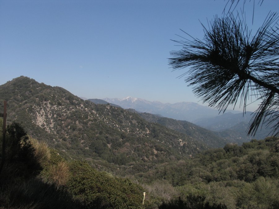
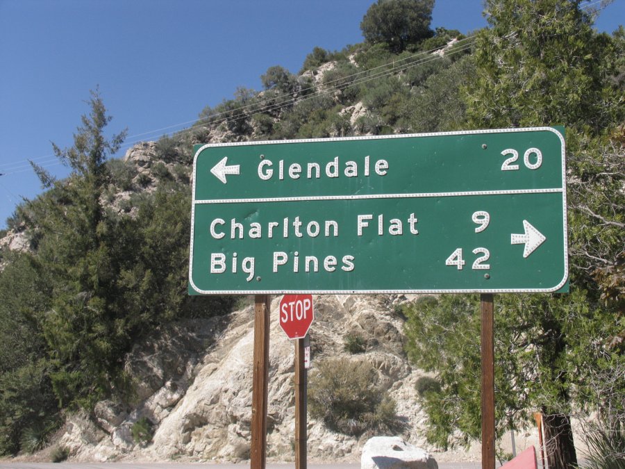
Highway 2 is a winding road that is fairly decent. The Mt. Wilson Observatory road is also very windy and much more slow going. There is a great overlook where the MW Observatory Road leads off from Highway 2. Look for the main road sign there that indicates Glendale is merely 20 miles away. This part of the drive, while relatively so close to Los Angeles feels like you are world’s away.
The air is often cleaner, the sky is bluer, and you are surrounded by wild chaparral and rugged canyons. There are a plethora of good hikes along this
road – some of which are definitely multi-day options as the trails are fairly long. All visitors who stop along Highway 2 or the MT Observatory road including the parking lot at Mt. Wilson need to have a Forest Service Adventure Pass. Two locations you can purchase these are both located near where Highway 2 hits the 210 freeway – The Sport’s Chalet and also at Jay’s Shell Station (just south of the 210 on the 2 Highway).
Be sure to stop at the Lowe Railway pullout on the Mt. Wilson Observatory Road. Did you know that a 7 mile + railway was built here in the 1890’s? There is an information plaque if you hike maybe 100 feet from the dirt side of the road parking lot which tells about this now defunct railroad and buildings. The old railroad bed makes for great hiking as well as scenic views of the rugged canyons and on a clear day, good views overlooking the greater Los Angeles basin. For more information about the Mt. Lowe Railway visit: www.mtlowe.net
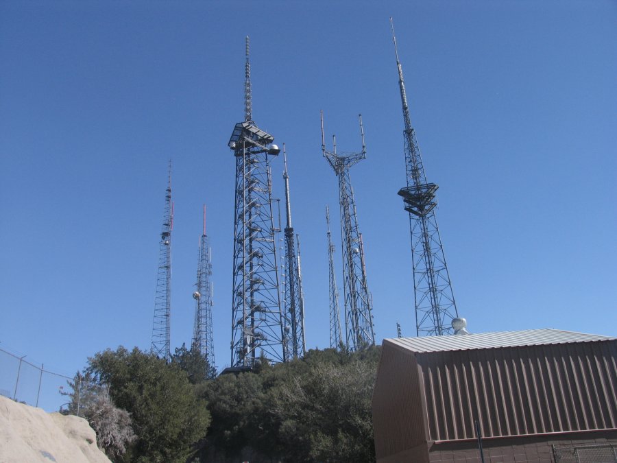
As you drive close to the Observatory check out the plethora of antennas on your left side – this will be about where the road becomes one way and circles around the top of the mountain. This antenna row or as it is also called, Media Center – is where much of Los Angele’s major media outlets have their broadcasting antennas. Powerhouse radio stations such as KLOS, KRTH, & KBIG as well as KABC & KTLA television stations (among many others) have antennas here.
You must park in the public parking observatory parking lot. The gate which leads to the main parking lot and facilities closes at 4pm (if you are already inside, don’t worry, the gate auto opens when you drive up to it for exiting). During operating months (see below), the observatory opens at 10am. Mt. Wilson Observatory is typically closed to the public from December 1st to March 31st.
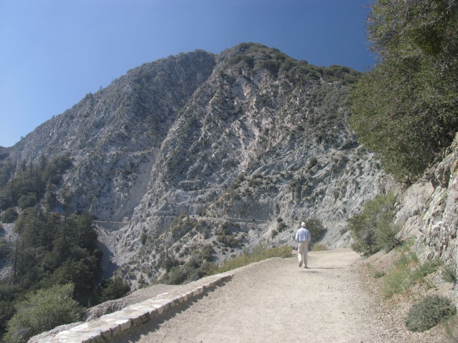
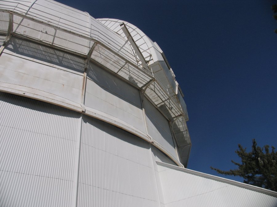
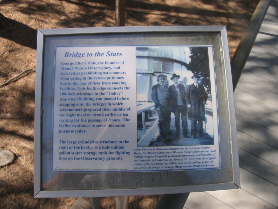
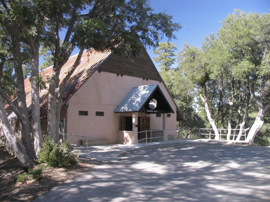
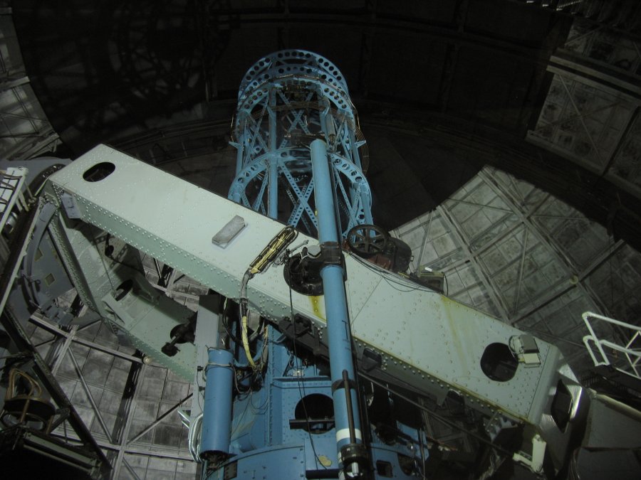
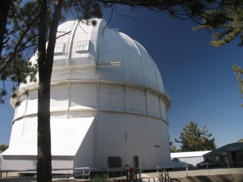
The walk from the parking lot to all the “good stuff” a the end of the road is about 1/4 mile along a paved road (no public cars allowed on this road). You will first come to a nice museum – good astronomical photos inside. Then a 150 foot tall Solar tower which helped during the original studies of sun spots. Keep walking down the road and you will see the 60″ telescope building – this can be rented out by groups on a 1/2 and full night basis. The real highlight is the 100 inch telescope. Cross a bridge to get here – look for the white railings next to the actual telescope building. There is a photo of Einstein standing near these. Be sure to walk around to the left side of this giant round white dome as the main steps to enter are on the far left. Walk up several very narrow flights of stairs until you reach a window overlooking the telescope.
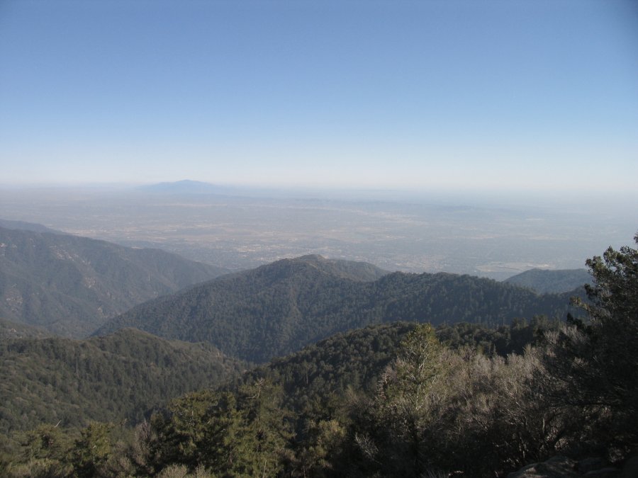
If you walk back across the bridge and then up the road heading towards the “lookout point” you will find a small trail leading off the paved road which winds around a chain link fence. This after a few minutes will lead you down to the lookout point which is a peninsula ridge with great views of the rugged mountains to the north and east. Good photo op here! More information about the observatory is here: www.mtwilson.edu and view some of our photos below.
Leave a Reply