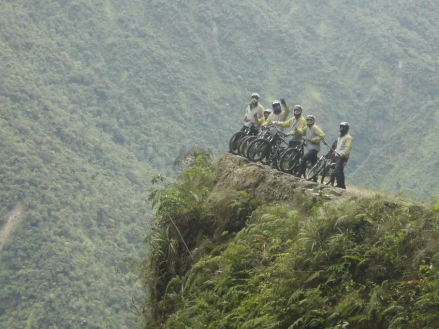
The fog rolled in before we’d even left La Cumbre, curling around the bikes stacked against the van like it was trying to talk us out of it. We were 4,650 metres up, the air thin enough that pulling on my gloves left me slightly out of breath, and somewhere below us, 61km of gravel, cliff edge and reputation was waiting.
Bolivia’s Yungas Road didn’t earn the nickname “El Camino de la Muerte” for nothing. Carved through the Andes in the 1930s by convict labour during the Chaco War, it spent decades as the only real link between La Paz and the northern lowlands, and for just as long, one of the most lethal stretches of road on the planet. No barriers, single-lane blind corners, near-vertical drops of 600 metres. At its worst, it was killing close to a person a day. A bypass finally opened in 2006, and the old road, no longer needed for buses and cargo trucks, quietly reinvented itself as one of the most sought-after bike rides in South America.
Which is how I found myself standing at the top of it, stomach doing something between excitement and regret.
The Warm-Up That Wasn’t
Our guide ran through the safety briefing with the calm of someone who’d said it a thousand times: stay right unless overtaking, listen for the horn, don’t get cocky on the wet sections. Then came the gear check, and my first small crisis of the day, every spare helmet in the van was either too big or too small for my apparently very average-sized head. I ended up with one that slid forward every time I hit a bump, which for a road that’s mostly bumps, was not ideal.
The first stretch is smooth tarmac, a gentle downhill that lulls you into thinking this whole “world’s most dangerous road” thing might be overblown. It isn’t a warm-up so much as a trap. Your guides use it to size up who can actually ride, who’s overestimated themselves after two Red Bulls and a hostel dorm pep talk, and who needs extra attention once the asphalt runs out.
It ran out about an hour later.
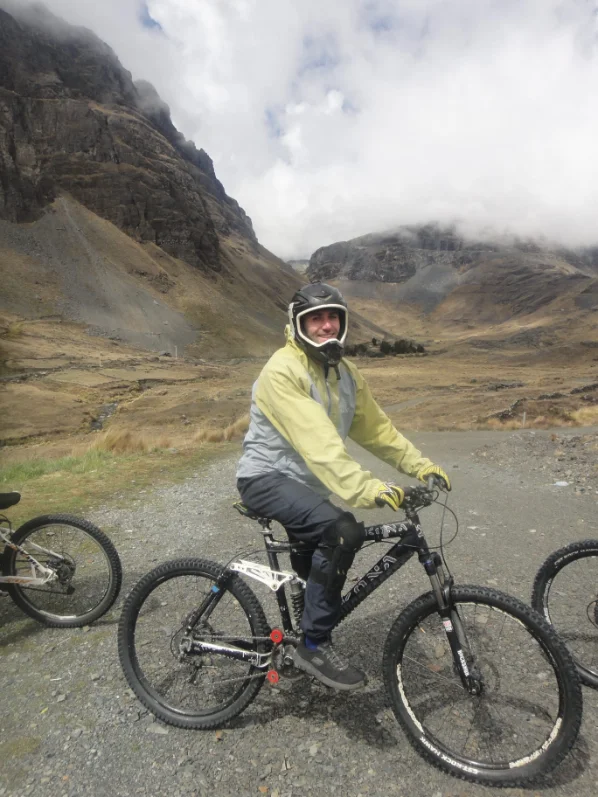
Gravel, Ghosts and a Very Well-Timed Condor
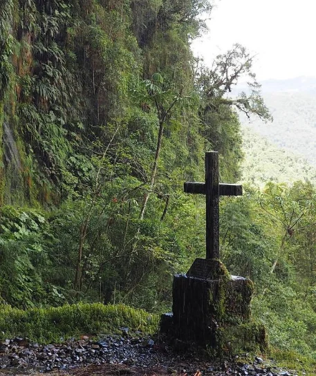
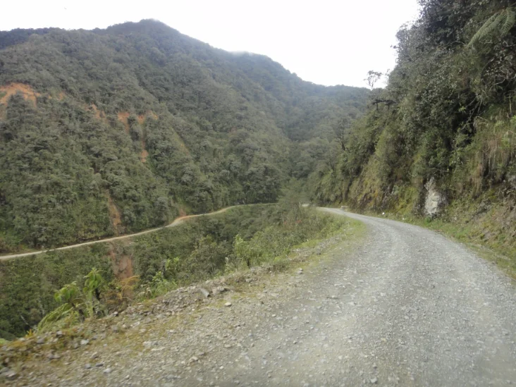
The transition from road to Road happens fast. One moment you’re cruising, the next you’re bouncing over loose stones with a cliff dropping away inches from your handlebars and a wall of jungle rising on the other side. The width, in places, is barely over three metres. Enough for a bike. Enough for a bus, once, which is part of why this stretch has so many small roadside memorials, crosses and flowers marking where someone didn’t make the corner.
I won’t pretend I wasn’t thinking about that.
The fog thickened and thinned as we dropped in altitude, sometimes clearing just long enough to catch the full scale of the drop beside us, then closing back in like the mountain had changed its mind about letting us see. At one point a condor came in low over the ridge, close enough that I actually stopped pedalling to watch it. Not for the photo. I just forgot to keep moving.
There’s a corner about two-thirds of the way down that the guides call Punto del Diablo, Devil’s Point, and it earns the name. Sharp, loose, camber all wrong. I watched someone from another group go down just ahead of us, more embarrassed than hurt, but it was a solid reminder that this road doesn’t really care how many countries you’ve cycled in before.
The Bit Nobody Warns You About: Waterfalls
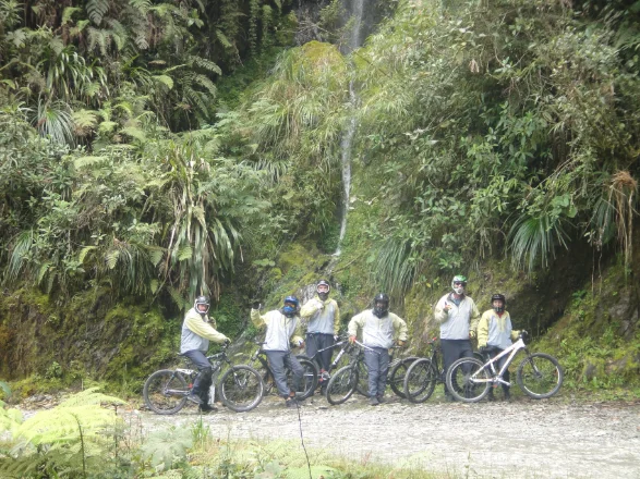
What I wasn’t expecting was how much water is actually on the road. Not rain, waterfalls, several of them, running straight across the path on their way down to the valley floor. You can dodge around the edge if you’re feeling cautious, or just ride straight through if you’re not. I rode through every single one. Cold, unnecessary, completely worth it.
By the time the jungle properly closed in around us, thick, green, humid after the exposed high-altitude start, my hands had gone numb from gripping the brakes and my legs had stopped complaining somewhere around checkpoint three. The altitude drop is enormous, from nearly 4,700 metres to about 1,200, and you feel every bit of it. The cold mountain air gives way to something thick and tropical, and the landscape changes just as dramatically, scrubby highland fading into dense rainforest by the time you roll into Yolosa at the bottom.
The End, and the Slightly Anticlimactic Part
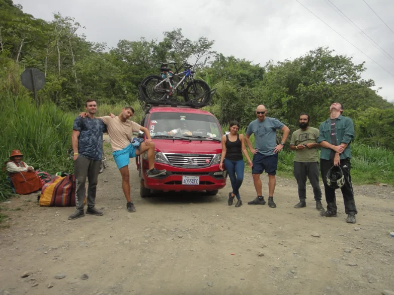
There’s a strange moment when you finish. The adrenaline that’s been running the whole way down suddenly has nowhere to go, and you’re just standing there, legs shaking, grinning at strangers who were equally terrified twenty minutes ago. We got the obligatory group photo, all of us a bit too pleased with ourselves, and were fed an enormous lunch that I demolished without much dignity.
The drive back to La Paz took a slight detour when our driver decided to run a couple of personal errands en route, not a huge deal, but a small reminder that this is still very much a local operation rather than a polished theme-park experience. That’s part of the charm, honestly. Nothing about Death Road feels manufactured for tourists, even now that it exists almost entirely because of them.
Was It Worth It?
Every uncomfortable, slightly terrifying minute. Death Road isn’t really about the danger, or at least, it stopped being about that for me somewhere around the first waterfall. It’s about riding through several completely different versions of Bolivia in the space of a few hours: high, cold, exposed mountain giving way to warm, dense jungle, with a genuinely brutal history sitting quietly at the edges the whole way down.
I’ve cycled a fair few roads since. None of them have made me forget to pedal because of a bird. This was just one stop on a much longer route through Bolivia, and easily one of the most memorable!




Leave a Reply