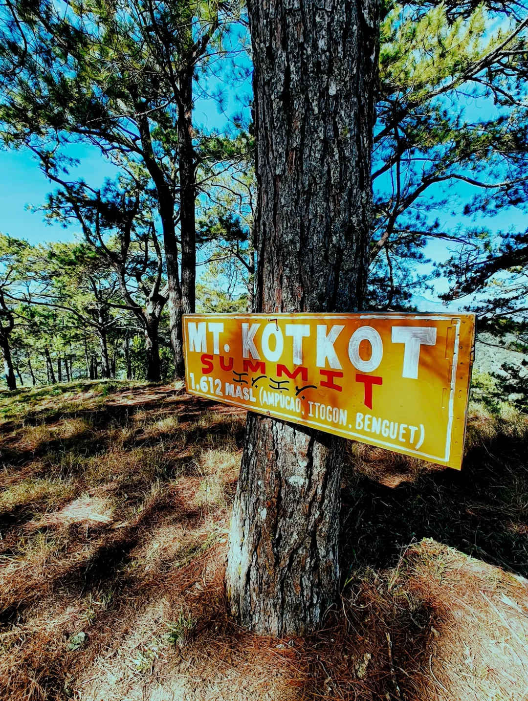
Mt. KotKot
Hey trail chasers, Welcome back to the blog.
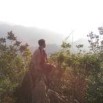
If you have spent any time scrolling through outdoor community feeds lately, you have undoubtedly paused on those sweeping, cinematic shots of the Benguet ridges. The endless rolling hills, the golden hour light hitting the pine trees, the sea of clouds in the distance—it all makes you think, “I need to be there immediately.” Mt. Kotkot in Itogon, Benguet is having a massive moment right now in 2026.
But before you start packing your bags and booking your overnight bus tickets up the mountains, we need to have a highly candid reality check.
As a professional travel blogger and trail researcher, my job is to cut through the social media filters and deliver the unvarnished truth. Compiling the latest 2026 trail logs, GPS data, satellite weather patterns, and hundreds of on-the-ground hiker reports reveals a stark “Instagram vs. Reality” divide. Mt. Kotkot looks like a gentle, breezy walk in the park on your screen. On the ground, it is a physically demanding, point-to-point traverse that will brutally test your heat tolerance, your hydration strategy, and the structural integrity of your knees.
Since we are currently sitting in early March 2026—right in the absolute sweet spot of the Benguet hiking season—this is the perfect time to break this mountain down. Here is the ultimate, meticulously researched, no-BS guide to exactly what you need to know, expect, train for, and pack to conquer the MarMax Farm to Sigsiglay route this year.
The Geography and Cultural Context of Ampucao
Before we talk about elevation gain and trail snacks, it is crucial to understand where you are stepping. Mt. Kotkot is located in Barangay Ampucao, within the municipality of Itogon, Benguet. This is the Cordillera Administrative Region (CAR), a place characterized by dramatic topography, deep valleys, and fierce, resilient indigenous communities.
The ridges you will be walking on are part of the ancestral domains of the Ibaloi and Kankanaey people. These mountains are not just weekend playgrounds; they are working landscapes dotted with small-scale farms, grazing lands for local cattle, and areas of deep cultural significance.
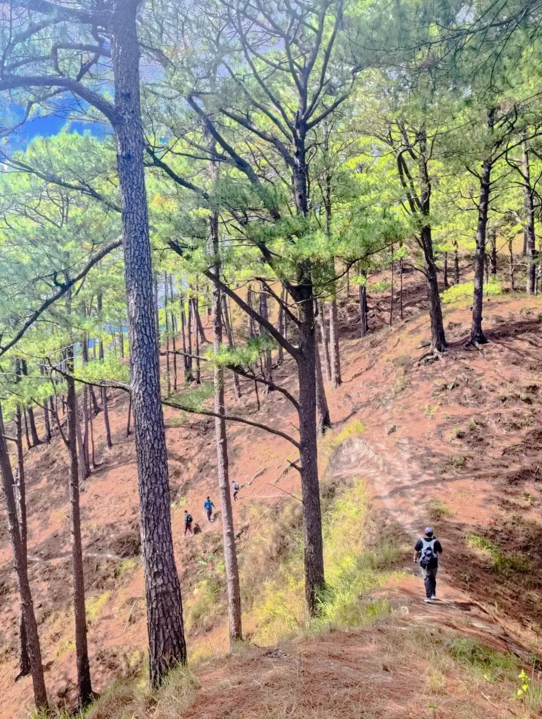
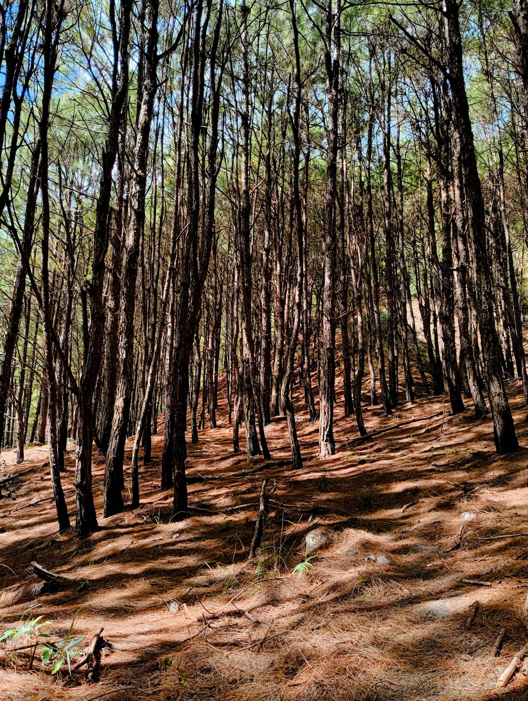
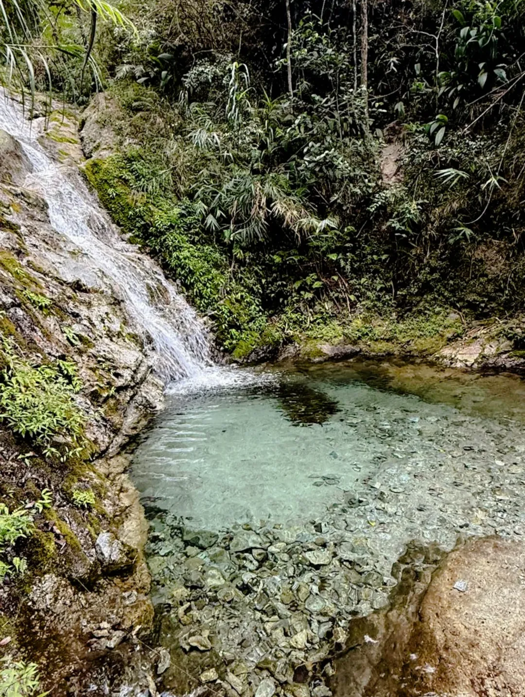
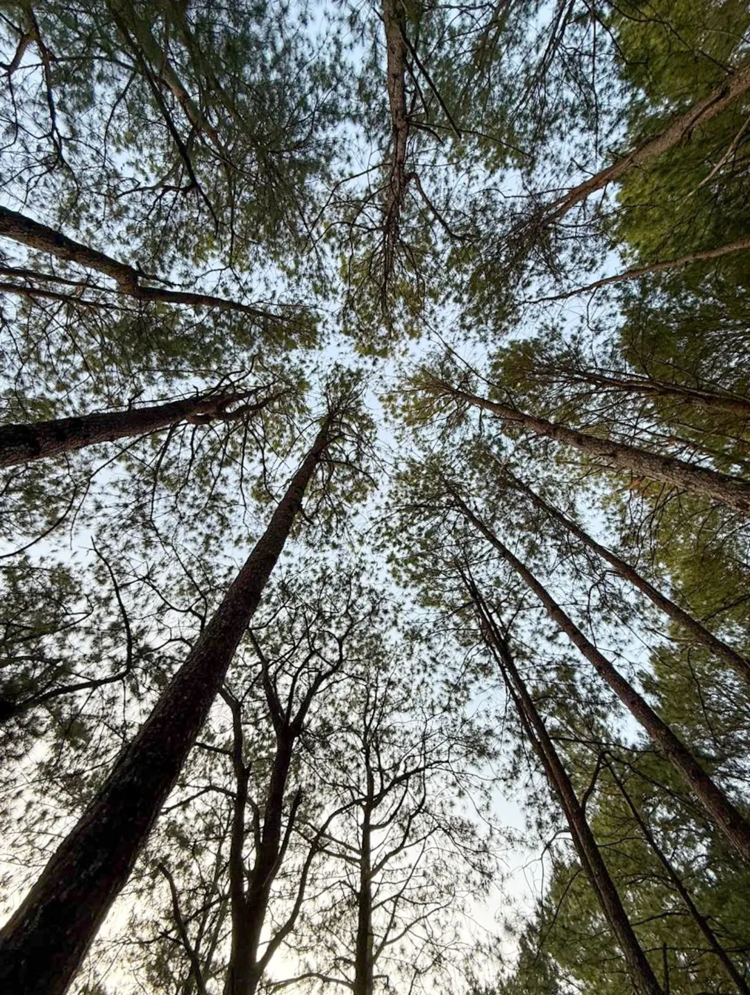
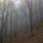
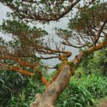
The topography here is unique. Unlike the dense, mossy forests of Mt. Pulag or Mt. Kalawitan, the Kotkot traverse is heavily exposed. It is categorized by open grassland ridges and scattered Benguet pine forests. The soil is predominantly laterite—a reddish, iron-rich earth that turns into fine, slippery dust during the dry season and a treacherous, clay-like mud slick during the monsoon. Understanding this soil composition is the key to surviving the descent later in the day.
Mt. KotKot
At a Glance: The 2026 Mt. Kotkot Trail Intel
Do not let the lack of ropes or technical rock climbing fool you; the environmental factors are the true crux of this climb. Here is the raw data you need to wrap your head around before committing to the traverse.
| Trail Feature | The 2026 Baseline Data |
| Location | Barangay Ampucao, Itogon, Benguet, Philippines |
| Difficulty Level | 6/9 (Demanding due to extreme sun exposure and a brutal exit descent) |
| Estimated Elevation | ~1,600+ MASL (Meters Above Sea Level) |
| Typical Moving Time | 8–12 hours total (7–10 hours of active, moving trekking) |
| Route Type | Point-to-point Traverse (Jump-off: MarMax Farm / Exit: Sigsiglay) |
| Best Time to Hike | January to early March (Peak Amihan season) |
| Water Sources | Zero reliable sources on the ridge (100% self-reliance required) |
| Cellular Signal | Highly intermittent (Do not rely on it for emergencies) |
| Mandatory Requirements | Local guide required; strictly enforced registration at Ampucao Barangay Hall |
The “Easy Ridge” Myth: A Psychological and Physical Reality Check
A common, dangerous trap for new hikers is assuming that a mountain covered in grass instead of jagged rocks is a beginner-friendly stroll. Trail reports from Mt. Kotkot forcefully correct this assumption the moment the sun crests the horizon.
The 6/9 difficulty rating is not assigned because you need to scramble up boulders. It is assigned because of a specific trifecta of challenges: sustained, inescapable sun exposure; zero water sources for the majority of the day; and an unforgiving, knee-crushing final descent.
Who Should Actually Hike This Route?
-
The Total Beginner: If you are relatively sedentary, work a desk job, and have never hiked a mountain before, I highly advise picking a different introductory trail. The combination of heat fatigue and the steep Sigsiglay exit frequently leads to severe muscle cramping, heat exhaustion, and slip-and-fall injuries for the completely unconditioned.
-
The “Fit Beginner”: If you regularly run 5Ks, cycle, engage in heavy strength training, or have comfortably completed a few minor 4-to-5-hour day hikes, this is a brilliant “level-up” mountain. It is the perfect open-air classroom to teach you how to manage your micro-pacing and hydration over a long, exposed day.
-
The Intermediate/Advanced Hiker: You will love this trail for the sweeping photography and the endurance conditioning. It is a fantastic place to test your fast-packing gear or dial in your hot-weather nutrition strategy.
The 4-Week Prep Plan:
Do not show up to Mt. Kotkot right off the couch. In the month leading up to your trip, focus on eccentric leg strength. Spend 45 minutes on a stair-stepper machine twice a week. Do weighted lunges and step-downs to bulletproof your knees for the descent. Your calves and quadriceps will thank you when you hit hour seven on the trail.
Mt. KotKot
Weather Windows: Decoding the Cordillera Microclimates
In the Cordilleras, the weather dictates your survival. Right now, in early March 2026, we are sitting at the absolute tail end of the ideal hiking window. Here is how the Philippine seasons drastically alter the Kotkot experience:
The Golden Window (January to Early March): This is unequivocally the best time to attempt the traverse. The Amihan (northeast monsoon) winds bring crisp, cooler air down from Siberia. The trails are bone dry, providing maximum traction for your shoe lugs, and the morning wind chill actively keeps your core temperature down during the initial, strenuous ascent.
The Sufferfest (Late March to May): As the Philippine summer sets in, the Mt. Kotkot ridge turns into a high-altitude solar oven. The heat radiating off the open, shadeless terrain is intense and relentless. If you hike during these months, you must secure a pre-dawn start and carry a minimum of 3 to 4 liters of water per person. Heatstroke is a very real, documented medical emergency on this trail during April and May.
The Danger Zone (June to October): When the Habagat (southwest monsoon) rains arrive, the dry laterite dust turns into a slippery, muddy clay slick. Worse, the open ridges offer absolutely zero cover from lightning strikes. Hiking an exposed ridge during a thunderstorm is a fatal gamble. Treat active thunderstorm forecasts, low-pressure areas, and typhoon windows as an automatic, non-negotiable no-go.
The 2026 Logistics Blueprint: A Masterclass in DIY Travel
Executing a day hike traverse requires tight, precise logistics, especially if you are doing a DIY commute from Metro Manila. The golden rule of Mt. Kotkot is beating the sun. Your primary, non-negotiable goal is to be standing at the Ampucao Barangay Hall before dawn.
The Step-by-Step Commute Strategy
-
The Night Bus from Manila: Head to the PITX or Cubao terminals and book a late-night trip to Baguio City (Victory Liner, JoyBus, and Solid North are the standard operators). You want a bus that departs around 10:00 PM or 11:00 PM. Your absolute target arrival time in Baguio City is between 2:30 AM and 3:00 AM.
-
The Baguio Transfer: Once you step off the bus into the cold Baguio night, head toward the jeepney staging areas near Lakandula Street, Orion Drug, or the Baguio Center Mall / Magsaysay area.
-
Chartering Your Ride: If you are with a group of 4 to 10 people, chartering a “special trip” jeepney directly to Ampucao is the most cost-effective and reliable method. This will generally run you around ₱1,500 to ₱2,000 one-way, which you split among the group. If you are a solo hiker or a pair, you can negotiate with a local taxi or attempt to book a Grab (expect to pay ₱350 to ₱800 depending on the driver’s willingness to go out of the city limits). The travel time from Baguio to Ampucao is roughly 40 to 60 minutes, depending on the fog and road conditions.
-
The Ampucao Barangay Hall: All hikers must process their paperwork here. You will fill out a hiker manifest, sign liability waivers, pay your environmental fees, and be assigned your mandatory local guide.
Your 2026 Budget Breakdown
-
Manila to Baguio Bus (Round Trip): ₱1,400 – ₱2,200+ (Depends heavily on regular aircon vs. luxury sleeper classes)
-
Baguio to Ampucao Transfer (Shared): ₱200 – ₱400 per person
-
Registration / Environmental Fee: ~₱150 per person (Subject to slight LGU adjustments)
-
Mandatory Local Guide Fee: ₱500 – ₱1,000+ per group (Pricing tiers vary by group ratio and traverse complexity)
-
Trail Food & Specialized Hydration: ₱400 – ₱800
Blogger Tip: Guide availability can become a major bottleneck on peak weekends. Expect queues at the Barangay Hall, coordinate your transport early, and bring a massive dose of patience.
Mt. KotKot
Segment-by-Segment: The Anatomy of the Traverse
To successfully conquer Mt. Kotkot without ending up in an exhausted heap, you must treat the hike as four distinct chapters. Do not sprint the first chapter. Your target time to begin trekking from the MarMax Farm jump-off is strictly between 04:30 AM and 05:10 AM.
Stage 1: The Dark Ascent (MarMax Farm to the Pines)
-
Estimated Time: 1 to 2 Hours
-
The Experience: You will start in pitch black, relying entirely on the beam of your headlamp. The air will be cold, and the terrain is a mix of established dirt paths and gradual inclines.
-
The Strategy: Keep your pace deliberately, almost frustratingly slow. Do not let the crisp air and morning adrenaline push you into a sprint. Your heart rate should remain in Zone 2 (a conversational pace). If you burn out your leg muscles and spike your heart rate in the first hour, the ridge will collect its toll later.
Stage 2: The Awakening (The Push to the Main Ridge)
-
Estimated Time: 1 to 2 Hours
-
The Experience: As the sun begins to rise, illuminating the Cordillera mountains in spectacular hues of orange and purple, the trail pitches upward into sustained, steeper climbs. The soil here becomes looser. You will shed your windbreaker as your body heat rises.
-
The Strategy: This is where you begin your fueling strategy. Start eating small, easily digestible snacks (a handful of trail mix, a piece of chocolate, half an energy bar) every 45 minutes to maintain your caloric baseline.
Stage 3: The Solar Oven (The Kotkot Traverse and Summit)
-
Estimated Time: 1 to 2 Hours
-
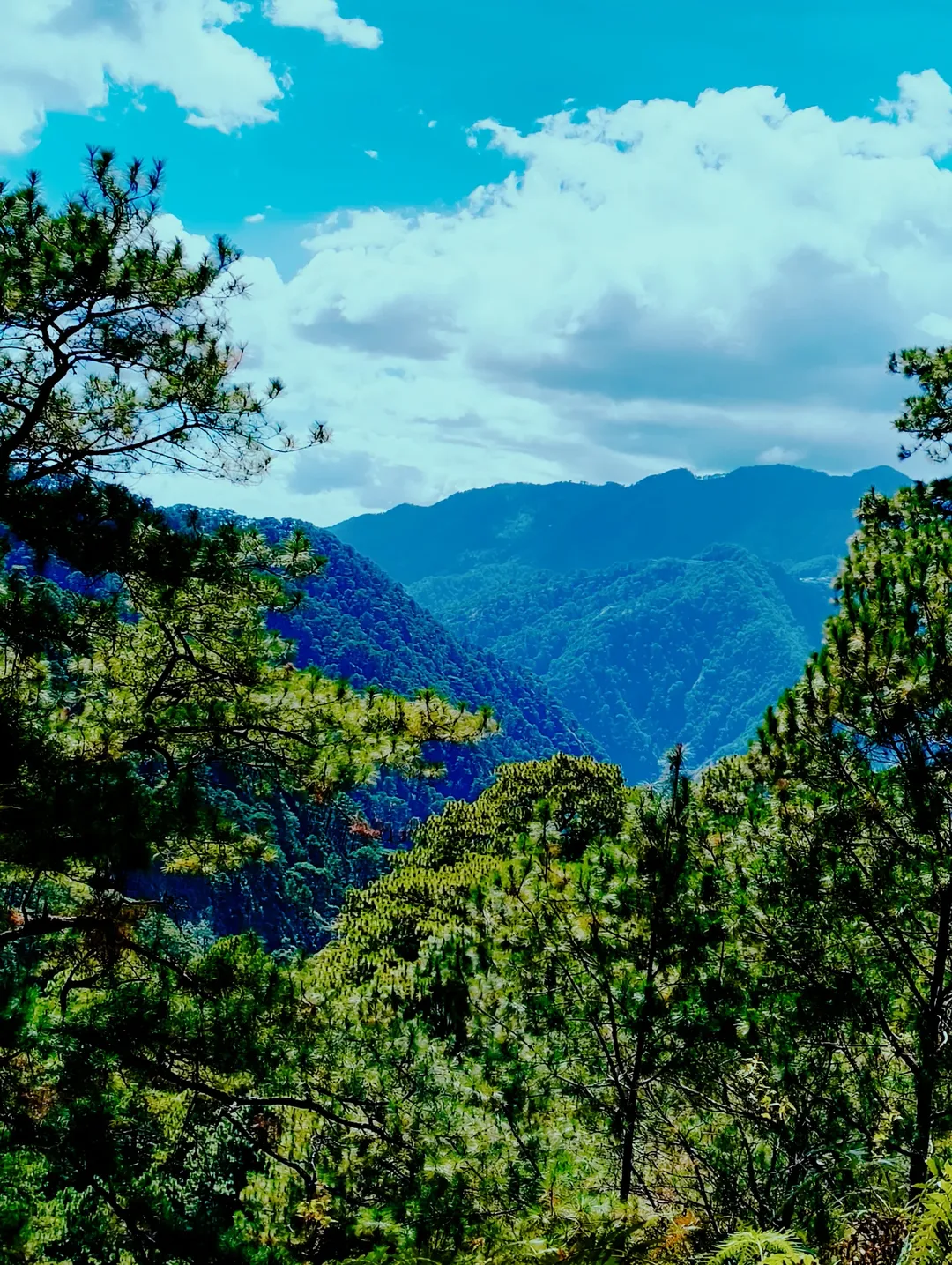
The Experience: This is the visual highlight of the entire trip, but it is also the most physically taxing phase. You will be walking along rolling, highly exposed ridges with absolutely zero shade. The views of the surrounding valleys are breathtaking, but the environment is hostile. The strong mountain winds will evaporate your sweat instantly, which dangerously masks your total fluid loss.
-
The Strategy: Adopt a militant hydration schedule. Sip water every 10 to 15 minutes, even if you do not feel actively thirsty. If your mouth feels dry, you are already slipping into dehydration. Take your summit photos quickly, and keep moving to minimize your time in the direct sun.
Stage 4: The Knee-Crusher (The Sigsiglay Descent)
-
Estimated Time: 2 to 4 Hours
-
The Experience: This is the crux of the hike, and where 90% of accidents happen. The descent down to the Sigsiglay exit is notoriously steep, long, and agonizing on tired legs. The ground is a treacherous, unstable mix of loose gravel, dry clay, and slick pine needles that act like ball bearings under your shoes.
-
The Strategy: Shorten your stride drastically. Lower your center of gravity slightly by keeping a micro-bend in your knees. Plant your feet carefully, utilize your trekking poles with every single step, and do not rush. Fatigue makes hikers clumsy, and rushing this descent guarantees a fall.
Mt. KotKot
The “Anti-Ultralight” Packing List: Gear That Saves Lives
The modern hiking trend is to go “ultralight,” cutting every possible ounce from your pack. When packing for the Mt. Kotkot traverse, you must abandon this mentality. Prioritize survival, hydration, and joint protection over a light backpack. An ultralight setup that skimps on water is a lethal liability on an exposed ridge.
1. The Aggressive Hydration Matrix
Pack an absolute minimum of 2 to 3 liters of fluid per person. Crucially, plain water is not enough. When you hike for 8 hours in the sun, you sweat out massive amounts of sodium and potassium. If you only drink plain water, you risk hyponatremia (water intoxication), which leads to severe cramps, nausea, and disorientation. You must pack electrolyte sachets, salt tablets, or sports drinks to replace the minerals you are losing.
2. Trekking Poles (Non-Negotiable)
I cannot stress this enough based on aggregate hiker injury reports. Trekking poles are not an optional luxury for old people; they are essential safety equipment. Poles provide two extra points of contact on the slippery Sigsiglay descent, transferring up to 20% of the impact load off your knees and drastically reducing your chance of a blown joint or a sprained ankle.
3. Strategic Sun Protection
A standard baseball cap leaves your neck and ears entirely exposed to UV radiation. Wear a wide-brimmed “boonie” hat, UV-blocking polarized sunglasses to prevent snow-blindness-style eye fatigue from the glare, and apply SPF 50 sunscreen every two hours. Consider wearing UPF-rated long sleeves and lightweight trekking pants to physically block the sun.
4. Footwear Science
Leave the flat-soled gym trainers at home. Deep, aggressive rubber lugs (the tread on the bottom of the shoe) are non-negotiable for gripping the loose dust and pine needles. Trail running shoes (like Salomon Speedcross or Hoka Speedgoats) are excellent for traction, but mid-cut hiking boots are highly recommended if you are prone to rolling your ankles.
5. Illumination and First Aid
Bring a reliable headlamp with fully charged or fresh batteries for that mandatory pre-dawn start. Your personal first aid kit must include blister plasters, athletic tape, ibuprofen for joint inflammation, and an emergency space blanket (ridgeline winds can cause hypothermia if you are forced to stop moving due to injury).
Mt. KotKot
Leave No Trace & Mountain Etiquette in 2026
The indigenous mountain communities in the Cordilleras graciously allow us to pass through their ancestral domains. It is a privilege, not a right, to be on Mt. Kotkot. We must treat the land and the locals with absolute respect.
-
Listen to Your Guide: Your local guide is not just a trail-pointer or a photographer; they are your safety officer. If they call for a retreat due to a sudden weather shift, or tell you to speed up to beat the midday heat, you listen without argument.
-
The Biology of Waste: Practice strict Leave No Trace (LNT) principles. Because there is virtually no water on the ridge, the natural decomposition of organic matter is incredibly slow. An apple core or a banana peel will sit there for months, attracting wildlife to the trail and altering their natural diet. Pack out absolutely everything you pack in, including organic waste and the tiny tear-off tabs from energy gels.
-
Trail Yielding: Uphill hikers always have the right of way. If you are descending Sigsiglay and someone is climbing up, step to the side and let them pass. Keep your voices down, do not play music on Bluetooth speakers, and preserve the wildness of the space.
Post-Hike: Recovery in Baguio City
Since you will likely be heading straight back to Baguio City after the Sigsiglay exit, your recovery starts immediately.
Once you are back in the city, prioritize a massive intake of protein and carbohydrates to rebuild the muscle tissue you just broke down. Skip the crowded tourist traps and find a local eatery serving Pinikpikan (a traditional Cordilleran chicken soup) to replenish your sodium levels. Before you get back on a 6-hour bus to Manila, spend 15 minutes doing deep static stretches for your calves, hamstrings, and hip flexors.
Mt. Kotkot is a brilliantly demanding, breathtaking trail that will reward you with stunning panoramic views and a profound sense of physical accomplishment—as long as you respect its rules, respect the heat, and prepare properly.
Stay safe, hydrate aggressively, and I’ll see you out on the ridges!

Leave a Reply