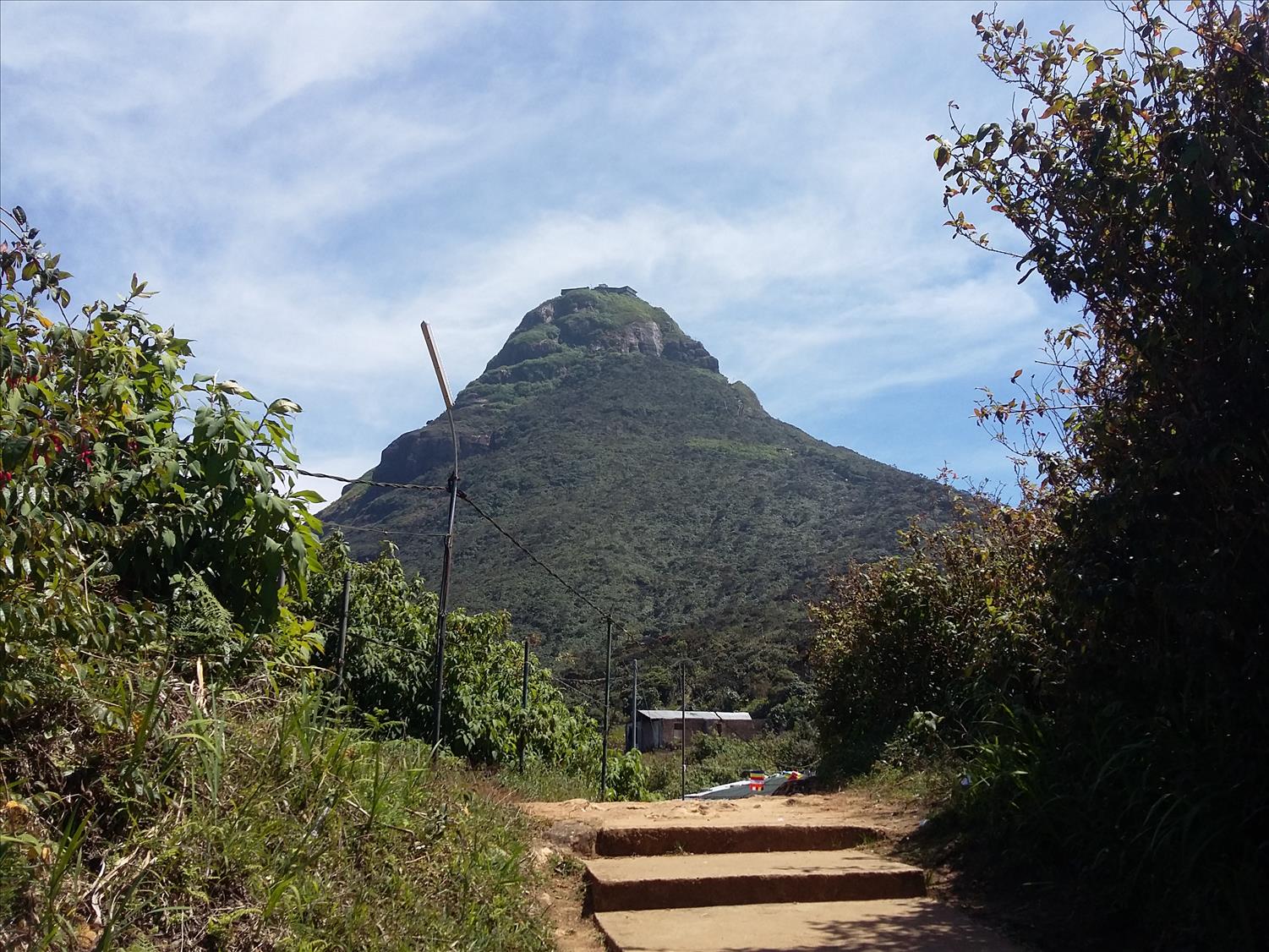
The Journey (Kuruwita-Erathna route)
The journey begins from a small town called Kuruwita located 82 km from Colombo in Sri Lanka. Kuruwita is on the Colombo – Ratnapura main road and situated 9km before Ratnapura. To reach the trail head you approach a small hamlet called “Adavikanda”. The nearest town to this sleepy village is Erathna; one proceeds left at the clock tower in Kuruwita and travels approximately 11 km. The road has signboards and can find the way without trouble. Proceed past Erathna about 1.5 km to reach the trailhead at Adavikanda. The road abruptly ends at a car park next to the trail where you can stop before hiking to purchase snacks and drinks from the small vendors located here.
Public Transport
Long distance buses running on No. 122 route (Ratnapura, Embilipitiya etc…), No. 98, 99 routes (Monaragala, Badulla) or No. 03 Kataragama can be used to reach Kuruwita.
Kuruwita bus stand is located just past the clock tower to the left of the main road. A bus to Adevikanda begins service at 06.00 AM and runs every hour. You’ll find a red CTB bus parked at the other side of the bus stand. It will take about 45 minutes to reach Adevikanda and costs about 50 LKR. Mind you, in the off-season, buses run only up to Erathna where you will have to hire a tuk-tuk to travel the rest of the way.
The Trail
For reference, I started climbing at 7.00 am and reached the summit at 1.45 pm. I made no prolonged stops along the way. The weather was perfect.
The steps are scarce on this trail
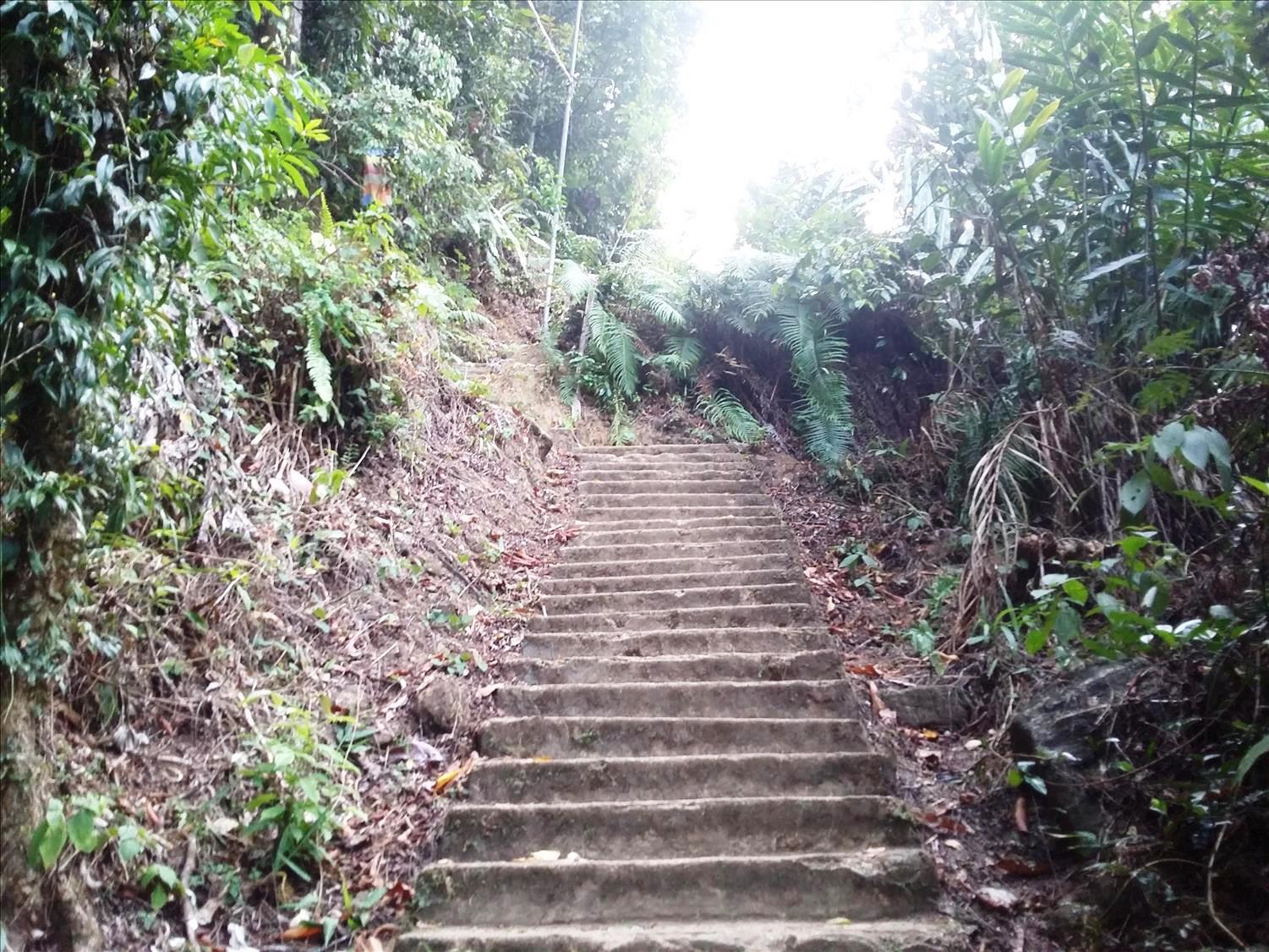
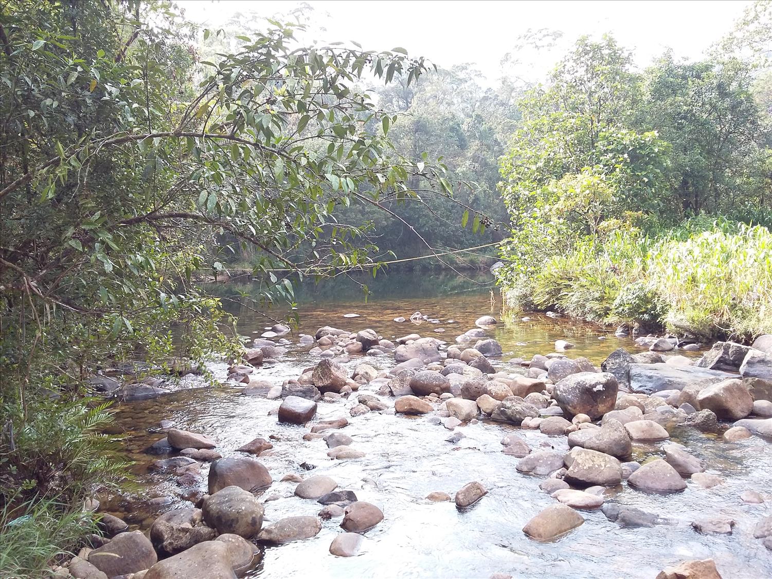
The trail starts with a brief flat section but soon turns into a continuous climb. Concrete stairs are not available most of the time, rather are located only in the steepest sections. In the early stages of the climb, you will see the Kuru River. After 1.6 km and 620 meters above sea level you will reach the first permanent resting place (Ambalama) called “Jambolagaha-Yata Ambalama”. I recommend you stop and hydrate here for a few moments as the climb does not get any easier past this point. Looking up you’ll observe “Heen Piduruthalawa” mountain (~1,500m) which rises above the forest reserve.
What is an Ambalama? Sri Pada has been climbed for thousands of years by kings and peasants alike. They have, since the old times, built these places to rest, eat and sleep. And now they’ve evolved into shelters renovated by the devotees around the island. These places are pretty simple and don’t contain furniture or any other luxuries. Most of these places have small stores attached to them that sell necessities for pilgrims.
Back to the journey at hand: the trail continues past small streams becoming mostly rocky with hints of what used to be pavement. These, I assume, must have been remnants of a proper path that existed in the old days but today has become worn out by nature and hikers. Trodden on for thousands of years these stones would’ve told many stories if they could talk. After 10 minutes of walking, you’ll come to a junction in the road as you climb up the rocky path – be sure to go straight past this fork.
Jambolagaha-Yata Ambalama, the first permanent resting place
The trail passes by a mini-hydro plant where hikers will observe metal pipes carrying water to the turbines. Passing over a small bridge above sloping bedrock you will hear the calming sounds of a waterfall. This is “Warnagala Falls” – named after the rock over which it falls (“Warnagala”). To reach this, look for a trail to your right after passing the small bridge.
Past 2.6 km and 780 m above the sea level you’ll reach the second Ambalama called “Diamondgala”. After 800m you will reach Warnagala Mountain. A large rock bed equipped with railings will ease your climbing. Be sure to look around and admire the scenery – you are now over 800m above sea level and 3.4 km in from the trailhead.
Climbing a pretty worn out staircase you will reach another small Ambalama called “Warnagala Ambalama”. Beyond this is a police post and a small temple adorned with tiny shrine rooms for the “God of Saman” and a replica of the footprint of Lord Buddha. This temple seems to be recently built and there are monks and helping staff who are friendly with the pilgrims.
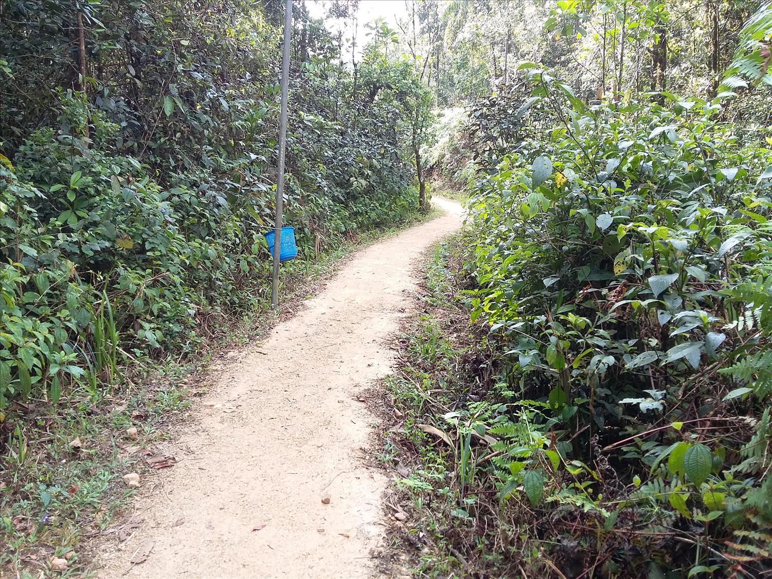
Past this point, you are hiking among mostly flat forested terrain – passing through pretty flora and fauna surrounding the path. Keep an eye out for snakes; I almost stepped on one. After about ½ hour and 5 km from the trailhead, you’ll reach another Ambalama at the Seetha Gangula (Cold River). This icy cold river is ever famous among pilgrims as it crosses three of the trails to Sri Pada. A line is attached to cross the river which isn’t deep at all during the dry season. Crossing it in the wet-season would be highly challenging. It’s a perfect place to have a dip if you can endure frigid water.
Seethagangula (“The Cold River”)
Past this point, the trail becomes steeper. It winds through thick forest canopy and becomes more challenging to hike because of all the rocks. Passing “Medahinna Ambalama” you are now 7.7 km from the trailhead and at 1,320 m above sea level. Astute readers will recall that I mentioned earlier a trail called “Deraniyagala-Uda Maliboda” as one of the possible routes leading to the peak. In fact, this particular trail joins in with the Kuruwita trail in a place just a few hundred meters past Medahinna. A footpath connecting to the trail is clearly visible from the left which leads deep into the wilderness from which you’ll emerge back to civilization after about 8km of arduous hiking.
As you continue forward on the rocky steps (if you can call these steps) you’ll reach a significant landmark on the trail – the “Idikatupana”, a large natural bedrock protusion featuring excellent views of the surrounding terrain. Looking ahead you get the first glimpse of the majestic Sri Pada looming like a pinnacle in the sky, a sight for sore eyes indeed. However, 700m of climbing lies ahead to reach the summit. Before continuing, turn around and look to your right to the northeast to see the famous Seven Virgins mountain range; this is considered one of the most difficult to conquer in Sri Lanka.
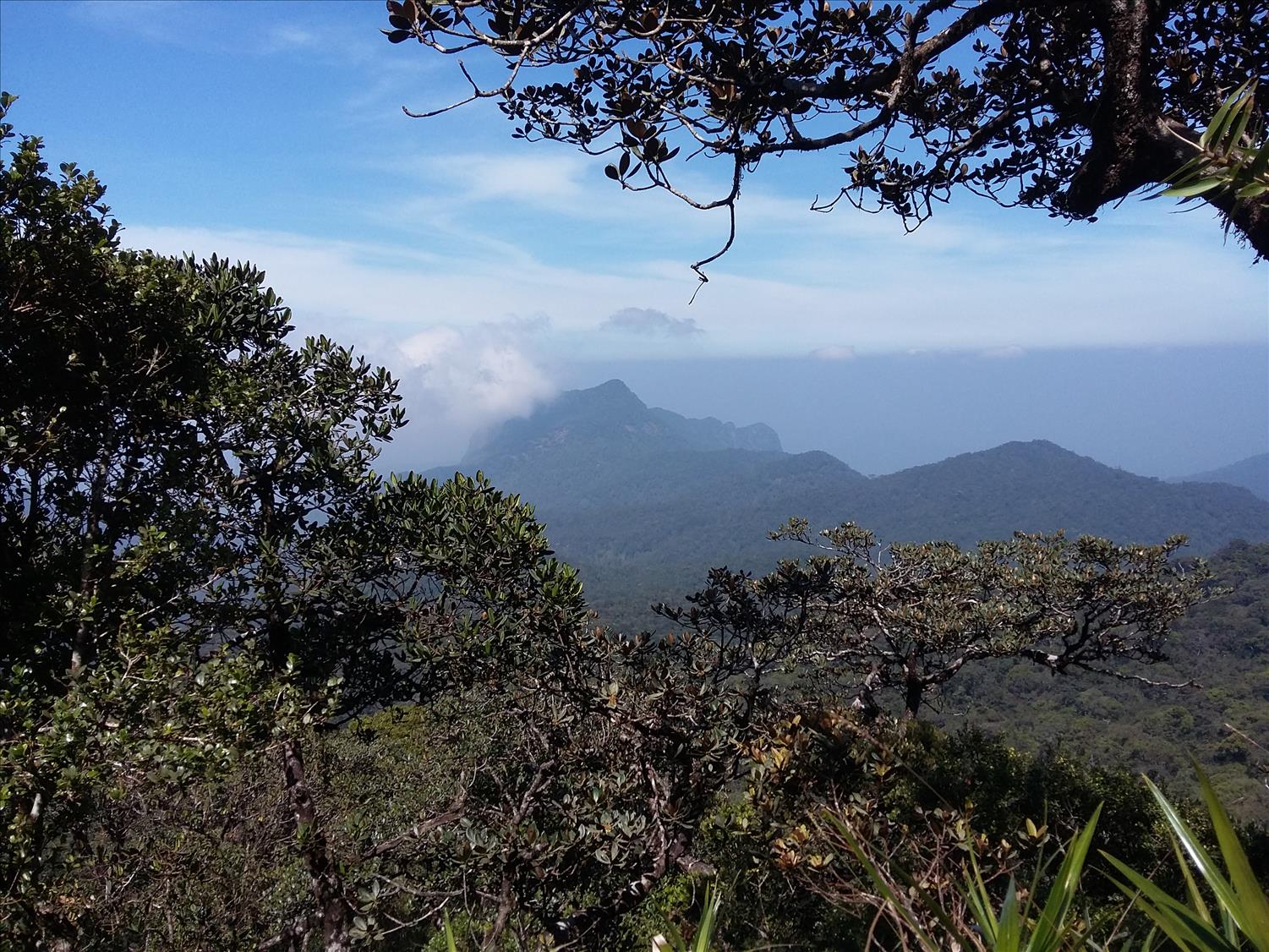
Seven virgin mountain range at the center
The path becomes strenuous and rocky until you reach the next significant resting place after 1.2 km at ~1,800m above sea level. The transformation of the flora is quite apparent here as the trees become shorter and more spread out.
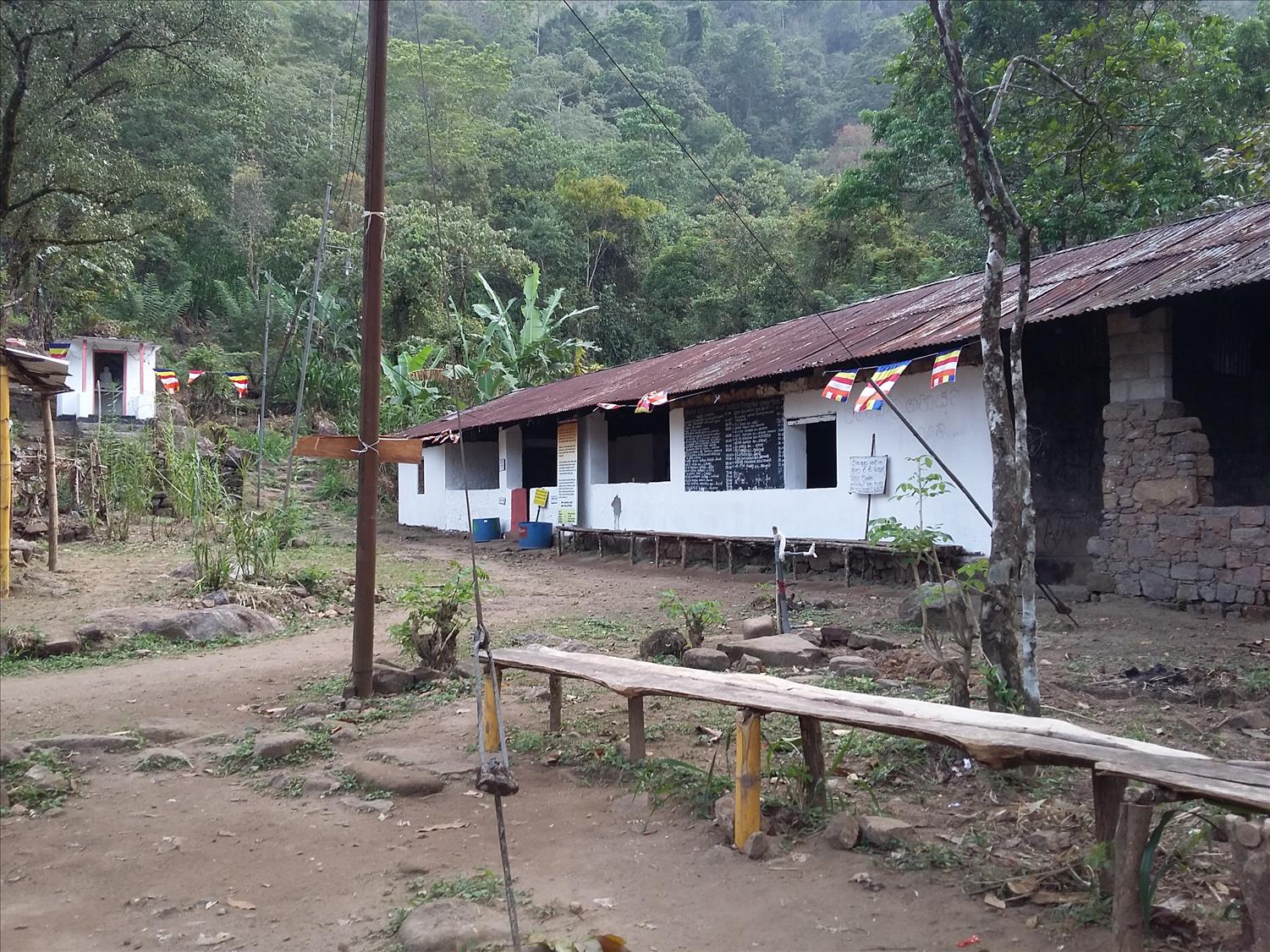
This resting place is “Galwangediya” – a memorable location because the renowned Ratnapura-Palabathgala trail joins here. Take advantage of the small diner located at this junction. It is worth stopping for the delicious food available at reasonable prices.
The actual climb of the peak begins beyond this junction. Gone are the rock and gravel – replaced by steps with handrails. My mind tries to relax but the elevation gain eventually takes a toll on my legs. The last Ambalama you’ll find is “Andiyamalatenna” located about 1 km from the Galwangediya. This Ambalama is pretty large and used by pilgrims for over-night stays. Past this, the path continues its steep ascent and eventually reaches a junction where a path branches to the left from the stairway. Continue straight up (do not turn left). Be sure to admire the view, in what is by now your physically exhausted state! Nearby mountains appear like guardian angels of the holy peak. Most prominent of these are “Bena Samanala” mountains; those twin peaks that stand to the right and a peculiarly shaped rock called Kunudiya rock.
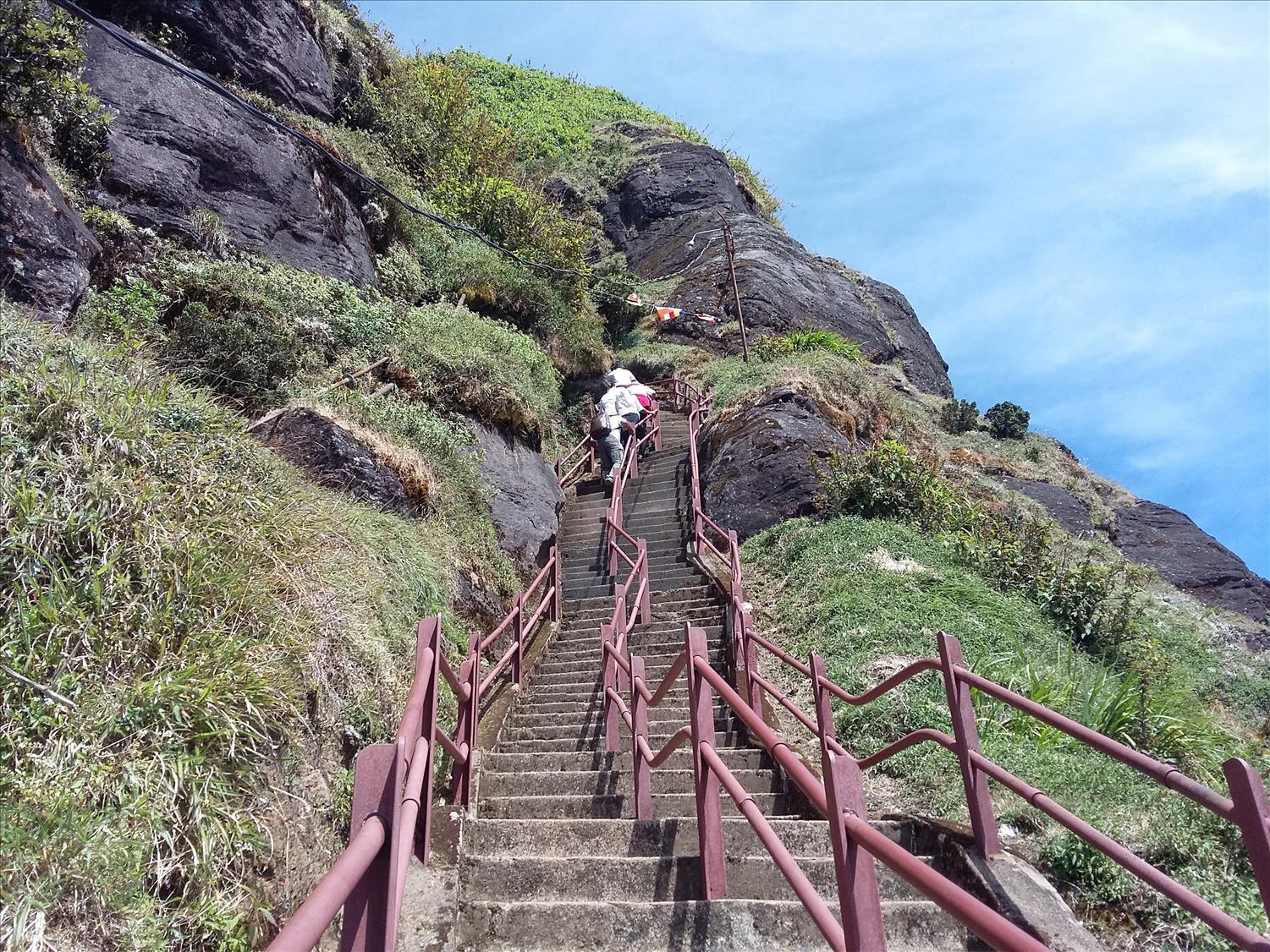
Mahagiridambaya – The steepest grade on the rock
After about ½ hour of climbing you’ll reach the steepest section of the trail called “Mahagiridambaya”. This section is a near vertical rock face with challenging steps sure to slow down your progress. In earlier days chains were used to conquer this unforgiving rock face; these are still visible by the side of the trail. Thanks to the railings and stairs hikers don’t need to be experts in technical rock climbing to get past this barrier. It is best to avoid weekend and holidays because this is where the congestion occurs due to both older people and younger ones who have no physical stamina.
Congratulations – you have finally reached the temple at the summit! The physical exertion is well worth it. While photography is not allowed inside the temple you can take pictures of the surrounding scenery.
And a final note – the best time to climb is between January and May (avoid full moon days to avoid crowds). The temple is closed in the off-season. And for good reason. The winds tends to be harsh and cold with unfavourable weather conditions.


A very nice article.. all information has mentioned on the blog. thank you for the help
Dear Radhika, You’re welcome.